Marsh, Big Stone County Fishing
Big Stone County, Lac qui Parle County and Swift County, 4,462 acres, 5 feet deep.
 Pick for walleyePiscifun Viper X spinning reel50% OFFSale $39.99
Photo of Big Stone Lake: McGhiever, CC BY-SA 3.0
Marsh, Big Stone County, the Minnesota rundown
LakeFinder puts Marsh, Big Stone County, a marsh in Big Stone County, Lac qui Parle County and Swift County, at 4,462 acres. Maximum depth is 5 feet, with an average of 3 feet. The littoral zone, water under 15 feet, takes in 4,428 acres (99%). Louisburg is the nearest city on the Census list, roughly 2 miles off. The DNR fisheries office in Ortonville manages it.
The species list from DNR surveys starts with walleye, northern pike, yellow perch, black crappie, bluegill and largemouth bass. Boaters have 5 public water accesses, 4 of them trailer launches. The last DNR standard survey ran on July 13, 2015. Walleye catch rates sat within normal: 7.75 per gill net against 3.2-15.3.
 For the walleye herePiscifun AlumiX spinning reel46% OFFSale $64.99
What the DNR nets turned up on Marsh, Big Stone County
The standard survey of July 13, 2015 supplied these counts; the DNR normal range shows what similar lakes produce.
| Species | Gear | Caught | Per set | Normal range | Avg lb | Normal lb |
|---|---|---|---|---|---|---|
| Walleye | Standard gill nets | 31 | 7.75 | 3.2-15.3 | 1.19 | 0.9-1.9 |
| Walleye | Standard trap nets | 11 | 0.79 | 0.3-1.7 | 0.72 | 0.9-2.4 |
| Northern pike | Standard gill nets | 18 | 4.5 | 1.2-7.8 | 1.78 | 1.5-3.0 |
| Northern pike | Standard trap nets | 58 | 4.14 | 3.04 | ||
| Yellow perch | Standard gill nets | 5 | 1.25 | 3.0-22.5 | 0.23 | 0.1-0.4 |
| Yellow perch | 1/4-in trap nets | 2 | 0.22 | 0.24 | ||
| Black crappie | Standard gill nets | 8 | 2 | 0.8-11.1 | 0.95 | 0.2-0.4 |
| Black crappie | Standard trap nets | 5 | 0.36 | 1.0-12.3 | 0.88 | 0.2-0.5 |
| Largemouth bass | Survey seining | 1 | 0.33 | |||
| Channel catfish | Standard gill nets | 33 | 8.25 | 2.84 | ||
| Channel catfish | Standard trap nets | 3 | 0.21 | 2.87 | ||
| White bass | Standard gill nets | 11 | 2.75 | 0.8-7.1 | 1.33 |
Marsh, Big Stone County gill net counts
Minnesota DNR LakeFinder lake survey data, survey report. Checked October 2026.
Status of the fishery on Marsh, Big Stone County
“Marsh Lake is an impoundment of the Minnesota River approximately three miles southwest of Appleton.”
“The lake was created in the 1930's by construction of a dam on the Minnesota River near the outlet of the Pomme de Terre River.”
“Marsh Lake measures 4,500 acres and has a maximum depth of 5 feet.”
“It frequently suffers from high turbidity due to wave action mixing up its silty bottom.”
Quoted from the DNR status of the fishery for Marsh (report). Checked October 2026.
Landings around Marsh, Big Stone County
- Marsh Lake (SE) Marsh #2 Access1 ramp, 6 trailer stalls, DNR Division of Parks and Trails
- Marsh Lake, Cement Bridge Access1 ramp, 8 trailer stalls, DNR Division of Parks and Trails
- Marsh Lake, Correll Landing Access1 ramp, 10 trailer stalls, DNR Division of Parks and Trails
- Marsh Lake, Peterson Access1 ramp, 10 trailer stalls, DNR Division of Parks and Trails
- Marsh Lake (N) Marsh #1 Access1 ramp, 2 trailer stalls, DNR Division of Fish and Wildlife
Water accesses near Marsh, Big Stone County
- Minnesota River, Marsh Lake AccessMinnesota River, 3 miles southeast
- Pomme De Terre River, #2 AccessPomme de Terre River, 4 miles east
- Minnesota River, Twin Bridges AccessLac qui Parle, 5 miles southeast
- Pomme de Terre River, Appleton AccessPomme de Terre River, 7 miles east
- Shible Lake AccessShible, 7 miles northeast
- Minnesota River, Hwy 75 AccessMinnesota River, 7 miles northwest
Minnesota DNR Public Water Access Sites and Public Fishing Sites layers and LakeFinder, checked October 2026.
Marsh, Big Stone County basin shape
Volunteers and DNR staff have logged 9 Secchi readings on Marsh, Big Stone County since 2006.
DNR LakeFinder morphology and water clarity, DNR ice-out records (ice-out data), checked October 2026.
Water level on Marsh, Big Stone County
US Army Corps of Engineers, St. Paul District (CWMS), reading for Oct 18, 2026. Retrieved Oct 22, 2026 2:32 am ET. Not updated since Oct 18, 2026.
USACE St. Paul District series Marsh Lake Dam, Marsh Lake Dam pool (Minnesota River); datum NGVD-29. Reading on file 937.31 ft on 2026-10-19.
DNR gauge readers record Marsh, Big Stone County by hand; the last entry is dated.
DNR lake level record (datum NGVD 29).
Fish found in Marsh, Big Stone County
Every species shown for Marsh, Big Stone County turned up in a DNR survey or holds a record here.
Minnesota DNR LakeFinder species list and survey catch.
Limits that apply on Marsh, Big Stone County
Statewide inland limits are the whole rule set on Marsh, Big Stone County.
| Species | Limit | Season |
|---|---|---|
| Walleye and sauger | 6 combined total (only 1 walleye over 20" in possession) | May 9, 2026 – Feb. 28, 2027 |
| Northern pike (Southern Zone) | 2 (minimum size 24") | May 9, 2026 – Feb. 28, 2027 |
| Northern pike (Southern Zone) | 2 (minimum size 24") | Nov. 15, 2026 – Feb. 28, 2027 except where prohibited |
| Largemouth bass | Catch-and-release only | March 1 – May 22, 2026 |
| Largemouth bass | 6 combined total largemouth or smallmouth bass (when smallmouth season is open) | May 23, 2026 – Feb. 28, 2027 |
| Smallmouth bass | Catch-and-release only | March 1 – May 22, 2026 |
| Smallmouth bass | 6 combined total largemouth or smallmouth bass | May 23 – Sept. 13, 2026 |
| Smallmouth bass | Catch-and-release only | Sept. 14, 2026 – Feb. 28, 2027 |
| Crappie | 10 combined total | Continuous |
| Sunfish | 20 combined total | Continuous |
| Yellow perch | 20 daily, 40 in possession | Continuous |
| Muskellunge | 1 (minimum size 54") | June 6 – Nov. 30, 2026 |
| Channel catfish | 5 (only 1 over 24") | Continuous |
| Rock bass | 30 | Continuous |
| Cisco (tullibee) | 15 (over 7") | Continuous |
| Burbot (eelpout) | 4 | Continuous |
Marsh, Big Stone County sits in the Southern Zone by map position, which sets the pike and bass rows.
2026 Minnesota Fishing Regulations and LakeFinder special regulations, checked October 2026. All Minnesota limits.
Sizing up Marsh, Big Stone County against nearby water
| Lake | Distance | Acres | Max depth ft | Accesses | Walleye per gill net |
|---|---|---|---|---|---|
| Marsh, Big Stone County | 4,462 | 5 | 5 | 7.75 | |
| Shible Lake | 6 miles northeast | 340 | 8.5 | 1 | 6 |
| Big Stone NWR East Pool | 8 miles west | 1,286 | 0 | 1.6 | |
| Long Lake, Big Stone County | 11 miles north | 395 | 10 | 0 | 31.5 |
| Lac qui Parle | 11 miles southeast | 5,741 | 15 | 9 | 14.42 |
| Artichoke Lake | 11 miles north | 1,971 | 15.5 | 3 | 44.33 |
DNR LakeFinder morphology, access layer and latest survey per lake.
Beyond the shore of Marsh, Big Stone County
More Minnesota lakes near Marsh, Big Stone County
- Shible Lake6 miles northeast
- Big Stone NWR East Pool8 miles west
- Long Lake, Big Stone County11 miles north
- Lac qui Parle11 miles southeast
- Artichoke Lake11 miles north
Minnow buckets filled near Marsh, Big Stone County
- Artie's Bait & Tacklebait and tackle shop, Ortonville, 16 miles
Towns within an easy drive of Marsh, Big Stone County
- Louisburg2 miles
- Correll3 miles
- Appleton6 miles
Counties that Marsh, Big Stone County reaches
- Big Stone Countyseat: Ortonville
- Lac qui Parle Countyseat: Madison
- Swift Countyseat: Benson
Four Piscifun picks for Marsh, Big Stone County


Piscifun and Amazon links are affiliate links; the site earns a commission on qualifying purchases.
Fish to look for at Marsh, Big Stone County
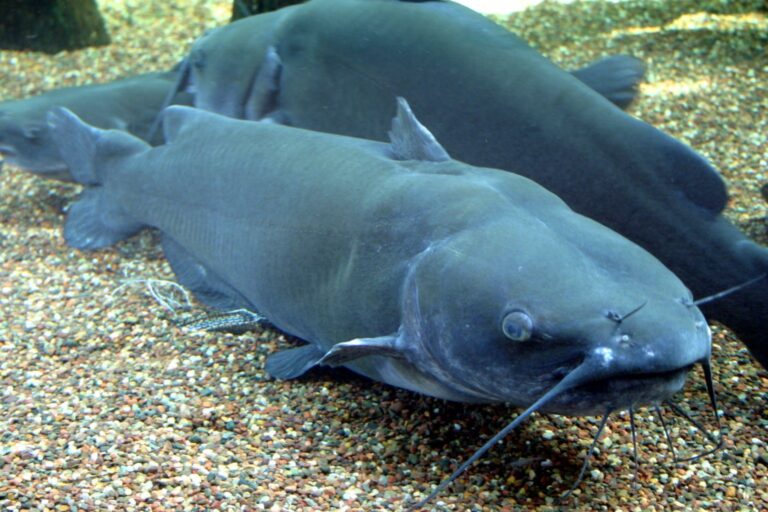
Photo: Ryan Somma, CC BY-SA 2.0

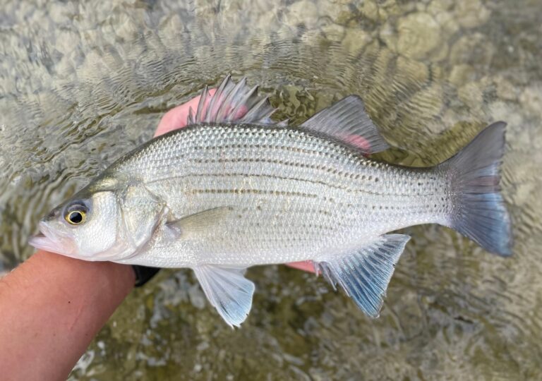
Photo: Nick Loveland, CC0

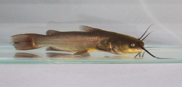
Photo: George Chernilevsky, CC BY-SA 4.0

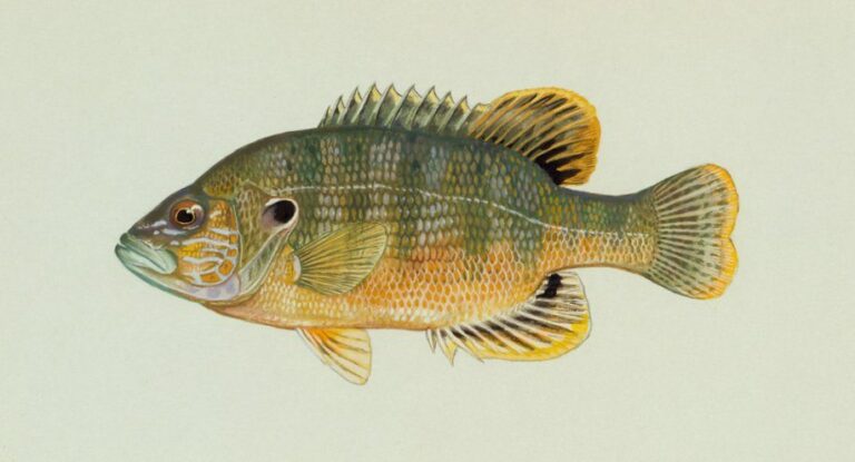
Photo: Duane Raver, Public domain

Handy answers on Marsh, Big Stone County
Which DNR office covers Marsh, Big Stone County?
In Big Stone County, Lac qui Parle County and Swift County, managed from the Ortonville fisheries office, about 2 miles from Louisburg.
What is the maximum depth of Marsh, Big Stone County?
The DNR record gives 4,462 acres, 5 feet at the deepest.
Is there a boat launch on Marsh, Big Stone County?
5 public accesses, with Marsh Lake (SE) Marsh #2 Access listed first.
Which species has the DNR recorded in Marsh, Big Stone County?
Expect walleye, northern pike, yellow perch, black crappie, bluegill, largemouth bass and channel catfish.
When did the DNR last survey Marsh, Big Stone County?
July 13, 2015, in a standard survey. walleye ran 7.75 per gill net.
Are there size limits on Marsh, Big Stone County?
No special rule; statewide rows in the Southern Zone.
Do kids need a license on Marsh, Big Stone County?
Minnesota residents 16 to 89 need an angling license ($25 for the year); nonresidents 16 and older pay $51.
How clear is Marsh, Big Stone County?
Average clarity: 0.9 feet.
Where are minnows sold near Marsh, Big Stone County?
Drive 16 miles to reach Artie's Bait & Tackle.
Plan a lake day on Marsh, Big Stone County
Minnesota license costs and limits are one click away.