Chesapeake Bay Fishing in Virginia
The Virginia side of the Bay: tidal rivers, Eastern Shore creeks, Hampton Roads and the VMRC limits.
 Pick for red drumPiscifun Alloy S inshore spinning reelCheck price at Piscifun
Photo: U.S. Fish and Wildlife Service Northeast Region, Public domain
Chesapeake Bay in brief
Virginia holds the southern, saltier part of Chesapeake Bay, from the fall-line rivers down to the mouth between Cape Charles and Cape Henry. This page gathers the Virginia side: 36 bay-side coast waters with pages of their own, 7 tidal river pages, 32 DWR saltwater launches, 9 NOAA water-level stations and the Marine Resources Commission limits as of November 6, 2026.
On the seaside of the Eastern Shore, 19 more coast pages cover the barrier-island bays and inlets. Limits for the Bay come from the Virginia Administrative Code; red drum, flounder and cobia rows are in the limits band, and striped bass inside the Bay follow their own spring and fall seasons.
USGS GNIS named features; Virginia DWR Boating Access Locations (saltwater class); NOAA CO-OPS; Virginia Administrative Code, Title 4 Agency 20 (Marine Resources Commission) on law.lis.virginia.gov, as of November 6, 2026 (VMRC rules change by emergency order; check the VMRC regulations page before keeping fish).
 For the red drum herePiscifun NautiX saltwater spinning reel14% OFFSale $94.99
Size and possession limits on Chesapeake Bay
| Species | Area | Size | Bag | Season | VAC section |
|---|---|---|---|---|---|
| Striped bass | Chesapeake Bay and its tributaries (spring/summer) | 19 in minimum, 24 in maximum | 1 | May 16 through June 15 | 4VAC20-252-80 |
| Striped bass | Chesapeake Bay and its tributaries (fall) | 19 in minimum, 24 in maximum | 1 | October 4 through December 31 | 4VAC20-252-90 |
| Striped bass | Potomac River tributaries | 19 in minimum, 24 in maximum | 1 | May 16 through July 6 and August 21 through December 31 | 4VAC20-252-100 |
| Striped bass | Coastal area | 28 in minimum, 31 in maximum | 1 | January 1 through March 31 and May 16 through December 31 | 4VAC20-252-110 |
| Striped bass | All Virginia waters | not stated | not stated | not stated | 4VAC20-252-50 |
| Speckled trout | Virginia tidal waters | 14 in minimum | 5 | Closed April 1, 2026 through June 30, 2026 | 4VAC20-280-30 |
| Black drum | Virginia tidal waters | 16 in minimum | 1 | not stated | 4VAC20-320-40 |
| Grey trout (weakfish) | Virginia tidal waters | 12 in minimum | 1 | not stated | 4VAC20-380-60 |
| Bluefish | Virginia tidal waters | not stated | 5 | not stated | 4VAC20-450-20 |
| Sharks (recreationally permitted) | Vessel: one per trip per vessel; shore angler: one per calendar day | 54 in minimum | 1 | not stated | 4VAC20-490-40 |
| Cobia | Virginia tidal waters | 43 in minimum | 1 | June 15 through September 20 | 4VAC20-510-20 |
| Amberjack | Virginia tidal waters | 32 in minimum | 2 | not stated | 4VAC20-510-20 |
| Spanish mackerel | Virginia tidal waters | 14 in minimum | 15 | not stated | 4VAC20-540-30 |
| King mackerel | Virginia tidal waters | 27 in minimum | 3 | not stated | 4VAC20-540-30 |
| Summer flounder | Tidal waters except Potomac River tributaries | 16 in minimum | 4 | Open year-round (January 1 through May 31 size) | 4VAC20-620-50 |
| Summer flounder | Tidal waters except Potomac River tributaries | 17.5 in minimum | 4 | Open year-round (June 1 through December 31 size) | 4VAC20-620-50 |
| Summer flounder | Potomac River tributaries | not stated | not stated | not stated | 4VAC20-620-60 |
| Scup | Virginia tidal waters | 9 in minimum | not stated | not stated | 4VAC20-910-30 |
| Black sea bass | Virginia tidal waters | 13 in minimum | 15 | 2026: May 11 through December 31; 2027: April 1 through December 31 | 4VAC20-950-45 |
| Tautog | Virginia tidal waters | 16 in minimum | 4 | Closed May 16 through June 30 | 4VAC20-960-45 |
| Spadefish | Virginia tidal waters | not stated | 4 | not stated | 4VAC20-970-30 |
| Sheepshead | Within or outside Virginia tidal waters | not stated | 4 | not stated | 4VAC20-1110-30 |
| Golden tilefish | Virginia tidal waters | not stated | 8 | not stated | 4VAC20-1120-30 |
| Blueline tilefish | Private or rental vessel | not stated | 3 | Closed January 1 through May 14 and November 16 through December 31 | 4VAC20-1120-30 |
| Grouper | Within or outside Virginia tidal waters | not stated | 1 | not stated | 4VAC20-1120-30 |
| Atlantic croaker | Virginia tidal waters | not stated | 50 | not stated | 4VAC20-1370-30 |
| Spot | Virginia tidal waters | not stated | 50 | not stated | 4VAC20-1380-30 |
| Red drum | Virginia tidal waters | 18 in minimum, 26 in maximum | 3 | not stated | 4VAC20-1400-30 |
| Atlantic tarpon | Virginia waters | not stated | no possession | not stated | 4VAC20-1420-30 |
| American shad | Chesapeake Bay and coastal area | not stated | no possession | not stated | 4VAC20-530-30 |
| River herring | Virginia tidal waters | not stated | no possession | not stated | 4VAC20-1260-30 |
Rows read "not stated" where the code section gives no number; the notes on the saltwater rules page quote the section text. Inside the Bay, striped bass rows run Chesapeake Bay and its tributaries (spring/summer), May 16 through June 15; Chesapeake Bay and its tributaries (fall), October 4 through December 31. Tarpon, American shad and river herring may not be kept.
Virginia Administrative Code, Title 4 Agency 20 (Marine Resources Commission) on law.lis.virginia.gov, as of November 6, 2026 (VMRC rules change by emergency order; check the VMRC regulations page before keeping fish).
Which license works where on Chesapeake Bay
| River | Fall line landmark | Freshwater/saltwater license line |
|---|---|---|
| Appomattox River | The remnants of Harvell Dam approx. 0.5 mi upstream of Rt. 1 | not listed |
| Chickahominy River | Walkers Dam | not listed |
| Tidal James River | 14th Street Bridge (Mayo Bridge) | A line connecting Hog Point on Hog Island (Surry County) and the downstream point of the mouth of College Creek (James City County) |
| Mattaponi River | Rt. 360 Bridge | Rt. 33 Bridges |
| Pamunkey River | Rt. 360 Bridge | Rt. 33 Bridges |
| Tidal Rappahannock River | Rt. 1 Bridge | Rt. 360 Bridge |
Above the license line on these rivers a freshwater license is needed; below it a saltwater license, and either works on tidal tributaries below the lines. The digest lists the Meherrin, Nottoway, Blackwater, Back Bay, Northwest River and North Landing River as freshwater throughout.
Rules as printed, 2026 Freshwater Fishing in Virginia digest (eRegulations, linked from the Virginia DWR regulations page), read November 6, 2026.
DWR tidal ramps around Chesapeake Bay
| Site | Recorded attributes | Owner | Location (DWR) |
|---|---|---|---|
| Back Bay boat ramp | dock and ramp, 1 ramp, fresh and salt | DWR | Princess Anne Road, South to Back Bay; L on Rt 622 |
| Cape Charles boat ramp on Cherrystone Inlet | dock and ramp, 4 ramps, barrier-free, saltwater | Town of Cape Charles | Town of Cape Charles, Rt. 1103 |
| Coles Point on Chesapeake Bay | concrete boat ramp, 1 ramp, barrier-free, saltwater | DWR | From of Coles Point |
| Coopers boat ramp on Great Wicomico River | dock and ramp, 1 ramp, barrier-free, saltwater | VDOT | From Heathsville, Rt. 360 East (4) to Horse Head; R on Rt 707 (1.5) |
| Deep Point on Piankatank River | dock and ramp, 1 ramp, barrier-free, saltwater | VDOT | From Glenns, Rt 198 East (7.5); L on Rt 606 (1.5) |
| Elizabeth River boat ramp on Southern Branch Elizabeth River | dock and ramp, 4 ramps, barrier-free, saltwater | Chesapeake | City of Chesapeake, Rt 337 |
| Fox Hill boat ramp on Back River | dock and ramp & separate hand launch, 3 ramps, barrier-free, saltwater | DWR | North (1) of Fox Hill at end of Dandy Point Road |
| Gloucester Point on York River | dock and ramp, 2 ramps, barrier-free, saltwater | VDOT | Town of Gloucester Point, Rt 1208 |
| Greenvale Creek boat ramp on Corrotoman River | dock and ramp, 1 ramp, barrier-free, saltwater | Lancaster County | From Lively Rt. 3, S. Rt 201, E. Rt. 354, S. foll. Rt 624 Mullosk (1/2mi.) |
| Grey's Creek boat ramp on Tidal James River | concrete ramp (no dock), 1 ramp, barrier-free, saltwater | Surry | |
| Hammock boat ramp on Pocomoke Sound | dock and ramp, 1 ramp, saltwater | No File | From Temperancev. Rt 13 turn W. Rt 695 (9.5), turn S. Rt 788 (1 mi.) |
| Harborton boat ramp on Pungoteague Creek | dock and ramp, 2 ramps, barrier-free, saltwater | Accomack County | From Pungoteague, West on Rt.180 (3) to Harborton. Access at end of Rt. 180 |
| Hoskin's Creek boat ramp on Chesapeake Bay | dock and ramp, 1 ramp, fresh and salt | VDOT | Town of Tappahannock, Rt T-1002 (Dock Street) |
| Jones Creek boat ramp | dock and ramp, 2 ramps, barrier-free, saltwater | Isle of Wight County | From Rt 17, West on 669 (.5), West on Rt 665 (1.5) , turn left into Jones Creek Landing |
| Lawnes Creek boat ramp on Tidal James River | dock and ramp, 1 ramp, barrier-free, fresh and salt | DWR | From Bacons Castle, Rt 650 North (5.2) |
| Mill Creek boat ramp on Tidal Rappahannock River | dock and ramp, 1 ramp, barrier-free, saltwater | VDOT | From Hartfield, Rt. 3 North (.5); R on Rt 626 (3.1) |
| Owls Creek boat ramp on Linkhorn Bay | dock and ramp, 4 ramps, barrier-free, saltwater | Vity of Virginia Beach | From Virginia Beach, South on General Booth Blvd. |
| Oyster boat ramp on Cherrystone Inlet | concrete ramp (no dock), 2 ramps, saltwater | Northampton | In Oyster on Rt 1802 |
| Peterson Yatch Basin boat ramp on Hampton Roads | 2 ramps, barrier-free, saltwater | City of Newport News | I-64 to Terminal Ave. exit,L on Jefferson Ave to 16th St;R 16th St(1) to Anderson Park |
| Princess Anne WMA boat ramp on Back Bay | 1 ramp, saltwater | From Va.Beach South on Princess Anne Road; L on Rt 699 | |
| Queens Sound boat ramp on Chincoteague Inlet | dock and ramp, 1 ramp, saltwater | DWR | On Rt 175 to Chincoteague from Wallop Station, * Very limited parking |
| Red Bank boat ramp on Hog Island Bay | dock and ramp, 2 ramps, saltwater | DWR | From Nassawadox, Rt 13 South (1); L on Rt 617 (1.9) |
| Saluda boat ramp on Tidal Rappahannock River | dock and ramp, 1 ramp, barrier-free, saltwater | VDOT | Rt 618 North (1.4) of Saluda |
| Shell boat ramp on Great Wicomico River | dock and ramp, 2 ramps, saltwater | VDOT | Southeast on Rt 657 (2) of Reedville |
| Simonson Landing on Tidal Rappahannock River | dock and ramp, 1 ramp, saltwater | VDOT | From Farnham, Rt 3 East to Rt 608 South to Rt 606 to ramp |
| Tanyard boat ramp on Chesapeake Bay | dock and gravel ramp, 1 ramp, saltwater | VDOT | From Gloucester, Rt 14 North (4.3); L on Rt 613 (3.3); R on Rt 610 (.6); L on Rt 617 (.5 |
| Totuskey boat ramp on Chesapeake Bay | dock and ramp, 1 ramp, saltwater | VDOT | From Warsaw, Southeast on Route 3 (3) |
| Town Point on East River | dock and ramp & seperate hand launch, 1 ramp, barrier-free, saltwater | VDOT | From Mathews, Rt. 14 South (3.8); R on Rt. 615 (.6) |
| Warehouse boat ramp | dock and ramp, 1 ramp, barrier-free, saltwater | VDOT | East of Glouceter on Rt 621 (2) |
| West Point on Mattaponi River | dock and ramp & seperate hand launch, 2 ramps, barrier-free, fresh and salt | DWR | Town of West Point on Rt. 33 |
| Windmill Point Landing on Tidal Rappahannock River | ramp, 1 ramp, barrier-free, saltwater | No File | Windmill Pt. Rd. for 7.2 mi, turn lft. on Windjammer Ln. .2mi ramp on Rt |
| Windmill Point on Tidal Rappahannock River | dock and ramp, 1 ramp, saltwater | Lancaster County | From Whitestone (Rt.3), turn East on Chesapeake Dr., in 0.3 mi. continue onto Windmill P |
Virginia DWR Boating Access Locations layer (attributes as recorded; lanes, fees and hours are not in the layer), read November 6, 2026.
Coast pages around Chesapeake Bay
- Back Rivertidal river, City of Hampton
- Cape Charlescape or island, Northampton County
- Cherrystone Inletinlet, Northampton County
- Coan Rivertidal river, Northumberland County
- Corrotoman Rivertidal river, Lancaster County
- East Rivertidal river, Mathews County
- Eastern Branch Elizabeth Rivertidal river, City of Chesapeake
- Elizabeth Rivertidal river, City of Portsmouth
- Fishermans Islandcape or island, Northampton County
- Great Wicomico Rivertidal river, Northumberland County
- Hampton Roadsbay, City of Hampton
- Hungars Creektidal creek, Northampton County
- Lafayette Rivertidal river, City of Norfolk
- Little Creekinlet, Prince William County
- Little Wicomico Rivertidal river, Northumberland County
- Lynnhaven Baybay, City of Virginia Beach
- Lynnhaven Inletinlet, City of Virginia Beach
- Lynnhaven Rivertidal river, City of Virginia Beach
- Mobjack Baybay, Mathews County
- Nandua Creektidal creek, Accomack County
- Nansemond Rivertidal river, City of Suffolk
- Occohannock Creektidal creek, Accomack County
- Onancock Creektidal creek, Accomack County
- Pagan Rivertidal river, Isle of Wight County
- Piankatank Rivertidal river, Middlesex County
- Pocomoke Soundsound, Accomack County
- Poquoson Rivertidal river, City of Poquoson
- Pungoteague Creektidal creek, Accomack County
- Severn Rivertidal river, Gloucester County
- Southern Branch Elizabeth Rivertidal river, City of Chesapeake
- Ware Rivertidal river, Gloucester County
- Warwick Rivertidal river, City of Newport News
- Western Branch Elizabeth Rivertidal river, City of Portsmouth
- Willoughby Baybay, City of Norfolk
- Yeocomico Rivertidal river, Northumberland County
- York Rivertidal river, Gloucester County
Coastal bays east of Chesapeake Bay
- Assateague Channelinlet, Accomack County
- Back Baybay, City of Virginia Beach
- Broad Baybay, City of Virginia Beach
- Cape Henrycape or island, City of Virginia Beach
- Chincoteague Inletinlet, Accomack County
- Fishermans Inletinlet, Northampton County
- Gargathy Inletinlet, Accomack County
- Great Machipongo Inletinlet, Northampton County
- Hog Island Baybay, Northampton County
- Linkhorn Baybay, City of Virginia Beach
- Magothy Baybay, Northampton County
- Metompkin Inletinlet, Accomack County
- New Inletinlet, Northampton County
- Quinby Inletinlet, Accomack County
- Sand Shoal Inletinlet, Northampton County
- Sandbridge Beachcape or island, City of Virginia Beach
- Smith Islandcape or island, Northampton County
- Smith Island Inletinlet, Northampton County
- Wachapreague Inletinlet, Accomack County
Tidal tributaries of Chesapeake Bay
- Appomattox RiverAppomattox County
- Chickahominy RiverCharles City and James City counties
- Tidal James RiverChesterfield County and 4 other localities
- Mattaponi RiverCaroline, King William and King and Queen counties
- North RiverAugusta County
- Pamunkey RiverCaroline and King William counties
- Tidal Rappahannock RiverCaroline County and 5 other localities
USGS GNIS named features, read November 6, 2026.
Reef structure across Chesapeake Bay
| Reef | Area | Latitude | Longitude | Clearance (ft, MLW) |
|---|---|---|---|---|
| Anglers Artificial Reef | Chesapeake Bay | 37.7363 | -75.8828 | 15 |
| Asphalt Pile Artificial Reef | Chesapeake Bay | 37.7463 | -76.2224 | 15 |
| Back River Artificial Reef | Chesapeake Bay | 37.1368 | -76.2312 | 15 |
| Blackfish Bank Artificial Reef | Atlantic Ocean | 37.8362 | -75.2522 | 30 |
| Bluefish Rock Artificial Reef | Chesapeake Bay | 37.0455 | -76.1877 | 15 |
| Cabbage Patch Artificial Reef | Chesapeake Bay | 37.1707 | -76.0494 | 15 |
| Cherrystone Artificial Reef | Chesapeake Bay | 37.3171 | -76.0426 | 15 |
| East Oceanview Artificial Reef | Chesapeake Bay | 36.9424 | -76.2017 | |
| Gwynn Island Artificial Reef | Chesapeake Bay | 37.4808 | -76.2402 | 14 |
| Middle Ground Artificial Reef | Chesapeake Bay | 36.9451 | -76.3912 | 12 |
| Mobjack Bay Artificial Reef | Chesapeake Bay | 37.2982 | -76.3289 | 15 |
| Nandua-Pungoteague Artificial Reef | Chesapeake Bay | 37.6691 | -75.9706 | 15 |
| Nassawadox Artificial Reef | Chesapeake Bay | 37.4927 | -76.0156 | 15 |
| Northern Neck Artificial Reef | Chesapeake Bay | 37.8014 | -76.1530 | 20 |
| Occohannock Artificial Reef | Chesapeake Bay | 37.5727 | -76.0104 | 15 |
| Parramore Artificial Reef | Atlantic Ocean | 37.5423 | -75.4375 | 30 |
| Poquoson Artificial Reef | Chesapeake Bay | 37.2180 | -76.3391 | 12 |
| Tower Artificial Reef | Atlantic Ocean | 36.9007 | -75.7257 | 30 |
| Triangle Artificial Reef | Atlantic Ocean | 36.9833 | -75.3783 | 66 |
| Wachapreague Artificial Reef | Atlantic Ocean | 37.5475 | -75.5575 | 15 |
| Windmill Point Artificial Reef | Chesapeake Bay | 37.6210 | -76.2367 | 15 |
| York Spit Artificial Reef | Chesapeake Bay | 37.2397 | -76.2295 |
Coordinates are the middle of the grid printed on each VMRC guide chart (charts dated 2004 to 2009), not a structure position; the current reef map is on the VMRC site.
Virginia Marine Resources Commission saltwater angler guide reef charts, read November 7, 2026.
Where to read the tide for Chesapeake Bay
| NOAA station | ID | Distance from the Bay point |
|---|---|---|
| Wachapreague | 8631044 | 45 miles |
| Kiptopeke | 8632200 | 11 miles |
| Dahlgren | 8635027 | 103 miles |
| Lewisetta | 8635750 | 70 miles |
| Windmill Point | 8636580 | 42 miles |
| Yorktown USCG Training Center | 8637689 | 26 miles |
| Sewells Point | 8638610 | 15 miles |
| CBBT, Chesapeake Channel | 8638901 | under a mile |
| Money Point | 8639348 | 21 miles |
NOAA also publishes tide predictions for 132 Virginia stations; the coast pages link the closest ones.
NOAA CO-OPS Tides & Currents station list, read November 6, 2026.
Bridge-Tunnel regulation on Chesapeake Bay
4VAC20-80-10. Purpose. The purpose of this chapter is to promote the general welfare of the seafood industry by avoiding gear conflicts proximate to the Chesapeake Bay Bridge-Tunnel. Statutory Authority § 28.2-201 of the Code of Virginia. Historical Notes Derived from VR450-01-0011 § 1, Virginia Register Volume 11, Issue 25 , eff. August 3, 1995. 4VAC20-80-20. Gill nets. It shall be unlawful for any person to set, place, or fish a gill net of any type in an area extending 250 yards from either span of the Chesapeake Bay Bridge-Tunnel.
The quoted chapter covers fixed fishing devices near the Chesapeake Bay Bridge-Tunnel; hook-and-line limits are the rows in the limits band.
Virginia Administrative Code 4VAC20-80, read November 6, 2026.
VMRC license fees for Chesapeake Bay
| License | Fee | Sold by |
|---|---|---|
| Individual, Resident | $17.50 | DWR |
| Individual, Resident (two years) | $33.50 | DWR |
| Individual, Resident (three years) | $49.50 | DWR |
| Individual, Resident (four years) | $65.50 | DWR |
| Individual, Nonresident | $25.00 | DWR |
| Temporary 10-Day, Resident | $10.00 | DWR |
| Temporary 10-Day, Nonresident | $10.00 | DWR |
| Recreational boat, Resident | $48.00 | DWR |
| Recreational boat, nonresident, provided a nonresident may not purchase a recreational boat license, unless his boat is registered in Virginia | $76.00 | DWR |
| Class A Fishing Guide License, Resident | $100.00 | VMRC OPERATIONS |
| Class A Fishing Guide License, Nonresident | $200.00 | VMRC OPERATIONS |
| Class B Fishing Guide License, Resident | $100.00 | VMRC OPERATIONS |
| Class B Fishing Guide License, Nonresident | $200.00 | VMRC OPERATIONS |
| Head Boat/Charter Boat, Resident, six or less passengers | $190.00 | VMRC OPERATIONS |
A Virginia saltwater license is $17.50 for residents and $25 for nonresidents 16 and older.
Virginia Marine Resources Commission license fees, read November 6, 2026. Virginia license fees in the 2026 Freshwater Fishing in Virginia digest (licenses run one year from purchase unless noted), read November 6, 2026.
Fishing towns around Chesapeake Bay
- Cape CharlesNorthampton County
- ChincoteagueAccomack County
- Colonial BeachWestmoreland County
- DeltavilleMiddlesex County
- Gloucester PointGloucester County
- HamptonHampton (city)
- KilmarnockLancaster County
- MathewsMathews County
- NorfolkNorfolk (city)
- OnancockAccomack County
- OysterNorthampton County
- PoquosonPoquoson (city)
- ReedvilleNorthumberland County
- SaxisAccomack County
- TangierAccomack County
- UrbannaMiddlesex County
- Virginia BeachVirginia Beach (city)
- WachapreagueAccomack County
- Willis WharfNorthampton County
- YorktownYork County
USGS GNIS populated places.
Neighbouring stops for Chesapeake Bay
Commonwealth tackle shops serving Chesapeake Bay
- Sherryjo's Custom Baits Incbait and tackle shop, Bloxom
- Blufin Bungalows & Marinamarina, Chincoteague Island
- Captain Steve's Bait and Tacklebait and tackle shop, Chincoteague Island
- Daisey's Docksidemarina, Chincoteague Island
- Deep Creek Marine & Boatyardmarina, Onancock
- Onancock Wharf & Marinamarina, Onancock
- James Parks Marinemarina, Tangier
- Captain Zed's Bait Tacklebait and tackle shop, Wachapreague
- Dons Tackle Shopbait and tackle shop, Wachapreague
- Wachapreague Town Marinamarina, Wachapreague
- Marine Sciencemarina, Wallops Island
- Bob's Fishing Holebait and tackle shop, Chesapeake
Who to hire for a day on Chesapeake Bay
- Captain Jay's Adventurescharter, Chincoteague Island, (757) 894-4620
- Easternshore Adventure Charterscharter, Greenbackville, (410) 251-1912
- Island Queen Inland Charterscharter, Chincoteague Island, (757) 990-2404
- Marlin Magic Charterscharter, Wachapreague, (757) 787-1908
- Carson Custom Charterscharter, Goodview, (540) 580-8436
- Fishing Connectioncharter, Chester, (804) 748-3197
- York River Charterscharter, Gloucester Point, (757) 645-8397
- Captain Hogg's Charterscharter, Hampton, (757) 876-1590
- Four Winds Charteringcharter, Hampton, (757) 713-2275
- Hampton Roads Charterscharter, Hampton, (757) 868-3474
- Seaduction Fishingcharter, Hampton, (757) 329-5137
- Peake Tide Fishingcharter, Kilmarnock, (804) 338-0109
Chesapeake Bay, broken out by Virginia locality
- Accomack Countycounty seat Accomac
- City of Chesapeakeindependent city
- Gloucester Countycounty seat Gloucester
- City of Hamptonindependent city
- Isle of Wight Countycounty seat Isle of Wight
- Lancaster Countycounty seat Lancaster
- Mathews Countycounty seat Mathews
- Middlesex Countycounty seat Saluda
- City of Newport Newsindependent city
- City of Norfolkindependent city
- Northampton Countycounty seat Eastville
- Northumberland Countycounty seat Heathsville
- City of Poquosonindependent city
- City of Portsmouthindependent city
- Prince William Countycounty seat Manassas
- City of Suffolkindependent city
- City of Virginia Beachindependent city
Piscifun reels for a Virginia day on Chesapeake Bay


Piscifun and Amazon links are affiliate links; the site earns a commission on qualifying purchases.
Old Dominion water near Chesapeake Bay, on camera

Photo: U.S. Army Corps of Engineers Norfolk District, CC BY 2.0
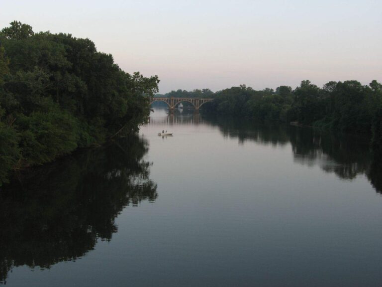
Photo: Ken Lund, CC BY-SA 2.0
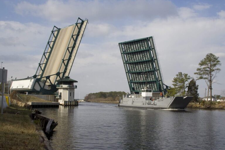
Photo: U.S. Army Corps of Engineers Norfolk District, CC BY 2.0

Photo: Doug Kerr, CC BY-SA 2.0
Straight replies on Chesapeake Bay from the Virginia rule books
Which Virginia waters count as the Chesapeake Bay here?
This page covers the Virginia side: 36 bay-side coast pages and 7 tidal river pages, with 19 seaside pages listed alongside.
Do I need a saltwater license to fish the Chesapeake Bay in Virginia?
A Virginia saltwater license is $17.50 for residents and $25 for nonresidents 16 and older. Below the digest license lines on the tidal rivers the saltwater license applies.
What is the red drum limit in Virginia waters of the Bay?
Red drum: 3 a day, 18-inch minimum, 26-inch maximum (4VAC20-1400-30), as of November 6, 2026.
What are the flounder rules in the Bay?
Summer flounder: 4 a day, 16-inch minimum (4VAC20-620-50); the minimum changes on June 1 per the code section, as of November 6, 2026.
When can I keep striped bass in the Virginia part of the Bay?
Chesapeake Bay and its tributaries (spring/summer): May 16 through June 15, 19 in min, 24 in max, bag 1; Chesapeake Bay and its tributaries (fall): October 4 through December 31, 19 in min, 24 in max, bag 1; Potomac River tributaries: May 16 through July 6 and August 21 through December 31, 19 in min, 24 in max, bag 1.
Is there a cobia season?
Cobia: 1 a day, 43-inch minimum (4VAC20-510-20), open June 15 through September 20 per the code section.
Where can I launch a boat on the Bay?
DWR lists 32 saltwater access sites; the access band maps them with owner and location text as recorded.
Where do I find tide information for the Bay?
NOAA runs 9 water-level stations in Virginia and publishes predictions for 132 stations; the tide band links them.
Are there artificial reefs in the Virginia part of the Bay?
The VMRC angler guide charts 22 reef sites with coordinates and names 21 more without them.
Plan a Chesapeake Bay trip from a Virginia ramp
Buy the saltwater license and check the VMRC rows before the first drift.