Back River Fishing
This tidal river lies in City of Hampton, on the Chesapeake Bay side.
 Pick for troutPiscifun Carbon X ultralight spinning reel28% OFFSale $57.99
Photo of Hampton Roads: Doug Kerr, CC BY-SA 2.0
First notes on Back River
In City of Hampton, Back River is a tidal river on the Chesapeake Bay side. The closest Census place is Poquoson, roughly 1 mile off.
DWR lists 1 saltwater launch on or beside it. A boat can reach 9 artificial reefs within 25 miles. It is covered by 5 water-level stations within 25 miles. It falls under the saltwater rules of the Marine Resources Commission.
USGS GNIS named feature 1478125; Virginia DWR Boating Access Locations; NOAA CO-OPS; read November 6, 2026.
Launches near Back River
| Site | Recorded attributes | Owner | Location (DWR) |
|---|---|---|---|
| Fox Hill boat ramp on Back River | dock and ramp & separate hand launch, 3 ramps, barrier-free, saltwater | DWR | North (1) of Fox Hill at end of Dandy Point Road |
Virginia DWR Boating Access Locations layer (attributes as recorded; lanes, fees and hours are not in the layer), read November 6, 2026.
Keep rules on Back River
| Species | Area | Size | Bag | Season | VAC section |
|---|---|---|---|---|---|
| Black drum | Virginia tidal waters | 16 in minimum | 1 | not stated | 4VAC20-320-40 |
| Bluefish | Virginia tidal waters | not stated | 5 | not stated | 4VAC20-450-20 |
| Cobia | Virginia tidal waters | 43 in minimum | 1 | June 15 through September 20 | 4VAC20-510-20 |
| Grey trout (weakfish) | Virginia tidal waters | 12 in minimum | 1 | not stated | 4VAC20-380-60 |
| Spanish mackerel | Virginia tidal waters | 14 in minimum | 15 | not stated | 4VAC20-540-30 |
| Speckled trout | Virginia tidal waters | 14 in minimum | 5 | Closed April 1, 2026 through June 30, 2026 | 4VAC20-280-30 |
| Striped bass | Potomac River tributaries | 19 in minimum, 24 in maximum | 1 | May 16 through July 6 and August 21 through December 31 | 4VAC20-252-100 |
| Striped bass | All Virginia waters | not stated | not stated | not stated | 4VAC20-252-50 |
VMRC code sections set these limits on Back River, current to November 6, 2026.
Virginia Administrative Code, Title 4 Agency 20 (Marine Resources Commission) on law.lis.virginia.gov, as of November 6, 2026 (VMRC rules change by emergency order; check the VMRC regulations page before keeping fish).
A Virginia saltwater license is $17.50 for residents and $25 for nonresidents 16 and older.
Virginia license fees in the 2026 Freshwater Fishing in Virginia digest (licenses run one year from purchase unless noted), read November 6, 2026. Virginia Marine Resources Commission license fees, read November 6, 2026.
 For the trout herePiscifun Carbon XT ultralight spinning reel25% OFFSale $59.99
Tide tables for Back River
| NOAA water-level station | ID | Distance |
|---|---|---|
| Sewells Point | 8638610 | 12 miles |
| Yorktown USCG Training Center | 8637689 | 13 miles |
| CBBT, Chesapeake Channel | 8638901 | 13 miles |
| Kiptopeke | 8632200 | 17 miles |
| Money Point | 8639348 | 23 miles |
Tide tables close to Back River
| Prediction station | Distance |
|---|---|
| Messick Point, Back River | 1 mile |
| Old Point Comfort | 8 miles |
| Tue Marshes Light | 10 miles |
| Yorktown, Goodwin Neck | 11 miles |
| Huntington Park | 11 miles |
| HAMPTON ROADS (Sewells Point) | 12 miles |
NOAA pages carry the live data for Back River; this band only links them.
NOAA CO-OPS Tides & Currents station list, read November 6, 2026.
Wrecks and reef sites around Back River
| Reef | Area | Distance | Clearance (ft, MLW) |
|---|---|---|---|
| Back River Artificial Reef | Chesapeake Bay | 4 miles | 15 |
| Bluefish Rock Artificial Reef | Chesapeake Bay | 7 miles | 15 |
| Poquoson Artificial Reef | Chesapeake Bay | 8 miles | 12 |
| York Spit Artificial Reef | Chesapeake Bay | 10 miles | |
| Middle Ground Artificial Reef | Chesapeake Bay | 13 miles | 12 |
| East Oceanview Artificial Reef | Chesapeake Bay | 13 miles | |
| Mobjack Bay Artificial Reef | Chesapeake Bay | 13 miles | 15 |
| Cabbage Patch Artificial Reef | Chesapeake Bay | 14 miles | 15 |
| Cherrystone Artificial Reef | Chesapeake Bay | 20 miles | 15 |
The reef distances from Back River use VMRC chart grids.
Virginia Marine Resources Commission saltwater angler guide reef charts, read November 7, 2026.
Named put-ins on Back River
- Back Creek ParkVMRC angler guide listing
- Back Creek RampVMRC angler guide listing
- Dandy Point Ramp (Back River)VMRC angler guide listing
- Gosnold Hope Park (Back River)VMRC angler guide listing
Waterfront towns close to Back River
- HamptonHampton (city), 6 miles
- Gloucester PointGloucester County, 15 miles
- PoquosonPoquoson (city), 3 miles
- YorktownYork County, 15 miles
Virginia Marine Resources Commission saltwater angler guide (c. 2008, names only); USGS GNIS populated places.
Around Back River, within a Virginia drive
Other coastal pages near Back River
- Poquoson Rivertidal river, 6 miles
- Hampton Roadsbay, 10 miles
- York Rivertidal river, 11 miles
- Willoughby Baybay, 11 miles
- Mobjack Baybay, 12 miles
The Bay that Back River feeds
- Chesapeake BayVirginia side
Upstream options near Back River
- Tidal James River21 miles
- Sandy Bottom Park Pond8 miles
- Harwood’s Mill Reservoir10 miles
- Lake Biggins11 miles
Where to buy bait before Back River
- Bell Isle Marinamarina, Hampton, 1 mile
- Wallace's Bait & Tacklebait and tackle shop, Hampton, 1 mile
- Dandy Haven Marinamarina, Hampton, 1 mile
- Marina Cove Boat Basinmarina, Hampton, 2 miles
- Sandman Hook & Tacklebait and tackle shop, Hampton, 2 miles
- Rollins Boat Yardmarina, Poquoson, 4 miles
Paid trips that cover Back River
- Captain Hogg's Charterscharter, Hampton, (757) 876-1590
- Four Winds Charteringcharter, Hampton, (757) 713-2275
- Hampton Roads Charterscharter, Hampton, (757) 868-3474
- Seaduction Fishingcharter, Hampton, (757) 329-5137
Virginia towns close to Back River
- Poquoson1 mile, City of Poquoson
- Hampton4 miles, City of Hampton
- Bethel Manor7 miles, York County
- Newport News13 miles, City of Newport News
The localities Back River runs through
- City of Hamptonindependent city
Piscifun spinning gear for a day out on Back River


Piscifun and Amazon links are affiliate links; the site earns a commission on qualifying purchases.
Shorelines around Back River through a camera

Photo: U.S. Fish and Wildlife Service Northeast Region, Public domain

Photo: Missy Schmidt, CC BY 2.0
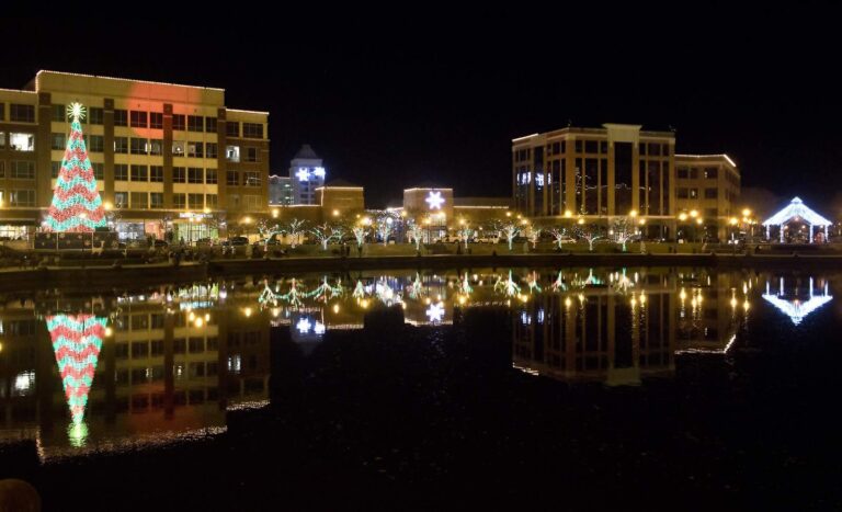
Photo: Watts, CC BY 2.0
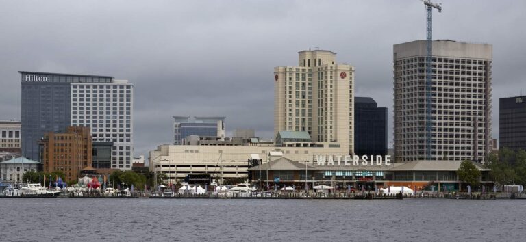
Photo: Watts, CC BY 2.0
Back River: what Old Dominion anglers keep asking
Where is Back River?
Head for City of Hampton, on the Chesapeake Bay side, about 1 mile from Poquoson.
Where do Tidewater boaters put in for Back River?
Fox Hill boat ramp on Back River is one of 1 saltwater launch on the DWR list.
Can I fish Back River with a freshwater license?
A Virginia saltwater license is $17.50 for residents and $25 for nonresidents 16 and older. Anglers under 16 need none.
Which puppy drum sizes may leave Back River?
Red drum: 3 a day, 18-inch minimum, 26-inch maximum (4VAC20-1400-30), as of November 6, 2026.
Is speckled trout season open on Back River?
Speckled trout: 5 a day, 14-inch minimum (4VAC20-280-30); the code closes the season April 1 through June 30, 2026, as of November 6, 2026.
How many flounder can I keep from Back River?
Summer flounder: 4 a day, 16-inch minimum (4VAC20-620-50); the minimum rises June 1 per the code section, as of November 6, 2026.
Where can I check the tide for Back River?
NOAA predicts the tide at Messick Point, Back River, some 1 mile away.
Which shop is on the way to Back River?
Stop at Bell Isle Marina (about 1 mile away).
Which VMRC reef is near Back River?
Back River Artificial Reef is the closest VMRC guide reef, about 4 miles away (chart-grid midpoint, not a structure position).
Bring the cast net to Back River
Every 2026 saltwater fee is one click away.