Nansemond River Fishing
Saltwater fishing on a tidal river in City of Suffolk.
 Pick for red drumPiscifun Alloy S inshore spinning reelCheck price at Piscifun
Photo of Hampton Roads: Doug Kerr, CC BY-SA 2.0
Nansemond River, sized up for saltwater anglers
Tidewater anglers know Nansemond River as a tidal river in City of Suffolk, on the Chesapeake Bay side. From the point, Carrollton is about 4 miles distant.
It has 2 saltwater launches in DWR saltwater access data. Within a 25-mile run sit 5 artificial reefs on the VMRC charts. 4 water-level stations from NOAA sit within 25 miles. Below the digest license line, a saltwater license and the VMRC limits apply.
USGS GNIS named feature 1480021; Virginia DWR Boating Access Locations; NOAA CO-OPS; read November 6, 2026.
Tidal ramps around Nansemond River
| Site | Recorded attributes | Owner | Location (DWR) |
|---|---|---|---|
| Peterson Yatch Basin boat ramp on Hampton Roads | 2 ramps, barrier-free, saltwater | City of Newport News | I-64 to Terminal Ave. exit,L on Jefferson Ave to 16th St;R 16th St(1) to Anderson Park |
| Jones Creek boat ramp | dock and ramp, 2 ramps, barrier-free, saltwater | Isle of Wight County | From Rt 17, West on 669 (.5), West on Rt 665 (1.5) , turn left into Jones Creek Landing |
Virginia DWR Boating Access Locations layer (attributes as recorded; lanes, fees and hours are not in the layer), read November 6, 2026.
What may come home from Nansemond River
| Species | Area | Size | Bag | Season | VAC section |
|---|---|---|---|---|---|
| Black sea bass | Virginia tidal waters | 13 in minimum | 15 | 2026: May 11 through December 31; 2027: April 1 through December 31 | 4VAC20-950-45 |
| Cobia | Virginia tidal waters | 43 in minimum | 1 | June 15 through September 20 | 4VAC20-510-20 |
| Spadefish | Virginia tidal waters | not stated | 4 | not stated | 4VAC20-970-30 |
| Spanish mackerel | Virginia tidal waters | 14 in minimum | 15 | not stated | 4VAC20-540-30 |
| Summer flounder | Tidal waters except Potomac River tributaries | 16 in minimum | 4 | Open year-round (January 1 through May 31 size) | 4VAC20-620-50 |
| Summer flounder | Tidal waters except Potomac River tributaries | 17.5 in minimum | 4 | Open year-round (June 1 through December 31 size) | 4VAC20-620-50 |
| Summer flounder | Potomac River tributaries | not stated | not stated | not stated | 4VAC20-620-60 |
| Tautog | Virginia tidal waters | 16 in minimum | 4 | Closed May 16 through June 30 | 4VAC20-960-45 |
Read the Nansemond River rows as of November 6, 2026; VMRC can change them by emergency order.
Virginia Administrative Code, Title 4 Agency 20 (Marine Resources Commission) on law.lis.virginia.gov, as of November 6, 2026 (VMRC rules change by emergency order; check the VMRC regulations page before keeping fish).
A Virginia saltwater license is $17.50 for residents and $25 for nonresidents 16 and older.
Virginia license fees in the 2026 Freshwater Fishing in Virginia digest (licenses run one year from purchase unless noted), read November 6, 2026. Virginia Marine Resources Commission license fees, read November 6, 2026.
Tides near Nansemond River
| NOAA water-level station | ID | Distance |
|---|---|---|
| Sewells Point | 8638610 | 8 miles |
| Money Point | 8639348 | 13 miles |
| Yorktown USCG Training Center | 8637689 | 22 miles |
| CBBT, Chesapeake Channel | 8638901 | 23 miles |
Tide prediction points near Nansemond River
| Prediction station | Distance |
|---|---|
| Pig Point | 2 miles |
| Town Point | 3 miles |
| Newport News | 4 miles |
| Huntington Park | 7 miles |
| Craney Island Light | 7 miles |
| Hollidays Point (Kings Highway bridge) | 7 miles |
For Nansemond River, follow the links for current water and tide data.
NOAA CO-OPS Tides & Currents station list, read November 6, 2026.
Reef sites near Nansemond River
| Reef | Area | Distance | Clearance (ft, MLW) |
|---|---|---|---|
| Middle Ground Artificial Reef | Chesapeake Bay | 5 miles | 12 |
| East Oceanview Artificial Reef | Chesapeake Bay | 15 miles | |
| Bluefish Rock Artificial Reef | Chesapeake Bay | 18 miles | 15 |
| Back River Artificial Reef | Chesapeake Bay | 20 miles | 15 |
| Poquoson Artificial Reef | Chesapeake Bay | 22 miles | 12 |
Reef points near Nansemond River are chart-grid midpoints from the VMRC guide, not structure positions.
Virginia Marine Resources Commission saltwater angler guide reef charts, read November 7, 2026.
Ports within reach of Nansemond River
Harbor places around Nansemond River
- NorfolkNorfolk (city), 11 miles
- HamptonHampton (city), 10 miles
Virginia Marine Resources Commission saltwater angler guide (c. 2008, names only); USGS GNIS populated places.
Old Dominion stops around Nansemond River
More Virginia coast pages near Nansemond River
- Elizabeth Rivertidal river, 7 miles
- Hampton Roadsbay, 8 miles
- Lafayette Rivertidal river, 8 miles
- Western Branch Elizabeth Rivertidal river, 8 miles
- Pagan Rivertidal river, 9 miles
The Bay beyond Nansemond River
- Chesapeake BayVirginia side
Lakes and rivers inland of Nansemond River
- Tidal James River20 miles
- Blackwater River24 miles
- Lone Star Lakes7 miles
- Lake Biggins7 miles
- Western Branch Reservoir10 miles
Bloodworm and minnow counters en route to Nansemond River
- Harbor View Partners, 106 Sharpe Drmarina, Suffolk, 2 miles
- G Daddy's Bait & Tacklebait and tackle shop, Carrollton, 4 miles
- Leeward Municipal Marinamarina, Newport News, 7 miles
- Nautical Boatsmarina, Portsmouth, 7 miles
- Shipwright Marinamarina, Portsmouth, 7 miles
- Virginia Boat & Yacht Servicemarina, Portsmouth, 7 miles
Towns that make a good base for Nansemond River
- Carrollton4 miles, Isle of Wight County
- Portsmouth7 miles, City of Portsmouth
- Smithfield9 miles, Isle of Wight County
- Newport News12 miles, City of Newport News
Each locality touching Nansemond River, linked
- City of Suffolkindependent city
A Piscifun spread to take to Nansemond River


Piscifun and Amazon links are affiliate links; the site earns a commission on qualifying purchases.
Pictures of the water by Nansemond River
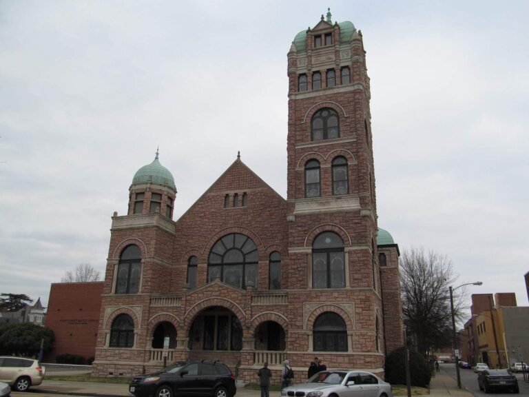
Photo: Doug Kerr, CC BY-SA 2.0

Photo: David Wilson, CC BY 2.0
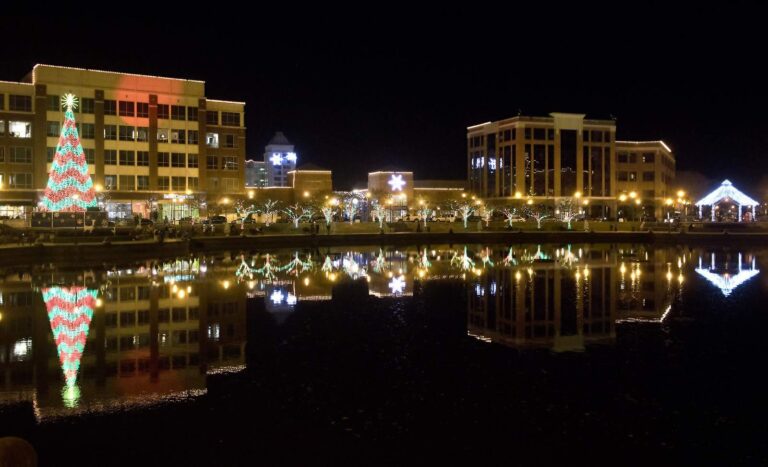
Photo: Watts, CC BY 2.0

Photo: U.S. Fish and Wildlife Service Northeast Region, Public domain
Sorting out Nansemond River, question by question
Which stretch of Tidewater holds Nansemond River?
Set the map on City of Suffolk, on the Chesapeake Bay side, about 4 miles from Carrollton.
Which DWR launch serves Nansemond River?
2 saltwater launches serve it, such as Peterson Yatch Basin boat ramp on Hampton Roads.
Which license covers Nansemond River?
A Virginia saltwater license is $17.50 for residents and $25 for nonresidents 16 and older. Under-16 anglers are exempt.
What red drum slot does VMRC set on Nansemond River?
Red drum: 3 a day, 18-inch minimum, 26-inch maximum (4VAC20-1400-30), as of November 6, 2026.
Is there a speckled trout closure on Nansemond River?
Speckled trout: 5 a day, 14-inch minimum (4VAC20-280-30); the code closes the season April 1 through June 30, 2026, as of November 6, 2026.
Is flounder open on Nansemond River?
Summer flounder: 4 a day, 16-inch minimum (4VAC20-620-50); the minimum rises June 1 per the code section, as of November 6, 2026.
How do I read water levels at Nansemond River?
The nearest prediction station is Pig Point, 2 miles away.
Does a listed marina or bait store serve Nansemond River?
Try Harbor View Partners (about 2 miles away).
Which VMRC reef chart sits nearest Nansemond River?
Middle Ground Artificial Reef is the closest VMRC guide reef, about 5 miles away (chart-grid midpoint, not a structure position).
 For the red drum herePiscifun NautiX saltwater spinning reel14% OFFSale $94.99
Plan a drift on Nansemond River
Saltwater limits and license fees sit on one page.