Sand Shoal Inlet Fishing
This inlet lies in Northampton County, on the Atlantic side.
 Pick for troutPiscifun Carbon X ultralight spinning reel28% OFFSale $57.99
Photo, nearby stand in for Sand Shoal Inlet: U.S. Army Corps of Engineers Norfolk District, CC BY 2.0
First notes on Sand Shoal Inlet
In Northampton County, Sand Shoal Inlet is a inlet on the Atlantic side. The closest Census place is Cape Charles, roughly 13 miles off.
DWR lists 1 saltwater launch on or beside it. A boat can reach 6 artificial reefs within 25 miles. It is covered by 3 water-level stations within 25 miles. It falls under the saltwater rules of the Marine Resources Commission.
USGS GNIS named feature 1473997; Virginia DWR Boating Access Locations; NOAA CO-OPS; read November 6, 2026.
Launches near Sand Shoal Inlet
| Site | Recorded attributes | Owner | Location (DWR) |
|---|---|---|---|
| Oyster boat ramp on Cherrystone Inlet | concrete ramp (no dock), 2 ramps, saltwater | Northampton | In Oyster on Rt 1802 |
Virginia DWR Boating Access Locations layer (attributes as recorded; lanes, fees and hours are not in the layer), read November 6, 2026.
Keep rules on Sand Shoal Inlet
| Species | Area | Size | Bag | Season | VAC section |
|---|---|---|---|---|---|
| Black drum | Virginia tidal waters | 16 in minimum | 1 | not stated | 4VAC20-320-40 |
| Bluefish | Virginia tidal waters | not stated | 5 | not stated | 4VAC20-450-20 |
| Cobia | Virginia tidal waters | 43 in minimum | 1 | June 15 through September 20 | 4VAC20-510-20 |
| Grey trout (weakfish) | Virginia tidal waters | 12 in minimum | 1 | not stated | 4VAC20-380-60 |
| Red drum | Virginia tidal waters | 18 in minimum, 26 in maximum | 3 | not stated | 4VAC20-1400-30 |
| Speckled trout | Virginia tidal waters | 14 in minimum | 5 | Closed April 1, 2026 through June 30, 2026 | 4VAC20-280-30 |
| Striped bass | Coastal area | 28 in minimum, 31 in maximum | 1 | January 1 through March 31 and May 16 through December 31 | 4VAC20-252-110 |
| Striped bass | All Virginia waters | not stated | not stated | not stated | 4VAC20-252-50 |
VMRC code sections set these limits on Sand Shoal Inlet, current to November 6, 2026.
Virginia Administrative Code, Title 4 Agency 20 (Marine Resources Commission) on law.lis.virginia.gov, as of November 6, 2026 (VMRC rules change by emergency order; check the VMRC regulations page before keeping fish).
A Virginia saltwater license is $17.50 for residents and $25 for nonresidents 16 and older.
Virginia license fees in the 2026 Freshwater Fishing in Virginia digest (licenses run one year from purchase unless noted), read November 6, 2026. Virginia Marine Resources Commission license fees, read November 6, 2026.
 For the trout herePiscifun Carbon XT ultralight spinning reel25% OFFSale $59.99
Tide tables for Sand Shoal Inlet
| NOAA water-level station | ID | Distance |
|---|---|---|
| Kiptopeke | 8632200 | 14 miles |
| Wachapreague | 8631044 | 23 miles |
| CBBT, Chesapeake Channel | 8638901 | 24 miles |
Tide tables close to Sand Shoal Inlet
| Prediction station | Distance |
|---|---|
| Sand Shoal Inlet (Coast Guard Station) | 1 mile |
| Oyster Harbor | 8 miles |
| Great Machipongo Inlet (inside) | 8 miles |
NOAA pages carry the live data for Sand Shoal Inlet; this band only links them.
NOAA CO-OPS Tides & Currents station list, read November 6, 2026.
Wrecks and reef sites around Sand Shoal Inlet
| Reef | Area | Distance | Clearance (ft, MLW) |
|---|---|---|---|
| Cherrystone Artificial Reef | Chesapeake Bay | 15 miles | 15 |
| Cabbage Patch Artificial Reef | Chesapeake Bay | 17 miles | 15 |
| Nassawadox Artificial Reef | Chesapeake Bay | 19 miles | 15 |
| Wachapreague Artificial Reef | Atlantic Ocean | 22 miles | 15 |
| Occohannock Artificial Reef | Chesapeake Bay | 24 miles | 15 |
| York Spit Artificial Reef | Chesapeake Bay | 25 miles |
The reef distances from Sand Shoal Inlet use VMRC chart grids.
Virginia Marine Resources Commission saltwater angler guide reef charts, read November 7, 2026.
Waterfront towns close to Sand Shoal Inlet
Shore towns near Sand Shoal Inlet
- Cape CharlesNorthampton County, 13 miles
- OysterNorthampton County, 8 miles
Virginia Marine Resources Commission saltwater angler guide (c. 2008, names only); USGS GNIS populated places.
Around Sand Shoal Inlet, within a Virginia drive
Other coastal pages near Sand Shoal Inlet
- New Inletinlet, 3 miles
- Great Machipongo Inletinlet, 6 miles
- Hog Island Baybay, 11 miles
- Magothy Baybay, 11 miles
- Smith Islandcape or island, 11 miles
Upstream options near Sand Shoal Inlet
- Lake Whitehurst35 miles
- Trashmore Lake37 miles
- Sandy Bottom Park Pond39 miles
Where to buy bait before Sand Shoal Inlet
- Bailey's Bait & Tacklebait and tackle shop, Cape Charles, 13 miles
- Captain Zed's Bait Tacklebait and tackle shop, Wachapreague, 23 miles
- Wachapreague Town Marinamarina, Wachapreague, 23 miles
- Bay Creek Marinamarina, Cape Charles
Paid trips that cover Sand Shoal Inlet
- Cape Charles Fishing Adventurecharter, Cape Charles, (717) 572-7589
Virginia towns close to Sand Shoal Inlet
- Cape Charles13 miles, Northampton County
- Exmore17 miles, Northampton County
- Onancock29 miles, Accomack County
The localities Sand Shoal Inlet runs through
- Northampton Countycounty seat Eastville
Piscifun spinning gear for a day out on Sand Shoal Inlet


Piscifun and Amazon links are affiliate links; the site earns a commission on qualifying purchases.
Shorelines around Sand Shoal Inlet through a camera
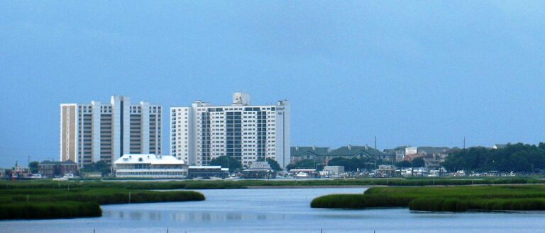
Photo: Nannette Turner, CC BY 2.0
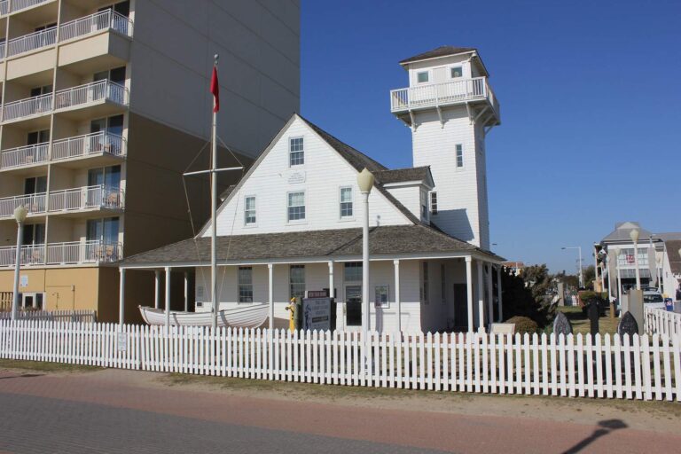
Photo: Nicolas Henderson, CC BY 2.0

Photo: Doug Lewis, CC BY 2.0

Photo: Doug Kerr, CC BY-SA 2.0
Sand Shoal Inlet: what Old Dominion anglers keep asking
Where is Sand Shoal Inlet?
Head for Northampton County, on the Atlantic side, about 13 miles from Cape Charles.
Where do Tidewater boaters put in for Sand Shoal Inlet?
Oyster boat ramp on Cherrystone Inlet is one of 1 saltwater launch on the DWR list.
Can I fish Sand Shoal Inlet with a freshwater license?
A Virginia saltwater license is $17.50 for residents and $25 for nonresidents 16 and older. Anglers under 16 need none.
Which puppy drum sizes may leave Sand Shoal Inlet?
Red drum: 3 a day, 18-inch minimum, 26-inch maximum (4VAC20-1400-30), as of November 6, 2026.
Is speckled trout season open on Sand Shoal Inlet?
Speckled trout: 5 a day, 14-inch minimum (4VAC20-280-30); the code closes the season April 1 through June 30, 2026, as of November 6, 2026.
How many flounder can I keep from Sand Shoal Inlet?
Summer flounder: 4 a day, 16-inch minimum (4VAC20-620-50); the minimum rises June 1 per the code section, as of November 6, 2026.
Where can I check the tide for Sand Shoal Inlet?
NOAA predicts the tide at Sand Shoal Inlet (Coast Guard Station), some 1 mile away.
Which shop is on the way to Sand Shoal Inlet?
Stop at Bailey's Bait & Tackle (about 13 miles away).
Which VMRC reef is near Sand Shoal Inlet?
Cherrystone Artificial Reef is the closest VMRC guide reef, about 15 miles away (chart-grid midpoint, not a structure position).
Bring the cast net to Sand Shoal Inlet
Every 2026 saltwater fee is one click away.