Corrotoman River Fishing
Coastal tidal river fishing in Lancaster County.
 Pick for troutPiscifun Carbon X ultralight spinning reel28% OFFSale $57.99
Photo of Eastern Shore of Virginia: U.S. Fish and Wildlife Service Northeast Region, Public domain
The essentials of Corrotoman River
Corrotoman River, a tidal river of Lancaster County, lies on the Chesapeake Bay side. Count on about 7 miles to Kilmarnock.
Boaters reach it from 5 saltwater launches on the DWR list. The VMRC angler guide charts 4 artificial reefs within 25 miles. There are 2 water-level stations close by. Marine limits and the saltwater license apply here.
USGS GNIS named feature 1465270; Virginia DWR Boating Access Locations; NOAA CO-OPS; read November 6, 2026.
Saltwater ramps close to Corrotoman River
| Site | Recorded attributes | Owner | Location (DWR) |
|---|---|---|---|
| Greenvale Creek boat ramp on Corrotoman River | dock and ramp, 1 ramp, barrier-free, saltwater | Lancaster County | From Lively Rt. 3, S. Rt 201, E. Rt. 354, S. foll. Rt 624 Mullosk (1/2mi.) |
| Windmill Point on Tidal Rappahannock River | dock and ramp, 1 ramp, saltwater | Lancaster County | From Whitestone (Rt.3), turn East on Chesapeake Dr., in 0.3 mi. continue onto Windmill P |
| Mill Creek boat ramp on Tidal Rappahannock River | dock and ramp, 1 ramp, barrier-free, saltwater | VDOT | From Hartfield, Rt. 3 North (.5); R on Rt 626 (3.1) |
| Saluda boat ramp on Tidal Rappahannock River | dock and ramp, 1 ramp, barrier-free, saltwater | VDOT | Rt 618 North (1.4) of Saluda |
| Deep Point on Piankatank River | dock and ramp, 1 ramp, barrier-free, saltwater | VDOT | From Glenns, Rt 198 East (7.5); L on Rt 606 (1.5) |
Virginia DWR Boating Access Locations layer (attributes as recorded; lanes, fees and hours are not in the layer), read November 6, 2026.
VMRC size and possession limits for Corrotoman River
| Species | Area | Size | Bag | Season | VAC section |
|---|---|---|---|---|---|
| Black drum | Virginia tidal waters | 16 in minimum | 1 | not stated | 4VAC20-320-40 |
| Bluefish | Virginia tidal waters | not stated | 5 | not stated | 4VAC20-450-20 |
| Grey trout (weakfish) | Virginia tidal waters | 12 in minimum | 1 | not stated | 4VAC20-380-60 |
| Speckled trout | Virginia tidal waters | 14 in minimum | 5 | Closed April 1, 2026 through June 30, 2026 | 4VAC20-280-30 |
| Striped bass | Chesapeake Bay and its tributaries (spring/summer) | 19 in minimum, 24 in maximum | 1 | May 16 through June 15 | 4VAC20-252-80 |
| Striped bass | Chesapeake Bay and its tributaries (fall) | 19 in minimum, 24 in maximum | 1 | October 4 through December 31 | 4VAC20-252-90 |
| Striped bass | Potomac River tributaries | 19 in minimum, 24 in maximum | 1 | May 16 through July 6 and August 21 through December 31 | 4VAC20-252-100 |
| Striped bass | All Virginia waters | not stated | not stated | not stated | 4VAC20-252-50 |
For Corrotoman River, these are the code limits as read on November 6, 2026.
Virginia Administrative Code, Title 4 Agency 20 (Marine Resources Commission) on law.lis.virginia.gov, as of November 6, 2026 (VMRC rules change by emergency order; check the VMRC regulations page before keeping fish).
A Virginia saltwater license is $17.50 for residents and $25 for nonresidents 16 and older.
Virginia license fees in the 2026 Freshwater Fishing in Virginia digest (licenses run one year from purchase unless noted), read November 6, 2026. Virginia Marine Resources Commission license fees, read November 6, 2026.
 For the trout herePiscifun Carbon XT ultralight spinning reel25% OFFSale $59.99
Where to check the tide at Corrotoman River
| NOAA water-level station | ID | Distance |
|---|---|---|
| Windmill Point | 8636580 | 11 miles |
| Lewisetta | 8635750 | 24 miles |
Where NOAA predicts the tide near Corrotoman River
| Prediction station | Distance |
|---|---|
| Millenbeck, Corrotoman River | 1 mile |
| Urbanna | 5 miles |
| Mill Creek (Grey Point) | 6 miles |
| Windmill Point | 11 miles |
| Dixie | 11 miles |
| Jackson Creek, Deltaville | 11 miles |
Open a station to see today near Corrotoman River.
NOAA CO-OPS Tides & Currents station list, read November 6, 2026.
Fish-holding reefs close to Corrotoman River
| Reef | Area | Distance | Clearance (ft, MLW) |
|---|---|---|---|
| Windmill Point Artificial Reef | Chesapeake Bay | 13 miles | 15 |
| Asphalt Pile Artificial Reef | Chesapeake Bay | 15 miles | 15 |
| Gwynn Island Artificial Reef | Chesapeake Bay | 18 miles | 14 |
| Northern Neck Artificial Reef | Chesapeake Bay | 20 miles | 20 |
Reef positions near Corrotoman River are approximate chart-grid centres.
Virginia Marine Resources Commission saltwater angler guide reef charts, read November 7, 2026.
Harbors and wharves by Corrotoman River
Waterfront towns by Corrotoman River
- DeltavilleMiddlesex County, 10 miles
- KilmarnockLancaster County, 7 miles
- UrbannaMiddlesex County, 5 miles
Virginia Marine Resources Commission saltwater angler guide (c. 2008, names only); USGS GNIS populated places.
Close to Corrotoman River on the Commonwealth map
Virginia saltwater next door to Corrotoman River
- Piankatank Rivertidal river, 13 miles
- Great Wicomico Rivertidal river, 15 miles
- Ware Rivertidal river, 20 miles
- East Rivertidal river, 21 miles
- Little Wicomico Rivertidal river, 21 miles
Out past Corrotoman River
- Chesapeake BayVirginia side
Non-tidal water close to Corrotoman River
- Beaverdam Swamp Reservoir14 miles
- Gardy’s Millpond25 miles
- Waller Mill Reservoir27 miles
Stores with hooks, line and lures around Corrotoman River
- Yankee Point Sailboat Marinamarina, Lancaster, 3 miles
- Tackle Cove Outfittersbait and tackle shop, White Stone, 4 miles
- Locklies Marinamarina, Topping, 5 miles
- Regent Point Marina & Boatyardmarina, Topping, 5 miles
- Urbanna Town Marinamarina, Urbanna, 5 miles
- Bridge Marinasmarina, Urbanna, 5 miles
Booking a skipper or guide for Corrotoman River
- Peake Tide Fishingcharter, Kilmarnock, (804) 338-0109
A bed and a breakfast counter near Corrotoman River
- Kilmarnock7 miles, Lancaster County
- Gloucester Courthouse17 miles, Gloucester County
- West Point19 miles, King William County
- Gloucester Point26 miles, Gloucester County
Locality pages that take in Corrotoman River
- Lancaster Countycounty seat Lancaster
Piscifun tackle that suits Corrotoman River


Piscifun and Amazon links are affiliate links; the site earns a commission on qualifying purchases.
How the banks by Corrotoman River look on a clear day
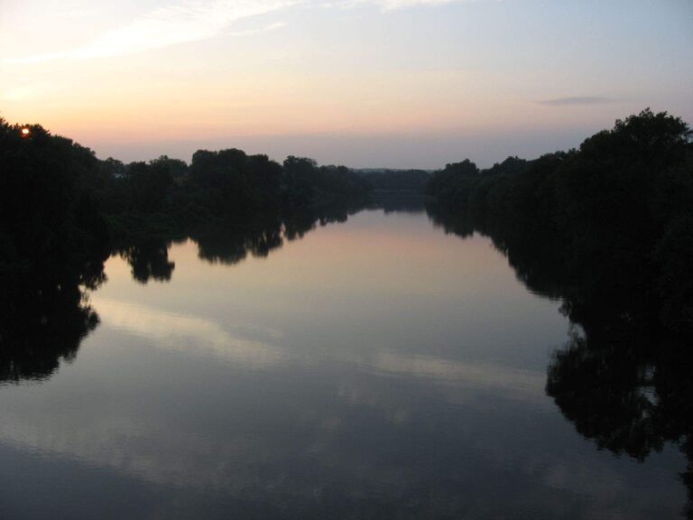
Photo: Ken Lund, CC BY-SA 2.0
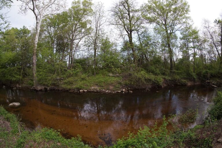
Photo: schizoform, CC BY 2.0

Photo: U.S. Fish and Wildlife Service Northeast Region, Public domain

Photo: Watts, CC BY 2.0
Questions on Corrotoman River before the truck is loaded
Which Virginia locality holds Corrotoman River?
GNIS places it in Lancaster County, on the Chesapeake Bay side, about 7 miles from Kilmarnock.
Which DWR saltwater ramp gets a boat to Corrotoman River?
DWR records 5 saltwater launches, among them Greenvale Creek boat ramp on Corrotoman River.
What does DWR charge to fish Corrotoman River?
A Virginia saltwater license is $17.50 for residents and $25 for nonresidents 16 and older. Kids under 16 are exempt.
Which red drum rule applies on Corrotoman River?
Red drum: 3 a day, 18-inch minimum, 26-inch maximum (4VAC20-1400-30), as of November 6, 2026.
What size speckled trout may go home from Corrotoman River?
Speckled trout: 5 a day, 14-inch minimum (4VAC20-280-30); the code closes the season April 1 through June 30, 2026, as of November 6, 2026.
What size flounder may go home from Corrotoman River?
Summer flounder: 4 a day, 16-inch minimum (4VAC20-620-50); the minimum rises June 1 per the code section, as of November 6, 2026.
Which NOAA gauge sits closest to Corrotoman River?
Millenbeck, Corrotoman River, about 1 mile away, is closest.
Which Virginia bait counter sits closest to Corrotoman River?
Nearest in our list: Yankee Point Sailboat Marina (about 3 miles away).
Can I reach a reef from Corrotoman River?
Windmill Point Artificial Reef is the closest VMRC guide reef, about 13 miles away (chart-grid midpoint, not a structure position).
Spend a falling tide on Corrotoman River
Know the slot and season before the first cast.