Bay, Crow Wing County Fishing
Crow Wing County, 2,330 acres, 74 feet deep.
 Pick for walleyePiscifun Viper X spinning reel50% OFFSale $39.99
Photo of Gull Lake: Onorem, CC BY-SA 3.0
First look at Bay, Crow Wing County
The DNR lists Bay, Crow Wing County as a bay covering 2,330 acres in Crow Wing County. Soundings put the deepest water at 74 feet, with an average of 21.4 feet. About 38% of the lake, 879 acres, is under 15 feet deep. About 6 miles separate the lake from Garrison. Surveys come from the Brainerd area fisheries office.
DNR surveys have recorded walleye, northern pike, yellow perch, black crappie, bluegill and largemouth bass. Anglers launch from 1 public water access. The newest catch data come from a standard survey on June 14, 2021. Walleye numbers, 1 per gill net, landed below the range the DNR expects (4.0-9.6). The DNR ice-out median is April 17 (13 records).
 For the walleye herePiscifun AlumiX spinning reel46% OFFSale $64.99
Fish counts from the last Bay, Crow Wing County survey
These rows come from the standard survey on June 14, 2021; the normal range is the DNR range for lakes of the same class.
| Species | Gear | Caught | Per set | Normal range | Avg lb | Normal lb |
|---|---|---|---|---|---|---|
| Walleye | Standard gill nets | 15 | 1 | 4.0-9.6 | 3.51 | 1.1-1.9 |
| Walleye | Standard trap nets | 1 | 0.07 | 0.3-0.9 | 5.57 | 1.0-2.2 |
| Northern pike | Standard gill nets | 148 | 9.87 | 3.0-7.9 | 1.93 | 1.7-2.8 |
| Northern pike | Standard trap nets | 20 | 1.33 | 0.96 | ||
| Yellow perch | Standard trap nets | 1 | 0.07 | 0.7-3.7 | 0.15 | 0.1-0.2 |
| Black crappie | Standard gill nets | 6 | 0.4 | 0.2-1.1 | 0.28 | 0.2-0.5 |
| Black crappie | Standard trap nets | 9 | 0.6 | 0.3-1.7 | 0.35 | 0.3-0.6 |
| Bluegill | Standard gill nets | 7 | 0.47 | 0.24 | ||
| Bluegill | Standard trap nets | 143 | 9.53 | 3.7-42.9 | 0.19 | 0.1-0.2 |
| Largemouth bass | Standard gill nets | 26 | 1.73 | 0.3-1.2 | 1.1 | 0.6-1.0 |
| Largemouth bass | Standard trap nets | 12 | 0.8 | 0.4-1.4 | 1.16 | 0.3-0.7 |
| Tullibee (cisco) | Standard gill nets | 3 | 0.2 | 0.5-5.2 | 1.98 | 0.4-1.0 |
Gill net totals, Bay, Crow Wing County
Minnesota DNR LakeFinder lake survey data, survey report. Checked October 2026.
The Bay, Crow Wing County fishery in the DNR report
“Bay Lake is a popular 2,392 acre lake located five miles south of Deerwood in Crow Wing County.”
“Development is heavy on its 24.3 miles of shoreline.”
“Maximum depth is 74 feet, with 42% of the lake 15 feet deep or less.”
“The lone public access located on the west shore of the northwest bay can get very crowded at times.”
Quoted from the DNR status of the fishery for Bay (report). Checked October 2026.
Where trailers back down on Bay, Crow Wing County
- Bay Lake Access1 ramp, 15 trailer stalls, 1 dock, toilet, DNR Division of Parks and Trails
Accesses a short drive from Bay, Crow Wing County
- Partridge Lake AccessPartridge, 3 miles south
- Clearwater Lake Access near DeerwoodClearwater, 3 miles northwest
- Crooked Lake Access near GarrisonCrooked, 4 miles southwest
- Rice Lake, Hesitation AccessRice, 4 miles southwest
- Farm Island Lake AccessFarm Island, 4 miles east
- Round Lake Access near GarrisonRound, 4 miles southeast
Minnesota DNR Public Water Access Sites and Public Fishing Sites layers and LakeFinder, checked October 2026.
Depth and shape of Bay, Crow Wing County
Since 2008, 4 Secchi readings have been recorded on Bay, Crow Wing County.
The earliest ice-out on record for Bay, Crow Wing County came March 13, 2024; the latest, May 11, 2013.
DNR LakeFinder morphology and water clarity, DNR ice-out records (ice-out data), checked October 2026.
Bay, Crow Wing County elevation
The Bay, Crow Wing County level history is a DNR volunteer gauge series, not a live feed.
DNR lake level record (datum NGVD 29).
Fish on record for Bay, Crow Wing County
Species for Bay, Crow Wing County come from DNR survey nets, so small or rare fish may be missing.
Minnesota DNR LakeFinder species list and survey catch.
Bag and size limits on Bay, Crow Wing County
The statewide table below is every limit that applies on Bay, Crow Wing County.
| Species | Limit | Season |
|---|---|---|
| Walleye and sauger | 6 combined total (only 1 walleye over 20" in possession) | May 9, 2026 – Feb. 28, 2027 |
| Northern pike (North-central Zone) | 10 (not more than 2 over 26", all from 22-26" must be immediately released) | May 9, 2026 – Feb. 28, 2027 |
| Northern pike (North-central Zone) | 10 (either 2 northern pike over 26" and none from 22 to 26" or 1 from 22 to 26" and 1 over 26") | Nov. 15, 2026 – Feb. 28, 2027 except where prohibited |
| Largemouth bass | Catch-and-release only | March 1 – May 22, 2026 |
| Largemouth bass | 6 combined total largemouth or smallmouth bass (when smallmouth season is open) | May 23, 2026 – Feb. 28, 2027 |
| Smallmouth bass | Catch-and-release only | March 1 – May 22, 2026 |
| Smallmouth bass | 6 combined total largemouth or smallmouth bass | May 23 – Sept. 13, 2026 |
| Smallmouth bass | Catch-and-release only | Sept. 14, 2026 – Feb. 28, 2027 |
| Crappie | 10 combined total | Continuous |
| Sunfish | 20 combined total | Continuous |
| Yellow perch | 20 daily, 40 in possession | Continuous |
| Muskellunge | 1 (minimum size 54") | June 6 – Nov. 30, 2026 |
| Channel catfish | 5 (only 1 over 24") | Continuous |
| Rock bass | 30 | Continuous |
| Cisco (tullibee) | 15 (over 7") | Continuous |
| Burbot (eelpout) | 4 | Continuous |
Map position places Bay, Crow Wing County in the North-central Zone for pike and bass.
2026 Minnesota Fishing Regulations and LakeFinder special regulations, checked October 2026. All Minnesota limits.
Bay, Crow Wing County compared with its neighbors
| Lake | Distance | Acres | Max depth ft | Accesses | Walleye per gill net |
|---|---|---|---|---|---|
| Bay, Crow Wing County | 2,330 | 74 | 1 | 1 | |
| Knieff Lake | 2 miles north | 44 | 42 | 0 | |
| Long / Tame Fish Lake | 2 miles northeast | 127 | 58 | 0 | 0.25 |
| Partridge Lake, Crow Wing County | 2 miles south | 188 | 42 | 1 | |
| Crooked Lake, Crow Wing County | 2 miles west | 463 | 72 | 1 | 0.67 |
| Turtle Lake, Crow Wing County | 3 miles southeast | 108 | 33 | 0 |
DNR LakeFinder morphology, access layer and latest survey per lake.
Close by Bay, Crow Wing County
Lakes a short haul from Bay, Crow Wing County
- Knieff Lake2 miles north
- Long / Tame Fish Lake2 miles northeast
- Partridge Lake, Crow Wing County2 miles south
- Crooked Lake, Crow Wing County2 miles west
- Turtle Lake, Crow Wing County3 miles southeast
Bait counters serving Bay, Crow Wing County
- Phil's Myr Mar Marinamarina, Aitkin, 6 miles
- Tutts Bait And Tacklebait and tackle shop, Garrison, 6 miles
- Garrison Sport LLCsporting goods store, Garrison, 6 miles
- Tutt's Bait & Tacklebait and tackle shop, Garrison, 6 miles
- Terry's Boat Harbormarina, Garrison, 9 miles
- Gopher Tacklebait and tackle shop, Deerwood, 10 miles
Places to bunk near Bay, Crow Wing County
- Garrison6 miles
- Deerwood6 miles
- Crosby9 miles
Minnesota counties sharing Bay, Crow Wing County
- Crow Wing Countyseat: Brainerd
Spinning and baitcasting picks for Bay, Crow Wing County


Piscifun and Amazon links are affiliate links; the site earns a commission on qualifying purchases.
Species in the nets at Bay, Crow Wing County
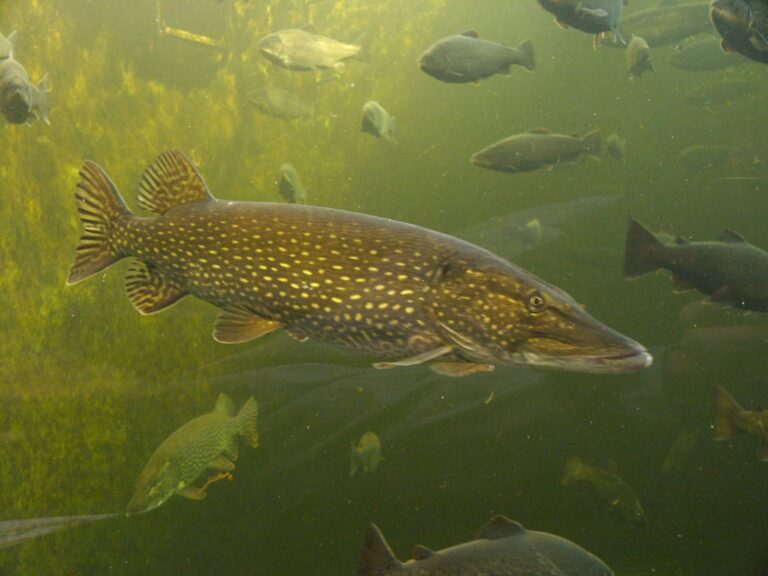
Photo: Georg Mittenecker, CC BY-SA 2.5

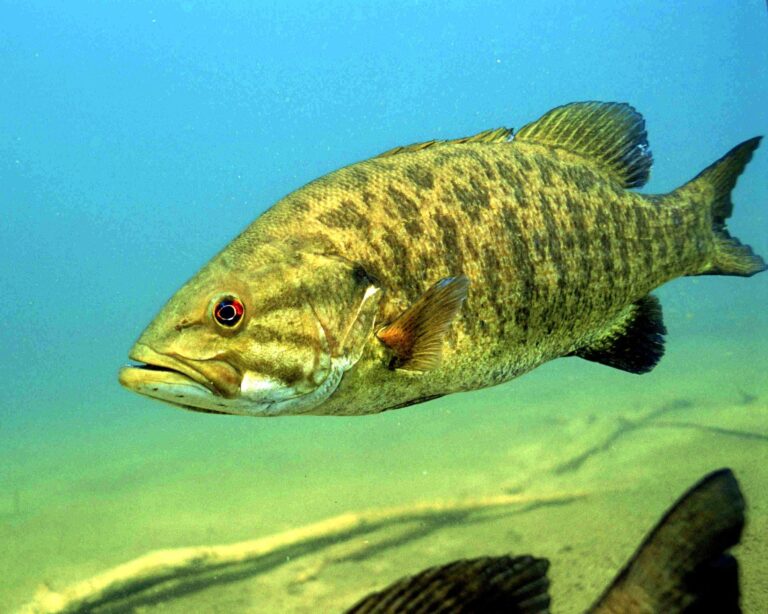
Photo: Engbretson Eric, U.S. Fish and Wildlife Service, Public domain

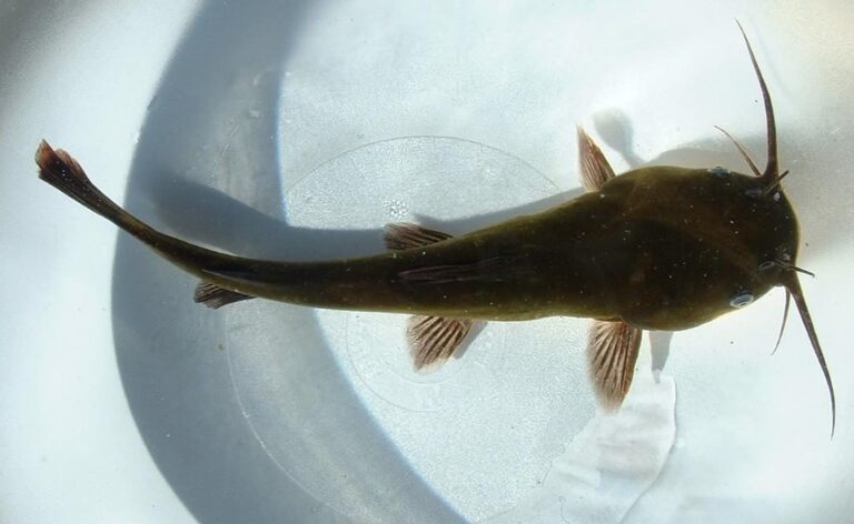
Photo: Unknown author, CC BY-SA 3.0


Photo: Everglades NPS from Homestead, Florida, United States, Public domain

Answers before you launch on Bay, Crow Wing County
Where does Bay, Crow Wing County sit on a Minnesota map?
The lake point falls in Crow Wing County, managed from the Brainerd fisheries office, about 6 miles from Garrison.
What acreage does LakeFinder give Bay, Crow Wing County?
2,330 surface acres, 74 feet at the deepest.
Where is the public access on Bay, Crow Wing County?
The DNR layer lists 1 public access; Bay Lake Access is a good start.
Is Bay, Crow Wing County a good panfish lake?
walleye, northern pike, yellow perch, black crappie, bluegill, largemouth bass and smallmouth bass, per DNR surveys.
Is Bay, Crow Wing County above normal for walleye?
A standard survey on June 14, 2021; walleye ran 1 per gill net.
Is Bay, Crow Wing County under experimental regulations?
Statewide limits, North-central Zone.
Do I need a Minnesota license for Bay, Crow Wing County?
Minnesota residents 16 to 89 need an angling license ($25 for the year); nonresidents 16 and older pay $51.
When does Bay, Crow Wing County freeze and thaw?
Around April 17 in most years; April 17, 2026 last time.
Where can I buy minnows near Bay, Crow Wing County?
Closest on our list: Phil's Myr Mar Marina, 6 miles.
Hook up the trailer for Bay, Crow Wing County
The license page lists every Minnesota limit.