North River Fishing
A river through Augusta County.
 Pick for troutPiscifun Carbon X ultralight spinning reel28% OFFSale $57.99
Photo of Eastern Shore of Virginia: U.S. Fish and Wildlife Service Northeast Region, Public domain
What a Virginia angler should know about the North River
The North River crosses Augusta County. Bridgewater lies roughly 15 miles away.
Live numbers come from 5 USGS gauges. Hatchery trout go into 8 stocked reaches of it. Downstream it becomes tidal water. Special trout regulations apply to part of it.
Virginia DWR waterbody pages, Stocked Trout Reaches and Cold Water Stream Survey layers and Boating Access Locations; USGS gauges; read November 6, 2026.
 For the trout herePiscifun Carbon XT ultralight spinning reel25% OFFSale $59.99
DWR notes on fishing the North River
North River originates high up in the mountains of National Forest within Augusta County. It exits public land near the town of Stokesville and winds its way through farmland all the way to its confluence with South River, which forms the South Fork Shenandoah River. North River is an extremely diverse fishery. In its headwaters you can find water cold enough to support trout and two separate impoundments. There are also numerous stocked trout areas available.
How DWR says to reach North River
North River Upper Elkhorn Lake North River Tailwaters Staunton Dam North River Gorge North River Natural Bridge Wildwood Park Float Trips Bridgewater to Mount Crawford This is an average float of 3.5 miles, characterized by gentle riffles and rolling farmland. The substrate is mostly made up of bedrock, so the fish habitat is not overly dynamic.
These sentences on North River belong to Virginia DWR.
Virginia DWR waterbody page (updated 11/17/2023), read November 6, 2026.
Live Virginia gauge readout for the North River
| USGS gauge | Latest reading | Time (ET) |
|---|---|---|
| North River Near Stokesville, Va | 2 cfs, 1.93 ft gage height | Nov 8 7:00 pm |
| North River Near Burketown, Va | 103 cfs, 1.95 ft gage height | Nov 8 6:45 pm |
| North Run At Old Washington Hwy At Glen Allen, Va | 1.08 ft gage height | Nov 8 7:25 pm |
US Geological Survey provisional data, retrieved Nov 8, 2026 7:32 pm ET. Provisional readings can be revised.
Provisional USGS data feed the North River panel.
| USGS site | Name |
|---|---|
| 01620500 | NORTH RIVER NEAR STOKESVILLE, VA |
| 01622000 | NORTH RIVER NEAR BURKETOWN, VA |
| 0204241133 | NORTH RUN AT OLD WASHINGTON HWY AT GLEN ALLEN, VA |
| 0204241200 | NORTH RUN AT MOUNTAIN ROAD AT GLEN ALLEN, VA |
| 0204241951 | NORTH RUN AT HILLIARD RD NEAR RICHMOND, VA |
USGS instantaneous values, provisional.
The fish DWR records for the North River
The North River list repeats DWR names; generic labels stay unlinked.
Virginia DWR waterbody page (updated 11/17/2023), read November 6, 2026.
Getting onto the North River
No DWR launch sits on North River itself.
Virginia DWR Boating Access Locations layer (attributes as recorded; lanes, fees and hours are not in the layer), read November 6, 2026.
Trout reaches on the North River
| Reach | Locality | Category | Species stocked | Heritage Day | National forest |
|---|---|---|---|---|---|
| North River | Augusta | ||||
| North River | Augusta | ||||
| North River | Augusta | ||||
| North River | Augusta | B (stocked 5 times between October 1 and May 15) | brook | yes | |
| North River | Augusta | ||||
| North River (Gorge) | Augusta | B (stocked 5 times between October 1 and May 15) | rainbow, brook | yes | |
| North River (Tail) | Augusta | DH (Delayed Harvest, special regulations, stocked 3 times) | rainbow, brown | yes | |
| North River (Natural Chimney/Lower) | Augusta | B (stocked 5 times between October 1 and May 15) | rainbow |
North River carries 8 reaches on the stocked trout layer, category category B and DH. Part of it runs through national forest land.
Virginia DWR Stocked Trout Reaches and Stocked Trout Lakes layers (category, species, heritage day), read November 6, 2026.
Fly, lure and harvest rules for the North River
| Water | Locality as printed | Regulation | Trout license Oct 1 to Jun 15 |
|---|---|---|---|
| North River | Augusta | Delayed Harvest | yes |
- Delayed Harvest Waters: North River (Augusta County)That portion of stream from the base of Elkhorn Dam downstream 1.5 miles to a sign posted at the head of Staunton City Reservoir. This is a remote section of stream that can only be reached by foot trail. Access is available by parking at Elkhorn Lake and following the trail along the lake to the spillway.
Special regulation trout waters as printed (page updated August 17, 2026), 2026 Freshwater Fishing in Virginia digest (eRegulations, linked from the Virginia DWR regulations page), read November 6, 2026.
Designated stocked trout waters require a trout license October 1 to June 15; urban waters November 1 to April 30 (as printed).
Catchable trout deliveries to the North River
| Date | Water as listed | Category | Species |
|---|---|---|---|
| October 26, 2026 | North River (Tail) | DH | Brown Trout |
| May 28, 2026 | North River (Natural Chimneys) | B | Rainbow Trout, Brown Trout |
| May 6, 2026 | North River (Gorge) | B | Rainbow Trout, Brown Trout |
| May 4, 2026 | North River (Upper) | B | Brook Trout |
| April 27, 2026 | North River (Tail) | DH | Brown Trout |
| April 8, 2026 | North River (Natural Chimneys) | B | Brown Trout |
| April 6, 2026 | North River (Upper) | B | Brook Trout |
| March 31, 2026 | North River (Tail) | DH | Brown Trout |
| March 27, 2026 | North River (Gorge) | B | Rainbow Trout, Brown Trout |
| March 27, 2026 | North River (Upper) | B | Brook Trout |
| March 23, 2026 | North River (Natural Chimneys) | B | Rainbow Trout |
| February 25, 2026 | North River (Gorge) | B | Rainbow Trout, Brook Trout |
The schedule shows 2026-27 1 date; 2025-26 17 dates; 2024-25 17 dates; 2023-24 17 dates on North River.
Plan category for the North River
| Water as printed | Locality as printed | Category | Meaning | National forest |
|---|---|---|---|---|
| North River (Natural Chimneys) | Augusta County | B | stocked 5 times between October 1 and May 15 | |
| North River (Gorge) | Augusta County | B | stocked 5 times between October 1 and May 15 | yes |
| North River (Upper) | Augusta County | B | stocked 5 times between October 1 and May 15 | yes |
| North River (Tail) | Augusta County | DH | Delayed Harvest, special regulations, stocked 3 times | yes |
Virginia DWR trout stocking schedule (date, county, water, category and species as listed; DWR prints no numbers or sizes), read November 6, 2026. 2026 Catchable Trout Stocking Plan (category letters as printed), read November 6, 2026.
Tidewater stretch of the North River
- Mouth (GNIS)Mathews County
- NoteTidal reach and saltwater-license boundary per VMRC/DWR, not given by GNIS.
The fall line on North River matters for striped bass and blue catfish rules.
| Species | Area | Size | Bag | Season | VAC section |
|---|---|---|---|---|---|
| Black drum | Virginia tidal waters | 16 in minimum | 1 | not stated | 4VAC20-320-40 |
| Red drum | Virginia tidal waters | 18 in minimum, 26 in maximum | 3 | not stated | 4VAC20-1400-30 |
| Speckled trout | Virginia tidal waters | 14 in minimum | 5 | Closed April 1, 2026 through June 30, 2026 | 4VAC20-280-30 |
| Striped bass | Chesapeake Bay and its tributaries (spring/summer) | 19 in minimum, 24 in maximum | 1 | May 16 through June 15 | 4VAC20-252-80 |
| Striped bass | Chesapeake Bay and its tributaries (fall) | 19 in minimum, 24 in maximum | 1 | October 4 through December 31 | 4VAC20-252-90 |
| Striped bass | Potomac River tributaries | 19 in minimum, 24 in maximum | 1 | May 16 through July 6 and August 21 through December 31 | 4VAC20-252-100 |
| Striped bass | All Virginia waters | not stated | not stated | not stated | 4VAC20-252-50 |
Rules as printed, 2026 Freshwater Fishing in Virginia digest (eRegulations, linked from the Virginia DWR regulations page), read November 6, 2026. Virginia Administrative Code, Title 4 Agency 20 (Marine Resources Commission) on law.lis.virginia.gov, as of November 6, 2026 (VMRC rules change by emergency order; check the VMRC regulations page before keeping fish).
Virginia creel and length for the North River
| Species as printed | Applies to | Creel | Length |
|---|---|---|---|
| Largemouth, Smallmouth Bass | statewide | 5 per day in the aggregate (combined) | No statewide length limits |
| Alabama, Spotted Bass | statewide | No statewide daily limit | No statewide length limit |
| Landlocked Striped Bass and Landlocked Striped Bass X White Bass Hybrids | statewide | 4 per day in the aggregate | No fish less than 20 inches |
| Striped Bass | Anadromous (coastal) striped bass above the fall line in all coastal rivers of the Chesapeake Bay and Crane Lake (City of Suffolk) | Creel and length limits shall be as set by the Virginia Marine Resources Commission for recreational fishing in tidal waters | no length limit printed |
| Striped Bass | Striped bass in the Meherrin, Nottoway, Blackwater (Chowan Drainage), North Landing and Northwest rivers and their tributaries plus Back Bay | No possession | no length limit printed |
| Walleye, Saugeye | statewide | 5 per day in the aggregate | No walleye or saugeye less than 18 inches |
| Sauger | statewide | 2 per day | No statewide length limits |
| White Bass | statewide | 5 per day | No statewide length limits |
| Chain Pickerel and Northern Pike | statewide | 5 per day | No statewide length limits |
| Muskellunge | statewide | 1 per day | No muskellunge less than 40 inches |
| Bluegill (bream) and other sunfish excluding Crappie, Rock Bass (redeye) and Roanoke Bass | statewide | 50 per day in the aggregate (combined) | No statewide length limits |
| Crappie (black or white) | statewide | 25 per day in the aggregate (combined) | No statewide length limits |
| Rock Bass (redeye) | statewide | 25 per day in the aggregate with Roanoke bass | No statewide length limits |
| Roanoke Bass | statewide | 25 per day in the aggregate with rock bass | No statewide length limits |
| Perch (yellow and white) | statewide | No statewide daily limit | No statewide length limit |
| Trout | statewide | 6 per day | 7 inch minimum size |
| Channel, White, and Flathead | statewide | 20 per day | No length limits |
| Blue | statewide | 20 per day | No statewide length limits |
On North River, statewide rows hold where no exception speaks.
- Smallmouth Bass:
- 5 per day. No Length Limit.
- Largemouth Bass:
- 5 per day. No length Limit
- Sunfish:
- 50 per day. No length Limit
- Trout:
- 6 per day. Minimum size 7 inches
- National Forest Permit required when fishing North River Upper, Elkhorn Lake, North River Tailwaters, Staunton Dam, and North River Gorge.
- Trout license required October 1 – June 15 for North River Upper, Elkhorn Lake, North River Delayed Harvest, North River Gorge, and North River Natural Chimneys.
Virginia DWR waterbody page (updated 11/17/2023), read November 6, 2026.
A Virginia freshwater license is $23 a year for residents and $47 for nonresidents 16 and older, and a saltwater license is $17.50 for residents and $25 for nonresidents. Designated stocked trout waters also need the $23 trout license from October 1 to June 15.
Statewide creel and length limits as printed (page updated August 17, 2026), 2026 Freshwater Fishing in Virginia digest (eRegulations, linked from the Virginia DWR regulations page), read November 6, 2026. Virginia license fees in the 2026 Freshwater Fishing in Virginia digest (licenses run one year from purchase unless noted), read November 6, 2026.
The North River next to nearby creeks and rivers
| Stream | Distance | DWR access sites | USGS gauges | Stocked reaches |
|---|---|---|---|---|
| North River | this stream | 0 | 5 | 8 |
| Hone Quarry Run | 11 miles northeast | 0 | 0 | 1 |
| Mossy Creek | 11 miles east | 0 | 0 | 1 |
| Falls Hollow | 11 miles south | 0 | 0 | 1 |
| Dry River | 18 miles northeast | 0 | 0 | 3 |
| Bullpasture River | 20 miles west | 0 | 1 | 1 |
Virginia DWR Boating Access Locations and Stocked Trout Reaches, USGS gauges; read November 6, 2026.
Just off North River, by road
Another Virginia impoundment after North River
- Elkhorn Lakeunder a mile
- Staunton Run2 miles
- Todd Lake3 miles
- Braley Pond5 miles
Filling the bait bucket close to North River
- Bridgewater Rod & Reelbait and tackle shop, Bridgewater, 15 miles
- Heartland Outfittersbait and tackle shop, Dayton, 17 miles
- Dubby's Fishing & Huntingbait and tackle shop, Harrisonburg, 21 miles
- Mossy Creek Fly Fishingfly shop, Harrisonburg, 22 miles
Places to stay near North River
- Bridgewater15 miles, Rockingham County
- Staunton15 miles, City of Staunton
- Verona16 miles, Augusta County
The Virginia counties and cities along North River
- Augusta Countycounty seat Staunton
Virginia streams near the North River
- Hone Quarry Run11 miles
- Mossy Creek11 miles
- Falls Hollow11 miles
- Dry River18 miles
- Bullpasture River20 miles
Reels from Piscifun for the next trip to North River


Piscifun and Amazon links are affiliate links; the site earns a commission on qualifying purchases.
Lakes, tidewater and stream riffles close to North River, in pictures

Photo: Doug Kerr, CC BY-SA 2.0

Photo: U.S. Fish and Wildlife Service Northeast Region, Public domain
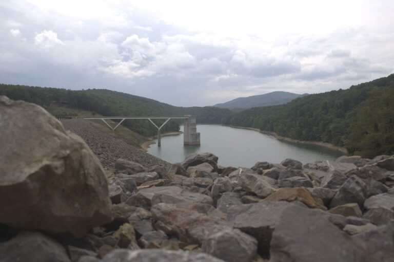
Photo: U.S. Army Corps of Engineers Norfolk District, CC BY 2.0
Photo: Tony Alter, CC BY 2.0
Sorting out the North River, question by question
Where does the North River show up on a Virginia road map?
Head for Augusta County, about 15 miles from Bridgewater.
Is there a DWR ramp on the North River?
No DWR site is nearby.
Which fish does DWR tie to the North River?
Expect black crappie, bluegill, brook trout, common carp, channel catfish, crappie and largemouth bass, per DWR.
Are there wild trout in the North River?
DWR stocks 8 reaches of it, coded category B and DH. Designated stocked trout waters require a trout license October 1 to June 15; urban waters November 1 to April 30 (as printed).
How many bass may go home from the North River?
The statewide digest row for largemouth and smallmouth bass reads: 5 per day in the aggregate (combined); No statewide length limits.
What does DWR charge to fish the North River?
A Virginia freshwater license is $23 a year for residents and $47 for nonresidents 16 and older, and a saltwater license is $17.50 for residents and $25 for nonresidents. Designated stocked trout waters also need the $23 trout license from October 1 to June 15. Anyone not yet 16 is excused from buying one.
Where do I check flow on the North River?
The panel above draws on 5 USGS gauges.
What tackle store is handiest for the North River trips?
Bridgewater Rod & Reel (about 15 miles away) heads the list.
Wet-wade the North River before the leaves turn
Every 2026 fee is one click away.