James River (Upper and Middle) Fishing
A Commonwealth river crossing Albemarle County and 13 other localities.
 Pick for troutPiscifun Carbon X ultralight spinning reel28% OFFSale $57.99
Photo: Ron Cogswell, CC BY 2.0
What a Virginia angler should know about James River (Upper and Middle)
This river, James River (Upper and Middle), flows through Albemarle County and 13 other localities. The nearest town on the Census list is Buchanan, some 5 miles away.
You can put in at 24 access sites DWR records. Discharge and height come from 8 USGS gauges.
Virginia DWR waterbody pages, Stocked Trout Reaches and Cold Water Stream Survey layers and Boating Access Locations; USGS gauges; read November 6, 2026.
 For the trout herePiscifun Carbon XT ultralight spinning reel25% OFFSale $59.99
The DWR description of James River (Upper and Middle)
Shenandoah, Cowpasture, and James River fish kills update From the junction between of the Jackson and Cowpasture Rivers in Botetourt County, downstream until the 14th Street bridge in Richmond, the Non-tidal James River offers a wide range of angling opportunities and settings. Smallmouth bass are the most common game species, but spotted and largemouth bass can also be caught. Smallmouth bass fishing will be good throughout the river.
Road directions for James River (Upper and Middle)
James River Float Trips & Access Points Iron Gate (Lick Run) to Glen Wilton Distance: 3 miles Iron Gate is the first access on the James River located less than one mile below the junction between the Jackson and Cowpasture rivers. The shoreline access is below the U.S. Route 220 Bridge over the James River and parking is available in the gravel lot across of Glen Wilton Rd.
DWR wrote the text above on James River (Upper and Middle); check its page for changes.
Virginia DWR waterbody page (updated 11/17/2023), read November 6, 2026.
Live discharge along the James River (Upper and Middle)
| USGS gauge | Latest reading | Time (ET) |
|---|---|---|
| James River At Lick Run, Va | 357 cfs, 1.72 ft gage height | Nov 8 7:00 pm |
| James River At Buchanan, Va | 451 cfs, 2.08 ft gage height | Nov 8 7:00 pm |
| James River At Bedford Dam Nr Major, Va | 5.81 ft gage height | Nov 8 7:15 pm |
US Geological Survey provisional data, retrieved Nov 8, 2026 7:32 pm ET. Provisional readings can be revised.
USGS reviews the James River (Upper and Middle) values later; read them as provisional.
| USGS site | Name |
|---|---|
| 02016500 | JAMES RIVER AT LICK RUN, VA |
| 02019500 | JAMES RIVER AT BUCHANAN, VA |
| 02024750 | JAMES RIVER AT BEDFORD DAM NR MAJOR, VA |
| 02024752 | JAMES RIVER AT BLUE RIDGE PKWY NR BIG ISLAND, VA |
| 02025500 | JAMES RIVER AT HOLCOMB ROCK, VA |
| 02026000 | JAMES RIVER AT BENT CREEK, VA |
USGS instantaneous values, provisional.
The fish DWR records for James River (Upper and Middle)
DWR labels alone drive the James River (Upper and Middle) list.
Virginia DWR waterbody page (updated 11/17/2023), read November 6, 2026.
Backing down a trailer at James River (Upper and Middle)
| Site | Recorded attributes | Owner | Location (DWR) |
|---|---|---|---|
| Arcadia boat ramp on James River (Upper and Middle) | concrete ramp (no dock), freshwater | VDOT | From Buchanan, N. Rt. 11, E. Rt. 614, 1 1/2 mi. |
| Bents Creek boat ramp on James River (Upper and Middle) | concrete ramp (no dock), 1 ramp, freshwater | VDOT | At Bent Creek at the intersection of Rt 60 and Rt 26 |
| Buchanan boat ramp on James River (Upper and Middle) | concrete ramp (no dock), freshwater | Town of Buchanan | Town of Buchanan |
| Cartersville boat ramp on James River (Upper and Middle) | concrete ramp (no dock), 1 ramp, freshwater | DWR | Town of Cartersville on Rt 45 |
| Columbia boat ramp on James River (Upper and Middle) | concrete ramp (no dock), 1 ramp, freshwater | DWR | South of Columbia on Rt 690 |
| Craig Creek boat ramp on James River (Upper and Middle) | concrete ramp (no dock), freshwater | VDOT | Under Rt. 220 Bridge at Rt. 683 |
| Glasgow boat ramp on James River (Upper and Middle) | hand launch (boat slide), 1 ramp, barrier-free, freshwater | Town of Glasgow | Rt.130 Town of Glasgow, turn S Rt.684, follow to parking lot shared w/ Locker Landing |
| Hardware River boat ramp on James River (Upper and Middle) | concrete ramp (no dock), freshwater | CSX | From Scottsville, Rt 6 East (6); R on Rt 646 (3.8) |
| Horseshoe Bend boat ramp on James River (Upper and Middle) | concrete ramp (no dock), freshwater | DWR | From Buchanan. West on Rt. 43 (7mi) |
| Howardsville boat ramp on James River (Upper and Middle) | concrete ramp (no dock), 1 ramp, barrier-free, freshwater | Ed amd John Crewe | |
| Huguenot Bridge boat ramp on James River (Upper and Middle) | hand launch (boat slide), freshwater | City of Richmond | West of Huguenot Bridge (.2) off Southampton Street |
| Irongate boat ramp on James River (Upper and Middle) | concrete ramp (no dock), freshwater | VDOT | From Irongate, Rt. 220 |
| Joshua Falls boat ramp on James River (Upper and Middle) | concrete ramp (no dock), barrier-free, freshwater | Appalacian Power | From Kelly on Rt 460 to N. Rt 726 (4) |
| Maidens/Beaumont boat ramp on James River (Upper and Middle) | freshwater | DWR | Rt. 522 South (1) of Maidens |
| Midway boat ramp on James River (Upper and Middle) | concrete ramp (no dock), 1 ramp, freshwater | DWR | In James River WMA off Rt 743 (3); Northeast of Wingina |
| New Canton boat ramp on James River (Upper and Middle) | concrete ramp (no dock), 1 ramp, barrier-free, freshwater | DWR | From Arvonia Rt. 15, N. app.2 mi, E. Rt 670, N. beyond P.O. (1/2/mi. |
| Reed Creek Landig boat ramp on James River (Upper and Middle) | concrete ramp (no dock), 1 ramp, freshwater | Georgia Pacific | From Big Island take 501 South, access adjacent to Georgia Pacific Plant on the River |
| Robious Park on James River (Upper and Middle) | hand launch (boat slide), barrier-free, freshwater | Chesterfield County | From Rt147&Rt711(Robious Rd.),West on Rt711(3),follow Chesterfield Park sign to river |
| Scottsville boat ramp on James River (Upper and Middle) | concrete ramp (no dock), 1 ramp, barrier-free, freshwater | CSX | Town of Scottsville, Ferry Street |
| Snowden boat ramp on James River (Upper and Middle) | concrete ramp (no dock), 1 ramp, freshwater | DWR | From Snowden, Rt 501/130 East cross over Rocky Roe Run (1) |
| Springwood boat ramp on James River (Upper and Middle) | concrete ramp (no dock), freshwater | VDOT | From Buchanan, Rt 43 North (3.5); L on Rt 630 to (1); to Rt 601 |
| Watkins boat ramp on James River (Upper and Middle) | concrete ramp (no dock), 2 ramps, barrier-free, freshwater | DWR | From Bon Air, Rt 147 West (3); R on Rt 711 (6.5); R on Rt 625 (1.2) |
| West View boat ramp on James River (Upper and Middle) | concrete ramp (no dock), 1 ramp, barrier-free, freshwater | DWR | From Goochland, Rt 6 West (3.5); L on Rt 600 (4.8); R on Rt 643 (1.2) |
| Wingina boat ramp on James River (Upper and Middle) | concrete ramp (no dock), 1 ramp, freshwater | DWR | Rt 56 South of Wingina |
Virginia DWR Boating Access Locations layer (attributes as recorded; lanes, fees and hours are not in the layer), read November 6, 2026.
Virginia keep counts for James River (Upper and Middle)
| Species as printed | Applies to | Creel | Length |
|---|---|---|---|
| Largemouth, Smallmouth Bass | statewide | 5 per day in the aggregate (combined) | No statewide length limits |
| Alabama, Spotted Bass | statewide | No statewide daily limit | No statewide length limit |
| Landlocked Striped Bass and Landlocked Striped Bass X White Bass Hybrids | statewide | 4 per day in the aggregate | No fish less than 20 inches |
| Striped Bass | Anadromous (coastal) striped bass above the fall line in all coastal rivers of the Chesapeake Bay and Crane Lake (City of Suffolk) | Creel and length limits shall be as set by the Virginia Marine Resources Commission for recreational fishing in tidal waters | no length limit printed |
| Striped Bass | Striped bass in the Meherrin, Nottoway, Blackwater (Chowan Drainage), North Landing and Northwest rivers and their tributaries plus Back Bay | No possession | no length limit printed |
| Walleye, Saugeye | statewide | 5 per day in the aggregate | No walleye or saugeye less than 18 inches |
| Sauger | statewide | 2 per day | No statewide length limits |
| White Bass | statewide | 5 per day | No statewide length limits |
| Chain Pickerel and Northern Pike | statewide | 5 per day | No statewide length limits |
| Muskellunge | statewide | 1 per day | No muskellunge less than 40 inches |
| Bluegill (bream) and other sunfish excluding Crappie, Rock Bass (redeye) and Roanoke Bass | statewide | 50 per day in the aggregate (combined) | No statewide length limits |
| Crappie (black or white) | statewide | 25 per day in the aggregate (combined) | No statewide length limits |
| Rock Bass (redeye) | statewide | 25 per day in the aggregate with Roanoke bass | No statewide length limits |
| Roanoke Bass | statewide | 25 per day in the aggregate with rock bass | No statewide length limits |
| Perch (yellow and white) | statewide | No statewide daily limit | No statewide length limit |
| Trout | statewide | 6 per day | 7 inch minimum size |
| Channel, White, and Flathead | statewide | 20 per day | No length limits |
| Blue | statewide | 20 per day | No statewide length limits |
For James River (Upper and Middle), the statewide digest is the starting point.
- Black Bass
- (Smallmouth, Largemouth and Spotted)
- 5 per day in aggregate, only 1 greater then 22 inches
- No bass 14 to 22 inches
- Catfish
- 20 per day
- Only 1 Blue Catfish greater than 32 inches
- Other Species
- See
- Creel & Length Limit Table
Virginia DWR waterbody page (updated 11/17/2023), read November 6, 2026.
Lines in the digest just for James River (Upper and Middle)
| Water as printed | Species | Rule as printed |
|---|---|---|
| James River–Confluence of the Jackson and Cowpasture rivers (Botetourt Cty) downstream to the 14th St. Bridge in Richmond | Largemouth, Smallmouth Bass | No largemouth or smallmouth bass 14 to 22 inches, only 1 per day longer than 22 inches |
Water-specific exceptions as printed, 2026 Freshwater Fishing in Virginia digest (eRegulations, linked from the Virginia DWR regulations page), read November 6, 2026.
A Virginia freshwater license is $23 a year for residents and $47 for nonresidents 16 and older.
Statewide creel and length limits as printed (page updated August 17, 2026), 2026 Freshwater Fishing in Virginia digest (eRegulations, linked from the Virginia DWR regulations page), read November 6, 2026. Virginia license fees in the 2026 Freshwater Fishing in Virginia digest (licenses run one year from purchase unless noted), read November 6, 2026.
Lining up the James River (Upper and Middle) with nearby rivers
| Stream | Distance | DWR access sites | USGS gauges | Stocked reaches |
|---|---|---|---|---|
| James River (Upper and Middle) | this stream | 24 | 8 | 0 |
| Jennings Creek | 8 miles southeast | 0 | 0 | 1 |
| McFalls Creek | 9 miles southeast | 0 | 0 | 1 |
| North Creek | 10 miles southeast | 0 | 0 | 2 |
| Roaring Run | 12 miles northwest | 0 | 0 | 2 |
| Buffalo Creek | 14 miles northeast | 0 | 1 | 1 |
Virginia DWR Boating Access Locations and Stocked Trout Reaches, USGS gauges; read November 6, 2026.
Neighbouring stops for James River (Upper and Middle)
Nearby lakes worth a cast after James River (Upper and Middle)
- Cave Mountain Lake11 miles
- Abbott Lake12 miles
- Lake Robertson16 miles
- Clifton Forge Reservoir19 miles
Commonwealth tackle shops serving James River (Upper and Middle)
- Journey Outdoorsbait and tackle shop, Lexington, 21 miles
- Sportsman's Warehouse, 3550 Ferncliff Ave NWsporting goods store, Roanoke, 24 miles
- TNT Outfittersbait and tackle shop, Spout Spring
- Angler's Lanefly shop, Forest
- All Seasons Marine Servicemarina, Huddleston
- Craddock Creek Marinamarina, Huddleston
Who to hire for a day on James River (Upper and Middle)
- Blue Ridge Fishing Adventurescharter, Rockbridge Baths, (719) 205-5466
- Carson Custom Charterscharter, Goodview, (540) 580-8436
- Fishing Connectioncharter, Chester, (804) 748-3197
Where anglers bunk when fishing James River (Upper and Middle)
- Buchanan5 miles, Botetourt County
- Glasgow15 miles, Rockbridge County
- Blue Ridge15 miles, Botetourt County
James River (Upper and Middle), broken out by Virginia locality
- Albemarle Countycounty seat Charlottesville
- Amherst Countycounty seat Amherst
- Appomattox Countycounty seat Appomattox
- Bedford Countycounty seat Bedford
- Botetourt Countycounty seat Fincastle
- Buckingham Countycounty seat Buckingham
- Campbell Countycounty seat Rustburg
- Chesterfield Countycounty seat Chesterfield
- Fluvanna Countycounty seat Palmyra
- Goochland Countycounty seat Goochland
- Henrico Countycounty seat Laurel
- Nelson Countycounty seat Lovingston
- Powhatan Countycounty seat Powhatan
- Rockbridge Countycounty seat Lexington
Rivers one drainage over from the James River (Upper and Middle)
- Jennings Creek8 miles
- McFalls Creek9 miles
- North Creek10 miles
- Roaring Run12 miles
- Buffalo Creek14 miles
Piscifun reels for a Virginia day on James River (Upper and Middle)


Piscifun and Amazon links are affiliate links; the site earns a commission on qualifying purchases.
Sorting out the James River (Upper and Middle) species by sight
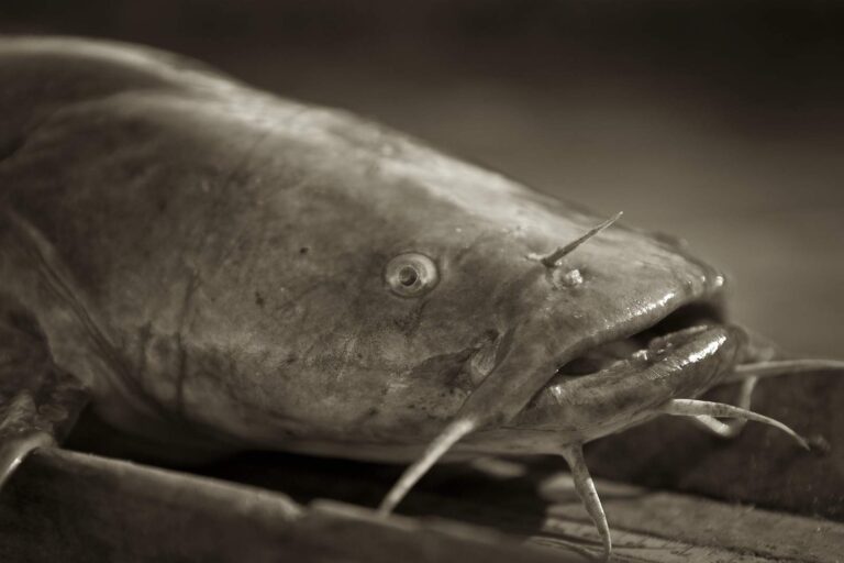
Photo: USFWS Mountain-Prairie, Public domain
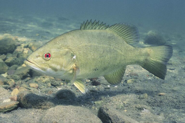
Photo: Yellowstone National Park, Public domain
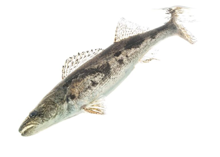
Photo: USFWS Mountain-Prairie, CC BY 2.0
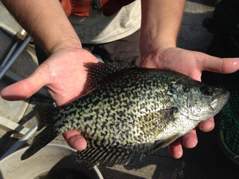
Photo: USFWS Mountain-Prairie, Public domain
Straight replies on James River (Upper and Middle) from the Virginia rule books
Which counties or cities touch James River (Upper and Middle)?
It crosses Albemarle County and 13 other localities, about 5 miles from Buchanan.
Which DWR site reaches James River (Upper and Middle)?
DWR maps 24 access sites; Arcadia boat ramp on James River (Upper and Middle) is one.
What might bite for a Virginia angler in James River (Upper and Middle)?
Look for bluegill, channel catfish, flathead catfish, largemouth bass, muskellunge, redbreast sunfish and rock bass.
Does James River (Upper and Middle) hold DWR trout?
Neither stocked nor wild trout reaches are mapped here.
What bass creel does the digest set for James River (Upper and Middle)?
The statewide digest row for largemouth and smallmouth bass reads: 5 per day in the aggregate (combined); No statewide length limits. See the water-specific rows above.
Which Virginia license does James River (Upper and Middle) call for?
A Virginia freshwater license is $23 a year for residents and $47 for nonresidents 16 and older. Kids under 16 fish free.
What is the flow on James River (Upper and Middle) today?
The flow band carries 8 USGS gauges.
What store sells bait near James River (Upper and Middle)?
Journey Outdoors (about 21 miles away) is first on our list.
Pencil in a Virginia weekday on James River (Upper and Middle)
Virginia fees and limits are on one page.