Virginia Special Regulation Trout Waters
63 Virginia special regulation trout waters: delayed harvest, catch and release, fly-only and tailwater rules from the 2026 digest.
 For weighing a catchPiscifun Lip gripper with digital scale27% OFFSale $39.99
Photo of Rapidan River: Mike Oswald, CC BY-SA 2.0
Virginia streams and lakes with special trout rules
The 2026 digest names 63 special regulation trout waters, each with its own regulation type: 21 catch and release; 16 delayed harvest; 14 9 inch min; 6 16 inch / 2 per day; 2 special slot; 2 20 inch / 1 per day ffo; 1 seasonal catch and release; 1 14 inch / 2 per day. Most require the trout license from October 1 to June 15 on top of a freshwater license.
Designated stocked trout waters require a trout license October 1 to June 15; urban waters November 1 to April 30 (as printed).
Special regulation trout waters as printed (page updated August 17, 2026), 2026 Freshwater Fishing in Virginia digest (eRegulations, linked from the Virginia DWR regulations page), read November 6, 2026.
Every Virginia special regulation trout water
| Water | County or city as printed | Regulation | Trout license Oct 1 to Jun 15 |
|---|---|---|---|
| Accotink Creek | Fairfax | Delayed Harvest | yes |
| Beaver Creek | Bristol | Catch and Release | |
| Big Mocassin Creek | Scott | Delayed Harvest | yes |
| Big Stony Creek (Mountain Fork) | Wise/Scott | Catch and Release | |
| Big Tumbling Creek | Washington | Seasonal Catch and Release | yes |
| Big Wilson Creek | Grayson | 9 inch min | |
| Brumley Creek | Washington | Catch and Release | |
| Buffalo Creek | Rockbridge | 16 inch / 2 per day | |
| Back Creek | Bath | Delayed Harvest | yes |
| Cabin Creek | Grayson | 9 inch min | |
| Chestnut Creek | Carroll | Delayed Harvest | yes |
| Conway River | Greene/Madison | 9 inch min | |
| Dan River | Patrick | 16 inch / 2 per day | |
| Dan River | Patrick | Catch and Release | |
| East Fork Chestnut Creek | Grayson/Carroll | Catch and Release | |
| Garth Run | Madison | 9 inch min | |
| Green Cove Creek | Washington | Catch and Release | |
| Hardy Creek | Lee | Delayed Harvest | yes |
| High Knob Lake | Wise | 14 inch / 2 per day | |
| Holliday Creek | Appomattox/Buckingham | Delayed Harvest | yes |
| Holmes Run | Fairfax | Delayed Harvest | yes |
| Indian Creek | Lee | Delayed Harvest | yes |
| Jackson River | Bath | 16 inch / 2 per day | yes |
| Jackson River (Tailwater) | Alleghany | Special slot | |
| Little Stony Creek | Giles | 9 inch min | |
| Little Stony Creek | Scott | Catch and Release | |
| Little Stony Creek | Shenandoah | 9 inch min | |
| Little Tumbling Creek | Smyth/Tazewell | Catch and Release | |
| Little Wilson Creek | Grayson | 9 inch min | |
| Middle Fork Powell River | Wise | Delayed Harvest | yes |
| Mill Creek | Giles | 9 inch min | |
| Mill Creek | Grayson | 9 inch min | |
| Mossy Creek | Augusta | 20 inch / 1 per day FFO | |
| North Creek | Botetourt | Catch and Release | |
| North Fork Buffalo River | Amherst | 9 inch min | |
| North Fork Pound River | Wise | Delayed Harvest | yes |
| North Fork Moormans River | Albemarle | Catch and Release | |
| North River | Augusta | Delayed Harvest | yes |
| Passage Creek | Warren | Delayed Harvest | yes |
| Pedlar River | Amherst | Delayed Harvest | yes |
| Piney River | Nelson/Amherst | Delayed Harvest | yes |
| Pound River | Dickenson | 16 inch / 2 per day | |
| Pound River | Wise | Delayed Harvest | yes |
| Quebec Branch | Grayson | 9 inch min | |
| Ramsey Draft | Augusta | 9 inch min | |
| Rapidan River | Madison | Catch and Release | |
| Roanoke River | Roanoke | Delayed Harvest | yes |
| Roaring Fork | Tazewell | Catch and Release | |
| Roaring Run | Botetourt | 16 inch / 2 per day | |
| Snake Creek | Carroll | Catch and Release | |
| Smith Creek | Alleghany | Catch and Release | |
| Smith River (Tailwater) | Henry | Special slot | |
| South Fork Holston River | Smyth | 16 inch / 2 per day | |
| South Fork Holston River | Smyth | Catch and Release | |
| South River City of Waynesboro | Augusta | Catch and Release | yes |
| South River | Augusta | 20 inch / 1 per day FFO | |
| Spring Run | Bath | Catch and Release | yes |
| St. Mary’s River | Augusta | 9 inch min | |
| Stewart’s Creek | Carroll | Catch and Release | |
| Venrick Run | Wythe | Catch and Release | |
| Whitetop Laurel Creek | Washington | Catch and Release | |
| Wilburn Branch | Grayson | 9 inch min | |
| Wolf Creek | Abingdon | Catch and Release |
Special regulation trout waters as printed (page updated August 17, 2026), 2026 Freshwater Fishing in Virginia digest (eRegulations, linked from the Virginia DWR regulations page), read November 6, 2026.
How Virginia delayed harvest waters work
From October 1 through May 31 fishing on the following waters is permitted under specific regulations only: Only artificial lures may be used. No trout may be in possession (catch and release only) while fishing these waters. No bait may be in possession while fishing these waters. Trout license required October 1–June 15. Note: During the period of June 1 through September 30 restrictions 1 through 3 above will not apply and these waters are like any other designated stocked trout water (see Trout Fishing Guide ). Accotink Creek (Fairfax County): That portion of stream from King Arthur Road downstream 3.1 miles to Route 620 (Braddock Road). Primary access is via the FCPA Wakefield Park facility off Braddock Road. Back Creek (Bath County): That portion of stream from the Rt. 600 Bridge just below the Virginia Power Back Creek Dam downstream 1.5 miles to the Rt. 600 Bridge at the lower boundary of the Virginia Power Recreational Area. Take Route 39 west from Warm Springs to Mountain Grove, then right on Route 600 for 6 miles.
Special regulation trout waters as printed (page updated August 17, 2026), 2026 Freshwater Fishing in Virginia digest (eRegulations, linked from the Virginia DWR regulations page), read November 6, 2026.
Virginia trout water rules as the digest describes them
- Jackson River Tailwater (Alleghany County)Bait Allowed: From Gathright Dam downstream to the Westvaco Dam at Covington: No rainbow trout 12 to 16 inches; no brown trout less than 20 inches; 4 trout (combined rainbow and brown) creel (harvest) limit per day, only 1 of 4 can be a brown trout over 20 inches.
- Lake Moomaw (Alleghany/Bath Counties)Bait Allowed: The entire reservoir has the special 16-inch minimum size limit and 2 fish per day creel limit on trout. Bait allowed.
- Smith River (Henry County)Bait Allowed: From Philpott Dam downstream to the State Route 636 bridge crossing (Mitchell Bridge) located approximately 31 miles downstream of Philpott Dam and approximately 10.5 miles below Martinsville Dam: No brown trout 10 to 24 inches, only 1 brown trout per day long.
- South Holston Reservoir (Washington County)Bait Allowed: 7 per day creel (harvest) limit, only 2 of 7 can be a Lake trout; no length limits. See licenses and regulations in the reciprocal section on the License Information page . Bait allowed.
- Cabin Creek (Grayson County)9-inch Minimum: That portion of stream and its tributaries within the Grayson Highlands State Park and the Jefferson National Forest Mount Rogers National Recreation Area. See above for more information on the area.
- Conway River/Devils Ditch (Greene and Madison Counties)9-inch Minimum: That portion of Conway River and its major tributary, Devils Ditch, within the Rapidan Wildlife Management Area (WMA) and the Shenandoah National Park. The stream lies north of Stanardsville and can be reached by Route 615 from Graves Mill.
- Garth Run (Madison County)9-inch Minimum: That portion of stream within the Rapidan WMA. The stream can be reached by Route 615 from Graves Mill. Most of the stream is accessible only by foot as the streams enters a gorge.
- Little Stony Creek (Giles County)9-inch Minimum: That portion of stream within the Jefferson National Forest. The stream is located near Pembroke and can be reached by Route 623.
- Little Stony Creek (Shenandoah County)9-inch Minimum: That portion of stream within the George Washington National Forest, including Woodstock Reservoir. The stream is located west of Woodstock and the Forest Service Road 92 crosses the lower portion of the special regulation section.
- Mill Creek (Giles County)9-inch Minimum: That portion of Mill Creek and its tributaries upstream of the Poplar Street Bridge in the Town of Narrows (Mill Creek flows through the National Forest in Giles County and the Town of Narrows.) The stream can be accessed from a parking area on Northview Stree.
- North Fork Buffalo River (Amherst County)9-inch Minimum: That portion of the stream and its tributaries within the George Washington National Forest. Access is available by a forest trail off Forest Road 51 or from the end of State Route 635.
- St. Mary’s River (Augusta County)9-inch Minimum: All portions of the stream and its tributaries above the gate near the George Washington National Forest property line. The stream lies east of Raphine off Route 608, a short distance from I-81.
- Ramsey’s Draft (Augusta County)9-inch Minimum: That portion of the stream and its tributaries within the George Washington National Forest.
- Buffalo Creek (Rockbridge County)16-inch Minimum, 2 Fish Per Day: That portion from the confluence of Collier’s Creek upstream 2.9 miles to the confluence of North and South Buffalo creeks. The stream flows through private land and *a free written landowner permit is required to fish these waters.
- Dan River (Patrick County)16-inch Minimum, 2 Fish Per Day: That portion from Talbott Dam approximately 6 miles downstream to a sign posted just upstream from the confluence of the Dan River and Townes Reservoir.
- Jackson River (Bath County)16-inch Minimum, 2 Fish Per Day: That portion from the Forest Service swinging bridge, located just upstream from the mouth of Muddy Run, upstream 3 miles to the last ford on Forest Service Road 481D.
- Pound River (Dickenson County)16-inch Minimum, 2 Fish Per Day: That portion from a sign 0.4 miles below Flannagan Dam downstream 1.2 miles to a sign just upstream of the confluence of the Pound River and the Russell Fork River. The section can be accessed from Flannagan Dam, which is owned and operated by the U.S.
- Roaring Run (Botetourt County)16-inch Minimum, 2 Fish Per Day: The 1-mile special trophy trout section is located in the Jefferson National Forest between the third foot bridge upstream of the Roaring Run Furnace Day Use Area and the Botetourt/Alleghany County line.
- South Fork Holston River (Smyth County)16-inch Minimum, 2 Fish Per Day: This section includes approximately 4 miles of stream extending from 500 feet above the concrete dam at Buller Fish Hatchery, upstream to the upper Jefferson National Forest boundary (above the crossing of the Appalachian Trail).
- Mossy Creek (Augusta County)20-inch Minimum, 1 Fish Per Day, Flyfishing Only: A 4-mile portion of stream upstream from the Augusta/Rockingham county line to a sign posted at the confluence of Joseph’s Spring. The stream is located just off Route 42 south of Bridgewater.
- South River (Augusta County)20-inch Minimum, 1 Fish Per Day, Flyfishing Only: That portion of South River from North Oak Lane Bridge in Waynesboro upstream to a sign posted approximately 1.5 miles above the Rt. 626 (Shalom Road) Bridge.
- Beaver Creek (Washington County)Catch and Release Only: That portion of stream and its tributaries within the boundaries of Sugar Hollow Park in the City of Bristol.
- Big Stony Creek (Mountain Fork)(Wise and Scott Counties)Catch and Release Only: That portion of Big Stony Creek (Mountain Fork) and its tributaries within the Jefferson National Forest from the outlet of High Knob Lake downstream to the confluence of Chimney Rock Fork and Big Stony Creek.
- Brumley Creek (Washington County)Catch and Release Only: That portion of stream and its tributaries from the Hidden Valley WMA boundary upstream to the Hidden Valley Lake Dam. This portion of stream is hike-in access only from the Hidden Valley WMA.
- Dan River (Patrick County)Catch and Release Only: That portion of stream and its tributaries between the Townes Dam and the Pinnacles Hydroelectric Powerhouse.
- East Fork Chestnut Creek (Farmers Creek) (Grayson and Carroll Counties)Catch and Release Only: That portion of stream and its tributaries upstream from the Blue Ridge Parkway. The stream lies south of Galax, crossing the Blue Ridge Parkway a short distance east of Route 89.
- Little Stony Creek (Scott County)Catch and Release Only: That portion of Little Stony Creek and its tributaries within the Jefferson National Forest from the Falls of Little Stony Creek downstream to a posted sign at the Hanging Rock Recreation Area.
- Little Tumbling Creek (Smyth and Tazewell Counties)Catch and Release Only: That portion of stream within the Clinch Mountain WMA. Access is available from Route 91 via a WMA access road that parallels the lower 2 miles of stream. Access to the headwaters is by foot only.
- Big Tumbling Creek (Russell, Smyth, and Washington Counties)Catch and Release Only: Seasonal Catch and Release Only (October 1st until five days prior to the start of the Fee Fishing Season. Closed to angling five days prior to the start of the Fee Fishing Season).
- North Creek (Botetourt County)Catch and Release Only: That portion of stream and its tributaries upstream from a sign at the North Creek Campground. The stream is located east of Buchanan, a short distance from I-81.
Special regulation trout waters as printed (page updated August 17, 2026), 2026 Freshwater Fishing in Virginia digest (eRegulations, linked from the Virginia DWR regulations page), read November 6, 2026.
South Holston Reservoir rules shared by Virginia and Tennessee
| Fish | Restriction | Creel |
|---|---|---|
| Largemouth & smallmouth bass | No smallmouth less than 15 inches | 5 per day |
| Spotted bass | No minimum size | No daily limit |
| Walleye | No walleye less than 18 inches | 5 per day |
| Crappie | No crappie less than 10 inches | 15 per day |
| Trout | No minimum size–only 2 lake trout per day | 7 per day |
| White bass | No harvest–all white bass must be released | |
| Catfish | Only 1 catfish over 34 inches | 20 per day |
| Bluegill | No minimum size | 50 per day |
| Rock bass | No minimum size | 20 per day |
| Trotlines* | 100 hooks per angler | |
| Jugs* | 50 per angler | |
| Limb-lines* | 15 per angler | |
| *All trotlines, limb-lines, and jugs must be tagged with angler’s name/address or license number. |
A South Holston Reservoir license ($21) is listed for fishing both states' waters of the lake.
Statewide creel and length limits as printed (page updated August 17, 2026), 2026 Freshwater Fishing in Virginia digest (eRegulations, linked from the Virginia DWR regulations page), read November 6, 2026.
Old Dominion water photographed for Virginia Special Regulation Trout Waters
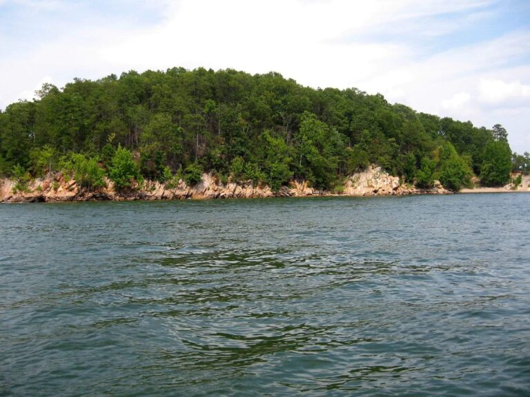
Photo: ted, CC BY 2.0

Photo: Virginia State Parks, CC BY 2.0
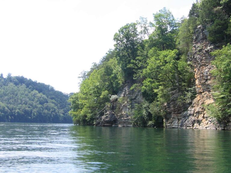
Photo: Jason Riedy, CC BY 2.0
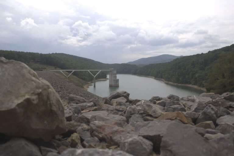
Photo: U.S. Army Corps of Engineers Norfolk District, CC BY 2.0
Virginia trout water questions
How many special regulation trout waters does Virginia have?
63 in the 2026 digest.
What is a delayed harvest water?
From October 1 through May 31 only artificial lures may be used, no trout may be kept and no bait may be carried; from June 1 to September 30 it fishes like other stocked trout water.
Do special regulation waters need a trout license?
Most do from October 1 to June 15; the quick reference marks each one.
What is the Jackson River tailwater rule?
From Gathright Dam downstream to the Westvaco Dam at Covington: No rainbow trout 12 to 16 inches; no brown trout less than 20 inches; 4 trout (combined rainbow and brown) creel (harvest) limit per day, only 1 of 4 can be a brown trout over 20 inches.
Which regulation type is most common?
Catch and Release, on 21 waters.
What is the statewide trout limit outside these waters?
Six per day with a 7-inch minimum, per the digest creel table.
Is South Holston covered by Virginia rules?
It has its own table shared with Tennessee and a $21 reservoir license.
Where are stocking dates?
On the trout stocking page, which lists every DWR date since 2023.