Fishing in Ontonagon County, Michigan
Seat: Ontonagon. Upper Peninsula, Western Lake Superior unit.
- 6lake pages
- 7launches
- 155trout streams
 Pick for troutPiscifun Carbon X ultralight spinning reel28% OFFSale $57.99
Photo of Lake Superior shore: Clockman26, CC BY-SA 4.0
Ontonagon County for visiting anglers
Government business for Ontonagon County runs out of Ontonagon, a Upper Peninsula county seat. At the 2020 Census 5,816 people lived across 1,311 square miles of land; water, Great Lakes included, accounts for 2,429.5 square miles more. MDNR fisheries work here is handled by the Western Lake Superior management unit. The county also fronts Lake Superior, with 1 harbor on the shoreline.
Its 6 lake pages add up to 13,505 surface acres, Lake Gogebic covering the most. Across 7 public launches the MDNR counts 13 lanes and 126 spaces for rigs. The trout regulation layer maps 155 county streams, including 3 Blue Ribbon streams. Shore access includes 2 MDNR fishing sites.
 For the trout herePiscifun Carbon XT ultralight spinning reel25% OFFSale $59.99
The fishing map of Ontonagon County
MDNR boat access sites, MDNR fishing sites, EGLE lake points and DNR harbors, checked October 2026.
Lake pages for Ontonagon County
| Lake | Acres | Launches | Satellite clarity | Trout Type | Fish on record |
|---|---|---|---|---|---|
| Lake Gogebic | 13,125 | 3 | 8.3 ft (2023) | lake herring | |
| Clouds, Lake of the | 152 | 0 | 7.1 ft (2023) | smallmouth bass, yellow perch | |
| Mirror Lake, Ontonagon County | 91 | 0 | 7 ft (2023) | Type C | |
| County Line Lake, Gogebic County | 67 | 1 | 13.2 ft (2023) | ||
| Steusser Lake | 36 | 0 | 9.6 ft (2023) | ||
| Courtney Lake | 33 | 0 | 9.4 ft (2023) | Type B |
EGLE Inland Lakes Water Clarity layer (acres, Landsat Secchi depth), MDNR trout lake regulation Types, MDNR Fish Atlas (species recorded 1970 or later) and MDNR boat access sites.
Small lakes of Ontonagon County without a page
Another 23 named lakes in Ontonagon County appear on state maps without enough published detail for a page of their own.
| Lake | Acres | MDNR lake id | Nearest place |
|---|---|---|---|
| Bond Falls Flowage | 2,127 | L40034 | Watersmeet |
| Victoria Reservoir | 282 | L32339 | Rockland |
| Sixmile Lake, Ontonagon County | 82 | L32452 | Mass City |
| Kostelnick Cr. Impound | 74 | L39707 | Ewen |
| Bass Lake, Ontonagon County | 65 | L36781 | Lake Gogebic |
| Clark Lake, Ontonagon County | 54 | L38177 | Lake Gogebic |
| Deadman Lake, Ontonagon County | 50 | L37321 | Watersmeet |
| Sudden Lake | 39 | L35276 | Mass City |
| Weidman Lake | 29 | L33030 | Bergland |
| Sleepy Pond | 23 | L34522 | Bergland |
| Erickson Lake, Ontonagon County | 20 | L39597 | Bruce Crossing |
| Camp Lake, Ontonagon County | 17 | L41316 | Watersmeet |
| Blair Lake, Ontonagon County | 16 | L42996 | Watersmeet |
| Mattie Lake | 15 | L41621 | Bruce Crossing |
| Temple Lake, Ontonagon County | 15 | L37566 | Watersmeet |
| Butterfield Lake, Ontonagon County | 15 | L32809 | Mass City |
| Sand Lake, Ontonagon County | 15 | L41114 | Watersmeet |
| Lily Pond, Ontonagon County | 14 | L38789 | White Pine |
| Millet Pond | 12 | L39920 | Bruce Crossing |
| Hemlock Lake, Ontonagon County | 12 | L41350 | Watersmeet |
| Johnson Lake, Ontonagon County | 11 | L37437 | Bruce Crossing |
| Weary Lake | 11 | L38622 | Lake Gogebic |
| Pickle Pond | 11 | L42202 | Bruce Crossing |
EGLE Inland Lakes Water Clarity layer and Michigan Geographic Framework hydrography names, checked October 2026.
Streams that run through Ontonagon County
- Presque Isle Riverriver, Type 1, Type 3, 1 launch
- Big Iron Riverriver, Type 1, Type 3, 1 launch
- Ontonagon Riverriver, Type 3, 2 launches
- Misery Riverriver, Type 1, Type 3, 1 launch
- Middle Branch Ontonagon Riverriver, Type 2, Type 3, Blue Ribbon
- East Branch Ontonagon Riverriver, Type 1, Type 3, Blue Ribbon
- West Branch Ontonagon Riverriver, Type 1, Type 3
- Cisco Branch Ontonagon Riverriver, Type 1
- West Branch Sturgeon River, Houghton Countyriver, Type 1, Blue Ribbon
- South Branch Ontonagon Riverriver
- Baltimore Riverriver, Type 1
- Flintsteel Riverriver, Type 1
- West Branch Otter Riverriver, Type 1
- East Branch Firesteel Riverriver, Type 1, Type 3
- West Branch Iron Riverriver, Type 1, Type 3
- East Sleeping Riverriver, Type 1, Type 3
- West Branch Firesteel Riverriver, Type 1, Type 3
- Cranberry Riverriver
- Twomile Creek, Ontonagon Countystream, Type 1
- Mineral Riverriver
- Firesteel Riverriver, Type 3
- Little Iron Riverriver, Type 1, Type 3
- Trout Creekstream, Type 1
- Sucker Creek, Ontonagon Countystream, Type 1
- Deer Creek, Ontonagon Countystream, Type 1
- Greenier Creekstream, Type 1
- Cascade Creekstream, Type 1
- Bluff Creekstream, Type 1
- Newholm Creekstream, Type 1
- Clear Creek, Ontonagon Countystream, Type 1
- Cherry Creek, Ontonagon Countystream, Type 1
- Warbler Creekstream, Type 1
Where trout swim in Ontonagon County
By MDNR regulation Type, the county trout streams split as Type 1 on 152 streams, Type 2 on 1 stream, Type 3 on 15 streams and Type 4 on 2 streams.
Type 1 stream close after September 30 and keep the smallest size limits, while Types 3 and 4 stay open all year with tighter limits on large fish.
- Little Carp River13.9 trout mi, Type 1, Type 3, near Wakefield
- Carp River11.7 trout mi, Type 1, Type 3, near Wakefield
- Little Elm River10.1 trout mi, Type 1, Type 4, near South Range
- Carp River Inlet9.8 trout mi, Type 1, near Ontonagon
- West Sleeping River8.4 trout mi, Type 1, near Ontonagon
- White Deer Creek7.6 trout mi, Type 1, near Wakefield
- Anderson Creek7.5 trout mi, Type 1, near Ontonagon
- McGinty Creek7.5 trout mi, Type 1, near Iron River
- Holland Creek7.2 trout mi, Type 1, near Ontonagon
- North Branch Misery River7.2 trout mi, Type 1, near South Range
- Black Creek7.2 trout mi, Type 1, near Ontonagon
- Hubbell Creek7.1 trout mi, Type 1, near Ontonagon
- Little Misery River6.8 trout mi, Type 1, near Ontonagon
- Dishinaw Creek6.7 trout mi, Type 1, near Ontonagon
- Elm Creek6.6 trout mi, Type 1, near Wakefield
- Bond Creek6.3 trout mi, Type 1, near Ontonagon
- Scott and Howe Creek6.3 trout mi, Type 1, near Wakefield
- Porterfield Creek6 trout mi, Type 1, near Ontonagon
- Tenmile Creek5.8 trout mi, Type 1, near Ontonagon
- Sleepy Creek5.8 trout mi, Type 1, near Ontonagon
- Union River5.6 trout mi, Type 1, Type 4, near Ontonagon
- Aldridge Creek5.5 trout mi, Type 1, near Wakefield
- Sleepy Creek5.5 trout mi, Type 1, near Ontonagon
- Eden Creek5.4 trout mi, Type 1, near Wakefield
- Merriweather Creek5.4 trout mi, Type 1, near Wakefield
- Kits Creek5.3 trout mi, Type 1, near Ontonagon
- Canyon Creek5.2 trout mi, Type 1, near Wakefield
- Pine Creek5.2 trout mi, Type 1, near Ontonagon
- Redlight Creek5.1 trout mi, Type 1, near Ontonagon
- McGuire Creek4.9 trout mi, Type 1, near Ontonagon
- Amundsan Creek4.8 trout mi, Type 1, near Wakefield
- Cunningham Creek4.8 trout mi, Type 1, near Ontonagon
- Payseor Creek4.8 trout mi, Type 1, near Ontonagon
- Hide Creek4.8 trout mi, Type 1, near Ontonagon
- Choate Creek4.6 trout mi, Type 1, near Ontonagon
- Jug Creek4.6 trout mi, Type 1, near Ontonagon
- Black Creek4.5 trout mi, Type 1, near Ontonagon
- McFarland Creek4.5 trout mi, Type 1, near Wakefield
- Rapid River4.5 trout mi, Type 1, near Wakefield
- Paulding Creek4.4 trout mi, Type 1, near Iron River
- Ledge Creek4.3 trout mi, Type 1, near Wakefield
- Senecal Creek4.2 trout mi, Type 1, near Ontonagon
- Little Union River4.2 trout mi, Type 1, near Ontonagon
- House Creek4.2 trout mi, Type 1, near Ontonagon
- St. Cullins Creek4.2 trout mi, Type 1, near Ontonagon
- Romague Creek4.1 trout mi, Type 1, near Ontonagon
- Inkala Creek4 trout mi, Type 1, near Ontonagon
- Scott Creek4 trout mi, Type 1, near Ontonagon
- Nugget Creek4 trout mi, Type 1, near Ontonagon
- Pony Trail Creek4 trout mi, Type 1, near Wakefield
- Emanuel Creek3.9 trout mi, Type 1, near Ontonagon
- Interior Creek3.9 trout mi, Type 1, near Iron River
- Snuffbox Creek3.9 trout mi, Type 1, near Wakefield
- Ellis Creek3.8 trout mi, Type 1, near Ontonagon
- Titmouse Creek3.8 trout mi, Type 1, near Wakefield
- Cute Creek3.8 trout mi, Type 1, near Ontonagon
- Greentown Creek3.8 trout mi, Type 1, near Ontonagon
- Lathrop Creek3.7 trout mi, Type 1, near Ontonagon
- Bush Creek3.6 trout mi, Type 1, near Ontonagon
- McCarthy Creek3.6 trout mi, Type 1, near Ontonagon
- Deadman Creek3.5 trout mi, Type 1, near Iron River
- Sugar Camp Creek3.4 trout mi, Type 1, near Wakefield
- Capone Creek3.4 trout mi, Type 1, near South Range
- Mannis Creek3.4 trout mi, Type 1, near Iron River
- Payne Creek3.3 trout mi, Type 1, near Ontonagon
- Hooded Creek3.3 trout mi, Type 1, near Ontonagon
- Sandhill Creek3.3 trout mi, Type 1, near Ontonagon
- Tom Creek3.2 trout mi, Type 1, near Ontonagon
- Matheson Creek3.1 trout mi, Type 1, near Iron River
- Chipping Creek3.1 trout mi, Type 1, near Wakefield
- Roselawn Creek3.1 trout mi, Type 1, near Ontonagon
- Texas Creek3 trout mi, Type 1, near Wakefield
- Toledo Creek3 trout mi, Type 1, near Wakefield
- Crowned Creek2.8 trout mi, Type 1, near Wakefield
- Landlookers Creek2.7 trout mi, Type 1, near Wakefield
- Pietila Creek2.7 trout mi, Type 1, near Ontonagon
- Rolston Creek2.6 trout mi, Type 1, near Ontonagon
- Aho Creek2.6 trout mi, Type 1, near Ontonagon
- Good Creek2.6 trout mi, Type 1, near Ontonagon
- Salt Pork Creek2.6 trout mi, Type 1, near Wakefield
- Bessemer Creek2.5 trout mi, Type 1, near Wakefield
- Longtime Creek2.5 trout mi, Type 1, near Ontonagon
- Buckless Creek2.4 trout mi, Type 1, near Wakefield
- Konteka Creek2.4 trout mi, Type 1, near Wakefield
- Slough Creek2.4 trout mi, Type 1, near Ontonagon
- Loggerhead Creek2.4 trout mi, Type 1, near Ontonagon
- Doe Creek2.4 trout mi, Type 1, near Wakefield
- Wabeno Creek2.4 trout mi, Type 1, near Wakefield
- Pori Creek2.3 trout mi, Type 1, near Ontonagon
- Washington Creek2.3 trout mi, Type 1, near Wakefield
- Blair Creek2.2 trout mi, Type 1, near Wakefield
- Dogwood Creek2.2 trout mi, Type 1, near Ontonagon
- Nuthatch Creek2.2 trout mi, Type 1, near Wakefield
- Ratford Creek2.2 trout mi, Type 1, near Wakefield
- Song Creek2.2 trout mi, Type 1, near Wakefield
- Blowdown Creek2.2 trout mi, Type 1, near Wakefield
- Diggings Creek2.1 trout mi, Type 1, near Ontonagon
- Kinglet Creek2.1 trout mi, Type 1, near Wakefield
- Lost Creek2.1 trout mi, Type 1, near Ontonagon
- Beaver Creek2 trout mi, Type 1, near Wakefield
- Caledonia Creek2 trout mi, Type 1, near Ontonagon
- Vine Creek2 trout mi, Type 1, near Wakefield
- Redstart Creek2 trout mi, Type 1, near Wakefield
- Extension Creek2 trout mi, Type 1, near Ontonagon
- Whisky Hollow Creek1.9 trout mi, Type 1, near Ontonagon
- Darling Creek1.9 trout mi, Type 1, near Ontonagon
- Towhee Creek1.9 trout mi, Type 1, near Wakefield
- Larochelle Creek1.9 trout mi, Type 1, near Ontonagon
- Redpoll Creek1.8 trout mi, Type 1, near Ontonagon
- Red Creek1.8 trout mi, Type 1, near Ontonagon
- Haskin Creek1.7 trout mi, Type 1, near Wakefield
- Sooty Creek1.7 trout mi, Type 1, near Wakefield
- Vesper Creek1.7 trout mi, Type 1, near Wakefield
- Mourning Creek1.7 trout mi, Type 1, near Ontonagon
- Grade Creek1.6 trout mi, Type 1, near Ontonagon
- Hash Creek1.6 trout mi, Type 1, near Ontonagon
- Silver Creek1.6 trout mi, Type 1, near Ontonagon
- Cleveland Creek1.6 trout mi, Type 1, near Ontonagon
- Champagne Creek1.6 trout mi, Type 1, near Ontonagon
- Meto Creek1.5 trout mi, Type 1, near Ontonagon
USGS gauges inside Ontonagon County
| USGS gauge | Latest reading | Time (ET) |
|---|---|---|
| Ontonagon River Near Rockland, Mi | 614 cfs, 5.56 ft gage height | Nov 11 12:15 am |
| Middle Branch Ontonagon River Near Paulding, Mi | 107 cfs, 4.26 ft gage height | Nov 10 11:45 pm |
| West Branch Ontonagon River Near Bergland, Mi | 42 cfs, 1.39 ft gage height | Nov 11 12:15 am |
| Mineral River Ds Of Native Ck Nr Silver City, Mi | 0 cfs, 8.10 ft gage height | Oct 1 12:45 am Not updated since Oct 1, 2026. |
US Geological Survey provisional data, retrieved Nov 11, 2026 12:32 am ET. Provisional readings can be revised.
MDNR Trout and Salmon Inland Stream Regulation Types layer and Blue Ribbon and Natural River layers (stream miles are whole-stream totals), checked October 2026.
Boat access sites across Ontonagon County
5 of the 7 county launches ask for a Recreation Passport on the vehicle.
- Bergland Dock Boat AccessLake Gogebic, 2 lanes, 22 trailer spaces, courtesy pier, toilet, Recreation Passport
- Big Iron River Mouth Boat AccessBig Iron River, 1 lane, 19 trailer spaces, courtesy pier, toilet
- County Line Lake Boat AccessCounty Line Lake, 1 lane, 6 trailer spaces, courtesy pier, toilet, Recreation Passport
- Ewen Boat AccessOntonagon River – South Branch, boat ramp, 8 trailer spaces, toilet, Recreation Passport
- Misery River Mouth Boat AccessMisery River, 1 lane, 6 trailer spaces, toilet
- Ontonagon Municipal Boat AccessOntonagon River, 6 lanes, 65 trailer spaces, courtesy pier, toilet, Recreation Passport
- Porcupine Mountains Wilderness State Park Union BayLake Superior, 2 lanes, courtesy pier, toilet, Recreation Passport
MDNR fishing sites in Ontonagon County (2)
- Lake of the Clouds fishing site, Carp Lake Townshipbank fishing area, Lake of the Clouds
- Steusser Lake fishing site, McMillan Townshipbank fishing area, Steusser Lake
MDNR Parks and Recreation boat access sites and MDNR fishing sites (Family Friendly Fishing).
Big-water fishing from Ontonagon County
- Ontonagon Village Marinaharbor on Lake Superior
- Misery Baybay of Lake Superior
- Sleeping Baybay of Lake Superior
- Tenmile Baybay of Lake Superior
- Union Baybay of Lake Superior
- Ash Creekmouth on Lake Superior
- Bear Creekmouth on Lake Superior
- Big Iron Rivermouth on Lake Superior
- Black Creekmouth on Lake Superior
- Carp Rivermouth on Lake Superior
- Cranberry Rivermouth on Lake Superior
- Dreiss Creekmouth on Lake Superior
- Duck Creekmouth on Lake Superior
- East Sleeping Rivermouth on Lake Superior
- Firesteel Rivermouth on Lake Superior
- Flintsteel Rivermouth on Lake Superior
- Floodwood Rivermouth on Lake Superior
- Halfway Creekmouth on Lake Superior
- Little Cranberry Rivermouth on Lake Superior
- Little Iron Rivermouth on Lake Superior
- Little Misery Rivermouth on Lake Superior
- McCarthy Creekmouth on Lake Superior
- Miles Creekmouth on Lake Superior
- Mineral Rivermouth on Lake Superior
- Misery Rivermouth on Lake Superior
- Mud Creekmouth on Lake Superior
- Native Creekmouth on Lake Superior
- Ontonagon Rivermouth on Lake Superior
- Paddys Creekmouth on Lake Superior
- Patent Creekmouth on Lake Superior
- Pine Creekmouth on Lake Superior
- Potato Rivermouth on Lake Superior
- Tenmile Creekmouth on Lake Superior
- Town Line Creekmouth on Lake Superior
- Union Rivermouth on Lake Superior
DNR harbors layer, USGS GNIS bays and stream mouths, MDNR Family Friendly Fishing piers, checked October 2026.
Plants and record fish in Ontonagon County
32 plants were recorded from 2024 through 2026, led by rainbow trout with 97,934 fish.
Latest MDNR plants in Ontonagon County
| Water | Species | Number | Avg length in | Date |
|---|---|---|---|---|
| Ontonagon River | Lake sturgeon | 226 | 18.4 | 2026-09-09 |
| Ontonagon River | Lake sturgeon | 225 | 18.4 | 2026-09-09 |
| Michigan (Rockland) Pond | Largemouth bass | 28 | 30.48 | 2026-06-04 |
| Michigan (Rockland) Pond | Pumpkinseed | 27 | 15.24 | 2026-06-04 |
| Michigan (Rockland) Pond | Pumpkinseed | 42 | 15.24 | 2026-06-01 |
| Michigan (Rockland) Pond | Largemouth bass | 15 | 30.5 | 2026-06-01 |
| Trout Creek Pond | Brook trout | 239 | 21.4 | 2026-05-12 |
| Mirror Lake | Splake | 1,998 | 17.7 | 2026-03-02 |
| Courtney Lake | Brook trout | 100 | 2025-12-19 | |
| Courtney Lake | Brook trout | 100 | 2025-12-17 | |
| Ontonagon River | Lake sturgeon | 878 | 25.4 | 2025-11-04 |
| Firesteel River | Rainbow trout | 97,934 | 7.06 | 2025-10-22 |
| Ontonagon River | Walleye | 13,802 | 5.72 | 2025-07-03 |
| Ontonagon River | Lake sturgeon | 4,586 | 5.5 | 2025-07-02 |
Ontonagon County in the Michigan record book
| Species | Weight lb | Water | Year |
|---|---|---|---|
| Lake Whitefish | 14.28 | Lake Superior | 1993 |
MDNR Fish Stocking Report (FSIS), January 2024 to October 2026, and the DNR State Record Fish table.
Bait shops past the Ontonagon County line
- Markham's Marinamarina, Houghton, 37 miles
- Freeman's Firearmsbait and tackle shop, Hancock, 39 miles
- Ojibwa Campground & Marinamarina, Baraga, 40 miles
- Indian Country Sports Incbait and tackle shop, Lanse, 41 miles
- Dollar Bay Motorsportsmarina, Osceola Twp, 42 miles
Exceptions printed for Ontonagon County
Being a Upper Peninsula county, walleye and northern pike on inland water open on May 15 here.
| Species | Limit | Season |
|---|---|---|
| Largemouth and smallmouth bass | 5 in any combination; minimum 14 inches | Possession: Sat. before Memorial Day – Dec. 31; catch-and-immediate-release open all year |
| Walleye (Upper Peninsula) | 5; minimum 15 inches | May 15 – March 15 |
| Northern pike (Upper Peninsula) | 2; minimum 24 inches | May 15 – March 15 |
| Muskellunge | Only 1 per angler per license year (April 1 – March 31); mandatory harvest registration within 24 hours; minimum 42 inches (46, 50 or 38 inches on listed waters) | Possession: 1st Sat. in June – March 15; catch-and-immediate-release open all year |
| Yellow perch | 25 | Open all year |
| Sunfish and crappie | 25 in any combination of the listed species | Open all year |
| Channel catfish | 10; minimum 12 inches | Open all year |
| Flathead catfish | 5; minimum 15 inches | Open all year |
| White bass | 10 | Open all year |
| Cisco and whitefish | 5 in any combination | Open all year |
| Burbot | 5 | Open all year |
| Trout in unclassified lakes | 5, no more than 3 of which may be 15 inches or greater; minimum 8 inches | Open all year |
Lakes and streams of Ontonagon County with exceptions (5)
| Water | Rule as printed |
|---|---|
| L. Gogebic the | L. Gogebic the daily possession limit for Yellow Perch is 25 with no more than 5 Yellow Perch 12" or greater. |
| Ontonagon R. from its confluence with the Victoria Hydro station tailrace (T50N, R39W, SE 1/4 of the SW 1/4 of S29) upstream to Victoria Dam, including the trailrace canal | Ontonagon R. from its confluence with the Victoria Hydro station tailrace (T50N, R39W, SE 1/4 of the SW 1/4 of S29) upstream to Victoria Dam, including the trailrace canal closed to fishing April 1 – Jun. 10. |
| L. of the Clouds (Carp L.) fishing | L. of the Clouds (Carp L.) fishing restricted to artificial lures only. |
| It shall be unlawful to use or possess live bait, dead bait or organic or processed food at any time on the shore or water. | |
| No spearing; | No spearing; no possession of Smallmouth Bass. |
2026 Michigan Fishing Regulations (Michigan DNR, April 1, 2026 to March 31, 2027): statewide tables and the county listing, pp. 28-31.
Bass and walleye events on Ontonagon County water
The MDNR Fishing Tournament Information System shows 7 public registrations for county waters, 0 of them not yet fished.
| Date | Event | Water | Fish |
|---|---|---|---|
| 2026-09-12 | 48th Annual Walleye Tournament | Lake Gogebic | Walleye |
| 2026-09-12 | 48th Annual Walleye Tournament | Lake Gogebic | Walleye |
| 2026-09-12 | 48th Annual Walleye Tournament | Lake Gogebic | Walleye |
| 2026-09-11 | 48th Annual Walleye Tournament | Lake Gogebic | Walleye |
| 2026-09-11 | 48th Annual Walleye Tournament | Lake Gogebic | Walleye |
| 2026-09-11 | 48th Annual Walleye Tournament | Lake Gogebic | Walleye |
| 2026-05-16 | Lake Gogebic Walleye Opener | Lake Gogebic | Walleye |
MDNR Fishing Tournament Information System, public registrations, checked October 2026.
Where to get bait in Ontonagon County
Guided trips out of Ontonagon County
- Voyager Charterscharter, Bruce Crossing, (906) 827-3466
In the Ontonagon County area
Ontonagon County towns
- Ontonagonpop. 1,285
- White Pinepop. 339
- Ewenpop. 229
- Bruce Crossingpop. 184
- Rocklandpop. 173
- Mass Citypop. 148
- Greenlandpop. 146
- Berglandpop. 141
- Lake Gogebicpop. 122
Next-door counties to Ontonagon County
- Houghton County32 miles east
- Gogebic County34 miles southwest
- Baraga County44 miles east
- Keweenaw County57 miles northeast
- Iron County58 miles southeast
Reels and a weigh-scale grip for Ontonagon County


Piscifun and Amazon links are affiliate links; the site earns a commission on qualifying purchases.
Lakes and streams near Ontonagon County, pictured
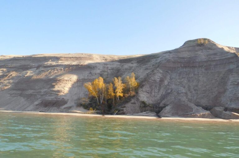
Photo: NPS, Public domain

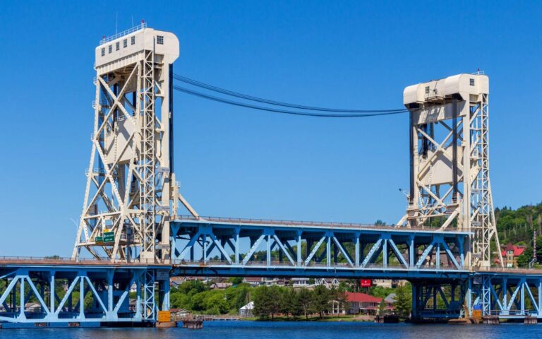
Photo: James Conkis, CC BY-SA 4.0

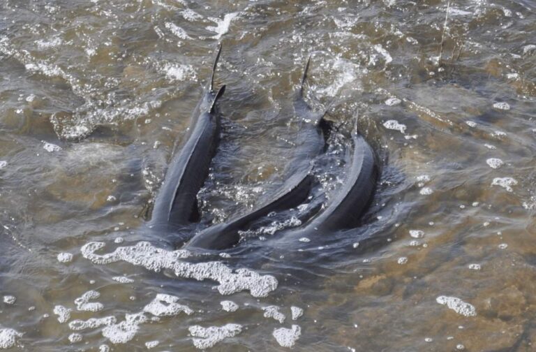
Photo: Robert Elliot/USFWS, Public domain

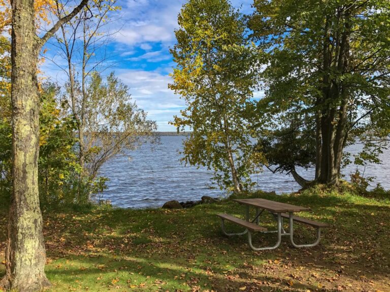
Photo: Tony Webster, CC BY 2.0

What to know about fishing Ontonagon County
Where does a trailer boat go in across Ontonagon County?
Boaters have 7 public launches and 13 lanes to pick from.
What is the largest lake with a page in Ontonagon County?
Lake Gogebic, at 13,125 acres on the EGLE layer.
Which trout Types apply to streams in Ontonagon County?
Yes: 155 trout streams, including 3 Blue Ribbon streams.
Does Ontonagon County follow Upper or Lower Peninsula seasons?
Inland walleye and pike open May 15 under the Upper Peninsula schedule.
Does Ontonagon County have a bait and tackle store?
None inside the county on our list.
Which guides work Ontonagon County waters?
The county has 1 charter or guide.
Who manages the fish in Ontonagon County?
The Western Lake Superior management unit handles it.
Which Michigan city serves as seat for Ontonagon County?
It is Ontonagon.
What do visitors to Ontonagon County pay to fish?
Anglers 17 and older carry a Michigan all-species fishing license: $26 a year for residents, $76 for nonresidents, $11 for seniors or $10 for one day. Trout and salmon need no separate stamp in Michigan; the all-species license ($26 resident, $76 nonresident a year) covers them. One Michigan all-species license covers the Great Lakes and connecting waters too: $26 a year for residents, $76 for nonresidents or $10 for a single day.
Which registered tournament comes next in Ontonagon County?
7 public registrations on file, none still ahead this season.
Are there exceptions to statewide rules in Ontonagon County?
The 2026 digest prints 5 exceptions for the county, starting with L. Gogebic the; all are in the table above.
Spend a day on Ontonagon County water
Open a launch page for lanes, parking and fees.