Sturgis Dam Pond Fishing
A 574-acre Michigan pond in St. Joseph County.
 Pick for smallmouthPiscifun Chaos Pro CNC baitcasting reel25% OFFSale $97.99
Photo of St. Joseph River: Humbles Art, CC BY-SA 3.0
Sturgis Dam Pond in brief
The state lake layer measures Sturgis Dam Pond at 574 acres; it lies in St. Joseph County. For fuel and groceries, Mendon is about 2 miles off. It sits on the Lower Peninsula inside the Southern Lake Michigan Management Unit of the MDNR. It drains to the Southeastern Lake Michigan watershed in the Southern Michigan/Northern Indiana Drift Plains ecoregion.
Trailers launch at 1 public launch. Summer satellite readings put clarity near 6.3 feet in 2023.
Where to launch on Sturgis Dam Pond
- Covered Bridge Park1 lane, 7 trailer spaces, courtesy pier, toilet; St. Joseph County
Boat launches by Sturgis Dam Pond
- Mendon Boat AccessSaint Joseph River, 2 miles northeast
- Portage Lake Boat Access near MendonPortage Lake, 4 miles northwest
- Fisher's Lake Boat AccessFishers Lake, 5 miles west
- Stump Bay Boat AccessThree Rivers Impoundment – Saint Joseph River, 6 miles southwest
- Noah Lake Boat AccessNoah Lake, 6 miles southwest
- Fish Lake Boat Access near CentrevilleFish Lake, 8 miles south
MDNR Parks and Recreation boat access sites and MDNR fishing sites, checked October 2026.
Clarity trend at Sturgis Dam Pond
EGLE averages Landsat images from July to September for Sturgis Dam Pond; values are converted here from meters to feet.
Chlorophyll a in 2023: 9.55 micrograms per liter.
EGLE Michigan Inland Lakes Water Clarity layer (Landsat, July to September), checked October 2026. Depth is not published here: the layer depth fields are unreliable.
Limits and seasons for Sturgis Dam Pond
| Species | Limit | Season |
|---|---|---|
| Largemouth and smallmouth bass | 5 in any combination; minimum 14 inches | Possession: Sat. before Memorial Day – Dec. 31; catch-and-immediate-release open all year |
| Walleye (Lower Peninsula) | 5; minimum 15 inches | Last Sat. in April – March 15 |
| Northern pike (Lower Peninsula) | 2; minimum 24 inches | Last Sat. in April – March 15 |
| Muskellunge | Only 1 per angler per license year (April 1 – March 31); mandatory harvest registration within 24 hours; minimum 42 inches (46, 50 or 38 inches on listed waters) | Possession: 1st Sat. in June – March 15; catch-and-immediate-release open all year |
| Yellow perch | 25 | Open all year |
| Sunfish and crappie | 25 in any combination of the listed species | Open all year |
| Channel catfish | 10; minimum 12 inches | Open all year |
| Flathead catfish | 5; minimum 15 inches | Open all year |
| White bass | 10 | Open all year |
| Cisco and whitefish | 5 in any combination | Open all year |
| Burbot | 5 | Open all year |
| Trout in unclassified lakes | 5, no more than 3 of which may be 15 inches or greater; minimum 8 inches | Open all year |
Statewide rows for the Lower Peninsula are shown for Sturgis Dam Pond; the trout row follows its MDNR lake Type when it has one.
2026 Michigan Fishing Regulations (April 1, 2026 to March 31, 2027), statewide tables and county exceptions, checked October 2026.
 For the smallmouth herePiscifun AlinoX 300 low profile baitcaster34% OFFSale $104.99
Neighbor lakes of Sturgis Dam Pond, measured
| Lake | Distance | Acres | Launches | Clarity ft | Fish listed |
|---|---|---|---|---|---|
| Sturgis Dam Pond | 574 | 1 | 6.3 | 0 | |
| Fishers Lake | 4 miles west | 330 | 1 | 8.6 | 0 |
| Portage Lake, St. Joseph County | 5 miles north | 400 | 1 | 5.8 | 0 |
| Sand Lake, St. Joseph County | 5 miles south | 95 | 0 | 6.7 | 6 |
| Three Rivers Imp. | 5 miles southwest | 491 | 1 | 4 | 0 |
| Noah Lake | 6 miles southwest | 51 | 1 | 2.3 | 0 |
EGLE inland lake layer, MDNR access sites and Fish Atlas.
What sits close to Sturgis Dam Pond
Lakes to try next to Sturgis Dam Pond
- Fishers Lake4 miles west
- Portage Lake, St. Joseph County5 miles north
- Sand Lake, St. Joseph County5 miles south
- Three Rivers Imp.5 miles southwest
- Noah Lake6 miles southwest
Where to pick up bait for Sturgis Dam Pond
- Keough Hacklesbait and tackle shop, Mendon, 2 miles
- Colon Bait & Tackle Sporting Goods-Sport Shopbait and tackle shop, Colon, 8 miles
- Double L Bait & Marinebait and tackle shop, Vicksburg, 13 miles
- Klinger Lake Trading Postbait and tackle shop, Sturgis, 13 miles
- Corey Lake Marinamarina, Three Rivers, 15 miles
- Boat City Marinemarina, Portage, 15 miles
Towns that put you close to Sturgis Dam Pond
- Mendon2 miles
- Centreville5 miles
- Three Rivers8 miles
The counties around Sturgis Dam Pond
- St. Joseph Countyseat: Centreville
Piscifun spinning and baitcasting picks for Sturgis Dam Pond


Piscifun and Amazon links are affiliate links; the site earns a commission on qualifying purchases.
Identifying the fish of Sturgis Dam Pond
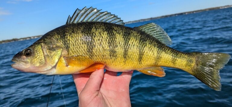
Photo: Fizzishin, CC BY 4.0

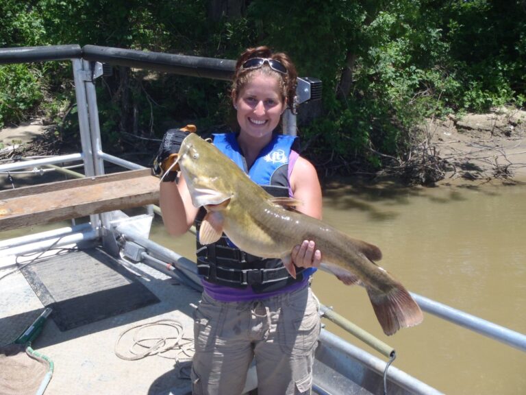
Photo: USFWSmidwest, Public domain

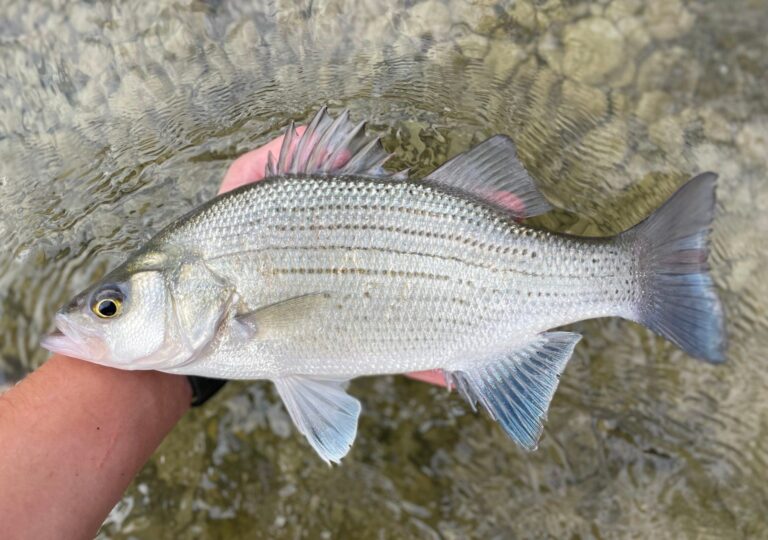
Photo: Nick Loveland, CC0 1.0

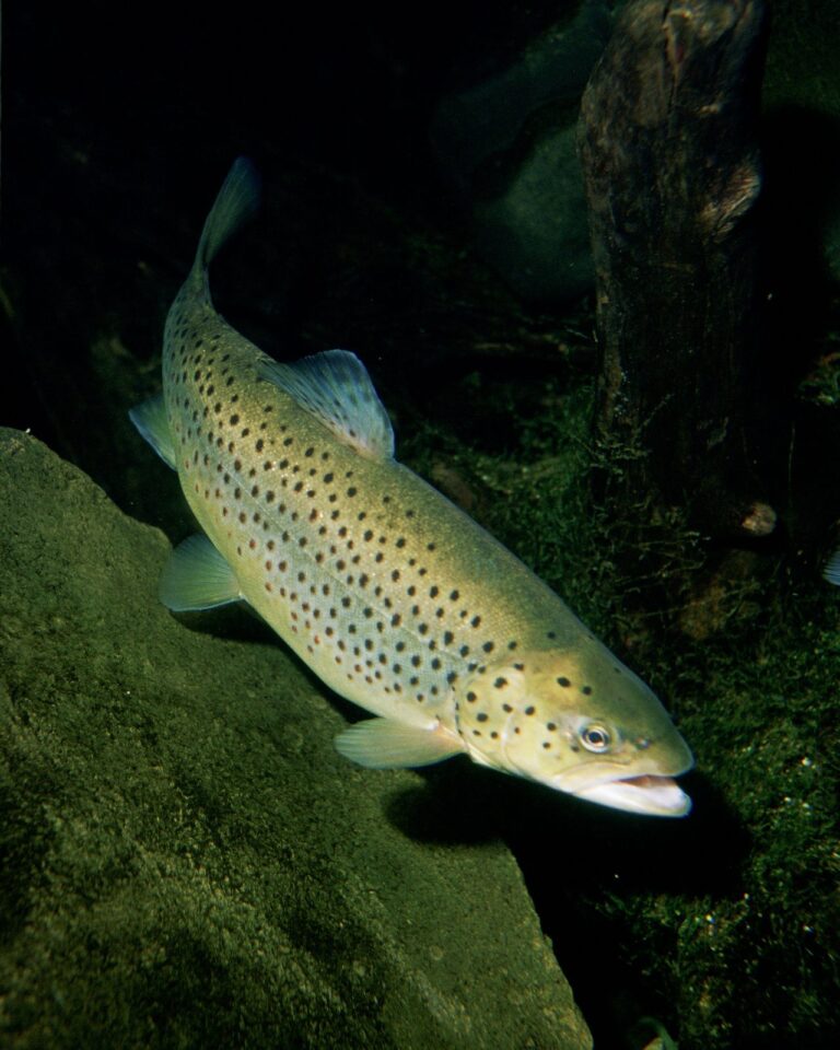
Photo: Eric Engbretson for U.S. Fish and Wildlife Service, Public domain

What to know ahead of a day at Sturgis Dam Pond
Which MDNR unit manages Sturgis Dam Pond?
St. Joseph County, Southern Lake Michigan Management Unit, about 2 miles from Mendon.
What surface area does EGLE give Sturgis Dam Pond?
The state layer shows 574 acres.
Is there a ramp for trailers on Sturgis Dam Pond?
1 public launch, led by Covered Bridge Park.
What bites in Sturgis Dam Pond?
No fish list exists for it.
What are the walleye limits on Sturgis Dam Pond?
Walleye (Lower Peninsula): 5; minimum 15 inches; season Last Sat. in April – March 15.
What does a visitor from out of state pay for Sturgis Dam Pond?
Anglers 17 and older carry a Michigan all-species fishing license: $26 a year for residents, $76 for nonresidents, $11 for seniors or $10 for one day.
How far can you see into Sturgis Dam Pond?
About 6.3 feet of Secchi depth in 2023, from EGLE satellite data.
Which tackle store sits handiest to Sturgis Dam Pond?
Keough Hackles is the nearest, 2 miles away.
Line up a day on Sturgis Dam Pond
Michigan license prices and limits are one click away.