Mattaponi River Fishing
River and creek fishing in Caroline, King William and King and Queen counties.
 Pick for troutPiscifun Carbon X ultralight spinning reel28% OFFSale $57.99
Photo of Rappahannock River: Ken Lund, CC BY-SA 2.0
The Mattaponi River, sized up for Virginia anglers
Look for the Mattaponi River, a river, in Caroline, King William and King and Queen counties. The closest Census place is Bowling Green, about 3 miles from the mapped point.
It has 5 access sites on DWR records. 2 USGS gauges measure it. The lower river is tidal, and Virginia draws license lines on it.
Virginia DWR waterbody pages, Stocked Trout Reaches and Cold Water Stream Survey layers and Boating Access Locations; USGS gauges; read November 6, 2026.
 For the trout herePiscifun Carbon XT ultralight spinning reel25% OFFSale $59.99
The Mattaponi River in the words of Virginia DWR
With little development or industry on the river, the Mattaponi provides a diverse array of scenery and angling opportunity. Beginning as a small, scenic, non-tidal stream draining much of Caroline County and serving as the border between King and Queen and King William counties, the upper Mattaponi has limited public access. Moving downstream from Zoar State Forest towards West Point the river changes character drastically from a small non-tidal stream to a large tidal river lined by vast expanses of marsh.
DWR directions to Mattaponi River
For public boating access, consult this list of public boat ramps on the Mattaponi River . There is also a ramp at Walkerton that can be accessed for a small donation of $3.00 to Walkerton Volunteer Fire and Rescue.
For Mattaponi River, the block above is DWR text cut to whole sentences.
Virginia DWR waterbody page (updated 11/17/2023), read November 6, 2026.
Streamflow on the Mattaponi River today
| USGS gauge | Latest reading | Time (ET) |
|---|---|---|
| Mattaponi River Near Bowling Green, Va | 24 cfs, 2.17 ft gage height | Nov 8 6:45 pm |
| Mattaponi River Near Beulahville, Va | 130 cfs, 3.60 ft gage height | Nov 8 6:45 pm |
US Geological Survey provisional data, retrieved Nov 8, 2026 7:32 pm ET. Provisional readings can be revised.
USGS posts these Mattaponi River values live; they are provisional.
| USGS site | Name |
|---|---|
| 01674000 | MATTAPONI RIVER NEAR BOWLING GREEN, VA |
| 01674500 | MATTAPONI RIVER NEAR BEULAHVILLE, VA |
USGS instantaneous values, provisional.
DWR-listed fish in the Mattaponi River
For Mattaponi River, the species follow DWR wording, not angler reports.
Virginia DWR waterbody page (updated 11/17/2023), read November 6, 2026.
Boating access along the Mattaponi River
| Site | Recorded attributes | Owner | Location (DWR) |
|---|---|---|---|
| Melrose boat ramp on Mattaponi River | dock and ramp, 1 ramp, barrier-free, freshwater | VDOT | From King & Queen C.H., Rt. 14 South (2.8); R on Rt 602 (1.2) to Ramp |
| Milford boat ramp on Mattaponi River | hand launch, freshwater | Caroline County | |
| Waterfence boat ramp on Mattaponi River | dock and ramp, 1 ramp, barrier-free, freshwater | VDOT | From West Point, Rt 33 East, turn L onto SR 14 (5), turn L onto SC 611 to end |
| West Point on Mattaponi River | dock and ramp & seperate hand launch, 2 ramps, barrier-free, fresh and salt | DWR | Town of West Point on Rt. 33 |
| Wright boat ramp on Mattaponi River | concrete ramp (no dock), 1 ramp, freshwater | DWR | Bowling green, take Paige Rd (route 605), landing is on the right prior to bridge |
Pier rails and bank spots near Mattaponi River
- Aylett fishing pier on Mattaponi Riverfishing pier
- West Point on Mattaponi Riverfishing pier
Neighbouring boat ramps around Mattaponi River
- Port Royal boat ramp on Tidal Rappahannock RiverTidal Rappahannock River, 15 miles northeast
Virginia DWR Boating Access Locations layer (attributes as recorded; lanes, fees and hours are not in the layer), read November 6, 2026.
The Mattaponi River below the fall line
- Mouth (GNIS)King and Queen County
- Fall line landmark (digest)Rt. 360 Bridge
- Freshwater/saltwater license line (digest)Rt. 33 Bridges
- NoteTidal reach and saltwater-license boundary per VMRC/DWR, not given by GNIS.
Which license works on Mattaponi River depends on which side of the digest line you fish.
| Species | Area | Size | Bag | Season | VAC section |
|---|---|---|---|---|---|
| Bluefish | Virginia tidal waters | not stated | 5 | not stated | 4VAC20-450-20 |
| Cobia | Virginia tidal waters | 43 in minimum | 1 | June 15 through September 20 | 4VAC20-510-20 |
| Grey trout (weakfish) | Virginia tidal waters | 12 in minimum | 1 | not stated | 4VAC20-380-60 |
| Spanish mackerel | Virginia tidal waters | 14 in minimum | 15 | not stated | 4VAC20-540-30 |
| Summer flounder | Tidal waters except Potomac River tributaries | 16 in minimum | 4 | Open year-round (January 1 through May 31 size) | 4VAC20-620-50 |
| Summer flounder | Tidal waters except Potomac River tributaries | 17.5 in minimum | 4 | Open year-round (June 1 through December 31 size) | 4VAC20-620-50 |
| Summer flounder | Potomac River tributaries | not stated | not stated | not stated | 4VAC20-620-60 |
Rules as printed, 2026 Freshwater Fishing in Virginia digest (eRegulations, linked from the Virginia DWR regulations page), read November 6, 2026. Virginia Administrative Code, Title 4 Agency 20 (Marine Resources Commission) on law.lis.virginia.gov, as of November 6, 2026 (VMRC rules change by emergency order; check the VMRC regulations page before keeping fish).
How many fish leave the Mattaponi River with you
| Species as printed | Applies to | Creel | Length |
|---|---|---|---|
| Largemouth, Smallmouth Bass | statewide | 5 per day in the aggregate (combined) | No statewide length limits |
| Alabama, Spotted Bass | statewide | No statewide daily limit | No statewide length limit |
| Landlocked Striped Bass and Landlocked Striped Bass X White Bass Hybrids | statewide | 4 per day in the aggregate | No fish less than 20 inches |
| Striped Bass | Anadromous (coastal) striped bass above the fall line in all coastal rivers of the Chesapeake Bay and Crane Lake (City of Suffolk) | Creel and length limits shall be as set by the Virginia Marine Resources Commission for recreational fishing in tidal waters | no length limit printed |
| Striped Bass | Striped bass in the Meherrin, Nottoway, Blackwater (Chowan Drainage), North Landing and Northwest rivers and their tributaries plus Back Bay | No possession | no length limit printed |
| Walleye, Saugeye | statewide | 5 per day in the aggregate | No walleye or saugeye less than 18 inches |
| Sauger | statewide | 2 per day | No statewide length limits |
| White Bass | statewide | 5 per day | No statewide length limits |
| Chain Pickerel and Northern Pike | statewide | 5 per day | No statewide length limits |
| Muskellunge | statewide | 1 per day | No muskellunge less than 40 inches |
| Bluegill (bream) and other sunfish excluding Crappie, Rock Bass (redeye) and Roanoke Bass | statewide | 50 per day in the aggregate (combined) | No statewide length limits |
| Crappie (black or white) | statewide | 25 per day in the aggregate (combined) | No statewide length limits |
| Rock Bass (redeye) | statewide | 25 per day in the aggregate with Roanoke bass | No statewide length limits |
| Roanoke Bass | statewide | 25 per day in the aggregate with rock bass | No statewide length limits |
| Perch (yellow and white) | statewide | No statewide daily limit | No statewide length limit |
| Trout | statewide | 6 per day | 7 inch minimum size |
| Channel, White, and Flathead | statewide | 20 per day | No length limits |
| Blue | statewide | 20 per day | No statewide length limits |
Start from the statewide table on Mattaponi River, then read any water line.
- General Regulations
- See the
- fishing regulations
- section.
- Blue Catfish
- There is a possession limit of one blue catfish larger than 32 inches per person per day. There is no creel limit for blue catfish less than 32 inches in Virginia’s tidal rivers.
- Anadromous Species
- Regulations regarding season and creel limits for American shad, hickory shad, river herring, and striped bass are set by the Virginia Marine Resources Commission (VMRC). For season information contact VMRC in Newport News at 1-800-541-4646 or on the web at:
- VMRC
- NOTE:
- Above Route 360, fishing for American and hickory shad is strictly catch and release only — no possession.
Virginia DWR waterbody page (updated 11/17/2023), read November 6, 2026.
A Virginia freshwater license is $23 a year for residents and $47 for nonresidents 16 and older, and a saltwater license is $17.50 for residents and $25 for nonresidents.
Statewide creel and length limits as printed (page updated August 17, 2026), 2026 Freshwater Fishing in Virginia digest (eRegulations, linked from the Virginia DWR regulations page), read November 6, 2026. Virginia license fees in the 2026 Freshwater Fishing in Virginia digest (licenses run one year from purchase unless noted), read November 6, 2026.
Moving water around the Mattaponi River, in a table
| Stream | Distance | DWR access sites | USGS gauges | Stocked reaches |
|---|---|---|---|---|
| Mattaponi River | this stream | 5 | 2 | 0 |
| Pamunkey River | 16 miles south | 2 | 2 | 0 |
| Tidal Rappahannock River | 25 miles east | 9 | 0 | 0 |
| Rapidan River (Trout Section) | 29 miles northwest | 2 | 1 | 0 |
| Upper Rappahannock River | 38 miles northwest | 1 | 2 | 0 |
| Appomattox River | 48 miles south | 0 | 4 | 0 |
Virginia DWR Boating Access Locations and Stocked Trout Reaches, USGS gauges; read November 6, 2026.
Close to Mattaponi River on the Commonwealth map
More Virginia lakes within reach of Mattaponi River
- Fort A.P. Hill Ponds and Lakes13 miles
- Old Cossey Pond19 miles
- Ni Reservoir20 miles
- Lake Anna20 miles
Stores with hooks, line and lures around Mattaponi River
- Lake Anna Beach Marinamarina, Bumpass, 18 miles
- Ken's Tackle Shopbait and tackle shop, Fredericksburg, 18 miles
- Bass Pro Shops, 11550 Lakeridge Pkwysporting goods store, Ashland, 20 miles
- Sportsman's Warehouse, 3708 Plank Rdsporting goods store, Fredericksburg, 21 miles
- Sturgeon Creek Marina Incmarina, Spotsylvania, 23 miles
- Waugh Point Marinamarina, King George, 23 miles
A bed and a breakfast counter near Mattaponi River
- Bowling Green3 miles, Caroline County
- Lake Caroline8 miles, Caroline County
- Lake Land'Or9 miles, Caroline County
Locality pages that take in Mattaponi River
- Caroline Countycounty seat Bowling Green
- King William Countycounty seat King William
- King and Queen Countycounty seat King and Queen
Other Commonwealth streams by the Mattaponi River
- Pamunkey River16 miles
- Tidal Rappahannock River25 miles
- Rapidan River (Trout Section)29 miles
- Upper Rappahannock River38 miles
- Appomattox River48 miles
Piscifun tackle that suits Mattaponi River


Piscifun and Amazon links are affiliate links; the site earns a commission on qualifying purchases.
Commonwealth fish worth recognizing at Mattaponi River
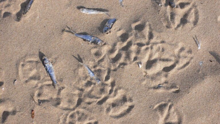
Photo: kjell, CC BY-SA 2.0

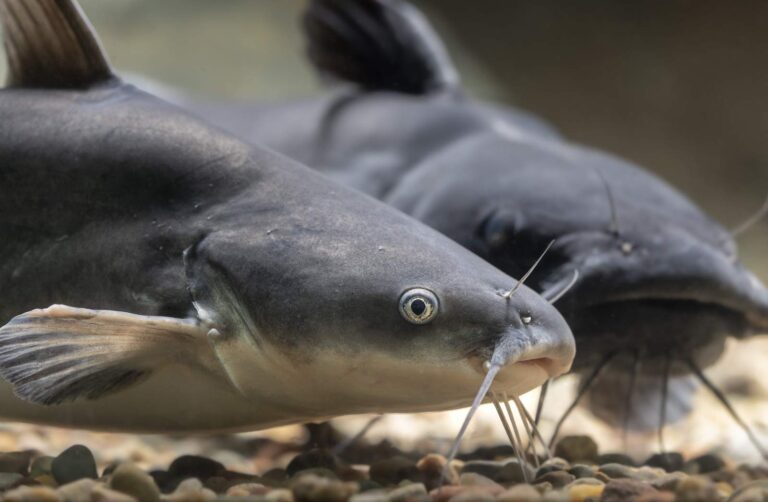
Photo: USFWS Mountain-Prairie, Public domain
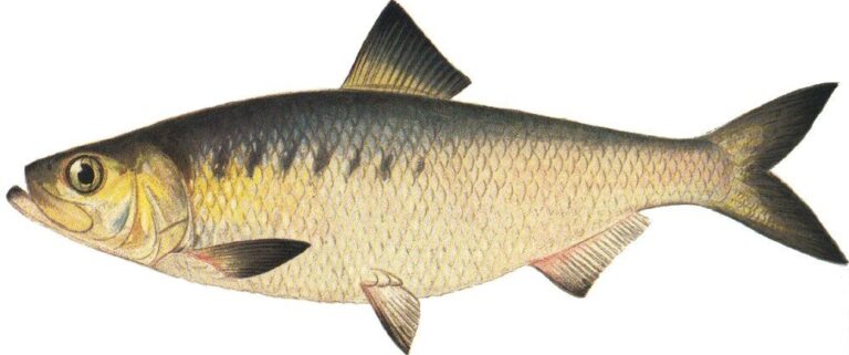
Photo: Ellen Edmonson and Hugh Chrisp, Public domain

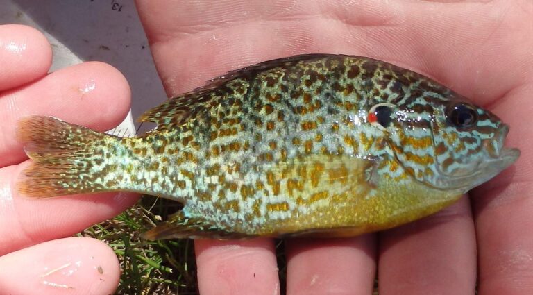
Photo: USFWS Mountain-Prairie, Public domain
The Mattaponi River, asked and answered for Virginia anglers
Which localities does the Mattaponi River cross?
Our records put it in Caroline, King William and King and Queen counties, about 3 miles from Bowling Green.
Where can I put a boat into the Mattaponi River?
5 access sites are on the DWR list, including Melrose boat ramp on Mattaponi River.
What swims in the Mattaponi River?
The DWR list includes American shad, alewife, black crappie, blue catfish, bluegill, chain pickerel and channel catfish.
When is the Mattaponi River stocked?
No DWR trout stocking or wild trout reach is listed for it.
Is there a length limit on smallmouth in the Mattaponi River?
The statewide digest row for largemouth and smallmouth bass reads: 5 per day in the aggregate (combined); No statewide length limits.
Can visitors fish the Mattaponi River?
A Virginia freshwater license is $23 a year for residents and $47 for nonresidents 16 and older, and a saltwater license is $17.50 for residents and $25 for nonresidents. Under-16 anglers are exempt.
What is the Mattaponi River running at on the USGS gauge?
See 2 USGS gauges above, live.
Which Virginia bait counter sits closest to the Mattaponi River?
Nearest in our list: Lake Anna Beach Marina (about 18 miles away).
Is the Mattaponi River fresh or salt water?
The digest license line: Rt. 33 Bridges. The fall line landmark: Rt. 360 Bridge.
Spend a cool Blue Ridge morning on the Mattaponi River
Buy the license online first.