Jackson River Fishing
Alleghany County holds this river.
 Pick for troutPiscifun Carbon X ultralight spinning reel28% OFFSale $57.99
Photo of Lake Moomaw: U.S. Army Corps of Engineers Norfolk District, CC BY 2.0
The Jackson River, the short version
The Jackson River is a Virginia river running through Alleghany County. From the mapped point, Covington is about 3 miles distant.
The DWR access layer has 4 access sites here. Check 3 USGS gauges for today. Trout rules differ on one section.
Virginia DWR waterbody pages, Stocked Trout Reaches and Cold Water Stream Survey layers and Boating Access Locations; USGS gauges; read November 6, 2026.
 For the trout herePiscifun Carbon XT ultralight spinning reel25% OFFSale $59.99
The DWR waterbody page on the Jackson River
Didymo in Virginia 2008 The Jackson is an excellent smallmouth bass, rock bass, rainbow trout, and brown trout fishery above Lake Moomaw. Below Gathright Dam, six public areas provide access to 18 miles of legally navigable water to Covington. Riverfront land owners have brought successful civil trespass claims against anglers fishing in the two portions of the river highlighted on the map (see the Maps section).
Finding Jackson River: DWR directions
Note: Pursuant to Va. Code � 28.2-1200, the riverbeds in the Commonwealth that have not been conveyed by special grant are the property of the Commonwealth, and may be used for fishing by all the people of the Commonwealth. The Commonwealth is presumed to own the bottom of rivers unless someone can prove ownership obtained by a valid grant.
Everything quoted here on Jackson River comes from the DWR waterbody page.
Virginia DWR waterbody page (updated 11/17/2023), read November 6, 2026.
Gauge numbers posted for the Jackson River
| USGS gauge | Latest reading | Time (ET) |
|---|---|---|
| Jackson River Bl Gathright Dam Nr Hot Spgs, Va | 164 cfs, 8.76 ft gage height | Nov 8 6:30 pm |
| Jackson River At Falling Spring, Va | 3.43 ft gage height | Nov 8 6:30 pm |
| Jackson River Bl Dunlap Creek At Covington, Va | 188 cfs, 4.71 ft gage height | Nov 8 6:30 pm |
US Geological Survey provisional data, retrieved Nov 8, 2026 7:32 pm ET. Provisional readings can be revised.
At Jackson River, the panel shows unreviewed USGS data.
| USGS site | Name |
|---|---|
| 02011800 | JACKSON RIVER BL GATHRIGHT DAM NR HOT SPGS, VA |
| 02012500 | JACKSON RIVER AT FALLING SPRING, VA |
| 02013100 | JACKSON RIVER BL DUNLAP CREEK AT COVINGTON, VA |
USGS instantaneous values, provisional.
What swims in the Jackson River, per DWR
Every fish shown for Jackson River has a DWR source.
Virginia DWR waterbody page (updated 11/17/2023), read November 6, 2026.
Launch sites on the Jackson River
| Site | Recorded attributes | Owner | Location (DWR) |
|---|---|---|---|
| Clifton Forge boat ramp on Jackson River | concrete ramp (no dock), 1 ramp, barrier-free, freshwater | Town of Clifton Forge | From Br. 220 Town of Clifton Forge, S. of River turn W on Verge St. Site on Rt. |
| Covington Access on Jackson River | concrete ramp (no dock), 1 ramp, barrier-free | Town of Covington | From I-64,Exit 16B, cont. W on Madison St.(Rt.220)1.2mi., turn South on Rt.18 go 1.6mi. |
| Island Ford II boat ramp on Jackson River | concrete ramp (no dock), freshwater | From Covington, E. on Rt. 1104 (2 mi. on right) | |
| Low Moor boat ramp on Jackson River | concrete ramp (no dock), freshwater | VDOT | From Low Moor exit (I64), N. 100 yds, E., on Rt. 1101, Follow Signs to Access |
More DWR launches near Jackson River
- Irongate boat ramp on James River (Upper and Middle)James River (Upper and Middle), 8 miles east
- Lake Moomaw (Coles Point)Lake Moomaw, 11 miles north
- Craig Creek boat ramp on James River (Upper and Middle)James River (Upper and Middle), 11 miles southeast
Virginia DWR Boating Access Locations layer (attributes as recorded; lanes, fees and hours are not in the layer), read November 6, 2026.
Stocking category and reaches on the Jackson River
Trout rules that differ on the Jackson River
| Water | Locality as printed | Regulation | Trout license Oct 1 to Jun 15 |
|---|---|---|---|
| Jackson River | Bath | 16 inch / 2 per day | yes |
| Jackson River (Tailwater) | Alleghany | Special slot |
- Bait Allowed: Jackson River Tailwater (Alleghany County)From Gathright Dam downstream to the Westvaco Dam at Covington: No rainbow trout 12 to 16 inches; no brown trout less than 20 inches; 4 trout (combined rainbow and brown) creel (harvest) limit per day, only 1 of 4 can be a brown trout over 20 inches. All rainbow trout between 12 and 16 inches and all brown trout less than 20 inches must be released immediately. The 7-inch statewide minimum size limit does not apply to rainbow trout in this section of river. Bait allowed.
- 16-inch Minimum, 2 Fish Per Day: Jackson River (Bath County)That portion from the Forest Service swinging bridge, located just upstream from the mouth of Muddy Run, upstream 3 miles to the last ford on Forest Service Road 481D. This section is stocked several times a year with catchable-sized trout and good populations are always present (a trout license is required to fish in this stream from October 1 through June 15) . This section can only be reached by foot travel, either from the Hidden Valley area or off Route 623 and FS Road 481. Note …
- Bait Allowed: Jackson River Tailwater (Alleghany County)From Gathright Dam downstream to the Westvaco Dam at Covington: No rainbow trout 12 to 16 inches; no brown trout less than 20 inches; 4 trout (combined rainbow and brown) creel (harvest) limit per day, only 1 of 4 can be a brown trout over 20 inches. All rainbow trout between 12 and 16 inches and all brown trout less than 20 inches must be released immediately. The 7-inch statewide minimum size limit does not apply to rainbow trout in this section of river. Bait allowed.
Special regulation trout waters as printed (page updated August 17, 2026), 2026 Freshwater Fishing in Virginia digest (eRegulations, linked from the Virginia DWR regulations page), read November 6, 2026.
Designated stocked trout waters require a trout license October 1 to June 15; urban waters November 1 to April 30 (as printed).
When DWR hatchery trout reached the Jackson River
| Date | Water as listed | Category | Species |
|---|---|---|---|
| October 8, 2026 | Jackson River (Hidden Valley) | A | Rainbow Trout, Brown Trout |
| October 2, 2026 | Jackson River (Rt. 623) | A | Rainbow Trout, Brown Trout |
| May 21, 2026 | Jackson River (Rt. 623) | A | Brown Trout |
| May 18, 2026 | Jackson River (Hidden Valley) | A | Brown Trout |
| May 6, 2026 | Jackson River (Rt. 623) | A | Rainbow Trout, Brown Trout |
| April 27, 2026 | Jackson River (Hidden Valley) | A | Brown Trout |
| April 22, 2026 | Jackson River (Rt. 623) | A | Rainbow Trout, Brown Trout, Tiger Trout |
| April 17, 2026 | Jackson River (Hidden Valley) | A | Brown Trout, Tiger Trout |
| March 26, 2026 | Jackson River (Rt. 623) | A | Brown Trout, Brook Trout, Tiger Trout |
| March 24, 2026 | Jackson River (Hidden Valley) | A | Brown Trout, Tiger Trout |
| March 4, 2026 | Jackson River (Hidden Valley) | A | Rainbow Trout, Brook Trout |
| March 3, 2026 | Jackson River (Rt. 623) | A | Rainbow Trout, Tiger Trout |
Stocking dates per season on Jackson River: 2026-27 2 dates; 2025-26 16 dates; 2024-25 16 dates; 2023-24 16 dates.
The 2026 catchable trout plan for the Jackson River
| Water as printed | Locality as printed | Category | Meaning | National forest |
|---|---|---|---|---|
| Jackson River (Hidden Valley) | Bath County | A | stocked 8 times between October 1 and May 31 | yes |
| Jackson River (Rt. 623) | Bath County | A | stocked 8 times between October 1 and May 31 | yes |
Virginia DWR trout stocking schedule (date, county, water, category and species as listed; DWR prints no numbers or sizes), read November 6, 2026. 2026 Catchable Trout Stocking Plan (category letters as printed), read November 6, 2026.
Digest size and creel, Jackson River
| Species as printed | Applies to | Creel | Length |
|---|---|---|---|
| Largemouth, Smallmouth Bass | statewide | 5 per day in the aggregate (combined) | No statewide length limits |
| Alabama, Spotted Bass | statewide | No statewide daily limit | No statewide length limit |
| Landlocked Striped Bass and Landlocked Striped Bass X White Bass Hybrids | statewide | 4 per day in the aggregate | No fish less than 20 inches |
| Striped Bass | Anadromous (coastal) striped bass above the fall line in all coastal rivers of the Chesapeake Bay and Crane Lake (City of Suffolk) | Creel and length limits shall be as set by the Virginia Marine Resources Commission for recreational fishing in tidal waters | no length limit printed |
| Striped Bass | Striped bass in the Meherrin, Nottoway, Blackwater (Chowan Drainage), North Landing and Northwest rivers and their tributaries plus Back Bay | No possession | no length limit printed |
| Walleye, Saugeye | statewide | 5 per day in the aggregate | No walleye or saugeye less than 18 inches |
| Sauger | statewide | 2 per day | No statewide length limits |
| White Bass | statewide | 5 per day | No statewide length limits |
| Chain Pickerel and Northern Pike | statewide | 5 per day | No statewide length limits |
| Muskellunge | statewide | 1 per day | No muskellunge less than 40 inches |
| Bluegill (bream) and other sunfish excluding Crappie, Rock Bass (redeye) and Roanoke Bass | statewide | 50 per day in the aggregate (combined) | No statewide length limits |
| Crappie (black or white) | statewide | 25 per day in the aggregate (combined) | No statewide length limits |
| Rock Bass (redeye) | statewide | 25 per day in the aggregate with Roanoke bass | No statewide length limits |
| Roanoke Bass | statewide | 25 per day in the aggregate with rock bass | No statewide length limits |
| Perch (yellow and white) | statewide | No statewide daily limit | No statewide length limit |
| Trout | statewide | 6 per day | 7 inch minimum size |
| Channel, White, and Flathead | statewide | 20 per day | No length limits |
| Blue | statewide | 20 per day | No statewide length limits |
The statewide digest rows above apply on Jackson River unless an exception names it.
A Virginia freshwater license is $23 a year for residents and $47 for nonresidents 16 and older. Designated stocked trout waters also need the $23 trout license from October 1 to June 15.
Statewide creel and length limits as printed (page updated August 17, 2026), 2026 Freshwater Fishing in Virginia digest (eRegulations, linked from the Virginia DWR regulations page), read November 6, 2026. Virginia license fees in the 2026 Freshwater Fishing in Virginia digest (licenses run one year from purchase unless noted), read November 6, 2026.
Heaviest Virginia fish from the Jackson River
| Species | Weight as printed | Date | Water as listed | Note |
|---|---|---|---|---|
| Fallfish | 3 lbs. 13 oz. | 4-3-2025 | Jackson River |
State Record Freshwater Fish as of 9-2-2025 (keeper: Virginia DWR (State Record Freshwater Fish list as of 9-2-2025); angler names left off here), read November 6, 2026.
Five Virginia streams close to the Jackson River
| Stream | Distance | DWR access sites | USGS gauges | Stocked reaches |
|---|---|---|---|---|
| Jackson River | this stream | 4 | 3 | 0 |
| Pounding Mill Creek | 1 mile west | 0 | 0 | 3 |
| Roaring Run | 5 miles southeast | 0 | 0 | 2 |
| Smith Creek | 8 miles northeast | 0 | 0 | 4 |
| Wilson Creek | 14 miles northeast | 0 | 0 | 2 |
| Barbours Creek | 15 miles southwest | 0 | 0 | 5 |
Virginia DWR Boating Access Locations and Stocked Trout Reaches, USGS gauges; read November 6, 2026.
Around Jackson River, within a Virginia drive
Other Virginia reservoirs close to Jackson River
- Clifton Forge Reservoir7 miles
- Douthat Lake11 miles
- Lake Moomaw13 miles
- Lake Robertson18 miles
Virginia towns close to Jackson River
- Covington3 miles, City of Covington
- Clifton Forge7 miles, Alleghany County
- Buchanan22 miles, Botetourt County
The localities Jackson River runs through
- Alleghany Countycounty seat Covington
Other Virginia rivers near the Jackson River
- Pounding Mill Creek1 mile
- Roaring Run5 miles
- Smith Creek8 miles
- Wilson Creek14 miles
- Barbours Creek15 miles
Piscifun spinning gear for a day out on Jackson River


Piscifun and Amazon links are affiliate links; the site earns a commission on qualifying purchases.
Shorelines around Jackson River through a camera
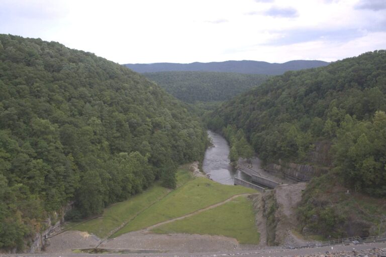
Photo: U.S. Army Corps of Engineers Norfolk District, CC BY 2.0
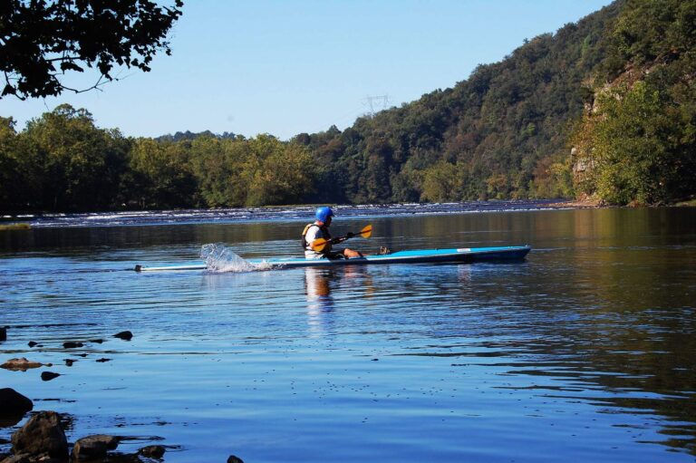
Photo: Virginia State Parks, CC BY 2.0
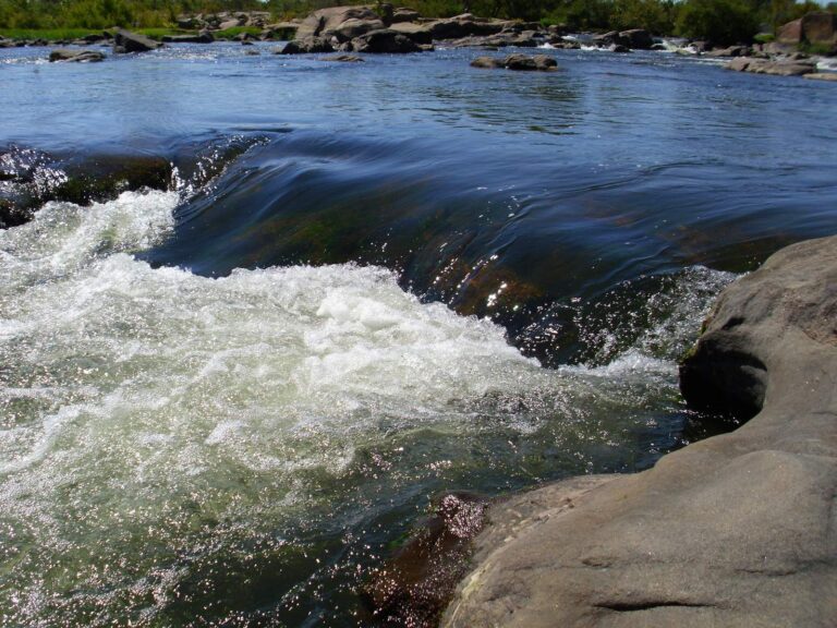
Photo: sdreelin, CC BY-SA 2.0
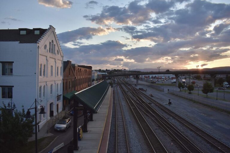
Photo: Matt Walter, CC BY-SA 2.0
Questions on the Jackson River before the truck is loaded
Where does the Jackson River flow in Virginia?
Look in Alleghany County, about 3 miles from Covington.
Where do floats start on the Jackson River?
Try Clifton Forge boat ramp on Jackson River, one of 4 access sites.
Which fish does DWR name in the Jackson River?
DWR names brown trout, rainbow trout, redbreast sunfish, rock bass, smallmouth bass, brook trout and tiger trout.
Is the Jackson River trout water?
It shows up on the DWR stocking schedule, latest Rainbow Trout, Brown Trout (October 8, 2026; category A). Designated stocked trout waters require a trout license October 1 to June 15; urban waters November 1 to April 30 (as printed).
Which bass rule applies on the Jackson River?
The statewide digest row for largemouth and smallmouth bass reads: 5 per day in the aggregate (combined); No statewide length limits.
Does a freshwater license cover the Jackson River?
A Virginia freshwater license is $23 a year for residents and $47 for nonresidents 16 and older. Designated stocked trout waters also need the $23 trout license from October 1 to June 15. No license is needed under 16.
Is there a live gauge on the Jackson River?
3 USGS gauges report it above.
Which shop is on the way to the Jackson River?
Nothing on the shop list is close.
Which Virginia record row names the Jackson River?
Fallfish, 3 lbs. 13 oz., 2025, is on the DWR record list for this water (no angler names here).
Strap the kayak down for the Jackson River
Check the digest before you go.