New River Fishing
Carroll County and 7 other localities holds this river.
 Pick for troutPiscifun Carbon X ultralight spinning reel28% OFFSale $57.99
Photo: Virginia State Parks, CC BY 2.0
The New River, the short version
The New River is a Virginia river running through Carroll County and 7 other localities. From the mapped point, Galax is about 6 miles distant.
The DWR access layer has 18 access sites here. Check 5 USGS gauges for today. Licenses from NC work on part of it, as printed below.
Virginia DWR waterbody pages, Stocked Trout Reaches and Cold Water Stream Survey layers and Boating Access Locations; USGS gauges; read November 6, 2026.
 For the trout herePiscifun Carbon XT ultralight spinning reel25% OFFSale $59.99
The DWR waterbody page on the New River
When you plan a trip on the New River in southwest Virginia, you will be floating into the past. The New River is an ancient river system, the oldest on the North American continent and second only to the Nile River in Africa as the oldest river in the world. It begins as two streams in the Blue Ridge Mountains of North Carolina, before merging into the New River four miles from the Virginia line.
Everything quoted here on New River comes from the DWR waterbody page.
Virginia DWR waterbody page (updated 11/17/2023), read November 6, 2026.
Gauge numbers posted for the New River
| USGS gauge | Latest reading | Time (ET) |
|---|---|---|
| New River Near Galax, Va | 822 cfs, 1.25 ft gage height | Nov 8 6:30 pm |
| New River At Ivanhoe, Va | 1,160 cfs, 2.58 ft gage height | Nov 8 7:20 pm |
| New River At Allisonia, Va | 1,600 cfs, 1.59 ft gage height | Nov 8 6:30 pm |
US Geological Survey provisional data, retrieved Nov 8, 2026 7:32 pm ET. Provisional readings can be revised.
At New River, the panel shows unreviewed USGS data.
| USGS site | Name |
|---|---|
| 03164000 | NEW RIVER NEAR GALAX, VA |
| 03165500 | NEW RIVER AT IVANHOE, VA |
| 03168000 | NEW RIVER AT ALLISONIA, VA |
| 03171000 | NEW RIVER AT RADFORD, VA |
| 03176500 | NEW RIVER AT GLEN LYN, VA |
USGS instantaneous values, provisional.
What swims in the New River, per DWR
Every fish shown for New River has a DWR source.
Virginia DWR waterbody page (updated 11/17/2023), read November 6, 2026.
Launch sites on the New River
| Site | Recorded attributes | Owner | Location (DWR) |
|---|---|---|---|
| Austinville boat ramp on New River | concrete ramp (no dock), 1 ramp, barrier-free, freshwater | DWR | From Austinville S. on Rt 69 to the River |
| Baywood boat ramp on New River | concrete ramp (no dock), freshwater | DWR | From Independent, Rt 58 East (6) |
| Bluff City boat ramp on New River | gravel access, 1 ramp, barrier-free, freshwater | Giles County | 460-exit Cord Dr 300'&lft Tannery Dr go 200'&RT on Thomas Rd Access on lft under bridge |
| Bridle Creek boat ramp on New River | concrete ramp (no dock), freshwater | DWR | From Independence, Rt 58 West (1.8); L on Rt 711 (3.9) |
| Claytor Dam boat ramp on New River | concreate ramp (no dock), 1 ramp, freshwater | Appalachian Power | Rt. 232-605 South (2) of Radford |
| Independence boat ramp on New River | concrete ramp (no dock), freshwater | DWR | From Independence, Rt 21 South to Rt 221 (3.2); L on Rt 700 (.5) |
| Ivanhoe boat ramp on New River | gravel access, freshwater | DWR | From Rt. 94 (S. of Ivanhoe), turn East on Rt. 658, follow under New River Trail, turn le |
| Loafers Rest boat ramp on New River | hand carry (hand launch), freshwater | AEP | |
| Mouth of Wilson boat ramp on New River | concrete ramp (no dock), freshwater | DWR | East of Mouth of Wilson; Intersection Rt 58 & 93 |
| Narrows boat ramp on New River | concrete ramp (no dock), barrier-free, freshwater | Town of Narrows | North of Narrows on Rt 649 |
| Oldtown boat ramp on New River | concrete ramp (no dock), freshwater | DWR | Rt 58 West; R on Rt 640 (Old Town Rd) (1); R on Rt 634 (1.3); L on Rt 641 (1.7) |
| Peppers Ferry boat ramp on New River | gravel access, 1 ramp, barrier-free, freshwater | No File | Route 11 turn on Route 114 (Peppers Ferry Blvd.) 2.1 miles to access on the right |
| Rich Creek boat ramp on New River | concrete ramp (no dock), freshwater | Town of Rich Creek | East of Rich Creek (.5) on Rt 460 |
| Riverside boat ramp on New River | concrete ramp (no dock), freshwater | DWR | Intersection of Rt 94 & Rt 274, South of Fries |
| Riverview Park on New River | concrete ramp (no dock), 1 ramp, freshwater | City of Radford | From West Main St. , trn S on Cowan St. go 400' turn E on River St. |
| Snidow Park (Pembroke) on New River | concrete ramp, barrier-free, freshwater | Town of Pembroke | In the Town of Pembroke take Snidow Road (Rt 623) south to bridge, L into Sindow Park |
| Whitethorne boat ramp on New River | concrete ramp (no dock), 1 ramp, freshwater | DWR | From Rt 460, Rt. 655 West (6.8); L on Rt 652 (.2); R on Rt 623 (1) |
| Whitt-Riverbend boat ramp on New River | concrete ramp (no dock), 1 ramp, barrier-free, freshwater | Giles County | Rt460-take Ripplemead exit, turn N on Rt636 continue 1.4mi to Access on left |
More DWR launches near New River
- Byllesby Pool boat rampByllesby Lake, 8 miles northeast
Virginia DWR Boating Access Locations layer (attributes as recorded; lanes, fees and hours are not in the layer), read November 6, 2026.
Digest size and creel, New River
| Species as printed | Applies to | Creel | Length |
|---|---|---|---|
| Largemouth, Smallmouth Bass | statewide | 5 per day in the aggregate (combined) | No statewide length limits |
| Alabama, Spotted Bass | statewide | No statewide daily limit | No statewide length limit |
| Landlocked Striped Bass and Landlocked Striped Bass X White Bass Hybrids | statewide | 4 per day in the aggregate | No fish less than 20 inches |
| Striped Bass | Anadromous (coastal) striped bass above the fall line in all coastal rivers of the Chesapeake Bay and Crane Lake (City of Suffolk) | Creel and length limits shall be as set by the Virginia Marine Resources Commission for recreational fishing in tidal waters | no length limit printed |
| Striped Bass | Striped bass in the Meherrin, Nottoway, Blackwater (Chowan Drainage), North Landing and Northwest rivers and their tributaries plus Back Bay | No possession | no length limit printed |
| Walleye, Saugeye | statewide | 5 per day in the aggregate | No walleye or saugeye less than 18 inches |
| Sauger | statewide | 2 per day | No statewide length limits |
| White Bass | statewide | 5 per day | No statewide length limits |
| Chain Pickerel and Northern Pike | statewide | 5 per day | No statewide length limits |
| Muskellunge | statewide | 1 per day | No muskellunge less than 40 inches |
| Bluegill (bream) and other sunfish excluding Crappie, Rock Bass (redeye) and Roanoke Bass | statewide | 50 per day in the aggregate (combined) | No statewide length limits |
| Crappie (black or white) | statewide | 25 per day in the aggregate (combined) | No statewide length limits |
| Rock Bass (redeye) | statewide | 25 per day in the aggregate with Roanoke bass | No statewide length limits |
| Roanoke Bass | statewide | 25 per day in the aggregate with rock bass | No statewide length limits |
| Perch (yellow and white) | statewide | No statewide daily limit | No statewide length limit |
| Trout | statewide | 6 per day | 7 inch minimum size |
| Channel, White, and Flathead | statewide | 20 per day | No length limits |
| Blue | statewide | 20 per day | No statewide length limits |
The statewide digest rows above apply on New River unless an exception names it.
- Bass
- New River-Fields Dam (Grayson County) downstream to the VA-WV state line and its tributaries Little River downstream from Little River Dam in Montgomery County, Big Walker Creek from the Norfolk Southern Railroad Bridge downstream to the New River, and Wolf Creek from the Narrows Dam downstream to the New River in Giles County (This does not include Claytor Lake which is delineated as: The upper end of the island at Allisonia downstream to the dam.):
- No bass 14 to 22 inches, only 1 per day longer than 22 inches, 5 per day in the aggregate.
- Walleye
- New River upstream of Buck Dam in Carroll County:
- Statewide size and creel limits apply, with no Walleye less than 18 inches, creel limit 5 per day
- Claytor Lake and the New River upstream of Claytor Lake Dam to Buck Dam in Carroll County:
- Year round: No Walleye 19 to 28 inches; 2 Walleye per day
- New River downstream from Claytor Dam:
- Statewide size and creel limits apply, with no Walleye less than 18 inches, creel limit 5 per day.
- Muskie
- New River-Fields Dam (Grayson County) downstream to Claytor Dam (includes Claytor Lake):
- 1 per day
- No Muskie less than 42 inches
Virginia DWR waterbody page (updated 11/17/2023), read November 6, 2026.
Special limits written for New River
| Water as printed | Species | Rule as printed |
|---|---|---|
| New River–Fields Dam (Grayson County) downstream to the VA-WV state line and its tributaries Little River downstream from Little River Dam in Montgomery County, | Largemouth, Smallmouth Bass | No largemouth or smallmouth bass 14 to 22 inches, only 1 per day longer than 22 inches |
| Claytor Lake and the New River upstream to Fries Dam in Grayson County | Walleye, Saugeye | 2 walleye per day; no walleye 19 to 28 inches |
| New River-Claytor Dam downstream to VA-WV state line | Muskellunge | 1 per day June 1–last day of February: No muskellunge 40 to 48 inches March 1–May 31: No muskellunge less than 48 inches |
Water-specific exceptions as printed, 2026 Freshwater Fishing in Virginia digest (eRegulations, linked from the Virginia DWR regulations page), read November 6, 2026.
The New River as a border water
- New River Virginia or North Carolina state fishing licenses and permits are honored on the mainstream portion lying between the confluence of the North and South Forks of the New River in North Carolina (Alleghany County) downstream to the confluence of the New and Little rivers in Virginia (Grayson County).
A Virginia freshwater license is $23 a year for residents and $47 for nonresidents 16 and older.
Statewide creel and length limits as printed (page updated August 17, 2026), 2026 Freshwater Fishing in Virginia digest (eRegulations, linked from the Virginia DWR regulations page), read November 6, 2026. Virginia license fees in the 2026 Freshwater Fishing in Virginia digest (licenses run one year from purchase unless noted), read November 6, 2026.
Heaviest Virginia fish from the New River
| Species | Weight as printed | Date | Water as listed | Note |
|---|---|---|---|---|
| Musky (includes Tiger) | 45 lbs. 8 oz. | 6-1-2007 | New River | |
| Walleye | 22 lbs. 8 oz. | 8-20-1973 | New River | retired category |
| Walleye | 15 lbs. 15 oz. | 12-15-2000 | New River | |
| Smallmouth Bass | 8 lbs. 1 oz. | 3-12-2003 | New River |
State Record Freshwater Fish as of 9-2-2025 (keeper: Virginia DWR (State Record Freshwater Fish list as of 9-2-2025); angler names left off here), read November 6, 2026.
Five Virginia streams close to the New River
| Stream | Distance | DWR access sites | USGS gauges | Stocked reaches |
|---|---|---|---|---|
| New River | this stream | 18 | 5 | 0 |
| Chestnut Creek | 6 miles east | 0 | 1 | 2 |
| Elk Creek | 10 miles west | 0 | 0 | 10 |
| Cripple Creek | 11 miles north | 0 | 0 | 2 |
| Crooked Creek | 12 miles east | 0 | 0 | 2 |
| Stewarts Creek | 16 miles southeast | 0 | 0 | 1 |
Virginia DWR Boating Access Locations and Stocked Trout Reaches, USGS gauges; read November 6, 2026.
Around New River, within a Virginia drive
Other Virginia reservoirs close to New River
- Byllesby Lake8 miles
- Hales Lake14 miles
- Rural Retreat Lake20 miles
- Lovill’s Creek Lake22 miles
Where to buy bait before New River
- Backwoods Outdoor Supplybait and tackle shop, Hillsville, 16 miles
- New River Sports-Wythevillebait and tackle shop, Wytheville, 19 miles
- Rock House Marinamarina, Pulaski
Virginia towns close to New River
- Galax6 miles, City of Galax
- Independence8 miles, Grayson County
- Hillsville17 miles, Carroll County
The localities New River runs through
- Carroll Countycounty seat Hillsville
- Giles Countycounty seat Pearisburg
- Grayson Countycounty seat Independence
- Montgomery Countycounty seat Christiansburg
- City of Radfordindependent city
- Wythe Countycounty seat Wytheville
- Alleghany Countycounty seat Covington
- Pulaski Countycounty seat Pulaski
Other Virginia rivers near the New River
- Chestnut Creek6 miles
- Elk Creek10 miles
- Cripple Creek11 miles
- Crooked Creek12 miles
- Stewarts Creek16 miles
Piscifun spinning gear for a day out on New River


Piscifun and Amazon links are affiliate links; the site earns a commission on qualifying purchases.
Shorelines around New River through a camera
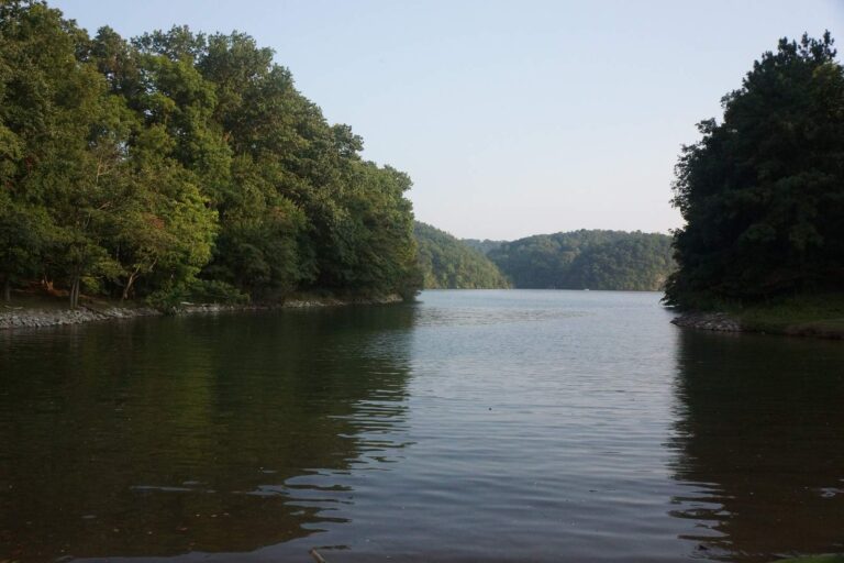
Photo: Virginia State Parks, CC BY 2.0

Photo: Chris Lawrence, CC BY-SA 2.0
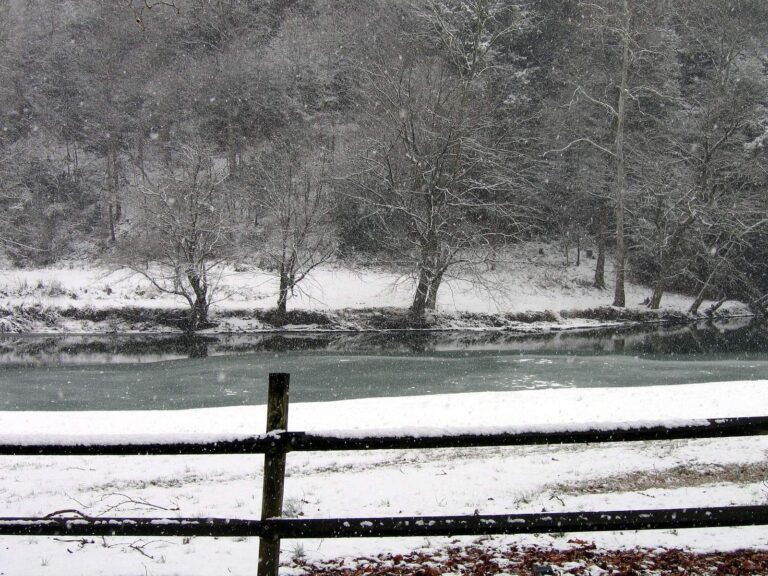
Photo: Jason Riedy, CC BY 2.0
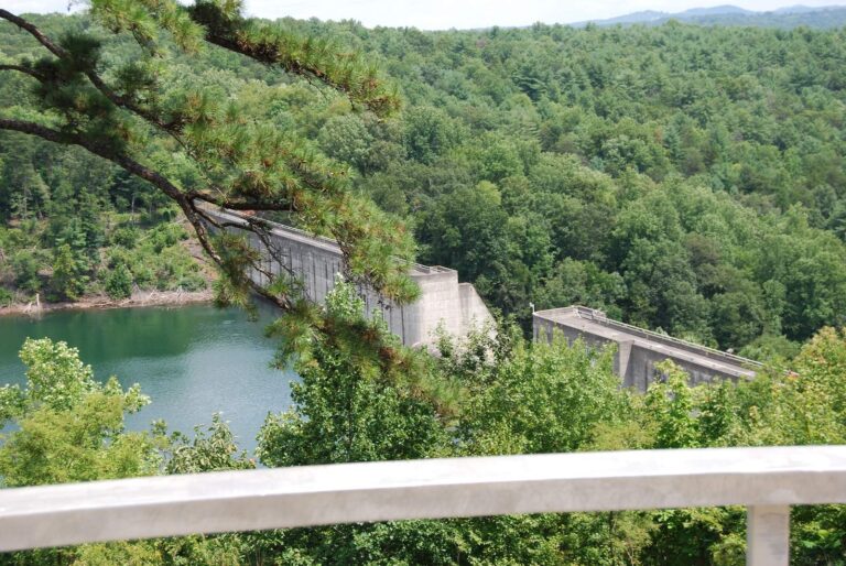
Photo: Virginia State Parks, CC BY 2.0
Questions on the New River before the truck is loaded
Where does the New River flow in Virginia?
Look in Carroll County and 7 other localities, about 6 miles from Galax.
Where do floats start on the New River?
Try Austinville boat ramp on New River, one of 18 access sites.
Which fish does DWR name in the New River?
DWR names black crappie, bluegill, channel catfish, crappie, flathead catfish, hybrid striped bass and largemouth bass.
Is the New River trout water?
DWR trout layers skip it.
Which bass rule applies on the New River?
The statewide digest row for largemouth and smallmouth bass reads: 5 per day in the aggregate (combined); No statewide length limits. An exception covers part of it.
Does a freshwater license cover the New River?
A Virginia freshwater license is $23 a year for residents and $47 for nonresidents 16 and older. No license is needed under 16.
Is there a live gauge on the New River?
5 USGS gauges report it above.
Which shop is on the way to the New River?
Stop at Backwoods Outdoor Supply (about 16 miles away).
Does a neighbouring state license work on the New River?
New River Virginia or North Carolina state fishing licenses and permits are honored on the mainstream portion lying between the confluence of the North and South Forks of the New River in North Carolina (Alleghany County) downstream to the confluence of the New and Little rivers in Virginia (Grayson County).
Which Virginia record row names the New River?
Musky (includes Tiger), 45 lbs. 8 oz., 2007, is on the DWR record list for this water (no angler names here).
Strap the kayak down for the New River
Check the digest before you go.