Fishing in Skagit County, Washington
County seat: Mount Vernon. Population 129,523.
- 15lake pages
- 23launches
- 11river pages
 Pick for salmonPiscifun Viper X spinning reel50% OFFSale $39.99
Photo of San Juan Islands: Bureau of Land Management, CC BY 2.0
The fishing picture across Skagit County, start to finish
Skagit County runs its county business from Mount Vernon, and the 2020 Census found 129,523 people living inside its lines. WDFW hatchery plants in this county are logged under WDFW Region 4 in the 2026 report. Hikers can aim for 62 lakes on the WDFW high lakes list.
Lake guides cover 15 waters totalling 4,723 acres; Lake Shannon is the largest of them. Salt water within the county belongs to Deception Pass, Hope Island, and Skagit Bay, East Juan de Fuca Strait, San Juan Islands and Deception Pass. WDFW SWIFD distribution data maps salmon or steelhead in Skagit River, North Fork Stillaguamish River, Baker River and South Fork Skagit River. Agency maps show 23 boat launches: 15 WDFW, 2 State Parks and 6 other agencies. WDFW maps 26 shore or access sites for bank anglers, 4 of them built piers.
Census 2020 population; WDFW Fish Washington lake layers, WDFW facilities and State Parks launch layers (WDFW GIS); WDFW marine areas; retrieved October 31, 2026.
 For the salmon herePiscifun AlumiX spinning reel46% OFFSale $64.99
One map of the Skagit County water access
WDFW and State Parks launch layers, WDFW facilities, WDFW lake points, NHD river midpoints and WDFW marine area points. Checked November 2026.
Lakes of Skagit County ranked by WDFW surface acres
| Lake | Acres | Launches | WDFW program | Fish WDFW maps |
|---|---|---|---|---|
| Lake Shannon | 2,060 | 0 | Trout emphasis | brook trout, coastal cutthroat trout, kokanee |
| Lake Cavanaugh | 833 | 1 | Mixed species – Trout emphasis | rainbow trout, coastal cutthroat trout, kokanee |
| Big Lake | 536 | 1 | Mixed species – Warmwater emphasis | coastal cutthroat trout, largemouth bass, brown bullhead |
| Lake Campbell | 391 | 1 | Mixed species – Warmwater emphasis | rainbow trout, coastal cutthroat trout, largemouth bass |
| Clear Lake (Skagit County) | 220 | 1 | Mixed species – Trout emphasis | rainbow trout, coastal cutthroat trout, largemouth bass |
| Lake McMurray | 155 | 1 | Mixed species – Trout emphasis | rainbow trout, coastal cutthroat trout, largemouth bass |
| Lake Erie | 114 | 1 | Mixed species – Trout emphasis | rainbow trout, largemouth bass, yellow perch |
| Pass Lake | 95 | 0 | Trout emphasis | rainbow trout, brown trout, coastal cutthroat trout |
| Beaver Lake (Skagit County) | 72 | 1 | Warmwater emphasis | coastal cutthroat trout, largemouth bass, yellow perch |
| Heart Lake (Skagit County) | 64 | 1 | Mixed species – Trout emphasis | rainbow trout, largemouth bass |
| Grandy Lake | 56 | 0 | Trout emphasis | rainbow trout, coastal cutthroat trout, largemouth bass |
| Sixteen Lake | 43 | 1 | Mixed species – Trout emphasis | rainbow trout |
| Whistle Lake | 37 | 0 | Mixed species – Trout emphasis | rainbow trout, coastal cutthroat trout, largemouth bass |
| Slide Lake | 31 | 0 | WDFW high lake, getting started lakes | coastal cutthroat trout |
| Vogler Lake | 15 | 1 | Trout emphasis | rainbow trout |
WDFW Fish Washington lowland and high lake layers (surface acres as published, management emphasis, mapped species); WDFW publishes no lake depths in these layers. Retrieved October 31, 2026.
Marine areas and inlets that touch Skagit County
Count 8 marine areas and regional waters along Skagit County.
| Water | Kind | Launches | Piers and shore | Marine area |
|---|---|---|---|---|
| Deception Pass, Hope Island, and Skagit Bay (Marine Area 8-1) | WDFW marine area | 5 | 5 | 8-1 |
| East Juan de Fuca Strait (Marine Area 6) | WDFW marine area | 4 | 3 | 6 |
| San Juan Islands (Marine Area 7) | WDFW marine area | 8 | 6 | 7 |
| Deception Pass | regional marine water | 3 | 3 | 8-1 |
| Puget Sound | regional marine water | 34 | 52 | 8-1, 8-2, 9, 10, 11, 12, 13 |
| Rosario Strait | regional marine water | 1 | 1 | 7 |
| Skagit Bay | regional marine water | 3 | 1 | 8-1 |
| Strait of Juan de Fuca | regional marine water | 5 | 3 | 5, 6 |
Dated NOAA ESI data (2003 to 2006) place 6 marinas along this shore.
WDFW Recreational Marine Areas (WAC 220-300-160 boundaries), WDFW and State Parks marine launches, WDFW piers and USGS GNIS bay names; retrieved October 31, 2026.
Which fish WDFW ties to water near Skagit County
Within 50 miles of Mount Vernon, rainbow trout shows up on the most lake and marine pages.
Species mapped in the WDFW Fish Washington layers, WDFW state records and the 2026 WDFW trout plants, counted per water page within 50 miles; not a survey.
More named lakes of Skagit County still without a page
Another 61 named lakes in Skagit County have too few published facts for a page of their own and are listed by size.
| Water | Acres | WDFW program | Nearest town |
|---|---|---|---|
| Upper Jordan Lake | 66 | WDFW high lake, fish stocking | Darrington |
| Found Lake | 63 | WDFW high lake, overabundant lakes | Darrington |
| Hidden Lake | 61 | WDFW high lake, fish stocking | Darrington |
| Lower Falls Lake | 60 | WDFW high lake, fish stocking | Darrington |
| Cyclone Lake | 55 | WDFW high lake, fish stocking | Darrington |
| Lower Jordan Lake | 52 | WDFW high lake, fish stocking | Darrington |
| Whale Lake | 45 | WDFW high lake, fish stocking | Darrington |
| Itswoot Lake | 37 | WDFW high lake, fish stocking | Darrington |
| Monogram Lake | 29 | WDFW high lake, overabundant lakes | Darrington |
| Snowking Lake | 26 | WDFW high lake, fish stocking | Darrington |
| Clear Lake (Skagit County) | 17 | WDFW high lake, fish stocking | Darrington |
| Springsteen Lake | 16 | WDFW high lake, fish stocking | Sedro-Woolley |
| Heart Lake (Skagit County) | 14 | WDFW high lake, fish stocking | Sedro-Woolley |
| Skaro Lake | 14 | WDFW high lake, fish stocking | Darrington |
| Granite Lake | 14 | WDFW high lake, fish stocking | Darrington |
| Wing Lake | 14 | WDFW high lake, fish stocking | Darrington |
| Enjar Lake | 12 | WDFW high lake, fish stocking | Darrington |
| Texas Pond | 11 | WDFW high lake, fish stocking | Darrington |
| Lewis Lake | 11 | WDFW high lake, fish stocking | Darrington |
| Arrowhead Lake | 10 | WDFW high lake, overabundant lakes | Darrington |
| Cub Lake | 10 | WDFW high lake, fish stocking | Darrington |
| Long Gone Lake | 10 | WDFW high lake, fish stocking | Darrington |
| Sweetpea Lake | 9 | WDFW high lake, fish stocking | Darrington |
| Stag Lake | 8 | WDFW high lake, fish stocking | Darrington |
| Pear Lake | 7 | WDFW high lake, fish stocking | Darrington |
| Lake Kawkawak | 7 | WDFW high lake, fish stocking | Darrington |
| Myrtle Lake | 7 | WDFW high lake, fish stocking | Darrington |
| McGinnis Lake | 6 | WDFW high lake, fish stocking | Sedro-Woolley |
| Lake Louise | 5 | WDFW high lake, fish stocking | Darrington |
| Foss Lake | 5 | WDFW high lake, fish stocking | Darrington |
| Hidden Lake Tarn | 4 | WDFW high lake, fish stocking | Darrington |
| Alp Lake | 4 | WDFW high lake, fish stocking | Darrington |
| Horse Lake | 4 | WDFW high lake, fish stocking | Darrington |
| Shelf Lake | 4 | WDFW high lake, fish stocking | Darrington |
| Lake Stilwell | 4 | WDFW high lake, fish stocking | Darrington |
| Lake Tupso | 4 | WDFW high lake, fish stocking | Darrington |
| La Rush Lake | 3 | WDFW high lake, fish stocking | Darrington |
| Gee Point Lake | 3 | WDFW high lake, fish stocking | Darrington |
| Edgar Lake | 3 | WDFW high lake, fish stocking | Darrington |
| Bald Lake | 3 | WDFW high lake, fish stocking | Darrington |
| Cabinet Lake | 3 | WDFW high lake, fish stocking | Darrington |
| Prairie Mountain Upper Lake | 3 | WDFW high lake, fish stocking | Darrington |
| Splendor Lake | 3 | WDFW high lake, fish stocking | Darrington |
| Upper Josephins Lake | 3 | WDFW high lake, fish stocking | Sedro-Woolley |
| Howard Lake | 2 | WDFW high lake, fish stocking | Sedro-Woolley |
| Lower Josephine Lake | 2 | WDFW high lake, overabundant lakes | Sedro-Woolley |
| Gordon Lake | 2 | WDFW high lake, fish stocking | Big Lake |
| Hawkins Lake | 2 | WDFW high lake, fish stocking | Darrington |
| Hyas Lake | 2 | WDFW high lake, fish stocking | Darrington |
| Gee – Little Lake | 2 | WDFW high lake, overabundant lakes | Darrington |
| Buller Lake | 2 | WDFW high lake, fish stocking | Darrington |
| Bee Lake | 2 | WDFW high lake, fish stocking | Darrington |
| Wagner Lake | 2 | WDFW high lake, fish stocking | Big Lake |
| Kitling Lake | 2 | WDFW high lake, fish stocking | Darrington |
| Bear Lake (Skagit County) | 1 | WDFW high lake, fish stocking | Darrington |
| Fisher Peak Lake | 1 | WDFW high lake, fish stocking | Darrington |
| Long Gone Pot Lake | 1 | WDFW high lake, fish stocking | Darrington |
| Halfcan Lake | 1 | WDFW high lake, fish stocking | Darrington |
| McGinnis Pot Lake | 1 | WDFW high lake, fish stocking | Sedro-Woolley |
| Fly Lake | 1 | WDFW high lake, fish stocking | Darrington |
| Basin Lake | 1 | WDFW high lake, fish stocking | Darrington |
WDFW Fish Washington lowland and high lake layers and USGS NHD lake outlines, retrieved October 31, 2026.
Rivers, creeks and sloughs of Skagit County
- Skagit RiverSWIFD lists chinook, chum and coho, 7 mapped launches, 3 WDFW shore or access sites, 11 USGS gauges, 124 mi in Washington
- North Fork Stillaguamish RiverSWIFD lists chinook, chum and coho, 1 mapped launch, 4 WDFW shore or access sites, 1 USGS gauge, 50 mi in Washington
- Baker RiverSWIFD lists chinook, chum and coho, 1 mapped launch, 2 USGS gauges, 35 mi in Washington
- South Fork Skagit RiverSWIFD lists chinook, chum and coho, 1 mapped launch, 4 mi in Washington
- Suiattle RiverSWIFD lists chinook, chum and coho, 48 mi in Washington
- South Fork Nooksack RiverSWIFD lists chinook, chum and coho, 2 USGS gauges, 42 mi in Washington
- Sauk RiverSWIFD lists chinook, chum and coho, 3 USGS gauges, 39 mi in Washington
- Samish RiverSWIFD lists chinook, chum and coho, 2 WDFW shore or access sites, 1 USGS gauge, 30 mi in Washington
- Cascade RiverSWIFD lists chinook, chum and coho, 1 USGS gauge, 19 mi in Washington
- North Fork Skagit RiverSWIFD lists chinook, chum and coho, 2 WDFW shore or access sites, 7 mi in Washington
- Segelsen Creek1 WDFW shore or access site, 6 mi in Washington
Skagit County creeks listed only here (10)
- Childs Creek1 WDFW shore or access site, 4 mi in Washington
- Gilligan Creek1 WDFW shore or access site, 6 mi in Washington
- Loretta Creek1 WDFW shore or access site, 4 mi in Washington
- Middle Fork Cascade River4 mi in Washington
- North Branch North Fork Stillaguamish River5 mi in Washington
- North Fork Cascade RiverSWIFD lists chinook, chum and coho, 6 mi in Washington
- Pressentin Creek1 mapped launch, 7 mi in Washington
- South Branch North Fork Stillaguamish River5 mi in Washington
- South Fork Cascade RiverSWIFD lists chinook, chum and coho, 10 mi in Washington
- Wiley Slough1 mapped launch, 2 mi in Washington
Live river readings in Skagit County
| USGS gauge | Latest reading | Time (ET) |
|---|---|---|
| Skagit River Near Mount Vernon, Wa | 18,400 cfs, 15.74 ft gage height | Nov 11 7:15 pm |
| Skagit River Near Concrete, Wa | 15,700 cfs, 18.45 ft gage height | Nov 11 7:15 pm |
| Skagit River Above Alma Creek Near Marblemount, Wa | 4,650 cfs, 7.55 ft gage height | Oct 20 7:15 pm Not updated since Oct 20, 2026. |
| Skagit River At Marblemount, Wa | 6,070 cfs, 4.28 ft gage height | Nov 11 7:15 pm |
| Baker River At Henry Thompson Br At Concrete, Wa | 1,370 cfs, 2.88 ft gage height | Nov 11 6:30 pm |
| Sauk River Near Sauk, Wa | 3,980 cfs, 4.89 ft gage height | Nov 11 7:15 pm |
US Geological Survey provisional data, retrieved Nov 11, 2026 7:33 pm ET. Provisional readings can be revised.
USGS NHD flowlines and Washington lengths, WDFW SWIFD salmon and steelhead distribution, WDFW and State Parks launches, USGS gauges; retrieved October 31, 2026.
The Skagit County trout plant log for 2026
So far in 2026 the WDFW report shows 19 plants into Skagit County water: 48,957 fish in 11 waters.
- Heart Lake T35Rainbow, 97 fish at 0.8 per pound, May 29, 2026, Kendall Cr Hatchery
- Heart Lake T35Rainbow, 1,235 fish at 1.8 per pound, May 29, 2026, Kendall Cr Hatchery
- Caskey LakeRainbow, 510 fish at 1.7 per pound, May 19, 2026, Arlington Hatchery
- Grandy LakeRainbow, 1,300 fish at 2 per pound, May 7, 2026, Whitehorse Pond
- Northern State PondRainbow, 1,250 fish at 1.9 per pound, May 1, 2026, Kendall Cr Hatchery
- Northern State PondRainbow, 75 fish at 0.5 per pound, May 1, 2026, Kendall Cr Hatchery
- Sixteen LakeRainbow, 5,130 fish at 1.8 per pound, April 23, 2026, Arlington Hatchery
- Lake McMurrayRainbow, 5,400 fish at 1.8 per pound, April 22, 2026, Arlington Hatchery
- Lake McMurrayRainbow, 5,600 fish at 2 per pound, April 22, 2026, Arlington Hatchery
- Lake ErieRainbow, 7,920 fish at 1.8 per pound, April 21, 2026, Arlington Hatchery
- Clear Lake T34Rainbow, 2,160 fish at 2 per pound, April 21, 2026, Kendall Cr Hatchery
- Pass CreekRainbow, 500 fish at 2 per pound, April 20, 2026, Kendall Cr Hatchery
WDFW Trout Plants report (rows January 2 to October 27, 2026), read October 31, 2026; newest plants first.
Launches and shore sites listed for Skagit County
- Baker River boat launchBaker River, WDFW, 1 ramp, unimproved surface surface, Discover Pass
- Beaver Lake boat launchBeaver Lake, WDFW, 1 ramp, gravel surface, Discover Pass
- Big Lake boat launchBig Lake, WDFW, 1 ramp, concrete surface, Discover Pass
- Clear Lake boat launch (north)Clear Lake, WDFW, 1 ramp, concrete surface, Discover Pass
- Edgewater Park boat launch on Skagit RiverSkagit River, City of Mount Vernon, 1 ramp, concrete surface
- Faber Ferry boat launch on Skagit RiverSkagit River, WDFW, 2 ramps, concrete surface, Discover Pass
- Hamilton boat launch on Skagit RiverSkagit River, WDFW, 1 ramp, concrete surface, Discover Pass
- Lake Campbell boat launchLake Campbell, WDFW, 1 ramp, concrete surface, 2 hand launches, Discover Pass
- Lake Cavanaugh boat launchLake Cavanaugh, WDFW, 1 ramp, gravel surface, Discover Pass
- Lake Erie boat launchLake Erie, WDFW, 1 ramp, concrete surface, Discover Pass
- Lake McMurray boat launchLake McMurray, WDFW, 1 ramp, gravel surface, Discover Pass
- Pressentin Ferry boat launchPressentin Creek, WDFW, 1 ramp, concrete surface, Discover Pass
- Sedro-Woolley boat launch on Skagit RiverSkagit River, City of Sedro-Woolley, 1 ramp, concrete surface
- Sixteen Lake boat launchSixteen Lake, WDFW, 1 ramp, concrete surface, Discover Pass
- Skagit Headquarters boat launch on Wiley SloughWiley Slough, WDFW, 1 ramp, concrete surface, 1 hand launch, Discover Pass
- Spud House boat launch on Skagit RiverSkagit River, WDFW, 1 ramp, concrete surface, Discover Pass
- Vogler Lake boat launchVogler Lake, WDFW, 1 ramp, gravel surface, Discover Pass
- Conway Bridge boat launch on South Fork Skagit RiverSouth Fork Skagit River, agency not given, unimproved surface
- Deception Pass, Bowman Bay boat launchDeception Pass, State Parks, boat ramp
- Deception Pass, Rosario beach boat launchDeception Pass, State Parks, boat ramp
- Heart Lake boat launchHeart Lake, agency not given, concrete surface
- Marblemount boat launch on Skagit RiverSkagit River, agency not given, gravel surface
- PUD / Gardner Road boat launch on Skagit RiverSkagit River, agency not given, concrete surface
Vehicles at 15 of these sites must display a Discover Pass, per the layers.
Walk-in fishing sites of Skagit County (26)
- Barnaby Slough on Skagit Riverwater access area
- La Conner Marina Docks on Skagit Bayfishing pier, Marine Area 8-1
- Lyman Ferry on Loretta Creekwater access area
- North Fork on North Fork Skagit Riverwater access area
- Utopia on Childs Creekwater access area
- Young's Bar on Skagit Riverwater access area
- Anacortes Municipal Pier on Rosario Straitfishing pier, Marine Area 7
- Beaver Lake shore accessshore fishing site, Very limited shore fishing at boat launch
- Big Lake fishing piershore fishing site, Public dock, limited shore fishing
- Clear Lake fishing piershore fishing site, Public pier
- Clear Lake shore access, Skagit Countyshore fishing site, Very limited shore fishing at boat launch
- Gilligan Creek shore accesswater access area
- Grandy Lake shore accessshore fishing site, Limited shore fishing
- Heart Lake shore access near Anacortesshore fishing site, Over 100 feet of shore fishing
- Kathman on North Fork Skagit Riveraccess point (no launch)
- Lake Campbell shore accessshore fishing site, Limited shore fishing at boat launch
- Lake Cavanaugh shore accessshore fishing site, Very limited shore fishing at boat launch
- Lake Erie shore accessshore fishing site, Over 50 feet of shore fishing next to boat launch
- Lake McMurray shore accessshore fishing site, Limited shore fishing at boat launch
- McLeod Slough on Skagit Riveraccess point (no launch)
- Milltownaccess point (no launch)
- Samish River (south) shore accessaccess point (no launch)
- Samish River shore accesswater access area
- Skagit Cityaccess point (no launch)
- Vogler Lake shore accessshore fishing site, Very limited shore fishing at boat launch
- Whistle Lake shore accessshore fishing site, 1/4 mile road provides access to shore fishing, may be limit
WDFW Facilities layer (boat launches, piers, shore sites) and the State Parks boat launch layer; retrieved October 31, 2026. Lanes and per-launch fees are not published in these layers.
Fish an angler may bag across Skagit County
For Skagit County, check the statewide rows first and then the waters WDFW singles out. The Freshwater license is the base item here, $39.95 resident and $115.85 nonresident for the 2026-27 license year. Salmon and bottomfish trips on marine water take the $40.71 resident Saltwater license ($81.70 for nonresidents). The catch record card, issued with the license, logs every salmon, steelhead, sturgeon or halibut taken home.
| Species | Limit | Season |
|---|---|---|
| Largemouth Bass | No min. size in lakes, ponds, and reservoirs. Only largemouth bass less than 12" may be retained, except 1 over 17" may be retained. Daily limit 5. | Lakes, ponds, and reservoirs: year-round; rivers, streams and beaver ponds: Sat. before Memorial Day through Oct. 31 |
| Largemouth Bass | No size restriction/daily limit in rivers, streams, and beaver ponds. | Lakes, ponds, and reservoirs: year-round; rivers, streams and beaver ponds: Sat. before Memorial Day through Oct. 31 |
| Smallmouth Bass | No min. size in lakes, ponds, and reservoirs. Only 1 smallmouth bass over 14" may be retained. Daily limit 10. | Lakes, ponds, and reservoirs: year-round; rivers, streams and beaver ponds: Sat. before Memorial Day through Oct. 31 |
| Smallmouth Bass | No size restriction/daily limit in rivers, streams, and beaver ponds. | Lakes, ponds, and reservoirs: year-round; rivers, streams and beaver ponds: Sat. before Memorial Day through Oct. 31 |
| Walleye | Min. size 12" in lakes, ponds, and reservoirs. Daily limit 8. Only 1 over 22" may be retained. May be caught, retained, and released alive from a livewell until daily limit is in possession. | Lakes, ponds, and reservoirs: year-round; rivers, streams and beaver ponds: Sat. before Memorial Day through Oct. 31 |
| Walleye | No size restriction/daily limit in rivers, streams, and beaver ponds. | Lakes, ponds, and reservoirs: year-round; rivers, streams and beaver ponds: Sat. before Memorial Day through Oct. 31 |
| Channel Catfish | No min. size in lakes, ponds, and reservoirs. Daily limit 5. | Lakes, ponds, and reservoirs: year-round; rivers, streams and beaver ponds: Sat. before Memorial Day through Oct. 31 |
| Channel Catfish | No min. size/daily limit in rivers, streams, and beaver ponds. | Lakes, ponds, and reservoirs: year-round; rivers, streams and beaver ponds: Sat. before Memorial Day through Oct. 31 |
| Burbot (Freshwater Ling) | No min. size. Daily limit 5. | Lakes, ponds, and reservoirs: year-round; rivers, streams and beaver ponds: Sat. before Memorial Day through Oct. 31 (p.23 general rule for |
| Crappie, Northern Pikeminnow, Peamouth Chub, Perch, Suckers, Sunfish, | No min. size. No daily limit. | Lakes, ponds, and reservoirs: year-round; rivers, streams and beaver ponds: Sat. before Memorial Day through Oct. 31 |
| Grass Carp | Closed unless otherwise listed in Special Rules. | Closed |
| Kokanee | No min. size. Daily limit 10. When fishing with bait, all kokanee that are lawful to possess and are equal to or greater than the minimum size are counted as part of the daily limit whether kept or released. | Lakes, ponds, and reservoirs: year-round; rivers, streams and beaver ponds: Sat. before Memorial Day through Oct. 31 (p.23 general rule for |
| Tiger Muskellunge (Tiger Muskie) | Min. size 50". Daily limit 1. | Lakes, ponds, and reservoirs: year-round; rivers, streams and beaver ponds: Sat. before Memorial Day through Oct. 31 (p.23 general rule for |
| Whitefish | No min. size. Daily limit 15. | Lakes, ponds, and reservoirs: year-round; rivers, streams and beaver ponds: Sat. before Memorial Day through Oct. 31 (p.23 general rule for |
| Steelhead | Release all wild steelhead. Min. size 20". Daily limit 2. Open during salmon or game fish seasons unless as otherwise listed. | Open during salmon or game fish seasons unless as otherwise listed |
| Brown Trout, Cutthroat Trout, Rainbow Trout, Golden Trout, Tiger Trout | In rivers, streams, and beaver ponds: Min. size 8". Daily limit 2. | Sat. before Memorial Day-Oct. 31 (statewide river season, p.23) |
Salt water follows marine-area tables, printed on each marine page. Marine area rules
Water-specific limits in Skagit County (214)
| Water and reach | Species | Rule |
|---|---|---|
| Baker River: from mouth to the lower Baker Dam | All species | CLOSED WATERS. |
| Cascade River: from mouth to Rockport-Cascade Rd. Bridge CRC (826) | All species | Night closure. Anti-snagging rule. Closed to all fishing Sundays, Mondays, and Tuesdays. (July 1-July 15) |
| Cascade River: from mouth to Rockport-Cascade Rd. Bridge CRC (826) | All species | Barbless hooks required. Anti-snagging rule. Night closure. Closed to all fishing Sundays, Mondays, and Tuesdays. (Sept. 16-Sept. 30) |
| Cascade River: from mouth to Rockport-Cascade Rd. Bridge CRC (826) | All species | Anti-snagging rule. Night closure. Closed to all fishing Sundays, Mondays, and Tuesdays. (Oct. 1-Oct. 31) |
| Cascade River: from mouth to Rockport-Cascade Rd. Bridge CRC (826) | Dolly varden/bull trout | Closed to retention. (July 1-July 15) |
| Cascade River: from mouth to Rockport-Cascade Rd. Bridge CRC (826) | Dolly varden/bull trout | Closed to retention. (Sept. 16-Oct. 31) |
| Cascade River: from mouth to Rockport-Cascade Rd. Bridge CRC (826) | Dolly varden/bull trout | Min. size 20". May be retained as part of trout daily limit. (Dec. 1-Jan. 31) |
| Cascade River: from mouth to Rockport-Cascade Rd. Bridge CRC (826) | Other trout | Statewide min. size/daily limit. Except: Cutthroat trout and wild rainbow trout: min. size 14". (July 1-July 15) |
| Cascade River: from mouth to Rockport-Cascade Rd. Bridge CRC (826) | Other trout | Statewide min. size/daily limit. Except: Cutthroat trout and wild rainbow trout: min. size 14". (Sept. 16-Oct. 31) |
| Cascade River: from mouth to Rockport-Cascade Rd. Bridge CRC (826) | Other trout | Statewide min. size/daily limit. Except: Cutthroat trout and wild rainbow trout: min. size 14". (Dec. 1-Jan. 31) |
| Cascade River: from mouth to Rockport-Cascade Rd. Bridge CRC (826) | Other game fish | Statewide min. size/daily limit. (July 1-July 15) |
| Cascade River: from mouth to Rockport-Cascade Rd. Bridge CRC (826) | Other game fish | Statewide min. size/daily limit. (Sept. 16-Oct. 31) |
| Cascade River: from mouth to Rockport-Cascade Rd. Bridge CRC (826) | Other game fish | Statewide min. size/daily limit. (Dec. 1-Jan. 31) |
| Cascade River: from mouth to Rockport-Cascade Rd. Bridge CRC (826) | Salmon | Min. size 12". Daily limit 4 including no more than 2 adults. Release all salmon other than hatchery Chinook. (July 1-July 15) |
| Cascade River: from mouth to Rockport-Cascade Rd. Bridge CRC (826) | Salmon | Min. size 12". Daily limit 4. Release all salmon other than coho. (Sept. 16-Oct. 31) |
| Cascade River: from Rockport-Cascade Road Bridge upstream 300' CRC (826) | All species | Selective gear rules. |
| Cascade River: from Rockport-Cascade Road Bridge upstream 300' CRC (826) | Steelhead (hatchery) | Statewide min. size/daily limit. (Jan. 1-Jan. 31) |
| Cascade River: from Rockport-Cascade Road Bridge upstream 300' CRC (826) | Other game fish | Catch and Release. (Jan. 1-Jan. 31) |
| Cascade River: from 300' upstream of Rockport-Cascade Road Bridge upstream CRC (826) | All species | Selective gear rules. |
| Cascade River: from 300' upstream of Rockport-Cascade Road Bridge upstream CRC (826) | Steelhead (hatchery) | Statewide min. size/daily limit. (June 1-Jan. 31) |
Limits and seasons as printed in the 2026-2027 Washington Sport Fishing Rules (WDFW pamphlet, in effect July 1, 2026 to June 30, 2027), PDF page 27 (pamphlet PDF; eRegulations statewide freshwater page), read October 31, 2026. Special Rules as printed in the 2026-2027 Washington Sport Fishing Rules (WDFW pamphlet, in effect July 1, 2026 to June 30, 2027), pamphlet page 26 (pamphlet PDF), read on eRegulations October 31, 2026.
Washington record fish tied to Skagit County
| Species | Weight | Angler | Water | Date |
|---|---|---|---|---|
| Yellow Perch | 2.75 lbs | Larry Benthien | Snelson's Slough, Skagit County | June 22, 1969 |
| Whitespotted Greenling | 1.00 lbs | Michael Peterson | Northeast Cypress Island, Skagit County | Sept. 24, 2021 |
Washington Department of Fish and Wildlife (WDFW) sport fish records list, as of October 31, 2026.
Weigh-ins held on Skagit County water
Organizer pages list 2 Skagit County events and 0 lie ahead.
| Date | Event | Water | Organizer |
|---|---|---|---|
| Sept. 6, 2025 | Big Lake 09/06/2025 | Big Lake | Washington State Pond Jumperz Bass Club |
| not printed | Big Lake Classic | Big Lake | Washington State Pond Jumperz Bass Club |
Organizer schedule and results pages, checked November 2026.
Tackle counters and guides in Skagit County
Washington tackle counters in Skagit County
- Renee's Custom Rod building &Repairbait and tackle shop, Hamilton
- Skagit Tackle Companybait and tackle shop, Mount Vernon
- Valley Sports and Morebait and tackle shop, Burlington
- Cape Sante Marinamarina, Anacortes
- Fidalgo Marinamarina, Anacortes
- Harbor Landmarina, Anacortes
- Latitude Marine Servicemarina, La Conner
- Marks Marine Repair & Inspectionmarina, Mount Vernon
- Marks Marine Repair and Inspections Incmarina, Mount Vernon
- Master Marine Service Incmarina, Mount Vernon
- Northwest Docksmarina, Anacortes
- Pioneer Point Marinamarina, La Conner
- Port of Anacortes, 100 Commercial Avemarina, Anacortes
- Pristine Marinemarina, Anacortes
- Shannon Point Marine Centermarina, Anacortes
- Twin Bridges Marinamarina, Mount Vernon
Yellow Pages and chain store listings, guide and charter listings (city of business); retrieved October 31, 2026.
On the roads out of Skagit County
Beds and diners for a Skagit County trip
- Mount Vernonpop. 35,219
- Anacortespop. 17,637
- Sedro-Woolleypop. 12,421
- Burlingtonpop. 9,152
- Big Lakepop. 2,980
- Clear Lake (Skagit County)pop. 1,228
County guides one line over from Skagit County
- Whatcom County26 miles north
- Snohomish County28 miles south
- Island County44 miles southwest
- San Juan County59 miles west
Rods and reels from Piscifun ahead of a trip to Skagit County


Piscifun and Amazon links are affiliate links; the site earns a commission on qualifying purchases.
Fish worth recognising before a day at Skagit County
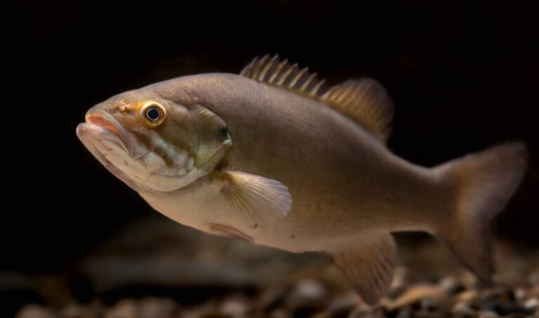
Photo: USFWS Mountain-Prairie, Public domain

Photo: Argyleist, CC BY 2.0

Photo: Oregon Department of Fish & Wildlife, CC BY-SA 2.0
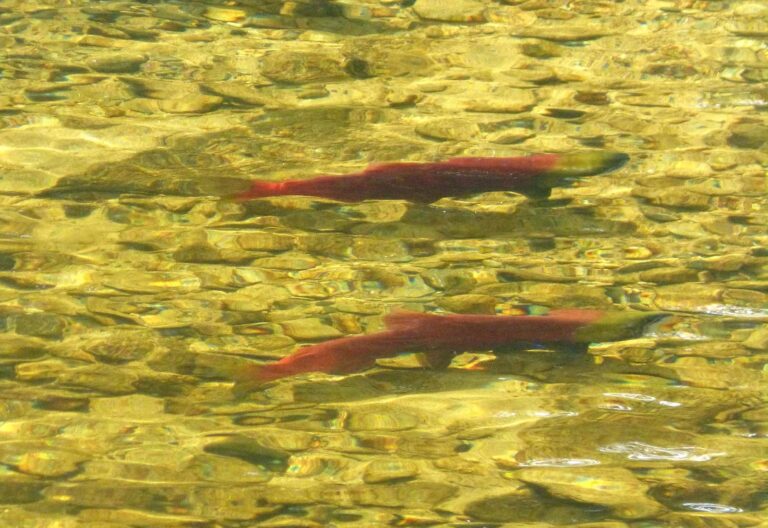
Photo: gailhampshire from Cradley, Malvern, U.K, CC BY 2.0

Short replies on fishing Skagit County
How many WDFW and park launches serve Skagit County?
23 launches on the layers (15 WDFW, 2 State Parks and 6 other agencies).
Which lake covers the most ground in Skagit County?
Lake Shannon, at 2,060 surface acres in the WDFW layer.
Which fish does WDFW map on water near Skagit County?
Rainbow trout lead the count of water pages within 50 miles, followed by largemouth bass, coastal cutthroat trout and yellow perch.
Which Skagit County stores keep jigs and leader?
16 in all, starting with Renee's Custom Rod building &Repair.
How many guide listings give a Skagit County city?
Guide listings name no city in the county.
Which Washington town holds the Skagit County county offices?
Mount Vernon is the seat.
How much does a visiting angler spend on a license in Skagit County?
The Freshwater license is the base item here, $39.95 resident and $115.85 nonresident for the 2026-27 license year. Salmon and bottomfish trips on marine water take the $40.71 resident Saltwater license ($81.70 for nonresidents).
What counties lie around Skagit County?
The nearest county pages are Whatcom County, Snohomish County and Island County.
Are tournaments or derbies held in Skagit County?
2 events on file from organizer pages, none with a date still ahead.
Do any Skagit County waters carry Special Rules?
The 2026-27 pamphlet prints 214 Special Rule entries touching this county, starting with Baker River; the table above shows the first ones.
Is there marine fishing in Skagit County?
Deception Pass, Hope Island, and Skagit Bay, East Juan de Fuca Strait, San Juan Islands and Deception Pass; the marine table above links each page.
Has Skagit County water put a fish on the WDFW list?
Yellow Perch, 2.75 lbs, from Snelson's Slough, Skagit County (June 22, 1969).
Does WDFW plant trout in Skagit County?
19 WDFW plants so far in 2026, 48,957 fish; the latest went into Heart Lake T35 on May 29, 2026.
Pick a lake or river in Skagit County
Open a lake for its ramps, limits and stocking.