Fishing in Whatcom County, Washington
County seat: Bellingham. Population 226,847.
- 21lake pages
- 19launches
- 8river pages
 Pick for troutPiscifun Carbon X ultralight spinning reel28% OFFSale $57.99
Photo of Ross Lake: Judy Gallagher, CC BY 4.0
Lakes, rivers and ramps of Whatcom County in one read
Bellingham houses the Whatcom County courthouse, serving 226,847 people as of the 2020 count. Trout planted here show up in the WDFW report as WDFW Region 4 releases. Similkameen River (Whatcom County) straddles the line with Oregon or Idaho. Up in the hills, WDFW maps 56 lakes as high lakes.
The paged lakes number 21, spread over 26,135 acres, with Ross Lake on top. Its salt water runs into San Juan Islands, Bellingham Bay and Strait of Georgia. Among the county streams, WDFW shows anadromous runs in Skagit River, Nooksack River, Baker River and Similkameen River (Whatcom County). Launching comes down to 19 boat launches, run by 16 WDFW and 3 other agencies. From shore, the WDFW facilities layer lists 24 shore or access sites here, 10 of them piers or platforms.
Census 2020 population; WDFW Fish Washington lake layers, WDFW facilities and State Parks launch layers (WDFW GIS); WDFW marine areas; retrieved October 31, 2026.
 For the trout herePiscifun Carbon XT ultralight spinning reel25% OFFSale $59.99
Lake points and ramps of Whatcom County, mapped together
WDFW and State Parks launch layers, WDFW facilities, WDFW lake points, NHD river midpoints and WDFW marine area points. Checked November 2026.
Still water WDFW maps within Whatcom County
| Lake | Acres | Launches | WDFW program | Fish WDFW maps |
|---|---|---|---|---|
| Ross Lake | 11,493 | 0 | Trout emphasis | rainbow trout |
| Lake Whatcom | 4,924 | 3 | Mixed species – Trout emphasis | coastal cutthroat trout, kokanee, largemouth bass |
| Baker Lake | 4,755 | 0 | Trout emphasis | kokanee, rainbow trout |
| Lake Shannon | 2,060 | 0 | Trout emphasis | brook trout, coastal cutthroat trout, kokanee |
| Lake Samish | 810 | 1 | Mixed species – Trout emphasis | coastal cutthroat trout, kokanee, largemouth bass |
| Diablo Lake | 804 | 0 | Trout emphasis | rainbow trout |
| Lake Terrell | 321 | 1 | Mixed species – Warmwater emphasis | rainbow trout, coastal cutthroat trout, largemouth bass |
| Gorge Lake | 220 | 0 | Trout emphasis | rainbow trout |
| Silver Lake (Whatcom County) | 157 | 1 | Mixed species – Trout emphasis | rainbow trout, coastal cutthroat trout |
| Lake Padden | 148 | 0 | Mixed species – Trout emphasis | rainbow trout, coastal cutthroat trout, kokanee |
| Wiser Lake | 116 | 1 | Warmwater emphasis | largemouth bass, brown bullhead, pumpkinseed |
| Cain Lake | 71 | 1 | Mixed species – Trout emphasis | rainbow trout, largemouth bass, yellow perch |
| Lower Thornton Lake | 52 | 0 | WDFW high lake, fish stocking | rainbow trout |
| Tennant Lake | 44 | 2 | NHD-mapped lake | |
| Depression Lake | 41 | 0 | Trout emphasis | |
| Lake Fazon | 32 | 1 | Warmwater emphasis | rainbow trout, brown trout, largemouth bass |
| Squalicum Lake | 31 | 1 | Trout emphasis | rainbow trout, tiger trout, coastal cutthroat trout |
| Toad Lake | 28 | 1 | Mixed species – Trout emphasis | rainbow trout, largemouth bass |
| Hayes Lake (Whatcom County) | 12 | 0 | WDFW high lake, getting started lakes | rainbow trout |
| Arbuthnot Lake | 7 | 0 | WDFW high lake, getting started lakes | rainbow trout |
| Pine Lake (Whatcom County) | 6 | 0 | WDFW high lake, fish stocking | coastal cutthroat trout |
WDFW Fish Washington lowland and high lake layers (surface acres as published, management emphasis, mapped species); WDFW publishes no lake depths in these layers. Retrieved October 31, 2026.
Sound and ocean water off Whatcom County
Launches, piers and bays put 3 marine waters in touch with Whatcom County.
| Water | Kind | Launches | Piers and shore | Marine area |
|---|---|---|---|---|
| San Juan Islands (Marine Area 7) | WDFW marine area | 8 | 6 | 7 |
| Bellingham Bay | regional marine water | 0 | 3 | 7 |
| Strait of Georgia | regional marine water | 0 | 0 | 7 |
CO-OPS stations serving Whatcom County
NOAA CO-OPS water level, preliminary reading at retrieval (October 31, 2026); station page for live data.
The 2003 to 2006 NOAA ESI atlas lists 8 marinas here, an old record worth confirming by phone.
WDFW Recreational Marine Areas (WAC 220-300-160 boundaries), WDFW and State Parks marine launches, WDFW piers and USGS GNIS bay names; retrieved October 31, 2026.
What the WDFW layers say swims near Whatcom County
Around Bellingham, to 50 miles, rainbow trout turns up on more water pages than the rest.
Species mapped in the WDFW Fish Washington layers, WDFW state records and the 2026 WDFW trout plants, counted per water page within 50 miles; not a survey.
Lakes in Whatcom County that live on this list only
WDFW and NHD maps hold 52 more named lakes in Whatcom County, shown with acreage and program.
| Water | Acres | WDFW program | Nearest town |
|---|---|---|---|
| Berdeen Lake | 126 | WDFW high lake, fish stocking | Darrington |
| Tomyhoi Lake | 62 | WDFW high lake, overabundant lakes | Peaceful Valley |
| Watson – Lower (Big) Lake | 47 | WDFW high lake, fish stocking | Darrington |
| Iceberg Lake | 36 | WDFW high lake, overabundant lakes | Peaceful Valley |
| Shuksan Lake | 29 | WDFW high lake, overabundant lakes | Peaceful Valley |
| Sourdough Lake | 27 | WDFW high lake, overabundant lakes | Darrington |
| Lake Wiseman | 19 | WDFW high lake, fish stocking | Sudden Valley |
| Maiden Lake | 18 | WDFW high lake, overabundant lakes | Peaceful Valley |
| Lower Twin Lake | 18 | WDFW high lake, overabundant lakes | Peaceful Valley |
| Kwahnesum Lake | 16 | WDFW high lake, fish stocking | Peaceful Valley |
| Upper Twin Lake | 16 | WDFW high lake, overabundant lakes | Peaceful Valley |
| Watson – Upper (Little) Lake | 16 | WDFW high lake, fish stocking | Darrington |
| Willow Lake | 15 | WDFW high lake, fish stocking | Peaceful Valley |
| Copper Lake | 13 | WDFW high lake, fish stocking | Peaceful Valley |
| Blue Lake (Whatcom County) | 12 | WDFW high lake, overabundant lakes | Sedro-Woolley |
| Middle Thornton Lake | 12 | WDFW high lake, fish stocking | Darrington |
| Skymo Lake | 11 | WDFW high lake, overabundant lakes | Darrington |
| Sub Zero Lake | 10 | WDFW high lake, fish stocking | Peaceful Valley |
| Upper Berdeen Lake | 9 | WDFW high lake, overabundant lakes | Darrington |
| Church Lake | 9 | WDFW high lake, fish stocking | Peaceful Valley |
| Lower Berdeen Lake | 7 | WDFW high lake, overabundant lakes | Darrington |
| Ridley Lake | 7 | WDFW high lake, fish stocking | Peaceful Valley |
| Freezeout Lake | 6 | WDFW high lake, fish stocking | Darrington |
| Hawkeye Lake | 6 | WDFW high lake, fish stocking | Peaceful Valley |
| Bearpaw Mountain Lake | 6 | WDFW high lake, overabundant lakes | Peaceful Valley |
| Dougs Lake | 6 | WDFW high lake, overabundant lakes | Darrington |
| Elbow Lake | 5 | WDFW high lake, fish stocking | Sudden Valley |
| Firn Lake | 4 | WDFW high lake, fish stocking | Darrington |
| Lost Lake (Whatcom County) | 4 | WDFW high lake, fish stocking | Peaceful Valley |
| Triumph Lake | 4 | WDFW high lake, fish stocking | Darrington |
| Middle Diobsud Lake | 4 | WDFW high lake, fish stocking | Darrington |
| Upper Bagley Lake | 4 | WDFW high lake, overabundant lakes | Peaceful Valley |
| Bald Mountain Lake | 3 | WDFW high lake, fish stocking | Peaceful Valley |
| Hi Yu Lake | 3 | WDFW high lake, fish stocking | Darrington |
| Diobsud – E'most Lake | 3 | WDFW high lake, fish stocking | Darrington |
| Joker Lake | 3 | WDFW high lake, fish stocking | Peaceful Valley |
| Picture Lake | 3 | WDFW high lake, fish stocking | Peaceful Valley |
| Pocket Lake | 3 | WDFW high lake, fish stocking | Peaceful Valley |
| Shuksan Pot – Large Lake | 2 | WDFW high lake, fish stocking | Peaceful Valley |
| Howard Creek Firepond Lake | 2 | WDFW high lake, fish stocking | Sedro-Woolley |
| Wiseman – Little Lake | 2 | WDFW high lake, fish stocking | Sudden Valley |
| Doreen – Pothole Lake | 2 | WDFW high lake, fish stocking | Sudden Valley |
| Upper String Lake | 2 | WDFW high lake, fish stocking | Peaceful Valley |
| Watson Pot Lake | 2 | WDFW high lake, overabundant lakes | Darrington |
| Mazama Lake | 2 | WDFW high lake, getting started lakes | Peaceful Valley |
| Rankin Lake | 1 | WDFW high lake, fish stocking | Peaceful Valley |
| Rainbow Lake (Whatcom County) | 1 | WDFW high lake, fish stocking | Peaceful Valley |
| Tuckway Lake | 1 | WDFW high lake, fish stocking | Sedro-Woolley |
| Upper Quill Lake | 1 | WDFW high lake, fish stocking | Darrington |
| Pinus Lake | 1 | WDFW high lake, fish stocking | Peaceful Valley |
| Upper Skymo Lake | 1 | WDFW high lake, overabundant lakes | Darrington |
| Lower Quill Lake | 0 | WDFW high lake, fish stocking | Darrington |
WDFW Fish Washington lowland and high lake layers and USGS NHD lake outlines, retrieved October 31, 2026.
Moving water with pages in Whatcom County
- Skagit RiverSWIFD lists chinook, chum and coho, 7 mapped launches, 3 WDFW shore or access sites, 11 USGS gauges, 124 mi in Washington
- Nooksack RiverSWIFD lists chinook, chum and coho, 3 mapped launches, 4 WDFW shore or access sites, 4 USGS gauges, 39 mi in Washington
- Baker RiverSWIFD lists chinook, chum and coho, 1 mapped launch, 2 USGS gauges, 35 mi in Washington
- Similkameen River (Whatcom County)SWIFD lists chinook, chum and coho, 48 mi in Washington
- North Fork Nooksack RiverSWIFD lists chinook, chum and coho, 1 WDFW shore or access site, 1 USGS gauge, 46 mi in Washington
- South Fork Nooksack RiverSWIFD lists chinook, chum and coho, 2 USGS gauges, 42 mi in Washington
- Samish RiverSWIFD lists chinook, chum and coho, 2 WDFW shore or access sites, 1 USGS gauge, 30 mi in Washington
- Middle Fork Nooksack RiverSWIFD lists chinook, chum and coho, 1 USGS gauge, 20 mi in Washington
Lesser streams of Whatcom County (4)
- Chilliwack RiverSWIFD lists chinook, coho and kokanee, 15 mi in Washington
- Little Chilliwack RiverSWIFD lists coho, 6 mi in Washington
- Little Fork Little Chilliwack River4 mi in Washington
- Lummi RiverSWIFD lists chinook, chum and coho, 4 mi in Washington
Streamflow posted by Whatcom County gauges
| USGS gauge | Latest reading | Time (ET) |
|---|---|---|
| Skagit River At Newhalem, Wa | 3,280 cfs, 83.68 ft gage height | Nov 11 8:15 pm |
| Nooksack River At Ferndale, Wa | 7,090 cfs, 9.15 ft gage height | Nov 11 7:30 pm |
| Nooksack River At Everson, Wa | 5,780 cfs, 75.83 ft gage height | Nov 11 8:00 pm |
| Nooksack River Near Lynden, Wa | 6,590 cfs, 40.30 ft gage height | Nov 11 8:00 pm |
| Nooksack River At North Cedarville, Wa | 3,880 cfs, 139.77 ft gage height | Nov 11 7:15 pm |
| Sf Nooksack River At Saxon Bridge, Wa | 1,270 cfs, 2.21 ft gage height | Nov 11 8:00 pm |
US Geological Survey provisional data, retrieved Nov 11, 2026 8:33 pm ET. Provisional readings can be revised.
USGS NHD flowlines and Washington lengths, WDFW SWIFD salmon and steelhead distribution, WDFW and State Parks launches, USGS gauges; retrieved October 31, 2026.
WDFW hatchery trucks that stopped in Whatcom County
The 2026 plant log for Whatcom County reads 23 releases and 52,445 fish, covering 9 waters.
- Fishtrap CreekRainbow, 75 fish at 0.25 per pound, June 12, 2026, Kendall Cr Hatchery
- Fishtrap CreekRainbow, 1,235 fish at 1.8 per pound, June 12, 2026, Kendall Cr Hatchery
- Whatcom CreekRainbow, 1,205 fish at 2 per pound, May 8, 2026, Kendall Cr Hatchery
- Whatcom CreekRainbow, 500 fish at 1.8 per pound, April 24, 2026, Bellingham Hatchery
- Squalicum LakeRainbow, 500 fish at 0.5 per pound, April 24, 2026, Kendall Cr Hatchery
- Silver Lake (Whatcom County)Rainbow, 7,050 fish at 2 per pound, April 24, 2026, Kendall Cr Hatchery
- Lake PaddenRainbow, 1,750 fish at 1.8 per pound, April 24, 2026, Bellingham Hatchery
- Toad LakeRainbow, 2,700 fish at 2 per pound, April 23, 2026, Kendall Cr Hatchery
- Lake PaddenRainbow, 4,200 fish at 2 per pound, April 21, 2026, Kendall Cr Hatchery
- Cain LakeRainbow, 4,800 fish at 2 per pound, April 21, 2026, Kendall Cr Hatchery
- Silver Lake (Whatcom County)Rainbow, 2,100 fish at 2 per pound, April 20, 2026, Kendall Cr Hatchery
- Lake PaddenRainbow, 4,200 fish at 2 per pound, April 20, 2026, Kendall Cr Hatchery
WDFW Trout Plants report (rows January 2 to October 27, 2026), read October 31, 2026; newest plants first.
Ramps, piers and access points of Whatcom County
- Cain Lake boat launchCain Lake, WDFW, 1 ramp, gravel surface, Discover Pass
- De Groot boat launch on Nooksack RiverNooksack River, WDFW, 1 ramp, concrete surface, Discover Pass
- Ferndale boat launch on Nooksack RiverNooksack River, Whatcom County Parks & Recreation Depatment, 1 ramp, concrete surface
- Lake Fazon boat launchLake Fazon, WDFW, 1 ramp, concrete surface, Discover Pass
- Lake Samish boat launchLake Samish, WDFW, 1 ramp, concrete surface, Discover Pass
- Lake Terrell boat launchLake Terrell, WDFW, 1 ramp, concrete surface, Discover Pass
- Lake Whatcom boat launchLake Whatcom, WDFW, 1 ramp, concrete surface, Discover Pass
- Nugents Corner boat launch on Nooksack RiverNooksack River, WDFW, 1 ramp, concrete surface, Discover Pass
- Silver Lake boat launch (north)Silver Lake, WDFW, 1 ramp, concrete surface, Discover Pass
- Toad Lake boat launchToad Lake, WDFW, 1 ramp, unimproved surface surface, Discover Pass
- Wiser Lake boat launchWiser Lake, WDFW, 1 ramp, concrete surface, Discover Pass
- Car Top Boat Launchlaunch site, WDFW, Discover Pass
- Lake Whatcom boat launchLake Whatcom, agency not given, gravel surface
- Public launch (east)launch site, WDFW, Discover Pass
- Public launch (west)launch site, WDFW, Discover Pass
- Public launch on Lake WhatcomLake Whatcom, WDFW, concrete surface, Discover Pass
- Squalicum Lake boat launchSqualicum Lake, WDFW, 1 hand launch, Discover Pass
- Tennant Lake LaunchTennant Lake, WDFW, unimproved surface, Discover Pass
- Tennant Lake boat launchTennant Lake, agency not given, unimproved surface
The pass flag is set at 16 launches: hang a Discover Pass from the mirror there.
Fishing on foot in Whatcom County (24)
- Bellingham Cruise Terminal on Bellingham Bayfishing pier, Marine Area 7
- Boulevard Park Pier (Bellingham) on Bellingham Bayfishing pier, Marine Area 7
- Drayton Harbor Park Pier (Port of Bellingham)fishing pier, Marine Area 7
- Gooseberry Pt. Ferry Dock on Bellingham Bayfishing pier, Marine Area 7
- Harksell on Nooksack Riverwater access area
- Hof Bar on Nooksack Riverwater access area
- Proctor-Rupke on Nooksack Riverwater access area
- Cedar Lakeaccess point (no launch)
- Fishing pier on Lake Terrellfishing pier
- Fishing pier on Lake Terrellfishing pier
- Hof on Nooksack Riveraccess point (no launch)
- Lake Padden fishing piershore fishing site, Public fishing pier
- Lake Padden fishing pier near Bellinghamshore fishing site, Public fishing pier, trail leads to additional fishing spots
- Lake Padden shore accessshore fishing site, Limited shore fishing next to boat launch
- Lake Samish shore accessshore fishing site, Very limited shore fishing next to boat launch
- Lake Terrell fishing piershore fishing site, Public fishing dock
- Lake Whatcom shore accessshore fishing site, Shore fishing
- Lake Whatcom shore access near Sudden Valleyshore fishing site, Trail provides shore fishing along 3 miles of shoreline
- North Fork Nooksackaccess point (no launch)
- Pine Lake shore accessaccess point (no launch)
- Silver Lake fishing pier near Maple Fallsshore fishing site, Public dock
- Silver Lake shore accessshore fishing site, Shore fishing from parking lot
- Silver Lake shore access near Maple Fallsshore fishing site, 150 feet of shore fishing
- Silver Lake shore access near Peaceful Valleyshore fishing site, Limited shore fishing next to boat launch
WDFW Facilities layer (boat launches, piers, shore sites) and the State Parks boat launch layer; retrieved October 31, 2026. Lanes and per-launch fees are not published in these layers.
The 2026-27 pamphlet rows covering Whatcom County
Start with the statewide table for Whatcom County; any Special Rule listed after it overrides those rows. WDFW sells the 2026-27 Freshwater license for $39.95 to Washington residents and $115.85 to visitors 16 and up. Marine areas fall under the Saltwater license: $40.71 resident, $81.70 nonresident in 2026-27. Keep a catch record card on you for salmon, steelhead, sturgeon or halibut; WDFW issues it with the license.
| Species | Limit | Season |
|---|---|---|
| Largemouth Bass | No min. size in lakes, ponds, and reservoirs. Only largemouth bass less than 12" may be retained, except 1 over 17" may be retained. Daily limit 5. | Lakes, ponds, and reservoirs: year-round; rivers, streams and beaver ponds: Sat. before Memorial Day through Oct. 31 |
| Largemouth Bass | No size restriction/daily limit in rivers, streams, and beaver ponds. | Lakes, ponds, and reservoirs: year-round; rivers, streams and beaver ponds: Sat. before Memorial Day through Oct. 31 |
| Smallmouth Bass | No min. size in lakes, ponds, and reservoirs. Only 1 smallmouth bass over 14" may be retained. Daily limit 10. | Lakes, ponds, and reservoirs: year-round; rivers, streams and beaver ponds: Sat. before Memorial Day through Oct. 31 |
| Smallmouth Bass | No size restriction/daily limit in rivers, streams, and beaver ponds. | Lakes, ponds, and reservoirs: year-round; rivers, streams and beaver ponds: Sat. before Memorial Day through Oct. 31 |
| Walleye | Min. size 12" in lakes, ponds, and reservoirs. Daily limit 8. Only 1 over 22" may be retained. May be caught, retained, and released alive from a livewell until daily limit is in possession. | Lakes, ponds, and reservoirs: year-round; rivers, streams and beaver ponds: Sat. before Memorial Day through Oct. 31 |
| Walleye | No size restriction/daily limit in rivers, streams, and beaver ponds. | Lakes, ponds, and reservoirs: year-round; rivers, streams and beaver ponds: Sat. before Memorial Day through Oct. 31 |
| Channel Catfish | No min. size in lakes, ponds, and reservoirs. Daily limit 5. | Lakes, ponds, and reservoirs: year-round; rivers, streams and beaver ponds: Sat. before Memorial Day through Oct. 31 |
| Channel Catfish | No min. size/daily limit in rivers, streams, and beaver ponds. | Lakes, ponds, and reservoirs: year-round; rivers, streams and beaver ponds: Sat. before Memorial Day through Oct. 31 |
| Burbot (Freshwater Ling) | No min. size. Daily limit 5. | Lakes, ponds, and reservoirs: year-round; rivers, streams and beaver ponds: Sat. before Memorial Day through Oct. 31 (p.23 general rule for |
| Crappie, Northern Pikeminnow, Peamouth Chub, Perch, Suckers, Sunfish, | No min. size. No daily limit. | Lakes, ponds, and reservoirs: year-round; rivers, streams and beaver ponds: Sat. before Memorial Day through Oct. 31 |
| Grass Carp | Closed unless otherwise listed in Special Rules. | Closed |
| Kokanee | No min. size. Daily limit 10. When fishing with bait, all kokanee that are lawful to possess and are equal to or greater than the minimum size are counted as part of the daily limit whether kept or released. | Lakes, ponds, and reservoirs: year-round; rivers, streams and beaver ponds: Sat. before Memorial Day through Oct. 31 (p.23 general rule for |
| Tiger Muskellunge (Tiger Muskie) | Min. size 50". Daily limit 1. | Lakes, ponds, and reservoirs: year-round; rivers, streams and beaver ponds: Sat. before Memorial Day through Oct. 31 (p.23 general rule for |
| Whitefish | No min. size. Daily limit 15. | Lakes, ponds, and reservoirs: year-round; rivers, streams and beaver ponds: Sat. before Memorial Day through Oct. 31 (p.23 general rule for |
| Steelhead | Release all wild steelhead. Min. size 20". Daily limit 2. Open during salmon or game fish seasons unless as otherwise listed. | Open during salmon or game fish seasons unless as otherwise listed |
| Brown Trout, Cutthroat Trout, Rainbow Trout, Golden Trout, Tiger Trout | In rivers, streams, and beaver ponds: Min. size 8". Daily limit 2. | Sat. before Memorial Day-Oct. 31 (statewide river season, p.23) |
Saltwater rows differ by marine area and sit on each marine area page. Marine area rules
Special Rules naming Whatcom County water (235)
| Water and reach | Species | Rule |
|---|---|---|
| Baker River: from mouth to the lower Baker Dam | All species | CLOSED WATERS. |
| Big Beaver Creek: from 1/4 mile upstream of Ross Lake markers to headwaters, including tributary streams and beaver ponds | All species | Selective gear rules. |
| Big Beaver Creek: from 1/4 mile upstream of Ross Lake markers to headwaters, including tributary streams and beaver ponds | Trout | Statewide min. size/daily limit. Except: release cutthroat trout and wild rainbow trout. (July 1-Oct. 31) |
| Big Beaver Creek: from 1/4 mile upstream of Ross Lake markers to headwaters, including tributary streams and beaver ponds | Other game fish | Statewide min. size/daily limit. (July 1-Oct. 31) |
| Channel Creek: (Baker River tributary) | All game fish | Statewide min. size/daily limit. (Sat. before Memorial Day-Aug. 31) |
| Dakota Creek: from mouth (a line from the outermost headland of the south bank to a house at 1285 Runge Avenue, Blaine, Washington, approx. 1/4 mile downstream | All species | Selective gear rules. |
| Dakota Creek: from mouth (a line from the outermost headland of the south bank to a house at 1285 Runge Avenue, Blaine, Washington, approx. 1/4 mile downstream | All game fish | Statewide min. size/daily limit. (Sat. before Memorial Day-Dec. 31) |
| Kendall Creek: from mouth through the hatchery to the hatchery boundary fence | All species | CLOSED WATERS. |
| Nooksack River: from the Lummi Indian Reservation boundary to the Yellow marker approx. 0.65 miles upstream of the Slater Rd. Bridge CRC (794) | All species | Anti-snagging rule. Night closure. (Aug. 1-Oct. 26) |
| Nooksack River: from the Lummi Indian Reservation boundary to the Yellow marker approx. 0.65 miles upstream of the Slater Rd. Bridge CRC (794) | Trout | Statewide min. size/daily limit. Except: Cutthroat trout and wild rainbow trout: min. size 14". (Aug. 1-Oct. 26) |
| Nooksack River: from the Lummi Indian Reservation boundary to the Yellow marker approx. 0.65 miles upstream of the Slater Rd. Bridge CRC (794) | Steelhead (hatchery) | Closed. (Aug. 1-Oct. 26) |
| Nooksack River: from the Lummi Indian Reservation boundary to the Yellow marker approx. 0.65 miles upstream of the Slater Rd. Bridge CRC (794) | Other game fish | Statewide min. size/daily limit. (Aug. 1-Oct. 26) |
| Nooksack River: from the Lummi Indian Reservation boundary to the Yellow marker approx. 0.65 miles upstream of the Slater Rd. Bridge CRC (794) | Salmon | Min. size 12". Daily limit 6 including no more than 2 each of wild coho, chum, and hatchery Chinook. Release wild Chinook. (Aug. 1-Sept. 30) |
| Nooksack River: from the Lummi Indian Reservation boundary to the Yellow marker approx. 0.65 miles upstream of the Slater Rd. Bridge CRC (794) | Salmon | Min. size 12". Daily limit 6 including no more than 2 each of Chinook, wild coho, and chum. (Oct. 1-Oct. 26) |
| Nooksack River: from the Yellow marker approx. 0.65 miles upstream of the Slater Rd. to the yellow marker at the FFA high school barn in Deming CRC (794) | All species | Anti-snagging rule. Night closure. (Aug. 1-Dec. 31) |
| Nooksack River: from the Yellow marker approx. 0.65 miles upstream of the Slater Rd. to the yellow marker at the FFA high school barn in Deming CRC (794) | Trout | Statewide min. size/daily limit. Except: Cutthroat trout and wild rainbow trout: min. size 14". (Aug. 1-Dec. 31) |
| Nooksack River: from the Yellow marker approx. 0.65 miles upstream of the Slater Rd. to the yellow marker at the FFA high school barn in Deming CRC (794) | Steelhead (hatchery) | Closed. (Aug. 1-Dec. 31) |
| Nooksack River: from the Yellow marker approx. 0.65 miles upstream of the Slater Rd. to the yellow marker at the FFA high school barn in Deming CRC (794) | Other game fish | Statewide min. size/daily limit. (Aug. 1-Dec. 31) |
| Nooksack River: from the Yellow marker approx. 0.65 miles upstream of the Slater Rd. to the yellow marker at the FFA high school barn in Deming CRC (794) | Salmon | Min. size 12". Daily limit 6 including no more than 2 each of wild coho, chum, and hatchery Chinook. Release wild Chinook. (Aug. 1-Sept. 30) |
| Nooksack River: from the Yellow marker approx. 0.65 miles upstream of the Slater Rd. to the yellow marker at the FFA high school barn in Deming CRC (794) | Salmon | Min. size 12". Daily limit 6 including no more than 2 each of Chinook, wild coho, and chum. (Oct. 1-Dec. 31) |
Limits and seasons as printed in the 2026-2027 Washington Sport Fishing Rules (WDFW pamphlet, in effect July 1, 2026 to June 30, 2027), PDF page 27 (pamphlet PDF; eRegulations statewide freshwater page), read October 31, 2026. Special Rules as printed in the 2026-2027 Washington Sport Fishing Rules (WDFW pamphlet, in effect July 1, 2026 to June 30, 2027), pamphlet page 26 (pamphlet PDF), read on eRegulations October 31, 2026.
Whatcom County entries on the WDFW record list
| Species | Weight | Angler | Water | Date |
|---|---|---|---|---|
| Channel Catfish | 37.70 lbs | Cole Abshere | Lake Terrell | Aug. 20, 2019 |
| Pumpkinseed | 1.09 lbs | Barbie Hathawayn | Lake Terrell | July 2, 2007 |
| Copper Rockfish | 10.00 lbs | David Northington | Point Roberts Reef, Whatcom County | Aug. 6, 1989 |
Washington Department of Fish and Wildlife (WDFW) sport fish records list, as of October 31, 2026.
Events launching inside Whatcom County
8 published events launch in or fish Whatcom County, with 0 upcoming.
| Date | Event | Water | Organizer |
|---|---|---|---|
| Aug. 29, 2026 | Resurrection Derby | Bellingham Bay | Resurrection Derby |
| Aug. 15, 2026 | Lake Whatcom 08/15/2026 | Lake Whatcom | Washington State Pond Jumperz Bass Club |
| July 18, 2026 | Lake Samish 07/18/2026 | Lake Samish | Washington State Pond Jumperz Bass Club |
| Oct. 4, 2025 | Lake Samish CLASSIC 10/04/2025 | Lake Samish | Washington State Pond Jumperz Bass Club |
| Aug. 16, 2025 | Resurrection Derby 2025 Derby | Bellingham Bay | Resurrection Derby |
| July 19, 2025 | Lake Samish 07/19/2025 | Lake Samish | Washington State Pond Jumperz Bass Club |
| April 6, 2025 | 9th Annual Team Terrell 04/06/2025 | Lake Terrell | Washington State Pond Jumperz Bass Club |
| not printed | 10th Annual Team Terrell Results | Lake Terrell | Washington State Pond Jumperz Bass Club |
Organizer schedule and results pages, checked November 2026.
Whatcom County fly shops, tackle and hired skippers
Stores keeping Whatcom County anglers supplied
- Barlean's Fisherybait and tackle shop, Bellingham
- Dave's Sports Shopbait and tackle shop, Lynden
- Fat Fish Tackle Co.bait and tackle shop, Bellingham
- Norm's Bait & Tacklebait and tackle shop, Bellingham
- Pappy Tacklebait and tackle shop, Bellingham
- Redden Marine Supply Incbait and tackle shop, Bellingham
- Starfish Incbait and tackle shop, Blaine
- The Confluence Fly Shopfly shop, Bellingham
- Tim McAllister Fishingbait and tackle shop, Bellingham
- Yeagers Sporting Goodsbait and tackle shop, Bellingham
- Blaine Harbormarina, Blaine
- Dick's Sporting Goods Bellinghamsporting goods store, Bellingham
- Harbor Marine Fuelmarina, Bellingham
- Hilton Harbor Marinamarina, Bellingham
- PR Marina LPmarina, Point Roberts
- Semiahmoo Marinamarina, Blaine
- Sportsman's Warehouse Bellinghamsporting goods store, Bellingham
- Squalicum Harbormarina, Bellingham
Yellow Pages and chain store listings, guide and charter listings (city of business); retrieved October 31, 2026.
Places that border Whatcom County
Whatcom County towns with a fishing page
- Bellinghampop. 91,482
- Lyndenpop. 15,749
- Ferndalepop. 15,048
- Birch Baypop. 10,115
- Sudden Valleypop. 6,354
- Blainepop. 5,884
- Marietta-Alderwoodpop. 4,015
- Peaceful Valleypop. 3,015
- Eversonpop. 2,888
- Genevapop. 2,652
- Sumaspop. 1,583
- Nooksackpop. 1,471
- Point Robertspop. 1,191
Neighbouring Washington counties of Whatcom County
- Skagit County26 miles south
- Snohomish County55 miles south
- Island County61 miles southwest
- San Juan County62 miles west
What Piscifun sells for a morning at Whatcom County


Piscifun and Amazon links are affiliate links; the site earns a commission on qualifying purchases.
Lakes, rivers and sound close to Whatcom County, pictured
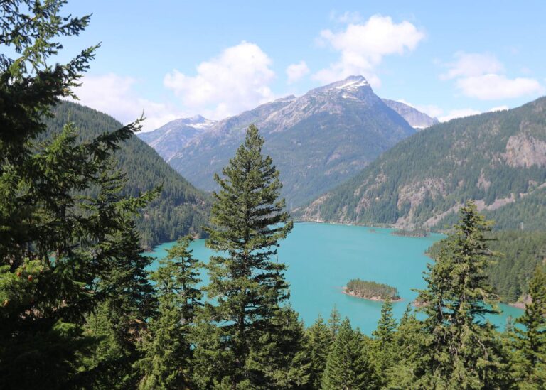
Photo: Mark Gunn, CC BY-SA 4.0

Photo: Jonathan Miske, CC BY-SA 2.0
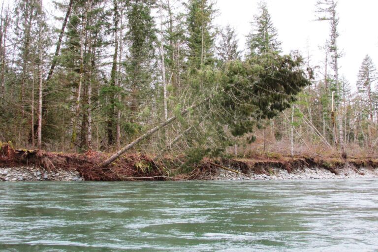
Photo: brewbooks, CC BY-SA 2.0

Photo: Terri Stewart, CC BY-SA 2.0
Common questions about angling in Whatcom County
How many boat launches are mapped in Whatcom County?
19 launches in all, managed by 16 WDFW and 3 other agencies.
Which Whatcom County lake spreads widest in the WDFW layer?
Ross Lake, at 11,493 surface acres in the WDFW layer.
Which species show up on the most waters by Whatcom County?
Rainbow trout lead the count of water pages within 50 miles, followed by largemouth bass, coastal cutthroat trout and yellow perch.
Is there a bait counter in Whatcom County?
There are 18, Barlean's Fishery among them.
Do any river guides call Whatcom County home?
No guide lists this county; the Washington guides page has the rest.
Where do Whatcom County residents go for county business?
The seat is Bellingham.
Which Washington license covers Whatcom County water?
WDFW sells the 2026-27 Freshwater license for $39.95 to Washington residents and $115.85 to visitors 16 and up. Marine areas fall under the Saltwater license: $40.71 resident, $81.70 nonresident in 2026-27.
What counties share a line with Whatcom County?
Neighbours by distance: Skagit County, Snohomish County and Island County.
Do clubs or derbies fish in Whatcom County?
8 events on file from organizer pages, none with a date still ahead.
Where do Whatcom County waters depart from the statewide tables?
The 2026-27 pamphlet prints 235 Special Rule entries touching this county, starting with Baker River; the table above shows the first ones.
Where is the salmon fishing on salt water near Whatcom County?
San Juan Islands, Bellingham Bay and Strait of Georgia; the marine table above links each page.
Has a Washington record fish come from Whatcom County?
Channel Catfish, 37.70 lbs, from Lake Terrell, Whatcom County (Aug. 20, 2019).
How many trout went into Whatcom County water in 2026?
23 WDFW plants so far in 2026, 52,445 fish; the latest went into Fishtrap Creek on June 12, 2026.
Hitch up the boat for Whatcom County
Check the Special Rules before keeping fish.