Puget Sound Fishing
Washington marine water across Marine Area 8-1, Marine Area 8-2, Marine Area 9, Marine Area 10, Marine Area 11, Marine Area 12, Marine Area 13.
 Pick for salmonPiscifun Viper X spinning reel50% OFFSale $39.99
Photo: Chris Ballance, CC BY 2.0
Starting out on Puget Sound
Puget Sound is not one rule area but several: Marine Area 8-1, Marine Area 8-2, Marine Area 9, Marine Area 10, Marine Area 11, Marine Area 12, Marine Area 13.
There are 34 saltwater launches serving it. Walk-out fishing comes from 52 piers and shore sites. Anglers can work 44 named fishing areas here. The pamphlet prints 251 marine rule rows for it. There are 12 NOAA tide stations for tide tables.
A detail from the source: WDFW defines Puget Sound in WAC 220-300-280 (polygon extends into the Strait and San Juan Islands); GNIS extent also published by WDFW. Puget Sound sub-basins here are the WDFW marine areas listed.
WDFW recreational marine area layer (WAC 220-311-010) on geodataservices.wdfw.wa.gov, USGS GNIS names, WDFW and State Parks launch layers, WDFW shore fishing layer; retrieved October 31, 2026.
How WDFW splits Puget Sound into marine areas
Each WDFW marine area inside Puget Sound carries its own seasons; open the area page before keeping a salmon.
| Marine area | Launches | Shore sites | Fishing areas | Rule rows |
|---|---|---|---|---|
| Deception Pass, Hope Island, and Skagit Bay (Marine Area 8-1) | 5 | 5 | 4 | 38 |
| Port Susan and Port Gardner (Marine Area 8-2) | 3 | 5 | 4 | 38 |
| Admiralty Inlet (Marine Area 9) | 5 | 4 | 9 | 26 |
| Seattle-Bremerton (Marine Area 10) | 3 | 22 | 7 | 59 |
| Tacoma-Vashon Island (Marine Area 11) | 0 | 8 | 6 | 28 |
| Hood Canal (Marine Area 12) | 9 | 4 | 6 | 35 |
| South Puget Sound (Marine Area 13) | 9 | 4 | 8 | 27 |
WDFW recreational marine areas (WAC 220-311-010), access layers and the 2026-27 pamphlet; retrieved October 31, 2026.
 For the salmon herePiscifun AlumiX spinning reel46% OFFSale $64.99
Species documented for Puget Sound
The Puget Sound rule rows and records name these fish.
2026-27 WDFW pamphlet marine area rows and WDFW sport fish records; retrieved October 31, 2026.
Where WDFW maps the fishing grounds of Puget Sound
- Deception PassMarine Area 8-1 Shoreline Access Available
- Deception Pass (The Hole)Marine Area 8-1 Boat Access Only
- Rocky PointMarine Area 8-1 Boat Access Only
- Strawberry/Polnell/Rock PointMarine Area 8-1 Boat Access Only
- Hat Island to Camano HeadMarine Area 8-2 Boat Access Only
- Humpy HollowMarine Area 8-2 Boat Access Only
- Kayak PointMarine Area 8-2 Shoreline Access Available
- Tulalip BubbleMarine Area 8-2 Boat Access Only
- Admiralty BayMarine Area 9 Boat Access Only
- Double BluffMarine Area 9 Boat Access Only
- Fort Casey ParkMarine Area 9 Shoreline Access Available
- Mid Channel BankMarine Area 9 Boat Access Only
- Mutiny BayMarine Area 9 Boat Access Only
- Point No PointMarine Area 9 Shoreline Access Available
- Point Wilson BeachMarine Area 9 Shoreline Access Available
- Possession Point/BarMarine Area 9 Boat Access Only
- Salsbury County ParkMarine Area 9 Shoreline Access Available
- Alki PointMarine Area 10 Shoreline Access Available
- Chico CreekMarine Area 10 Shoreline Access Available
- Faye Bainbridge ParkMarine Area 10 Shoreline Access Available
- Golden Gardens ParkMarine Area 10 Shoreline Access Available
- Jefferson HeadMarine Area 10 Boat Access Only
- Port Orchard/Point WhiteMarine Area 10 Boat Access Only
- West/Meadow PointMarine Area 10 Boat Access Only
- Browns PointMarine Area 11 Shoreline Access Available
- Browns to Dash PointMarine Area 11 Boat Access Only
- Dash PointMarine Area 11 Shoreline Access Available
- Des MoinesMarine Area 11 Boat Access Only
- Point DefianceMarine Area 11 Boat Access Only
- South Maury IslandMarine Area 11 Boat Access Only
WDFW Major Fishing Areas layer on geodataservices.wdfw.wa.gov (names and access notes as published); retrieved October 31, 2026.
Putting in for Puget Sound
- Big Ditch boat launch on Skagit Bayn/a surface, 1 hand launch, Discover Pass, WDFW
- Boston Harbor on Budd Inlet1 ramp, concrete surface, Thurston County
- Grasser's Lagoon boat launchn/a surface, Discover Pass, WDFW
- Hat Slough boat launch1 ramp, concrete surface, Discover Pass, Washington Department of Fish and Wildlife
- Indian George Creek boat launch on Dabob Bayn/a surface, Discover Pass, WDFW
- Jarrell Cove, north boat launch on Case InletDiscover Pass, Washington State Parks and Recreation Commission
- Jarrell Cove, south boat launch on Case InletDiscover Pass, Washington State Parks and Recreation Commission
- Luhr's Landing on Nisqually Reach1 ramp, concrete surface, Discover Pass, WDFW
- Misery Point boat launch on Dabob Bay1 ramp, concrete surface, Discover Pass, WDFW
- Mueller Park boat launchn/a surface, Discover Pass, WDFW
- Mystery Bay, pier and floatsDiscover Pass, Washington State Parks and Recreation Commission
- North Bay boat launchn/a surface, Discover Pass, WDFW
- Oakland Bay boat launchn/a surface, Discover Pass, WDFW
- Pleasant Harbor1 ramp, concrete surface, Discover Pass, Washington Department of Fish and Wildlife
- Point No Point boat launchn/a surface, Discover Pass, WDFW
- Point Whitney boat launch on Dabob Bay1 ramp, concrete surface, Discover Pass, WDFW
- Ross Point boat launch on Sinclair Inletn/a surface, Discover Pass, WDFW
- Sherwood Creek boat launch on Case Inletn/a surface, Discover Pass, WDFW
- Skagit Headquarters boat launch on Wiley Slough1 ramp, concrete surface, 1 hand launch, Discover Pass, Washington Department of Fish and Wildlife
- Triton Cove boat launchn/a surface, 1 hand launch, Discover Pass, WDFW
- Blake Island boat launchboat ramp, Washington State Parks and Recreation Commission
- Camano Island boat launch on Port Susanboat ramp, Washington State Parks and Recreation Commission
- Davis Slough boat launch on Port Susan1 hand launch, Discover Pass, Washington Department of Fish and Wildlife
- Deception Pass, Cornet Bay boat launchboat ramp, Washington State Parks and Recreation Commission
- Fort Casey launchboat ramp, Washington State Parks and Recreation Commission
- Fort Flagler boat launchboat ramp, Washington State Parks and Recreation Commission
- Fort Worden launchboat ramp, Washington State Parks and Recreation Commission
- Illahee, pier and floats on Sinclair Inletboat ramp, Washington State Parks and Recreation Commission
- Joemma Beach boat launch on Case Inletboat ramp, Washington State Parks and Recreation Commission
- Penrose Point, pier and floats on Carr Inletboat ramp, Washington State Parks and Recreation Commission
WDFW Water Access Sites and Shore Fishing Sites layers (geodataservices.wdfw.wa.gov) and the Washington State Parks boat launch layer, retrieved October 31, 2026. Parking at WDFW and State Parks launches needs a Discover Pass.
Public piers along Puget Sound
- La Conner Marina Docks on Skagit Bayfishing pier, Marine Area 8-1
- Cornet Bay Docks on Deception Passfishing pier, Marine Area 8-1
- Oak Harbor Marina on Saratoga Passagefishing pier, Marine Area 8-1
- Oak Harbor Pier (Flintstone Park) on Saratoga Passagefishing pier, Marine Area 8-1
- Coupeville Pier on Saratoga Passagefishing pier, Marine Area 8-1
- Kayak Point County Park Pier on Port Susanfishing pier, Marine Area 8-2
- Langley Marina (City Pier) on Possession Soundfishing pier, Marine Area 8-2
- Fort Worden Marine Science Center Dockfishing pier, Marine Area 9
- Port Hudson Jettyfishing pier, Marine Area 9
- Everett – 10th Street Marine Park Pier on Port Gardnerfishing pier, Marine Area 8-2
- Mukilteo Fishing Piers on Possession Soundfishing pier, Marine Area 8-2
- Edmonds Pierfishing pier, Marine Area 9
- Indianola Pierfishing pier, Marine Area 10
- Brownsville Dockfishing pier, Marine Area 10
- Silverdale Pierfishing pier, Marine Area 10
- Illahee City Pier on Sinclair Inletfishing pier, Marine Area 10
- Crystal Springs Public Fishing Pier on Sinclair Inletfishing pier, Marine Area 10
- Illahee State Park Pier on Sinclair Inletfishing pier, Marine Area 10
- Coal Dock (Lion's Community Park) on Sinclair Inletfishing pier, Marine Area 10
- Evergreen Park Boat Ramp on Sinclair Inletfishing pier, Marine Area 10
- Waterman Point Pier (Sinclair Inlet) on Sinclair Inletfishing pier, Marine Area 10
- Annapolis Dock (Retsil Pier) on Sinclair Inletfishing pier, Marine Area 10
- Shilshole Marina (A-Dock) on Elliott Bayfishing pier, Marine Area 10
- Elliott Bay Fishing Pier at Terminal 86fishing pier, Marine Area 10
WDFW piers and shore fishing layers, retrieved October 31, 2026.
NOAA readings around Puget Sound
NOAA CO-OPS water level, preliminary reading at retrieval (October 31, 2026); station page for live data.
- Port Townsendtide predictions, 24 miles
- Mystery Bay, Marrowstone Islandtide predictions, 20 miles
- Marrowstone Pointtide predictions, 21 miles
- Foulweather Blufftide predictions, 11 miles
- Port Ludlowtide predictions, 13 miles
- Port Gambletide predictions, 7 miles
Salish Sea and coastal tides swing several feet, and the ebb sets up hard current at points and passes on Puget Sound; read the table before you anchor.
NOAA CO-OPS water level and tide prediction stations inside or beside the marine area; retrieved October 31, 2026.
Moorage and marinas near Puget Sound, older NOAA list
- Port Of Poulsbo Marinamarina 360/779-3505
- Port Of Allyn Waterfront Parkmarina 360/275-2430
- Totem Marina Moorage Assoc.marina 253/272-4404
- Ole & Charlie's Marinamarina 253/272-1173
- Port Of Everett Marinamarina 800/729-7678
- Chinook Landing Marinamarina 253/845-9225
- Arabella's Landing Marinamarina 253/851-1793
- Bremerton Marinamarina 360/674-2381
- City Of Des Moines Marinamarina 206/878-4995
- Shelton Marinamarina 360/426-1151
- Elliott Bay Marinamarina 206/285-4817
- Fiddlehead Marinamarina 360/352-0528
- Jarrell's Cove Marinamarina 800/362-8823
- Port Of Silverdalemarina 360/698-4918
- Pleasant Harbor State Marine Parkmarina 360/902-8500
- Coupeville Wharfmarina 360/678-5020
Boat-access reefs around Puget Sound
- Onamac Pointboat
- Gedney Islandboat
- Possession Pointboat
- The Trees (Boeing Creek)boat
- Misery Pointboat
- West Seattleboat
- Blake Islandboat
- Point Heyerboat
- Toliva Shoalboat
- Itsami Ledgeboat
NOAA Environmental Sensitivity Index atlas records (2003 to 2006); facility and reef details reflect the source year, not today. Retrieved october 31, 2026.
Daily limits and seasons, Puget Sound
Salmon rules across Puget Sound, area by area; open the area pages for bottomfish and others.
| Marine area | Rule rows | First salmon row |
|---|---|---|
| Deception Pass, Hope Island, and Skagit Bay (Marine Area 8-1) | 38 | No min. size. Daily limit 2. Release Chinook and chum. (Aug. 1-Oct. 11) |
| Port Susan and Port Gardner (Marine Area 8-2) | 38 | No min. size. Daily limit 2. Release Chinook and chum. (Aug. 1-Oct. 11) |
| Admiralty Inlet (Marine Area 9) | 26 | Chinook – min. size 22”. Other salmon species – no min. size. Daily limit 2 including no more than 1 Chinook. Release chum, wild coho, and wild Chinook. Additio (July 16-July 18) |
| Seattle-Bremerton (Marine Area 10) | 59 | No min. size. Daily limit 2. Release Chinook and chum. (June 1-July 22) |
| Tacoma-Vashon Island (Marine Area 11) | 28 | Chinook – min. size 22”. Other salmon species – no min. size. Daily limit 2 including no more than 1 Chinook. Release chum and wild Chinook. (June 1-June 30) |
| Hood Canal (Marine Area 12) | 35 | CLOSED. (July 1-July 31) |
| South Puget Sound (Marine Area 13) | 27 | Chinook – min. size 20”. Other salmon species – no min. size. Daily limit 2. Release chum, wild coho, and wild Chinook. Anglers may fish with two poles with Two (July 1-Sept. 30) |
Anglers 16 and older fishing marine water carry a Saltwater license ($40.71 resident, $81.70 nonresident for 2026-27) or a Combination license, plus a catch record card for salmon, sturgeon, steelhead or halibut.
Limits and seasons as printed in the 2026-2027 Washington Sport Fishing Rules (WDFW pamphlet, in effect July 1, 2026 to June 30, 2027), PDF page 123 (pamphlet PDF; eRegulations marine area page), read October 31, 2026.
Derby days on Puget Sound
Derby dates and results for Puget Sound are kept on their own page.
Ports named for Puget Sound
- SeattleKing County
- BremertonKitsap County, 1 launch within 5 km
- TacomaPierce County
USGS GNIS populated places and harbors named by WDFW for the area; retrieved October 31, 2026.
Sizing Puget Sound against nearby salt water
| Water | Distance | Marine area | Launches | Piers and shore sites | Tide stations |
|---|---|---|---|---|---|
| Puget Sound | Marine Area 8-1, Marine Area 8-2, Marine Area 9, Marine Area 10, Marine Area 11, Marine Area 12, Marine Area 13 | 34 | 52 | 12 | |
| Seattle-Bremerton (Marine Area 10) | 12 miles | Marine Area 10 | 3 | 22 | 16 |
| Possession Sound | 13 miles | Marine Area 8-2 | 0 | 4 | 7 |
| Port Gardner | 14 miles | Marine Area 8-2 | 1 | 3 | 7 |
| Admiralty Inlet (Marine Area 9) | 15 miles | Marine Area 9 | 5 | 4 | 10 |
| Elliott Bay | 16 miles | Marine Area 10 | 0 | 5 | 10 |
WDFW marine areas and access layers, NOAA stations; retrieved October 31, 2026.
Near Puget Sound
Salt water beside Puget Sound
- Seattle-Bremerton (Marine Area 10)12 miles
- Possession Sound13 miles
- Port Gardner14 miles
- Admiralty Inlet (Marine Area 9)15 miles
- Elliott Bay16 miles
Other water an easy drive past Puget Sound
- Echo Lake (King County)6 miles
- Ballinger Lake6 miles
- Lake Serene (Snohomish County) near Picnic Point7 miles
- Buck Lake (Kitsap County)8 miles
- Sammamish River11 miles
- Snohomish River14 miles
- Pilchuck River17 miles
- Big Quilcene River20 miles
Gear stores used by Puget Sound anglers
- Dick's Sporting Goods Seattlesporting goods store, Seattle, 10 miles
- Sportsman's Warehouse Everettsporting goods store, Everett, 11 miles
- Sportsman's Warehouse Silverdalesporting goods store, Silverdale, 17 miles
- Dick's Sporting Goods Silverdalesporting goods store, Silverdale, 17 miles
- Dick's Sporting Goods Bellevuesporting goods store, Bellevue, 20 miles
- Cabela's Tulalipsporting goods store, Tulalip, 21 miles
Guide services listed near Puget Sound
- Puget Charterscharter, Shelton, (360) 490-8482
- Northwest Fishing Newsfishing guide, Port Ludlow, (206) 450-7947
Lodging towns for anglers working Puget Sound
- Woodway4 miles
- Edmonds4 miles
- Kingston4 miles
- Esperance5 miles
Puget Sound county by county
- Kitsap Countyseat: Port Orchard
- Jefferson Countyseat: Port Townsend
- Mason Countyseat: Shelton
- Island Countyseat: Coupeville
- King Countyseat: Seattle
- Snohomish Countyseat: Everett
- Pierce Countyseat: Tacoma
- Thurston Countyseat: Olympia
Piscifun reels and line rigged for Puget Sound


Piscifun and Amazon links are affiliate links; the site earns a commission on qualifying purchases.
Photographs of fishing water around Puget Sound
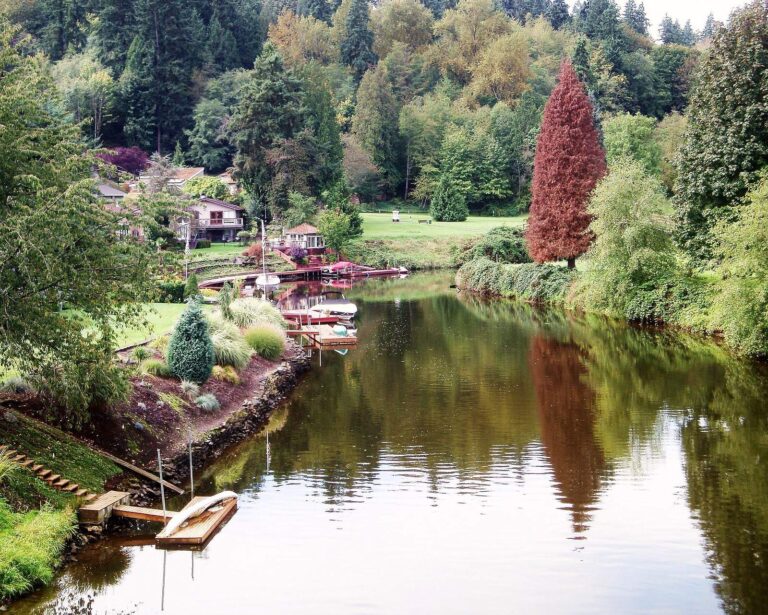
Photo: KurtClark, CC BY 2.0
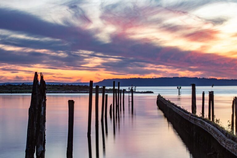
Photo: Cindy Shebley, CC BY 2.0
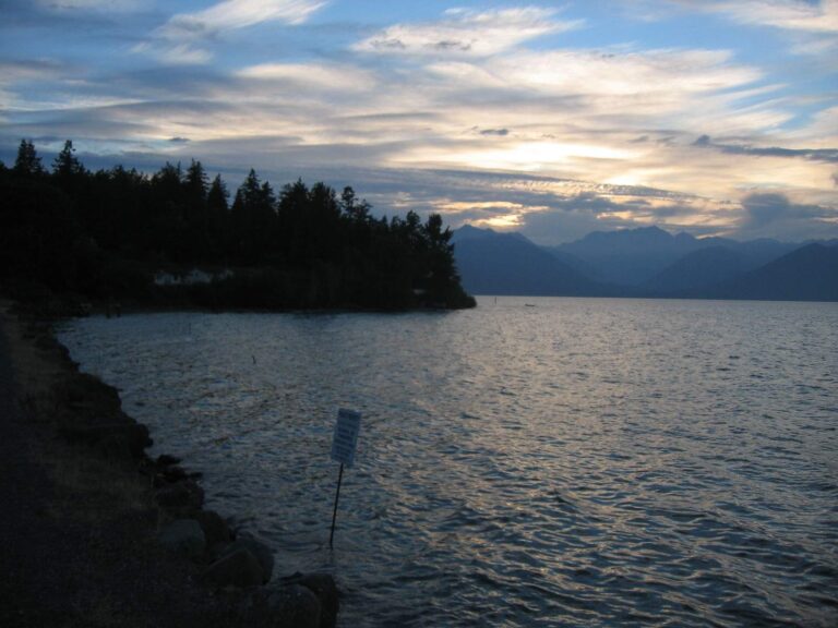
Photo: Peter Abrahamsen, CC BY-SA 2.0

Photo: Jonathan Miske, CC BY-SA 2.0
Before you drive to Puget Sound: common questions
How does WDFW classify Puget Sound?
The rules for Marine Area 8-1, Marine Area 8-2, Marine Area 9, Marine Area 10, Marine Area 11, Marine Area 12, Marine Area 13 apply.
When can I keep a salmon on Puget Sound?
Salmon on Marine Area 8: No min. size. Daily limit 2. Release Chinook and chum.; Aug. 1-Oct. 11. Watch for in-season changes.
How many lingcod may I keep at Puget Sound?
Lingcod: Hook and line season. Min. size 26”. Max. size 36”. Daily limit 1. (May 1-June 15).
Can a trailered boat reach Puget Sound from a listed launch?
The layers list 34 launches; Jarrell Cove, north boat launch on Case Inlet is one.
Where is pier fishing near Puget Sound?
Yes: 52 piers and shore sites, including La Conner Marina Docks on Skagit Bay.
Which WDFW license and card cover a day on Puget Sound?
Anglers 16 and older fishing marine water carry a Saltwater license ($40.71 resident, $81.70 nonresident for 2026-27) or a Combination license, plus a catch record card for salmon, sturgeon, steelhead or halibut.
Which tide station serves Puget Sound?
Start with Port Townsend for tide times.
Who sells herring and jigs near Puget Sound?
Stop at Dick's Sporting Goods Seattle, about 10 miles away.
Which named fishing areas lie in Puget Sound?
44 named fishing areas; Deception Pass, Deception Pass (The Hole) and Rocky Point is one.
Plan a saltwater day on Puget Sound
Check emergency rules for the area before the trip.