Fishing in Curry County, Oregon
County seat: Gold Beach. Population 23,446.
- 2lake pages
- 28open launches
- 7river pages
 Pick for chinook salmonPiscifun Viper X spinning reel50% OFFSale $39.99
Photo of Brookings Harbor: Rick Obst, CC BY 2.0
The short version of fishing in Curry County
At the 2020 count Curry County held 23,446 residents, and its courthouse is in Gold Beach. Most waters ODFW lists in Curry County fall under the ODFW Southwest Zone table, though zone lines follow drainages rather than county lines.
The largest of 2 paged lakes in Curry County is Floras Lake. Tidewater and ocean water here include Southern Oregon Subarea, Euchre Creek estuary, Port Orford Head and Whaleshead Creek estuary. The OSMB access layer lists 28 open launches here, 20 for trailer launching. No boat is needed at 13 mapped shore sites, 3 of them a pier or jetty.
Census 2020 population; BLM Oregon NHD lake outlines; OSMB Boating Access Sites; DLCD and ODFW shore access layers; 2026 Oregon Sport Fishing Regulations zone lists; read November 2, 2026.
Where the put-ins of Curry County are
OSMB launch points, DLCD and ODFW shore sites, NHD lake points, PMEP estuary points; read November 2, 2026.
Still water across Curry County
| Lake | Acres | Kind | OSMB launches | Fish mapped |
|---|---|---|---|---|
| Floras Lake | 274 (outline) | lake | 1 | largemouth bass, rainbow trout |
| Garrison Lake | 146 (outline) | lake | 2 | bluegill, chinook salmon, largemouth bass |
Curry County has few lake pages of its own, so the closest ones past its line are listed by miles from Gold Beach.
| Lake | From Gold Beach | Acres | Kind | OSMB launches | Fish mapped |
|---|---|---|---|---|---|
| Sru Lake | 31 miles northeast | 1 (outline) | lake | 1 | rainbow trout |
| Powers Pond | 37 miles northeast | 23 (outline) | lake | 1 | black crappie, brown bullhead, largemouth bass |
| Lake Selmac | 44 miles east | 138 (outline) | lake | 2 | black crappie, bluegill, brown bullhead |
| Bradley Lake | 45 miles north | 26 (outline) | lake | 1 | brown bullhead, cutthroat trout, rainbow trout |
| Johnson Log Storage and Storing Reservoir | 51 miles north | 88 (outline) | reservoir | 1 | bluegill, brown bullhead, largemouth bass |
| Bolan Lake | 56 miles southeast | 13 (outline) | lake | 1 | brook trout |
BLM Oregon hydrography lake outlines (NHD), summed by GNIS name (layer), read November 2, 2026. Species: ODFW Fish Habitat Distribution layers (ODFW ArcGIS), read November 2, 2026; a mapped species is habitat use ODFW records, not a catch report. ODFW publishes no lake depths in these layers.
 For the chinook salmon herePiscifun AlumiX spinning reel46% OFFSale $64.99
Estuaries of Curry County
Along Curry County the guide covers 17 saltwater waters.
| Water | Kind | OSMB launches | Piers and shore sites | Marinas |
|---|---|---|---|---|
| Southern Oregon Subarea | ODFW ocean area | 0 | 0 | 0 |
| Euchre Creek estuary | estuary | 0 | 1 | 0 |
| Port Orford Head | estuary | 2 | 1 | 0 |
| Whaleshead Creek estuary | estuary | 0 | 2 | 0 |
| Brush Creek estuary | estuary | 0 | 0 | 0 |
| Chetco River | estuary | 3 | 3 | 3 |
| Elk River | estuary | 0 | 0 | 0 |
| Floras Creek estuary | estuary | 0 | 0 | 0 |
| Hubbard Creek estuary | estuary | 0 | 0 | 0 |
| Hunter Creek estuary | estuary | 0 | 0 | 0 |
| Mussel Creek estuary | estuary | 0 | 0 | 0 |
| Myers Creek estuary | estuary | 0 | 0 | 0 |
| Pistol River | estuary | 0 | 1 | 0 |
| Rogue River | estuary | 4 | 3 | 1 |
| Sixes River | estuary | 1 | 0 | 0 |
| Thomas Creek estuary | estuary | 0 | 0 | 0 |
| Winchuck River | estuary | 0 | 2 | 0 |
Tide gauges for the Curry County shore
NOAA CO-OPS water level, preliminary reading at retrieval; station page for live data.
ODFW ocean management areas, PMEP estuaries, OSMB launches and marinas, DLCD shore sites; read November 2, 2026.
Species on the water pages near Curry County
Within 40 miles of Gold Beach the most-listed fish is rainbow trout.
Species from ODFW Fish Habitat Distribution layers, booklet exceptions and ODFW records, counted per water page within 40 miles; habitat mapping, not a catch survey.
Further lakes on the Curry County outline map
The outline map shows 4 further named lakes in Curry County, listed by mapped acreage.
| Water | Acres (outline) | Nearest place |
|---|---|---|
| Libby Creek Pond | 8 | Gold Beach |
| Babyfoot Lake | 4 | Cave Junction |
| Laird Lake | 1 | Port Orford |
| Southard Lake | 0 | Port Orford |
BLM Oregon hydrography lake outlines (NHD), summed by GNIS name (layer), read November 2, 2026.
Moving water in Curry County
- Chetco RiverODFW maps coho, fall chinook and winter steelhead runs, tidewater at Chetco River, 8 OSMB launches, 1 USGS gauge, 6 booklet exceptions
- Elk RiverODFW maps coho, fall chinook and winter steelhead runs, tidewater at Elk River, 2 OSMB launches, 3 booklet exceptions
- Illinois RiverODFW maps coho, fall chinook and spring chinook runs, 1 OSMB launch, 2 USGS gauges, 11 booklet exceptions
- Sixes RiverODFW maps coho, fall chinook and winter steelhead runs, tidewater at Sixes River, 3 OSMB launches, 1 USGS gauge, 7 booklet exceptions
- Pistol RiverODFW maps coho, fall chinook and winter steelhead runs, tidewater at Pistol River, 3 booklet exceptions
- Winchuck RiverODFW maps coho, fall chinook and winter steelhead runs, tidewater at Winchuck River, 5 booklet exceptions
- Rogue Rivertidewater at Rogue River, 44 OSMB launches, 7 USGS gauges, 44 booklet exceptions
Rivers of Curry County still without a page (12)
- East Fork Pistol RiverODFW maps fall chinook and winter steelhead runs
- East Fork Winchuck RiverODFW maps coho, fall chinook and winter steelhead runs
- Little Chetco RiverODFW maps winter steelhead runs
- Middle Fork Sixes RiverODFW maps coho, fall chinook and winter steelhead runs
- North Fork Chetco RiverODFW maps coho, fall chinook and winter steelhead runs
- North Fork Elk RiverODFW maps coho, fall chinook and winter steelhead runs
- North Fork Pistol RiverODFW maps coho, fall chinook and winter steelhead runs
- North Fork Sixes RiverODFW maps coho, fall chinook and winter steelhead runs
- South Fork Chetco RiverODFW maps coho, fall chinook and winter steelhead runs
- South Fork Elk RiverODFW maps coho, fall chinook and winter steelhead runs
- South Fork Pistol RiverODFW maps coho, fall chinook and winter steelhead runs
- South Fork Sixes RiverODFW maps coho, fall chinook and winter steelhead runs
How fast the rivers of Curry County are running
| USGS gauge | Latest reading | Time (ET) |
|---|---|---|
| Rogue River Near Agness, Or | 1,580 cfs, 3.87 ft gage height | Nov 11 9:10 pm |
| Illinois River Near Agness, Or | 409 cfs, 4.20 ft gage height | Nov 11 8:45 pm |
| Chetco River Near Brookings, Or | 563 cfs, 0.35 ft gage height | Nov 11 8:30 pm |
| Sixes River At Sixes, Or | 73 cfs, 2.13 ft gage height | Nov 11 8:30 pm |
US Geological Survey provisional data, retrieved Nov 11, 2026 9:33 pm ET. Provisional readings can be revised.
ODFW Fish Habitat Distribution stream names and runs, OSMB launches, booklet exceptions and USGS gauges; read November 2, 2026.
Launch sites across Curry County
- 12th Street Ramp on Garrison LakeGarrison Lake, 1 lane, trailered launch
- Alfred A Loeb State Park on Chetco RiverChetco River, 1 lane, trailered launch
- Bagnell Ferry Ramp on Rogue RiverRogue River, 1 lane, trailered launch
- Boice Cope Park on Floras LakeFloras Lake, 1 lane, trailered launch
- Cape Blanco State Park on Sixes RiverSixes River, hand carry launch
- Cougar Lane Store & Lodge boat ramp on Rogue RiverRogue River, trailered launch
- Edson Creek Recreation Site boat ramp on Sixes RiverSixes River, 1 lane, trailered launch
- Elk River Fish Hatchery boat rampElk River, 1 lane, trailered launch
- Foster Bar boat ramp on Rogue RiverRogue River, 2 lanes, trailered launch
- Huntley Park on Rogue RiverRogue River, hand carry launch
- Iron Head boat ramp on Elk RiverElk River, trailered launch
- Jots Resort boat ramp on Rogue RiverRogue River, 1 lane, trailered launch
- Lexs Landing on Rogue RiverRogue River, 1 lane, trailered launch
- Lobster Creek Ramp on Rogue RiverRogue River, 1 lane, trailered launch
- Miller Bar boat ramp on Chetco RiverChetco River, 1 lane, trailered launch
- Nook Bar boat ramp on Chetco RiverChetco River, 1 lane, trailered launch
- Pinehurst Boat Ramp on Garrison LakeGarrison Lake, 1 lane, hand carry launch
- Port of Brookings Harbor – Basin II on Chetco RiverChetco River, hand carry launch
- Port of Brookings Harbor on Chetco RiverChetco River, 6 lanes, trailered launch
- Port of Gold Beach Marina on Rogue RiverRogue River, hand carry launch
- Port of Gold Beach Ramp on Rogue RiverRogue River, 3 lanes, trailered launch
- Quosatana Boat Ramp on Rogue RiverRogue River, 1 lane, trailered launch
- Redwood Bar boat ramp on Chetco RiverChetco River, 1 lane, trailered launch
- Sixes Grange boat rampSixes River, 1 lane, trailered launch
- Social Security Bar launch on Chetco RiverChetco River, 1 lane, hand carry launch
- South Fork Day Use boat ramp on Chetco RiverChetco River, 1 lane, trailered launch
- Port of Gold Beach Kayak Launch on Rogue RiverRogue River, floating kayak dock
- Port of Port Orford Hoist boat ramp on Pacific Ocean (South Coast)Pacific Ocean (South Coast), hoist
Status comes straight from OSMB, and closed launches are rows only.
Shore access in Curry County
- Port of Brookings on Chetco Riverfishing pier, Owner
- Port of Port Orford on Port Orford Headfishing pier, Owner
- Chetco Point Parkshore site
- Harris Beach State Park on Chetco Rivershore site
- Lone Ranch Beach on Whaleshead Creek estuaryshore site
- McVay State Park on Winchuck Rivershore site
- Nesika Beach, Ophir on Euchre Creek estuaryshore site
- North Jetty, Rogue Rivershore site
- Pistol Rivershore site
- Port of Gold Beach on Rogue Riverfishing pier
- South Jetty, Rogue Rivershore site
- Whaleshead Beach on Whaleshead Creek estuaryshore site
- Winchuck State Recreation Siteshore site
Oregon State Marine Board Boating Access Sites layer (OSMB ArcGIS), read November 2, 2026; status as OSMB publishes it. Oregon Coastal Management Program (DLCD) Shoreline Access Inventory (layer) and the ODFW shore access map, read November 2, 2026.
Trout stocking in Curry County
The ODFW schedule plans 4 trout releases for 1 water in Curry County, 11,200 fish in all as printed.
- Floras Lake4 releases planned, next listed: Apr. 26, 2027 – Apr. 30, 2027: 5,450 legal-size trout
ODFW weekly trout stocking schedule (planned releases; ODFW prints size classes, not species), myodfw.com, read November 2, 2026.
Bag rows for a day in Curry County
Waters in Curry County without an exception of their own follow the zone rows below. Oregon residents pay $50 for the annual angling license, visitors $138. Add the Combined Angling Tag, $69 resident, before keeping salmon or steelhead. Bottomfish, halibut and other ocean trips need the $9 Ocean Endorsement as well.
| Species | Limit | Season |
|---|---|---|
| Trout | Lakes: 5 per day, 3 daily limits in possession. Streams: (including tidewaters and bays); 2 per day, 3 daily catch limits in possession; 8-inch minimum | Lakes: Open all year Streams: (including tidewaters and bays): Open May 22 – Oct 31 unless noted under Exceptions. |
| Salmon and Steelhead | In the aggregate: 2 adult salmon or steelhead per day, 20 per year. 5 jack salmon per day, 2 daily jack limits in possession. Wild salmon bag limits are determined annually. | Closed unless noted under Exceptions. |
| Sturgeon | Catch-and-release only. | Streams: (including tidewaters and bays): Open during trout, salmon or steelhead seasons. |
| Bass | Lakes: 5 per day, 3 daily limits in possession unless noted under Exceptions. Streams: No limit. | Lakes: Open all year. Streams (including tidewaters and bays): Open during trout, salmon or steelhead seasons. |
| Bluegill, Catfish, Crappie, Other Sunfish, Walleye, Yellow Perch, Stri. | No limit. | Lakes: Open all year. Streams (including tidewaters and bays): Open during trout, salmon or steelhead seasons. |
| Smelt | Unless specifically authorized under emergency rules, it is unlawful to take or attempt to take Eulachon smelt in inland waters, including bays, rivers, estuaries, and streams. | Unless specifically authorized under emergency rules, it is unlawful to take or attempt to take Eulachon smelt in inland waters, including bays, rivers, estuari. |
| Marine Fish and Marine Shellfish | See Marine Zone. | See Marine Zone. |
| Species | Limit | Season |
|---|---|---|
| General Marine Species: Rockfish ("sea bass", "snapper"), Greenling (“. | Bag limits are set after this book is printed. Check current regulations before fishing on the Sport Bottomfish Seasons page. Retention of yelloweye and quillback rockfishes is prohibited. | Waters are open 24 hours per day. The offshore long-leader fishery is limited to fishing seaward of the 40-fathom regulatory line. |
| Lingcod (including green-colored lingcod) | 3 fish. | Waters are open 24 hours per day. The offshore long-leader fishery is limited to fishing seaward of the 40-fathom regulatory line. |
| Sablefish (black cod) | 10 fish. | Waters are open 24 hours per day. The offshore long-leader fishery is limited to fishing seaward of the 40-fathom regulatory line. |
| Flatfish (flounders, soles, sanddabs, turbots, and halibuts except Pac. | 25 fish in aggregate. | Waters are open 24 hours per day. The offshore long-leader fishery is limited to fishing seaward of the 40-fathom regulatory line. |
| Surfperch (includes all marine perch species) | 15 fish in aggregate. | Waters open all year, 24 hours per day, unless noted under Management Designations for Marine Areas. |
| Herring, Anchovy, Sardine, Topsmelt, Jacksmelt, and true smelts | 25 pounds in aggregate. | Waters open all year, 24 hours per day, unless noted under Management Designations for Marine Areas. |
| Offshore Pelagic Species: Includes all tuna and mackerel species, swor. | 25 fish in aggregate. White shark, basking shark, mega-mouth shark, and oceanic whitetip shark are prohibited and must be immediately released unharmed. | Waters open all year, 24 hours per day, unless noted under Management Designations for Marine Areas. |
| Striped Bass and/or Hybrid Bass | No limit | Waters open all year, 24 hours per day, unless noted under Management Designations for Marine Areas. |
| Sturgeon | Catch-and-release only. | Open all year. |
| Salmon and Steelhead | Ocean salmon and steelhead seasons and restrictions are set each April by the Pacific Fishery Management Council. Regulations are published each May and are available from license agents. | Ocean salmon and steelhead seasons and restrictions are set each April by the Pacific Fishery Management Council. |
| Pacific Halibut | May be taken by angling with a single line, no more than 2 hooks; and by spear. Pacific halibut seasons are managed and enforced based on port of landing. | May be taken by angling with a single line, no more than 2 hooks; and by spear. Pacific halibut seasons are managed and enforced based on port of landing. |
| Razor Clams | First 15 dug (no sorting or releasing). | Waters open all year, 24 hours per day Exceptions: Razor clams are closed Jul 15 to Sep 30 north of Tillamook Head (Clatsop County) Shellfish harvests may be cl. |
Booklet rows naming Curry County waters (79)
| Water | Species | Rule | Booklet |
|---|---|---|---|
| Chetco River (Mouth to Nook Cr) | steelhead | Open for steelhead Jan 1 – Mar 31 and Dec 1-31. | p. 36 |
| Chetco River (Mouth to Nook Cr) | chinook, salmon | Open for Chinook salmon Jan 1 – Mar 31 and May 22 – Dec 31. | p. 36 |
| Chetco River (Mouth to Nook Cr) | wild steelhead | Wild steelhead may be harvested; 1 per day and 3 per season. | p. 36 |
| Chetco River (Mouth to Nook Cr) | Gear Restriction: Angling restricted to fly fishing (must include a strike indicator) or bobber fishing from RM 2.2 to Nook Cr Sep 1 – Nov 3 (See Bobber Fishing Rule). | p. 36 | |
| Chetco River (Above Nook Cr) | steelhead | Open for steelhead Jan 1 – Mar 31 and Dec 1-31. | p. 36 |
| Chetco River (Above Nook Cr) | wild steelhead | Wild steelhead may be harvested; 1 per day and 3 per season. | p. 36 |
| Elk River (Mouth to Bald Mt Cr) | steelhead | Open for steelhead Jan 1 – Mar 31 and Dec 1-31. | p. 36 |
| Elk River (Mouth to Bald Mt Cr) | wild steelhead | Wild steelhead may be harvested; 1 per day and 3 per season. | p. 36 |
| Elk River (Mouth to Bald Mt Cr) | chinook, salmon | Open for hatchery Chinook salmon Jan 1 – Mar 31 and Jul 1 – Dec 31. | p. 36 |
| Illinois River | trout | Open for hatchery trout Jan 1 – Mar 31 and May 22 – Dec 31, 5 per day. | p. 34 |
| Illinois River | trout, cutthroat | Wild rainbow and cutthroat trout must be released. | p. 34 |
| Illinois River | hatchery steelhead | Open for hatchery steelhead Jan 1 – Mar 31 and May 22 – Dec 31. | p. 34 |
| Illinois River | Artificial flies and lures only. | p. 34 | |
| Illinois River | Closed to angling on all tributaries. | p. 34 | |
| Illinois River | Open as described above. | p. 34 | |
| Illinois River | wild steelhead | Wild steelhead over 24 inches may be harvested Jan 1 – Mar 31 and Dec 1-31; 1 per day and 3 per season. | p. 34 |
| Illinois River (Fall Cr to 400 ft above Illinois Falls) | Closed. | p. 34 | |
| Illinois River (Fall Cr to 400 ft above Illinois Falls) | wild steelhead | Wild steelhead over 24 inches may be harvested Jan 1 – Mar 31 and Dec 1-31; 1 per day and 3 per season. | p. 34 |
| Illinois River (Fall Cr to 400 ft above Illinois Falls) | Closed to all angling between 8 Dollar Bridge and the confluence of the East Fork and West Fork Illinois River. Oct 1 – Nov 30. | p. 34 | |
| Illinois River (Mainstem and tributaries above the confluence of the East Fork and West Fork Illinois River.) | Closed. | p. 34 |
Limits as printed in the 2026 Oregon Sport Fishing Regulations (ODFW, eRegulations edition) (Southwest Zone page), read November 2, 2026. Limits as printed in the 2026 Oregon Sport Fishing Regulations (ODFW, eRegulations edition) (Marine Zone page), read November 2, 2026. Water exceptions as printed in the 2026 Oregon Sport Fishing Regulations (ODFW, eRegulations edition) (booklet PDF; printed page shown), read November 2, 2026. In-season changes from ODFW override them. Fees as printed on the ODFW license, tag and permit fee page of the 2026 Oregon Sport Fishing Regulations (ODFW, eRegulations edition) (fees page), read November 2, 2026.
Record weights from Curry County waters
| Species | Weight | Water | Date |
|---|---|---|---|
| Rainbow Trout | 28 lb 0 oz | Rogue River | 1982 |
Oregon record fish as listed by Oregon Department of Fish and Wildlife (record fish article, dated March 4, 2026), read November 2, 2026.
Bait counters around Curry County
Bait counters of Curry County
- Brookings Ocean Fishingbait and tackle shop, Brookings
- Chetco Marine Supplybait and tackle shop, Brookings
- Tradewinds Sportfishingbait and tackle shop, Brookings
- U Save Bait & Tacklebait and tackle shop, Brookings
- Bi-Mart (Brookings)sporting goods store, Brookings
- The Boat Shopmarina, Brookings
Captains based in Curry County
- Brookings Fishing Charterscharter, Brookings, (541) 813-1082
- Five Star Charterscharter, Gold Beach, (541) 247-0217
- Mark Van Hook Guide Svccharter, Gold Beach, (541) 247-6702
- Tidewinds Sportfishingcharter, Brookings
- Charthouse Sportfishingfishing guide, Brookings, (541) 251-1943
Yellow Pages and store-locator listings, guide and charter business listings (county of the business), read November 2, 2026.
Around Curry County
Communities around Curry County
- Brookingspop. 6,744
- Harborpop. 2,551
- Gold Beachpop. 2,341
- Port Orfordpop. 1,146
Counties touching Curry County
- Josephine County33 miles east
- Coos County50 miles north
- Douglas County78 miles northeast
- Jackson County78 miles east
Piscifun gear an angler could carry out to Curry County


Piscifun and Amazon links are affiliate links; the site earns a commission on qualifying purchases.
Know the Curry County catch by sight
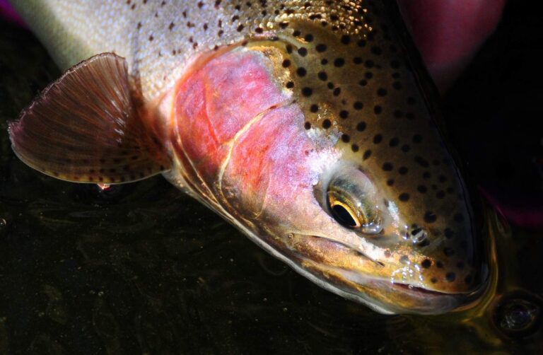
Photo: USFWS Mountain-Prairie, Public domain

Photo: gailhampshire, CC BY 2.0
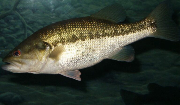
Photo: robposse, CC BY 2.0
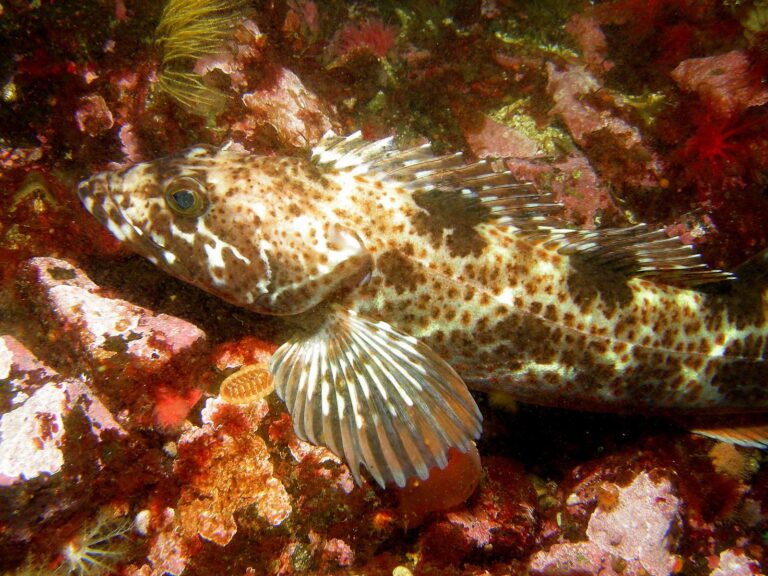
Photo: Ed Bierman, CC BY 2.0
Short answers on fishing Curry County
Where can I put a boat in around Curry County?
There are 28 open launches, 20 with a trailer ramp.
Which Curry County lake spreads over the most mapped acres?
Floras Lake, about 274 acres on its mapped outline.
What fish show up most near Curry County?
Rainbow trout lead the count of water pages within 40 miles, then chinook salmon, steelhead and coho salmon.
Which Curry County stores carry fishing gear?
6 listed, including Brookings Ocean Fishing.
Are there charter or guide listings in Curry County?
5 guides and charters name this county.
In which town does Curry County hold court?
Gold Beach is the seat.
What does ODFW charge to fish in Curry County?
Annual angling runs $50 for residents of Oregon and $138 for everyone else in 2026. Retained salmonids, sturgeon and halibut are logged on the $69 resident Combined Angling Tag. Beach, jetty and boat anglers on the ocean add the Ocean Endorsement at $9, apart from salmon-only and steelhead-only trips.
Which counties border Curry County?
Josephine County, Coos County and Douglas County lie closest.
Which regulation zone fits Curry County?
ODFW files most of the Curry County waters it names under the ODFW Southwest Zone rows, with drainages, not county lines, setting the edges.
Does the booklet set exceptions in Curry County?
The 2026 booklet prints 79 water exceptions reaching this county, starting with Chetco River; the table above shows each.
Which bays or estuaries lie in Curry County?
Southern Oregon Subarea, Euchre Creek estuary, Port Orford Head and Whaleshead Creek estuary; the coastal table above links the pages.
Which Curry County waters get hatchery trout?
Yes: 1 water on the ODFW schedule, such as Floras Lake; releases are planned, not confirmed.
Which ODFW record fish came out of Curry County water?
Rainbow Trout, 28 lb 0 oz, from Rogue River (1982).
Give Curry County a weekend of fishing
Launch pages give lanes, amenities and directions.