Fishing in Douglas County, Oregon
County seat: Roseburg. Population 111,201.
- 18lake pages
- 75open launches
- 4river pages
 Pick for crappiePiscifun Carbon X ultralight spinning reel28% OFFSale $57.99
Photo of Diamond Lake: brx0, CC BY-SA 2.0
First look at fishing in Douglas County
Census 2020 placed 111,201 people in Douglas County, governed from Roseburg. In the booklet, the bulk of Douglas County waters sit in the ODFW Southwest Zone pages, since zones track watersheds.
Siltcoos Lake leads the 18 paged lakes reaching into Douglas County by outline acreage. Salt water in the county runs to Winchester Bay and the Umpqua estuary and Tahkenitch Creek estuary. OSMB maps 75 open launches here, 56 of them built for trailered boats. Land-based fishing runs to 2 mapped shore sites here, 2 on a pier or jetty.
Census 2020 population; BLM Oregon NHD lake outlines; OSMB Boating Access Sites; DLCD and ODFW shore access layers; 2026 Oregon Sport Fishing Regulations zone lists; read November 2, 2026.
Launches, lakes and shore spots of Douglas County on one map
OSMB launch points, DLCD and ODFW shore sites, NHD lake points, PMEP estuary points; read November 2, 2026.
Reservoirs inside Douglas County
| Lake | Acres | Kind | OSMB launches | Fish mapped |
|---|---|---|---|---|
| Siltcoos Lake | 3,286 (outline) | lake | 8 | black crappie, bluegill, brown bullhead |
| Diamond Lake | 3,038 (outline) | lake | 7 | brown trout, largemouth bass, rainbow trout |
| Tahkenitch Lake | 2,324 (outline) | lake | 3 | black crappie, bluegill, brown bullhead |
| North Tenmile Lake | 829 (outline) | lake | 2 | black crappie, bluegill, brown bullhead |
| Galesville Reservoir | 557 (outline) | reservoir | 2 | black crappie, bluegill, brown bullhead |
| Lemolo Lake | 431 (outline) | lake | 3 | brook trout, brown trout, rainbow trout |
| Eel Lake | 347 (outline) | lake | 1 | black crappie, largemouth bass, rainbow trout |
| Ben Irving Reservoir | 182 (outline) | reservoir | 1 | black crappie, bluegill, largemouth bass |
| Fords Pond | 92 (outline) | lake | 1 | largemouth bass |
| Toketee Lake | 79 (outline) | lake | 1 | brown trout |
| Timpanogas Lake | 38 (outline) | lake | 1 | brook trout |
| Soda Springs Reservoir | 30 (outline) | reservoir | 0 | brown trout, rainbow trout |
| Carter Lake | 29 (outline) | lake | 1 | largemouth bass, rainbow trout, yellow perch |
| Maidu Lake | 20 (outline) | lake | 1 | brook trout, rainbow trout |
| Elbow Lake | 19 (outline) | lake | 1 | bluegill, largemouth bass, rainbow trout |
| Lake Marie | 14 (outline) | lake | 1 | cutthroat trout, largemouth bass, rainbow trout |
| Lake Lucile | 8 (outline) | lake | 1 | |
| Perkins Lake | 4 (outline) | lake | 0 | rainbow trout |
BLM Oregon hydrography lake outlines (NHD), summed by GNIS name (layer), read November 2, 2026. Species: ODFW Fish Habitat Distribution layers (ODFW ArcGIS), read November 2, 2026; a mapped species is habitat use ODFW records, not a catch report. ODFW publishes no lake depths in these layers.
 For the crappie herePiscifun Carbon XT ultralight spinning reel25% OFFSale $59.99
Tidewater and bays around Douglas County
Douglas County borders 2 ocean areas, bays and estuaries in this guide; built pages are linked.
| Water | Kind | OSMB launches | Piers and shore sites | Marinas |
|---|---|---|---|---|
| Winchester Bay and the Umpqua estuary | bay | 12 | 2 | 4 |
| Tahkenitch Creek estuary | estuary | 0 | 0 | 0 |
ODFW ocean management areas, PMEP estuaries, OSMB launches and marinas, DLCD shore sites; read November 2, 2026.
The species tally near Douglas County
Each bar counts the lake, river and bay pages within 40 miles of Roseburg that list the fish; chinook salmon shows up most.
Species from ODFW Fish Habitat Distribution layers, booklet exceptions and ODFW records, counted per water page within 40 miles; habitat mapping, not a catch survey.
Lakes of Douglas County listed here only
40 smaller lakes in Douglas County are listed here only.
| Water | Acres (outline) | Nearest place |
|---|---|---|
| Clear Lake (Douglas County) | 310 | Lakeside |
| Fish Lake (Douglas County) | 95 | Shady Cove |
| Threemile Lake | 69 | Reedsport |
| Little River Log Pond | 39 | Roseburg North |
| Mar-Linn Log Pond | 38 | Roseburg North |
| Yoncalla Log Pond | 37 | Yoncalla |
| Lake Edna | 35 | Lakeside |
| Kinnan Reservoir | 22 | Winston |
| Dixonville Log Pond | 22 | Roseburg |
| Lemolo Forebay Number Two | 21 | Oakridge |
| Bear Creek Reservoir | 21 | Yoncalla |
| Indigo Lake | 19 | Oakridge |
| Mount Baldy Log Pond | 16 | Drain |
| Calamut Lake | 16 | Oakridge |
| Skookum Pond | 15 | Shady Cove |
| Twin Lakes | 15 | Oakridge |
| Win Walker Reservoir | 14 | Canyonville |
| Clearwater Number One Forebay | 14 | Oakridge |
| June Lake | 12 | Oakridge |
| Opal Lake | 11 | Oakridge |
| Updegrave Reservoir | 11 | Roseburg North |
| Sun Studs Log Pond | 11 | Green |
| Esmond Lake | 11 | Veneta |
| Skookum Lake | 11 | Oakridge |
| Stump Lake | 11 | Oakridge |
| Thurman Weaver Reservoir | 10 | Yoncalla |
| Buckeye Lake | 10 | Shady Cove |
| Herbert Log Pond | 7 | Canyonville |
| Loletta Lakes | 7 | Oakridge |
| Cliff Lake | 6 | Shady Cove |
| Andy Lake | 6 | Oakridge |
| Clearwater Number Two Forebay | 6 | Oakridge |
| Lost Lake (Douglas County) | 6 | Dunes City |
| Fuller Lake | 4 | Oakridge |
| Wolf Lake | 3 | Oakridge |
| Lizard Lake | 3 | Oakridge |
| Lake Charline | 3 | Oakridge |
| Bug Lake | 3 | Oakridge |
| Lake Patricia | 2 | Oakridge |
| Red Top Spring Helipond | 0 | Myrtle Creek |
BLM Oregon hydrography lake outlines (NHD), summed by GNIS name (layer), read November 2, 2026.
River guides for Douglas County
- North Umpqua RiverODFW maps coho, fall chinook and spring chinook runs, 12 OSMB launches, 3 USGS gauges, 26 booklet exceptions
- South Umpqua RiverODFW maps coho, fall chinook and spring chinook runs, 13 OSMB launches, 3 USGS gauges, 9 booklet exceptions
- Smith River8 OSMB launches, 2 USGS gauges, 20 booklet exceptions
- Umpqua River17 OSMB launches, 1 USGS gauge, 9 booklet exceptions
More river names in Douglas County (6)
- Clearwater River1 USGS gauge
- Little South Fork Smith RiverODFW maps coho and winter steelhead runs
- Middle Fork North Fork Smith RiverODFW maps coho, fall chinook and winter steelhead runs
- South Fork Smith RiverODFW maps coho, fall chinook and winter steelhead runs
- West Branch North Fork Smith RiverODFW maps coho, fall chinook and winter steelhead runs
- West Fork Smith RiverODFW maps coho, fall chinook and winter steelhead runs
Gauge stations around Douglas County
| USGS gauge | Latest reading | Time (ET) |
|---|---|---|
| Umpqua River Near Elkton, Or | 993 cfs, 2.96 ft gage height | Nov 11 8:15 pm |
| North Umpqua River At Winchester, Or | 831 cfs, 1.88 ft gage height | Nov 11 8:30 pm |
| N Umpqua River Abv Copeland Ck Nr Toketee Falls,or | 726 cfs, 4.80 ft gage height | Nov 11 8:30 pm |
| N.umpqua R Blw Warm Springs Ck Nr Toketee Falls,or | 288 cfs, 6.14 ft gage height | Nov 11 8:30 pm |
| N.umpqua R Blw Soda Spgs Resv, Nr Toketee Falls,or | 643 cfs, 3.91 ft gage height | Nov 11 8:45 pm |
| N.umpqua R Blw Slide Ck Dam Nr Toketee Falls, Or | 260 cfs, 2.66 ft gage height | Nov 11 8:15 pm |
US Geological Survey provisional data, retrieved Nov 11, 2026 9:33 pm ET. Provisional readings can be revised.
ODFW Fish Habitat Distribution stream names and runs, OSMB launches, booklet exceptions and USGS gauges; read November 2, 2026.
OSMB launches in Douglas County
- Ada Resort boat ramp on Siltcoos LakeSiltcoos Lake, 1 lane, trailered launch
- Alfred S. Tyson Park on Umpqua RiverUmpqua River, 1 lane, trailered launch
- Amacher Park on North Umpqua RiverNorth Umpqua River, 1 lane, trailered launch
- Apple Creek boat ramp on North Umpqua RiverNorth Umpqua River, 1 lane, trailered launch
- Art Moss launch on Smith RiverSmith River, hand carry launch
- Ben Irving Reservoir boat rampBen Irving Reservoir, 2 lanes, trailered launch
- Bolin Island boat ramp on Umpqua RiverUmpqua River, 1 lane, trailered launch
- Boulder Flat boat ramp on North Umpqua RiverNorth Umpqua River, 1 lane, trailered launch
- Bumble Bee boat ramp on Umpqua RiverUmpqua River, 1 lane, trailered launch
- Carter Lake Boat LaunchCarter Lake, 1 lane, trailered launch
- Chief Miwaleta Park on Galesville ReservoirGalesville Reservoir, 2 lanes, trailered launch
- Cleveland Rapids boat ramp on Umpqua RiverUmpqua River, 1 lane, trailered launch
- Colliding Rivers boat ramp on North Umpqua RiverNorth Umpqua River, 1 lane, trailered launch
- Cooper Creek East boat rampCooper Creek Reservoir, 2 lanes, trailered launch
- Cooper Creek West boat rampCooper Creek Reservoir, 2 lanes, trailered launch
- Dailey Slide Takeout boat ramp on Smith RiverSmith River, 1 lane, boat slide
- Days Creek boat ramp on South Umpqua RiverSouth Umpqua River, 1 lane, trailered launch
- Diamond Lake Campground – C Loop boat rampDiamond Lake, 1 lane, trailered launch
- Diamond Lake Campground – M Loop boat rampDiamond Lake, 1 lane, trailered launch
- Diamond Lake Resort MarinaDiamond Lake, hand carry launch
- East Shore Day Use launch on Loon LakeLoon Lake, hand carry launch
- Elbow Lake Recreation Area launchElbow Lake, hand carry launch
- Fairgrounds boat ramp on South Umpqua RiverSouth Umpqua River, 1 lane, trailered launch
- Fawn Creek boat ramp on Smith RiverSmith River, 1 lane, trailered launch
- Fords Bridge boat ramp on South Umpqua RiverSouth Umpqua River, 1 lane, trailered launch
- Fords Pond City ParkFords Pond, hand carry launch
- Gardiner Ramp on Umpqua RiverUmpqua River, 1 lane, trailered launch
- Gravel Bin Take Out launch on North Umpqua RiverNorth Umpqua River, hand carry launch
- Happy Valley boat ramp on South Umpqua RiverSouth Umpqua River, 1 lane, trailered launch
- Hemlock Meadows Campground boat rampHemlock Lake, trailered launch
- Hestness Landing on North Umpqua RiverNorth Umpqua River, 1 lane, trailered launch
- Horseshoe Bend launch on North Umpqua RiverNorth Umpqua River, hand carry launch
- James Wood boat ramp on Umpqua RiverUmpqua River, 1 lane, trailered launch
- Lake Lucile launchLake Lucile, 1 lane, hand carry launch
- Lavadoure boat ramp on South Umpqua RiverSouth Umpqua River, trailered launch
- Lawson Bar boat ramp on South Umpqua RiverSouth Umpqua River, trailered launch
- Lemolo Lake Resort boat rampLemolo Lake, 1 lane, trailered launch
- Lone Rock Drift Boat Slide boat ramp on North Umpqua RiverNorth Umpqua River, 1 lane, boat slide
- Loon Lake Lodge Resorts boat rampLoon Lake, 1 lane, trailered launch
- Lower Drift Takeout boat ramp on Smith RiverSmith River, trailered launch
- Maidu Lake launchMaidu Lake, 1 lane, hand carry launch
- Milo Boat Ramp on South Umpqua RiverSouth Umpqua River, hand carry launch
- Noel Ranch Boat Launch on Smith RiverSmith River, 1 lane, trailered launch
- North End Boat Ramp on Diamond LakeDiamond Lake, 2 lanes, trailered launch
- Osprey Boat Ramp on Umpqua RiverUmpqua River, 1 lane, trailered launch
- Page Road launch on North Umpqua RiverNorth Umpqua River, hand carry launch
- Pickett Park on South Umpqua RiverSouth Umpqua River, 1 lane, trailered launch
- Plat I Reservoir Ramp on Plat 1 ReservoirPlat 1 Reservoir, 1 lane, hand carry launch
- Rainbow Plaza boat ramp on Umpqua RiverUmpqua River, 2 lanes, trailered launch
- River Forks Park on Umpqua RiverUmpqua River, 1 lane, trailered launch
- Riverside Wayside on Smith RiverSmith River, 1 lane, trailered launch
- Salmon Harbor – East Basin on Umpqua RiverUmpqua River, 3 lanes, trailered launch
- Salmon Harbor – West Basin on Winchester Bay and the Umpqua estuaryWinchester Bay and the Umpqua estuary, 2 lanes, trailered launch
- Sawyers Rapids boat ramp on Umpqua RiverUmpqua River, 1 lane, trailered launch
- Scott Creek Campground boat ramp on Umpqua RiverUmpqua River, 1 lane, trailered launch
- Scottsburg Park on Umpqua RiverUmpqua River, 1 lane, trailered launch
- Sid Nichols Park on South Umpqua RiverSouth Umpqua River, 1 lane, trailered launch
- Smith River Marina & CampgroundSmith River, 1 lane, trailered launch
- South Shore Boating Site boat ramp on Diamond LakeDiamond Lake, 2 lanes, trailered launch
- Stanton Park on South Umpqua RiverSouth Umpqua River, 1 lane, hand carry launch
- Susan Creek boat ramp on North Umpqua RiverNorth Umpqua River, trailered launch
- Tahkenitch Fishing Village launchTahkenitch Lake, hand carry launch
- Tahkenitch Landing Campground RampTahkenitch Lake, 1 lane, trailered launch
- Templin Beach Ramp on South Umpqua RiverSouth Umpqua River, 1 lane, trailered launch
- Thielsen View boat ramp on Diamond LakeDiamond Lake, 1 lane, trailered launch
- Three C Rock boat ramp on South Umpqua RiverSouth Umpqua River, trailered launch
- Tiller Bridge launch on South Umpqua RiverSouth Umpqua River, hand carry launch
- Toketee Lake Campground boat rampToketee Lake, 1 lane, trailered launch, OSMB status: restricted
- Umpqua LandingUmpqua River, 1 lane, trailered launch
- Umpqua Wayside State ParkUmpqua River, 1 lane, trailered launch
- Upper Ramp on Galesville ReservoirGalesville Reservoir, 2 lanes, trailered launch
- Vincent Creek Takeout launch on Smith RiverSmith River, hand carry launch
- Whistlers Bend Park on North Umpqua RiverNorth Umpqua River, 1 lane, trailered launch
- Yellow Creek boat ramp on Umpqua RiverUmpqua River, 1 lane, trailered launch
- South Shore Tie-Up Dock on Diamond LakeDiamond Lake, floating kayak dock
- Bogus Creek launch on North Umpqua RiverNorth Umpqua River, closed per OSMB
- East Lemolo Campground boat rampLemolo Lake, closed per OSMB
- Loon Lake Recreation Site boat rampLoon Lake, closed per OSMB
- Poole Creek boat ramp on Lemolo LakeLemolo Lake, closed per OSMB
- Tahkenitch Lake Boat RampTahkenitch Lake, closed per OSMB
- Tyee Campground Umpqua boat rampUmpqua River, closed per OSMB
Launches marked closed on the OSMB layer get no page; restricted ones carry the OSMB note on theirs.
Piers and jetties of Douglas County
- Windy Cove Day Use Area on Winchester Bay and the Umpqua estuaryfishing pier, Owner
- Salmon Harbor Boat Basin on Winchester Bay and the Umpqua estuaryjetty
Oregon State Marine Board Boating Access Sites layer (OSMB ArcGIS), read November 2, 2026; status as OSMB publishes it. Oregon Coastal Management Program (DLCD) Shoreline Access Inventory (layer) and the ODFW shore access map, read November 2, 2026.
Planned trout plants across Douglas County
ODFW lists 29 planned plants across 5 waters of Douglas County, adding up to 72,200 trout.
- Galesville Reservoir6 releases planned, next listed: May. 10, 2027 – May. 14, 2027: 3,750 legal-size trout
- Lemolo Lake7 releases planned, next listed: Aug. 30, 2027 – Sep. 03, 2027: 4,000 trophy trout
- Ben Irving Reservoir4 releases planned, next listed: May. 10, 2027 – May. 14, 2027: 2,500 legal-size trout
- Carter Lake8 releases planned, next listed: Apr. 26, 2027 – Apr. 30, 2027: 800 legal-size trout
- Perkins Lake4 releases planned, next listed: May. 17, 2027 – May. 21, 2027: 300 legal-size trout
ODFW weekly trout stocking schedule (planned releases; ODFW prints size classes, not species), myodfw.com, read November 2, 2026.
Daily limits for Douglas County waters
Begin with the zone rows for Douglas County, then check the exception list for the water you fish. Budget $50 if you live in Oregon, $138 if not, for the annual angling license. Salmon, steelhead, sturgeon and halibut also go on a Combined Angling Tag ($69 resident). An Ocean Endorsement ($9) is now part of most ocean fishing trips in Oregon.
| Species | Limit | Season |
|---|---|---|
| Trout | Lakes: 5 per day, 3 daily limits in possession. Streams: (including tidewaters and bays); 2 per day, 3 daily catch limits in possession; 8-inch minimum | Lakes: Open all year Streams: (including tidewaters and bays): Open May 22 – Oct 31 unless noted under Exceptions. |
| Salmon and Steelhead | In the aggregate: 2 adult salmon or steelhead per day, 20 per year. 5 jack salmon per day, 2 daily jack limits in possession. Wild salmon bag limits are determined annually. | Closed unless noted under Exceptions. |
| Sturgeon | Catch-and-release only. | Streams: (including tidewaters and bays): Open during trout, salmon or steelhead seasons. |
| Bass | Lakes: 5 per day, 3 daily limits in possession unless noted under Exceptions. Streams: No limit. | Lakes: Open all year. Streams (including tidewaters and bays): Open during trout, salmon or steelhead seasons. |
| Bluegill, Catfish, Crappie, Other Sunfish, Walleye, Yellow Perch, Stri. | No limit. | Lakes: Open all year. Streams (including tidewaters and bays): Open during trout, salmon or steelhead seasons. |
| Smelt | Unless specifically authorized under emergency rules, it is unlawful to take or attempt to take Eulachon smelt in inland waters, including bays, rivers, estuaries, and streams. | Unless specifically authorized under emergency rules, it is unlawful to take or attempt to take Eulachon smelt in inland waters, including bays, rivers, estuari. |
| Marine Fish and Marine Shellfish | See Marine Zone. | See Marine Zone. |
| Species | Limit | Season |
|---|---|---|
| General Marine Species: Rockfish ("sea bass", "snapper"), Greenling (“. | Bag limits are set after this book is printed. Check current regulations before fishing on the Sport Bottomfish Seasons page. Retention of yelloweye and quillback rockfishes is prohibited. | Waters are open 24 hours per day. The offshore long-leader fishery is limited to fishing seaward of the 40-fathom regulatory line. |
| Lingcod (including green-colored lingcod) | 3 fish. | Waters are open 24 hours per day. The offshore long-leader fishery is limited to fishing seaward of the 40-fathom regulatory line. |
| Sablefish (black cod) | 10 fish. | Waters are open 24 hours per day. The offshore long-leader fishery is limited to fishing seaward of the 40-fathom regulatory line. |
| Flatfish (flounders, soles, sanddabs, turbots, and halibuts except Pac. | 25 fish in aggregate. | Waters are open 24 hours per day. The offshore long-leader fishery is limited to fishing seaward of the 40-fathom regulatory line. |
| Surfperch (includes all marine perch species) | 15 fish in aggregate. | Waters open all year, 24 hours per day, unless noted under Management Designations for Marine Areas. |
| Herring, Anchovy, Sardine, Topsmelt, Jacksmelt, and true smelts | 25 pounds in aggregate. | Waters open all year, 24 hours per day, unless noted under Management Designations for Marine Areas. |
| Offshore Pelagic Species: Includes all tuna and mackerel species, swor. | 25 fish in aggregate. White shark, basking shark, mega-mouth shark, and oceanic whitetip shark are prohibited and must be immediately released unharmed. | Waters open all year, 24 hours per day, unless noted under Management Designations for Marine Areas. |
| Striped Bass and/or Hybrid Bass | No limit | Waters open all year, 24 hours per day, unless noted under Management Designations for Marine Areas. |
| Sturgeon | Catch-and-release only. | Open all year. |
| Salmon and Steelhead | Ocean salmon and steelhead seasons and restrictions are set each April by the Pacific Fishery Management Council. Regulations are published each May and are available from license agents. | Ocean salmon and steelhead seasons and restrictions are set each April by the Pacific Fishery Management Council. |
| Pacific Halibut | May be taken by angling with a single line, no more than 2 hooks; and by spear. Pacific halibut seasons are managed and enforced based on port of landing. | May be taken by angling with a single line, no more than 2 hooks; and by spear. Pacific halibut seasons are managed and enforced based on port of landing. |
| Razor Clams | First 15 dug (no sorting or releasing). | Waters open all year, 24 hours per day Exceptions: Razor clams are closed Jul 15 to Sep 30 north of Tillamook Head (Clatsop County) Shellfish harvests may be cl. |
Water-by-water rules in Douglas County (70)
| Water | Species | Rule | Booklet |
|---|---|---|---|
| Siltcoos Lake (Above Hwy 101 bridge, below RR trestle on Maple Cr Arm, and below Fivemile Rd crossing on the Fiddle Cr Arm) | coho, salmon | Open for coho salmon Oct 1 – Dec 31 (Wild Coho Aggregate Bag Limit applies). | p. 26 |
| Siltcoos Lake (Above Hwy 101 bridge, below RR trestle on Maple Cr Arm, and below Fivemile Rd crossing on the Fiddle Cr Arm) | coho, salmon | Closed to two rod angling for all species during coho salmon season. | p. 26 |
| Tahkenitch Lake (Above Hwy 101 bridge, below first road crossing on Mallard Arm, and below the 059 bridge on the Fivemile Arm) | coho, salmon | Open for coho salmon Oct 1 – Dec 31 (Wild Coho Aggregate Bag Limit applies). | p. 26 |
| Tahkenitch Lake (Above Hwy 101 bridge, below first road crossing on Mallard Arm, and below the 059 bridge on the Fivemile Arm) | coho, salmon | Closed to two rod angling for all species during coho salmon season. | p. 26 |
| Diamond Lake | brown trout | Catch-and-release for tiger and brown trout. | p. 36 |
| Galesville Reservoir | salmon, trout | All landlocked salmon are considered trout. | p. 37 |
| North Umpqua River | trout, cutthroat | Catch-and-release for rainbow and cutthroat trout May 22 – Oct 31. | p. 38 |
| North Umpqua River | hatchery steelhead, coho, salmon | Open all year for hatchery steelhead and hatchery coho salmon. | p. 38 |
| North Umpqua River | chinook, salmon | Open for Chinook salmon Feb 1 – Jun 30. | p. 38 |
| North Umpqua River | Use of bait allowed. | p. 38 | |
| North Umpqua River (Old Hwy 99 bridge to 200 ft above Winchester Dam) | Closed. | p. 38 | |
| North Umpqua River (Old Hwy 99 bridge to 200 ft above Winchester Dam) | chinook, salmon | Open for Chinook salmon Feb 1 – Jun 30. | p. 38 |
| North Umpqua River (Old Hwy 99 bridge to 200 ft above Winchester Dam) | Use of bait allowed. | p. 38 | |
| North Umpqua River (Old Hwy 99 bridge to 200 ft above Winchester Dam) | chinook, salmon | Open for Chinook salmon Feb 1 – Jun 30. | p. 38 |
| North Umpqua River (Old Hwy 99 bridge to 200 ft above Winchester Dam) | Use of bait allowed. | p. 38 | |
| North Umpqua River (Old Hwy 99 bridge to 200 ft above Winchester Dam) | No angling from a floating device. | p. 38 | |
| North Umpqua River (Old Hwy 99 bridge to 200 ft above Winchester Dam) | Anti-Snagging Gear Restriction: Leader length must be between 18 and 36 inches Mar 1 – Jul 31 (See Anti-Snagging Gear Restriction Rules). | p. 38 | |
| North Umpqua River (Markers (painted lines) above Rock Cr to Fly Area Boundary at Deadline Falls) | Closed. | p. 38 | |
| North Umpqua River (Markers (painted lines) above Rock Cr to Fly Area Boundary at Deadline Falls) | Any type of rod or reel permitted. | p. 38 | |
| North Umpqua River (Markers (painted lines) above Rock Cr to Fly Area Boundary at Deadline Falls) | No angling from a floating device. | p. 38 |
Limits as printed in the 2026 Oregon Sport Fishing Regulations (ODFW, eRegulations edition) (Southwest Zone page), read November 2, 2026. Limits as printed in the 2026 Oregon Sport Fishing Regulations (ODFW, eRegulations edition) (Marine Zone page), read November 2, 2026. Water exceptions as printed in the 2026 Oregon Sport Fishing Regulations (ODFW, eRegulations edition) (booklet PDF; printed page shown), read November 2, 2026. In-season changes from ODFW override them. Fees as printed on the ODFW license, tag and permit fee page of the 2026 Oregon Sport Fishing Regulations (ODFW, eRegulations edition) (fees page), read November 2, 2026.
Record-book catches around Douglas County
| Species | Weight | Water | Date |
|---|---|---|---|
| Chinook Salmon | 83 lb 0 oz | Winchester Bay and the Umpqua estuary | 1910 |
| Coho Salmon | 25 lb 5.25 oz | Siltcoos Lake | 1966 |
| Striped Bass | 68 lb 0 oz | Winchester Bay and the Umpqua estuary | 1973 |
| Green Sunfish | 0 lb 11 oz | Winchester Bay and the Umpqua estuary | 1991 |
Oregon record fish as listed by Oregon Department of Fish and Wildlife (record fish article, dated March 4, 2026), read November 2, 2026.
Competitive fishing in Douglas County
0 of 1 derbies and tournaments linked to Douglas County have not been fished yet.
| Date | Event | Water | Organizer |
|---|---|---|---|
| date not printed | Gardiner Reedsport Winchester Bay STEP Labor Day Weekend Salmon Derby 2026 | Umpqua River | Gardiner Reedsport Winchester Bay STEP |
Organizer schedule and results pages (ODFW publishes no tournament calendar), checked November 2026.
Gear stores across Douglas County
Douglas County bait and tackle
- City Sporting Goodsbait and tackle shop, Sutherlin
- Dreamcast Fly Fishingfly shop, Glide
- Elkton Bait & Tacklebait and tackle shop, Elkton
- Reedsport Outdoor Storebait and tackle shop, Reedsport
- Salmon Harbor Tacklebait and tackle shop, Reedsport
- Stockade Market & Tackle Shopbait and tackle shop, Reedsport
- Turman Tacklebait and tackle shop, Reedsport
- Umpqua Baitbait and tackle shop, Reedsport
- Waldron's Outdoor Sportsbait and tackle shop, Roseburg
- Bi-Mart (Roseburg)sporting goods store, Roseburg
- Bi-Mart (Sutherlin)sporting goods store, Sutherlin
- Bi-Mart (Winston)sporting goods store, Winston
- Mac Marina Activity Centermarina, Reedsport
- Sportsman's Warehouse Roseburgsporting goods store, Roseburg
Douglas County guides and charters
- River's End Guide Service & Oceancharter, Reedsport, (541) 271-3125
- Winchesterbay Charterscharter, Oakland, (541) 361-0180
Yellow Pages and store-locator listings, guide and charter business listings (county of the business), read November 2, 2026.
Close by Douglas County
Town guides for Douglas County
- Roseburgpop. 23,683
- Sutherlinpop. 8,524
- Greenpop. 7,614
- Winstonpop. 5,625
- Roseburg Northpop. 4,375
- Reedsportpop. 4,310
- Tri-Citypop. 4,019
- Myrtle Creekpop. 3,481
- Canyonvillepop. 1,640
- Riddlepop. 1,214
- Drainpop. 1,172
- Yoncallapop. 1,021
Neighbours of Douglas County
- Lane County46 miles north
- Coos County48 miles west
- Jackson County65 miles south
- Josephine County65 miles south
Piscifun tackle that suits a trip to Douglas County


Piscifun and Amazon links are affiliate links; the site earns a commission on qualifying purchases.
Photographs from the shoreline near Douglas County
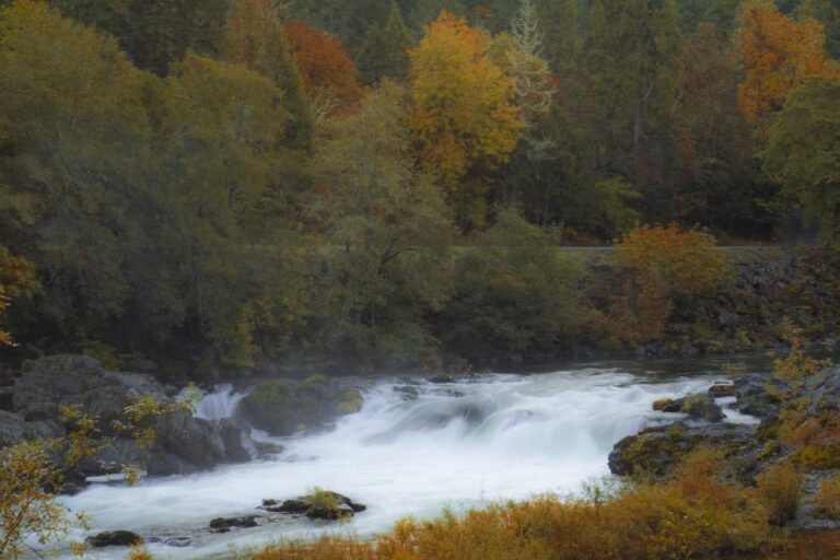
Photo: Bonnie Moreland, Public domain
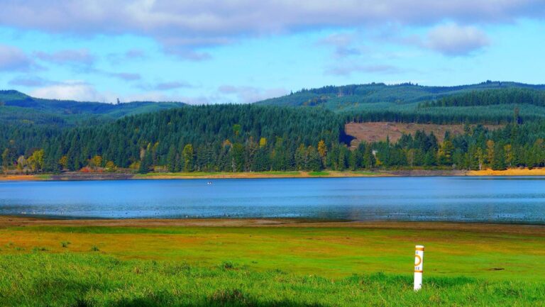
Photo: Rick Obst, CC BY 2.0
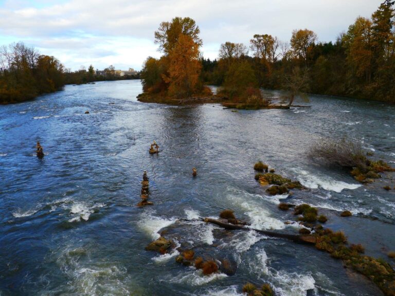
Photo: Rick Obst, CC BY 2.0
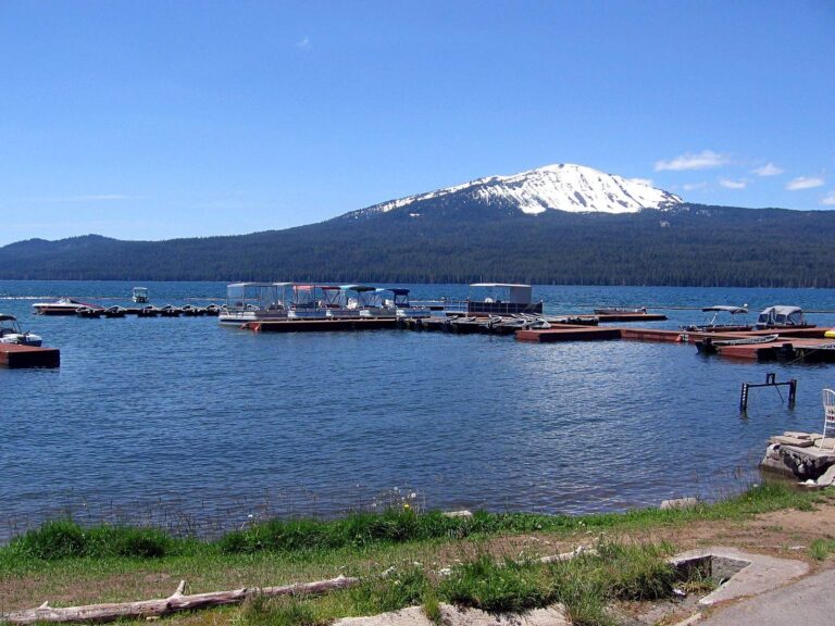
Photo: brx0, CC BY-SA 2.0
Fishing in Douglas County: the questions that come up
Can I launch a trailered boat in Douglas County?
Count 75 open launches, 56 for trailers.
Which Douglas County lake has the widest outline?
Siltcoos Lake, about 3,286 acres on its mapped outline.
What species live in water around Douglas County?
Chinook salmon lead the count of water pages within 40 miles, then coho salmon, cutthroat trout and rainbow trout.
Where can Douglas County anglers buy roe, shrimp or worms?
Try City Sporting Goods; 14 are listed.
How many guide or charter listings give Douglas County as home port?
The listings show 2 guides and charters here.
Where is Douglas County governed from?
The seat is Roseburg.
What does ODFW charge an out-of-state angler in Douglas County?
A year of Oregon angling privileges costs $50 in state and $138 from out of state this season. For salmon and steelhead the booklet adds the Combined Angling Tag at $69 resident. Bottomfish, halibut and other ocean trips need the $9 Ocean Endorsement as well.
Which Oregon counties are a short drive from Douglas County?
Try Lane County, Coos County and Jackson County.
Which booklet zone applies in Douglas County?
Most waters ODFW lists in Douglas County fall under the ODFW Southwest Zone table, though zone lines follow drainages rather than county lines.
How many organizer events touch Douglas County?
1 event on file from organizer pages, none ahead yet.
Are there water-specific limits in Douglas County?
The 2026 booklet prints 70 water exceptions reaching this county, starting with Siltcoos Lake; the table above shows each.
Which coastal pages cover Douglas County?
Winchester Bay and the Umpqua estuary and Tahkenitch Creek estuary; the coastal table above links the pages.
Where are stocked lakes in Douglas County?
Yes: 5 waters on the ODFW schedule, such as Galesville Reservoir, Lemolo Lake and Ben Irving Reservoir; releases are planned, not confirmed.
What record-list weights trace to Douglas County?
Chinook Salmon, 83 lb 0 oz, from Umpqua River (1910).
Point the rig toward Douglas County
Each Oregon river page shows its USGS gauges live.