Port Orford Head Fishing
A coastal estuary in Curry County, about 141 acres of tidal habitat.
 Pick for rockfishPiscifun AlinoX 400 baitcaster with bait clicker25% OFFSale $149.99
Photo: Sheila Sund, CC BY 2.0
Port Orford Head summed up before the tide turns
Close to 57 hectares of tidal wetland and open water, about 141 acres, make up Port Orford Head in Curry County. PMEP classes it as riverine estuary. Offshore it opens onto the Central Oregon Coast Subarea. The closest town is Port Orford, under a mile away.
OSMB maps 2 launch sites for it. Walk-in anglers have 1 dock, pier or jetty site. 2 marine reserves or protected areas sit near it.
Pacific Marine and Estuarine Fish Habitat Partnership estuary extent (PMEP), read November 2, 2026. Census 2023 places.
Boat ramps on Port Orford Head
- 12th Street Ramp on Garrison LakeGarrison Lake; 1 lane, trailered launch; parking, restrooms; City of Port Orford
- Pinehurst Boat Ramp on Garrison LakeGarrison Lake; 1 lane, hand carry launch; parking, hand launch; City of Port Orford
Walk-out fishing at Port Orford Head
- Port of Port Orford on Port Orford Headfishing pier, Owner
Oregon State Marine Board Boating Access Sites layer (OSMB ArcGIS), read November 2, 2026; status as OSMB publishes it. Oregon Coastal Management Program (DLCD) Shoreline Access Inventory (layer) and the ODFW shore access map, read November 2, 2026.
Tide stations around Port Orford Head
NOAA CO-OPS water level, preliminary reading at retrieval; station page for live data.
- Port OrfordNOAA tide predictions
Plan any trip on Port Orford Head around the tide predictions.
NOAA CO-OPS stations and tide predictions, read November 2, 2026.
Saltwater rules at Port Orford Head
| Species | Daily limit as printed | Season |
|---|---|---|
| General Marine Species: Rockfish ("sea bass", "snapper"), Greenling (“. | Bag limits are set after this book is printed. Check current regulations before fishing on the Sport Bottomfish Seasons page. Retention of yelloweye and quillback rockfishes is prohibited. | Waters are open 24 hours per day. The offshore long-leader fishery is limited to fishing seaward of the 40-fathom regulatory line. |
| Lingcod (including green-colored lingcod) | 3 fish. | Waters are open 24 hours per day. The offshore long-leader fishery is limited to fishing seaward of the 40-fathom regulatory line. |
| Sablefish (black cod) | 10 fish. | Waters are open 24 hours per day. The offshore long-leader fishery is limited to fishing seaward of the 40-fathom regulatory line. |
| Flatfish (flounders, soles, sanddabs, turbots, and halibuts except Pac. | 25 fish in aggregate. | Waters are open 24 hours per day. The offshore long-leader fishery is limited to fishing seaward of the 40-fathom regulatory line. |
| Surfperch (includes all marine perch species) | 15 fish in aggregate. | Waters open all year, 24 hours per day, unless noted under Management Designations for Marine Areas. |
| Herring, Anchovy, Sardine, Topsmelt, Jacksmelt, and true smelts | 25 pounds in aggregate. | Waters open all year, 24 hours per day, unless noted under Management Designations for Marine Areas. |
| Offshore Pelagic Species: Includes all tuna and mackerel species, swor. | 25 fish in aggregate. White shark, basking shark, mega-mouth shark, and oceanic whitetip shark are prohibited and must be immediately released unharmed. | Waters open all year, 24 hours per day, unless noted under Management Designations for Marine Areas. |
| Striped Bass and/or Hybrid Bass | No limit | Waters open all year, 24 hours per day, unless noted under Management Designations for Marine Areas. |
| Sturgeon | Catch-and-release only. | Open all year. |
| Salmon and Steelhead | Ocean salmon and steelhead seasons and restrictions are set each April by the Pacific Fishery Management Council. Regulations are published each May and are available from license agents. | Ocean salmon and steelhead seasons and restrictions are set each April by the Pacific Fishery Management Council. |
| Pacific Halibut | May be taken by angling with a single line, no more than 2 hooks; and by spear. Pacific halibut seasons are managed and enforced based on port of landing. | May be taken by angling with a single line, no more than 2 hooks; and by spear. Pacific halibut seasons are managed and enforced based on port of landing. |
| Razor Clams | First 15 dug (no sorting or releasing). | Waters open all year, 24 hours per day Exceptions: Razor clams are closed Jul 15 to Sep 30 north of Tillamook Head (Clatsop County) Shellfish harvests may be cl. |
Season dates for Port Orford Head
| Fishery and area | Season | Limit |
|---|---|---|
| crab, Bays, beaches, estuaries, tide pools, piers and jetties | Open for crabbing all year, 24 hours per day. | Dungeness crab 12 (males only); 5-3/4" minimum size |
Ocean seasons as published by ODFW (myodfw.com, myodfw.com, dfw.state.or.us, eregulations.com), read November 2, 2026; ODFW changes ocean seasons in season.
Crab, clams and bay fish at Port Orford Head are governed by the Marine Zone.
An Oregon angling license ($50 resident, $138 nonresident for 2026) covers anglers 12 and older; ocean fishing from boats, beaches and jetties now also needs the Ocean Endorsement ($9 annual) unless you fish only for salmon or steelhead.
Limits as printed in the 2026 Oregon Sport Fishing Regulations (ODFW, eRegulations edition) (Marine Zone page), read November 2, 2026.
 For the rockfish herePiscifun Saltflow offshore rod25% OFFSale $299.99
The ODFW ocean area for Port Orford Head
For the ocean past Port Orford Head, read the Central Oregon Coast Subarea page; halibut note: Spring All-Depth Season: May 1 through July 31, seven days per week, or until the quota is caught.
Marine reserves near Port Orford Head
- Redfish Rocks Marine ReserveNo extractive activities allowed., 2.63 sq mi
- Redfish Rocks Marine Protected AreaAllowed take: salmon by troll, crab., 5.1 sq mi
ODFW Marine Reserve and Marine Protected Area Boundaries (layer), read November 2, 2026; full rules on oregonmarinereserves.com.
Bays and estuaries near Port Orford Head, side by side
| Bay or estuary | Distance | Acres (PMEP) | OSMB launches | Shore sites | Marinas |
|---|---|---|---|---|---|
| Port Orford Head | 141 | 2 | 1 | 0 | |
| Euchre Creek estuary | 15 miles southeast | 33 | 0 | 1 | 0 |
| Fourmile Creek estuary | 18 miles north | 82 | 1 | 0 | 0 |
| Sunset Bay | 40 miles north | 2 | 0 | 3 | 0 |
| Whaleshead Creek estuary | 43 miles south | 6 | 0 | 2 | 0 |
| Coos Bay | 47 miles north | 20,566 | 15 | 6 | 3 |
PMEP extents, OSMB launches, DLCD and ODFW shore sites, Clean Marina list; read November 2, 2026.
Lakes, rivers and towns inland from Port Orford Head
Rivers worth fishing once the Port Orford Head is done
- Elk River3 miles
- Sixes River7 miles
- New River17 miles
- Coquille River26 miles
Lakes for a second day near Port Orford Head
- Garrison Lakeunder a mile southwest
- Floras Lake10 miles north
- Bradley Lake22 miles north
- Powers Pond24 miles northeast
Picking up tackle for Port Orford Head
- Brookings Ocean Fishingbait and tackle shop, Brookings
- Chetco Marine Supplybait and tackle shop, Brookings
- The Boat Shopmarina, Brookings
- Tradewinds Sportfishingbait and tackle shop, Brookings
- U Save Bait & Tacklebait and tackle shop, Brookings
- Bi-Mart (Brookings)sporting goods store, Brookings
Booking a fishing guide for Port Orford Head
- Brookings Fishing Charterscharter, Brookings, (541) 813-1082
- Five Star Charterscharter, Gold Beach, (541) 247-0217
- Mark Van Hook Guide Svccharter, Gold Beach, (541) 247-6702
- Tidewinds Sportfishingcharter, Brookings
Towns that work as a base for Port Orford Head
- Port Orfordunder a mile
- Gold Beach24 miles
- Bandon25 miles
The counties around Port Orford Head
- Curry Countyseat: Gold Beach
Rods, reels and braid from Piscifun for Port Orford Head


Piscifun and Amazon links are affiliate links; the site earns a commission on qualifying purchases.
Picture key to the fish of Port Orford Head
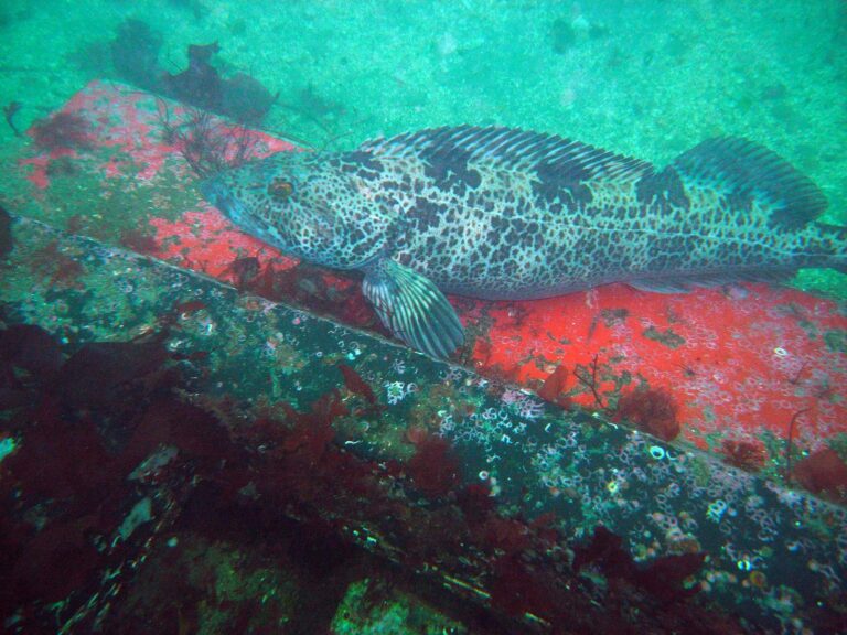
Photo: Patrick Briggs, CC BY 2.0

Photo: U.S. Fish and Wildlife Service, Public domain

What gets asked about Port Orford Head first
What town is nearest Port Orford Head?
Its county is Curry County, under a mile from Port Orford.
How large is the estuary at Port Orford Head?
Near 141 acres, per PMEP.
Where does OSMB map a launch on Port Orford Head?
2 launch sites on the OSMB layer, including 12th Street Ramp on Garrison Lake.
Are there clam beds at Port Orford Head?
No ODFW shellfish guide covers it by name. Diggers 12 and older need a shellfish license.
Does ODFW set a size limit at Port Orford Head?
Razor Clams: First 15 dug (no sorting or releasing).
What does an Oregon license cost for Port Orford Head in 2026?
An Oregon angling license ($50 resident, $138 nonresident for 2026) covers anglers 12 and older; ocean fishing from boats, beaches and jetties now also needs the Ocean Endorsement ($9 annual) unless you fish only for salmon or steelhead.
Is there a jetty at Port Orford Head?
Start at Port of Port Orford on Port Orford Head.
Who sells Oregon bait near Port Orford Head?
The nearest listed counter is Brookings Ocean Fishing in the same county.
Where do I check tides for Port Orford Head?
The tides band links Port Orford.
Do reserve rules apply near Port Orford Head?
Redfish Rocks Marine Reserve and Redfish Rocks Marine Protected Area lie nearby; read the take rules first.
Take Highway 101 to Port Orford Head
Every Oregon fee and bag limit is one click away.