Fishing in Coos County, Oregon
County seat: Coquille. Population 64,929.
- 12lake pages
- 57open launches
- 8river pages
 Pick for crappiePiscifun Carbon X ultralight spinning reel28% OFFSale $57.99
Photo of Charleston: Rick Obst, CC BY 2.0
Getting to know the water in Coos County
64,929 Oregonians called Coos County home in 2020, with Coquille as county seat. ODFW files most of the Coos County waters it names under the ODFW Southwest Zone rows, with drainages, not county lines, setting the edges.
Coos County shares 12 lake pages, and Tenmile Lake spreads widest. On the coast the county reaches Coos Bay, Fourmile Creek estuary, Sunset Bay and Tenmile Creek estuary (Coos County). 57 open launches sit in the county on the OSMB map; 45 take a trailer. From land there are 13 mapped shore sites on the DLCD and ODFW layers, including 8 piers and jetties.
Census 2020 population; BLM Oregon NHD lake outlines; OSMB Boating Access Sites; DLCD and ODFW shore access layers; 2026 Oregon Sport Fishing Regulations zone lists; read November 2, 2026.
A map of where to get on the water in Coos County
OSMB launch points, DLCD and ODFW shore sites, NHD lake points, PMEP estuary points; read November 2, 2026.
Lakes to try around Coos County
| Lake | Acres | Kind | OSMB launches | Fish mapped |
|---|---|---|---|---|
| Tenmile Lake | 1,138 (outline) | lake | 6 | black crappie, bluegill, brown bullhead |
| North Tenmile Lake | 829 (outline) | lake | 2 | black crappie, bluegill, brown bullhead |
| Eel Lake | 347 (outline) | lake | 1 | black crappie, largemouth bass, rainbow trout |
| Johnson Log Storage and Storing Reservoir | 88 (outline) | reservoir | 1 | bluegill, brown bullhead, largemouth bass |
| Saunders Lake | 56 (outline) | lake | 1 | black crappie, bluegill, largemouth bass |
| Bradley Lake | 26 (outline) | lake | 1 | brown bullhead, cutthroat trout, rainbow trout |
| Upper Empire Lake | 26 (outline) | lake | 1 | black crappie, brown bullhead, largemouth bass |
| Powers Pond | 23 (outline) | lake | 1 | black crappie, brown bullhead, largemouth bass |
| Lower Empire Lake | 22 (outline) | lake | 1 | bluegill, largemouth bass, rainbow trout |
| Bluebill Lake | 14 (outline) | lake | 0 | largemouth bass, rainbow trout |
| Butterfield Lake | 11 (outline) | lake | 1 | cutthroat trout, largemouth bass, rainbow trout |
| Sru Lake | 1 (outline) | lake | 1 | rainbow trout |
BLM Oregon hydrography lake outlines (NHD), summed by GNIS name (layer), read November 2, 2026. Species: ODFW Fish Habitat Distribution layers (ODFW ArcGIS), read November 2, 2026; a mapped species is habitat use ODFW records, not a catch report. ODFW publishes no lake depths in these layers.
 For the crappie herePiscifun Carbon XT ultralight spinning reel25% OFFSale $59.99
Where Coos County meets the Pacific
7 saltwater pages reach Coos County, from ODFW ocean areas to tidal bays.
| Water | Kind | OSMB launches | Piers and shore sites | Marinas |
|---|---|---|---|---|
| Coos Bay | bay | 15 | 6 | 3 |
| Fourmile Creek estuary | estuary | 1 | 0 | 0 |
| Sunset Bay | bay | 0 | 3 | 0 |
| Tenmile Creek estuary (Coos County) | estuary | 9 | 0 | 6 |
| Coquille River | estuary | 12 | 4 | 4 |
| New River | estuary | 1 | 0 | 0 |
| Twomile Creek estuary | estuary | 0 | 0 | 0 |
Ocean and bay readings for Coos County
NOAA CO-OPS water level, preliminary reading at retrieval; station page for live data.
ODFW ocean management areas, PMEP estuaries, OSMB launches and marinas, DLCD shore sites; read November 2, 2026.
What the habitat maps show near Coos County
rainbow trout tops the tally of water pages within 40 miles of Coquille.
Species from ODFW Fish Habitat Distribution layers, booklet exceptions and ODFW records, counted per water page within 40 miles; habitat mapping, not a catch survey.
The rest of the named lakes in Coos County
Coos County holds 20 more named lakes on the outline map.
| Water | Acres (outline) | Nearest place |
|---|---|---|
| Horsfall Lake | 122 | North Bend |
| Upper Pony Creek Reservoir | 111 | Coos Bay |
| Sandpoint Lake | 66 | North Bend |
| Croft Lake | 66 | Bandon |
| Spirit Lake | 57 | North Bend |
| Beale Lake | 54 | Lakeside |
| Laurel Lake | 51 | Bandon |
| Snag Lake | 32 | North Bend |
| Lake Merritt | 27 | Coos Bay |
| Fahys Lake | 19 | Bandon |
| Clear Lake (Coos County) | 17 | Lakeside |
| Tarheel Reservoir | 16 | Coos Bay |
| Myrtle Point Log Pond | 15 | Myrtle Point |
| New Lake | 14 | Bandon |
| Muddy Lake | 14 | Bandon |
| C A Smith L and M Company Storage Reservoir | 14 | Coos Bay |
| Hall Lake | 12 | Lakeside |
| Shuttpelz Lake | 7 | Lakeside |
| Jordan Lake | 2 | North Bend |
| Azalea Lake | 1 | Port Orford |
BLM Oregon hydrography lake outlines (NHD), summed by GNIS name (layer), read November 2, 2026.
Drift and wade water in Coos County
- Coquille RiverODFW maps coho, fall chinook and spring chinook runs, tidewater at Coquille River, 11 OSMB launches, 1 USGS gauge, 14 booklet exceptions
- Middle Fork Coquille RiverODFW maps coho, fall chinook and spring chinook runs, 1 OSMB launch
- Millicoma RiverODFW maps chum, coho and fall chinook runs, 2 OSMB launches, 4 booklet exceptions
- New RiverODFW maps coho, fall chinook and winter steelhead runs, tidewater at New River, 2 OSMB launches
- South Fork Coos RiverODFW maps coho, fall chinook and winter steelhead runs, 1 OSMB launch
- South Fork Coquille RiverODFW maps coho, fall chinook and spring chinook runs, 7 OSMB launches, 1 USGS gauge
- West Fork Millicoma RiverODFW maps chum, coho and fall chinook runs, 1 OSMB launch
- Coos RiverODFW maps chum, coho and fall chinook runs, 5 booklet exceptions
Other named rivers of Coos County (5)
- East Fork Coquille RiverODFW maps coho, fall chinook and spring chinook runs
- East Fork Millicoma RiverODFW maps chum, coho and fall chinook runs
- Little North Fork Coquille RiverODFW maps winter steelhead runs
- North Fork Coquille RiverODFW maps coho, fall chinook and spring chinook runs
- Williams RiverODFW maps coho, fall chinook and winter steelhead runs
Stream gauges in Coos County
| USGS gauge | Latest reading | Time (ET) |
|---|---|---|
| Sf Coquille River At Myrtle Point, Or | 255 cfs, 4.50 ft gage height | Nov 11 9:20 pm |
| South Fork Coquille River At Powers, Or | 47 cfs, 0.62 ft gage height | Nov 11 9:00 pm |
| Mf Coquille River Blw Mcmullen Creek Nr Bridge, Or | 30 cfs, 2.46 ft gage height | Nov 11 8:15 pm |
| N Fk Coquille R Nr Myrtle Point, Or | 39 cfs, 4.44 ft gage height | Nov 11 8:45 pm |
| Coquille River At Coquille, Or | 9.03 ft gage height | Nov 11 8:45 pm |
US Geological Survey provisional data, retrieved Nov 11, 2026 9:33 pm ET. Provisional readings can be revised.
ODFW Fish Habitat Distribution stream names and runs, OSMB launches, booklet exceptions and USGS gauges; read November 2, 2026.
Where to launch in Coos County
- 6th Street Ramp on Tenmile LakeTenmile Lake, 1 lane, trailered launch
- 8th Street Ramp on Tenmile LakeTenmile Lake, 1 lane, trailered launch
- Arago Boat Ramp on Coquille RiverCoquille River, 1 lane, trailered launch
- Baker Pond boat ramp on South Fork Coquille RiverSouth Fork Coquille River, trailered launch
- Beaver Creek boat ramp on South Fork Coquille RiverSouth Fork Coquille River, trailered launch
- Beaver Slough Paddle Launch on Coquille RiverCoquille River, hand carry launch
- Bradley Lake Boat RampBradley Lake, 1 lane, trailered launch
- Broadbent boat ramp on South Fork Coquille RiverSouth Fork Coquille River, trailered launch
- Bryant Ramp on South Fork Coquille RiverSouth Fork Coquille River, 1 lane, trailered launch
- Bullards Beach State Park on Coquille RiverCoquille River, 2 lanes, trailered launch
- Butterfield Lake RampButterfield Lake, 1 lane, trailered launch
- California Street Boat Ramp on Coos BayCoos Bay, 1 lane, trailered launch
- Catching Slough boat ramp on Coos BayCoos Bay, trailered launch
- Charleston Boat Basin Ramp on Coos BayCoos Bay, 6 lanes, trailered launch
- Charleston South Slough Paddle Launch on Coos BayCoos Bay, trailered launch
- Conde B. McCullough S.R.S. Wayside on Coos BayCoos Bay, 1 lane, trailered launch
- Coos Bay City DockCoos Bay, hand carry launch
- Coquille RampCoquille River, 1 lane, trailered launch
- Doris Place boat ramp on Millicoma RiverMillicoma River, 1 lane, trailered launch
- Eastside Ramp on Coos BayCoos Bay, 2 lanes, trailered launch
- Empire Ramp on Coos BayCoos Bay, 2 lanes, trailered launch
- Four Mile Creek launch on New RiverNew River, 1 lane, hand carry launch
- Green Acres boat ramp on Coos BayCoos Bay, 1 lane, trailered launch
- Hinch Bridge Launch on Coos BayCoos Bay, 1 lane, hand carry launch
- Hoffman Bridge launch on Middle Fork Coquille RiverMiddle Fork Coquille River, hand carry launch
- John Topits Lower Lake boat ramp on Lower Empire LakeLower Empire Lake, trailered launch
- John Topits Upper Lake boat ramp on Upper Empire LakeUpper Empire Lake, trailered launch
- Johnson Mill Pond County Park on Johnson Log Storage and Storing ReservoirJohnson Log Storage and Storing Reservoir, hand carry launch
- La Playa boat ramp on Tenmile LakeTenmile Lake, 1 lane, trailered launch
- Mid-Drift boat ramp on South Fork Coquille RiverSouth Fork Coquille River, trailered launch
- Myrtle Grove State Natural Site boat ramp on South Fork Coquille RiverSouth Fork Coquille River, trailered launch
- Myrtle Tree boat ramp on South Fork Coos RiverSouth Fork Coos River, 2 lanes, trailered launch
- New River boat rampNew River, 1 lane, trailered launch
- North Lake Resort and Marina on North Tenmile LakeNorth Tenmile Lake, 1 lane, trailered launch
- North Spit boat ramp on Coos BayCoos Bay, 2 lanes, trailered launch
- Orchard Park on South Fork Coquille RiverSouth Fork Coquille River, trailered launch
- Osprey Point Resort Marina on Tenmile LakeTenmile Lake, 1 lane, trailered launch
- Port of Bandon Marina on Coquille RiverCoquille River, hand carry launch
- Port of Bandon Ramp on Coquille RiverCoquille River, 2 lanes, trailered launch
- Powers ParkPowers Pond, trailered launch
- Ringos Lakeside Marina on Tenmile LakeTenmile Lake, hand carry launch
- Riverton Ramp on Coquille RiverCoquille River, 1 lane, trailered launch
- Rocky Point boat ramp on Coquille RiverCoquille River, 1 lane, trailered launch
- Rooke-Higgins boat ramp on Millicoma RiverMillicoma River, 1 lane, trailered launch
- Saunders Lake RampSaunders Lake, 1 lane, trailered launch
- Shinglehouse Slough boat ramp on Coos BayCoos Bay, 1 lane, trailered launch
- Spinreel Campground boat ramp on Tenmile Creek estuary (Coos County)Tenmile Creek estuary (Coos County), trailered launch
- Sru Lake Campground launchSru Lake, hand carry launch
- Stonehouse Bridge boat ramp on West Fork Millicoma RiverWest Fork Millicoma River, trailered launch
- Sturdivant Park on Coquille RiverCoquille River, 1 lane, trailered launch
- Sunlake Marina on North Tenmile LakeNorth Tenmile Lake, 1 lane, trailered launch
- Sunset Bay State Park on Pacific Ocean (South Coast)Pacific Ocean (South Coast), 1 lane, trailered launch
- Tenmile Lake ParkTenmile Lake, 4 lanes, trailered launch
- William Tugman State Park on Eel LakeEel Lake, 2 lanes, trailered launch
- Bandon Marsh Boat-In launch on Coquille RiverCoquille River, hand carry launch
- Charleston Boat Basin "B" Dock on Coos BayCoos Bay, launch
- Port of Bandon Paddle Launch on Coquille RiverCoquille River, floating kayak dock
Closed sites stay as plain rows; check the OSMB note on any restricted launch.
Docks and banks around Coos County
- Albacore Lane on Coos Bayfishing pier
- Chicago Wayside/end of pier on Coquille Riverfishing pier
- Empire Boat Ramp on Coos Bayfishing pier, Owner
- Bandon Boardwalk on Coquille Riverfishing pier, Owner
- Bastendorff Beach County Park on Sunset Bayshore site
- Bullards Beach on Coquille Rivershore site
- Bullards Boat Ramp on Coquille Riverfishing pier
- Coos Bay Boardwalkfishing pier, Owner
- Horsfall Beach, Oregon Dunes NRA on Coos Bayshore site
- North Bend Boardwalk on Coos Bayfishing pier, Owner
- North Spit Ramp, Coos Bayjetty
- South Cove Beach, Cape Arago State Park on Sunset Bayshore site
- Sunset Bay State Parkshore site
Oregon State Marine Board Boating Access Sites layer (OSMB ArcGIS), read November 2, 2026; status as OSMB publishes it. Oregon Coastal Management Program (DLCD) Shoreline Access Inventory (layer) and the ODFW shore access map, read November 2, 2026.
Stocked lakes and ponds of Coos County
Planned stocking in Coos County: 35 releases, 6 waters, 85,900 trout by the schedule.
- Eel Lake6 releases planned, next listed: Apr. 26, 2027 – Apr. 30, 2027: 4,000 legal-size trout
- Saunders Lake8 releases planned, next listed: Oct. 11, 2027 – Oct. 15, 2027: 1,300 trophy trout
- Powers Pond12 releases planned, next listed: Oct. 11, 2027 – Oct. 15, 2027: 1,300 trophy trout
- Bluebill Lake1 release planned, next listed: Mar. 29, 2027 – Apr. 02, 2027: 3,000 legal-size trout
- Butterfield Lake6 releases planned, next listed: Oct. 11, 2027 – Oct. 15, 2027: 1,600 trophy trout
- Sru Lake2 releases planned, next listed: Apr. 26, 2027 – Apr. 30, 2027: 1,000 legal-size trout
ODFW weekly trout stocking schedule (planned releases; ODFW prints size classes, not species), myodfw.com, read November 2, 2026.
The booklet table for Coos County
Every Coos County water missing from the exception list uses the zone limits. ODFW prices the 2026 annual angling license at $50 for Oregonians and $138 for nonresidents. The Combined Angling Tag ($69 resident) records any salmon, steelhead, sturgeon or halibut kept. Beach, jetty and boat anglers on the ocean add the Ocean Endorsement at $9, apart from salmon-only and steelhead-only trips.
| Species | Limit | Season |
|---|---|---|
| Trout | Lakes: 5 per day, 3 daily limits in possession. Streams: (including tidewaters and bays); 2 per day, 3 daily catch limits in possession; 8-inch minimum | Lakes: Open all year Streams: (including tidewaters and bays): Open May 22 – Oct 31 unless noted under Exceptions. |
| Salmon and Steelhead | In the aggregate: 2 adult salmon or steelhead per day, 20 per year. 5 jack salmon per day, 2 daily jack limits in possession. Wild salmon bag limits are determined annually. | Closed unless noted under Exceptions. |
| Sturgeon | Catch-and-release only. | Streams: (including tidewaters and bays): Open during trout, salmon or steelhead seasons. |
| Bass | Lakes: 5 per day, 3 daily limits in possession unless noted under Exceptions. Streams: No limit. | Lakes: Open all year. Streams (including tidewaters and bays): Open during trout, salmon or steelhead seasons. |
| Bluegill, Catfish, Crappie, Other Sunfish, Walleye, Yellow Perch, Stri. | No limit. | Lakes: Open all year. Streams (including tidewaters and bays): Open during trout, salmon or steelhead seasons. |
| Smelt | Unless specifically authorized under emergency rules, it is unlawful to take or attempt to take Eulachon smelt in inland waters, including bays, rivers, estuaries, and streams. | Unless specifically authorized under emergency rules, it is unlawful to take or attempt to take Eulachon smelt in inland waters, including bays, rivers, estuari. |
| Marine Fish and Marine Shellfish | See Marine Zone. | See Marine Zone. |
| Species | Limit | Season |
|---|---|---|
| General Marine Species: Rockfish ("sea bass", "snapper"), Greenling (“. | Bag limits are set after this book is printed. Check current regulations before fishing on the Sport Bottomfish Seasons page. Retention of yelloweye and quillback rockfishes is prohibited. | Waters are open 24 hours per day. The offshore long-leader fishery is limited to fishing seaward of the 40-fathom regulatory line. |
| Lingcod (including green-colored lingcod) | 3 fish. | Waters are open 24 hours per day. The offshore long-leader fishery is limited to fishing seaward of the 40-fathom regulatory line. |
| Sablefish (black cod) | 10 fish. | Waters are open 24 hours per day. The offshore long-leader fishery is limited to fishing seaward of the 40-fathom regulatory line. |
| Flatfish (flounders, soles, sanddabs, turbots, and halibuts except Pac. | 25 fish in aggregate. | Waters are open 24 hours per day. The offshore long-leader fishery is limited to fishing seaward of the 40-fathom regulatory line. |
| Surfperch (includes all marine perch species) | 15 fish in aggregate. | Waters open all year, 24 hours per day, unless noted under Management Designations for Marine Areas. |
| Herring, Anchovy, Sardine, Topsmelt, Jacksmelt, and true smelts | 25 pounds in aggregate. | Waters open all year, 24 hours per day, unless noted under Management Designations for Marine Areas. |
| Offshore Pelagic Species: Includes all tuna and mackerel species, swor. | 25 fish in aggregate. White shark, basking shark, mega-mouth shark, and oceanic whitetip shark are prohibited and must be immediately released unharmed. | Waters open all year, 24 hours per day, unless noted under Management Designations for Marine Areas. |
| Striped Bass and/or Hybrid Bass | No limit | Waters open all year, 24 hours per day, unless noted under Management Designations for Marine Areas. |
| Sturgeon | Catch-and-release only. | Open all year. |
| Salmon and Steelhead | Ocean salmon and steelhead seasons and restrictions are set each April by the Pacific Fishery Management Council. Regulations are published each May and are available from license agents. | Ocean salmon and steelhead seasons and restrictions are set each April by the Pacific Fishery Management Council. |
| Pacific Halibut | May be taken by angling with a single line, no more than 2 hooks; and by spear. Pacific halibut seasons are managed and enforced based on port of landing. | May be taken by angling with a single line, no more than 2 hooks; and by spear. Pacific halibut seasons are managed and enforced based on port of landing. |
| Razor Clams | First 15 dug (no sorting or releasing). | Waters open all year, 24 hours per day Exceptions: Razor clams are closed Jul 15 to Sep 30 north of Tillamook Head (Clatsop County) Shellfish harvests may be cl. |
Exceptions printed for Coos County (26)
| Water | Species | Rule | Booklet |
|---|---|---|---|
| Coos River (Mainstem) | hatchery steelhead | Open all year for hatchery steelhead. | p. 36 |
| Coos River (Mainstem) | chinook, salmon | Open all year for Chinook salmon. | p. 36 |
| Coos River, South Fork (Mouth to head of tide at Dellwood) | hatchery steelhead | Open all year for hatchery steelhead. | p. 36 |
| Coos River, South Fork (Mouth to head of tide at Dellwood) | chinook, salmon | Open all year for Chinook salmon. | p. 36 |
| Coos River, South Fork (Head of tide at Dellwood to concrete bridge near Tioga Cr) | hatchery steelhead | Open all year for hatchery steelhead. | p. 36 |
| Coquille River (Mainstem) | hatchery steelhead | Open all year for hatchery steelhead. | p. 36 |
| Coquille River (Mainstem) | Use of bait allowed June 1 – Oct 31. | p. 36 | |
| Coquille River, East Fork | hatchery steelhead, wild steelhead | Open for wild steelhead (1 per day and 3 per year) and hatchery steelhead from mouth to marker at lower end of Brewster Gorge at approx. MP 23 above Dora Jan 1 – Apr 30 and Oct 1 – Dec 31. | p. 36 |
| Coquille River, East Fork | Use of bait allowed June 1 – Oct 31. | p. 36 | |
| Coquille River, East Fork | Closed 200 ft above and below falls above MP 21 near Dora. | p. 36 | |
| Coquille River, Middle Fork | hatchery steelhead | Open for hatchery steelhead Jan 1 – Apr 30 and Oct 1 – Dec 31. | p. 36 |
| Coquille River, Middle Fork | Use of bait allowed June 1 – Oct 31. | p. 36 | |
| Coquille River, North Fork | hatchery steelhead | Open for hatchery steelhead Jan 1 – Apr 30 and Oct 1 – Dec 31. | p. 36 |
| Coquille River, North Fork | Use of bait allowed June 1 – Oct 31. | p. 36 | |
| Coquille River, North Fork | Closed 200 ft above and below LaVerne Falls. | p. 36 | |
| Coquille River, South Fork (Mouth to Middle Fork) | hatchery steelhead | Open all year for hatchery steelhead. | p. 36 |
| Coquille River, South Fork (Mouth to Middle Fork) | Use of bait allowed Jun 1 – Oct 31. | p. 36 | |
| Coquille River, South Fork (Middle Fork to USFS boundary near Powers) | hatchery steelhead | Open for hatchery steelhead Jan 1 – Apr 30 and Oct 1 – Dec 31. | p. 36 |
| Coquille River, South Fork (Middle Fork to USFS boundary near Powers) | Use of bait allowed June 1 – Oct 31. | p. 36 | |
| Millicoma River (Mainstem) | hatchery steelhead | Open all year for hatchery steelhead. | p. 38 |
Limits as printed in the 2026 Oregon Sport Fishing Regulations (ODFW, eRegulations edition) (Southwest Zone page), read November 2, 2026. Limits as printed in the 2026 Oregon Sport Fishing Regulations (ODFW, eRegulations edition) (Marine Zone page), read November 2, 2026. Water exceptions as printed in the 2026 Oregon Sport Fishing Regulations (ODFW, eRegulations edition) (booklet PDF; printed page shown), read November 2, 2026. In-season changes from ODFW override them. Fees as printed on the ODFW license, tag and permit fee page of the 2026 Oregon Sport Fishing Regulations (ODFW, eRegulations edition) (fees page), read November 2, 2026.
ODFW records tied to Coos County
No ODFW record traces to Coos County water, so the nearest record waters within 80 miles are shown.
| Species | Weight | Water | Date |
|---|---|---|---|
| Chinook Salmon | 83 lb 0 oz | Winchester Bay and the Umpqua estuary | 1910 |
| Striped Bass | 68 lb 0 oz | Winchester Bay and the Umpqua estuary | 1973 |
| Green Sunfish | 0 lb 11 oz | Winchester Bay and the Umpqua estuary | 1991 |
| Coho Salmon | 25 lb 5.25 oz | Siltcoos Lake | 1966 |
Oregon record fish as listed by Oregon Department of Fish and Wildlife (record fish article, dated March 4, 2026), read November 2, 2026.
Kokanee, bass and salmon contests in Coos County
5 organizer events involve Coos County; 0 remain.
| Date | Event | Water | Organizer |
|---|---|---|---|
| Aug. 22, 2026 | 16th Annual Sunset Bay Angler of the Day Kayak Fishing Challenge 2026 | Pacific Ocean | Sunset Bay Angler of the Day (SBAOTD) |
| May 30, 2026 | KFNW Tour Event 2 Tenmile Lakes 2026 | Tenmile Lakes | Kayak Fishing Northwest |
| April 19, 2025 | KFNW/OKBF Tour Event 1 Tenmile Lakes 2025 | Tenmile Lakes | Kayak Fishing Northwest (KFNW) / Oregon Kayak Bass Fishing (OKBF) |
| date not printed | DiscountTackle.com Oregon B.A.S.S. Classic 2025 (Oregon B.A.S.S. Nation state championship) | Tenmile Lakes | Oregon B.A.S.S. Nation |
| date not printed | DiscountTackle.com Oregon B.A.S.S. Classic 2025 | Tenmile Lakes | Oregon B.A.S.S. Nation |
Organizer schedule and results pages (ODFW publishes no tournament calendar), checked November 2026.
Where Coos County anglers stock up
Listed shops across Coos County
- Bandon Baitbait and tackle shop, Bandon
- Bite's on Bait & Tacklebait and tackle shop, Coos Bay
- Ringo's Lakeside Marinabait and tackle shop, Lakeside
- Bi-Mart (Coos Bay)sporting goods store, Coos Bay
- Bi-Mart (North Bend)sporting goods store, North Bend
- Charleston Marina Complexmarina, Coos Bay
- La Playa Marina & Resortmarina, Lakeside
- Y Marina, 1307 Newmark Avemarina, Coos Bay
Charter listings for Coos County
- Betty Kay Charterscharter, Coos Bay, (541) 888-9021
- Pacific Charter Servicescharter, Coos Bay, (541) 378-3040
- Prowler Charterscharter, Bandon, (541) 347-1901
Yellow Pages and store-locator listings, guide and charter business listings (county of the business), read November 2, 2026.
Near Coos County
Cities and towns of Coos County
- Coos Baypop. 15,985
- North Bendpop. 10,317
- Coquillepop. 4,015
- Bandonpop. 3,321
- Myrtle Pointpop. 2,475
- Lakesidepop. 1,904
Across the line from Coos County
- Douglas County48 miles east
- Curry County50 miles south
- Josephine County61 miles southeast
- Lane County79 miles northeast
Piscifun reels and line chosen with Coos County in mind


Piscifun and Amazon links are affiliate links; the site earns a commission on qualifying purchases.
What the Coos County species look like
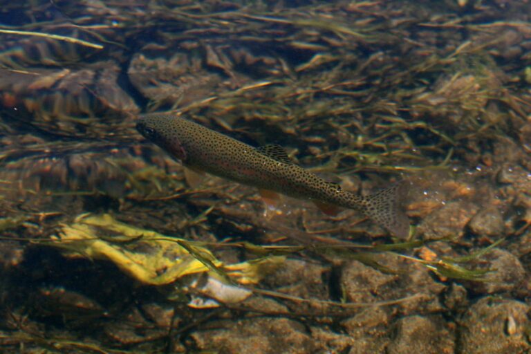
Photo: Alaska Region U.S. Fish & Wildlife Service, Public domain
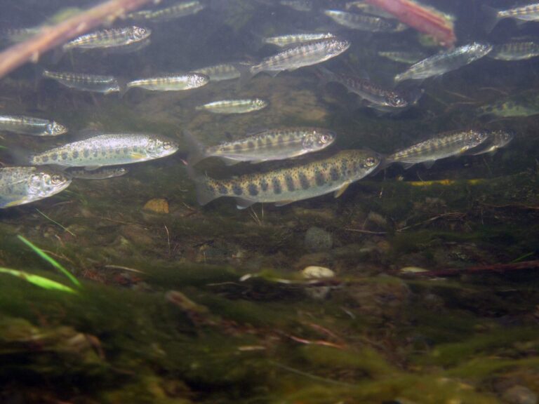
Photo: U.S. Fish and Wildlife Service Headquarters, CC BY 2.0
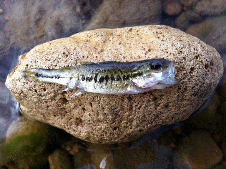
Photo: kmitschke, CC BY 2.0

Photo: Ed Bierman, CC BY 2.0
Settling the usual questions about water in Coos County
Where are the boat ramps in Coos County?
OSMB shows 57 open launches; 45 take trailers.
What is the biggest lake outline on the Coos County map?
Tenmile Lake, about 1,138 acres on its mapped outline.
What can an angler target in Coos County?
Rainbow trout lead the count of water pages within 40 miles, then cutthroat trout, chinook salmon and largemouth bass.
Is there a bait and tackle store in Coos County?
Bandon Bait heads 8 listings.
Do guide services list an address in Coos County?
3 guides and charters are on file.
Where is the Coos County seat?
Coquille holds the courthouse.
Which fishing license fits Coos County?
The 2026 fee page lists the yearly angling license at $50 resident, $138 nonresident. Keep a salmon or steelhead and you need the Combined Angling Tag too, $69 for residents. An Ocean Endorsement ($9) is now part of most ocean fishing trips in Oregon.
Which county centre sits nearest Coos County?
Closest by centre point: Douglas County, Curry County and Josephine County.
Which zone rows govern Coos County?
In the booklet, the bulk of Coos County waters sit in the ODFW Southwest Zone pages, since zones track watersheds.
What is the next weigh-in in Coos County?
5 events on file from organizer pages, none ahead yet.
Which exception rows reach Coos County?
The 2026 booklet prints 26 water exceptions reaching this county, starting with Coos River (Mainstem); the table above shows each.
Which tidal waters touch Coos County?
Coos Bay, Fourmile Creek estuary, Sunset Bay and Tenmile Creek estuary (Coos County); the coastal table above links the pages.
Which waters in Coos County does ODFW plant?
Yes: 6 waters on the ODFW schedule, such as Eel Lake, Saunders Lake and Powers Pond; releases are planned, not confirmed.
Choose your Coos County water
Lake pages list launches, species and limits.