Southern Oregon Subarea Fishing
ODFW ocean area from Oregon/California Border to Humbug Mt., OR.
 Pick for halibutPiscifun Alloy S inshore spinning reelCheck price at Piscifun
Photo of South Jetty: Bonnie Moreland, Public domain
The quick picture on Southern Oregon Subarea
ODFW draws the Southern Oregon Subarea between Oregon/California Border at 42.000 N and Humbug Mt., OR at 42.675 N; it is a band of ocean bounded by latitude lines, with no single point of its own. The formal name is Southern Oregon Subarea (OR/CA Border to Humbug Mountain).
2026 halibut status: May 1 through October 31, seven days per week, or until the quota is caught. For the bag, ODFW says: Daily bag limit: 2 Pacific halibut ODFW sets Chinook at Chinook (south of Cape Falcon) = 24 inches.
Tidewater on this stretch: Mussel Creek estuary, Euchre Creek estuary, Rogue River, Hunter Creek estuary, Myers Creek estuary and Pistol River. Port districts along it: Port of Brookings and Port of Gold Beach.
ODFW ocean salmon landmarks and regulatory boundaries and the Pacific halibut sport regulations page (updated October 30, 2026), read November 2, 2026.
 For the halibut herePiscifun NautiX saltwater spinning reel14% OFFSale $94.99
Regulatory lines inside Southern Oregon Subarea
| Landmark | Latitude as published | ODFW note |
|---|---|---|
| Humbug Mt., OR | 42°40'30" N. lat. | Standard fishery area boundary line and regulatory line (currently in use). Also current Southern boundary for Elk River state waters fishery. |
| Sisters Rocks, OR | 42°35'45" N. lat. | Not currently in use. |
| Mack Arch, OR | 42°13'40" N. lat. | Not currently in use. |
| House Rock, OR | 42°06'32" N. lat. | Not currently in use. |
| Twin Rocks (Brookings), OR | 42°05'36" N. lat. | Current Northern boundary for Chetco River state waters fishery. |
| Chetco Pt., OR | 42°02'35" N. lat. | Not currently in use. |
| Oregon/California Border | 42°00'00" N. lat. | Currently used as management line for commercial troll and recreational salmon. |
Lines run straight out to sea along the latitude shown.
ODFW ocean salmon landmarks and regulatory boundaries (myodfw.com), read November 2, 2026.
Halibut and salmon seasons in Southern Oregon Subarea
| Fishery and area | Season as printed | Limit as printed |
|---|---|---|
| ocean salmon, Cape Falcon to OR/CA Border | March 15 – August 31 (all salmon except coho; except as provided in the mark-selective coho season) | 2 salmon per day |
| ocean salmon, Cape Falcon to OR/CA Border | June 6 – August 18 (or quota) (mark-selective coho, open for all salmon) | 2 salmon per day, all retained coho must have a healed adipose fin-clip |
| pacific halibut, Southern Oregon Subarea (OR/CA Border to Humbug Mountain) | May 1 through October 31, seven days per week, or until the quota is caught | Daily bag limit: 2 Pacific halibut |
| pacific halibut, Statewide | Pacific halibut possession limit: 1 daily bag limit at sea, 3 daily bag limits on land. Pacific halibut annual limit: 6. | |
| bottomfish, Ocean (rockfish / cabezon / lingcod / etc.) | Open at all-depths year-round, no seasonal depth restriction. | General marine species (rockfish, cabezon, greenling, skates, etc.): 4-fish daily bag limit per angler beginning January 1, 2026. |
| bottomfish, Ocean (cabezon) | No retention January 1 through June 30; 1-fish sub-bag beginning July 1, 2026. | Cabezon: 1-fish daily sub-bag limit per angler as part of the general marine bag limit beginning July 1, 2026. Minimum length of 16 inches. |
| bottomfish, Ocean (lingcod) | Lingcod: 3-fish daily bag limit per angler beginning January 1, 2026 with a minimum length limit of 22 inches. Lingcod are not part of the general marine species bag limit. | |
| bottomfish, Ocean (sablefish) | Sablefish: 10-fish daily bag limit per angler. | |
| bottomfish, Ocean (flatfish) | Open at all depths year round. | Flatfish daily bag limit is 25 fish for species of sanddab, sole, flounder, etc. Does not include Pacific halibut. |
| bottomfish, Seaward of the 40-fathom regulatory line (offshore long-leader gear fishery) | The offshore long-leader gear fishery is open year-round outside (seaward) of the 40-fathom regulatory line. | The daily bag limit is 10 fish per angler. For canary rockfish, there is a daily sub-bag limit of two fish per angler beginning January 1, 2026. |
| crab, Ocean waters | Ocean waters are closed for crabbing Oct 16 – Nov 30 | Dungeness crab 12 (males only); 5-3/4" minimum size |
Ocean seasons change in season; ODFW posts closures on its regulation updates page before they take effect.
Ocean seasons as published by ODFW (myodfw.com, myodfw.com, dfw.state.or.us, eregulations.com), read November 2, 2026; ODFW changes ocean seasons in season.
Depth lines and gear rules in Southern Oregon Subarea
- 30-fathom regulatory lineDescending devices are mandatory; and must be used to release any rockfish outside of the 30-fathom regulatory line.
- 40-fathom regulatory lineThe offshore long-leader gear fishery is open year-round outside (seaward) of the 40-fathom regulatory line.
- Stonewall Bank Yelloweye Rockfish Conservation AreaThe Stonewall Bank Yelloweye Rockfish Conservation Area (approximately 15 miles from Newport) is CLOSED to the long-leader gear fishery, as well as the regular bottomfish fishery.
ODFW sport bottomfish seasons page (myodfw.com), read November 2, 2026; waypoints in the linked ODFW PDFs.
Keepers allowed out of Southern Oregon Subarea
| Species | Daily limit as printed | Season |
|---|---|---|
| General Marine Species: Rockfish ("sea bass", "snapper"), Greenling (“. | Bag limits are set after this book is printed. Check current regulations before fishing on the Sport Bottomfish Seasons page. Retention of yelloweye and quillback rockfishes is prohibited. | Waters are open 24 hours per day. The offshore long-leader fishery is limited to fishing seaward of the 40-fathom regulatory line. |
| Lingcod (including green-colored lingcod) | 3 fish. | Waters are open 24 hours per day. The offshore long-leader fishery is limited to fishing seaward of the 40-fathom regulatory line. |
| Sablefish (black cod) | 10 fish. | Waters are open 24 hours per day. The offshore long-leader fishery is limited to fishing seaward of the 40-fathom regulatory line. |
| Flatfish (flounders, soles, sanddabs, turbots, and halibuts except Pac. | 25 fish in aggregate. | Waters are open 24 hours per day. The offshore long-leader fishery is limited to fishing seaward of the 40-fathom regulatory line. |
| Surfperch (includes all marine perch species) | 15 fish in aggregate. | Waters open all year, 24 hours per day, unless noted under Management Designations for Marine Areas. |
| Herring, Anchovy, Sardine, Topsmelt, Jacksmelt, and true smelts | 25 pounds in aggregate. | Waters open all year, 24 hours per day, unless noted under Management Designations for Marine Areas. |
| Offshore Pelagic Species: Includes all tuna and mackerel species, swor. | 25 fish in aggregate. White shark, basking shark, mega-mouth shark, and oceanic whitetip shark are prohibited and must be immediately released unharmed. | Waters open all year, 24 hours per day, unless noted under Management Designations for Marine Areas. |
| Striped Bass and/or Hybrid Bass | No limit | Waters open all year, 24 hours per day, unless noted under Management Designations for Marine Areas. |
| Sturgeon | Catch-and-release only. | Open all year. |
| Salmon and Steelhead | Ocean salmon and steelhead seasons and restrictions are set each April by the Pacific Fishery Management Council. Regulations are published each May and are available from license agents. | Ocean salmon and steelhead seasons and restrictions are set each April by the Pacific Fishery Management Council. |
| Pacific Halibut | May be taken by angling with a single line, no more than 2 hooks; and by spear. Pacific halibut seasons are managed and enforced based on port of landing. | May be taken by angling with a single line, no more than 2 hooks; and by spear. Pacific halibut seasons are managed and enforced based on port of landing. |
| Razor Clams | First 15 dug (no sorting or releasing). | Waters open all year, 24 hours per day Exceptions: Razor clams are closed Jul 15 to Sep 30 north of Tillamook Head (Clatsop County) Shellfish harvests may be cl. |
An Oregon angling license ($50 resident, $138 nonresident for 2026) covers anglers 12 and older; ocean fishing from boats, beaches and jetties now also needs the Ocean Endorsement ($9 annual) unless you fish only for salmon or steelhead.
Limits as printed in the 2026 Oregon Sport Fishing Regulations (ODFW, eRegulations edition) (Marine Zone page), read November 2, 2026. Fees as printed on the ODFW license, tag and permit fee page of the 2026 Oregon Sport Fishing Regulations (ODFW, eRegulations edition) (fees page), read November 2, 2026.
Tidewater that opens onto Southern Oregon Subarea
- Euchre Creek estuaryCurry County, about 33 acres (PMEP)
- Whaleshead Creek estuaryCurry County, about 6 acres (PMEP)
Ports near Southern Oregon Subarea
- Port of BrookingsCurry County, Commercial Basin Pumpout (Basin II), Port of Brookings and Port of Brookings Harbor
- Port of Gold BeachCurry County, Port of Gold Beach, Port of Gold Beach Kayak Launch and Port of Gold Beach Marina
Pacific Marine and Estuarine Fish Habitat Partnership estuary extent (PMEP), read November 2, 2026. Port names from the OSMB launch layer and the Clean Marina list.
Tides and water level near Southern Oregon Subarea
- Brookings, Chetco CoveNOAA tide predictions
- Gold Beach, Rogue RiverNOAA tide predictions
NOAA CO-OPS stations and tide predictions, read November 2, 2026.
Around Southern Oregon Subarea: Oregon towns, tackle and more water
The neighbouring ocean areas
Stores that outfit trips to Southern Oregon Subarea
- Bi-Mart (Brookings)sporting goods store, Brookings, 19 miles
- Brookings Ocean Fishingbait and tackle shop, Brookings, 19 miles
- Tradewinds Sportfishingbait and tackle shop, Brookings, 19 miles
- The Boat Shopmarina, Brookings, 19 miles
- U Save Bait & Tacklebait and tackle shop, Brookings, 19 miles
- Chetco Marine Supplybait and tackle shop, Brookings, 19 miles
Guided trips on Southern Oregon Subarea
- Brookings Fishing Charterscharter, Brookings, (541) 813-1082
- Five Star Charterscharter, Gold Beach, (541) 247-0217
- Mark Van Hook Guide Svccharter, Gold Beach, (541) 247-6702
- Tidewinds Sportfishingcharter, Brookings
Oregon towns to sleep in near Southern Oregon Subarea
- Gold Beach8 miles
- Brookings17 miles
- Harbor20 miles
- Port Orford31 miles
County fishing pages tied to Southern Oregon Subarea
- Curry Countyseat: Gold Beach
A Piscifun kit worth stowing before you head to Southern Oregon Subarea


Piscifun and Amazon links are affiliate links; the site earns a commission on qualifying purchases.
What the Southern Oregon Subarea species look like
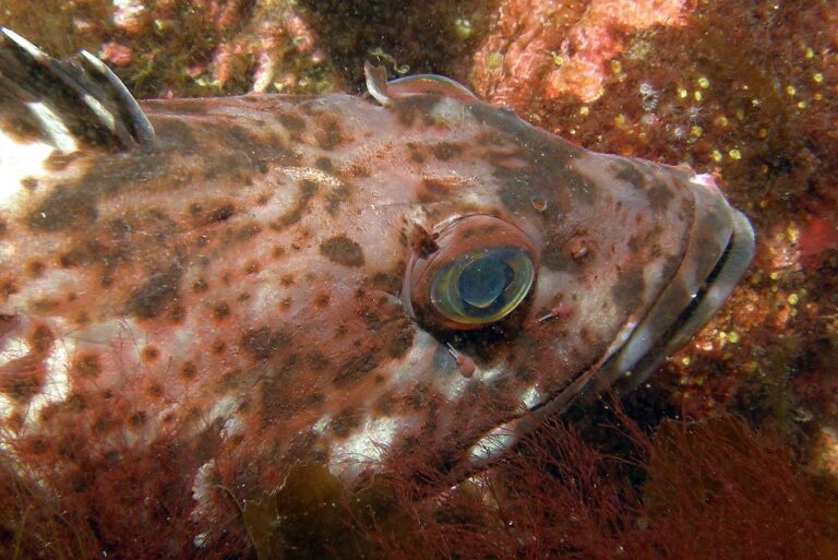
Photo: Ed Bierman, CC BY 2.0

Photo: USFWS Pacific Southwest Region, CC BY 2.0
Read these before you fish the Southern Oregon Subarea
Where does the Southern Oregon Subarea begin and end?
ODFW draws the Southern Oregon Subarea between Oregon/California Border at 42.000 N and Humbug Mt., OR at 42.675 N; it is a band of ocean bounded by latitude lines, with no single point of its own.
How many halibut may I keep in the Southern Oregon Subarea?
2026 halibut status: May 1 through October 31, seven days per week, or until the quota is caught. For the bag, ODFW says: Daily bag limit: 2 Pacific halibut
What salmon rules apply in the Southern Oregon Subarea?
ODFW sets Chinook at Chinook (south of Cape Falcon) = 24 inches.
Where can I launch for the Southern Oregon Subarea?
Port districts along it: Port of Brookings and Port of Gold Beach.
Can I fish everywhere in the Southern Oregon Subarea?
It holds no marine reserve.
Which license covers the Southern Oregon Subarea?
An Oregon angling license ($50 resident, $138 nonresident for 2026) covers anglers 12 and older; ocean fishing from boats, beaches and jetties now also needs the Ocean Endorsement ($9 annual) unless you fish only for salmon or steelhead.
Can bottomfish be kept in the Southern Oregon Subarea?
Descending devices are mandatory; and must be used to release any rockfish outside of the 30-fathom regulatory line. The offshore long-leader gear fishery is open year-round outside (seaward) of the 40-fathom regulatory line.
Do quotas affect the Southern Oregon Subarea?
Quotas can close any fishery early; check ODFW updates.
Check the bar and head into the Southern Oregon Subarea
Read the zone rows, then choose the launch closest to your water.