St. Louis River Fishing
St. Louis County, Carlton County and Lake County, St. Louis River State Water Trail.
 Pick for walleyePiscifun Viper X spinning reel50% OFFSale $39.99
Photo: James St. John, CC BY 2.0
Key facts on the St. Louis River
The DNR maps the St. Louis River as a river running through St. Louis County, Carlton County and Lake County. Roughly 202 miles of channel are mapped. Census points put Meadowlands closest, around 9 miles off. It is part of the St. Louis River State Water Trail.
North Shore tributary rules govern its lower reach. Live numbers come from 2 active gauges. Boaters and paddlers have 26 public accesses.
USGS readings on the St. Louis River
| USGS gauge | Latest reading | Time (ET) |
|---|---|---|
| St. Louis River Near Skibo, Mn | 300 cfs, 19.17 ft gage height | Nov 11 12:45 am |
| St. Louis River At Scanlon, Mn | 6,590 cfs, 6.41 ft gage height | Nov 11 12:30 am |
US Geological Survey provisional data, retrieved Nov 11, 2026 1:32 am ET. Provisional readings can be revised.
Landings on the St. Louis River
- Round Lake Access near Babbittcarry-in access, St. Louis County, river mile 200
- St. Louis River, Skibo Mill Access1 ramp, 10 trailer stalls, St. Louis County, river mile 192
- St. Louis River, Laird Creek Accesscarry-in access, St. Louis County, river mile 188.5
- St. Louis River, Hwy 110 Access1 ramp, St. Louis County, river mile 183.9
- St. Louis River, Hush Access1 ramp, 3 trailer stalls, St. Louis County, river mile 181.4
- St. Louis River, Co Rd 346 Access1 ramp, 6 trailer stalls, toilet, St. Louis County, river mile 175.2
- St. Louis River, County Rd 95 Accesscarry-in access, St. Louis County, river mile 144.5
- St. Louis River, Townline Rd Accesscarry-in access, 1 trailer stalls, St. Louis County, river mile 127.9
- St. Louis River, Forbes Accesscarry-in access, St. Louis County, river mile 125.9
- St. Louis River, Zim Access1 ramp, St. Louis County, river mile 113
- St. Louis River, Toivola Access1 ramp, 3 trailer stalls, St. Louis County, river mile 94.2
- St. Louis River, Co Rd 29 Access1 ramp, toilet, St. Louis County, river mile 78.5
- Floodwood River Access1 ramp, 10 trailer stalls, St. Louis County, river mile 72.5
- St. Louis River, Paupores Access1 ramp, 3 trailer stalls, St. Louis County, river mile 61.8
- St. Louis River, Brookston Access1 ramp, 4 trailer stalls, St. Louis County, river mile 53.8
- St. Louis River, Hwy 2 Access1 ramp, 4 trailer stalls, St. Louis County, river mile 51.3
- St. Louis River, Cloquet Access1 ramp, 6 trailer stalls, 1 dock, toilet, Carlton County, river mile 37.1
- Thomson Reservoir Accesscarry-in access, Carlton County, river mile 33.6
- St. Louis River, Fond du Lac Reservoir Accesscarry-in access, Carlton County, river mile 22.8
- St. Louis River, Fond du Lac Campground Access2 ramps, 6 trailer stalls, 1 dock, St. Louis County, river mile 21.7
- St. Louis River, Fond du Lac (W) Accesscarry-in access, St. Louis County, river mile 20.4
- St. Louis River, Fond du Lac (E) Access1 ramp, St. Louis County, river mile 19.9
- St. Louis River, Boyscout Access2 ramps, 10 trailer stalls, 1 dock, toilet, DNR alert posted, St. Louis County, river mile 16.8
- St. Louis River, Munger Landing, Clyde Avenue Access2 ramps, 24 trailer stalls, 1 dock, toilet, St. Louis County, river mile 12.1
- St. Louis River, Grassy Point Accesscarry-in access, St. Louis County, river mile 8.4
- St. Louis River, Rice's Point Access3 ramps, 20 trailer stalls, 3 docks, toilet, St. Louis County, river mile 5.3
Minnesota DNR Public Water Access Sites and Kittle route lines, USGS gauges.
Impoundments of the St. Louis River
- St. Louis River Estuary10,255 acres
Possession limits on the St. Louis River
The statewide inland rows are the rule set on the St. Louis River.
| Species | Limit | Season |
|---|---|---|
| Walleye and sauger | 6 combined total (only 1 walleye over 20" in possession) | May 9, 2026 – Feb. 28, 2027 |
| Northern pike (North-central Zone) | 10 (not more than 2 over 26", all from 22-26" must be immediately released) | May 9, 2026 – Feb. 28, 2027 |
| Northern pike (North-central Zone) | 10 (either 2 northern pike over 26" and none from 22 to 26" or 1 from 22 to 26" and 1 over 26") | Nov. 15, 2026 – Feb. 28, 2027 except where prohibited |
| Largemouth bass | Catch-and-release only | March 1 – May 22, 2026 |
| Largemouth bass | 6 combined total largemouth or smallmouth bass (when smallmouth season is open) | May 23, 2026 – Feb. 28, 2027 |
| Smallmouth bass | Catch-and-release only | March 1 – May 22, 2026 |
| Smallmouth bass | 6 combined total largemouth or smallmouth bass | May 23 – Sept. 13, 2026 |
| Smallmouth bass | Catch-and-release only | Sept. 14, 2026 – Feb. 28, 2027 |
| Crappie | 10 combined total | Continuous |
| Sunfish | 20 combined total | Continuous |
| Yellow perch | 20 daily, 40 in possession | Continuous |
| Muskellunge | 1 (minimum size 54") | June 6 – Nov. 30, 2026 |
| Channel catfish | 5 (only 1 over 24") | Continuous |
| Rock bass | 30 | Continuous |
| Cisco (tullibee) | 15 (over 7") | Continuous |
| Burbot (eelpout) | 4 | Continuous |
2026 Minnesota Fishing Regulations. All Minnesota limits.
 For the walleye herePiscifun AlumiX spinning reel46% OFFSale $64.99
What sits close to St. Louis River
Lakes one stop past St. Louis River
- Upstead Lake9 miles
- Little Finberg Lake10 miles
- Finberg Lake10 miles
- Janette Lake11 miles
Guide services on St. Louis River
- Nolan's Guide Servicefishing guide (season not stated), Duluth, (218) 203-0612
Towns to stay in near St. Louis River
- Meadowlands9 miles
- Hibbing16 miles
- Iron Junction18 miles
- Keewatin20 miles
More Minnesota streams near the St. Louis River
- Hellwig Creek19 miles
- Chicken Creek22 miles
- Sand Creek, Itasca County23 miles
- Us-kab-wan-ka River23 miles
St. Louis River and its counties
Reels and a weigh grip for the St. Louis River


Piscifun and Amazon links are affiliate links; the site earns a commission on qualifying purchases.
Catches common at St. Louis River
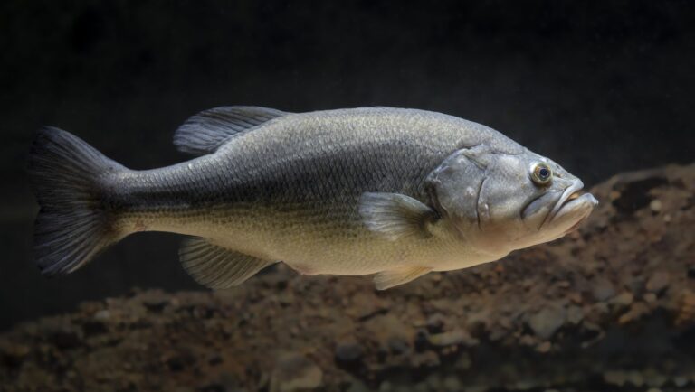
Photo: USFWS Mountain Prairie, Public domain

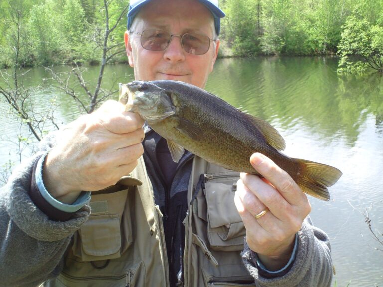
Photo: James Mann from Moncton, New Brunswick, Canada, CC BY 2.0

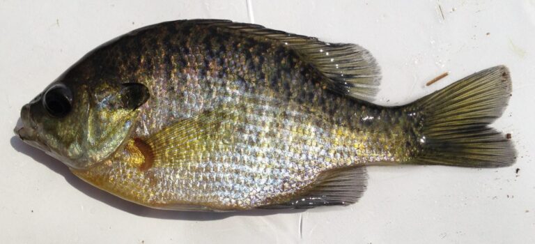
Photo: Fredlyfish4, CC BY-SA 3.0

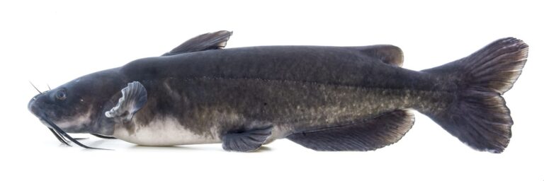
Photo: USFWS Mountain Prairie, Public domain

What people ask about the St. Louis River
Which Minnesota counties does the St. Louis River cross?
Counties: St. Louis County, Carlton County and Lake County.
How does the DNR list the St. Louis River for trout?
No trout designation applies to it.
Is the St. Louis River running high today?
2 USGS gauges post readings above.
Can I paddle a kayak on the St. Louis River?
26 public accesses on file, led by St. Louis River, Co Rd 346 Access.
What are the limits on the St. Louis River?
Fish Sanctuary, See Regulations for Closures
What does a license for the St. Louis River cost?
Minnesota residents 16 to 89 need an angling license ($25 for the year); nonresidents 16 and older pay $51.
Where can I buy minnows near the St. Louis River?
Buy bait before you leave; listed shops are past 25 miles.
Which city is nearest the St. Louis River?
Meadowlands is the closest Census city, around 9 miles.
Which fish bite in the St. Louis River?
DNR records name walleye, northern pike, yellow perch, black crappie, bluegill and largemouth bass.
Drive to the St. Louis River
Trout rules change by season; read them first.