Alabama Gulf waters Fishing
Alabama state waters of the Gulf of Mexico off Baldwin and Mobile counties.
 Pick for snapperPiscifun AlinoX 400 baitcaster with bait clicker25% OFFSale $149.99
Photo: blgrssby, CC BY-SA 2.0
The short version on Alabama Gulf waters for salt water
This page treats the Gulf off Baldwin and Mobile counties as one water: Alabama Gulf waters. Plan on near 12 miles to Gulf Shores.
There are 1 public ramp serving it. Visitors reach the water at 34 public access sites. It reaches 16 reef zones on the ADCNR reef maps. 8 water level stations from NOAA sit close by.
ADCNR Marine Resources Division state waters description; ADCNR coastal layers; Census 2023 places.
Where the license line falls near Alabama Gulf waters
Gulf reef fish: state waters extend 9 nautical miles from the beach (including Pelican/Sand Island); all other species: 3 nautical miles (MRD 2026 sheet).
Where a saltwater license starts, per ADCNR:
Beginning at the Mississippi state line, a Saltwater Fishing License is required in those waters south of a meandering line following U.S. Highway 90 eastwardly to its junction with State Highway 188; State Highway 188 eastwardly to its junction with State Highway 193; /State Highway 193 northwardly (all of Theodore Industrial Canal is in Marine Resources Div. jurisdiction) to its junction with State Highway 163; /State Highway 163 northwardly to its intersection with Interstate Highway 10; Interstate Highway 10 eastbound lane (exc. that portion of Interstate 10 which lies north of U.S. Highway 90 Battleship Parkway) to Interstate Highway 10’s intersection with U.S. 98; U.S. Highway …
Limits as printed by the ADCNR Marine Resources Division recreational size, creel and possession limits for state waters (MRD limits page), read November 1, 2026.
Reef zones off Alabama Gulf waters
The 16 zones below carry 2,277 reefs from the ADCNR master list.
| Zone | Class | Deployments | Acres | Reefs listed |
|---|---|---|---|---|
| Alabama Charter Fishing Association | Nearshore | Reserved for AMRD Reef Deployments | 6,388 | 100 |
| Alabama Gulf Coast Reef and Restoration Foundation | Nearshore | Reserved for AMRD Reef Deployments | 17,919 | 106 |
| Alabama Wildlife Federation | Nearshore | Reserved for AMRD Reef Deployments | 4,778 | 89 |
| C.M. Blankenship | Offshore | Reserved for AMRD Reef Deployments | 40,193 | 128 |
| Coastal Conservation Association of Alabama | Nearshore | Reserved for AMRD Reef Deployments | 9,402 | 120 |
| Don Kelley | Offshore | Available for Public Reef Deployments | 155,273 | 183 |
| Dr. Robert (Bob) Shipp | Offshore | Available for Public Reef Deployments | 233,217 | 424 |
| Dr. Sean Powers | Nearshore | Reserved for AMRD Reef Deployments | 5,351 | 84 |
| Dr. Stephen Szedlmayer | Nearshore | Juvenile – Reserved for AMRD Reef Deployments | 4,030 | 37 |
| Hugh Swingle | Offshore | Available for Public Reef Deployments | 55,808 | 159 |
| National Fish and Wildlife Foundation | Nearshore | Juvenile – Reserved for AMRD Reef Deployments | 1,872 | 33 |
| R.V. Minton East | Nearshore | Reserved for AMRD Reef Deployments | 325 | 46 |
| R.V. Minton West | Nearshore | Reserved for AMRD Reef Deployments | 727 | 92 |
| Tatum Winn North | Offshore | Available for Public Reef Deployments | 170,233 | 347 |
| Tatum Winn South | Offshore | Available for Public Reef Deployments | 45,686 | 113 |
| Trolling Corridor | Corridor | 216 |
ADCNR Marine Resources Division public reef master list 2025 (KMZ; reef layer), read November 1, 2026. Coordinates are for information only, not for navigation.
Reef fish seasons for Alabama Gulf waters
| Season | Opens | Closes | Rule as printed |
|---|---|---|---|
| Red snapper (private anglers, shore, state-licensed charter) | May 22, 2026 | not set (quota) | Open 7 days a week until the end of the year or when Alabama's quota has been met; 2 per person per day, 16 inches TL minimum; 2026 private angler quota 664,552 pounds; report through Snapper Check. |
| Red snapper (federally permitted for-hire vessels) | June 1, 2026 | October 26, 2026 | Opens 12:01 a.m. local time June 1, 2026, closes 12:01 a.m. local time October 26, 2026 (147 days in federal waters). |
Saltwater anglers 16 and older carry an Alabama saltwater license ($30.90 resident, $66.80 nonresident for 2026-27), plus the $10 Gulf Reef Fish Endorsement to keep reef fish such as red snapper.
Limits as printed by the ADCNR Marine Resources Division recreational size, creel and possession limits for state waters (MRD limits page), read November 1, 2026.
 For the snapper herePiscifun Saltflow offshore rod25% OFFSale $299.99
Coastal ramps that reach Alabama Gulf waters
- Matthews Lower Bryant Landingramps: 2, docks: 2, 75 trailer parking/100 …, 8900 Lower Bryant Landing, Stockton, AL 36570
Beach and bay access by Alabama Gulf waters
- Anderson StreetPonce de Leon Court at Anderson Street, Gulf Shores, Gulf Frontal
- Barrineau Park RoadBarrineau Park Road at Alabama/Florida border, Robertsdale, Gulf Frontal
- Beach Boulevard Access 1Beach Boulevard between Our Road and Cortez Street, Gulf Shores, Gulf Frontal
- Beach Boulevard Access 2Beach Boulevard east of Cortez Street, Gulf Shores, Gulf Frontal
- Beach Boulevard Access 3Beach Boulevard east of Cortez Street, Gulf Shores, Gulf Frontal
- Beacon LanePonce de Leon Court at Beacon Lane, Gulf Shores, Gulf Frontal
- Bernard Court EastPonce de Leon Court at Bernard Court East, Gulf Shores, Gulf Frontal
- Bernard Court WestSouth end of Bernard Court West, Fort Morgan, Gulf Frontal
- Bon Secour National Wildlife Refuge BeachFort Morgan Road (AL-180), 19.8 miles west of Gulf …, Fort Morgan, Gulf Frontal
- Bon Secour National Wildlife Refuge Beach Mobile Street Beach AccessSouth end of Mobile Street off Fort Morgan Road (AL-180), Gulf Shores, Gulf Frontal
- Bon Secour National Wildlife Refuge Gator Lake Trail (Mobile Street)Mobile Street, 1 mile south of Fort Morgan road (AL-180), Gulf Shores, Gulf Frontal
- Bon Secour National Wildlife Refuge Veterans Road BeachSouth end of Veterans Road, Gulf Shores, Gulf Frontal
- Boykin Court NorthNorth end of Boykin Court, Fort Morgan, Gulf Frontal
- Boykin Court SouthSouth end of Boykin Court South, Fort Morgan, Gulf Frontal
- Buchanan Court EastSouth end of Buchanan Court East, Fort Morgan, Gulf Frontal
- Buchanan Court WestSouth end of Buchanan Court West, Fort Morgan, Gulf Frontal
- Chickasabogue Park760 Aldock Road, Eight Mile, Gulf Frontal
- Cortez StreetBeach Boulevard at Cortez Street, Gulf Shores, Gulf Frontal
- Ebb Tide LanePonce de Leon Court at Ebb Tide Lane, Gulf Shores, Gulf Frontal
- Gulf State Park Beach PavilionPerdido Beach Boulevard (AL-182), 2.8 miles east of AL-59, Gulf Shores, Gulf Frontal
- Gulf State Park Boat Launch and Nature Center (Middle Lake Park)Campground Road off State Park Road 2, Gulf Shores, Gulf Frontal
- Gulf State Park Lake Shelby Recreation AreaState Park Road just north of Highway 182, Gulf Shores, Gulf Frontal
- Gulf State Park PierEast Beach Boulevard (AL-182), 1.4 miles east of AL-59, Gulf Shores, Gulf Frontal
- Gulf State Park State Park Road 2 Beach AccessPerdido Beach Boulevard (AL-182) at State Park Road 2, Gulf Shores, Gulf Frontal
More ADCNR ramps close to Alabama Gulf waters
- The Pines Boat Launch on Bon Secour BayBon Secour Bay, 5 miles northwest
- Lagoon Park Launch on Oyster BayOyster Bay, 10 miles northeast
- Ft. Morgan Boat Ramp on Pass DruryPass Drury, 11 miles northwest
- Canal Park on Oyster BayOyster Bay, 12 miles northeast
- View Point Launch on Weeks BayWeeks Bay, 14 miles north
- Little Billygoat Hole Ramp on Pass DruryPass Drury, 15 miles northwest
ADCNR coastal boating access pages and public access site layer (ADCNR GIS), read November 1, 2026; ADCNR WFF public boat ramp list (list), read November 1, 2026.
Walk-out fishing on Alabama Gulf waters
Places to fish on foot near Alabama Gulf waters
- The Pines Fishing Pier and Boat Launch on Bon Secour Bayfishing pier, salt water, 5 miles
- Little Lagoon Pierfishing pier, salt water, 9 miles
- Fort Morgan Fishing Pier and Boat Ramp on Pass Druryfishing pier, salt water, 11 miles
- Gulf State Park Pier on Oyster Bayfishing pier, salt water, 12 miles
- Magnolia Springs Public Pierfishing pier, salt water, 16 miles
ADCNR coastal boating access pages and public access site layer (ADCNR GIS), read November 1, 2026.
Watching the tide on Alabama Gulf waters
NOAA CO-OPS water level, preliminary reading at retrieval (November 1, 2026); station page for live data.
- Mobile Point (Fort Morgan)tide predictions, 11 miles
- Bon Secour, Bon Secour Rivertide predictions, 11 miles
- Gulf State Park Piertide predictions, 12 miles
- Gulf Shores, ICWWtide predictions, 12 miles
Predictions for Alabama Gulf waters are a guide; wind and runoff set the real level.
NOAA CO-OPS water level and tide prediction stations; read November 1, 2026.
Channels and passes close to Alabama Gulf waters
- Choctaw Pass36 miles north
- Pass Picada36 miles north
- Pinto Pass37 miles north
- Sardine Pass35 miles north
- The Cut12 miles west
- Little Pass Margaret18 miles northwest
- Pass Berron23 miles northwest
- Pass Chateaugue17 miles northwest
- Duck Skiff Pass35 miles north
- Perdido Pass19 miles northeast
- Petit Bois Pass28 miles west
- Pass aux Herons19 miles northwest
- Grants Pass19 miles northwest
- Pass Drury16 miles northwest
USGS GNIS domestic names (feature class and primary point), read November 1, 2026.
Harbors that serve Alabama Gulf waters
- Dauphin IslandMobile County, 17 miles
- Bayou La BatreMobile County, 29 miles
- CodenMobile County, 27 miles
- Gulf ShoresBaldwin County, 10 miles
- Orange BeachBaldwin County, 19 miles
- Fort MorganBaldwin County, 11 miles
- FairhopeBaldwin County, 25 miles
- DaphneBaldwin County, 30 miles
- MobileMobile County, 38 miles
- TheodoreMobile County, 33 miles
USGS GNIS domestic names (feature class and primary point), read November 1, 2026.
Inshore creel and size rules at Alabama Gulf waters
| Species | Daily limit and size | Waters |
|---|---|---|
| Cobia (Ling) | 1 per person, not to exceed 2 per vessel; 36" min. FL | state waters |
| King Mackerel | 3 per person; 24" min. FL | state waters |
| Gag Grouper | 2 per person; 24" min TL | state waters; see seasons |
| Red Grouper | 2 per person; 20" min TL | state waters; see seasons |
| Scamp | 4 per person; 16" min TL | state waters; see seasons |
| Greater Amberjack | 1 per person; 34" min FL | state waters; see seasons |
| Gray Triggerfish | 1 per person; 15" min FL | state waters; see seasons |
| Red Snapper | 2 per person in state and federal waters; 16" min. TL | state waters; see seasons |
| Vermilion Snapper (beeliner) | 10 per person; 10" min. TL | state waters; see seasons |
| Lane Snapper | Reef Fish aggregate; 10" min. TL | state waters; see seasons |
| Gray Snapper (mangrove, black) | 10 per person; 12" min. TL | state waters; see seasons |
Reef fish rows lead for Alabama Gulf waters; the saltwater page lists every MRD row.
Saltwater anglers 16 and older carry an Alabama saltwater license ($30.90 resident, $66.80 nonresident for 2026-27), plus the $10 Gulf Reef Fish Endorsement to keep reef fish such as red snapper.
Limits as printed by the ADCNR Marine Resources Division recreational size, creel and possession limits for state waters (MRD limits page), read November 1, 2026.
Saltwater tournaments at Alabama Gulf waters
Open the tournament page for Alabama Gulf waters.
Where Alabama Gulf waters ranks along the Alabama coast
By access count, Bon Secour Bay tops the table at 30.
| Water | Distance | Type | Ramps | Piers and banks | Access sites | Inshore reefs |
|---|---|---|---|---|---|---|
| Alabama Gulf waters | stretch of the Gulf | 1 | 0 | 34 | 0 | |
| Little Lagoon | 8 miles northeast | coastal lagoon | 0 | 1 | 6 | 6 |
| Bon Secour Bay | 10 miles north | bay | 4 | 2 | 26 | 19 |
| Bon Secour River | 10 miles northeast | tidal river | 0 | 0 | 0 | 7 |
| Oyster Bay | 10 miles northeast | bay | 2 | 1 | 14 | 7 |
| Magnolia River | 15 miles north | tidal river | 0 | 1 | 5 | 13 |
ADCNR ramp, access and reef layers, USGS GNIS; read November 1, 2026.
Inland Alabama options behind Alabama Gulf waters
Neighbouring Alabama lakes to Alabama Gulf waters
- Shelby Lakes13 miles
- Big Creek Lake50 miles
Alabama rivers within easy reach of Alabama Gulf waters
- Fowl River25 miles
Tackle counters that serve Alabama Gulf waters
- Fort Morgan Marina Restaurantmarina, Gulf Shores, 10 miles
- Alabama Girl Fishingbait and tackle shop, Gulf Shores, 10 miles
- Dolphin Cove Marinamarina, Gulf Shores, 11 miles
- Legendary Marina & Yacht Club Gulf Shoresmarina, Gulf Shores, 12 miles
- Beach Bum Outdoorsbait and tackle shop, Gulf Shores, 12 miles
- Frith's Bait & Supplybait and tackle shop, Gulf Shores, 12 miles
Paid trips on Alabama Gulf waters from our list
- AAA Charterscharter, Foley, (251) 948-2525
- Action Charter Service Inccharter, Orange Beach, (888) 558-3889
- Alabama Coastal Charterscharter, Gulf Shores, (251) 943-6017
- Alabama Deep Sea Fishingcharter, Lillian, (251) 981-3733
- Alabama Fun Fishing LLCcharter, Orange Beach, (251) 550-5002
- Alabama Inshore Charterscharter, Fairhope, (251) 421-6797
- Allen Stella Marina Charterscharter, Foley, (251) 981-4510
- Annan Brian Capt Gulf Rebelcharter, Orange Beach, (251) 981-3119
Alabama towns within a drive of Alabama Gulf waters
- Gulf Shores12 miles
- Orange Beach17 miles
- Foley19 miles
- Dauphin Island20 miles
Which county pages list Alabama Gulf waters
- Baldwin Countyseat: Bay Minette
- Mobile Countyseat: Mobile
Piscifun rods and reels lined up for Alabama Gulf waters


Piscifun and Amazon links are affiliate links; the site earns a commission on qualifying purchases.
Telling the Alabama Gulf waters fish apart, by photo
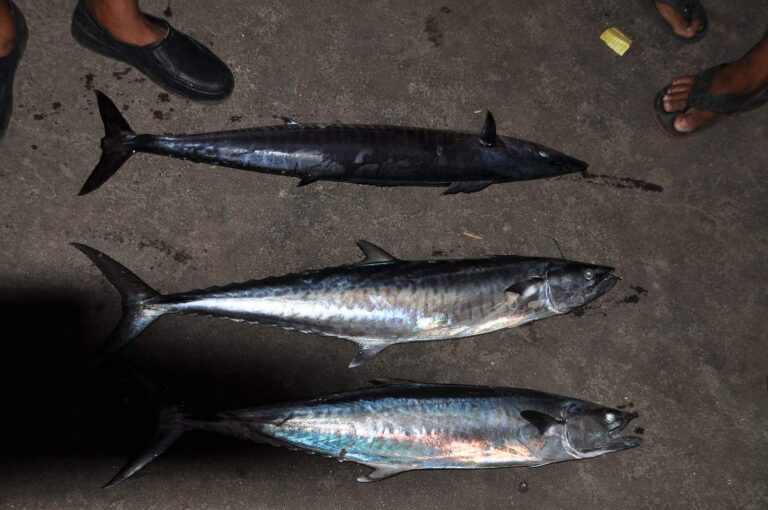
Photo: shankar s, CC BY 2.0
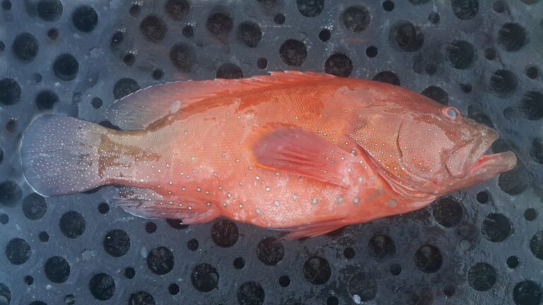
Photo: Challiyan, CC BY-SA 3.0

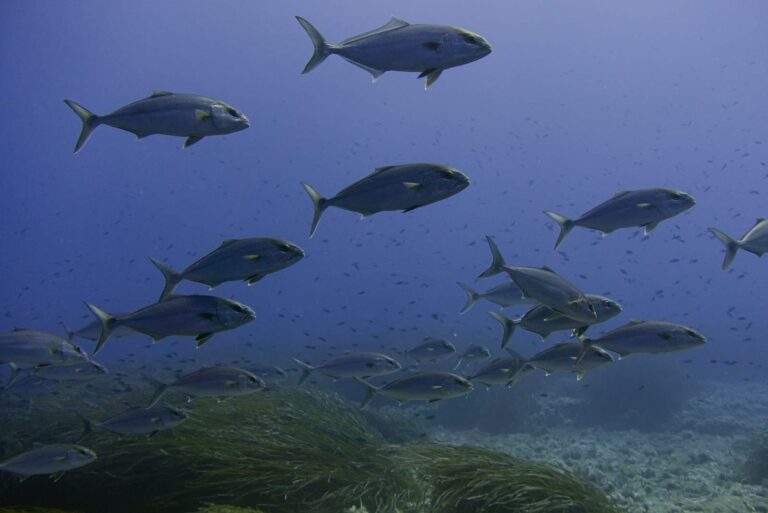
Photo: Enrico Strocchi, CC BY-SA 2.0
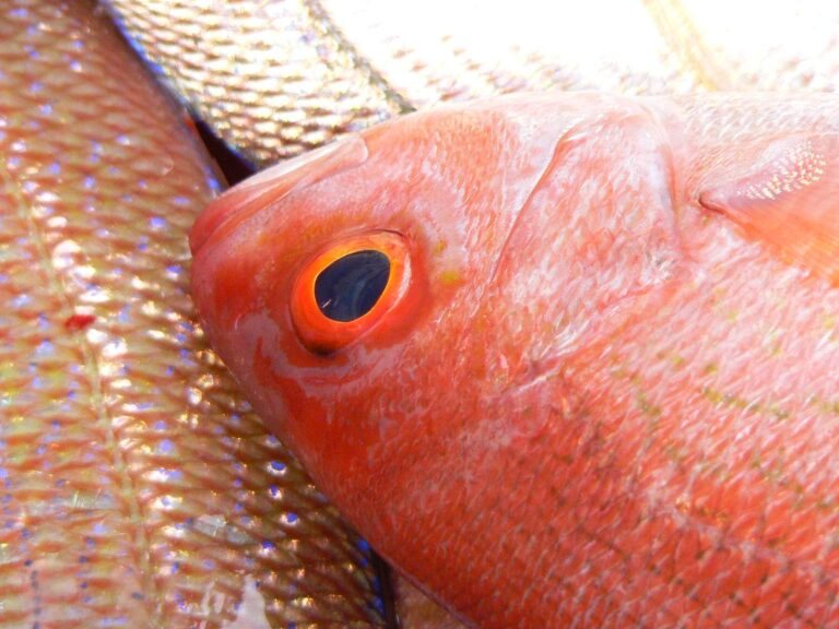
Photo: Pen Waggener, CC BY 2.0
Alabama Gulf waters: answers for an Alabama fishing day
Where is Alabama Gulf waters?
Its named point falls in Baldwin and Mobile counties, about 12 miles from Gulf Shores.
Which license covers Alabama Gulf waters?
Saltwater anglers 16 and older carry an Alabama saltwater license ($30.90 resident, $66.80 nonresident for 2026-27), plus the $10 Gulf Reef Fish Endorsement to keep reef fish such as red snapper.
How many ADCNR ramps reach Alabama Gulf waters?
Matthews Lower Bryant Landing is the lone listing.
What is the king mackerel limit in Alabama Gulf waters?
Red Snapper: 2 per person in state and federal waters; 16" min. TL.
Where are tide predictions for Alabama Gulf waters?
Dauphin Island is the nearest NOAA water level station; its dated reading is in the tide band.
Can I wade Alabama Gulf waters?
Nearest on file: The Pines Fishing Pier and Boat Launch on Bon Secour Bay, 5 miles.
Which bait counter on our Alabama list serves Alabama Gulf waters?
Closest on our list: Fort Morgan Marina Restaurant, about 10 miles away,.
Has ADCNR built reefs around Alabama Gulf waters?
ADCNR maps 16 zones with 2,277 reefs.
Which Gulf passes lie near Alabama Gulf waters?
Nearby passes: Choctaw Pass, Pass Picada, Pinto Pass, Sardine Pass and The Cut.
When is red snapper season in Alabama Gulf waters?
Red snapper (private anglers, shore, state-licensed charter): opens May 22, 2026, closes not set (quota). Open 7 days a week until the end of the year or when Alabama's quota has been met; 2 per person per day, 16 inches TL minimum; 2026 private angler quota 664,552 pounds; report thro
Plan a Gulf Coast run to Alabama Gulf waters
Get the Alabama saltwater license squared away online ahead of launch day.