Fishing in Pacific County, Washington
County seat: South Bend. Population 23,365.
- 2lake pages
- 10launches
- 15river pages
 Pick for troutPiscifun Carbon X ultralight spinning reel28% OFFSale $57.99
Photo of Willapa Bay: Sam Beebe, CC BY 2.0
Lakes, rivers and ramps of Pacific County in one read
South Bend houses the Pacific County courthouse, serving 23,365 people as of the 2020 count. Trout planted here show up in the WDFW report as WDFW Region 6 releases.
The paged lakes number 2, spread over 178 acres, with Loomis Lake on top. Its salt water runs into Ilwaco, Willapa Bay, Columbia River mouth (Buoy 10) and Outer coast (Pacific Ocean). Among the county streams, WDFW shows anadromous runs in Grays River, Naselle River, North River and Willapa River. Launching comes down to 10 boat launches, run by 7 WDFW, 2 State Parks and 1 other agencies. From shore, the WDFW facilities layer lists 5 shore or access sites here, 1 of them piers or platforms.
Census 2020 population; WDFW Fish Washington lake layers, WDFW facilities and State Parks launch layers (WDFW GIS); WDFW marine areas; retrieved October 31, 2026.
 For the trout herePiscifun Carbon XT ultralight spinning reel25% OFFSale $59.99
Lake points and ramps of Pacific County, mapped together
WDFW and State Parks launch layers, WDFW facilities, WDFW lake points, NHD river midpoints and WDFW marine area points. Checked November 2026.
Still water WDFW maps within Pacific County
| Lake | Acres | Launches | WDFW program | Fish WDFW maps |
|---|---|---|---|---|
| Loomis Lake | 150 | 1 | Mixed species – Trout emphasis | rainbow trout, largemouth bass, yellow perch |
| Black Lake (Pacific County) | 28 | 0 | Mixed species – Trout emphasis | rainbow trout, largemouth bass |
Measured from South Bend, these lake guides past the Pacific County line are the shortest drives.
| Lake | From South Bend | Acres | Launches | WDFW program | Fish WDFW maps |
|---|---|---|---|---|---|
| Quigg Lake | 21 miles north | 23 | 0 | Mixed species – Trout emphasis | coastal cutthroat trout |
| Lake Aberdeen | 22 miles north | 52 | 0 | Mixed species – Trout emphasis | rainbow trout, coastal cutthroat trout, largemouth bass |
| Sylvia Lake | 25 miles northeast | 28 | 1 | Mixed species – Trout emphasis | rainbow trout, coastal cutthroat trout, largemouth bass |
| Duck Lake | 26 miles northwest | 249 | 0 | Mixed species – Trout emphasis | rainbow trout, largemouth bass, yellow perch |
| Vance Creek Pond 2 (Inez Lake) | 29 miles northeast | 16 | 0 | Mixed species – Trout emphasis | rainbow trout, largemouth bass, yellow perch |
| Vance Creek Pond 1 (Bowers Lake) | 29 miles northeast | 13 | 0 | Mixed species – Trout emphasis | rainbow trout, largemouth bass, yellow perch |
WDFW Fish Washington lowland and high lake layers (surface acres as published, management emphasis, mapped species); WDFW publishes no lake depths in these layers. Retrieved October 31, 2026.
Sound and ocean water off Pacific County
Launches, piers and bays put 4 marine waters in touch with Pacific County.
| Water | Kind | Launches | Piers and shore | Marine area |
|---|---|---|---|---|
| Ilwaco (Marine Area 1) | WDFW marine area | 2 | 0 | 1 |
| Willapa Bay (Marine Area 2-1) | WDFW marine area | 3 | 0 | 2-1 |
| Columbia River mouth (Buoy 10) | regional marine water | 2 | 0 | 1 |
| Outer coast (Pacific Ocean) | regional marine water | 2 | 0 | 1, 2, 3, 4 |
CO-OPS stations serving Pacific County
NOAA CO-OPS water level, preliminary reading at retrieval (October 31, 2026); station page for live data.
WDFW Recreational Marine Areas (WAC 220-300-160 boundaries), WDFW and State Parks marine launches, WDFW piers and USGS GNIS bay names; retrieved October 31, 2026.
What the WDFW layers say swims near Pacific County
Around South Bend, to 50 miles, largemouth bass turns up on more water pages than the rest.
Species mapped in the WDFW Fish Washington layers, WDFW state records and the 2026 WDFW trout plants, counted per water page within 50 miles; not a survey.
Lakes in Pacific County that live on this list only
WDFW and NHD maps hold 5 more named lakes in Pacific County, shown with acreage and program.
| Water | Acres | WDFW program | Nearest town |
|---|---|---|---|
| Island Lake (Pacific County) | 53 | NHD-mapped lake | Long Beach |
| Western Lake (Radar Hill Ponds) | 4 | Trout emphasis | Ocean Park |
| Snag Lake (Radar Hill Ponds) | 3 | Trout emphasis | Ocean Park |
| South Bend Mill Pond | 2 | Mixed species – Trout emphasis | South Bend |
| Cases Pond | 2 | Trout emphasis | Raymond |
WDFW Fish Washington lowland and high lake layers and USGS NHD lake outlines, retrieved October 31, 2026.
Moving water with pages in Pacific County
- Grays RiverSWIFD lists chinook, chum and coho, 1 mapped launch, 3 WDFW shore or access sites, 31 mi in Washington
- Naselle RiverSWIFD lists chinook, chum and coho, 2 mapped launches, 1 USGS gauge, 30 mi in Washington
- North RiverSWIFD lists chinook, chum and coho, 60 mi in Washington
- Willapa RiverSWIFD lists chinook, chum and coho, 1 USGS gauge, 48 mi in Washington
- South Fork Willapa RiverSWIFD lists chinook, chum and coho, 24 mi in Washington
- North Nemah RiverSWIFD lists chinook, chum and coho, 14 mi in Washington
- South Fork Grays RiverSWIFD lists chinook, coho and steelhead trout, 11 mi in Washington
- South Naselle RiverSWIFD lists chinook, chum and coho, 10 mi in Washington
- Middle Nemah RiverSWIFD lists chinook, chum and coho, 10 mi in Washington
- West Fork Grays RiverSWIFD lists chinook, chum and coho, 9 mi in Washington
- South Nemah RiverSWIFD lists chinook, chum and coho, 9 mi in Washington
- Chinook RiverSWIFD lists chinook, chum and coho, 7 mi in Washington
- East Fork Grays RiverSWIFD lists chinook, coho and steelhead trout, 7 mi in Washington
- Bear RiverSWIFD lists chinook, chum and coho, 3 mi in Washington
- Niawiakum RiverSWIFD lists coho and steelhead trout, 2 mi in Washington
Lesser streams of Pacific County (15)
- Bone RiverSWIFD lists coho, 1 mi in Washington
- Canon RiverSWIFD lists chinook, chum and coho, 8 mi in Washington
- Cedar River6 mi in Washington
- East Branch Elk RiverSWIFD lists steelhead trout, 4 mi in Washington
- Fall RiverSWIFD lists chinook, chum and coho, 17 mi in Washington
- Little East Fork Naselle River2 mi in Washington
- Middle Branch Elk RiverSWIFD lists coho and steelhead trout, 3 mi in Washington
- Middle Fork Palix RiverSWIFD lists coho, 1 mi in Washington
- North Fork Cedar River2 mi in Washington
- North Fork Palix RiverSWIFD lists chinook, chum and coho, 6 mi in Washington
- North Naselle RiverSWIFD lists chinook, chum and coho, 11 mi in Washington
- South Fork Palix RiverSWIFD lists chinook, coho and steelhead trout, 5 mi in Washington
- Wallacut River5 mi in Washington
- Ward Creek1 mapped launch, 11 mi in Washington
- West Branch Elk RiverSWIFD lists coho and steelhead trout, 5 mi in Washington
Streamflow posted by Pacific County gauges
| USGS gauge | Latest reading | Time (ET) |
|---|---|---|
| Naselle River Near Naselle, Wa | 459 cfs, 5.76 ft gage height | Nov 11 5:30 pm |
| Willapa River Near Willapa, Wa | 421 cfs, 4.88 ft gage height | Nov 11 5:45 pm |
US Geological Survey provisional data, retrieved Nov 11, 2026 6:33 pm ET. Provisional readings can be revised.
USGS NHD flowlines and Washington lengths, WDFW SWIFD salmon and steelhead distribution, WDFW and State Parks launches, USGS gauges; retrieved October 31, 2026.
WDFW hatchery trucks that stopped in Pacific County
The 2026 plant log for Pacific County reads 38 releases and 25,429 fish, covering 6 waters.
- Western LakeRainbow, 200 fish at 0.83 per pound, September 23, 2026, Forks Creek Hatchery
- Snag LakeRainbow, 200 fish at 0.83 per pound, September 23, 2026, Forks Creek Hatchery
- Western LakeRainbow, 1,000 fish at 2 per pound, May 18, 2026, Nemah Hatchery
- Snag LakeRainbow, 300 fish at 2 per pound, May 18, 2026, Nemah Hatchery
- Cases PondRainbow, 468 fish at 1.6 per pound, May 18, 2026, Forks Creek Hatchery
- Black Lake (Pacific County)Rainbow, 1,000 fish at 2 per pound, May 18, 2026, Nemah Hatchery
- Loomis LakeRainbow, 1,000 fish at 2 per pound, May 15, 2026, Nemah Hatchery
- Loomis LakeRainbow, 60 fish at 0.33 per pound, May 15, 2026, Nemah Hatchery
- Western LakeRainbow, 1,000 fish at 2 per pound, May 11, 2026, Nemah Hatchery
- Snag LakeRainbow, 1,000 fish at 2 per pound, May 11, 2026, Nemah Hatchery
- Mill PondRainbow, 200 fish at 2 per pound, May 11, 2026, Nemah Hatchery
- Black Lake (Pacific County)Rainbow, 2,000 fish at 2 per pound, May 11, 2026, Nemah Hatchery
WDFW Trout Plants report (rows January 2 to October 27, 2026), read October 31, 2026; newest plants first.
Ramps, piers and access points of Pacific County
- Cape Disappointment launch on Columbia River mouth (Buoy 10)Columbia River mouth (Buoy 10), State Parks, Discover Pass
- Loomis Lake boat launchLoomis Lake, WDFW, 1 ramp, gravel surface, Discover Pass
- Old Naselle Bridge boat launchNaselle River, WDFW, 1 ramp, concrete surface, Discover Pass
- Palix River boat launchMarine Area 2-1, WDFW, 1 ramp, concrete surface, Discover Pass
- Smith Creek boat launchMarine Area 2-1, WDFW, 1 ramp, concrete surface, Discover Pass
- South Bend boat launch on South Bend Mill PondSouth Bend Mill Pond, City of South Bend, 1 ramp, concrete surface
- Ward Creek boat launchWard Creek, WDFW, 1 ramp, concrete surface, Discover Pass
- Cape Disappointment launch on Columbia River mouth (Buoy 10)Columbia River mouth (Buoy 10), State Parks, Discover Pass
- Highway boat launch on Naselle RiverNaselle River, WDFW, 3 hand launches, Discover Pass
- Island Lake boat launch (south)Island Lake, WDFW, 1 hand launch, Discover Pass
The pass flag is set at 9 launches: hang a Discover Pass from the mirror there.
Fishing on foot in Pacific County (5)
- Black Lake pacific countyshore fishing site, Public dock, shore fishing
- South Fork Willapawater access area
- Bear Riveraccess point (no launch)
- Black Lake pacific countyshore fishing site, shore fishing
- Loomis Lake shore accessshore fishing site, Limited shore fishing at boat launch
WDFW Facilities layer (boat launches, piers, shore sites) and the State Parks boat launch layer; retrieved October 31, 2026. Lanes and per-launch fees are not published in these layers.
The 2026-27 pamphlet rows covering Pacific County
Start with the statewide table for Pacific County; any Special Rule listed after it overrides those rows. WDFW sells the 2026-27 Freshwater license for $39.95 to Washington residents and $115.85 to visitors 16 and up. Marine areas fall under the Saltwater license: $40.71 resident, $81.70 nonresident in 2026-27. Keep a catch record card on you for salmon, steelhead, sturgeon or halibut; WDFW issues it with the license.
| Species | Limit | Season |
|---|---|---|
| Largemouth Bass | No min. size in lakes, ponds, and reservoirs. Only largemouth bass less than 12" may be retained, except 1 over 17" may be retained. Daily limit 5. | Lakes, ponds, and reservoirs: year-round; rivers, streams and beaver ponds: Sat. before Memorial Day through Oct. 31 |
| Largemouth Bass | No size restriction/daily limit in rivers, streams, and beaver ponds. | Lakes, ponds, and reservoirs: year-round; rivers, streams and beaver ponds: Sat. before Memorial Day through Oct. 31 |
| Smallmouth Bass | No min. size in lakes, ponds, and reservoirs. Only 1 smallmouth bass over 14" may be retained. Daily limit 10. | Lakes, ponds, and reservoirs: year-round; rivers, streams and beaver ponds: Sat. before Memorial Day through Oct. 31 |
| Smallmouth Bass | No size restriction/daily limit in rivers, streams, and beaver ponds. | Lakes, ponds, and reservoirs: year-round; rivers, streams and beaver ponds: Sat. before Memorial Day through Oct. 31 |
| Walleye | Min. size 12" in lakes, ponds, and reservoirs. Daily limit 8. Only 1 over 22" may be retained. May be caught, retained, and released alive from a livewell until daily limit is in possession. | Lakes, ponds, and reservoirs: year-round; rivers, streams and beaver ponds: Sat. before Memorial Day through Oct. 31 |
| Walleye | No size restriction/daily limit in rivers, streams, and beaver ponds. | Lakes, ponds, and reservoirs: year-round; rivers, streams and beaver ponds: Sat. before Memorial Day through Oct. 31 |
| Channel Catfish | No min. size in lakes, ponds, and reservoirs. Daily limit 5. | Lakes, ponds, and reservoirs: year-round; rivers, streams and beaver ponds: Sat. before Memorial Day through Oct. 31 |
| Channel Catfish | No min. size/daily limit in rivers, streams, and beaver ponds. | Lakes, ponds, and reservoirs: year-round; rivers, streams and beaver ponds: Sat. before Memorial Day through Oct. 31 |
| Burbot (Freshwater Ling) | No min. size. Daily limit 5. | Lakes, ponds, and reservoirs: year-round; rivers, streams and beaver ponds: Sat. before Memorial Day through Oct. 31 (p.23 general rule for |
| Crappie, Northern Pikeminnow, Peamouth Chub, Perch, Suckers, Sunfish, | No min. size. No daily limit. | Lakes, ponds, and reservoirs: year-round; rivers, streams and beaver ponds: Sat. before Memorial Day through Oct. 31 |
| Grass Carp | Closed unless otherwise listed in Special Rules. | Closed |
| Kokanee | No min. size. Daily limit 10. When fishing with bait, all kokanee that are lawful to possess and are equal to or greater than the minimum size are counted as part of the daily limit whether kept or released. | Lakes, ponds, and reservoirs: year-round; rivers, streams and beaver ponds: Sat. before Memorial Day through Oct. 31 (p.23 general rule for |
| Tiger Muskellunge (Tiger Muskie) | Min. size 50". Daily limit 1. | Lakes, ponds, and reservoirs: year-round; rivers, streams and beaver ponds: Sat. before Memorial Day through Oct. 31 (p.23 general rule for |
| Whitefish | No min. size. Daily limit 15. | Lakes, ponds, and reservoirs: year-round; rivers, streams and beaver ponds: Sat. before Memorial Day through Oct. 31 (p.23 general rule for |
| Steelhead | Release all wild steelhead. Min. size 20". Daily limit 2. Open during salmon or game fish seasons unless as otherwise listed. | Open during salmon or game fish seasons unless as otherwise listed |
| Brown Trout, Cutthroat Trout, Rainbow Trout, Golden Trout, Tiger Trout | In rivers, streams, and beaver ponds: Min. size 8". Daily limit 2. | Sat. before Memorial Day-Oct. 31 (statewide river season, p.23) |
Saltwater rows differ by marine area and sit on each marine area page. Marine area rules
Special Rules naming Pacific County water (279)
| Water and reach | Species | Rule |
|---|---|---|
| Bear River: from mouth (Hwy. 101 Bridge) to Lime Quarry Rd. (approx. 2 river miles) CRC (305) | All species | Night closure. Single-point barbless hooks required. Anti-snagging rule. (Aug. 16-Nov. 30) |
| Bear River: from mouth (Hwy. 101 Bridge) to Lime Quarry Rd. (approx. 2 river miles) CRC (305) | All species | Selective gear rules. (Dec. 1-Mar. 31) |
| Bear River: from mouth (Hwy. 101 Bridge) to Lime Quarry Rd. (approx. 2 river miles) CRC (305) | Trout | Statewide min. size/daily limit. Except: Cutthroat trout and wild rainbow trout: min. size 14". (Sat. before Memorial Day-Oct. 31) |
| Bear River: from mouth (Hwy. 101 Bridge) to Lime Quarry Rd. (approx. 2 river miles) CRC (305) | Trout | Statewide min. size/daily limit. Except: Release cutthroat trout and wild rainbow trout. (Nov. 1-Mar. 31) |
| Bear River: from mouth (Hwy. 101 Bridge) to Lime Quarry Rd. (approx. 2 river miles) CRC (305) | Other game fish | Statewide min. size/daily limit. (Sat. before Memorial Day-Mar. 31) |
| Bear River: from mouth (Hwy. 101 Bridge) to Lime Quarry Rd. (approx. 2 river miles) CRC (305) | Salmon | Min. size 12". Daily limit 6. Up to 2 adults may be retained. Release wild Chinook. (Sept. 1-Jan. 31) |
| Bear River: from Lime Quarry Rd. upstream to Longview Fiber Bridge CRC (305) | All species | Selective gear rules. |
| Bear River: from Lime Quarry Rd. upstream to Longview Fiber Bridge CRC (305) | All species | Night closure. (Aug. 16-Nov. 30) |
| Bear River: from Lime Quarry Rd. upstream to Longview Fiber Bridge CRC (305) | Trout | Statewide min. size/daily limit. Except: Cutthroat trout and wild rainbow trout: min. size 14". (Sat. before Memorial Day-Oct. 31) |
| Bear River: from Lime Quarry Rd. upstream to Longview Fiber Bridge CRC (305) | Trout | Statewide min. size/daily limit. Except: Release cutthroat trout and wild rainbow trout. (Nov. 1-Mar. 31) |
| Bear River: from Lime Quarry Rd. upstream to Longview Fiber Bridge CRC (305) | Other game fish | Statewide min. size/daily limit. (Sat. before Memorial Day-Mar. 31) |
| Crim Creek | All species | CLOSED WATERS. |
| Elk Creek: CRC (320) | All species | Closed. (Oct. 1-Dec. 31) |
| Elk Creek: CRC (320) | All game fish | Statewide min. size/daily limit. (Sat. before Memorial Day-Sept. 30) |
| Elk Creek: CRC (320) | Trout | Statewide min. size/daily limit. Except: Release cutthroat trout and wild rainbow trout. (Jan. 1-Mar. 31) |
| Elk Creek: CRC (320) | Other game fish | Statewide min. size/daily limit. (Jan. 1-Mar. 31) |
| Fork Creek | All species | Closed. (Year-round) |
| Naselle River: from the Hwy. 101 Bridge upstream to the confluence of the South Fork CRC (375) | All species | Night closure. Anti-snagging rule. Single-point barbless hooks required. (Aug. 1-Nov. 30) |
| Naselle River: from the Hwy. 101 Bridge upstream to the confluence of the South Fork CRC (375) | All species | 2-Pole allowed. (Aug. 1-Jan. 31) |
| Naselle River: from the Hwy. 101 Bridge upstream to the confluence of the South Fork CRC (375) | All species | Selective gear rules. (Dec. 1-Mar. 31) |
Limits and seasons as printed in the 2026-2027 Washington Sport Fishing Rules (WDFW pamphlet, in effect July 1, 2026 to June 30, 2027), PDF page 27 (pamphlet PDF; eRegulations statewide freshwater page), read October 31, 2026. Special Rules as printed in the 2026-2027 Washington Sport Fishing Rules (WDFW pamphlet, in effect July 1, 2026 to June 30, 2027), pamphlet page 26 (pamphlet PDF), read on eRegulations October 31, 2026.
Pacific County entries on the WDFW record list
| Species | Weight | Angler | Water | Date |
|---|---|---|---|---|
| Dolphinfish | 21.00 lbs | Wade La Fontaine | Pacific Ocean, Pacific County | Aug. 25, 2023 |
| Arrowtooth Flounder | 9.98 lbs | Drew Tretheway | Willapa Canyon, west of Long Beach, Pacific County | June 26, 2025 |
| Opah | 113.40 lbs | Kyle Tapio | Pacific Ocean, Pacific County | Sept. 7, 2018 |
| Black Rockfish | 10.72 lbs | Steven Charles Orr | Ilwaco (Marine Area 1) | May 15, 2016 |
| Pacific Bluefin Tuna | 92.15 lbs | Adam Speer | Pacific Ocean, Pacific County | Aug. 12, 2019 |
Washington Department of Fish and Wildlife (WDFW) sport fish records list, as of October 31, 2026.
Pacific County fly shops, tackle and hired skippers
Stores keeping Pacific County anglers supplied
- Chinook Bait & Tacklebait and tackle shop, Chinook
- Columbia River Bait Cobait and tackle shop, Ilwaco
- Ed's Bait & AMP Tacklebait and tackle shop, Ilwaco
- Feather Freak Fly Tying Materialsbait and tackle shop, Ocean Park
- Port of Chinookmarina, Chinook
- Port of Ilwacomarina, Ilwaco
- Port of Peninsulamarina, Ocean Park
- South Bend Boat Shopmarina, South Bend
Guide services listing Pacific County
- Beacon Charters & RV Parkcharter, Ilwaco, (360) 642-2138
- Coho Charters & Motelcharter, Ilwaco, (360) 244-4680
- Commercial Fishing Adventurescharter, Long Beach, (360) 642-4935
- Net Prophet Charterscharter, Ilwaco, (360) 642-2150
- Pacific Salmon Charterscharter, Ilwaco, (360) 642-3466
- Sea Breeze Charters LLPcharter, Ilwaco, (360) 642-2300
Yellow Pages and chain store listings, guide and charter listings (city of business); retrieved October 31, 2026.
Places that border Pacific County
Pacific County towns with a fishing page
- Raymondpop. 3,081
- Ocean Parkpop. 1,814
- South Bendpop. 1,746
- Long Beachpop. 1,688
- Ilwacopop. 1,087
Neighbouring Washington counties of Pacific County
- Wahkiakum County25 miles southeast
- Grays Harbor County38 miles north
- Thurston County52 miles northeast
- Cowlitz County58 miles southeast
What Piscifun sells for a morning at Pacific County


Piscifun and Amazon links are affiliate links; the site earns a commission on qualifying purchases.
Photographs of fishing water around Pacific County

Photo: Bruce Fingerhood, CC BY 2.0

Photo: Bernd Thaller, CC BY 2.0
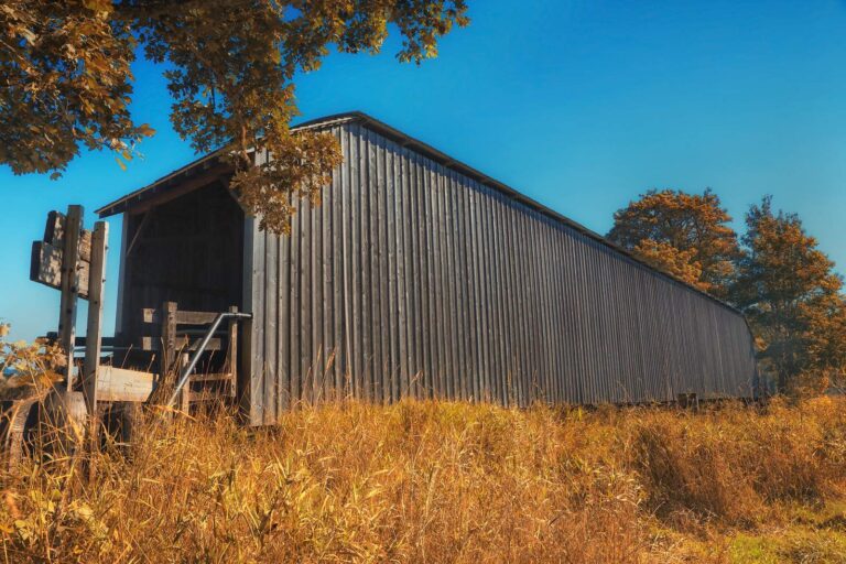
Photo: Ian Sane, CC BY 2.0
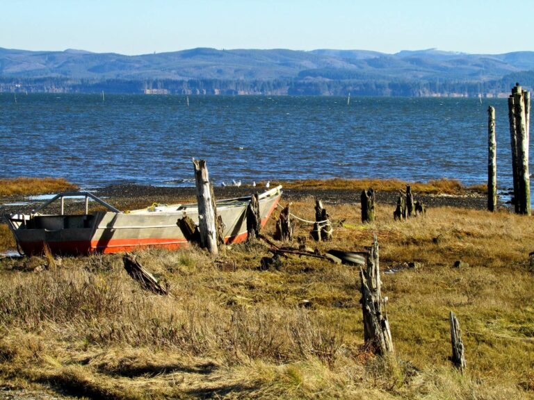
Photo: Tara Schmidt, CC BY 2.0
Common questions about angling in Pacific County
How many boat launches are mapped in Pacific County?
10 launches in all, managed by 7 WDFW, 2 State Parks and 1 other agencies.
Which Pacific County lake spreads widest in the WDFW layer?
Loomis Lake, at 150 surface acres in the WDFW layer.
Which species show up on the most waters by Pacific County?
Largemouth bass lead the count of water pages within 50 miles, followed by rainbow trout, coastal cutthroat trout and yellow perch.
Is there a bait counter in Pacific County?
There are 8, Chinook Bait & Tackle among them.
Do any river guides call Pacific County home?
6 guides and charters list a city here.
Where do Pacific County residents go for county business?
The seat is South Bend.
Which Washington license covers Pacific County water?
WDFW sells the 2026-27 Freshwater license for $39.95 to Washington residents and $115.85 to visitors 16 and up. Marine areas fall under the Saltwater license: $40.71 resident, $81.70 nonresident in 2026-27.
What counties share a line with Pacific County?
Neighbours by distance: Wahkiakum County, Grays Harbor County and Thurston County.
Where do Pacific County waters depart from the statewide tables?
The 2026-27 pamphlet prints 279 Special Rule entries touching this county, starting with Bear River; the table above shows the first ones.
Where is the salmon fishing on salt water near Pacific County?
Ilwaco, Willapa Bay, Columbia River mouth (Buoy 10) and Outer coast (Pacific Ocean); the marine table above links each page.
Has a Washington record fish come from Pacific County?
Dolphinfish, 21.00 lbs, from Pacific Ocean, Pacific County (Aug. 25, 2023).
How many trout went into Pacific County water in 2026?
38 WDFW plants so far in 2026, 25,429 fish; the latest went into Western Lake on Sept. 23, 2026.
Hitch up the boat for Pacific County
Check the Special Rules before keeping fish.