Fishing in Thurston County, Washington
County seat: Olympia. Population 294,793.
- 17lake pages
- 17launches
- 6river pages
 Pick for troutPiscifun Carbon X ultralight spinning reel28% OFFSale $57.99
Photo of Alder Lake: Ken Lund, CC BY-SA 2.0
Sizing up Thurston County before the drive out
Thurston County numbered 294,793 residents in 2020; its commissioners meet in Olympia. The 2026 WDFW trout plants report files its plantings here under WDFW Region 6. Part of Chehalis River lies on the state line, where the border-water rule applies.
Alder Lake leads the 17 paged lakes inside the county, which add up to 6,503 acres. The county shoreline opens onto South Puget Sound, Budd Inlet, Nisqually Reach and Puget Sound. Runs of salmon or steelhead show on WDFW maps for Chehalis River, Black River, Nisqually River and Deschutes River. Count 17 boat launches across the county, split as 15 WDFW and 2 other agencies. Without a boat there are 18 shore or access sites on the WDFW map, and 5 include a pier.
Census 2020 population; WDFW Fish Washington lake layers, WDFW facilities and State Parks launch layers (WDFW GIS); WDFW marine areas; retrieved October 31, 2026.
 For the trout herePiscifun Carbon XT ultralight spinning reel25% OFFSale $59.99
Where to put in across Thurston County, pinned
WDFW and State Parks launch layers, WDFW facilities, WDFW lake points, NHD river midpoints and WDFW marine area points. Checked November 2026.
Lowland and alpine lakes spread over Thurston County
| Lake | Acres | Launches | WDFW program | Fish WDFW maps |
|---|---|---|---|---|
| Alder Lake | 2,877 | 0 | Mixed species – Trout emphasis | coastal cutthroat trout, kokanee, largemouth bass |
| Black Lake (Thurston County) | 574 | 1 | Mixed species – Trout emphasis | rainbow trout, largemouth bass, smallmouth bass |
| Skookumchuck Reservoir | 552 | 0 | Trout emphasis | rainbow trout, coastal cutthroat trout |
| Summit Lake (Thurston County) | 511 | 1 | Mixed species – Trout emphasis | rainbow trout, coastal cutthroat trout, kokanee |
| Lake Lawrence | 326 | 1 | Mixed species – Trout emphasis | rainbow trout, largemouth bass, brown bullhead |
| Long Lake (Thurston County) | 308 | 1 | Mixed species – Trout emphasis | rainbow trout, largemouth bass, yellow perch |
| Pattison Lake | 255 | 1 | Mixed species – Trout emphasis | rainbow trout, largemouth bass, yellow perch |
| St. Clair Lake | 233 | 1 | Mixed species – Trout emphasis | rainbow trout, brown trout, largemouth bass |
| Offutt Lake | 191 | 1 | Mixed species – Trout emphasis | rainbow trout, brown trout, coastal cutthroat trout |
| Clear Lake (Thurston County) | 181 | 1 | Mixed species – Trout emphasis | rainbow trout, kokanee, largemouth bass |
| Hicks Lake | 162 | 1 | Mixed species – Trout emphasis | rainbow trout, brown trout, largemouth bass |
| McIntosh Lake | 110 | 1 | Mixed species – Trout emphasis | rainbow trout, largemouth bass, brown bullhead |
| Ward Lake | 66 | 1 | Mixed species – Trout emphasis | rainbow trout, coastal cutthroat trout, kokanee |
| Deep Lake (Thurston County) | 63 | 0 | Mixed species – Trout emphasis | rainbow trout |
| Chambers Lake (Thurston County) | 53 | 1 | Warmwater emphasis | largemouth bass, yellow perch |
| Munn Lake | 32 | 1 | Trout emphasis | rainbow trout, brown trout, yellow perch |
| Long's Pond | 9 | 0 | Mixed species – Trout emphasis | rainbow trout, largemouth bass, yellow perch |
WDFW Fish Washington lowland and high lake layers (surface acres as published, management emphasis, mapped species); WDFW publishes no lake depths in these layers. Retrieved October 31, 2026.
Marine water along the edge of Thurston County
Salt water off Thurston County is split among 4 marine pages.
| Water | Kind | Launches | Piers and shore | Marine area |
|---|---|---|---|---|
| South Puget Sound (Marine Area 13) | WDFW marine area | 9 | 4 | 13 |
| Budd Inlet | regional marine water | 1 | 0 | 13 |
| Nisqually Reach | regional marine water | 1 | 1 | 13 |
| Puget Sound | regional marine water | 34 | 52 | 8-1, 8-2, 9, 10, 11, 12, 13 |
5 marina sites appear in the NOAA ESI record of 2003 to 2006.
WDFW Recreational Marine Areas (WAC 220-300-160 boundaries), WDFW and State Parks marine launches, WDFW piers and USGS GNIS bay names; retrieved October 31, 2026.
The species tally for water around Thurston County
Each bar is a tally of waters inside 50 miles of Olympia naming the fish, with rainbow trout first.
Species mapped in the WDFW Fish Washington layers, WDFW state records and the 2026 WDFW trout plants, counted per water page within 50 miles; not a survey.
Current-bearing water through Thurston County
- Chehalis RiverSWIFD lists chinook, chum and coho, 4 mapped launches, 7 USGS gauges, 134 mi in Washington
- Black RiverSWIFD lists chinook, chum and coho, 3 mapped launches, 30 mi in Washington
- Nisqually RiverSWIFD lists chinook, chum and coho, 2 WDFW shore or access sites, 4 USGS gauges, 77 mi in Washington
- Deschutes RiverSWIFD lists chinook, chum and coho, 2 USGS gauges, 54 mi in Washington
- Skookumchuck RiverSWIFD lists chinook, coho and steelhead trout, 1 WDFW shore or access site, 3 USGS gauges, 43 mi in Washington
- Mashel RiverSWIFD lists chinook, chum and coho, 1 USGS gauge, 23 mi in Washington
Other named streams in Thurston County (2)
- Little Deschutes River6 mi in Washington
- Little Nisqually River8 mi in Washington
USGS stage and flow across Thurston County
| USGS gauge | Latest reading | Time (ET) |
|---|---|---|
| Nisqually River At Mckenna, Wa | 883 cfs, 1.74 ft gage height | Nov 11 7:15 pm |
| Nisqually River At La Grande, Wa | 721 cfs, 4.23 ft gage height | Nov 11 7:00 pm |
| Chehalis River Near Grand Mound, Wa | 1,410 cfs, 130.91 ft gage height | Nov 11 7:00 pm |
| Skookumchuck River Near Bucoda, Wa | 138 cfs, 203.76 ft gage height | Nov 11 6:45 pm |
| Deschutes River At E St Bridge At Tumwater, Wa | 321 cfs, 25.26 ft gage height | Nov 11 6:45 pm |
| Skookumchuck River Bl Bldy Run Cr Nr Centralia, Wa | 109 cfs, 325.99 ft gage height | Nov 11 6:45 pm |
US Geological Survey provisional data, retrieved Nov 11, 2026 7:33 pm ET. Provisional readings can be revised.
USGS NHD flowlines and Washington lengths, WDFW SWIFD salmon and steelhead distribution, WDFW and State Parks launches, USGS gauges; retrieved October 31, 2026.
Hatchery rainbows and cutthroat in Thurston County
WDFW logged 61 trout plants in Thurston County so far in 2026, 177,282 fish across 15 waters.
- Ward LakeCutthroat, 306 fish at 1.6 per pound, October 26, 2026, Eells Springs
- Long's PondCutthroat, 150 fish at 1.6 per pound, October 26, 2026, Eells Springs
- Lake LawrenceRainbow, 5,000 fish at 2.2 per pound, May 27, 2026, Puyallup Hatchery
- Summit Lake (Thurston County)Rainbow, 4,620 fish at 1.9 per pound, May 15, 2026, Eells Springs
- Offutt LakeRainbow, 502 fish at 1.1 per pound, May 15, 2026, Lakewood Hatchery
- Long's PondRainbow, 303 fish at 1.1 per pound, May 15, 2026, Lakewood Hatchery
- Columbus Prk PondRainbow, 1,000 fish at 2.16 per pound, May 8, 2026, Eells Springs
- Columbus Prk PondRainbow, 20 fish at 0.5 per pound, May 8, 2026, Eells Springs
- St. Clair LakeRainbow, 4,000 fish at 2.4 per pound, May 6, 2026, Puyallup Hatchery
- Pattison LakeRainbow, 2,140 fish at 2.5 per pound, April 24, 2026, Eells Springs
- St. Clair LakeRainbow, 3,003 fish at 2.26 per pound, April 23, 2026, Eells Springs
- Long Lake (Thurston County)Rainbow, 3,500 fish at 2.26 per pound, April 23, 2026, Eells Springs
WDFW Trout Plants report (rows January 2 to October 27, 2026), read October 31, 2026; newest plants first.
WDFW and State Parks ramps in Thurston County
- Black Lake boat launch (west)Black Lake, WDFW, 1 ramp, concrete surface, Discover Pass
- Boston Harbor on Budd InletBudd Inlet, Thurston County, 1 ramp, concrete surface
- Chambers Lake boat launchChambers Lake, Thurston County, 1 ramp, concrete surface
- Clear Lake boat launch (west), Thurston CountyClear Lake, WDFW, 1 ramp, concrete surface, Discover Pass
- Gate boat launch on Black RiverBlack River, WDFW, 1 ramp, gravel surface, Discover Pass
- Hicks Lake boat launchHicks Lake, WDFW, 1 ramp, concrete surface, Discover Pass
- Lake Lawrence boat launchLake Lawrence, WDFW, 1 ramp, concrete surface, Discover Pass
- Lake Saint Clair boat launch on St. Clair LakeSt. Clair Lake, WDFW, 2 ramps, concrete surface, Discover Pass
- Littlerock boat launch on Black RiverBlack River, WDFW, 1 ramp, gravel surface, Discover Pass
- Long Lake boat launch (west)Long Lake, WDFW, 1 ramp, concrete surface, Discover Pass
- Luhr's Landing on Nisqually ReachNisqually Reach, WDFW, 1 ramp, concrete surface, Discover Pass
- McIntosh Lake boat launchMcIntosh Lake, WDFW, 1 ramp, concrete surface, Discover Pass
- Munn Lake boat launchMunn Lake, WDFW, 1 ramp, concrete surface, Discover Pass
- Offutt Lake boat launchOffutt Lake, WDFW, 1 ramp, concrete surface, Discover Pass
- Pattison Lake boat launchPattison Lake, WDFW, 1 ramp, concrete surface, Discover Pass
- Summit Lake boat launchSummit Lake, WDFW, 1 ramp, concrete surface, Discover Pass
- Ward Lake boat launchWard Lake, WDFW, 1 ramp, concrete surface, Discover Pass
15 of the listed ramps sit on land where a Discover Pass is required for parking.
Thurston County shore fishing on WDFW maps (18)
- Handicap Hole on Nisqually Riverfishing platform
- Black Lake fishing piershore fishing site, Public dock
- Chambers Lake shore accessshore fishing site, Limited shore fishing
- Clear Lake shore accessshore fishing site, Limited shore fishing at primitive boat launch
- Fishing pier on Nisqually Riverfishing pier
- Hicks Lake shore accessshore fishing site, Limited shore fishing
- Hicks Lake shore accessshore fishing site, Limited shore fishing at boat launch
- Lake Lawrence shore accessshore fishing site, 75 feet of shore fishing at boat launch
- Long Lake shore access near Laceyshore fishing site, Limited shore fishing at boat launch
- Long's Pond fishing piershore fishing site, Public dock, shore fishing around pond, open only to juvenil
- Luhr's Beach Dock on Nisqually Reachfishing pier, Marine Area 13
- Munn Lake shore accessshore fishing site, Limited shore fishing at boat launch
- Pattison Lake shore accessshore fishing site, Limited shore fishing at boat launch
- Skookumchuck River shore accessaccess point (no launch)
- St. Clair Lake shore accessshore fishing site, Over 200 feet of shore fishing at boat launch
- St. Clair Lake shore accessshore fishing site, Limited shore fishing at boat launch
- Ward Lake shore accessshore fishing site, Shore fishing, limited by vegetation
- Ward Lake shore accessshore fishing site, Limited shore fishing at boat launch
WDFW Facilities layer (boat launches, piers, shore sites) and the State Parks boat launch layer; retrieved October 31, 2026. Lanes and per-launch fees are not published in these layers.
Washington statewide limits that apply in Thurston County
Every Thurston County lake or creek without a Special Rule uses these statewide rows. At 2026-27 WDFW prices, freshwater fishing runs $39.95 for a resident and $115.85 for an out-of-state angler 16 or older. For the sound and the coast, WDFW prices the Saltwater license at $40.71 resident and $81.70 nonresident. Retained salmon, steelhead, sturgeon and halibut go on a catch record card issued with the license.
| Species | Limit | Season |
|---|---|---|
| Largemouth Bass | No min. size in lakes, ponds, and reservoirs. Only largemouth bass less than 12" may be retained, except 1 over 17" may be retained. Daily limit 5. | Lakes, ponds, and reservoirs: year-round; rivers, streams and beaver ponds: Sat. before Memorial Day through Oct. 31 |
| Largemouth Bass | No size restriction/daily limit in rivers, streams, and beaver ponds. | Lakes, ponds, and reservoirs: year-round; rivers, streams and beaver ponds: Sat. before Memorial Day through Oct. 31 |
| Smallmouth Bass | No min. size in lakes, ponds, and reservoirs. Only 1 smallmouth bass over 14" may be retained. Daily limit 10. | Lakes, ponds, and reservoirs: year-round; rivers, streams and beaver ponds: Sat. before Memorial Day through Oct. 31 |
| Smallmouth Bass | No size restriction/daily limit in rivers, streams, and beaver ponds. | Lakes, ponds, and reservoirs: year-round; rivers, streams and beaver ponds: Sat. before Memorial Day through Oct. 31 |
| Walleye | Min. size 12" in lakes, ponds, and reservoirs. Daily limit 8. Only 1 over 22" may be retained. May be caught, retained, and released alive from a livewell until daily limit is in possession. | Lakes, ponds, and reservoirs: year-round; rivers, streams and beaver ponds: Sat. before Memorial Day through Oct. 31 |
| Walleye | No size restriction/daily limit in rivers, streams, and beaver ponds. | Lakes, ponds, and reservoirs: year-round; rivers, streams and beaver ponds: Sat. before Memorial Day through Oct. 31 |
| Channel Catfish | No min. size in lakes, ponds, and reservoirs. Daily limit 5. | Lakes, ponds, and reservoirs: year-round; rivers, streams and beaver ponds: Sat. before Memorial Day through Oct. 31 |
| Channel Catfish | No min. size/daily limit in rivers, streams, and beaver ponds. | Lakes, ponds, and reservoirs: year-round; rivers, streams and beaver ponds: Sat. before Memorial Day through Oct. 31 |
| Burbot (Freshwater Ling) | No min. size. Daily limit 5. | Lakes, ponds, and reservoirs: year-round; rivers, streams and beaver ponds: Sat. before Memorial Day through Oct. 31 (p.23 general rule for |
| Crappie, Northern Pikeminnow, Peamouth Chub, Perch, Suckers, Sunfish, | No min. size. No daily limit. | Lakes, ponds, and reservoirs: year-round; rivers, streams and beaver ponds: Sat. before Memorial Day through Oct. 31 |
| Grass Carp | Closed unless otherwise listed in Special Rules. | Closed |
| Kokanee | No min. size. Daily limit 10. When fishing with bait, all kokanee that are lawful to possess and are equal to or greater than the minimum size are counted as part of the daily limit whether kept or released. | Lakes, ponds, and reservoirs: year-round; rivers, streams and beaver ponds: Sat. before Memorial Day through Oct. 31 (p.23 general rule for |
| Tiger Muskellunge (Tiger Muskie) | Min. size 50". Daily limit 1. | Lakes, ponds, and reservoirs: year-round; rivers, streams and beaver ponds: Sat. before Memorial Day through Oct. 31 (p.23 general rule for |
| Whitefish | No min. size. Daily limit 15. | Lakes, ponds, and reservoirs: year-round; rivers, streams and beaver ponds: Sat. before Memorial Day through Oct. 31 (p.23 general rule for |
| Steelhead | Release all wild steelhead. Min. size 20". Daily limit 2. Open during salmon or game fish seasons unless as otherwise listed. | Open during salmon or game fish seasons unless as otherwise listed |
| Brown Trout, Cutthroat Trout, Rainbow Trout, Golden Trout, Tiger Trout | In rivers, streams, and beaver ponds: Min. size 8". Daily limit 2. | Sat. before Memorial Day-Oct. 31 (statewide river season, p.23) |
Marine limits are set per marine area; each linked marine page above prints its own table. Marine area rules
Pamphlet Special Rules inside Thurston County (120)
| Water and reach | Species | Rule |
|---|---|---|
| Black River: from mouth to bridge on 128th Ave. SW (west of Littlerock) CRC (706) | All species | Barbless hooks required. Anti-snagging rule. Night closure. |
| Black River: from mouth to bridge on 128th Ave. SW (west of Littlerock) CRC (706) | Trout | Statewide min. size/daily limit. Except: Cutthroat trout and wild rainbow trout: min. size 14". (Sat. before Memorial Day-Oct. 31) |
| Black River: from mouth to bridge on 128th Ave. SW (west of Littlerock) CRC (706) | Other game fish | Statewide min. size/daily limit. (Sat. before Memorial Day-Oct. 31) |
| Black River: from mouth to bridge on 128th Ave. SW (west of Littlerock) CRC (706) | Salmon | Min. size 12". Daily limit 6 including no more than 2 adults. Release Chinook. (Oct. 16-Oct. 31) |
| Black River: from mouth to bridge on 128th Ave. SW (west of Littlerock) CRC (706) | Salmon | Min. size 12". Daily limit 6 including no more than 1 adult. Release Chinook. (Nov. 1-Dec. 31) |
| Deschutes River: from Old Hwy. 99 Bridge upstream CRC (728) | All species | Selective gear rules. |
| Deschutes River: from Old Hwy. 99 Bridge upstream CRC (728) | Trout | Statewide min. size/daily limit. Except: release cutthroat trout and wild rainbow trout. (Year-round) |
| Deschutes River: from Old Hwy. 99 Bridge upstream CRC (728) | Other game fish | Statewide min. size/daily limit. (Year-round) |
| Deschutes River: from Old Hwy. 99 Bridge upstream CRC (728) | Salmon | Min. size 12". Daily limit 6 including no more than 2 adults. Release coho. (Year-round) |
| Kennedy Creek: from mouth (500 yards east of the northbound Hwy. 101 Bridge) to northbound Hwy. 101 Bridge CRC (754) | Trout | Statewide min. size/daily limit. Except: release cutthroat trout and wild rainbow trout. (Sat. before Memorial Day-Sept. 30) |
| Kennedy Creek: from mouth (500 yards east of the northbound Hwy. 101 Bridge) to northbound Hwy. 101 Bridge CRC (754) | Other game fish | Statewide min. size/daily limit. (Sat. before Memorial Day-Sept. 30) |
| Kennedy Creek: from Hwy. 101 Bridge upstream CRC (754) | All game fish | Selective gear rules. (Sat. before Memorial Day-Sept. 30) |
| Kennedy Creek: from Hwy. 101 Bridge upstream CRC (754) | Trout | Statewide min. size/daily limit. Except: release cutthroat trout and wild rainbow trout. (Sat. before Memorial Day-Sept. 30) |
| Kennedy Creek: from Hwy. 101 Bridge upstream CRC (754) | Other game fish | Statewide min. size/daily limit. (Sat. before Memorial Day-Sept. 30) |
| Mcallister Creek: CRC (770) | All species | Selective gear rules. (Sat. before Memorial Day-Nov. 15) |
| Mcallister Creek: CRC (770) | Trout | Statewide min. size/daily limit. Except: Release cutthroat trout and wild rainbow trout. (Sat. before Memorial Day-Nov. 15) |
| Mcallister Creek: CRC (770) | Other game fish | Statewide min. size/daily limit. (Sat. before Memorial Day-Nov. 15) |
| Mcallister Creek: CRC (770) | Salmon | Min. size 12". Daily limit 6 including no more than 2 adults. Release chum, wild coho, and wild Chinook. (July 1-Nov. 15) |
| Mclane Creek: from mouth (a line 100' upstream of and parallel to the south bridge on Hwy. 101) upstream | All species | Selective gear rules. Night closure. |
| Mclane Creek: from mouth (a line 100' upstream of and parallel to the south bridge on Hwy. 101) upstream | Trout | Statewide min. size/daily limit. Except: release cutthroat trout and wild rainbow trout. (Sat. before Memorial Day-Oct. 31) |
Limits and seasons as printed in the 2026-2027 Washington Sport Fishing Rules (WDFW pamphlet, in effect July 1, 2026 to June 30, 2027), PDF page 27 (pamphlet PDF; eRegulations statewide freshwater page), read October 31, 2026. Special Rules as printed in the 2026-2027 Washington Sport Fishing Rules (WDFW pamphlet, in effect July 1, 2026 to June 30, 2027), pamphlet page 27 (pamphlet PDF), read on eRegulations October 31, 2026.
WDFW record entries for Thurston County
No WDFW record traces to Thurston County water, so the nearest record waters within 70 miles are shown.
| Species | Weight | Angler | Water | Date |
|---|---|---|---|---|
| Cutthroat Trout, Coastal, sea-run | 6.00 lbs | Bud Johnson | Carr Inlet | May 1, 1943 |
| Rock Bass | 1.38 lbs | William Jackson | Steilacoom Lake | June 26, 1981 |
| Chum Salmon | 25.97 lbs | Johnny Wilson | Satsop River | Oct. 19, 1997 |
| Black Crappie | 4.50 lbs | John W. Smart | Lake Washington | May 1, 1956 |
Washington Department of Fish and Wildlife (WDFW) sport fish records list, as of October 31, 2026.
Gear and guided trips around Thurston County
Thurston County counters for tackle and bait
- Northwest Guide Baitsbait and tackle shop, Olympia
- Boston Harbor Marinamarina, Olympia
- Cabela's Laceysporting goods store, Lacey
- Dick's Sporting Goods Olympiasporting goods store, Olympia
- Fiddlehead Marine Incmarina, Olympia
- Inlet Marinemarina, Olympia
- Martin Marinamarina, Olympia
- Swantown Marina & Boatworksmarina, Olympia
- West Bay Marinamarina, Olympia
Guided trips from Thurston County
- The Fly Fishercharter, Lacey, (360) 491-0181
- D & J Guided Sport Fishingfishing guide, Olympia, (206) 914-9137
Yellow Pages and chain store listings, guide and charter listings (city of business); retrieved October 31, 2026.
Close around Thurston County
Thurston County communities ranked by size
- Olympiapop. 55,605
- Laceypop. 53,526
- Tumwaterpop. 25,350
- Yelmpop. 10,617
- Tanglewildepop. 6,265
- Rochesterpop. 6,064
- Grand Moundpop. 3,301
- North Yelmpop. 3,140
- Rainierpop. 2,369
- Teninopop. 1,870
Washington county pages surrounding Thurston County
- Lewis County33 miles southeast
- Pierce County33 miles east
- Mason County33 miles northwest
- Grays Harbor County48 miles west
Piscifun gear a Cascades angler could bring to Thurston County


Piscifun and Amazon links are affiliate links; the site earns a commission on qualifying purchases.
Photographs of fishing water around Thurston County
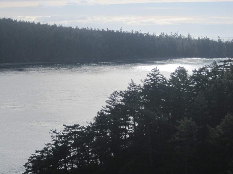
Photo: Chris Ballance, CC BY 2.0

Photo: pfly, CC BY-SA 2.0
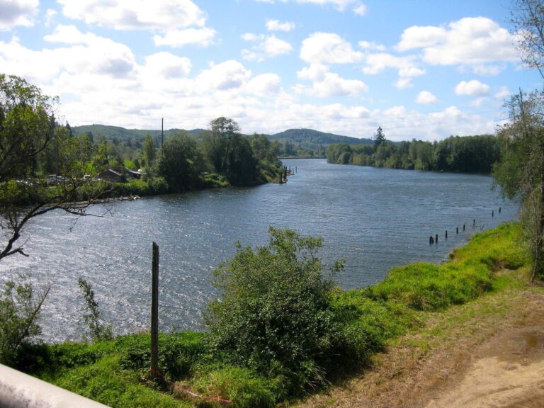
Photo: Bjorn, CC BY-SA 2.0
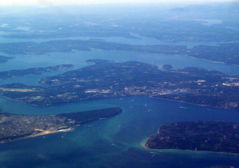
Photo: WorldIslandInfo.com, CC BY 2.0
Water in Thurston County, question by question
Can I launch a drift boat or sled in Thurston County?
Count 17 launches, run by 15 WDFW and 2 other agencies.
Which Thurston County lake comes first on surface acres?
Alder Lake, at 2,877 surface acres in the WDFW layer.
What ends up in the cooler around Thurston County?
Rainbow trout lead the count of water pages within 50 miles, followed by largemouth bass, yellow perch and coastal cutthroat trout.
Where do Thurston County anglers buy bait and tackle?
Try Northwest Guide Baits; the list holds 9.
Are any charter skippers based in Thurston County?
The file holds 2 guides and charters.
Which Washington town runs the business of Thurston County?
Olympia hosts the county offices.
Which WDFW license does a Thurston County trip call for?
At 2026-27 WDFW prices, freshwater fishing runs $39.95 for a resident and $115.85 for an out-of-state angler 16 or older. For the sound and the coast, WDFW prices the Saltwater license at $40.71 resident and $81.70 nonresident.
Which neighbouring county page should Thurston County anglers open next?
Closest by centre point: Lewis County, Pierce County and Mason County.
Which Special Rules apply in Thurston County?
The 2026-27 pamphlet prints 120 Special Rule entries touching this county, starting with Black River; the table above shows the first ones.
Which marine areas touch Thurston County?
South Puget Sound, Budd Inlet, Nisqually Reach and Puget Sound; the marine table above links each page.
Is there stocked trout water in Thurston County?
61 WDFW plants so far in 2026, 177,282 fish; the latest went into Ward Lake on Oct. 26, 2026.
Plan two days of fishing in Thurston County
Lake pages list ramps, trout plants and WDFW species.