Outer coast (Pacific Ocean) Fishing
Washington marine water across Marine Area 1, Marine Area 2, Marine Area 3, Marine Area 4.
 Pick for rainbow troutPiscifun Carbon X ultralight spinning reel28% OFFSale $57.99
Photo: Richard Probst – Shot in a Frame, CC BY 2.0
Getting to know Outer coast (Pacific Ocean)
Anglers on Outer coast (Pacific Ocean) fish under the rows for Marine Area 1, Marine Area 2, Marine Area 3, Marine Area 4.
It has 2 saltwater launches in the access layers. It holds 10 named fishing areas on the WDFW map. WDFW lists 139 marine rule rows covering it. NOAA keeps 9 NOAA tide stations in range.
From the WDFW definition: Marine Areas 1 to 4 on the outer coast. GNIS has one Pacific Ocean point (in California); it is not used for location.
WDFW recreational marine area layer (WAC 220-311-010) on geodataservices.wdfw.wa.gov, USGS GNIS names, WDFW and State Parks launch layers, WDFW shore fishing layer; retrieved October 31, 2026.
Outer coast (Pacific Ocean) area by area
The table counts launches, shore sites, fishing areas and rule rows for each area of Outer coast (Pacific Ocean).
| Marine area | Launches | Shore sites | Fishing areas | Rule rows |
|---|---|---|---|---|
| Ilwaco (Marine Area 1) | 2 | 0 | 2 | 24 |
| Westport-Ocean Shores (Marine Area 2) | 0 | 0 | 3 | 37 |
| La Push (Marine Area 3) | 0 | 0 | 2 | 31 |
| Neah Bay (Marine Area 4) | 0 | 0 | 3 | 47 |
WDFW recreational marine areas (WAC 220-311-010), access layers and the 2026-27 pamphlet; retrieved October 31, 2026.
Species with a source on Outer coast (Pacific Ocean)
Species with a source on Outer coast (Pacific Ocean).
2026-27 WDFW pamphlet marine area rows and WDFW sport fish records; retrieved October 31, 2026.
 For the rainbow trout herePiscifun Carbon XT ultralight spinning reel25% OFFSale $59.99
WDFW fishing areas inside Outer coast (Pacific Ocean)
- 30-50 milesMarine Area 1 Boat Access Only
- North Buoy 10 ZoneMarine Area 1 Boat Access Only
- 06-20 milesMarine Area 2 Boat Access Only
- 25-50 milesMarine Area 2 Boat Access Only
- 40-100 milesMarine Area 2 Boat Access Only
- 3-8 milesMarine Area 3 Boat Access Only
- Quillayute RockfishMarine Area 3 Boat Access Only
- Cape FlatteryMarine Area 4 Boat Access Only
- Neah BayMarine Area 4 Boat Access Only
- U.S. Swiftsure BankMarine Area 4 Boat Access Only
WDFW Major Fishing Areas layer on geodataservices.wdfw.wa.gov (names and access notes as published); retrieved October 31, 2026.
Marine ramps serving Outer coast (Pacific Ocean)
- Cape Disappointment launch on Columbia River mouth (Buoy 10)Discover Pass, Washington State Parks and Recreation Commission
- Cape Disappointment launch on Columbia River mouth (Buoy 10)Discover Pass, Washington State Parks and Recreation Commission
WDFW Water Access Sites and Shore Fishing Sites layers (geodataservices.wdfw.wa.gov) and the Washington State Parks boat launch layer, retrieved October 31, 2026. Parking at WDFW and State Parks launches needs a Discover Pass.
Reading the tide on Outer coast (Pacific Ocean)
NOAA CO-OPS water level, preliminary reading at retrieval (October 31, 2026); station page for live data.
- Columbia River Entrance (N. Jetty)tide predictions, 112 miles
- Cape Disappointmenttide predictions, 113 miles
- Point Grenvilletide predictions, 69 miles
- James Islandtide predictions, 60 miles
- La Push, Quillayute Rivertide predictions, 61 miles
- Tskawahyah Island, Cape Alavatide predictions, 69 miles
Current on Outer coast (Pacific Ocean) follows the tide table closely, so plan crossings and drifts around it.
NOAA CO-OPS water level and tide prediction stations inside or beside the marine area; retrieved October 31, 2026.
Where boats moor near Outer coast (Pacific Ocean)
- Port Of Neah Bay/Makah Marinamarina 360/645-2201
NOAA Environmental Sensitivity Index atlas records (2003 to 2006); facility and reef details reflect the source year, not today. Retrieved october 31, 2026.
Marine rules for Outer coast (Pacific Ocean)
Limits on Outer coast (Pacific Ocean) come from each marine area in turn; the first salmon row of each area is shown, and the area pages carry the full tables.
| Marine area | Rule rows | First salmon row |
|---|---|---|
| Ilwaco (Marine Area 1) | 24 | Chinook – min. size 22”. Coho – min. size 16”. Other salmon species – no min. size. Daily limit 2 including no more than 1 Chinook. Release wild coho. (June 20-Sept. 30, 2026) |
| Westport-Ocean Shores (Marine Area 2) | 37 | Chinook – min. size 22”. Other salmon species – no min. size. Daily limit 1. Release coho. (June 20-June 28) |
| La Push (Marine Area 3) | 31 | Chinook – min. size 24”. Other salmon species – no min. size. Daily limit 1. Release coho. (June 20-June 30, 2026) |
| Neah Bay (Marine Area 4) | 47 | Chinook – min. size 24”. Other salmon species – no min. size. Daily limit 1. Release coho. (June 20-June 30, 2026) |
Anglers 16 and older fishing marine water carry a Saltwater license ($40.71 resident, $81.70 nonresident for 2026-27) or a Combination license, plus a catch record card for salmon, sturgeon, steelhead or halibut.
Limits and seasons as printed in the 2026-2027 Washington Sport Fishing Rules (WDFW pamphlet, in effect July 1, 2026 to June 30, 2027), PDF page 112 (pamphlet PDF; eRegulations marine area page), read October 31, 2026.
Harbor communities on Outer coast (Pacific Ocean)
- IlwacoPacific County
- WestportGrays Harbor County
- Ocean ShoresGrays Harbor County
- La PushClallam County
- Neah BayClallam County
USGS GNIS populated places and harbors named by WDFW for the area; retrieved October 31, 2026.
Neighbouring marine water set beside Outer coast (Pacific Ocean)
| Water | Distance | Marine area | Launches | Piers and shore sites | Tide stations |
|---|---|---|---|---|---|
| Outer coast (Pacific Ocean) | Marine Area 1, Marine Area 2, Marine Area 3, Marine Area 4 | 2 | 0 | 9 | |
| La Push (Marine Area 3) | 30 miles | Marine Area 3 | 0 | 0 | 2 |
| Westport-Ocean Shores (Marine Area 2) | 32 miles | Marine Area 2 | 0 | 0 | 1 |
| Ilwaco (Marine Area 1) | 80 miles | Marine Area 1 | 2 | 0 | 2 |
| Neah Bay (Marine Area 4) | 83 miles | Marine Area 4 | 0 | 0 | 4 |
| Grays Harbor (Marine Area 2-2) | 86 miles | Marine Area 2-2 | 1 | 0 | 5 |
WDFW marine areas and access layers, NOAA stations; retrieved October 31, 2026.
A few miles from Outer coast (Pacific Ocean)
Neighbouring water to Outer coast (Pacific Ocean)
- La Push (Marine Area 3)30 miles
- Westport-Ocean Shores (Marine Area 2)32 miles
- Ilwaco (Marine Area 1)80 miles
- Neah Bay (Marine Area 4)83 miles
- Grays Harbor (Marine Area 2-2)86 miles
Tackle and bait counters serving Outer coast (Pacific Ocean)
- Chinook Bait & Tacklebait and tackle shop, Chinook
- Port of Chinookmarina, Chinook
- Columbia River Bait Cobait and tackle shop, Ilwaco
- Ed's Bait & AMP Tacklebait and tackle shop, Ilwaco
- Port of Ilwacomarina, Ilwaco
- Feather Freak Fly Tying Materialsbait and tackle shop, Ocean Park
Paid fishing guides around Outer coast (Pacific Ocean)
- Beacon Charters & RV Parkcharter, Ilwaco, (360) 642-2138
- Coho Charters & Motelcharter, Ilwaco, (360) 244-4680
- Commercial Fishing Adventurescharter, Long Beach, (360) 642-4935
- Net Prophet Charterscharter, Ilwaco, (360) 642-2150
- Pacific Salmon Charterscharter, Ilwaco, (360) 642-3466
- Sea Breeze Charters LLPcharter, Ilwaco, (360) 642-2300
County guides for Outer coast (Pacific Ocean)
- Pacific Countyseat: South Bend
Piscifun gear a Cascades angler could bring to Outer coast (Pacific Ocean)


Piscifun and Amazon links are affiliate links; the site earns a commission on qualifying purchases.
The shoreline country around Outer coast (Pacific Ocean), in pictures

Photo: Jett Brooks, CC BY 2.0
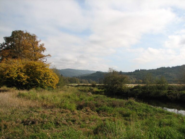
Photo: designatednaphour, CC BY 2.0
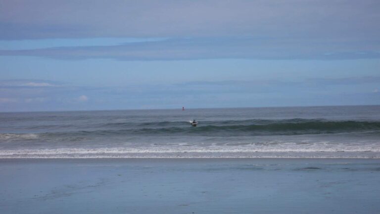
Photo: Tim Regan, CC BY 2.0
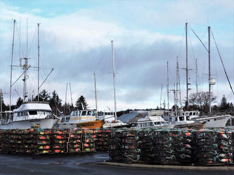
Photo: Upupa4me, CC BY-SA 2.0
What people planning Outer coast (Pacific Ocean) want to know
What marine area number applies to Outer coast (Pacific Ocean)?
Look up Marine Area 1, Marine Area 2, Marine Area 3, Marine Area 4 in the pamphlet.
What salmon rules apply on Outer coast (Pacific Ocean)?
The first salmon row for Marine Area 1: Chinook – min. size 22”. Coho – min. size 16”. Other salmon species – no min. size. Daily limit 2 including no more than 1 Chinook. Release wild coho. (June 20-Sept. 30, 2026). Emergency rules can change it.
What size lingcod is legal on Outer coast (Pacific Ocean)?
Lingcod on Outer coast (Pacific Ocean): Daily limit 2. No retention or possession seaward of the Deepwater Lingcod Depth Restriction Line. Check the WDFW website at https://wdfw.wa.gov/fishing/regulat; Second Sat. in Mar.-May 31.
Which listed saltwater launch is the way onto Outer coast (Pacific Ocean)?
Try Cape Disappointment launch on Columbia River mouth (Buoy 10), one of 2 launches.
Does WDFW list a public pier on Outer coast (Pacific Ocean)?
No listed shore site nearby.
Is a catch record card needed on Outer coast (Pacific Ocean)?
Anglers 16 and older fishing marine water carry a Saltwater license ($40.71 resident, $81.70 nonresident for 2026-27) or a Combination license, plus a catch record card for salmon, sturgeon, steelhead or halibut.
When is slack water on Outer coast (Pacific Ocean)?
Check Columbia River Entrance (N. Jetty); the tide band links it.
Is there a shop near Outer coast (Pacific Ocean)?
Chinook Bait & Tackle in a county on its shore is first on our list.
What spots does WDFW chart on Outer coast (Pacific Ocean)?
Try 30-50 miles, North Buoy 10 Zone and 06-20 miles of the 10 named fishing areas.
Head for Outer coast (Pacific Ocean) on the next opener
Saltwater fees, catch record cards and marine area rows are on the license page.