Willapa Bay Fishing, Marine Area 2-1
WDFW Marine Area 2-1 on the Washington coast and Salish Sea, touching Pacific County.
 Pick for troutPiscifun Carbon X ultralight spinning reel28% OFFSale $57.99
Photo: Tara Schmidt, CC BY 2.0
Getting to know Willapa Bay
Salmon and bottomfish seasons on Willapa Bay follow its Marine Area 2-1 rows; WAC 220-311-010 sets the lines off Pacific County. Ocean Park is the nearest town, about 7 miles off.
It has 3 saltwater launches in the access layers. It holds 2 named fishing areas on the WDFW map. WDFW lists 37 marine rule rows covering it. NOAA keeps 9 NOAA tide stations in range.
WDFW recreational marine area layer (WAC 220-311-010) on geodataservices.wdfw.wa.gov, USGS GNIS names, WDFW and State Parks launch layers, WDFW shore fishing layer; retrieved October 31, 2026.
The legal edges of Willapa Bay
- Defined(2)(b): … a line from Leadbetter Point (46°39'12"N, 124°3'31"W) due west to 46°39'12"N, 124°5'20"W then due north to the westerly most landfall on Cape Shoalwater at 46°44'40"N, 124°5'20"W
- ImpliedNeeded to close polygon from boundary to landfall in data
WAC 220-311-010 boundary text as published in the WDFW marine area layer; NOAA light list positions; retrieved October 31, 2026.
Species with a source on Willapa Bay
Species with a source on Willapa Bay.
2026-27 WDFW pamphlet marine area rows and WDFW sport fish records; retrieved October 31, 2026.
 For the trout herePiscifun Carbon XT ultralight spinning reel25% OFFSale $59.99
WDFW fishing areas inside Willapa Bay
- Interior WillapaBoat Access Only
- Salmon zoneBoat Access Only
WDFW Major Fishing Areas layer on geodataservices.wdfw.wa.gov (names and access notes as published); retrieved October 31, 2026.
Marine ramps serving Willapa Bay
- Palix River boat launch1 ramp, concrete surface, Discover Pass, Washington Department of Fish and Wildlife
- Smith Creek boat launch1 ramp, concrete surface, Discover Pass, WDFW
- South Bend boat launch on South Bend Mill Pond1 ramp, concrete surface, City of South Bend
WDFW Water Access Sites and Shore Fishing Sites layers (geodataservices.wdfw.wa.gov) and the Washington State Parks boat launch layer, retrieved October 31, 2026. Parking at WDFW and State Parks launches needs a Discover Pass.
Smaller named water within Willapa Bay
- Bay Center Channelpassage/strait Pacific County
- Bay Center Cutoff Channelpassage/strait Pacific County
- Cannery Sloughslough Pacific County
- Chetlo Harborharbor Pacific County
- Ellsworth Sloughslough Pacific County
- Greenhead Sloughslough Pacific County
- I I Sloughslough Pacific County
- Kaffee Sloughslough Pacific County
- Kellogg Sloughslough Pacific County
- Leadbetter Channelpassage/strait Pacific County
- Lewis Sloughslough Pacific County
- Long Island Sloughslough Pacific County
- Nahcotta Channelpassage/strait Pacific County
- Nemah River Channelpassage/strait Pacific County
- North Covecove Pacific County
- Pine Island Channelpassage/strait Pacific County
- Russell Channelpassage/strait Pacific County
- Shoalwater Baybay Pacific County
- Smoky Hollowother named water Pacific County
- Stackpole Harborharbor Pacific County
- Stanley Channelpassage/strait Pacific County
- The Narrowspassage/strait Pacific County
USGS GNIS names inside the WDFW marine area polygon; retrieved October 31, 2026.
Reading the tide on Willapa Bay
NOAA CO-OPS water level, preliminary reading at retrieval (October 31, 2026); station page for live data.
- Greenhead Sloughtide predictions, 15 miles
- Naselle River, 4 Miles Above Swing Bridgetide predictions, 15 miles
- Naselle River, Swing Bridgetide predictions, 11 miles
- Paradise Point, Long Islandtide predictions, 8 miles
- Nahcottatide predictions, 6 miles
- Palix River, South Forktide predictions, 3 miles
Current on Willapa Bay follows the tide table closely, so plan crossings and drifts around it.
NOAA CO-OPS water level and tide prediction stations inside or beside the marine area; retrieved October 31, 2026.
Marine rules for Willapa Bay
| Species and location | Daily limit and size | Season |
|---|---|---|
| Trout | Catch-and-release | Year-round |
| Steelhead | Daily limit 2 hatchery steelhead. | Year-round |
| Sturgeon | Catch-and-release. | Year-round |
| Tuna and Mackerel | No min. size. No daily limit except Northern bluefin, skipjack, and yellowfin tuna daily limit of 2 each. | Year-round |
| Herring, Sand Lance, and Smelt | No min. size. Daily limit 10 lbs., all species combined. All smelt caught must be kept and count toward the daily limit except Closed to eulachon (Columbia River smelt). | Year-round |
| Anchovy and Sardine | No min. size. Daily limit 25 lbs., all species combined. May be taken by a cast net. | Year-round |
| Pacific Halibut | Check the WDFW website at https://wdfw.wa.gov/fishing/regulations/halibut or call (360) 902-2700 in April for information on Pacific halibut seasons and regulations. No min. size. Daily limit 1. Annual limit 6. Descendin | see the pamphlet |
| Other Food Fish | No min. size. Daily limit 2 of each species. See definition. | Year-round |
| All Other Fish | CLOSED to fishing for, retaining, or possessing. | CLOSED |
| Salmon (Area 2 except the Grays Harbor Control Zone below.) | Chinook – min. size 22”. Other salmon species – no min. size. Daily limit 1. Release coho. | June 20-June 28 |
| Salmon (Area 2 except the Grays Harbor Control Zone below.) | Chinook – min. size 22”. Coho – min. size 16”. Other salmon species – no min. size. Daily limit 2 including no more than 1 Chinook. Release wild coho. | June 29-Sept. 30 |
| Salmon (Area 2 except the Grays Harbor Control Zone below.) | Check the WDFW website at wdfw.wa.gov or call (360) 902-2700 in late April for information on the 2027 salmon season. | May-June, 2027 |
| Salmon (Grays Harbor Control Zone) | Open concurrent with the ocean (Area 2) for salmon. Area 2 rules apply. | June 20-Sept. 30 |
| Salmon (Area 2-1 including Willapa Bay Control Zone. See exception for North River Area below.) | Open concurrent with the ocean (Area 2) for salmon. Area 2 rules apply. | June 20-July 31, 2026 |
| Salmon (Area 2-1 including Willapa Bay Control Zone. See exception for North River Area below.) | Min. size 12”. Daily limit 6 including no more than 2 adults. Release wild Chinook. Anglers may fish with two poles with Two-Pole Endorsement. | Aug. 1-Jan. 31 |
| Salmon (North River Area) | Open concurrent with the ocean (Area 2) for salmon. Area 2 rules apply. | June 20-July 31, 2026 |
| Salmon (North River Area) | CLOSED. | Aug. 1-Sept. 30 |
| Salmon (North River Area) | Min. size 12”. Daily limit 6 including no more than 2 adults. Release wild Chinook. Anglers may fish with two poles with Two-Pole Endorsement. | Oct. 1-Jan. 31 |
| Salmon (Area 2-2 (west of Buoy 13 line)) | Open concurrent with the ocean (Area 2) for salmon. Area 2 rules apply. | June 20-Sept. 30 |
| Salmon (Area 2-2 (east of the Buoy 13 line) see exceptions for Humptulips North Bay, East Grays Harbor fisheri | Closed except fisheries listed below. All salmon required to be released may not be totally removed from the water, except anglers fishing from boats 30’ or longer as listed on either their state or Coast Guard registrat | Year-round. |
| Salmon (Humptulips North Bay Fishery) | Min. size 12”. Daily limit 1. Release wild Chinook and wild coho. | Aug. 1-Sept. 15 |
| Salmon (East Grays Harbor Fishery) | Min. size 12”. Daily limit 2. Release Chinook. | Sept. 16-Nov. 30 |
| Salmon (Westport Boat Basin and Ocean Shores Boat Basin) | Min. size 12”. Daily limit 6 including no more than 4 adults. Release Chinook. Night closure and anti-snagging rule in effect except any hook where the weight is molded directly to the hook such as twitching jigs, swim j | Aug. 16-Jan. 31 |
| Bottomfish | Daily limit is a total of 9 bottomfish (see definition) except surfperch and flatfish. Subject to individual limits and seasons shown below. Descending device required onboard vessels. | Second Sat. in Mar.-Third Sat. in Oct. |
There are 37 rows for Marine Area 2-1; open the pamphlet for all of them.
Anglers 16 and older fishing marine water carry a Saltwater license ($40.71 resident, $81.70 nonresident for 2026-27) or a Combination license, plus a catch record card for salmon, sturgeon, steelhead or halibut.
Limits and seasons as printed in the 2026-2027 Washington Sport Fishing Rules (WDFW pamphlet, in effect July 1, 2026 to June 30, 2027), PDF page 114 (pamphlet PDF; eRegulations marine area page), read October 31, 2026.
Neighbouring marine water set beside Willapa Bay
| Water | Distance | Marine area | Launches | Piers and shore sites | Tide stations |
|---|---|---|---|---|---|
| Willapa Bay | Marine Area 2-1 | 3 | 0 | 9 | |
| Columbia River mouth (Buoy 10) | 24 miles | Marine Area 1 | 2 | 0 | 5 |
| Grays Harbor (Marine Area 2-2) | 26 miles | Marine Area 2-2 | 1 | 0 | 5 |
| Budd Inlet | 61 miles | Marine Area 13 | 1 | 0 | 7 |
| Nisqually Reach | 69 miles | Marine Area 13 | 1 | 1 | 12 |
| Case Inlet | 73 miles | Marine Area 13 | 5 | 0 | 12 |
WDFW marine areas and access layers, NOAA stations; retrieved October 31, 2026.
A few miles from Willapa Bay
Neighbouring water to Willapa Bay
- Columbia River mouth (Buoy 10)24 miles
- Grays Harbor (Marine Area 2-2)26 miles
- Budd Inlet61 miles
- Nisqually Reach69 miles
- Case Inlet73 miles
The country around Willapa Bay
- Loomis Lake11 miles
- Black Lake (Pacific County)19 miles
- Duck Lake27 miles
- Quigg Lake29 miles
- Niawiakum River4 miles
- North Nemah River7 miles
- South Nemah River8 miles
- Middle Nemah River8 miles
Tackle and bait counters serving Willapa Bay
- Chinook Bait & Tacklebait and tackle shop, Chinook
- Port of Chinookmarina, Chinook
- Columbia River Bait Cobait and tackle shop, Ilwaco
- Ed's Bait & AMP Tacklebait and tackle shop, Ilwaco
- Port of Ilwacomarina, Ilwaco
- Feather Freak Fly Tying Materialsbait and tackle shop, Ocean Park
Paid fishing guides around Willapa Bay
- Beacon Charters & RV Parkcharter, Ilwaco, (360) 642-2138
- Coho Charters & Motelcharter, Ilwaco, (360) 244-4680
- Commercial Fishing Adventurescharter, Long Beach, (360) 642-4935
- Net Prophet Charterscharter, Ilwaco, (360) 642-2150
- Pacific Salmon Charterscharter, Ilwaco, (360) 642-3466
- Sea Breeze Charters LLPcharter, Ilwaco, (360) 642-2300
Where to book a room for Willapa Bay
- Ocean Park7 miles
- South Bend10 miles
- Raymond13 miles
- Long Beach16 miles
County guides for Willapa Bay
- Pacific Countyseat: South Bend
Piscifun gear a Cascades angler could bring to Willapa Bay


Piscifun and Amazon links are affiliate links; the site earns a commission on qualifying purchases.
The shoreline country around Willapa Bay, in pictures

Photo: Bruce Fingerhood, CC BY 2.0

Photo: designatednaphour, CC BY 2.0
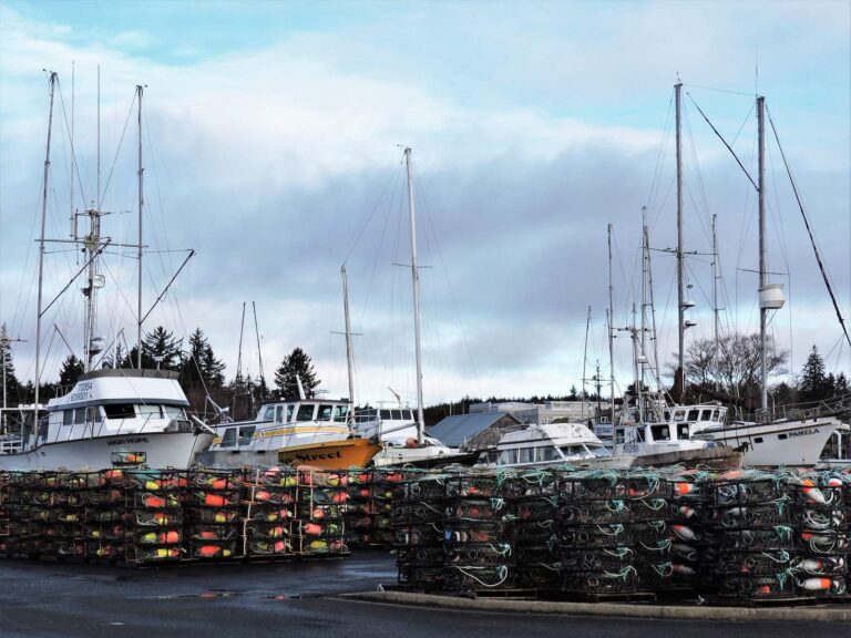
Photo: Upupa4me, CC BY-SA 2.0
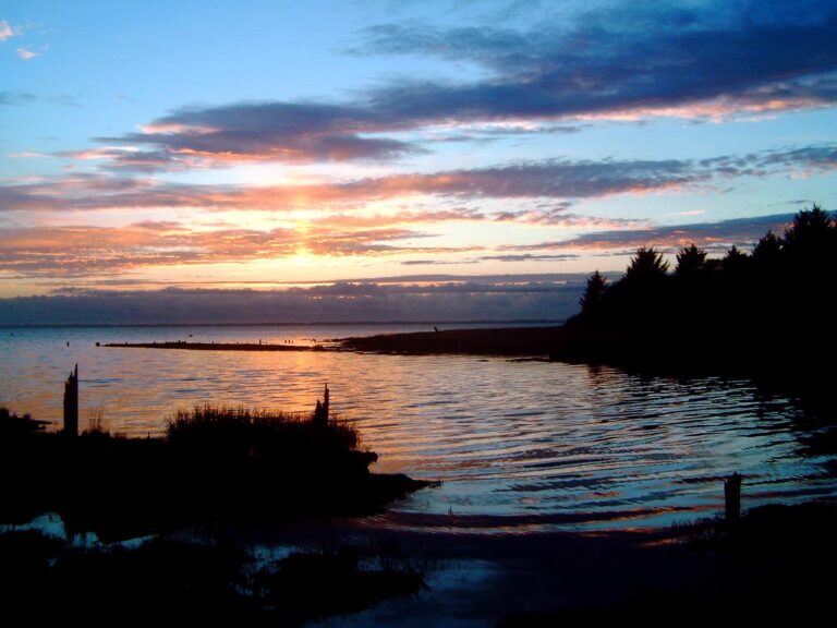
Photo: jc.winkler, CC BY 2.0
What people planning Willapa Bay want to know
What marine area number applies to Willapa Bay?
Look up Marine Area 2-1 in the pamphlet.
What salmon rules apply on Willapa Bay?
The first salmon row for Marine Area 2: Chinook – min. size 22”. Other salmon species – no min. size. Daily limit 1. Release coho. (June 20-June 28). Emergency rules can change it.
What size lingcod is legal on Willapa Bay?
Lingcod on Willapa Bay: Daily limit 2. No retention or possession seaward of a line drawn from, 47°31.70’ N, 124°45.00’ W to 46°38.17’ N, 124°30.00’ W (Area 2 Deepwater Lingcod) except; Second Sat. in Mar.-Apr. 30.
Which listed saltwater launch is the way onto Willapa Bay?
Try South Bend boat launch on South Bend Mill Pond, one of 3 launches.
Does WDFW list a public pier on Willapa Bay?
No listed shore site nearby.
Is a catch record card needed on Willapa Bay?
Anglers 16 and older fishing marine water carry a Saltwater license ($40.71 resident, $81.70 nonresident for 2026-27) or a Combination license, plus a catch record card for salmon, sturgeon, steelhead or halibut.
When is slack water on Willapa Bay?
Check Greenhead Slough; the tide band links it.
Is there a shop near Willapa Bay?
Chinook Bait & Tackle in a county on its shore is first on our list.
What spots does WDFW chart on Willapa Bay?
Try Interior Willapa and Salmon zone of the 2 named fishing areas.
Head for Willapa Bay on the next opener
Saltwater fees, catch record cards and marine area rows are on the license page.