Fishing in Jefferson County, Washington
County seat: Port Townsend. Population 32,977.
- 12lake pages
- 14launches
- 19river pages
 Pick for troutPiscifun Carbon X ultralight spinning reel28% OFFSale $57.99
Photo of Admiralty Inlet: Ken Lund, CC BY-SA 2.0
Sizing up Jefferson County before the drive out
Jefferson County numbered 32,977 residents in 2020; its commissioners meet in Port Townsend. The 2026 WDFW trout plants report files its plantings here under WDFW Region 6. The WDFW high lakes program lists 4 lakes here.
Leland Lake leads the 12 paged lakes inside the county, which add up to 444 acres. The county shoreline opens onto Admiralty Inlet, East Juan de Fuca Strait, Hood Canal and La Push. Runs of salmon or steelhead show on WDFW maps for Wynoochee River, Hoh River, Bogachiel River and Quinault River. Count 14 boat launches across the county, split as 6 WDFW, 5 State Parks and 3 other agencies. Without a boat there are 11 shore or access sites on the WDFW map, and 6 include a pier.
Census 2020 population; WDFW Fish Washington lake layers, WDFW facilities and State Parks launch layers (WDFW GIS); WDFW marine areas; retrieved October 31, 2026.
 For the trout herePiscifun Carbon XT ultralight spinning reel25% OFFSale $59.99
Where to put in across Jefferson County, pinned
WDFW and State Parks launch layers, WDFW facilities, WDFW lake points, NHD river midpoints and WDFW marine area points. Checked November 2026.
Lowland and alpine lakes spread over Jefferson County
| Lake | Acres | Launches | WDFW program | Fish WDFW maps |
|---|---|---|---|---|
| Leland Lake | 108 | 1 | Warmwater emphasis | rainbow trout, largemouth bass, yellow perch |
| Crocker Lake | 75 | 1 | NHD-mapped lake | |
| Anderson Lake | 57 | 0 | Trout emphasis | rainbow trout, largemouth bass |
| Lower Lena Lake | 51 | 0 | WDFW high lake, fish stocking | coastal cutthroat trout |
| Gibbs Lake | 36 | 0 | Trout emphasis | rainbow trout |
| Sandy Shore Lake | 35 | 0 | Mixed species – Trout emphasis | rainbow trout, largemouth bass, brown bullhead |
| Tarboo Lake | 20 | 1 | Mixed species – Trout emphasis | rainbow trout |
| Ludlow Lake | 15 | 0 | Mixed species – Trout emphasis | rainbow trout, largemouth bass, brown bullhead |
| Teal Lake | 15 | 0 | Mixed species – Trout emphasis | rainbow trout, coastal cutthroat trout |
| Horseshoe Lake (Jefferson County) | 11 | 0 | Mixed species – Trout emphasis | rainbow trout, largemouth bass, pumpkinseed |
| Silent Lake | 11 | 0 | Mixed species – Trout emphasis | rainbow trout, coastal cutthroat trout |
| Yahoo Lake | 9 | 0 | Trout emphasis | coastal cutthroat trout, rainbow trout |
WDFW Fish Washington lowland and high lake layers (surface acres as published, management emphasis, mapped species); WDFW publishes no lake depths in these layers. Retrieved October 31, 2026.
Marine water along the edge of Jefferson County
Salt water off Jefferson County is split among 7 marine pages.
| Water | Kind | Launches | Piers and shore | Marine area |
|---|---|---|---|---|
| Admiralty Inlet (Marine Area 9) | WDFW marine area | 5 | 4 | 9 |
| East Juan de Fuca Strait (Marine Area 6) | WDFW marine area | 4 | 3 | 6 |
| Hood Canal (Marine Area 12) | WDFW marine area | 9 | 4 | 12 |
| La Push (Marine Area 3) | WDFW marine area | 0 | 0 | 3 |
| Dabob Bay | regional marine water | 4 | 1 | 12 |
| Puget Sound | regional marine water | 34 | 52 | 8-1, 8-2, 9, 10, 11, 12, 13 |
| Strait of Juan de Fuca | regional marine water | 5 | 3 | 5, 6 |
NOAA water level near Jefferson County
NOAA CO-OPS water level, preliminary reading at retrieval (October 31, 2026); station page for live data.
7 marina sites appear in the NOAA ESI record of 2003 to 2006.
WDFW Recreational Marine Areas (WAC 220-300-160 boundaries), WDFW and State Parks marine launches, WDFW piers and USGS GNIS bay names; retrieved October 31, 2026.
The species tally for water around Jefferson County
Each bar is a tally of waters inside 50 miles of Port Townsend naming the fish, with rainbow trout first.
Species mapped in the WDFW Fish Washington layers, WDFW state records and the 2026 WDFW trout plants, counted per water page within 50 miles; not a survey.
The remaining named lakes in Jefferson County
Jefferson County carries 3 more named lakes, largest first.
| Water | Acres | WDFW program | Nearest town |
|---|---|---|---|
| Lake Constance | 11 | WDFW high lake, overabundant lakes | Seabeck |
| Goat Lake | 7 | WDFW high lake, fish stocking | Sequim |
| Buckhorn Lake | 1 | WDFW high lake, overabundant lakes | Sequim |
WDFW Fish Washington lowland and high lake layers and USGS NHD lake outlines, retrieved October 31, 2026.
Current-bearing water through Jefferson County
- Wynoochee RiverSWIFD lists chinook, chum and coho, 2 mapped launches, 3 USGS gauges, 67 mi in Washington
- Hoh RiverSWIFD lists chinook, chum and coho, 1 mapped launch, 1 USGS gauge, 57 mi in Washington
- Bogachiel RiverSWIFD lists chinook, chum and coho, 3 mapped launches, 2 WDFW shore or access sites, 2 USGS gauges, 49 mi in Washington
- Quinault RiverSWIFD lists chinook, chum and coho, 2 USGS gauges, 70 mi in Washington
- Queets RiverSWIFD lists chinook, chum and coho, 1 USGS gauge, 55 mi in Washington
- Elwha RiverSWIFD lists chinook, chum and coho, 2 WDFW shore or access sites, 1 USGS gauge, 44 mi in Washington
- Clearwater River (Jefferson County)SWIFD lists chinook, chum and coho, 40 mi in Washington
- North Fork Skokomish RiverSWIFD lists chinook, chum and coho, 3 USGS gauges, 35 mi in Washington
- Dungeness RiverSWIFD lists chinook, chum and coho, 1 USGS gauge, 32 mi in Washington
- South Fork Skokomish RiverSWIFD lists chinook, chum and coho, 1 USGS gauge, 30 mi in Washington
- Dosewallips RiverSWIFD lists chinook, chum and coho, 30 mi in Washington
- Duckabush RiverSWIFD lists chinook, chum and coho, 1 USGS gauge, 26 mi in Washington
- South Fork Hoh RiverSWIFD lists chinook, chum and coho, 21 mi in Washington
- Big Quilcene RiverSWIFD lists chinook, chum and coho, 1 WDFW shore or access site, 1 USGS gauge, 20 mi in Washington
- Gray Wolf RiverSWIFD lists chinook, chum and coho, 18 mi in Washington
- Salmon RiverSWIFD lists chinook, chum and coho, 15 mi in Washington
- Snahapish RiverSWIFD lists chinook, coho and steelhead trout, 14 mi in Washington
- Little Quilcene RiverSWIFD lists chinook, chum and coho, 13 mi in Washington
- Solleks RiverSWIFD lists chinook, coho and steelhead trout, 12 mi in Washington
Other named streams in Jefferson County (12)
- Goldie River9 mi in Washington
- Hayes River8 mi in Washington
- Hemp Hill Creek1 WDFW shore or access site, 2 mi in Washington
- Indian George Creek2 WDFW shore or access sites, 2 mi in Washington
- Lillian River12 mi in Washington
- Lost River7 mi in Washington
- Middle Fork Salmon RiverSWIFD lists coho and steelhead trout, 6 mi in Washington
- North Fork Quinault RiverSWIFD lists chinook, coho and steelhead trout, 18 mi in Washington
- North Fork Salmon RiverSWIFD lists coho and steelhead trout, 6 mi in Washington
- Sams RiverSWIFD lists chinook, coho and steelhead trout, 17 mi in Washington
- South Fork Salmon RiverSWIFD lists coho and steelhead trout, 4 mi in Washington
- West Fork Dosewallips River8 mi in Washington
USGS stage and flow across Jefferson County
| USGS gauge | Latest reading | Time (ET) |
|---|---|---|
| Queets River Near Clearwater, Wa | 13,500 cfs, 13.04 ft gage height | Nov 12 6:30 pm |
| Hoh River At Us Highway 101 Near Forks, Wa | 5,580 cfs, 5.13 ft gage height | Nov 12 7:15 pm |
| Duckabush River Near Brinnon, Wa | 643 cfs, 2.03 ft gage height | Nov 12 6:45 pm |
| Big Quilcene River Below Diversion Nr Quilcene, Wa | 106 cfs, 1.55 ft gage height | Nov 12 6:30 pm |
US Geological Survey provisional data, retrieved Nov 12, 2026 7:33 pm ET. Provisional readings can be revised.
USGS NHD flowlines and Washington lengths, WDFW SWIFD salmon and steelhead distribution, WDFW and State Parks launches, USGS gauges; retrieved October 31, 2026.
Hatchery rainbows and cutthroat in Jefferson County
WDFW logged 12 trout plants in Jefferson County so far in 2026, 9,331 fish across 5 waters.
- Leland LakeCutthroat, 450 fish at 1.62 per pound, October 16, 2026, Eells Springs
- Teal LakeRainbow, 150 fish at 1 per pound, September 29, 2026, George Adams Hatchery
- Leland LakeRainbow, 1,510 fish at 1 per pound, September 29, 2026, George Adams Hatchery
- Gibbs LakeRainbow, 350 fish at 1 per pound, September 29, 2026, George Adams Hatchery
- Leland LakeRainbow, 2,707 fish at 1.8 per pound, May 21, 2026, Eells Springs
- Leland LakeRainbow, 1,560 fish at 1.7 per pound, May 5, 2026, Solduc Hatchery
- Tarboo LakeRainbow, 960 fish at 1.7 per pound, April 22, 2026, Solduc Hatchery
- Silent LakeRainbow, 480 fish at 1.7 per pound, April 22, 2026, Solduc Hatchery
- Teal LakeRainbow, 301 fish at 1.38 per pound, March 16, 2026, Lakewood Hatchery
- Gibbs LakeRainbow, 773 fish at 1.38 per pound, March 16, 2026, Lakewood Hatchery
- Teal LakeRainbow, 40 fish at 0.23 per pound, January 29, 2026, Eells Springs
- Gibbs LakeRainbow, 50 fish at 0.23 per pound, January 29, 2026, Eells Springs
WDFW Trout Plants report (rows January 2 to October 27, 2026), read October 31, 2026; newest plants first.
WDFW and State Parks ramps in Jefferson County
- Crocker Lake boat launchCrocker Lake, WDFW, 1 ramp, concrete surface, Discover Pass
- Gardiner boat launchMarine Area 6, Port of Port Townsend, 1 ramp, concrete surface, Discover Pass
- Indian George Creek boat launch on Dabob BayDabob Bay, WDFW, n/a surface, Discover Pass
- Leland Lake boat launchLeland Lake, Jefferson County Parks & Rec, 1 ramp, gravel surface
- Mystery Bay, pier and floatsMarine Area 9, State Parks, Discover Pass
- Pleasant HarborMarine Area 12, WDFW, 1 ramp, concrete surface, Discover Pass
- Point Whitney boat launch on Dabob BayDabob Bay, WDFW, 1 ramp, concrete surface, Discover Pass
- Tarboo Lake boat launchTarboo Lake, WDFW, 1 ramp, gravel surface, Discover Pass
- Triton Cove boat launchMarine Area 12, WDFW, n/a surface, 1 hand launch, Discover Pass
- Fort Flagler boat launchMarine Area 9, State Parks, boat ramp
- Fort Worden launchMarine Area 9, State Parks, boat ramp
- Morgan's Crossing boat launch on Hoh RiverHoh River, agency not given, unimproved surface
- Pleasant Harbor on Dabob BayDabob Bay, State Parks, boat ramp
- Triton Cove launchMarine Area 12, State Parks, boat ramp
8 of the listed ramps sit on land where a Discover Pass is required for parking.
Jefferson County shore fishing on WDFW maps (11)
- Big Quilcenewater access area
- Fort Worden Marine Science Center Dockfishing pier, Marine Area 9
- Pleasant Harbor on Dabob Bayfishing pier, Marine Area 12
- Port Hudson Jettyfishing pier, Marine Area 9
- Port Townsend – Union Wharffishing pier, Marine Area 9
- Vannausdle on Hemp Hill Creekwater access area
- Fishing pier on Leland Lakefishing pier
- Indian George Creek shore accessaccess point (no launch)
- Indian George Creek shore accesswater access area
- Leland Lake fishing piershore fishing site, Public fishing dock
- Tarboo Lake shore accessshore fishing site, Limited shore fishing access at boat launch
WDFW Facilities layer (boat launches, piers, shore sites) and the State Parks boat launch layer; retrieved October 31, 2026. Lanes and per-launch fees are not published in these layers.
Washington statewide limits that apply in Jefferson County
Every Jefferson County lake or creek without a Special Rule uses these statewide rows. At 2026-27 WDFW prices, freshwater fishing runs $39.95 for a resident and $115.85 for an out-of-state angler 16 or older. For the sound and the coast, WDFW prices the Saltwater license at $40.71 resident and $81.70 nonresident. Retained salmon, steelhead, sturgeon and halibut go on a catch record card issued with the license.
| Species | Limit | Season |
|---|---|---|
| Largemouth Bass | No min. size in lakes, ponds, and reservoirs. Only largemouth bass less than 12" may be retained, except 1 over 17" may be retained. Daily limit 5. | Lakes, ponds, and reservoirs: year-round; rivers, streams and beaver ponds: Sat. before Memorial Day through Oct. 31 |
| Largemouth Bass | No size restriction/daily limit in rivers, streams, and beaver ponds. | Lakes, ponds, and reservoirs: year-round; rivers, streams and beaver ponds: Sat. before Memorial Day through Oct. 31 |
| Smallmouth Bass | No min. size in lakes, ponds, and reservoirs. Only 1 smallmouth bass over 14" may be retained. Daily limit 10. | Lakes, ponds, and reservoirs: year-round; rivers, streams and beaver ponds: Sat. before Memorial Day through Oct. 31 |
| Smallmouth Bass | No size restriction/daily limit in rivers, streams, and beaver ponds. | Lakes, ponds, and reservoirs: year-round; rivers, streams and beaver ponds: Sat. before Memorial Day through Oct. 31 |
| Walleye | Min. size 12" in lakes, ponds, and reservoirs. Daily limit 8. Only 1 over 22" may be retained. May be caught, retained, and released alive from a livewell until daily limit is in possession. | Lakes, ponds, and reservoirs: year-round; rivers, streams and beaver ponds: Sat. before Memorial Day through Oct. 31 |
| Walleye | No size restriction/daily limit in rivers, streams, and beaver ponds. | Lakes, ponds, and reservoirs: year-round; rivers, streams and beaver ponds: Sat. before Memorial Day through Oct. 31 |
| Channel Catfish | No min. size in lakes, ponds, and reservoirs. Daily limit 5. | Lakes, ponds, and reservoirs: year-round; rivers, streams and beaver ponds: Sat. before Memorial Day through Oct. 31 |
| Channel Catfish | No min. size/daily limit in rivers, streams, and beaver ponds. | Lakes, ponds, and reservoirs: year-round; rivers, streams and beaver ponds: Sat. before Memorial Day through Oct. 31 |
| Burbot (Freshwater Ling) | No min. size. Daily limit 5. | Lakes, ponds, and reservoirs: year-round; rivers, streams and beaver ponds: Sat. before Memorial Day through Oct. 31 (p.23 general rule for |
| Crappie, Northern Pikeminnow, Peamouth Chub, Perch, Suckers, Sunfish, | No min. size. No daily limit. | Lakes, ponds, and reservoirs: year-round; rivers, streams and beaver ponds: Sat. before Memorial Day through Oct. 31 |
| Grass Carp | Closed unless otherwise listed in Special Rules. | Closed |
| Kokanee | No min. size. Daily limit 10. When fishing with bait, all kokanee that are lawful to possess and are equal to or greater than the minimum size are counted as part of the daily limit whether kept or released. | Lakes, ponds, and reservoirs: year-round; rivers, streams and beaver ponds: Sat. before Memorial Day through Oct. 31 (p.23 general rule for |
| Tiger Muskellunge (Tiger Muskie) | Min. size 50". Daily limit 1. | Lakes, ponds, and reservoirs: year-round; rivers, streams and beaver ponds: Sat. before Memorial Day through Oct. 31 (p.23 general rule for |
| Whitefish | No min. size. Daily limit 15. | Lakes, ponds, and reservoirs: year-round; rivers, streams and beaver ponds: Sat. before Memorial Day through Oct. 31 (p.23 general rule for |
| Steelhead | Release all wild steelhead. Min. size 20". Daily limit 2. Open during salmon or game fish seasons unless as otherwise listed. | Open during salmon or game fish seasons unless as otherwise listed |
| Brown Trout, Cutthroat Trout, Rainbow Trout, Golden Trout, Tiger Trout | In rivers, streams, and beaver ponds: Min. size 8". Daily limit 2. | Sat. before Memorial Day-Oct. 31 (statewide river season, p.23) |
Marine limits are set per marine area; each linked marine page above prints its own table. Marine area rules
Pamphlet Special Rules inside Jefferson County (217)
| Water and reach | Species | Rule |
|---|---|---|
| Big Quilcene River: from the mouth to the downstream terminus of WDFW public access easement (lat. 47.81675, long. -122.89056) CRC (812) | All species | WDFW access easement is from Hwy. 101 Bridge downstream approx. 1 mile on north side of the river only. Internal combustion motors prohibited. |
| Big Quilcene River: from the mouth to the downstream terminus of WDFW public access easement (lat. 47.81675, long. -122.89056) CRC (812) | All species | Selective gear rules. (Sat. before Memorial Day-Aug. 15) |
| Big Quilcene River: from the mouth to the downstream terminus of WDFW public access easement (lat. 47.81675, long. -122.89056) CRC (812) | Trout | Statewide min. size/daily limit. Except: release cutthroat trout and wild rainbow trout. (Sat. before Memorial Day-Aug. 15) |
| Big Quilcene River: from the mouth to the downstream terminus of WDFW public access easement (lat. 47.81675, long. -122.89056) CRC (812) | Other game fish | Statewide min. size/daily limit. (Sat. before Memorial Day-Aug. 15) |
| Big Quilcene River: from the downstream terminus (lat. 47.81675, long. -122.89056) of WDFW public access easement to Hwy. 101 Bridge | All species | WDFW access easement is from Hwy. 101 Bridge downstream approx. 1 mile on north side of the river only. Internal combustion motors prohibited. |
| Big Quilcene River: from the downstream terminus (lat. 47.81675, long. -122.89056) of WDFW public access easement to Hwy. 101 Bridge | All species | Selective gear rules. (Sat. before Memorial Day-Aug. 15) |
| Big Quilcene River: from the downstream terminus (lat. 47.81675, long. -122.89056) of WDFW public access easement to Hwy. 101 Bridge | Trout | Statewide min. size/daily limit. Except: release cutthroat trout and wild rainbow trout. (Sat. before Memorial Day-Aug. 15) |
| Big Quilcene River: from the downstream terminus (lat. 47.81675, long. -122.89056) of WDFW public access easement to Hwy. 101 Bridge | Other game fish | Statewide min. size/daily limit. (Sat. before Memorial Day-Aug. 15) |
| Big Quilcene River: from Hwy. 101 Bridge to the weir at Quilcene National Fish Hatchery | All species | CLOSED WATERS. |
| Big Quilcene River: from the weir at Quilcene National Fish Hatchery to upper boundary of Falls View Campground CRC (812) | All species | Selective gear rules. |
| Big Quilcene River: from the weir at Quilcene National Fish Hatchery to upper boundary of Falls View Campground CRC (812) | Trout | Statewide min. size/daily limit. Except: release cutthroat trout and wild rainbow trout. (Sat. before Memorial Day-Oct. 31) |
| Big Quilcene River: from the weir at Quilcene National Fish Hatchery to upper boundary of Falls View Campground CRC (812) | Other game fish | Statewide min. size/daily limit. (Sat. before Memorial Day-Oct. 31) |
| Bogachiel River: from mouth to Hwy. 101 Bridge CRC (398) | All species | Only 1 single-point barbless hook allowed. Internal combustion motors prohibited. |
| Bogachiel River: from mouth to Hwy. 101 Bridge CRC (398) | All species | Bait prohibited. (Sat. before Memorial Day-Aug. 31) |
| Bogachiel River: from mouth to Hwy. 101 Bridge CRC (398) | All species | Bait prohibited. (Jan. 1-Mar. 31) |
| Bogachiel River: from mouth to Hwy. 101 Bridge CRC (398) | Trout | Statewide min. size/daily limit. Except: Cutthroat trout min. size 14". Release wild rainbow trout. (Sat. before Memorial Day-Oct. 31) |
| Bogachiel River: from mouth to Hwy. 101 Bridge CRC (398) | Trout | Statewide min. size/daily limit. Except: Release cutthroat trout and wild rainbow trout. (Nov. 1-Mar. 31) |
| Bogachiel River: from mouth to Hwy. 101 Bridge CRC (398) | Other game fish | Statewide min. size/daily limit. (Sat. before Memorial Day-Mar. 31) |
| Bogachiel River: from mouth to Hwy. 101 Bridge CRC (398) | Salmon | Min. size 12". Daily limit 2. Release wild Chinook and wild coho. (July 1-Aug. 31) |
| Bogachiel River: from mouth to Hwy. 101 Bridge CRC (398) | Salmon | Min. size 12". Daily limit 3. Up to 2 adults including no more than 1 wild adult may be retained. Release wild coho and sockeye. (Sept. 1-Sept. 15) |
Limits and seasons as printed in the 2026-2027 Washington Sport Fishing Rules (WDFW pamphlet, in effect July 1, 2026 to June 30, 2027), PDF page 27 (pamphlet PDF; eRegulations statewide freshwater page), read October 31, 2026. Special Rules as printed in the 2026-2027 Washington Sport Fishing Rules (WDFW pamphlet, in effect July 1, 2026 to June 30, 2027), pamphlet page 26 (pamphlet PDF), read on eRegulations October 31, 2026.
WDFW record entries for Jefferson County
| Species | Weight | Angler | Water | Date |
|---|---|---|---|---|
| Brown Bullhead | 3.90 lbs | Joe Ochota | Ludlow Lake | June 26, 1997 |
| Atlantic Salmon, resident | 8.96 lbs | Gregory Lepping | Goat Lake, Jefferson County | Sept. 13, 1992 |
| Coho Salmon | 25.27 lbs | Brad Wilson | Quinault River | Nov. 11, 2001 |
Washington Department of Fish and Wildlife (WDFW) sport fish records list, as of October 31, 2026.
Gear and guided trips around Jefferson County
Jefferson County counters for tackle and bait
- Northwest Fishing Newsbait and tackle shop, Port Ludlow
- Fish N Holemarina, Port Townsend
- Port Ludlow Marinamarina, Port Ludlow
- Port of Port Townsendmarina, Port Townsend
- Port of Port Townsend Moorage & Yardmarina, Port Townsend
Guided trips from Jefferson County
- Northwest Fishing Newsfishing guide, Port Ludlow, (206) 450-7947
Yellow Pages and chain store listings, guide and charter listings (city of business); retrieved October 31, 2026.
Close around Jefferson County
Jefferson County communities ranked by size
- Port Townsendpop. 10,148
- Port Hadlock-Irondalepop. 3,983
- Port Ludlowpop. 2,959
Washington county pages surrounding Jefferson County
- Clallam County27 miles northwest
- Mason County35 miles southeast
- Kitsap County42 miles east
- Island County47 miles northeast
Piscifun gear a Cascades angler could bring to Jefferson County


Piscifun and Amazon links are affiliate links; the site earns a commission on qualifying purchases.
The shoreline country around Jefferson County, in pictures
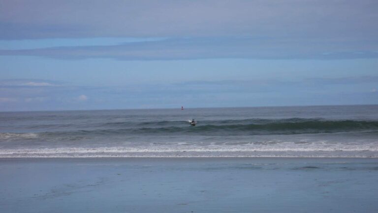
Photo: Tim Regan, CC BY 2.0
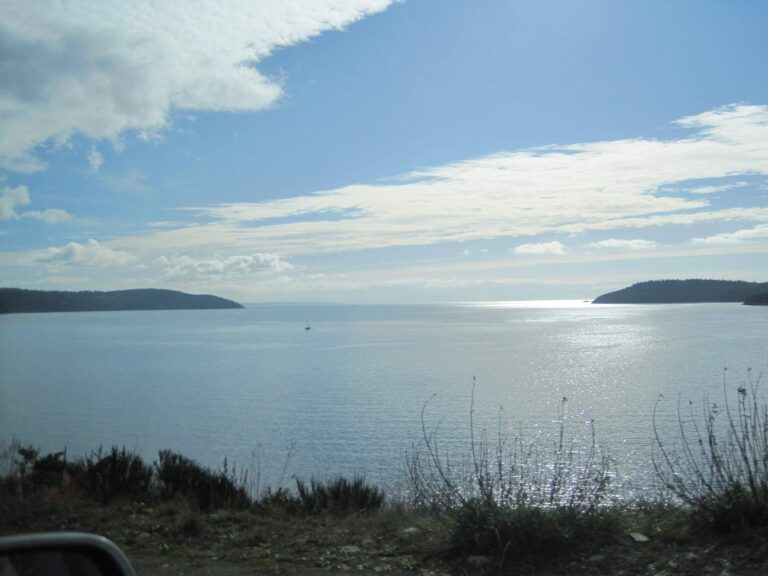
Photo: Chris Ballance, CC BY 2.0
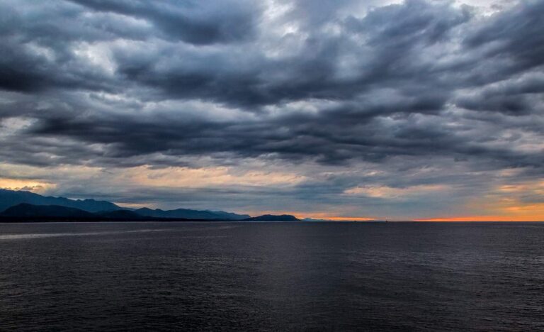
Photo: Sheila Sund, CC BY 2.0

Photo: Doug Kerr, CC BY-SA 2.0
Water in Jefferson County, question by question
Can I launch a drift boat or sled in Jefferson County?
Count 14 launches, run by 6 WDFW, 5 State Parks and 3 other agencies.
Which Jefferson County lake comes first on surface acres?
Leland Lake, at 108 surface acres in the WDFW layer.
What ends up in the cooler around Jefferson County?
Rainbow trout lead the count of water pages within 50 miles, followed by largemouth bass, coastal cutthroat trout and yellow perch.
Where do Jefferson County anglers buy bait and tackle?
Try Northwest Fishing News; the list holds 5.
Are any charter skippers based in Jefferson County?
The file holds 1 guide or charter.
Which Washington town runs the business of Jefferson County?
Port Townsend hosts the county offices.
Which WDFW license does a Jefferson County trip call for?
At 2026-27 WDFW prices, freshwater fishing runs $39.95 for a resident and $115.85 for an out-of-state angler 16 or older. For the sound and the coast, WDFW prices the Saltwater license at $40.71 resident and $81.70 nonresident.
Which neighbouring county page should Jefferson County anglers open next?
Closest by centre point: Clallam County, Mason County and Kitsap County.
Which Special Rules apply in Jefferson County?
The 2026-27 pamphlet prints 217 Special Rule entries touching this county, starting with Big Quilcene River; the table above shows the first ones.
Which marine areas touch Jefferson County?
Admiralty Inlet, East Juan de Fuca Strait, Hood Canal and La Push; the marine table above links each page.
What record weights trace to Jefferson County?
Brown Bullhead, 3.90 lbs, from Ludlow Lake, Jefferson County (June 26, 1997).
Is there stocked trout water in Jefferson County?
12 WDFW plants so far in 2026, 9,331 fish; the latest went into Leland Lake on Oct. 16, 2026.
Plan two days of fishing in Jefferson County
Lake pages list ramps, trout plants and WDFW species.