Fishing in Mason County, Washington
County seat: Shelton. Population 65,726.
- 28lake pages
- 29launches
- 11river pages
 Pick for salmonPiscifun Viper X spinning reel50% OFFSale $39.99
Photo of Lake Cushman: Dan Ox, CC BY-SA 2.0
The fishing picture across Mason County, start to finish
Mason County runs its county business from Shelton, and the 2020 Census found 65,726 people living inside its lines. WDFW hatchery plants in this county are logged under WDFW Region 6 in the 2026 report. Hikers can aim for 10 lakes on the WDFW high lakes list.
Lake guides cover 28 waters totalling 7,113 acres; Lake Cushman is the largest of them. Salt water within the county belongs to Hood Canal, South Puget Sound, Case Inlet and Puget Sound. WDFW SWIFD distribution data maps salmon or steelhead in Middle Fork Satsop River, Skokomish River, Quinault River and North Fork Skokomish River. Agency maps show 29 boat launches: 23 WDFW, 3 State Parks and 3 other agencies. WDFW maps 13 shore or access sites for bank anglers, 4 of them built piers.
Census 2020 population; WDFW Fish Washington lake layers, WDFW facilities and State Parks launch layers (WDFW GIS); WDFW marine areas; retrieved October 31, 2026.
 For the salmon herePiscifun AlumiX spinning reel46% OFFSale $64.99
One map of the Mason County water access
WDFW and State Parks launch layers, WDFW facilities, WDFW lake points, NHD river midpoints and WDFW marine area points. Checked November 2026.
Lakes of Mason County ranked by WDFW surface acres
| Lake | Acres | Launches | WDFW program | Fish WDFW maps |
|---|---|---|---|---|
| Lake Cushman | 4,015 | 0 | Trout emphasis | coastal cutthroat trout, kokanee |
| Mason Lake | 966 | 0 | Mixed species – Trout emphasis | kokanee, largemouth bass, brown bullhead |
| Nahwatzel Lake | 280 | 1 | Mixed species – Trout emphasis | rainbow trout, coastal cutthroat trout, largemouth bass |
| Spencer Lake | 212 | 1 | Mixed species – Trout emphasis | rainbow trout, coastal cutthroat trout, largemouth bass |
| Isabella Lake | 211 | 1 | Mixed species – Warmwater emphasis | coastal cutthroat trout, largemouth bass, brown bullhead |
| Lake Limerick | 132 | 1 | Mixed species – Trout emphasis | rainbow trout, largemouth bass, yellow perch |
| Lost Lake (Mason County) | 123 | 1 | Mixed species – Trout emphasis | rainbow trout, coastal cutthroat trout, kokanee |
| Tiger Lake | 107 | 1 | Mixed species – Trout emphasis | rainbow trout, coastal cutthroat trout, largemouth bass |
| Phillips Lake | 106 | 1 | Mixed species – Trout emphasis | rainbow trout, largemouth bass, bluegill |
| Island Lake (Mason County) | 105 | 1 | Mixed species – Trout emphasis | rainbow trout, largemouth bass, smallmouth bass |
| Lake Kokanee | 103 | 1 | Trout emphasis | rainbow trout, kokanee |
| Panther Lake (Kitsap County) | 101 | 1 | Mixed species – Trout emphasis | rainbow trout |
| Devereaux Lake | 98 | 1 | Mixed species – Trout emphasis | rainbow trout, coastal cutthroat trout, kokanee |
| Benson Lake | 80 | 1 | Mixed species – Trout emphasis | rainbow trout, largemouth bass |
| Trails End Lake | 73 | 1 | Mixed species – Trout emphasis | rainbow trout, coastal cutthroat trout |
| Haven Lake | 70 | 1 | Warmwater emphasis | rainbow trout, pumpkinseed |
| Lake Wooten | 68 | 1 | Mixed species – Trout emphasis | rainbow trout, coastal cutthroat trout |
| Price Lake | 65 | 0 | Trout emphasis | rainbow trout, brook trout, coastal cutthroat trout |
| Tee Lake | 48 | 1 | Mixed species – Trout emphasis | rainbow trout, coastal cutthroat trout, largemouth bass |
| Melbourne Lake | 39 | 0 | Trout emphasis | coastal cutthroat trout |
| Lake Maggie | 22 | 1 | Mixed species – Trout emphasis | rainbow trout |
| Robbins Lake | 16 | 0 | Mixed species – Trout emphasis | rainbow trout |
| Cady Lake | 15 | 1 | Trout emphasis | rainbow trout, brown trout, coastal cutthroat trout |
| Twin Lake – Big | 15 | 1 | Mixed species – Trout emphasis | rainbow trout, coastal cutthroat trout, brown bullhead |
| Clara Lake | 14 | 1 | Mixed species – Trout emphasis | rainbow trout |
| Aldrich Lake | 11 | 1 | Mixed species – Trout emphasis | rainbow trout |
| Wood Lake | 10 | 0 | Trout emphasis | rainbow trout, coastal cutthroat trout |
| Howell Lake | 9 | 0 | Trout emphasis | rainbow trout |
WDFW Fish Washington lowland and high lake layers (surface acres as published, management emphasis, mapped species); WDFW publishes no lake depths in these layers. Retrieved October 31, 2026.
Marine areas and inlets that touch Mason County
Count 4 marine areas and regional waters along Mason County.
| Water | Kind | Launches | Piers and shore | Marine area |
|---|---|---|---|---|
| Hood Canal (Marine Area 12) | WDFW marine area | 9 | 4 | 12 |
| South Puget Sound (Marine Area 13) | WDFW marine area | 9 | 4 | 13 |
| Case Inlet | regional marine water | 5 | 0 | 13 |
| Puget Sound | regional marine water | 34 | 52 | 8-1, 8-2, 9, 10, 11, 12, 13 |
Dated NOAA ESI data (2003 to 2006) place 8 marinas along this shore.
WDFW Recreational Marine Areas (WAC 220-300-160 boundaries), WDFW and State Parks marine launches, WDFW piers and USGS GNIS bay names; retrieved October 31, 2026.
Which fish WDFW ties to water near Mason County
Within 50 miles of Shelton, rainbow trout shows up on the most lake and marine pages.
Species mapped in the WDFW Fish Washington layers, WDFW state records and the 2026 WDFW trout plants, counted per water page within 50 miles; not a survey.
More named lakes of Mason County still without a page
Another 10 named lakes in Mason County have too few published facts for a page of their own and are listed by size.
| Water | Acres | WDFW program | Nearest town |
|---|---|---|---|
| Spider Lake | 18 | WDFW high lake, fish stocking | Shelton |
| Elk Lake | 9 | WDFW high lake, fish stocking | Seabeck |
| Pine Lake (Mason County) | 8 | WDFW high lake, fish stocking | Shelton |
| Snow Lake | 6 | WDFW high lake, fish stocking | Shelton |
| Ellinor Lake | 6 | WDFW high lake, fish stocking | Belfair |
| Upper Elk Lake | 4 | WDFW high lake, fish stocking | Belfair |
| Lincoln Pond | 3 | WDFW high lake, fish stocking | Belfair |
| Pershing Lake | 2 | WDFW high lake, fish stocking | Belfair |
| Goober Pond | 1 | WDFW high lake, fish stocking | Belfair |
| Tracy Lake | 1 | WDFW high lake, fish stocking | Shelton |
WDFW Fish Washington lowland and high lake layers and USGS NHD lake outlines, retrieved October 31, 2026.
Rivers, creeks and sloughs of Mason County
- Middle Fork Satsop RiverSWIFD lists chinook, chum and coho, 1 mapped launch, 1 WDFW shore or access site, 35 mi in Washington
- Skokomish RiverSWIFD lists chinook, chum and coho, 2 mapped launches, 1 USGS gauge, 8 mi in Washington
- Quinault RiverSWIFD lists chinook, chum and coho, 2 USGS gauges, 70 mi in Washington
- North Fork Skokomish RiverSWIFD lists chinook, chum and coho, 3 USGS gauges, 35 mi in Washington
- South Fork Skokomish RiverSWIFD lists chinook, chum and coho, 1 USGS gauge, 30 mi in Washington
- Tahuya RiverSWIFD lists chinook, chum and coho, 1 WDFW shore or access site, 21 mi in Washington
- Canyon RiverSWIFD lists chinook, chum and coho, 21 mi in Washington
- Hamma Hamma RiverSWIFD lists chinook, chum and coho, 18 mi in Washington
- Union RiverSWIFD lists chinook, chum and coho, 11 mi in Washington
- Dewatto RiverSWIFD lists chinook, chum and coho, 10 mi in Washington
- Decker Creek1 WDFW shore or access site, 16 mi in Washington
Mason County creeks listed only here (2)
- East Fork Satsop RiverSWIFD lists chinook, chum and coho, 15 mi in Washington
- North East Fork Union RiverSWIFD lists chum and coho, 3 mi in Washington
Live river readings in Mason County
| USGS gauge | Latest reading | Time (ET) |
|---|---|---|
| Skokomish River Near Potlatch, Wa | 4,500 cfs, 16.83 ft gage height | Nov 11 5:30 pm |
| Nf Skokomish R Bl Staircase Rpds Nr Hoodsport, Wa | 1,960 cfs, 5.31 ft gage height | Nov 11 5:30 pm |
| North Fork Skokomish River Near Potlatch, Wa | 376 cfs, 3.37 ft gage height | Nov 11 5:30 pm |
| Nf Skokomish R Nr Lwr Cushman Dam Nr Potlatch, Wa | 310 cfs, 2.50 ft gage height | Nov 11 5:30 pm |
| South Fork Skokomish River Near Union, Wa | 2,120 cfs, 2.36 ft gage height | Nov 11 5:45 pm |
| Goldsborough Creek Above 7th Street At Shelton, Wa | 112 cfs, 19.27 ft gage height | Nov 11 6:00 pm |
US Geological Survey provisional data, retrieved Nov 11, 2026 6:33 pm ET. Provisional readings can be revised.
USGS NHD flowlines and Washington lengths, WDFW SWIFD salmon and steelhead distribution, WDFW and State Parks launches, USGS gauges; retrieved October 31, 2026.
The Mason County trout plant log for 2026
So far in 2026 the WDFW report shows 73 plants into Mason County water: 98,506 fish in 27 waters.
- Nahwatzel LakeRainbow, 500 fish at 0.8 per pound, October 6, 2026, Satsop Springs Ponds
- Nahwatzel LakeRainbow, 500 fish at 0.8 per pound, September 30, 2026, Satsop Springs Ponds
- Cady LakeRainbow, 300 fish at 0.8 per pound, September 29, 2026, Eells Springs
- Trails End LakeRainbow, 95 fish at 0.8 per pound, September 28, 2026, Eells Springs
- Trails End LakeRainbow, 605 fish at 0.95 per pound, September 28, 2026, Eells Springs
- Spencer LakeRainbow, 2,534 fish at 0.95 per pound, September 28, 2026, Eells Springs
- Spencer LakeRainbow, 1,466 fish at 0.8 per pound, September 28, 2026, Eells Springs
- Nahwatzel LakeRainbow, 2,000 fish at 0.8 per pound, September 28, 2026, Eells Springs
- Lost Lake (Mason County)Rainbow, 2,000 fish at 0.95 per pound, September 28, 2026, Eells Springs
- Island Lake (Mason County)Rainbow, 2,000 fish at 0.95 per pound, September 28, 2026, Eells Springs
- Lake KokaneeRainbow, 2,605 fish at 1.13 per pound, September 1, 2026, Mckernan Hatchery
- Lake KokaneeRainbow, 2,615 fish at 1.58 per pound, July 1, 2026, George Adams Hatchery
WDFW Trout Plants report (rows January 2 to October 27, 2026), read October 31, 2026; newest plants first.
Launches and shore sites listed for Mason County
- Benson Lake boat launchBenson Lake, WDFW, 1 ramp, concrete surface, Discover Pass
- Cady Lake boat launchCady Lake, WDFW, 1 ramp, gravel surface, Discover Pass
- Devereaux Lake boat launchDevereaux Lake, WDFW, 1 ramp, concrete surface, Discover Pass
- Haven Lake boat launchHaven Lake, WDFW, 1 ramp, gravel surface, Discover Pass
- Isabella Lake boat launchIsabella Lake, WDFW, 1 ramp, gravel surface, Discover Pass
- Island Lake boat launch (north)Island Lake, WDFW, 1 ramp, concrete surface, Discover Pass
- Jarrell Cove, north boat launch on Case InletCase Inlet, State Parks, Discover Pass
- Jarrell Cove, south boat launch on Case InletCase Inlet, State Parks, Discover Pass
- Lake Limerick boat launchLake Limerick, WDFW, 1 ramp, concrete surface, Discover Pass
- Lake Wooten boat launchLake Wooten, WDFW, 1 ramp, concrete surface, Discover Pass
- Lost Lake boat launchLost Lake, WDFW, 1 ramp, concrete surface, Discover Pass
- Maggie Lake boat launchLake Maggie, WDFW, 1 ramp, gravel surface, Discover Pass
- Nahwatzel Lake boat launchNahwatzel Lake, WDFW, 1 ramp, concrete surface, Discover Pass
- North Bay boat launchMarine Area 13, WDFW, n/a surface, Discover Pass
- Oakland Bay boat launchMarine Area 13, WDFW, n/a surface, Discover Pass
- Panther Lake boat launch (west)Panther Lake, WDFW, 1 ramp, gravel surface, Discover Pass
- Phillips Lake boat launchPhillips Lake, WDFW, 1 ramp, concrete surface, Discover Pass
- Sherwood Creek boat launch on Case InletCase Inlet, WDFW, n/a surface, Discover Pass
- Skokomish boat launchSkokomish River, WDFW, 1 ramp, unimproved surface surface, Discover Pass
- Spencer Lake boat launchSpencer Lake, WDFW, 1 ramp, concrete surface, Discover Pass
- Tee Lake boat launchTee Lake, WDFW, 1 ramp, gravel surface, Discover Pass
- Trails End Lake boat launchTrails End Lake, WDFW, 1 ramp, gravel surface, Discover Pass
- Twin Lakes boat launch on Twin Lake – BigTwin Lake – Big, WDFW, 1 ramp, gravel surface, Discover Pass
- Aldrich Lake boat launchAldrich Lake, agency not given, gravel surface
- Colonel's Hole boat launch on Skokomish RiverSkokomish River, WDFW, 1 hand launch, Discover Pass
- Don Lake boat launch on Clara LakeClara Lake, agency not given, gravel surface
- Lake Kokanee boat launchLake Kokanee, agency not given, concrete surface
- Twanoh, pier and floatsMarine Area 12, State Parks, boat ramp
- Union River boat launchMarine Area 12, WDFW, 1 hand launch, Discover Pass
Vehicles at 25 of these sites must display a Discover Pass, per the layers.
Walk-in fishing sites of Mason County (13)
- Allyn Pierfishing pier, Marine Area 13
- Hoodsport Hatchery Handicap Platformfishing pier, Marine Area 12
- Hoodsport Pierfishing pier, Marine Area 12
- Oakland Baywater access area
- Twanoh Park Pierfishing pier, Marine Area 12
- Decker Creek shore accessaccess point (no launch)
- Devereaux Lake shore accessshore fishing site, shore fishing at boat launch
- Isabella Lake shore accessshore fishing site, Shore fishing at boat launch
- Island Lake shore accessshore fishing site, Limited shore fishing at boat launch
- Lake Limerick shore accessshore fishing site, Limited shore fishing at boat launch
- Lost Lake shore accessshore fishing site, 75 feet of shore fishing at boat launch
- Spencer Lake shore accessshore fishing site, 75 feet of shore fishing at boat launch
- Tahuya River shore accessaccess point (no launch)
WDFW Facilities layer (boat launches, piers, shore sites) and the State Parks boat launch layer; retrieved October 31, 2026. Lanes and per-launch fees are not published in these layers.
Fish an angler may bag across Mason County
For Mason County, check the statewide rows first and then the waters WDFW singles out. The Freshwater license is the base item here, $39.95 resident and $115.85 nonresident for the 2026-27 license year. Salmon and bottomfish trips on marine water take the $40.71 resident Saltwater license ($81.70 for nonresidents). The catch record card, issued with the license, logs every salmon, steelhead, sturgeon or halibut taken home.
| Species | Limit | Season |
|---|---|---|
| Largemouth Bass | No min. size in lakes, ponds, and reservoirs. Only largemouth bass less than 12" may be retained, except 1 over 17" may be retained. Daily limit 5. | Lakes, ponds, and reservoirs: year-round; rivers, streams and beaver ponds: Sat. before Memorial Day through Oct. 31 |
| Largemouth Bass | No size restriction/daily limit in rivers, streams, and beaver ponds. | Lakes, ponds, and reservoirs: year-round; rivers, streams and beaver ponds: Sat. before Memorial Day through Oct. 31 |
| Smallmouth Bass | No min. size in lakes, ponds, and reservoirs. Only 1 smallmouth bass over 14" may be retained. Daily limit 10. | Lakes, ponds, and reservoirs: year-round; rivers, streams and beaver ponds: Sat. before Memorial Day through Oct. 31 |
| Smallmouth Bass | No size restriction/daily limit in rivers, streams, and beaver ponds. | Lakes, ponds, and reservoirs: year-round; rivers, streams and beaver ponds: Sat. before Memorial Day through Oct. 31 |
| Walleye | Min. size 12" in lakes, ponds, and reservoirs. Daily limit 8. Only 1 over 22" may be retained. May be caught, retained, and released alive from a livewell until daily limit is in possession. | Lakes, ponds, and reservoirs: year-round; rivers, streams and beaver ponds: Sat. before Memorial Day through Oct. 31 |
| Walleye | No size restriction/daily limit in rivers, streams, and beaver ponds. | Lakes, ponds, and reservoirs: year-round; rivers, streams and beaver ponds: Sat. before Memorial Day through Oct. 31 |
| Channel Catfish | No min. size in lakes, ponds, and reservoirs. Daily limit 5. | Lakes, ponds, and reservoirs: year-round; rivers, streams and beaver ponds: Sat. before Memorial Day through Oct. 31 |
| Channel Catfish | No min. size/daily limit in rivers, streams, and beaver ponds. | Lakes, ponds, and reservoirs: year-round; rivers, streams and beaver ponds: Sat. before Memorial Day through Oct. 31 |
| Burbot (Freshwater Ling) | No min. size. Daily limit 5. | Lakes, ponds, and reservoirs: year-round; rivers, streams and beaver ponds: Sat. before Memorial Day through Oct. 31 (p.23 general rule for |
| Crappie, Northern Pikeminnow, Peamouth Chub, Perch, Suckers, Sunfish, | No min. size. No daily limit. | Lakes, ponds, and reservoirs: year-round; rivers, streams and beaver ponds: Sat. before Memorial Day through Oct. 31 |
| Grass Carp | Closed unless otherwise listed in Special Rules. | Closed |
| Kokanee | No min. size. Daily limit 10. When fishing with bait, all kokanee that are lawful to possess and are equal to or greater than the minimum size are counted as part of the daily limit whether kept or released. | Lakes, ponds, and reservoirs: year-round; rivers, streams and beaver ponds: Sat. before Memorial Day through Oct. 31 (p.23 general rule for |
| Tiger Muskellunge (Tiger Muskie) | Min. size 50". Daily limit 1. | Lakes, ponds, and reservoirs: year-round; rivers, streams and beaver ponds: Sat. before Memorial Day through Oct. 31 (p.23 general rule for |
| Whitefish | No min. size. Daily limit 15. | Lakes, ponds, and reservoirs: year-round; rivers, streams and beaver ponds: Sat. before Memorial Day through Oct. 31 (p.23 general rule for |
| Steelhead | Release all wild steelhead. Min. size 20". Daily limit 2. Open during salmon or game fish seasons unless as otherwise listed. | Open during salmon or game fish seasons unless as otherwise listed |
| Brown Trout, Cutthroat Trout, Rainbow Trout, Golden Trout, Tiger Trout | In rivers, streams, and beaver ponds: Min. size 8". Daily limit 2. | Sat. before Memorial Day-Oct. 31 (statewide river season, p.23) |
Salt water follows marine-area tables, printed on each marine page. Marine area rules
Water-specific limits in Mason County (201)
| Water and reach | Species | Rule |
|---|---|---|
| Big Mission Creek | All species | Selective gear rules. |
| Big Mission Creek | Trout | Statewide min. size/daily limit. Except: release cutthroat trout and wild rainbow trout. (Sat. before Memorial Day-Oct. 31) |
| Big Mission Creek | Other game fish | Statewide min. size/daily limit. (Sat. before Memorial Day-Oct. 31) |
| Campbell Creek | All species | Selective gear rules. |
| Campbell Creek | Trout | Statewide min. size/daily limit. Except: release cutthroat trout and wild rainbow trout. (Sat. before Memorial Day-Oct. 31) |
| Campbell Creek | Other game fish | Statewide min. size/daily limit. (Sat. before Memorial Day-Oct. 31) |
| Canyon River | All species | CLOSED WATERS. |
| Church Creek: from mouth to the bridge on U.S.F.S. Rd. #2361 | All species | CLOSED WATERS. |
| Cloquallum Creek: from mouth to the outlet at Stump Lake CRC (321) | All species | Selective gear rules. (Nov. 1-Last Day of Feb.) |
| Cloquallum Creek: from mouth to the outlet at Stump Lake CRC (321) | Trout | Statewide min. size/daily limit. Except: Cutthroat trout and wild rainbow trout: min. size 14". (Sat. before Memorial Day-Oct. 31) |
| Cloquallum Creek: from mouth to the outlet at Stump Lake CRC (321) | Trout | Statewide min. size/daily limit. Except: Release cutthroat trout and wild rainbow trout. (Nov. 1-Last Day of Feb.) |
| Cloquallum Creek: from mouth to the outlet at Stump Lake CRC (321) | Other game fish | Statewide min. size/daily limit. (Sat. before Memorial Day-Last Day of Feb.) |
| Coulter Creek | All species | Selective gear rules. |
| Coulter Creek | Trout | Statewide min. size/daily limit. Except: release cutthroat trout and wild rainbow trout. (Sat. before Memorial Day-Oct. 31) |
| Coulter Creek | Other game fish | Statewide min. size/daily limit. (Sat. before Memorial Day-Oct. 31) |
| Cranberry Creek | All species | Selective gear rules. |
| Cranberry Creek | Trout | Statewide min. size/daily limit. Except: release cutthroat trout and wild rainbow trout. (Sat. before Memorial Day-Oct. 31) |
| Cranberry Creek | Other game fish | Statewide min. size/daily limit. (Sat. before Memorial Day-Oct. 31) |
| Deer Creek | All species | Selective gear rules. |
| Deer Creek | Trout | Statewide min. size/daily limit. Except: release cutthroat trout and wild rainbow trout. (Sat. before Memorial Day-Oct. 31) |
Limits and seasons as printed in the 2026-2027 Washington Sport Fishing Rules (WDFW pamphlet, in effect July 1, 2026 to June 30, 2027), PDF page 27 (pamphlet PDF; eRegulations statewide freshwater page), read October 31, 2026. Special Rules as printed in the 2026-2027 Washington Sport Fishing Rules (WDFW pamphlet, in effect July 1, 2026 to June 30, 2027), pamphlet page 26 (pamphlet PDF), read on eRegulations October 31, 2026.
Washington record fish tied to Mason County
| Species | Weight | Angler | Water | Date |
|---|---|---|---|---|
| Coho Salmon | 25.27 lbs | Brad Wilson | Quinault River | Nov. 11, 2001 |
Washington Department of Fish and Wildlife (WDFW) sport fish records list, as of October 31, 2026.
Tackle counters and guides in Mason County
Washington tackle counters in Mason County
- Fair Harbor Marinamarina, Allyn
- Hood Canal Marinamarina, Union
- Jarrell's Cove Marinamarina, Shelton
- Oakland Bay Marinamarina, Shelton
Guides and charters based in Mason County
- Puget Charterscharter, Shelton, (360) 490-8482
Yellow Pages and chain store listings, guide and charter listings (city of business); retrieved October 31, 2026.
On the roads out of Mason County
Beds and diners for a Mason County trip
- Sheltonpop. 10,371
- Belfairpop. 4,279
- Allynpop. 2,194
County guides one line over from Mason County
- Kitsap County32 miles northeast
- Thurston County33 miles southeast
- Grays Harbor County35 miles southwest
- Jefferson County35 miles northwest
Rods and reels from Piscifun ahead of a trip to Mason County


Piscifun and Amazon links are affiliate links; the site earns a commission on qualifying purchases.
Lakes, rivers and sound close to Mason County, pictured

Photo: Chris Ballance, CC BY 2.0
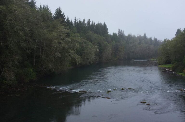
Photo: Ferrous Büller, CC BY-SA 2.0

Photo: U.S. Forest Service- Pacific Northwest Region, Public domain
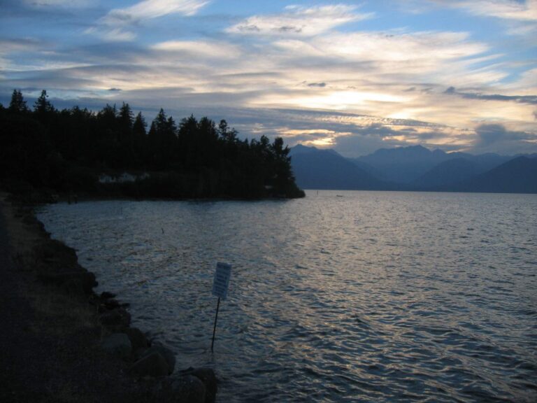
Photo: Peter Abrahamsen, CC BY-SA 2.0
Short replies on fishing Mason County
How many WDFW and park launches serve Mason County?
29 launches on the layers (23 WDFW, 3 State Parks and 3 other agencies).
Which lake covers the most ground in Mason County?
Lake Cushman, at 4,015 surface acres in the WDFW layer.
Which fish does WDFW map on water near Mason County?
Rainbow trout lead the count of water pages within 50 miles, followed by largemouth bass, yellow perch and coastal cutthroat trout.
Which Mason County stores keep jigs and leader?
4 in all, starting with Fair Harbor Marina.
How many guide listings give a Mason County city?
Count 1 guide or charter with a local city.
Which Washington town holds the Mason County county offices?
Shelton is the seat.
How much does a visiting angler spend on a license in Mason County?
The Freshwater license is the base item here, $39.95 resident and $115.85 nonresident for the 2026-27 license year. Salmon and bottomfish trips on marine water take the $40.71 resident Saltwater license ($81.70 for nonresidents).
What counties lie around Mason County?
The nearest county pages are Kitsap County, Thurston County and Grays Harbor County.
Do any Mason County waters carry Special Rules?
The 2026-27 pamphlet prints 201 Special Rule entries touching this county, starting with Big Mission Creek; the table above shows the first ones.
Is there marine fishing in Mason County?
Hood Canal, South Puget Sound, Case Inlet and Puget Sound; the marine table above links each page.
Has Mason County water put a fish on the WDFW list?
Coho Salmon, 25.27 lbs, from Quinault River, Grays Harbor County (Nov. 11, 2001).
Does WDFW plant trout in Mason County?
73 WDFW plants so far in 2026, 98,506 fish; the latest went into Nahwatzel Lake on Oct. 6, 2026.
Pick a lake or river in Mason County
Open a lake for its ramps, limits and stocking.