Dabob Bay Fishing
Washington marine water in Jefferson and Kitsap counties, inside Marine Area 12.
 Pick for troutPiscifun Carbon X ultralight spinning reel28% OFFSale $57.99
Photo of Hood Canal: Peter Abrahamsen, CC BY-SA 2.0
Starting out on Dabob Bay
Seasons on Dabob Bay follow the Marine Area 12 rows; the shore is Jefferson and Kitsap counties. Roughly 6 miles separates it from Bangor Base.
There are 4 saltwater launches serving it. Walk-out fishing comes from 1 pier or shore site. Anglers can work 2 named fishing areas here. The pamphlet prints 35 marine rule rows for it. There are 7 NOAA tide stations for tide tables.
WDFW recreational marine area layer (WAC 220-311-010) on geodataservices.wdfw.wa.gov, USGS GNIS names, WDFW and State Parks launch layers, WDFW shore fishing layer; retrieved October 31, 2026.
Species documented for Dabob Bay
The Dabob Bay rule rows and records name these fish.
2026-27 WDFW pamphlet marine area rows and WDFW sport fish records; retrieved October 31, 2026.
 For the trout herePiscifun Carbon XT ultralight spinning reel25% OFFSale $59.99
Where WDFW maps the fishing grounds of Dabob Bay
- Misery PointBoat Access Only
- Quilcene BayBoat Access Only
WDFW Major Fishing Areas layer on geodataservices.wdfw.wa.gov (names and access notes as published); retrieved October 31, 2026.
Putting in for Dabob Bay
- Indian George Creek boat launch on Dabob Bayn/a surface, Discover Pass, WDFW
- Misery Point boat launch on Dabob Bay1 ramp, concrete surface, Discover Pass, WDFW
- Point Whitney boat launch on Dabob Bay1 ramp, concrete surface, Discover Pass, WDFW
- Pleasant Harbor on Dabob Bayboat ramp, Washington State Parks and Recreation Commission
Fallback launches for Dabob Bay
- Pleasant Harbor1 ramp, concrete surface, Discover Pass, 6 miles southwest
- Triton Cove boat launchn/a surface, 1 hand launch, Discover Pass, 11 miles southwest
- Ross Point boat launch on Sinclair InletSinclair Inlet, 16 miles southeast
- Point No Point boat launchn/a surface, Discover Pass, 19 miles northeast
WDFW Water Access Sites and Shore Fishing Sites layers (geodataservices.wdfw.wa.gov) and the Washington State Parks boat launch layer, retrieved October 31, 2026. Parking at WDFW and State Parks launches needs a Discover Pass.
Public piers along Dabob Bay
- Pleasant Harbor on Dabob Bayfishing pier, Marine Area 12
Fishing piers a short drive from Dabob Bay
- Silverdale Pierfishing pier, Marine Area 10, 9 miles
- Brownsville Dockfishing pier, Marine Area 10, 12 miles
- Suquamish Dockfishing pier, Marine Area 10, 14 miles
- Coal Dock (Lion's Community Park) on Sinclair Inletfishing pier, Marine Area 10, 14 miles
- Illahee City Pier on Sinclair Inletfishing pier, Marine Area 10, 14 miles
WDFW piers and shore fishing layers, retrieved October 31, 2026.
Inlets that branch off Dabob Bay
- Fisherman Harborharbor Jefferson County
- Jackson Covecove Jefferson County
- Right Smart Covecove Jefferson County
USGS GNIS names inside the WDFW marine area polygon; retrieved October 31, 2026.
NOAA readings around Dabob Bay
NOAA CO-OPS water level, preliminary reading at retrieval (October 31, 2026); station page for live data.
- Zelatched Point, Dabob Baytide predictions, 2 miles
- Whitney Point, Dabob Baytide predictions, 2 miles
- Quilcene, Quilcene Bay, Dabob Baytide predictions, 5 miles
- Bangor Wharftide predictions, 5 miles
- Pleasant Harbortide predictions, 6 miles
- Seabeck, Seabeck Baytide predictions, 6 miles
Salish Sea and coastal tides swing several feet, and the ebb sets up hard current at points and passes on Dabob Bay; read the table before you anchor.
NOAA CO-OPS water level and tide prediction stations inside or beside the marine area; retrieved October 31, 2026.
Moorage and marinas near Dabob Bay, older NOAA list
- Pleasant Harbor State Marine Parkmarina 360/902-8500
- Quilcene Boat Havenmarina 360/385-0656
Boat-access reefs around Dabob Bay
- Misery Pointboat
NOAA Environmental Sensitivity Index atlas records (2003 to 2006); facility and reef details reflect the source year, not today. Retrieved october 31, 2026.
Daily limits and seasons, Dabob Bay
| Species and location | Daily limit and size | Season |
|---|---|---|
| Trout | Catch-and-release. | Year-round |
| Steelhead | Daily limit 2 hatchery steelhead. | Year-round |
| Sturgeon | Catch-and-release. | Year-round |
| Mackerel | CLOSED to fishing for, retaining, or possessing. | Year-round |
| Herring, Anchovy, Sardine, Sand Lance, and Smelt | CLOSED to fishing for, retaining, or possessing. | Year-round |
| Pacific Halibut | CLOSED to fishing for, retaining, or possessing. | CLOSED |
| Other Food Fish | CLOSED to fishing for, retaining, or possessing. | Year-round |
| All Other Fish | CLOSED to fishing for, retaining, or possessing. | CLOSED |
| Salmon (North of Ayock Point (see exception for Tarboo Bay below) (see A for Dosewalips River, B Duckabush Riv | CLOSED. | July 1-July 31 |
| Salmon (North of Ayock Point (see exception for Tarboo Bay below) (see A for Dosewalips River, B Duckabush Riv | No min. size. Daily limit 4. Release Chinook, chum, and sockeye. | Aug. 1-Oct. 15 |
| Salmon (North of Ayock Point (see exception for Tarboo Bay below) (see A for Dosewalips River, B Duckabush Riv | No min. size. Daily limit 4. Release Chinook. | Oct. 16-Oct. 31 |
| Salmon (North of Ayock Point (see exception for Tarboo Bay below) (see A for Dosewalips River, B Duckabush Riv | No min. size. Daily limit 4. Release Chinook and coho. | Nov. 1-Nov. 30 |
| Salmon (Tarboo Bay) | CLOSED. | July 1-July 31 |
| Salmon (Tarboo Bay) | No min. size. Daily limit 4. Release Chinook, chum, and sockeye. | Aug. 1-Sept. 15 |
| Salmon (Tarboo Bay) | CLOSED. | Sept. 16-Nov. 30 |
| Salmon (South of Ayock Point (see exception for Skokomish Mouth Area below) (see D for Skokomish River and E D | Chinook – min. size 20”. Other salmon species – no min. size. Daily limit 4. Release chum, sockeye, and wild Chinook. Anglers may fish with two poles with Two-Pole Endorsement. | July 1-Sept. 30 |
| Salmon (South of Ayock Point (see exception for Skokomish Mouth Area below) (see D for Skokomish River and E D | No min. size. Daily limit 4. Release Chinook and chum. | Oct. 1-Oct. 15 |
| Salmon (South of Ayock Point (see exception for Skokomish Mouth Area below) (see D for Skokomish River and E D | No min. size. Daily limit 4. Release Chinook. | Oct. 16-Oct. 31 |
| Salmon (South of Ayock Point (see exception for Skokomish Mouth Area below) (see D for Skokomish River and E D | No min. size. Daily limit 4. Release Chinook and coho. | Nov. 1-Nov. 30 |
| Salmon (Hoodsport Hatchery Zone (see below for boundaries)) | No min. size. Daily limit 4. Release chum, sockeye, and wild Chinook. Night closure. Anglers may fish with two poles with Two-Pole Endorsement | July 1-Sept. 30 |
| Salmon (Hoodsport Hatchery Zone (see below for boundaries)) | No min. size. Daily limit 4. Release Chinook and chum. Night closure. | Oct. 1-Oct. 15 |
| Salmon (Hoodsport Hatchery Zone (see below for boundaries)) | No min. size. Daily limit 4. Release Chinook. Night closure. | Oct 16-Oct. 31 |
| Salmon (Hoodsport Hatchery Zone (see below for boundaries)) | No min. size. Daily limit 4. Release Chinook and coho. Night closure. | Nov. 1-Nov. 30 |
| Salmon (Skokomish Mouth Area) | Chinook – min. size 20”. Other salmon species – no min. size. Daily limit 4. Release chum, sockeye, and wild Chinook. Anglers may fish with two poles with Two-Pole Endorsement. Fishing from a floating device only. | July 1-Sept. 30 |
Showing 24 of 35 pamphlet rows for Marine Area 12.
Anglers 16 and older fishing marine water carry a Saltwater license ($40.71 resident, $81.70 nonresident for 2026-27) or a Combination license, plus a catch record card for salmon, sturgeon, steelhead or halibut.
Limits and seasons as printed in the 2026-2027 Washington Sport Fishing Rules (WDFW pamphlet, in effect July 1, 2026 to June 30, 2027), PDF page 130 (pamphlet PDF; eRegulations marine area page), read October 31, 2026.
Sizing Dabob Bay against nearby salt water
| Water | Distance | Marine area | Launches | Piers and shore sites | Tide stations |
|---|---|---|---|---|---|
| Dabob Bay | Marine Area 12 | 4 | 1 | 7 | |
| Hood Canal (Marine Area 12) | 7 miles | Marine Area 12 | 9 | 4 | 11 |
| Sinclair Inlet | 16 miles | Marine Area 10 | 2 | 10 | 8 |
| Seattle-Bremerton (Marine Area 10) | 18 miles | Marine Area 10 | 3 | 22 | 16 |
| Admiralty Inlet (Marine Area 9) | 23 miles | Marine Area 9 | 5 | 4 | 10 |
| Elliott Bay | 23 miles | Marine Area 10 | 0 | 5 | 10 |
WDFW marine areas and access layers, NOAA stations; retrieved October 31, 2026.
Near Dabob Bay
Salt water beside Dabob Bay
- Hood Canal (Marine Area 12)7 miles
- Sinclair Inlet16 miles
- Seattle-Bremerton (Marine Area 10)18 miles
- Admiralty Inlet (Marine Area 9)23 miles
- Elliott Bay23 miles
Other water an easy drive past Dabob Bay
- Silent Lake5 miles
- Island Lake (Kitsap County)9 miles
- Wildcat Lake10 miles
- Sandy Shore Lake11 miles
- Big Quilcene River6 miles
- Duckabush River8 miles
- Little Quilcene River10 miles
- Tahuya River13 miles
Gear stores used by Dabob Bay anglers
- Dick's Sporting Goods Silverdalesporting goods store, Silverdale, 9 miles
- Sportsman's Warehouse Silverdalesporting goods store, Silverdale, 9 miles
- Dick's Sporting Goods Seattlesporting goods store, Seattle, 24 miles
- Sportsman's Warehouse Sequimsporting goods store, Sequim, 27 miles
- Northwest Fishing Newsbait and tackle shop, Port Ludlow
- Port Ludlow Marinamarina, Port Ludlow
Guide services listed near Dabob Bay
- Northwest Fishing Newsfishing guide, Port Ludlow, (206) 450-7947
Lodging towns for anglers working Dabob Bay
- Bangor Base6 miles
- Seabeck6 miles
- Silverdale9 miles
- Poulsbo9 miles
Dabob Bay county by county
- Jefferson Countyseat: Port Townsend
- Kitsap Countyseat: Port Orchard
Piscifun reels and line rigged for Dabob Bay


Piscifun and Amazon links are affiliate links; the site earns a commission on qualifying purchases.
Photographs of fishing water around Dabob Bay
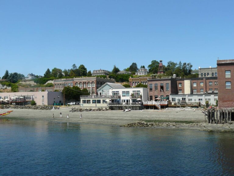
Photo: B. Carlson, CC BY 2.0
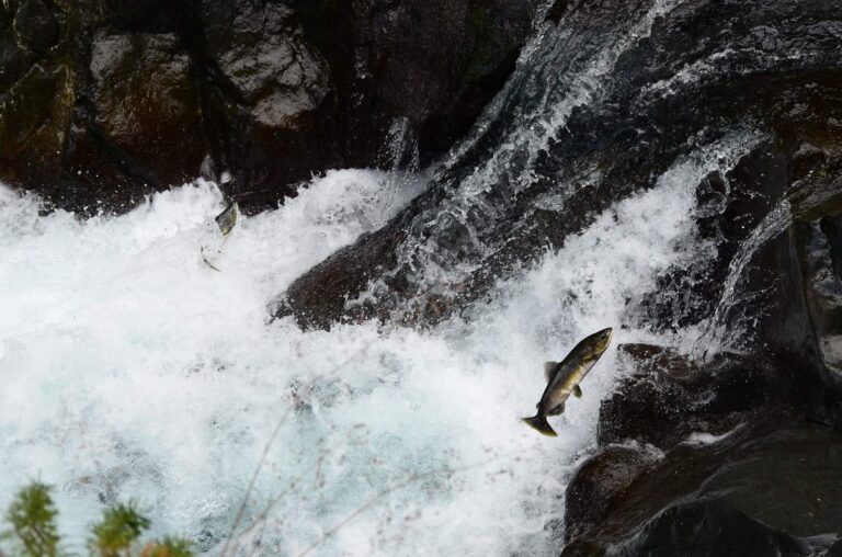
Photo: U.S. Forest Service- Pacific Northwest Region, Public domain

Photo: Larry Syverson, CC BY-SA 2.0
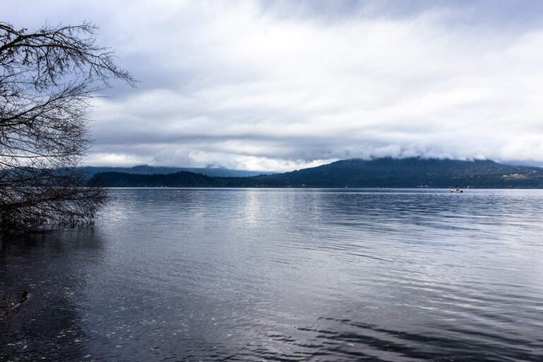
Photo: Jonathan Miske, CC BY-SA 2.0
Before you drive to Dabob Bay: common questions
How does WDFW classify Dabob Bay?
The rules for Marine Area 12 apply.
When can I keep a salmon on Dabob Bay?
Salmon on Marine Area 12: CLOSED.; July 1-July 31. Watch for in-season changes.
How many lingcod may I keep at Dabob Bay?
Lingcod: CLOSED to fishing for, retaining, or possessing. (CLOSED).
Can a trailered boat reach Dabob Bay from a listed launch?
The layers list 4 launches; Misery Point boat launch on Dabob Bay is one.
Where is pier fishing near Dabob Bay?
Yes: 1 pier or shore site, including Pleasant Harbor on Dabob Bay.
Which WDFW license and card cover a day on Dabob Bay?
Anglers 16 and older fishing marine water carry a Saltwater license ($40.71 resident, $81.70 nonresident for 2026-27) or a Combination license, plus a catch record card for salmon, sturgeon, steelhead or halibut.
Which tide station serves Dabob Bay?
Start with Zelatched Point, Dabob Bay for tide times.
Who sells herring and jigs near Dabob Bay?
Stop at Dick's Sporting Goods Silverdale, about 9 miles away.
Which named fishing areas lie in Dabob Bay?
2 named fishing areas; Misery Point and Quilcene Bay is one.
Plan a saltwater day on Dabob Bay
Check emergency rules for the area before the trip.