Nottoway River Fishing
Moving water in Greensville County and 5 other localities.
 Pick for troutPiscifun Carbon X ultralight spinning reel28% OFFSale $57.99
Photo of Lake Chesdin: Ken Lund, CC BY-SA 2.0
First notes on the Nottoway River
Greensville County and 5 other localities carries the Nottoway River, a river. Budget about 12 miles of driving to Courtland.
DWR maps 6 access sites along its banks. It has 5 USGS gauges reporting live.
Virginia DWR waterbody pages, Stocked Trout Reaches and Cold Water Stream Survey layers and Boating Access Locations; USGS gauges; read November 6, 2026.
 For the trout herePiscifun Carbon XT ultralight spinning reel25% OFFSale $59.99
The DWR description of the Nottoway River
Moratorium on Possession of American Shad It is now illegal for any person fishing this river to have American Shad in their possession. All American Shad inadvertently caught by anglers must be immediately released back into the water. Overview The Nottoway is a DCR designated state scenic river, with a minimum of development and good fishing for a variety of species.
Access notes DWR gives for Nottoway River
The following are three of the better float-fishing trip worth trying on the river: Cutbank Bridge (Rt. 609) to Double Bridge (Rt. 619) (11.5 miles) This is a trip for canoes only, as the river reaches the Fall Line in the last three miles of the trip. Put in at the Rt. 609 bridge and take out at the VDWR boat ramp on Rt. 651, just past the Rt. 619 bridge.
The quoted passages are Virginia DWR wording about Nottoway River, unedited.
Virginia DWR waterbody page (updated 11/17/2023), read November 6, 2026.
USGS stage and discharge, Nottoway River
| USGS gauge | Latest reading | Time (ET) |
|---|---|---|
| Nottoway River Near Rawlings, Va | 104 cfs, 2.71 ft gage height | Nov 8 7:20 pm |
| Nottoway River At Route 609 Near Mckenney, Va | 131 cfs, 0.70 ft gage height | Nov 8 6:45 pm |
| Nottoway River Near Stony Creek, Va | 124 cfs, 2.87 ft gage height | Nov 8 6:30 pm |
US Geological Survey provisional data, retrieved Nov 8, 2026 7:32 pm ET. Provisional readings can be revised.
The live Nottoway River figures await USGS review.
| USGS site | Name |
|---|---|
| 02044500 | NOTTOWAY RIVER NEAR RAWLINGS, VA |
| 02045320 | NOTTOWAY RIVER AT ROUTE 609 NEAR MCKENNEY, VA |
| 02045500 | NOTTOWAY RIVER NEAR STONY CREEK, VA |
| 02047000 | NOTTOWAY RIVER NEAR SEBRELL, VA |
| 02047370 | NOTTOWAY RIVER NEAR RIVERDALE, VA |
USGS instantaneous values, provisional.
Fish DWR names on the Nottoway River
Fish listed for Nottoway River come from DWR pages, trout layers, the stocking schedule or the record list; this is not a catch report.
Virginia DWR waterbody page (updated 11/17/2023), read November 6, 2026.
DWR access points along the Nottoway River
| Site | Recorded attributes | Owner | Location (DWR) |
|---|---|---|---|
| Carey's Bridge boat ramp on Nottoway River | ramp (gravel), 1 ramp, freshwater | Carrys Bridge LLC | From Capron, Rt 653 Northeast (4.5) |
| General Vaughan Bridge boat ramp on Nottoway River | dock and ramp, 2 ramps, freshwater | DWR | From Franklin, Rt 258 South (9.5) |
| Hercules boat ramp on Nottoway River | dock and ramp, 1 ramp, freshwater | Ashland Chemical Inc. | From Franklin, Rt 671 West (4) |
| Jarratt boat ramp on Nottoway River | ramp (no dock), 1 ramp, barrier-free, freshwater | DWR | From Jarratt, Rt 630 East (2.2) to Nottoway River; site on left |
| Peter's Bridge boat ramp on Nottoway River | ramp (no dock), 1 ramp, freshwater | Goodwood VA, LCC. | From Littleton, Rt 35 South (1); R on Rt 631 (2.7) |
| Purdy boat ramp on Nottoway River | ramp (no dock), 1 ramp, freshwater | DWR | From Jarratt, Rt. 610 West (.7); R on Rt 608 (4.4); R on Rt 651 (1.2) |
Alternate DWR ramps when Nottoway River overflows
- Airfield Pond boat rampLake Airfield, 10 miles east
Virginia DWR Boating Access Locations layer (attributes as recorded; lanes, fees and hours are not in the layer), read November 6, 2026.
Virginia limits in force on the Nottoway River
| Species as printed | Applies to | Creel | Length |
|---|---|---|---|
| Largemouth, Smallmouth Bass | statewide | 5 per day in the aggregate (combined) | No statewide length limits |
| Alabama, Spotted Bass | statewide | No statewide daily limit | No statewide length limit |
| Landlocked Striped Bass and Landlocked Striped Bass X White Bass Hybrids | statewide | 4 per day in the aggregate | No fish less than 20 inches |
| Striped Bass | Anadromous (coastal) striped bass above the fall line in all coastal rivers of the Chesapeake Bay and Crane Lake (City of Suffolk) | Creel and length limits shall be as set by the Virginia Marine Resources Commission for recreational fishing in tidal waters | no length limit printed |
| Striped Bass | Striped bass in the Meherrin, Nottoway, Blackwater (Chowan Drainage), North Landing and Northwest rivers and their tributaries plus Back Bay | No possession | no length limit printed |
| Walleye, Saugeye | statewide | 5 per day in the aggregate | No walleye or saugeye less than 18 inches |
| Sauger | statewide | 2 per day | No statewide length limits |
| White Bass | statewide | 5 per day | No statewide length limits |
| Chain Pickerel and Northern Pike | statewide | 5 per day | No statewide length limits |
| Muskellunge | statewide | 1 per day | No muskellunge less than 40 inches |
| Bluegill (bream) and other sunfish excluding Crappie, Rock Bass (redeye) and Roanoke Bass | statewide | 50 per day in the aggregate (combined) | No statewide length limits |
| Crappie (black or white) | statewide | 25 per day in the aggregate (combined) | No statewide length limits |
| Rock Bass (redeye) | statewide | 25 per day in the aggregate with Roanoke bass | No statewide length limits |
| Roanoke Bass | statewide | 25 per day in the aggregate with rock bass | No statewide length limits |
| Perch (yellow and white) | statewide | No statewide daily limit | No statewide length limit |
| Trout | statewide | 6 per day | 7 inch minimum size |
| Channel, White, and Flathead | statewide | 20 per day | No length limits |
| Blue | statewide | 20 per day | No statewide length limits |
An exception for Nottoway River would override the row above.
- Black Bass (Smallmouth & Largemouth)
- 5 per day in aggregate
- No length limits
- Roanoke Bass
- 5 per day in aggregate with rock bass
- No Roanoke or rock bass less than 8 inches
- Sunfish
- 50 per day in aggregate
- No length limits
- Crappie
- 25 per day
- No length limits
- Blue and Channel Catfish
- 20 per day
Virginia DWR waterbody page (updated 11/17/2023), read November 6, 2026.
Water-specific limits for Nottoway River
| Water as printed | Species | Rule as printed |
|---|---|---|
| Nottoway, Meherrin, Blackwater (Franklin County), Blackwater (Chowan), Falling and Smith rivers and their tributaries | Rock Bass (redeye) | 5 per day in the aggregate (combined) with Roanoke bass No rock bass less than 8 inches |
| Nottoway, Meherrin, and Blackwater (Franklin County), Blackwater (Chowan), Falling and Smith rivers and their tributaries | Roanoke Bass | 5 per day in the aggregate (combined) with rock bass No Roanoke bass less than 8 inches |
Water-specific exceptions as printed, 2026 Freshwater Fishing in Virginia digest (eRegulations, linked from the Virginia DWR regulations page), read November 6, 2026.
A Virginia freshwater license is $23 a year for residents and $47 for nonresidents 16 and older.
Statewide creel and length limits as printed (page updated August 17, 2026), 2026 Freshwater Fishing in Virginia digest (eRegulations, linked from the Virginia DWR regulations page), read November 6, 2026. Virginia license fees in the 2026 Freshwater Fishing in Virginia digest (licenses run one year from purchase unless noted), read November 6, 2026.
The Nottoway River and its closest Virginia neighbours
| Stream | Distance | DWR access sites | USGS gauges | Stocked reaches |
|---|---|---|---|---|
| Nottoway River | this stream | 6 | 5 | 0 |
| Blackwater River | 18 miles east | 3 | 5 | 0 |
| Meherrin River | 23 miles southwest | 2 | 4 | 0 |
| Chickahominy River | 31 miles northeast | 0 | 2 | 0 |
| Appomattox River | 32 miles north | 0 | 4 | 0 |
| Tidal James River | 34 miles northeast | 6 | 0 | 0 |
Virginia DWR Boating Access Locations and Stocked Trout Reaches, USGS gauges; read November 6, 2026.
Within a tank of gas of Nottoway River
Lakes in the same corner of Virginia as Nottoway River
- Lake Airfield9 miles
- Emporia Reservoir24 miles
- Wilcox Lake26 miles
- Burnt Mills Reservoir29 miles
Picking up minnows and bloodworms near Nottoway River
- The Fishing Holebait and tackle shop, Waverly, 13 miles
- Virginia Outdoorsbait and tackle shop, Franklin, 19 miles
- Whippernock Marinamarina, Sutherland
Old Dominion towns a quick hop from Nottoway River
- Courtland12 miles, Southampton County
- Waverly13 miles, Sussex County
- Franklin18 miles, City of Franklin
County and city guides tied to Nottoway River
- Greensville Countycounty seat Emporia
- Lunenburg Countycounty seat Lunenburg
- Southampton Countycounty seat Courtland
- Sussex Countycounty seat Sussex
- Dinwiddie Countycounty seat Dinwiddie
- Nottoway Countycounty seat Nottoway
Virginia rivers neighbouring the Nottoway River
- Blackwater River18 miles
- Meherrin River23 miles
- Chickahominy River31 miles
- Appomattox River32 miles
- Tidal James River34 miles
Piscifun kit lined up for a day on Nottoway River


Piscifun and Amazon links are affiliate links; the site earns a commission on qualifying purchases.
Old Dominion water near Nottoway River, on camera

Photo: David Wilson, CC BY 2.0
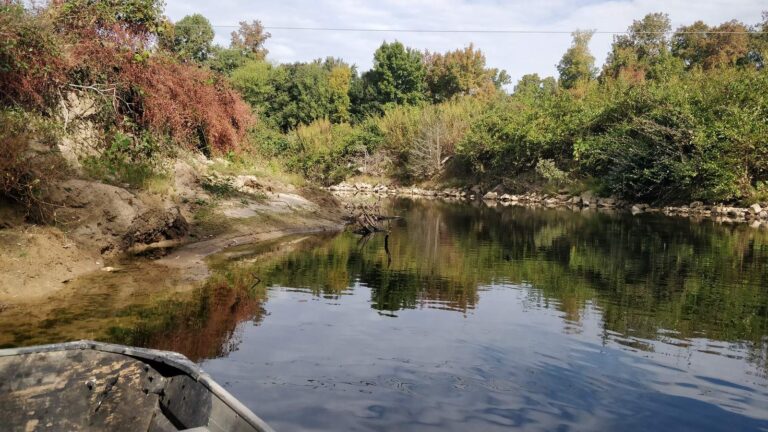
Photo: schizoform, CC BY 2.0
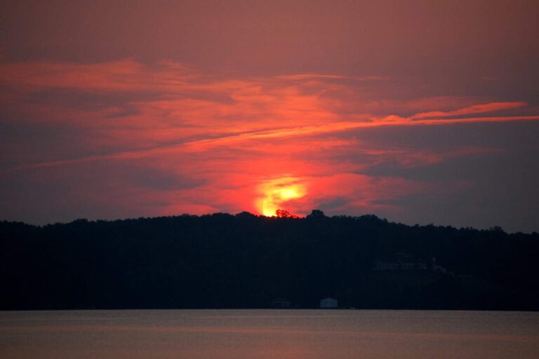
Photo: ted, CC BY 2.0

Photo: Jim, CC BY-SA 2.0
Straight replies on the Nottoway River from the Virginia rule books
What town is near the Nottoway River?
It runs through Greensville County and 5 other localities, about 12 miles from Courtland.
Can I launch a canoe on the Nottoway River?
Use Carey's Bridge boat ramp on Nottoway River or another of 6 access sites.
Does DWR name smallmouth bass for the Nottoway River?
DWR lists American shad, alewife, black crappie, blue catfish, bluegill, bowfin and crappie.
Does DWR stock trout in the Nottoway River?
No trout data for it in DWR layers.
How many black bass may leave the Nottoway River in a Virginia cooler?
The statewide digest row for largemouth and smallmouth bass reads: 5 per day in the aggregate (combined); No statewide length limits. Its own digest line may change that.
Does a teenager need a DWR license on the Nottoway River?
A Virginia freshwater license is $23 a year for residents and $47 for nonresidents 16 and older. Youth under 16 are exempt.
Is the Nottoway River too high to float?
The flow band shows 5 USGS gauges, live and provisional.
Where do anglers fishing the Nottoway River buy tackle?
Our list starts with The Fishing Hole (about 13 miles away).
Float a Commonwealth stretch of the Nottoway River
Licenses, trout rules and exceptions sit on the regulations page.