Meherrin River Fishing
Virginia river fishing in Greensville and Mecklenburg counties.
 Pick for troutPiscifun Carbon X ultralight spinning reel28% OFFSale $57.99
Photo of Lake Gaston: ted, CC BY 2.0
The Meherrin River in brief
In Greensville and Mecklenburg counties you meet the Meherrin River, a river on the Virginia map. Supplies are nearest in Emporia, under a mile off.
Boaters get 2 access sites from the DWR list. Flow comes from 4 USGS gauges.
Virginia DWR waterbody pages, Stocked Trout Reaches and Cold Water Stream Survey layers and Boating Access Locations; USGS gauges; read November 6, 2026.
 For the trout herePiscifun Carbon XT ultralight spinning reel25% OFFSale $59.99
What Virginia DWR writes about the Meherrin River
Moratorium on Possession of River Herring It is now illegal for any person fishing this river to have river herring in their possession — this includes blueback herring and alewife. All river herring inadvertently caught by anglers must be immediately released back into the water. New Regulations for Herring The Meherrin River originates on the Lunenburg-Mecklenburg County line in Virginia and flows southeasterly through the coastal piedmont into Emporia Reservoir.
Getting to Meherrin River, per DWR
For access to the boat ramp in the city of Emporia, Virginia, take the Rt. 58 East Business exit off of Interstate 95. Continue east on Business Rt. 58 to Main Street (Rt. 301 South). Turn south on Main Street and follow the Meherrin River. The entrance to the boat ramp is on the east side of the street. The boat ramp is located under the Main Street bridge.
The DWR page supplies the quoted lines on Meherrin River.
Virginia DWR waterbody page (updated 11/17/2023), read November 6, 2026.
USGS stations on the Meherrin River
| USGS gauge | Latest reading | Time (ET) |
|---|---|---|
| Meherrin River At Rt 637 Near South Hill, Va | 45 cfs, 3.41 ft gage height | Nov 8 6:45 pm |
| Meherrin River Near Lawrenceville, Va | 79 cfs, 1.82 ft gage height | Nov 8 6:45 pm |
| Meherrin River At Emporia, Va | 46 cfs, 2.22 ft gage height | Nov 8 6:30 pm |
US Geological Survey provisional data, retrieved Nov 8, 2026 7:32 pm ET. Provisional readings can be revised.
The Meherrin River readings update on their own and can be revised.
| USGS site | Name |
|---|---|
| 02051190 | MEHERRIN RIVER AT RT 637 NEAR SOUTH HILL, VA |
| 02051500 | MEHERRIN RIVER NEAR LAWRENCEVILLE, VA |
| 02052000 | MEHERRIN RIVER AT EMPORIA, VA |
| 02052090 | MEHERRIN RIVER NEAR BRYANTS CORNER, VA |
USGS instantaneous values, provisional.
Species on the DWR page for the Meherrin River
No survey or catch data went into the Meherrin River list beyond DWR labels.
Virginia DWR waterbody page (updated 11/17/2023), read November 6, 2026.
DWR boating access along the Meherrin River
| Site | Recorded attributes | Owner | Location (DWR) |
|---|---|---|---|
| Farmers Market boat ramp on Meherrin River | hand launch (boat slide), 1 ramp, barrier-free, freshwater | City of Emporia | On Main Street, south of river, east of Main Street at Farmers Market. |
| Meherrin Park | dock and ramp, 1 ramp, barrier-free, freshwater | City of Emporia | In Emporia, Off of Route 301 , East on Hicksford Ave. into Meherrin Park Road, signs to |
Ramps worth knowing close to Meherrin River
- Emporia boat rampEmporia Reservoir, 1 mile northwest
- Purdy boat ramp on Nottoway RiverNottoway River, 11 miles north
- Jarratt boat ramp on Nottoway RiverNottoway River, 11 miles north
- Brunswick Lake boat rampBrunswick Lake, 13 miles northwest
Virginia DWR Boating Access Locations layer (attributes as recorded; lanes, fees and hours are not in the layer), read November 6, 2026.
Virginia keep counts for the Meherrin River
| Species as printed | Applies to | Creel | Length |
|---|---|---|---|
| Largemouth, Smallmouth Bass | statewide | 5 per day in the aggregate (combined) | No statewide length limits |
| Alabama, Spotted Bass | statewide | No statewide daily limit | No statewide length limit |
| Landlocked Striped Bass and Landlocked Striped Bass X White Bass Hybrids | statewide | 4 per day in the aggregate | No fish less than 20 inches |
| Striped Bass | Anadromous (coastal) striped bass above the fall line in all coastal rivers of the Chesapeake Bay and Crane Lake (City of Suffolk) | Creel and length limits shall be as set by the Virginia Marine Resources Commission for recreational fishing in tidal waters | no length limit printed |
| Striped Bass | Striped bass in the Meherrin, Nottoway, Blackwater (Chowan Drainage), North Landing and Northwest rivers and their tributaries plus Back Bay | No possession | no length limit printed |
| Walleye, Saugeye | statewide | 5 per day in the aggregate | No walleye or saugeye less than 18 inches |
| Sauger | statewide | 2 per day | No statewide length limits |
| White Bass | statewide | 5 per day | No statewide length limits |
| Chain Pickerel and Northern Pike | statewide | 5 per day | No statewide length limits |
| Muskellunge | statewide | 1 per day | No muskellunge less than 40 inches |
| Bluegill (bream) and other sunfish excluding Crappie, Rock Bass (redeye) and Roanoke Bass | statewide | 50 per day in the aggregate (combined) | No statewide length limits |
| Crappie (black or white) | statewide | 25 per day in the aggregate (combined) | No statewide length limits |
| Rock Bass (redeye) | statewide | 25 per day in the aggregate with Roanoke bass | No statewide length limits |
| Roanoke Bass | statewide | 25 per day in the aggregate with rock bass | No statewide length limits |
| Perch (yellow and white) | statewide | No statewide daily limit | No statewide length limit |
| Trout | statewide | 6 per day | 7 inch minimum size |
| Channel, White, and Flathead | statewide | 20 per day | No length limits |
| Blue | statewide | 20 per day | No statewide length limits |
The 2026 statewide rows are the default for Meherrin River.
- Striped Bass
- 2 per day
- No Striped Bass less than 18 inches
- Shad (Hickory and American)
- Above Emporia Dam
- No Possession; Catch and Release Only
- Below Emporia Dam
- 10 per day in aggregate
- No length limits
- River Herring (Blueback and Alewife)
- Above Emporia Dam
- No Possession; Catch and Release Only
- Below Emporia Dam
- No possession
Virginia DWR waterbody page (updated 11/17/2023), read November 6, 2026.
Digest exceptions on Meherrin River
| Water as printed | Species | Rule as printed |
|---|---|---|
| Nottoway, Meherrin, Blackwater (Franklin County), Blackwater (Chowan), Falling and Smith rivers and their tributaries | Rock Bass (redeye) | 5 per day in the aggregate (combined) with Roanoke bass No rock bass less than 8 inches |
| Nottoway, Meherrin, and Blackwater (Franklin County), Blackwater (Chowan), Falling and Smith rivers and their tributaries | Roanoke Bass | 5 per day in the aggregate (combined) with rock bass No Roanoke bass less than 8 inches |
Water-specific exceptions as printed, 2026 Freshwater Fishing in Virginia digest (eRegulations, linked from the Virginia DWR regulations page), read November 6, 2026.
A Virginia freshwater license is $23 a year for residents and $47 for nonresidents 16 and older.
Statewide creel and length limits as printed (page updated August 17, 2026), 2026 Freshwater Fishing in Virginia digest (eRegulations, linked from the Virginia DWR regulations page), read November 6, 2026. Virginia license fees in the 2026 Freshwater Fishing in Virginia digest (licenses run one year from purchase unless noted), read November 6, 2026.
The Meherrin River beside other Virginia streams
| Stream | Distance | DWR access sites | USGS gauges | Stocked reaches |
|---|---|---|---|---|
| Meherrin River | this stream | 2 | 4 | 0 |
| Nottoway River | 23 miles northeast | 6 | 5 | 0 |
| Blackwater River | 38 miles east | 3 | 5 | 0 |
| Appomattox River | 46 miles north | 0 | 4 | 0 |
| Chickahominy River | 52 miles northeast | 0 | 2 | 0 |
| Tidal James River | 57 miles northeast | 6 | 0 | 0 |
Virginia DWR Boating Access Locations and Stocked Trout Reaches, USGS gauges; read November 6, 2026.
Old Dominion stops around Meherrin River
Other impoundments a short drive from Meherrin River
- Emporia Reservoir2 miles
- Brunswick Lake13 miles
- Great Creek Watershed Lake20 miles
- Fort Pickett Lakes29 miles
Bloodworm and minnow counters en route to Meherrin River
- Buggs Island Boat Comarina, Boydton
- Rudd's Creek Marinamarina, Boydton
- Bobcat's Bait & Tacklebait and tackle shop, Clarksville
- Clarksville Marina Incmarina, Clarksville
- Twin Lakes Outfittersbait and tackle shop, South Hill
Towns that make a good base for Meherrin River
- Emporiaunder a mile, City of Emporia
- Lawrenceville18 miles, Brunswick County
- Courtland27 miles, Southampton County
Each locality touching Meherrin River, linked
- Greensville Countycounty seat Emporia
- Mecklenburg Countycounty seat Boydton
Neighbouring rivers of the Meherrin River
- Nottoway River23 miles
- Blackwater River38 miles
- Appomattox River46 miles
- Chickahominy River52 miles
- Tidal James River57 miles
A Piscifun spread to take to Meherrin River


Piscifun and Amazon links are affiliate links; the site earns a commission on qualifying purchases.
Photo ID for the fish swimming at Meherrin River
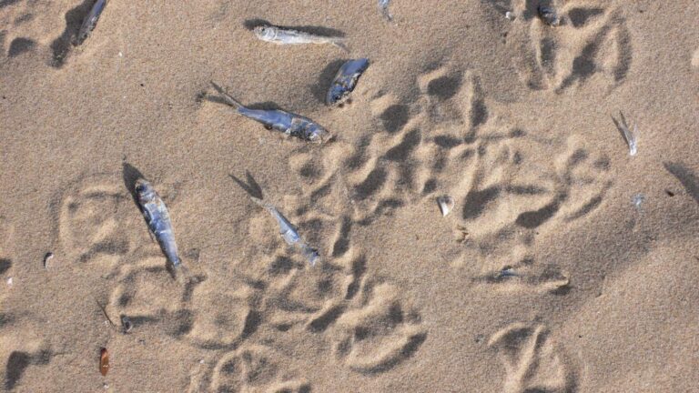
Photo: kjell, CC BY-SA 2.0

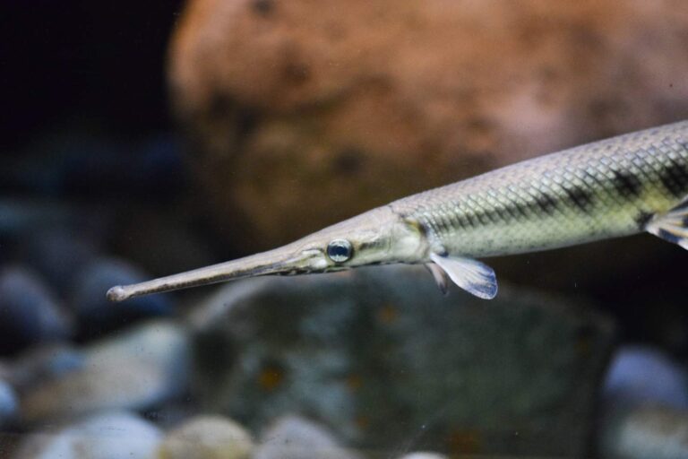
Photo: Thomas Quine, CC BY 2.0
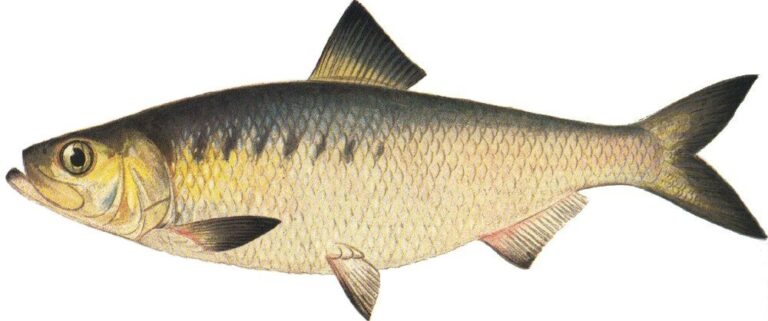
Photo: Ellen Edmonson and Hugh Chrisp, Public domain

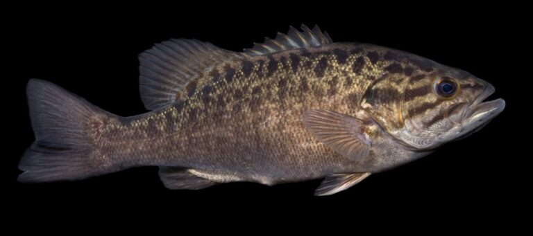
Photo: USFWS Mountain-Prairie, Public domain
What a Virginia tackle counter hears about the Meherrin River
Which part of the Commonwealth holds the Meherrin River?
Set the map on Greensville and Mecklenburg counties, under a mile from Emporia.
How many access sites serve the Meherrin River?
DWR shows 2 access sites; start at Farmers Market boat ramp on Meherrin River.
Which species does DWR list for the Meherrin River?
DWR sources name alewife, black crappie, bluegill, channel catfish, crappie, longnose gar and hickory shad.
Do DWR trout trucks visit the Meherrin River?
It is not on the DWR trout layers.
Do I measure bass on the Meherrin River?
The statewide digest row for largemouth and smallmouth bass reads: 5 per day in the aggregate (combined); No statewide length limits. Check its exception rows too.
Which license do I carry on the Meherrin River?
A Virginia freshwater license is $23 a year for residents and $47 for nonresidents 16 and older. Anglers under 16 need none.
Which USGS gauge reads the Meherrin River?
Live numbers come from 4 USGS gauges above.
Does a listed fly or tackle store serve the Meherrin River?
Try Buggs Island Boat Co (same locality).
Read the USGS gauge, then fish the Meherrin River
Know the creel limits before the first cast.