Fishing in Bath County, Virginia
Government seat in Warm Springs; 4,209 residents at the 2020 Census.
- 3lake pages
- 0DWR launches
- 6river pages
 Pick for troutPiscifun Carbon X ultralight spinning reel28% OFFSale $57.99
Photo of Lake Moomaw: U.S. Army Corps of Engineers Norfolk District, CC BY 2.0
Old Dominion water in Bath County, in a few lines
Warm Springs serves as the seat of Bath County, home to 4,209 people at the last Census. Its own DWR lakes, ramps and piers are filed under DWR Region 4.
Of 3 lake pages reaching it, Lake Moomaw spreads widest. Pier fishing here includes 2 fishing piers recorded by DWR. 352 stocking dates on the DWR trout schedule list it.
Census 2020 population; Virginia DWR Public Fishing Lakes layer (outline, motor rule, region number), read November 6, 2026. Virginia DWR Boating Access Locations layer (attributes as recorded; lanes, fees and hours are not in the layer), read November 6, 2026. Virginia DWR trout stocking schedule (date, county, water, category and species as listed; DWR prints no numbers or sizes), read November 6, 2026.
 For the trout herePiscifun Carbon XT ultralight spinning reel25% OFFSale $59.99
Dots for each Bath County ramp, pier and lake
Virginia DWR Boating Access Locations layer (attributes as recorded; lanes, fees and hours are not in the layer), read November 6, 2026. Lake points from the Virginia DWR Public Fishing Lakes layer (outline, motor rule, region number), read November 6, 2026.
Lake pages inside Bath County
| Lake | Area | Kind | DWR launches | Fish DWR names |
|---|---|---|---|---|
| Lake Moomaw | 2,530 acres | lake | 1 | alewife, black crappie, bluegill |
| Douthat Lake | 50 acres | lake | 0 | black crappie, brook trout, chain pickerel |
| Bath County Recreation Ponds | 45 acres | pond | 0 | bluegill, channel catfish, largemouth bass |
Measured from Warm Springs, these lake pages are the closest outside Bath County.
| Lake | From Warm Springs | Area | Kind | DWR launches | Fish DWR names |
|---|---|---|---|---|---|
| Clifton Forge Reservoir | 14 miles south | 9 acres | reservoir | 0 | black crappie, bluegill, channel catfish |
| Lake Robertson | 19 miles southeast | 31 acres | reservoir | 0 | bluegill, common carp, channel catfish |
| Braley Pond | 31 miles northeast | 4 acres | reservoir | 0 | bluegill, channel catfish, largemouth bass |
| Cave Mountain Lake | 35 miles south | 2 acres (DWR outline area) | lake | 0 | brook trout, brown trout, rainbow trout |
| Elkhorn Lake | 36 miles northeast | 54 acres | reservoir | 0 | bluegill, channel catfish, largemouth bass |
| Staunton Run | 37 miles northeast | 15 acres | lake | 0 | bluegill, channel catfish, muskellunge |
Acres are the NHD outline area of the mapped lake (USGS National Hydrography Dataset), not a DWR figure. Virginia DWR Boating Access Locations layer (attributes as recorded; lanes, fees and hours are not in the layer), read November 6, 2026.
Counting species on lake pages by Bath County
Out to 50 miles from Warm Springs, bluegill appears on the most lake pages DWR describes.
Species DWR names on waterbody pages and its fishing grid, counted per lake page within 50 miles; not a survey of fish numbers.
More lakes on the Bath County roster
Bath County holds 3 more DWR or NHD lakes with too few published facts for a page.
| Water | Kind | Area | Nearest town |
|---|---|---|---|
| Bath County Pumped Storage Lake | lake | 298 acres (NHD outline area) | Clifton Forge |
| Lake Sherwood | lake | 166 acres (NHD outline area) | Covington |
| Wallace Tract Pond | pond | 2 acres (DWR outline area) | Clifton Forge |
Virginia DWR Public Fishing Lakes layer (outline, motor rule, region number), read November 6, 2026. Acres are the NHD outline area of the mapped lake (USGS National Hydrography Dataset), not a DWR figure.
Rivers and trout streams of Bath County
- Cowpasture River1 stocked trout reach, 1 USGS gauge
- Little Back Creek1 stocked trout reach, wild trout survey class II, 9.9 km, 1 USGS gauge
- Muddy Run1 stocked trout reach, wild trout survey class II, 8.7 km, 1 USGS gauge
- Pads Creek1 stocked trout reach, wild trout survey class VIII, 12.2 km
- Spring Run1 stocked trout reach
- Wilson Creek2 stocked trout reaches
Additional flowing water through Bath County (65)
- Cedar Creek, 10CRE-01Twild trout survey class III, 55.4 km
- Jackson River, 10JKS-03wild trout survey class V, 52.0 km
- Cascades Creek, 10CSC-01Twild trout survey class II, 25.3 km
- Mill Creek, 10MIT-01wild trout survey class VI, 25.2 km
- Mare Run1 stocked trout reach, wild trout survey class II, 10.6 km
- Dry Run, 10DRR-01wild trout survey class II, 19.5 km
- Jordan Run1 stocked trout reach, wild trout survey class II, 7.5 km
- County Line Run, 10CYL-01Twild trout survey class II, 14.6 km
- Wilson Creek, LP, 10WNL-01Twild trout survey class II, 11.3 km
- Lick Run, 10LIK-01wild trout survey class II, 11.2 km
- Wilson Creek, 10WLN-01wild trout survey class II, 10.9 km
- Mill Creek, 10MIX-01wild trout survey class II, 10.8 km
- Back Creek1 stocked trout reach, 1 USGS gauge
- Back Creek1 stocked trout reach, 2 USGS gauges
- Cascades Creek1 stocked trout reach
- Jackson River1 stocked trout reach
- Jackson River1 stocked trout reach
- Jackson River1 stocked trout reach, 1 USGS gauge
- Mill Creek1 stocked trout reach
- Smith Creek, 10SMH-02Twild trout survey class II, 8.3 km
- Smith Creek, 10SMH-02wild trout survey class II, 8.2 km
- Little Mill Creekwild trout survey class II, 7.9 km
- Bolshers Runwild trout survey, 7.8 km
- Little Wilson Creek, 10LWL-01wild trout survey class II, 7.8 km
- Cowardin Run, 10CWD-01wild trout survey class II, 6.8 km
- Jim Dave Runwild trout survey class IV, 6.7 km
- Pads Creek, SFwild trout survey class VI, 6.2 km
- Porters Mill Creekwild trout survey class III, 5.8 km
- Wilson Creek, LP, 10WNL-01wild trout survey class II, 5.8 km
- Cascades Creek, 10CSC-01wild trout survey class II, 5.7 km
- Little Valley Runwild trout survey class III, 5.5 km
- Wilson Creek, 10WLN-01Twild trout survey class II, 5.5 km
- Mill Creek, 10MIW-01wild trout survey class I, 4.9 km
- Portage Runwild trout survey class VII, 4.2 km
- Cowardin Run, 10CWD-01Twild trout survey class II, 3.4 km
- Mill Creek, 10MIW-01Twild trout survey class I, 3.3 km
- Rocky Run, 10ROR-01wild trout survey class II, 3.3 km
- Lick Block Runwild trout survey class II, 3.2 km
- Waterfall Branch, 10WAT-01wild trout survey class II, 3.0 km
- Castle Runwild trout survey class II, 2.9 km
- Back Creek, 10BCC-01wild trout survey class V, 2.8 km
- Big Lick Runwild trout survey class II, 2.8 km
- Spring Run, 10SIN-01wild trout survey class II, 2.7 km
- Thompson Creekwild trout survey class III, 2.6 km
- County Line Run, 10CYL-01wild trout survey class II, 2.5 km
- Bear Hole Runwild trout survey class II, 2.4 km
- Laurel Run, 10LAA-01wild trout survey class II, 2.4 km
- Cub Run, 10CUN-01wild trout survey class II, 2.2 km
- Panther Runwild trout survey class II, 2.2 km
- Kelly Runwild trout survey class II, 2.0 km
- Beaver Runwild trout survey class II, 1.9 km, 1 USGS gauge
- Cave Runwild trout survey class II, 1.9 km
- Sawmill Run, 10SAW-01wild trout survey class II, 1.9 km
- Copeland Creekwild trout survey class VII, 1.8 km
- Ford Runwild trout survey class II, 1.8 km
- Hidden Valley Springwild trout survey class II, 1.7 km
- Wildcat Hollow, 10WID-01wild trout survey class III, 1.7 km
- Big Run, 10BIR-01wild trout survey class III, 1.6 km
- Bogen Runwild trout survey class VIII, 1.6 km
- Long Spring Runwild trout survey class IV, 1.5 km
- Barney Runwild trout survey class II, 1.4 km
- Pheasanty Runwild trout survey class II, 1.4 km
- Spring Branch, 10SPI-01wild trout survey class II, 1.4 km
- Bear Loop Branchwild trout survey class II, 1.1 km
- Big Run, 10BIR-01Twild trout survey class III, 0.8 km
Live USGS flow across Bath County
| USGS gauge | Latest reading | Time (ET) |
|---|---|---|
| Jackson River Near Bacova, Va | 21 cfs, 2.89 ft gage height | Nov 12 5:30 pm |
| Back Creek Near Sunrise, Va | 11 cfs, 1.13 ft gage height | Nov 12 6:00 pm |
| Back Creek At Sunrise, Va | 22 cfs, 4.14 ft gage height | Nov 12 5:30 pm |
| Little Back Creek Near Sunrise, Va | 4 cfs, 0.95 ft gage height | Nov 12 5:45 pm |
| Back Creek Near Mountain Grove, Va | 30 cfs, 2.71 ft gage height | Nov 12 5:30 pm |
| Bullpasture River At Williamsville, Va | 36 cfs, 1.30 ft gage height | Nov 12 5:45 pm |
US Geological Survey provisional data, retrieved Nov 12, 2026 6:33 pm ET. Provisional readings can be revised.
DWR waterbody pages, DWR Stocked Trout Reaches and Cold Water Stream Survey layers (wild trout classes and kilometres as recorded), DWR launches and USGS gauges (live readings); read November 6, 2026.
Reservoir pool snapshots for Bath County
| Lake | Pool | Operator | Reading time |
|---|---|---|---|
| Lake Moomaw | 1565.38 ft | USACE Norfolk District | 2026-11-06 19:30:00 UTC |
These pools are single timed readings, not a running feed.
USACE Norfolk District pool as reported through the NOAA National Water Prediction Service gauge MOOV2, read November 6, 2026 (one dated reading, not live; feet as published, datum not printed).
DWR launches across Bath County
Bath County pier sites on the DWR layer
- Bolar Flats Recreation Area on Lake MoomawLake Moomaw, fishing pier
- Douthat State ParkDouthat Lake, fishing pier
Virginia DWR Boating Access Locations layer (attributes as recorded; lanes, fees and hours are not in the layer), read November 6, 2026. Virginia DWR Fishing Piers layer (name and water only), read November 6, 2026.
Stocked trout water in Bath County
| Date | Water as listed | Category | Species |
|---|---|---|---|
| October 28, 2026 | Back Creek | A | Rainbow Trout, Brown Trout, Tiger Trout |
| October 23, 2026 | Douthat Lake & Wilson Creek | + | Brown Trout |
| October 20, 2026 | Cowpasture River | A | Brown Trout |
| October 19, 2026 | Douthat Lake & Wilson Creek | + | Brown Trout |
| October 14, 2026 | Douthat Lake & Wilson Creek | + | Rainbow Trout |
| October 14, 2026 | Jackson River Special Reg * | Rainbow Trout | |
| October 9, 2026 | Douthat Lake & Wilson Creek | + | Rainbow Trout, Brown Trout |
| October 9, 2026 | Bullpasture River | A | Rainbow Trout, Brown Trout |
| October 8, 2026 | Jackson River (Hidden Valley) | A | Rainbow Trout, Brown Trout |
| October 6, 2026 | Spring Run | CR | Brown Trout |
| October 5, 2026 | Back Creek | DH | Brown Trout |
| October 5, 2026 | Douthat Lake & Wilson Creek | + | Rainbow Trout, Brown Trout |
| October 2, 2026 | Jackson River (Rt. 623) | A | Rainbow Trout, Brown Trout |
| May 29, 2026 | Douthat Lake & Wilson Creek | + | Brown Trout |
| May 27, 2026 | Back Creek | A | Brown Trout |
| May 26, 2026 | Cowpasture River | A | Rainbow Trout, Brown Trout, Tiger Trout |
| May 21, 2026 | Jackson River (Rt. 623) | A | Brown Trout |
| May 18, 2026 | Jackson River (Hidden Valley) | A | Brown Trout |
| May 18, 2026 | Douthat Lake & Wilson Creek | + | Brown Trout |
| May 8, 2026 | Bullpasture River | A | Rainbow Trout, Brown Trout |
Bath County waters in the 2026 trout plan
| Water | County or city as printed | Category | Category meaning | National forest |
|---|---|---|---|---|
| Back Creek | Bath County | DH | Delayed Harvest, special regulations, stocked 3 times | |
| Back Creek | Bath County | A | stocked 8 times between October 1 and May 31 | yes |
| Bullpasture River | Bath County | A | stocked 8 times between October 1 and May 31 | |
| Cowpasture River | Bath County | A | stocked 8 times between October 1 and May 31 | yes |
| Jackson River (Hidden Valley) | Bath County | A | stocked 8 times between October 1 and May 31 | yes |
| Jackson River (Rt. 623) | Bath County | A | stocked 8 times between October 1 and May 31 | yes |
| Pads Creek | Bath County | B | stocked 5 times between October 1 and May 15 | yes |
| Spring Run | Bath County | CR | catch and release, stocked 3 times between October 1 and May 31 |
Delayed harvest and fly water of Bath County
| Water | County or city as printed | Regulation | Trout license Oct 1 to Jun 15 |
|---|---|---|---|
| Back Creek | Bath | Delayed Harvest | yes |
| Jackson River | Bath | 16 inch / 2 per day | yes |
| Spring Run | Bath | Catch and Release | yes |
Virginia DWR trout stocking schedule (date, county, water, category and species as listed; DWR prints no numbers or sizes), read November 6, 2026 2026 Catchable Trout Stocking Plan (category letters as printed), read November 6, 2026. Special regulation trout waters as printed (page updated August 17, 2026), 2026 Freshwater Fishing in Virginia digest (eRegulations, linked from the Virginia DWR regulations page), read November 6, 2026. Designated stocked trout waters require a trout license October 1 to June 15; urban waters November 1 to April 30 (as printed).
Bait counters a short drive from Bath County
- Journey Outdoorsbait and tackle shop, Lexington, 25 miles
- Tycoon Tackle Incbait and tackle shop, Waynesboro, 48 miles
- South River Fly Shopfly shop, Waynesboro, 49 miles
- Bridgewater Rod & Reelbait and tackle shop, Bridgewater, 49 miles
- Heartland Outfittersbait and tackle shop, Dayton, 52 miles
Yellow Pages and chain store listings; straight-line miles from Warm Springs.
Statewide creel rows applied to Bath County
Start with the statewide table for Bath County, then check any water the digest lists by name. A year of Virginia freshwater fishing costs residents $23 and nonresidents $47; anglers under 16 need none.
| Species | Where it applies | Creel | Length |
|---|---|---|---|
| Largemouth, Smallmouth Bass | statewide | 5 per day in the aggregate (combined) | No statewide length limits |
| Alabama, Spotted Bass | statewide | No statewide daily limit | No statewide length limit |
| Landlocked Striped Bass and Landlocked Striped Bass X White Bass Hybrids | statewide | 4 per day in the aggregate | No fish less than 20 inches |
| Striped Bass | Anadromous (coastal) striped bass above the fall line in all coastal rivers of the Chesapeake Bay and Crane Lake (City of Suffolk) | Creel and length limits shall be as set by the Virginia Marine Resources Commission for recreational fishing in tidal waters | no length limit printed |
| Striped Bass | Striped bass in the Meherrin, Nottoway, Blackwater (Chowan Drainage), North Landing and Northwest rivers and their tributaries plus Back Bay | No possession | no length limit printed |
| Walleye, Saugeye | statewide | 5 per day in the aggregate | No walleye or saugeye less than 18 inches |
| Sauger | statewide | 2 per day | No statewide length limits |
| White Bass | statewide | 5 per day | No statewide length limits |
| Chain Pickerel and Northern Pike | statewide | 5 per day | No statewide length limits |
| Muskellunge | statewide | 1 per day | No muskellunge less than 40 inches |
| Bluegill (bream) and other sunfish excluding Crappie, Rock Bass (redeye) and Roanoke Bass | statewide | 50 per day in the aggregate (combined) | No statewide length limits |
| Crappie (black or white) | statewide | 25 per day in the aggregate (combined) | No statewide length limits |
| Rock Bass (redeye) | statewide | 25 per day in the aggregate with Roanoke bass | No statewide length limits |
| Roanoke Bass | statewide | 25 per day in the aggregate with rock bass | No statewide length limits |
| Perch (yellow and white) | statewide | No statewide daily limit | No statewide length limit |
| Trout | statewide | 6 per day | 7 inch minimum size |
| Channel, White, and Flathead | statewide | 20 per day | No length limits |
| Blue | statewide | 20 per day | No statewide length limits |
| Hickory Shad | Above and below the fall line in all coastal rivers of the Chesapeake Bay and their tributaries | Creel and length limits shall be the same as those set by the Virginia Marine Resources Comm. in tidal rivers | no length limit printed |
| Hickory Shad | Meherrin River below Emporia Dam, Nottoway River, Blackwater River (Chowan Drainage), North Landing and Northwest rivers, and their tributaries plus Back Bay | 10 per day | No length limits |
| Anadromous (coastal) Alewife and Blueback Herring | Above and below the fall line in all coastal rivers of the Chesapeake Bay and their tributaries | Creel and length limits shall be the same as those set by the Virginia Marine Resources Comm. for these species in tidal rivers | no length limit printed |
| Other native or naturalized nongame fish | statewide | 20 per day | No length limits |
| Threatened and endangered species | statewide | No possession | no length limit printed |
| Grass Carp | statewide | No statewide daily limit | No statewide length limit |
| Longnose Gar | statewide | July 1 to April 14: 5 per day | April 15 to June 30: 1 per day No statewide length limits |
| Bowfin | statewide | July 1 to April 14: 5 per day | April 15 to June 30: 1 per day No statewide length limits |
| Northern Snakehead | statewide | No statewide daily limit | No statewide length limit |
| Spotted Sea Trout | Back Bay and tributaries, including Brinson’s Inlet Lake (Lake Tecumseh), and the North Landing River and its tributaries | 4 per day, no fish less than 14 inches | no length limit printed |
| Red Drum | Back Bay and tributaries, including Brinson’s Inlet Lake (Lake Tecumseh), and the North Landing River and its tributaries | 1 per day between 18 and 27 inches | no length limit printed |
| Grey Trout | Back Bay and tributaries, including Brinson’s Inlet Lake (Lake Tecumseh), and the North Landing River and its tributaries | 1 per day, no fish less than 12 inches | no length limit printed |
Named-water rules across Bath County (2)
| Water | Species | Rule as printed |
|---|---|---|
| Lake Moomaw | Largemouth, Smallmouth Bass | No largemouth or smallmouth bass less than 12 inches |
| Lake Moomaw | Perch (yellow and white) | 10 per day |
Statewide creel and length limits as printed (page updated August 17, 2026), 2026 Freshwater Fishing in Virginia digest (eRegulations, linked from the Virginia DWR regulations page), read November 6, 2026. Water-specific exceptions as printed, 2026 Freshwater Fishing in Virginia digest (eRegulations, linked from the Virginia DWR regulations page), read November 6, 2026. Virginia license fees in the 2026 Freshwater Fishing in Virginia digest (licenses run one year from purchase unless noted), read November 6, 2026.
State record catches tied to Bath County
| Species | Weight as printed | Water | Year |
|---|---|---|---|
| Chain Pickerel | 7 lbs. 12 oz. | Douthat Lake | 1974 |
State Record Freshwater Fish as of 9-2-2025 (keeper: Virginia DWR (State Record Freshwater Fish list as of 9-2-2025); angler names left off here), read November 6, 2026.
Trail and club events touching Bath County
Organizer pages put water of Bath County in 2 events, 1 of them upcoming.
| Date | Event | Water | Organizer |
|---|---|---|---|
| May 29, 2027 | Fishers of Men Virginia West – Classic – Moomaw Lake | Moomaw Lake | Fishers of Men National Tournament Trail |
| June 27, 2026 | Fishers of Men Virginia West – Classic – Lake Moomaw 2026-06-27 | Lake Moomaw | Fishers of Men National Tournament Trail |
Organizer schedule and results pages (DWR publishes no tournament calendar); checked November 2026.
Around Bath County
Localities next to Bath County
- Highland County22 miles northeast
- Rockbridge County23 miles southeast
- City of Covington24 miles southwest
- Alleghany County25 miles southwest
Reels from Piscifun for the next trip to Bath County


Piscifun and Amazon links are affiliate links; the site earns a commission on qualifying purchases.
Commonwealth fish worth recognizing at Bath County
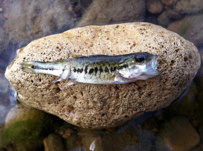
Photo: kmitschke, CC BY 2.0
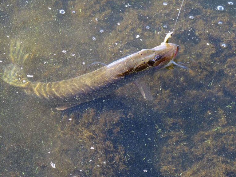
Photo: Argyleist, CC BY 2.0
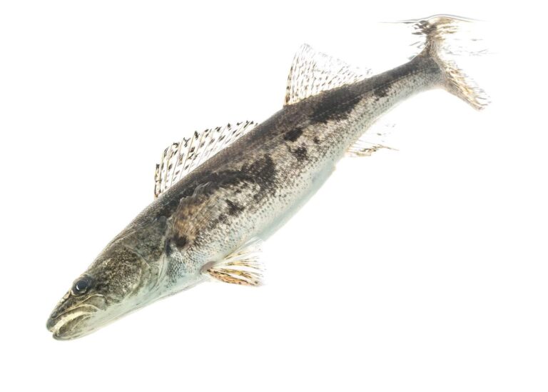
Photo: USFWS Mountain-Prairie, CC BY 2.0
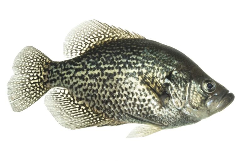
Photo: USFWS Mountain-Prairie, Public domain
The lakes and streams of Bath County, answered
Which Bath County launches sit on the DWR access layer?
The DWR layer shows no launch here.
What is the biggest reservoir with a page in Bath County?
Lake Moomaw, at 2,530 acres.
Which fish does DWR list for lakes near Bath County?
Bluegill leads the count of lake pages within 50 miles, then largemouth bass, channel catfish and brook trout; DWR names them on its waterbody pages.
Where can I restock hooks and line in Bath County?
None inside; the shops band lists the closest.
Which Virginia town houses the Bath County offices?
Warm Springs is the seat.
Which Virginia license covers a Bath County trip?
A year of Virginia freshwater fishing costs residents $23 and nonresidents $47; anglers under 16 need none.
What locality pages sit beside Bath County?
Going by distance, Highland County, Rockbridge County and City of Covington come first.
Which DWR region number covers Bath County?
DWR lakes, ramps or piers inside it carry the number for DWR Region 4.
What DWR piers does the layer show in Bath County?
The DWR layer lists 2 fishing piers, such as Bolar Flats Recreation Area on Lake Moomaw.
Do clubs book water in Bath County for events?
2 events on file; the next is Fishers of Men Virginia West – Classic – Moomaw Lake on Moomaw Lake, May 29, 2027.
Which waters of Bath County have limits of their own?
The digest lists 2 water exceptions here, starting with Lake Moomaw; the table above shows each.
Which waters of Bath County show up on the trout schedule?
The DWR schedule carries 352 stocking dates; the newest lists Rainbow Trout, Brown Trout, Tiger Trout (October 28, 2026; category A) at Back Creek.
Is a state record held by water in Bath County?
Chain Pickerel, 7 lbs. 12 oz., 1974, from Douthat Lake.
Work the ponds and streams across Bath County
Check the digest exceptions before keeping fish.