Fishing in Piscataquis County, Maine
County seat: Dover-Foxcroft. Census 2020 residents: 16,800.
- 1,507named waters
- 60ramps
- 1river pages
 Pick for catfishPiscifun LumiCat II catfish rod48% OFFSale $114.99
Photo of Flagstaff Lake: Jack Flanagan, CC0 1.0
Piscataquis County: the short version in Maine
Piscataquis County stood at 16,800 people in 2020, and county offices are located in Dover-Foxcroft. By Census measure the county holds 3,961 square miles of land and 417.2 square miles of water. Piscataquis County shows 1,507 waters in the data, and Moosehead Lake is the largest of them. For flowing water, begin with Piscataquis River.
Maine launch data lists 60 boat ramps here, along with 0 other fishing points other coastal or shore sites. On the MDIFW program list, 253 waters are in the county. MDIFW dated stocking exists for 1 event in Piscataquis County.
U.S. Census Bureau, 2020 Census counts (TIGERweb) and the 2023 Gazetteer, read November 18, 2026. Maine GeoLibrary boat launches layer (ArcGIS service), read November 18, 2026.
Trout and catfish deliveries around Piscataquis County
- Harlow PondNov. 11, 2026, Brook trout, 25 printed, 18 in., Parkman, stocked, per the 2026 year-to-date report (preliminary receipt data)
Maine stocking this week and the week-ahead outlook
MDIFW 2026 year-to-date stocking report (MDIFW report), preliminary receipt data as of Nov. 17, 2026, read November 18, 2026. Dates, sizes and counts are as printed; the report may be corrected after review.
 For the catfish herePiscifun Chaos XS round baitcaster36% OFFSale $57.99
Pins on the ponds, brooks and tidal reaches of Piscataquis County
Maine GeoLibrary boat launches layer (ArcGIS service), read November 18, 2026. Water pins sit at the point MDIFW or the USGS gives for each water.
Lakes and ponds in Piscataquis County, Maine
| Lake | Size | Access points | Kind | Fish the MDIFW lists |
|---|---|---|---|---|
| Moosehead Lake | 75,528 acres | 8 | lake | landlocked salmon, threespine stickleback, lake trout (togue) |
| Schoodic Lake (Piscataquis County) | 7,026 acres | 1 | lake | none listed |
| Sebec Lake | 6,367 acres | 2 | lake | none listed |
| Seboeis Lake | 4,917 acres | 1 | lake | brook trout, white sucker, smallmouth bass |
| First Roach Pond | 3,110 acres | 1 | pond | none listed |
| Ragged Lake | 2,608 acres | 1 | lake | none listed |
| Indian Pond (T7 R12 WELS, Piscataquis County) | 1,224 acres | 0 | pond, Heritage Fish location | none listed |
| Haymock Lake | 930 acres | 0 | lake | none listed |
| Lake Hebron | 638 acres | 1 | lake | none listed |
| Prong Pond | 447 acres | 1 | pond | brook trout, smallmouth bass, redbelly dace |
| Piper Pond | 424 acres | 0 | pond | brook trout, blacknose dace, splake |
| Third Lake (Piscataquis County) | 403 acres | 0 | lake | brook trout, yellow perch, redbelly dace |
| Lower Togue Pond | 396 acres | 0 | pond | none listed |
| Chesuncook Pond | 299 acres | 0 | pond | brook trout, lake whitefish, common shiner |
| Whetstone Pond | 256 acres | 1 | pond | lake trout (togue), creek chub, brook trout |
| Fourth Roach Pond | 248 acres | 0 | pond | landlocked salmon, redbelly dace, brook trout |
| Island Pond (Piscataquis County) | 231 acres | 0 | pond | none listed |
| Holbrook Pond (Piscataquis County) | 222 acres | 0 | pond | brook trout, blacknose dace, splake |
| First Davis Pond | 216 acres | 0 | pond | landlocked salmon, brook trout, golden shiner |
| Horseshoe Pond (Bowdoin College Grant West Twp, Piscataquis County) | 171 acres | 0 | pond, Heritage Fish location | none listed |
| Hale Pond (Piscataquis County) | 170 acres | 0 | pond | brook trout, brown bullhead, redbelly dace |
| Big Pine Pond | 148 acres | 0 | pond | brook trout, creek chub, rainbow smelt |
| Salmon Pond (T4 R13 WELS, Piscataquis County) | 103 acres | 0 | pond | redbelly dace, brook trout |
| Abol Pond | 88 acres | 0 | pond | brook trout, banded killifish, pumpkinseed sunfish |
| Fifth Debsconeag Lake | 87 acres | 0 | lake | brook trout, yellow perch, creek chub |
| Upper Elbow Pond | 86 acres | 0 | pond | white sucker, redbelly dace, yellow perch |
| Little Greenwood Pond | 76 acres | 0 | pond | brook trout, rainbow smelt, creek chub |
| Sawyer Pond (Piscataquis County) | 72 acres | 1 | pond | brook trout, redbelly dace, rainbow smelt |
| Mountain Pond (T10 R10 WELS, Piscataquis County) | 71 acres | 0 | pond | brook trout, white sucker, creek chub |
| Billfish Pond | 65 acres | 0 | pond | brook trout, finescale dace |
| Shirley Pond | 64 acres | 0 | pond | white sucker, creek chub, pearl dace |
| Spectacle Pond (Piscataquis County) | 61 acres | 0 | pond, Heritage Fish location | brook trout, banded killifish, splake |
| Turtle Pond (Piscataquis County) | 60 acres | 0 | pond | none listed |
| Big Bennett Pond | 56 acres | 0 | pond | lake trout (togue), brook trout, redbelly dace |
| Big Caribou Pond | 55 acres | 0 | pond | brook trout, white sucker, common shiner |
| Long Pond (Trout Brook Twp, Piscataquis County) | 51 acres | 0 | pond, Heritage Fish location | brook trout, rainbow smelt, blacknose dace |
| Leavitt Pond | 51 acres | 0 | pond | brook trout, creek chub |
| Doe Pond | 50 acres | 1 | pond | brook trout, golden shiner |
| Big Beaver Pond (Rainbow Twp, Piscataquis County) | 42 acres | 0 | pond, Heritage Fish location | brook trout, yellow perch |
| Bear Pond (Bowerbank, Piscataquis County) | 42 acres | 0 | pond | brook trout, white sucker, smallmouth bass |
| Little Pillsbury Pond | 41 acres | 0 | pond | brook trout, white sucker, blacknose shiner |
| Jo-Mary Pond | 40 acres | 0 | pond | white sucker, blacknose dace, redbelly dace |
| Frost Pond (Trout Brook Twp, Piscataquis County) | 40 acres | 0 | pond | brook trout |
| Lower Bean Pond | 39 acres | 0 | pond | brook trout |
| Bennett Pond | 36 acres | 0 | pond | brook trout, chain pickerel, white sucker |
| Sixth Debsconeag Lake | 30 acres | 0 | lake | brook trout, creek chub, golden shiner |
| Grindstone Pond (Piscataquis County) | 28 acres | 0 | pond | fathead minnow, golden shiner, pearl dace |
| Rocky Pond (T3 R10 WELS, Piscataquis County) | 27 acres | 0 | pond, Heritage Fish location | none listed |
| Garland Pond (Piscataquis County) | 27 acres | 0 | pond | brook trout, blacknose dace, splake |
| Norton Pond (Piscataquis County) | 24 acres | 0 | pond | brook trout |
| Clifford Pond | 21 acres | 0 | pond | brook trout |
| Mitchell Pond (Piscataquis County) | 20 acres | 0 | pond | brook trout, white sucker, redbelly dace |
| Fowler Pond | 19 acres | 0 | pond | brook trout |
| South Pond (Monson, Piscataquis County) | 18 acres | 0 | pond | brook trout, lake chub, golden shiner |
| Lazy Tom Pond | 17 acres | 0 | pond | finescale dace, brook trout |
| Matthews Pond | 16 acres | 0 | pond | none listed |
| Shadow Pond (Piscataquis County) | 16 acres | 0 | pond | none listed |
| Center Pond (T4 R10 WELS, Piscataquis County) | 12 acres | 0 | pond, Heritage Fish location | brown trout, brook trout, blacknose dace |
| Long Bog (Shawtown Twp, Piscataquis County) | 12 acres | 0 | lake | redbelly dace, creek chub, lake chub |
| Smith Pond (Piscataquis County) | 11 acres | 0 | pond | brook trout |
Surface acres from the MDIFW MaineLakes polygon layer for this water (ArcGIS service; geodesic acres of the mapped outline), read November 18, 2026. Waters with no acreage in the MDIFW record show their mapped outline instead. MDIFW MaineLakes layer record for this water (ArcGIS service), read November 18, 2026.
Streams crossing Piscataquis County across the Pine Tree State
- Piscataquis River6 access points, 3 USGS gauges, dated stocking rows
Gauges on record within Piscataquis County
USGS has no current reading for these gauges.
USGS National Hydrography Dataset record for this river (NHD service), read November 18, 2026. Length is the NHD flowline length inside Maine, not a fishable length. USGS Water Data for the Nation, live through the site, retrieved on page view.
Fish the MDIFW lists across Piscataquis County waters
Across 288 waters in Piscataquis County, the MDIFW lists brook trout on more records than any other fish.
MDIFW Popular Fish Species lists, counted per water; presence in the list is not a catch survey. Species named on the MDIFW lake survey map (map PDF), read November 18, 2026. A listed species was recorded for that survey, not reported as a catch.
Ramps and carry-downs in Piscataquis County
- Allagash Lake (T8 R15 WELS) Fishing Areacarry-in access; Piscataquis County
- Allagash River (T10 R12 WELS) Fishing Areacarry-in access; Piscataquis County
- Ambajejus Lake (T1 R9 WELS) Fishing Areatrailer ramp, freshwater, hard surface; Piscataquis County
- Big Indian Pond (Moosehead Jct Twp) Fishing Areacarry-in access; Piscataquis County
- Big Wilson Stream (Willimantic) Fishing Areatrailer ramp, freshwater, hard surface; Piscataquis County
- Branns Mill Pond (Dover-Foxcroft) Fishing Areatrailer ramp, freshwater, hard surface; Piscataquis County
- Caucomgomoc Lake (T7 R15 WELS) Fishing Areatrailer ramp, freshwater, gravel surface; Piscataquis County
- Center Pond (Sangerville) Fishing Areatrailer ramp, freshwater, hard surface; Piscataquis County
- Chamberlain Lake (T6 R11 WELS) Fishing Areatrailer ramp, freshwater, hard surface; Piscataquis County
- Chesuncook Lake (T3 R12 WELS) Fishing Areatrailer ramp, freshwater, gravel surface; Piscataquis County
- Churchill Lake (T10 R12 WELS) Fishing Areacarry-in access; Piscataquis County
- Coffeelos Pond (T6 R11 WELS) Fishing Areacarry-in access; Piscataquis County
- Debsconeag Deadwater (T2 R9 WELS) Fishing Areatrailer ramp, freshwater, gravel surface; Piscataquis County
- Doe Pond (Monson) Fishing Areacarry-in access; Piscataquis County
- First Roach Pond (Frenchtown Twp) Fishing Areatrailer ramp, freshwater, gravel surface; Piscataquis County
- Fourth Debsconeag Lake (T1 R11 WELS) Fishing Areacarry-in access; Piscataquis County
- Harrington Lake (T3 R11 WELS) Fishing Areatrailer ramp, freshwater, gravel surface; Piscataquis County
- Indian Pond (Big Moose Twp) Fishing Areatrailer ramp, freshwater, gravel surface; Piscataquis County
- Indian Stream (T7 R12 WELS) Fishing Areacarry-in access; Piscataquis County
- Johnson Pond (Abbot) Fishing Areatrailer ramp, freshwater, hard surface; Piscataquis County
- Lake Hebron (Monson) Fishing Areatrailer ramp, freshwater, hard surface; Piscataquis County
- Lake Onawa (Elliottsville Twp) Fishing Areatrailer ramp, freshwater, hard surface; Piscataquis County
- Lobster Stream (T3 R15 WELS) Fishing Areatrailer ramp, freshwater, gravel surface; Piscataquis County
- Manhanock Pond (Sangerville) Fishing Areatrailer ramp, freshwater, hard surface; Piscataquis County
Maine GeoLibrary boat launches layer (ArcGIS service), read November 18, 2026.
Ponds, brooks and tidal creeks in Piscataquis County, pinned
Maine lakes and ponds in Piscataquis County
| Water | Kind | Size | Fish the MDIFW lists | Access | Map pin |
|---|---|---|---|---|---|
| Chesuncook Lake | lake | 18,663 acres | none listed | 1 | 45.9868, -69.3345 |
| Chamberlain Lake (Piscataquis County) | lake | 10,958 acres | none listed | 1 | 46.2342, -69.3009 |
| Pemadumcook Lake | lake | 9,791 acres | none listed | 0 | 45.7018, -68.9298 |
| Big Eagle Lake | lake | 8,993 acres | none listed | 0 | 46.3379, -69.3499 |
| Caribou Lake (Piscataquis County) | lake | 4,635 acres | none listed | 0 | 45.8679, -69.3177 |
| Caucomgomoc Lake | lake | 4,598 acres | none listed | 1 | 46.2040, -69.6040 |
| Allagash Lake | lake, Heritage Fish location | 4,213 acres | none listed | 0 | 46.3204, -69.5279 |
| Churchill Lake (Piscataquis County) | lake | 3,467 acres | none listed | 1 | 46.4458, -69.3085 |
| Lobster Lake | lake | 3,384 acres | none listed | 0 | 45.8545, -69.5238 |
| Ross Lake (Piscataquis County) | lake | 2,927 acres | none listed | 0 | 46.4956, -69.6159 |
| Second Matagamon Lakes | lake | 2,343 acres | none listed | 0 | 46.1906, -68.8587 |
| Millinocket Lake (Piscataquis County) | lake | 2,077 acres | none listed | 2 | 46.3020, -68.8736 |
| Ambajejus Lake | lake | 2,001 acres | none listed | 1 | 45.7227, -68.8703 |
| Lower Jo-Mary Lake | lake | 1,891 acres | none listed | 0 | 45.6761, -68.9704 |
| Upper Jo-Mary Lake | lake, dated stocking rows | 1,848 acres | none listed | 0 | 45.6007, -68.9618 |
| Ripogenus Lake | lake | 1,800 acres | none listed | 0 | 45.8912, -69.2155 |
| Black Pond (T6 R14 WELS, Piscataquis County) | pond | 1,740 acres | brook trout, white sucker, brown bullhead, finescale dace | 0 | 46.1401, -69.4817 |
| Telos Lake | lake | 1,727 acres | none listed | 0 | 46.1363, -69.1699 |
| Rainbow Lake | lake, Heritage Fish location | 1,627 acres | none listed | 0 | 45.8239, -69.1169 |
| Umbazooksus Lake | lake | 1,573 acres | none listed | 0 | 46.1685, -69.3777 |
| Lower Wilson Pond | pond, dated stocking rows | 1,420 acres | none listed | 0 | 45.4799, -69.5236 |
| Munsungan Lake | lake, Heritage Fish location | 1,400 acres | none listed | 0 | 46.3806, -68.9932 |
| Nesowadnehunk Lake | lake, Heritage Fish location | 1,370 acres | brook trout, blacknose dace, freshwater sculpin | 0 | 46.0407, -69.0958 |
| Mud Pond (T6 R12 WELS, Piscataquis County) | pond, Heritage Fish location | 1,299 acres | none listed | 0 | 46.1793, -69.3146 |
| Harrington Lake | lake | 1,220 acres | none listed | 1 | 45.9356, -69.1616 |
| Brandy Pond (Piscataquis County) | pond | 1,214 acres | none listed | 0 | 46.0810, -69.4472 |
| Lake Onawa | lake | 1,193 acres | none listed | 1 | 45.3818, -69.3791 |
| Shallow Lake | lake | 1,114 acres | none listed | 0 | 46.2257, -69.4802 |
| Loon Lake (Piscataquis County) | lake | 1,097 acres | longnose sucker, brook trout, common shiner, white perch | 0 | 46.1428, -69.6351 |
| Spencer Pond (Piscataquis County) | pond | 1,065 acres | none listed | 0 | 45.7426, -69.5687 |
| Boyd Lake | lake | 1,064 acres | none listed | 0 | 45.1776, -68.9212 |
| Nahmakanta Lake | lake, dated stocking rows | 987 acres | none listed | 1 | 45.7518, -69.1371 |
| Upper Wilson Pond | pond | 983 acres | none listed | 0 | 45.5021, -69.4837 |
| Third Debsconeag Lake | lake | 971 acres | brook trout, creek chub, lake trout (togue), golden shiner | 0 | 45.7580, -69.0296 |
| Big Pleasant Lake | lake, Heritage Fish location | 965 acres | none listed | 0 | 46.4734, -69.1800 |
| Spider Lake | lake | 918 acres | none listed | 0 | 46.4486, -69.2090 |
| Ebeemee Lake | lake | 906 acres | none listed | 0 | 45.4290, -69.0107 |
| Second Roach Pond | pond | 873 acres | landlocked salmon, finescale dace, brook trout, creek chub | 0 | 45.6766, -69.2942 |
| Longley Pond | pond | 760 acres | none listed | 0 | 46.1602, -69.4388 |
| Fourth Musquacook Lake | lake, Heritage Fish location | 730 acres | none listed | 0 | 46.5681, -69.1464 |
| Hurd Pond (Piscataquis County) | pond, Heritage Fish location | 667 acres | brook trout, lake trout (togue), common shiner, white sucker | 0 | 45.8002, -68.9962 |
| Big Houston Pond | pond | 645 acres | none listed | 0 | 45.4255, -69.2346 |
| Long Pond (Bowdoin College Grant West Twp, Piscataquis County) | pond | 645 acres | landlocked salmon, common shiner, lake trout (togue), blacknose dace | 0 | 45.4594, -69.3482 |
| Priestly Lake | lake | 629 acres | none listed | 0 | 46.5441, -69.3861 |
| Clear Lake (Piscataquis County) | lake | 626 acres | none listed | 0 | 46.5202, -69.1291 |
| B Pond (Piscataquis County) | pond, Heritage Fish location | 610 acres | brook trout, white sucker, lake chub | 0 | 45.5706, -69.1322 |
| Cuxabexis Lake | lake | 597 acres | none listed | 0 | 46.1110, -69.3100 |
| Round Pond (T6 R11 WELS, Piscataquis County) | pond | 581 acres | none listed | 0 | 46.1626, -69.1960 |
| Round Pond (T9 R13 WELS, Piscataquis County) | pond | 556 acres | none listed | 0 | 46.4091, -69.3555 |
| Third Roach Pond | pond | 554 acres | none listed | 0 | 45.6429, -69.2285 |
| Debsconeag Deadwater | lake | 537 acres | none listed | 0 | 45.7694, -68.9502 |
| Fitzgerald Pond (Piscataquis County) | pond, dated stocking rows | 533 acres | none listed | 0 | 45.5198, -69.6902 |
| Little Millinocket Lake | lake | 520 acres | none listed | 0 | 46.2847, -68.9275 |
| Webster Lake | lake | 516 acres | none listed | 0 | 46.1560, -69.0799 |
| Manhancock Pond | pond | 475 acres | none listed | 0 | 45.1449, -69.3715 |
| Passamagamet Lake | lake | 468 acres | white sucker, brook trout, longnose sucker, white perch | 0 | 45.7460, -68.9423 |
| Duck Pond (T5 R12 WELS, Piscataquis County) | pond, Heritage Fish location | 466 acres | none listed | 0 | 46.0474, -69.3276 |
| Daggett Pond | pond | 460 acres | white perch, fallfish, yellow perch, golden shiner | 0 | 46.2319, -69.5250 |
| Poland Pond | pond, Heritage Fish location | 455 acres | none listed | 0 | 46.2638, -69.5939 |
| Mud Pond (T4 R12 WELS, Piscataquis County) | pond | 448 acres | none listed | 0 | 45.9627, -69.2873 |
| Fifth Musquacook Lake | lake | 436 acres | brook trout, white sucker, burbot (cusk), common shiner | 0 | 46.5502, -69.1030 |
| Chase Lake | lake, Heritage Fish location | 421 acres | landlocked salmon, longnose sucker, brook trout, white sucker | 0 | 46.4112, -69.0451 |
| Burnham Pond (Piscataquis County) | pond, Heritage Fish location | 414 acres | brown bullhead, pearl dace, white sucker | 0 | 45.5409, -69.7186 |
| Harrow Lake | lake, Heritage Fish location | 405 acres | brook trout, creek chub, lake whitefish, fallfish | 0 | 46.5122, -69.2135 |
| Cliff Lake | lake, Heritage Fish location | 404 acres | brook trout, lake trout (togue), fallfish, brown bullhead | 0 | 46.3993, -69.2489 |
| Mooseleuk Lake | lake, Heritage Fish location | 397 acres | landlocked salmon, fallfish, brook trout, longnose sucker | 1 | 46.5109, -68.9068 |
| First Buttermilk Pond | pond | 390 acres | brook trout, common shiner, lake trout (togue), creek chub | 0 | 45.3214, -69.2887 |
| Center Pond (Sangerville, Piscataquis County) | pond | 376 acres | none listed | 1 | 45.1239, -69.3022 |
| Round Pond (T7 R14 WELS, Piscataquis County) | pond | 371 acres | fallfish, yellow perch, golden shiner, lake chub | 0 | 46.2421, -69.5594 |
| Long Pond (TA R11 WELS, Piscataquis County) | pond | 371 acres | brook trout, blacknose dace, splake, creek chub | 0 | 45.6695, -69.1387 |
| First Debsconeag Lake | lake | 361 acres | lake whitefish, lake trout (togue), round whitefish, rainbow smelt | 0 | 45.7767, -68.9824 |
| Monson Pond (Piscataquis County) | pond | 351 acres | brook trout, lake trout (togue), common shiner, brown bullhead | 0 | 45.3116, -69.4904 |
| Crawford Pond (Piscataquis County) | pond, Heritage Fish location | 340 acres | brook trout, lake trout (togue), common shiner, white sucker | 0 | 45.6259, -69.1309 |
| Big Benson Pond | pond, Heritage Fish location | 333 acres | brook trout, lake trout (togue), golden shiner, white sucker | 0 | 45.3648, -69.3319 |
| Crescent Pond (T9 R15 WELS, Piscataquis County) | pond | 318 acres | brook trout | 0 | 46.4268, -69.6078 |
| North Branns Mill Pond | pond | 318 acres | smallmouth bass, chain pickerel, largemouth bass, white sucker | 0 | 45.1087, -69.1676 |
| Indian Pond (T7 R9 NWP, Piscataquis County) | pond | 290 acres | brook trout, lake chub, white sucker, redbelly dace | 0 | 45.4193, -69.2928 |
| Penobscot Pond | pond, Heritage Fish location | 284 acres | brook trout, white sucker, lake chub, common shiner | 0 | 45.6830, -69.2055 |
| Big Beaver Pond (T7 R9 WELS, Piscataquis County) | pond | 284 acres | brook trout, white sucker, redbelly dace, blacknose dace | 0 | 46.2658, -68.8576 |
| Silver Lake (Piscataquis County) | lake | 279 acres | brown bullhead, smallmouth bass, white sucker, white perch | 0 | 45.4554, -69.1797 |
| Big Hurd Pond | pond | 276 acres | brook trout, white perch, common shiner, yellow perch | 0 | 46.1678, -69.6604 |
| Big Indian Pond (Piscataquis County) | pond, Heritage Fish location | 269 acres | lake trout (togue), brook trout, finescale dace, round whitefish | 1 | 45.4388, -69.7373 |
| Upper Russell Pond | pond, Heritage Fish location | 269 acres | brook trout, creek chub, lake chub, white sucker | 0 | 46.4211, -69.5599 |
| Snake Pond (Piscataquis County) | pond, Heritage Fish location | 266 acres | brook trout, finescale dace, white sucker, redbelly dace | 0 | 46.2484, -69.1325 |
| Little Shallow Lake | lake, Heritage Fish location | 265 acres | none listed | 0 | 46.2530, -69.4901 |
| Rowe Pond (Piscataquis County) | pond | 249 acres | none listed | 0 | 46.2370, -69.6367 |
| Cooper Pond | pond | 242 acres | brook trout, white perch, creek chub, yellow perch | 0 | 45.6460, -69.0070 |
| Heron Lake | lake | 242 acres | none listed | 0 | 46.4866, -69.2974 |
| Wadleigh Pond (T1 R11 WELS, Piscataquis County) | pond | 239 acres | none listed | 2 | 45.7444, -69.1893 |
| Little Lobster Lake | lake | 238 acres | landlocked salmon, brook trout, golden shiner, rainbow smelt | 0 | 45.8870, -69.5033 |
| Rum Pond (Greenville, Piscataquis County) | pond, Heritage Fish location | 232 acres | none listed | 0 | 45.4641, -69.4870 |
| Fourth Debsconeag Lake | lake, Heritage Fish location | 223 acres | brook trout, lake trout (togue), common shiner, yellow perch | 1 | 45.7526, -69.0774 |
| Mud Pond (Beaver Cove, Piscataquis County) | pond | 223 acres | brook trout, fallfish, yellow perch, white sucker | 0 | 45.5591, -69.5244 |
| Soper Pond | pond | 223 acres | brook trout, white sucker, blacknose dace, redbelly dace | 0 | 46.3740, -69.2295 |
| Upper Togue Pond | pond | 223 acres | chain pickerel, white sucker | 0 | 45.8238, -68.8957 |
| Cassidy Deadwater | lake | 221 acres | none listed | 0 | 45.9796, -69.6270 |
| Mud Pond (TA R10 WELS, Piscataquis County) | pond | 218 acres | none listed | 0 | 45.6708, -69.0129 |
| Lucky Pond | pond, Heritage Fish location | 214 acres | brook trout, yellow perch, creek chub, golden shiner | 0 | 45.7082, -69.6082 |
| North Inlet First Roach Pond | pond | 212 acres | none listed | 0 | 45.6645, -69.3529 |
| Big Greenwood Pond | pond | 210 acres | brook trout, lake trout (togue), common shiner, rainbow smelt | 0 | 45.3608, -69.4060 |
| Burden Pond | pond, Heritage Fish location | 202 acres | brook trout, brown bullhead, blacknose dace, white sucker | 0 | 45.3467, -69.2450 |
| Little Munsungan Lake | lake | 200 acres | none listed | 0 | 46.3812, -68.9463 |
| Frost Pond (T3 R11 WELS, Piscataquis County) | pond | 199 acres | none listed | 0 | 45.9060, -69.1870 |
| Henderson Pond | pond, Heritage Fish location | 196 acres | brook trout, golden shiner | 0 | 45.6674, -69.1026 |
| Big Pleasant Pond | pond, Heritage Fish location | 194 acres | brook trout, lake trout (togue), blacknose dace, creek chub | 0 | 45.6425, -69.1693 |
| Upper Ebeemee Lake | lake | 192 acres | brook trout, longnose sucker, smallmouth bass, white perch | 0 | 45.5009, -68.9806 |
| Coffeelos Pond | pond, Heritage Fish location | 191 acres | golden shiner, finescale dace, pearl dace, creek chub | 1 | 46.1635, -69.1417 |
| Buttermilk Pond | pond, Heritage Fish location | 183 acres | none listed | 0 | 45.3570, -69.2192 |
| Nesourdnehunk Deadwater | lake | 183 acres | none listed | 0 | 45.8498, -69.0568 |
| West Shirley Bog | lake | 180 acres | brook trout, fallfish, finescale dace, golden shiner | 0 | 45.3719, -69.6728 |
| Harlow Pond | pond, dated stocking rows | 179 acres | none listed | 0 | 45.1424, -69.3966 |
| Deer Pond (T3 R13 WELS, Piscataquis County) | pond | 179 acres | landlocked salmon, brook trout, lake chub, splake | 0 | 45.9114, -69.3835 |
| Little Hurd Pond (T6 R15 WELS, Piscataquis County) | pond | 176 acres | none listed | 0 | 46.1751, -69.6446 |
| Second Debsconeag Lake | lake, Heritage Fish location | 172 acres | yellow perch, fallfish, common shiner, white sucker | 0 | 45.7788, -69.0381 |
| Wassataquoik Lake | lake, Heritage Fish location | 171 acres | brook trout | 0 | 46.0164, -68.9517 |
| Mud Pond (T9 R15 WELS, Piscataquis County) | pond | 169 acres | brook trout, white sucker, redbelly dace | 0 | 46.4038, -69.5957 |
| Pillsbury Pond | pond | 164 acres | brook trout, white sucker, common shiner, creek chub | 0 | 46.3343, -69.1829 |
| Upper Ellis Pond | pond, Heritage Fish location | 163 acres | white sucker, pearl dace, finescale dace, creek chub | 0 | 46.2751, -69.5361 |
| Wadleigh Pond (T8 R15 WELS, Piscataquis County) | pond, Heritage Fish location | 161 acres | brook trout, lake trout (togue), fallfish, common shiner | 0 | 46.3562, -69.7097 |
| Lower Spectacle Pond | pond | 157 acres | brook trout | 0 | 45.3361, -69.5426 |
| Twin Lake | lake | 153 acres | brook trout, pearl dace, common shiner | 0 | 46.4107, -69.2622 |
| Second West Branch Pond | pond | 152 acres | golden shiner | 0 | 45.5908, -69.2644 |
| Narrow Pond | pond, Heritage Fish location | 152 acres | brook trout, redbelly dace | 0 | 46.3737, -69.5714 |
| Little Benson Pond | pond, Heritage Fish location | 149 acres | brook trout, white sucker, creek chub, common shiner | 0 | 45.3659, -69.3034 |
| River Pond | pond | 146 acres | none listed | 0 | 45.8042, -68.9295 |
| Pollywog Pond | pond, Heritage Fish location | 146 acres | lake trout (togue), brook trout, fallfish, white sucker | 1 | 45.7585, -69.1934 |
| Carpenter Pond | pond, Heritage Fish location | 144 acres | fathead minnow, threespine stickleback | 0 | 46.2835, -69.1172 |
| Big Lyford Pond | pond, Heritage Fish location | 142 acres | golden shiner | 0 | 45.5916, -69.3219 |
| Hardy Pond | pond | 139 acres | none listed | 0 | 45.3362, -68.8196 |
| Trout Pond (Shawtown Twp, Piscataquis County) | pond | 139 acres | none listed | 0 | 45.6506, -69.2609 |
| Thissell Pond | pond | 139 acres | brook trout | 0 | 46.0820, -69.1002 |
| Little Leadbetter Pond | pond | 138 acres | none listed | 0 | 46.2458, -69.1969 |
| Leadbetter Pond (T7 R12 WELS, Piscataquis County) | pond | 138 acres | brook trout, white sucker, fathead minnow, blacknose shiner | 0 | 46.2369, -69.2593 |
| Lower Russell Pond | pond | 136 acres | none listed | 0 | 46.3998, -69.4952 |
| Johnson Pond (Piscataquis County) | pond, Heritage Fish location | 135 acres | brook trout, lake whitefish, common shiner, redbelly dace | 1 | 46.3195, -69.5787 |
| Bear Pond (T6 R15 WELS, Piscataquis County) | pond | 130 acres | none listed | 0 | 46.1351, -69.6889 |
| Chandler Pond (Piscataquis County) | pond, Heritage Fish location | 127 acres | landlocked salmon, blacknose shiner, brook trout, creek chub | 0 | 46.3070, -69.0623 |
| Black Pond (T1 R12 WELS, Piscataquis County) | pond | 127 acres | none listed | 0 | 45.7469, -69.2777 |
| Echo Lake (Piscataquis County) | lake | 124 acres | brook trout, lake trout (togue), common shiner, yellow perch | 0 | 46.4314, -69.1146 |
| Hudson Pond | pond, Heritage Fish location | 121 acres | creek chub, golden shiner | 0 | 46.1681, -69.0007 |
| Little Indian Pond (Piscataquis County) | pond | 121 acres | brook trout, brown bullhead, finescale dace, white sucker | 0 | 46.2615, -69.2388 |
| Foss Pond | pond, Heritage Fish location | 117 acres | brook trout, lake trout (togue), fallfish, white sucker | 0 | 45.1848, -69.6085 |
| First West Branch Pond | pond, Heritage Fish location | 115 acres | brook trout, golden shiner | 0 | 45.5841, -69.2851 |
| Little Beaver Pond (T7 R9 WELS, Piscataquis County) | pond | 112 acres | brook trout, common shiner, yellow perch, creek chub | 0 | 46.2547, -68.8576 |
| Big Rocky Pond | pond, Heritage Fish location | 110 acres | brook trout, white sucker, creek chub | 0 | 45.6523, -69.1417 |
| Moose Pond (T7 R10 WELS, Piscataquis County) | pond | 110 acres | brook trout, golden shiner, finescale dace, creek chub | 0 | 46.2794, -68.9564 |
| Lower South Branch Pond | pond, Heritage Fish location | 108 acres | brook trout | 0 | 46.1030, -68.8965 |
| Yoke Ponds | pond, Heritage Fish location | 108 acres | brook trout, white sucker, golden shiner, creek chub | 0 | 45.6304, -69.1619 |
| Otter Pond (T8 R14 WELS, Piscataquis County) | pond | 106 acres | brook trout, finescale dace, fathead minnow | 0 | 46.3232, -69.4888 |
| Compass Pond | pond | 106 acres | none listed | 0 | 45.8026, -68.9121 |
| Bottle Pond | pond | 104 acres | none listed | 0 | 45.7764, -68.8522 |
| Little Nesowadnehunk Lake | lake, Heritage Fish location | 103 acres | brook trout, redbelly dace | 0 | 46.0689, -69.1029 |
| Female Pond | pond, Heritage Fish location | 99 acres | brook trout, white sucker, common shiner, creek chub | 0 | 45.7481, -69.2230 |
| Brown Pond (T8 R9 WELS, Piscataquis County) | pond | 98 acres | brook trout, pearl dace, redbelly dace, fathead minnow | 0 | 46.3796, -68.8280 |
| Pleasant Pond (Piscataquis County) | pond | 96 acres | none listed | 0 | 45.1506, -68.9806 |
| Upper South Branch Pond | pond, Heritage Fish location | 96 acres | brook trout | 0 | 46.0891, -68.8931 |
| Big Reed Pond | pond, Heritage Fish location | 96 acres | none listed | 0 | 46.3531, -69.0574 |
| Ordway Pond | pond, Heritage Fish location | 96 acres | white sucker, golden shiner, lake chub | 0 | 45.3047, -69.6570 |
| Leadbetter Pond (T9 R11 WELS, Piscataquis County) | pond, Heritage Fish location | 95 acres | none listed | 0 | 46.4252, -69.1908 |
| Kidney Pond (T3 R10 WELS, Piscataquis County) | pond, Heritage Fish location | 95 acres | none listed | 0 | 45.8901, -69.0449 |
| Big Moose Pond | pond, Heritage Fish location | 92 acres | brook trout, white sucker | 0 | 45.4544, -69.6795 |
| Upper Portage Pond | pond, Heritage Fish location | 89 acres | brook trout, brown bullhead, redbelly dace, white sucker | 0 | 46.4489, -69.1448 |
| Allagash Pond | pond, Heritage Fish location | 88 acres | brook trout, white sucker, redbelly dace, creek chub | 0 | 46.4218, -69.6709 |
| Lower Hudson Pond | pond | 88 acres | landlocked salmon, brook trout, blacknose dace, rainbow smelt | 0 | 46.5572, -69.0350 |
| Marr Pond | pond | 85 acres | white sucker, creek chub, pumpkinseed sunfish | 0 | 45.1481, -69.3017 |
| Round Pond (Lobster Twp, Piscataquis County) | pond | 84 acres | none listed | 0 | 45.8974, -69.4544 |
| Big Duck Pond | pond, Heritage Fish location | 83 acres | brook trout, yellow perch, finescale dace, white sucker | 0 | 45.7621, -69.6322 |
| Ripogenus Pond | pond, Heritage Fish location | 81 acres | none listed | 0 | 45.9880, -69.2602 |
| Bear Pond (T2 R13 WELS, Piscataquis County) | pond | 81 acres | brook trout, yellow perch, lake chub, white sucker | 0 | 45.8248, -69.3280 |
| Duck Pond (Bowerbank, Piscataquis County) | pond, Heritage Fish location | 78 acres | none listed | 0 | 45.3492, -69.2626 |
| Saddle Pond | pond | 78 acres | brook trout, yellow perch, blacknose shiner, brown bullhead | 0 | 46.2235, -68.8724 |
| Midnight Pond | pond | 77 acres | finescale dace, fathead minnow, pearl dace | 0 | 46.1376, -69.2421 |
| Lower Ellis Pond | pond, Heritage Fish location | 74 acres | brook trout, white sucker, redbelly dace, fathead minnow | 0 | 46.2726, -69.4998 |
| Bartlett Pond (Piscataquis County) | pond | 74 acres | brook trout, fallfish, yellow perch, pearl dace | 0 | 46.5552, -68.8717 |
| Shack Pond | pond, Heritage Fish location | 73 acres | none listed | 0 | 45.9067, -69.4676 |
| Pine Stream Flowage | reservoir | 72 acres | none listed | 0 | 45.9596, -69.4250 |
| Second South Branch Russell Pond | pond | 72 acres | none listed | 0 | 46.3731, -69.5222 |
| Berry Pond (Piscataquis County) | pond, Heritage Fish location | 72 acres | brook trout, white sucker, brown bullhead, lake chub | 0 | 45.8064, -69.3971 |
| Salmon Stream Pond | pond | 70 acres | none listed | 0 | 45.2221, -69.3267 |
| Little Pleasant Pond (T10 R11 WELS, Piscataquis County) | pond, Heritage Fish location | 70 acres | brook trout, blacknose dace, creek chub, redbelly dace | 0 | 46.5155, -69.1091 |
| Second Davis Pond | pond | 70 acres | none listed | 0 | 45.2448, -69.4146 |
| Indian Pond (Bowdoin College Grant West Twp, Piscataquis County) | pond, Heritage Fish location | 68 acres | brook trout, rainbow smelt, golden shiner, lake chub | 0 | 45.4492, -69.4557 |
| Upper Soper Pond | pond | 68 acres | brook trout, white sucker, blacknose dace, creek chub | 0 | 46.3871, -69.2085 |
| McPherson Pond (Piscataquis County) | pond, Heritage Fish location | 68 acres | brook trout, white sucker, slimy sculpin, lake chub | 0 | 46.5534, -68.9830 |
| Slaughter Pond | pond, Heritage Fish location | 66 acres | brook trout | 0 | 45.9127, -69.0827 |
| Big Fisher Pond | pond, Heritage Fish location | 64 acres | brook trout, finescale dace, redbelly dace, creek chub | 0 | 45.7788, -69.2815 |
| Mile Pond | pond, Heritage Fish location | 63 acres | none listed | 0 | 46.3573, -69.5811 |
| Horseshoe Pond (Willimantic, Piscataquis County) | pond | 63 acres | brook trout, white sucker, brown bullhead, golden shiner | 0 | 45.2869, -69.3766 |
| Rainbow Deadwaters | lake, Heritage Fish location | 62 acres | brook trout, blacknose dace, golden shiner | 0 | 45.8134, -69.1690 |
| Fourth Lake (Piscataquis County) | lake, Heritage Fish location | 62 acres | brook trout, white sucker, redbelly dace, common shiner | 0 | 46.2691, -69.1675 |
| Cow Pond (Piscataquis County) | pond | 61 acres | none listed | 0 | 45.7616, -69.3421 |
| LIttle Round Pond (Piscataquis County) | pond, Heritage Fish location | 60 acres | none listed | 0 | 46.3300, -69.4526 |
| Kelly Pond | pond, Heritage Fish location | 60 acres | brook trout, redbelly dace, golden shiner | 0 | 45.8052, -69.2289 |
| Little Hurd Pond (T2 R10 WELS, Piscataquis County) | pond, Heritage Fish location | 60 acres | none listed | 0 | 45.8258, -69.0320 |
| Cedar Pond (TB R10 WELS, Piscataquis County) | pond, Heritage Fish location | 59 acres | none listed | 0 | 45.5570, -69.0235 |
| Lower Fowler Pond | pond, Heritage Fish location | 59 acres | brook trout, creek chub, blacknose shiner, blacknose dace | 0 | 46.1327, -68.8619 |
| Little Spencer Pond | pond | 59 acres | none listed | 0 | 45.7730, -69.5722 |
| North Pond (Piscataquis County) | pond, Heritage Fish location | 59 acres | brook trout, ninespine stickleback, golden shiner | 0 | 45.3558, -69.4873 |
| Johnston Pond | pond, Heritage Fish location | 58 acres | brook trout, blacknose dace, golden shiner | 0 | 45.5987, -69.0650 |
| Second Buttermilk Pond | pond, Heritage Fish location | 57 acres | brook trout, white sucker, banded killifish, common shiner | 0 | 45.3336, -69.2655 |
| Mountain Pond (Beaver Cove, Piscataquis County) | pond, Heritage Fish location | 57 acres | none listed | 0 | 45.5439, -69.4634 |
| Grassy Pond (T2 R12 WELS, Piscataquis County) | pond, Heritage Fish location | 56 acres | none listed | 0 | 45.8209, -69.2446 |
| McKenna Pond | pond, dated stocking rows | 55 acres | none listed | 0 | 45.9090, -69.1022 |
| Bean Pot Pond | pond, Heritage Fish location | 54 acres | none listed | 0 | 46.0556, -69.7122 |
| Pretty Pond (Piscataquis County) | pond | 54 acres | yellow perch, creek chub, blacknose dace, redbelly dace | 0 | 46.3215, -69.1211 |
| Tarbox Pond | pond | 53 acres | none listed | 0 | 46.1952, -69.5301 |
| West Chairback Pond | pond, Heritage Fish location | 52 acres | brook trout, golden shiner, finescale dace, blacknose dace | 0 | 45.4446, -69.2836 |
| Roaring Brook Pond | pond | 52 acres | none listed | 0 | 45.3940, -69.2268 |
| Snowshoe Pond (Piscataquis County) | pond | 51 acres | none listed | 0 | 46.3092, -69.1008 |
| Grass Pond (T9 R12 WELS, Piscataquis County) | pond | 50 acres | none listed | 0 | 46.4402, -69.2492 |
| Pockwockamus Pond | pond | 50 acres | none listed | 0 | 45.7993, -68.8814 |
| East Chairback Pond | pond, Heritage Fish location | 50 acres | brook trout | 0 | 45.4638, -69.2787 |
| Cranberry Pond (Lobster Twp, Piscataquis County) | pond | 50 acres | brook trout | 0 | 45.8610, -69.4681 |
| Woodman Pond (T7 R12 WELS, Piscataquis County) | pond | 50 acres | brook trout, blacknose dace | 0 | 46.2870, -69.2194 |
| Middle Elbow Pond | pond | 49 acres | brook trout, blacknose dace, yellow perch, creek chub | 0 | 46.5267, -69.0717 |
| Alligator Pond | pond | 49 acres | brook trout, white sucker, creek chub, pearl dace | 0 | 45.6302, -69.1896 |
| Horserace Ponds | pond, Heritage Fish location | 49 acres | brook trout, redbelly dace | 0 | 45.8521, -69.1064 |
| Sixth Roach Pond | pond, Heritage Fish location | 48 acres | brook trout, creek chub, white sucker, lake chub | 0 | 45.6241, -69.2153 |
| Blood Pond | pond, Heritage Fish location | 48 acres | none listed | 0 | 45.8007, -69.4311 |
| Sing Sing Pond | pond, Heritage Fish location | 48 acres | brook trout, white sucker | 0 | 45.6828, -69.1429 |
| Church Pond | pond, Heritage Fish location | 47 acres | brook trout, creek chub, white sucker, fallfish | 0 | 45.6482, -69.0417 |
| Little Holbrook Pond | pond | 47 acres | none listed | 0 | 45.8587, -69.1513 |
| East Branch Pond | pond, Heritage Fish location | 46 acres | brook trout, white sucker, finescale dace, redbelly dace | 0 | 46.2588, -69.1582 |
| Third West Branch Pond | pond, Heritage Fish location | 46 acres | none listed | 0 | 45.5875, -69.2510 |
| Foss and Knowlton Pond | pond, Heritage Fish location | 46 acres | brook trout, creek chub | 0 | 45.8573, -69.0014 |
| Lost Pond (T7 R13 WELS, Piscataquis County) | pond | 45 acres | redbelly dace, finescale dace | 0 | 46.2176, -69.3474 |
| Dunham Pond | pond | 44 acres | chain pickerel | 0 | 45.2153, -69.2915 |
| Middle Fowler Pond | pond, Heritage Fish location | 44 acres | brook trout, golden shiner, blacknose dace, redbelly dace | 0 | 46.1217, -68.8432 |
| Mud Pond (Bowerbank, Piscataquis County) | pond | 44 acres | none listed | 0 | 45.3567, -69.2955 |
| Little Mud Pond (T4 R12 WELS, Piscataquis County) | pond | 43 acres | brook trout, golden shiner, yellow perch, common shiner | 0 | 45.9431, -69.2456 |
| Lucia Pond | pond | 42 acres | brook trout, white sucker, finescale dace | 0 | 45.4028, -69.3198 |
| Kidney Pond (East Middlesex Canal Grant Twp, Piscataquis County) | pond, Heritage Fish location | 42 acres | brook trout, redbelly dace | 0 | 45.7764, -69.4922 |
| First Musquash Pond | pond | 42 acres | common shiner, creek chub | 0 | 45.7284, -69.1777 |
| Little Frost Pond | pond, Heritage Fish location | 41 acres | brook trout, lake chub, redbelly dace, burbot (cusk) | 0 | 45.9164, -69.2054 |
| Punchbowl Pond | pond, Heritage Fish location | 41 acres | white sucker, golden shiner, banded killifish, redbreast sunfish | 0 | 45.2261, -69.5929 |
| McGooseley Pond | pond | 40 acres | none listed | 0 | 46.0062, -69.6183 |
| Bluffer Pond | pond, Heritage Fish location | 40 acres | brook trout, redbelly dace | 0 | 46.3739, -69.0977 |
| Poverty Pond | pond | 40 acres | none listed | 0 | 45.2717, -69.3876 |
| Little Harrow Lake | lake | 39 acres | none listed | 0 | 46.5112, -69.1721 |
| Leonard Pond | pond | 39 acres | brook trout, redbelly dace, blacknose dace, creek chub | 0 | 46.5412, -68.8450 |
| Harrington Pond | pond | 39 acres | brook trout, white sucker, yellow perch, brown bullhead | 0 | 45.9127, -69.1154 |
| Middle Branch Pond (Piscataquis County) | pond, Heritage Fish location | 39 acres | brook trout | 0 | 45.4909, -69.0867 |
| Jaquith Pond | pond | 38 acres | yellow perch, chain pickerel, golden shiner, white sucker | 0 | 45.3404, -68.9723 |
| Hedgehog Pond (Bowdoin College Grant West Twp, Piscataquis County) | pond, Heritage Fish location | 36 acres | finescale dace | 0 | 45.4793, -69.4127 |
| Mill Brook Pond | pond, Heritage Fish location | 36 acres | brook trout, fathead minnow, creek chub, golden shiner | 0 | 45.3224, -69.2434 |
| Juniper Knee Pond | pond, Heritage Fish location | 36 acres | brook trout, lake chub, creek chub, pearl dace | 0 | 45.3625, -69.4830 |
| Clarkson Pond | pond | 36 acres | none listed | 0 | 46.4212, -69.4652 |
| Bog Pond (TA R11 WELS, Piscataquis County) | pond | 35 acres | none listed | 0 | 45.6670, -69.1711 |
| Daicey Pond | pond, Heritage Fish location | 35 acres | brook trout, redbelly dace | 0 | 45.8815, -69.0258 |
| Upper Moose Pond | pond | 35 acres | none listed | 0 | 46.2771, -69.0496 |
| Trout Pond (Moosehead Junction Twp, Piscataquis County) | pond, Heritage Fish location | 34 acres | brook trout, golden shiner, redbelly dace, fathead minnow | 0 | 45.4618, -69.7436 |
| Bog Pond (T7 R12 WELS, Piscataquis County) | pond | 34 acres | brook trout, white sucker, lake chub, creek chub | 0 | 46.2738, -69.2844 |
| South Branns Mill Pond | pond | 34 acres | none listed | 0 | 45.1051, -69.1707 |
| Ira Bog | lake | 34 acres | none listed | 0 | 45.4170, -69.6502 |
| Upper Island Pond | pond, Heritage Fish location | 34 acres | brook trout, yellow perch, creek chub, blacknose dace | 0 | 46.5022, -69.0654 |
| Stink Pond / Snake Bog | pond | 33 acres | brook trout, creek chub, pearl dace, blacknose dace | 0 | 46.2817, -69.1590 |
| Bear Pond (Rainbow Twp, Piscataquis County) | pond, Heritage Fish location | 32 acres | brook trout, blacknose dace | 0 | 45.8032, -69.1569 |
| Second Musquash Pond | pond | 32 acres | none listed | 0 | 45.7157, -69.1684 |
| Lower Portage Pond | pond | 32 acres | none listed | 0 | 46.4488, -69.1655 |
| First South Branch Russell Pond | pond | 32 acres | none listed | 0 | 46.3834, -69.5202 |
| Little Fisher Pond | pond | 32 acres | none listed | 0 | 45.7668, -69.2742 |
| Atkins Pond | pond | 32 acres | none listed | 0 | 46.3090, -68.9371 |
| Mud Greenwood Pond | pond | 31 acres | brook trout, white sucker, golden shiner, common shiner | 0 | 45.3538, -69.3880 |
| Upper Twin Pond | pond, Heritage Fish location | 31 acres | none listed | 0 | 45.8009, -68.8340 |
| Little Penobscot Pond | pond | 31 acres | none listed | 0 | 45.6800, -69.1783 |
| Sampson Pond | pond | 31 acres | none listed | 0 | 45.4133, -69.3169 |
| Second Currier Pond | pond, Heritage Fish location | 31 acres | brook trout, pearl dace | 0 | 46.4155, -69.1078 |
| Otter Pond (Soper Mountain Twp, Piscataquis County) | pond | 30 acres | none listed | 0 | 46.3943, -69.3166 |
| Partridge Pond (Piscataquis County) | pond | 30 acres | none listed | 0 | 46.3687, -69.1491 |
| Lazy Tom Stream Pond | pond | 29 acres | none listed | 0 | 45.6965, -69.4385 |
| Lower Twin Pond | pond, Heritage Fish location | 29 acres | none listed | 0 | 45.7985, -68.8281 |
| Unnamed Pond (Moosehead Junction Twp, Piscataquis County) (MIDAS 6494) | pond | 29 acres | none listed | 0 | 45.4410, -69.6276 |
| Mountain Pond (T8 R14 WELS, Piscataquis County) | pond, Heritage Fish location | 29 acres | brook trout, golden shiner, pearl dace | 0 | 46.3115, -69.6007 |
| Pingree Pond (Piscataquis County) | pond | 29 acres | brook trout, white sucker, creek chub, redbelly dace | 0 | 45.1097, -69.4519 |
| Upper Deadwater Pond (Piscataquis County) | pond | 29 acres | none listed | 0 | 46.4876, -69.1408 |
| Little Scott Deadwater | lake | 28 acres | none listed | 0 | 46.1478, -69.5215 |
| Seventh Roach Pond | pond | 28 acres | brook trout, white sucker, creek chub, lake chub | 0 | 45.6264, -69.1924 |
| Ten-Forty Pond | pond, dated stocking rows | 28 acres | none listed | 0 | 45.7899, -69.2415 |
| Lower Elbow Pond | pond | 28 acres | none listed | 0 | 46.5231, -69.0493 |
| Beaver Pond (Shawtown Twp, Piscataquis County) | pond, Heritage Fish location | 27 acres | none listed | 0 | 45.6359, -69.2376 |
| Fogg Pond (Piscataquis County) | pond, Heritage Fish location | 27 acres | brook trout | 0 | 45.5378, -69.4693 |
| Greenleaf Pond | pond | 27 acres | brook trout, yellow perch, golden shiner, chain pickerel | 0 | 45.2133, -69.4351 |
| Unnamed Pond (T2 R12 WELS, Piscataquis County) (MIDAS 9702) | pond | 27 acres | none listed | 0 | 45.8177, -69.3189 |
| East Shirley Bog | lake | 26 acres | none listed | 0 | 45.3901, -69.6225 |
| Little Wilson Pond (Piscataquis County) | pond, Heritage Fish location | 26 acres | brook trout, finescale dace, creek chub, golden shiner | 0 | 45.3760, -69.4908 |
| Grassy Pond (T3 R10 WELS, Piscataquis County) | pond, Heritage Fish location | 26 acres | none listed | 0 | 45.8840, -69.0076 |
| Lewis Pond | pond | 26 acres | none listed | 0 | 46.3764, -69.3047 |
| Little Moose Pond (Moosehead Junction Twp, Piscataquis County) | pond, Heritage Fish location | 26 acres | brook trout, lake chub | 0 | 45.4583, -69.6680 |
| Squankin Pond | pond | 26 acres | brook trout, finescale dace, creek chub, golden shiner | 0 | 45.3369, -69.4545 |
| Upper Bean Pond | pond, dated stocking rows | 26 acres | none listed | 0 | 45.8270, -69.1814 |
| Lost Pond (T3 R10 WELS, Piscataquis County) | pond, Heritage Fish location | 26 acres | none listed | 0 | 45.8689, -69.0110 |
| Snow's Pond | pond, dated stocking rows | 26 acres | none listed | 0 | 45.2007, -69.2431 |
| Little Kelly Pond | pond | 26 acres | none listed | 0 | 45.8174, -69.2294 |
| Elbow Pond | pond, Heritage Fish location | 25 acres | brook trout | 0 | 45.8881, -69.0166 |
| Little Reed Pond | pond, Heritage Fish location | 25 acres | brook trout, fathead minnow | 0 | 46.3423, -69.0808 |
| Logan Pond #1 | pond | 25 acres | none listed | 0 | 45.8153, -68.8319 |
| May Pond | pond | 25 acres | none listed | 0 | 46.2876, -69.0997 |
| Tea Pond (Piscataquis County) | pond | 25 acres | none listed | 0 | 45.8390, -68.8560 |
| Duck Pond (T4 R11 WELS, Piscataquis County) | pond, Heritage Fish location | 25 acres | brook trout, creek chub, rainbow smelt, blacknose dace | 0 | 45.9455, -69.1996 |
| Middle Russell Pond | pond | 24 acres | none listed | 0 | 46.4199, -69.5119 |
| Six Ponds #4 | pond, Heritage Fish location | 24 acres | none listed | 0 | 46.0095, -68.9245 |
| Fourth Davis Pond | pond | 24 acres | none listed | 0 | 45.2575, -69.3942 |
| Jackson Pond #1 | pond | 24 acres | none listed | 0 | 45.8943, -69.0741 |
| Mountain Brook Pond | pond, Heritage Fish location | 23 acres | brook trout | 0 | 45.5232, -69.4000 |
| Dow Pond | pond, Heritage Fish location | 23 acres | brook trout, fathead minnow, blacknose dace, golden shiner | 0 | 45.2472, -69.0714 |
| Russell Pond (Piscataquis County) | pond, Heritage Fish location | 23 acres | brook trout | 0 | 45.9959, -68.9071 |
| Kyle Pond (T7 R12 WELS, Piscataquis County) | pond | 23 acres | none listed | 0 | 46.2528, -69.2227 |
| Round Pond (T7 R9 WELS, Piscataquis County) | pond, Heritage Fish location | 23 acres | none listed | 0 | 46.3022, -68.8227 |
| Gilbert Pond (Piscataquis County) | pond | 23 acres | none listed | 0 | 45.0724, -69.4041 |
| Pogy Pond | pond, Heritage Fish location | 22 acres | none listed | 0 | 46.0326, -68.8922 |
| Little Churchill Pond | pond, Heritage Fish location | 22 acres | brook trout, blacknose dace, creek chub | 0 | 46.5062, -69.3949 |
| Rum Pond (T2 R9 WELS, Piscataquis County) | pond | 22 acres | brook trout, rainbow smelt, lake chub | 0 | 45.8400, -68.8924 |
| Sucker Brook Lake | lake | 22 acres | none listed | 0 | 45.4478, -69.1357 |
| Harriman Pond (Piscataquis County) | pond | 22 acres | none listed | 0 | 45.2303, -69.1319 |
| First Currier Pond | pond, dated stocking rows | 22 acres | brook trout | 0 | 46.4194, -69.0989 |
| Little Scott Pond | pond | 22 acres | none listed | 0 | 46.1236, -69.5194 |
| Little Moose Pond (T7 R10 WELS, Piscataquis County) | pond | 21 acres | none listed | 0 | 46.2738, -68.9939 |
| Bait Pond | pond | 21 acres | none listed | 0 | 45.6809, -68.8603 |
| Tumbledown Dick Pond | pond, Heritage Fish location | 21 acres | brook trout, creek chub | 0 | 45.6970, -69.0801 |
| Otter Pond (T3 R13 WELS, Piscataquis County) | pond, Heritage Fish location | 21 acres | brook trout, golden shiner, redbelly dace | 0 | 45.8565, -69.3558 |
| Little Pine Pond | pond | 21 acres | none listed | 0 | 45.8714, -69.4442 |
| Monkey Pond | pond | 21 acres | brook trout, finescale dace | 0 | 45.6551, -69.1880 |
| Buckley Pond | pond, Heritage Fish location | 21 acres | brook trout, pearl dace, redbelly dace | 0 | 46.3345, -69.0521 |
| Little Houston Pond | pond, Heritage Fish location | 21 acres | none listed | 0 | 45.4322, -69.2093 |
| Logan Pond #2 | pond | 20 acres | none listed | 0 | 45.8180, -68.8367 |
| Upper Spectacle Pond | pond | 20 acres | none listed | 0 | 45.3350, -69.5611 |
| Lily Pad Pond | pond, Heritage Fish location | 20 acres | brook trout, golden shiner | 0 | 45.8770, -69.0421 |
| Abbee Pond | pond | 20 acres | chain pickerel, brown bullhead, golden shiner, white sucker | 0 | 45.3270, -69.0053 |
| First Little Lyford Pond | pond, Heritage Fish location | 20 acres | brook trout, golden shiner | 0 | 45.5201, -69.3598 |
| Avery Pond | pond | 20 acres | none listed | 0 | 46.2418, -69.6675 |
| Tom Young Pond | pond | 20 acres | brook trout, yellow perch, golden shiner | 0 | 45.7621, -69.5913 |
| Blunder Pond | pond | 20 acres | none listed | 0 | 46.1586, -68.9883 |
| Lily Pond (Shirley, Piscataquis County) | pond | 20 acres | none listed | 0 | 45.3381, -69.5739 |
| Trout Pond (Bowdoin College Grant West Twp, Piscataquis County) | pond, Heritage Fish location | 20 acres | brook trout, creek chub, lake chub, longnose sucker | 0 | 45.4760, -69.3912 |
| Towne Pond | pond | 20 acres | none listed | 0 | 45.3023, -69.5243 |
| Weed Pond | pond, Heritage Fish location | 20 acres | none listed | 0 | 46.0322, -68.8765 |
| Black Brook Deadwater | lake | 19 acres | none listed | 0 | 45.7742, -69.3129 |
| Lily Bog | lake | 19 acres | none listed | 0 | 45.0571, -69.5317 |
| Little Longley Pond | pond | 19 acres | none listed | 0 | 46.1458, -69.3909 |
| Second Little Lyford Pond | pond, Heritage Fish location | 19 acres | brook trout, golden shiner | 0 | 45.5232, -69.3647 |
| Bell Pond (Monson, Piscataquis County) | pond, dated stocking rows | 18 acres | none listed | 0 | 45.3428, -69.5215 |
| Brown Pond (Bowdoin College Grant West Twp, Piscataquis County) | pond, Heritage Fish location | 18 acres | brook trout, redbelly dace | 0 | 45.4706, -69.4232 |
| Greenwood Pond | pond, Heritage Fish location | 18 acres | brook trout | 0 | 45.5358, -69.2321 |
| Mink Marsh Pond | pond, Heritage Fish location | 18 acres | brook trout, white sucker, creek chub, redbelly dace | 0 | 46.5720, -68.9938 |
| Parker Pond (Piscataquis County) | pond | 18 acres | none listed | 0 | 45.2355, -69.1145 |
| Thanksgiving Pond | pond | 18 acres | brook trout, golden shiner | 0 | 45.2417, -69.6517 |
| Harding Pond | pond | 18 acres | none listed | 0 | 45.6841, -69.1701 |
| Bear Pond (Elliottsville Twp, Piscataquis County) | pond, Heritage Fish location | 17 acres | brook trout, golden shiner, rainbow smelt, redbelly dace | 0 | 45.3596, -69.4657 |
| Lower Doughty Pond | pond, Heritage Fish location | 17 acres | brook trout, creek chub, golden shiner | 0 | 45.3109, -69.5556 |
| East Branch Deadwater | lake | 17 acres | none listed | 0 | 46.2646, -69.0780 |
| Twin Pond #1 (Piscataquis County) | pond, Heritage Fish location | 17 acres | none listed | 0 | 45.9610, -68.8369 |
| Mud Pond (T2 R10 WELS, Piscataquis County) | pond | 16 acres | none listed | 0 | 45.7997, -68.9542 |
| Little Rocky Pond (T3 R10 WELS, Piscataquis County) | pond, Heritage Fish location | 16 acres | brook trout, finescale dace | 0 | 45.9034, -69.0609 |
| Marble Pond (Piscataquis County) | pond, Heritage Fish location | 16 acres | brook trout, lake chub, golden shiner | 0 | 45.2370, -69.6816 |
| Sewall Deadwater Pond | pond, Heritage Fish location | 16 acres | brook trout, blacknose dace, lake chub, fallfish | 0 | 46.4393, -69.0766 |
| Boot Pond | pond | 16 acres | none listed | 0 | 45.4266, -69.2891 |
| Third Musquash Pond | pond | 16 acres | none listed | 0 | 45.7130, -69.2017 |
| Hay Pond (Piscataquis County) | pond, Heritage Fish location | 16 acres | brook trout, white sucker, common shiner, blacknose shiner | 0 | 46.2979, -69.1062 |
| Little Pleasant Pond (TA R11 WELS, Piscataquis County) | pond, Heritage Fish location | 16 acres | brook trout, white sucker, lake chub, golden shiner | 0 | 45.6356, -69.1678 |
| Upper Bluffer Pond | pond, Heritage Fish location | 16 acres | brook trout, redbelly dace | 0 | 46.3596, -69.1248 |
| Cloud Pond | pond | 16 acres | none listed | 0 | 45.4178, -69.3572 |
| Soper Brook Deadwater | lake | 16 acres | none listed | 0 | 45.9818, -69.1797 |
| Unnamed Pond (T4 R12 WELS, Piscataquis County) | pond | 16 acres | none listed | 0 | 45.9803, -69.2321 |
| Spring Pond (Piscataquis County) | pond, Heritage Fish location | 16 acres | brook trout, redbelly dace, lake chub, finescale dace | 0 | 46.3017, -69.0455 |
| Mountain View Pond | pond, Heritage Fish location | 16 acres | brook trout | 1 | 45.6091, -69.1751 |
| Unnamed Pond (T2 R9 WELS, Piscataquis County) (MIDAS 8180) | pond | 15 acres | none listed | 0 | 45.7873, -68.8568 |
| Moose Pond (Elliottsville Twp, Piscataquis County) | pond, Heritage Fish location | 15 acres | none listed | 0 | 45.3763, -69.4808 |
| Prescott Pond (Piscataquis County) | pond, Heritage Fish location | 15 acres | brook trout, golden shiner, finescale dace | 0 | 45.3801, -69.4885 |
| Smith Brook Pond (Piscataquis County) | pond | 15 acres | creek chub, pearl dace | 0 | 46.4623, -68.9717 |
| Doughnut Pond (Piscataquis County) | pond, Heritage Fish location | 15 acres | brook trout | 0 | 45.8097, -69.1227 |
| Third Davis Pond | pond | 15 acres | none listed | 0 | 45.2510, -69.4096 |
| South Pond (T7 R9 NWP, Piscataquis County) | pond | 15 acres | none listed | 0 | 45.4256, -69.2585 |
| Little Mud Pond (Greenville, Piscataquis County) | pond, Heritage Fish location | 15 acres | none listed | 0 | 45.5132, -69.5115 |
| Prentiss Pond (Piscataquis County) | pond, Heritage Fish location | 15 acres | brook trout | 0 | 45.7295, -69.1520 |
| Peaked Mountain Pond (Piscataquis County) | pond, Heritage Fish location | 14 acres | brook trout, golden shiner | 0 | 46.5080, -69.0878 |
| Pine Pond | pond | 14 acres | none listed | 0 | 46.2745, -69.6557 |
| Unnamed Pond (T10 R10 WELS, Piscataquis County) (MIDAS 6544) | pond | 14 acres | none listed | 0 | 46.4838, -68.9611 |
| Beaver Pond (T3 R11 WELS, Piscataquis County) | pond, Heritage Fish location | 14 acres | none listed | 0 | 45.8871, -69.0795 |
| McLellan Pond | pond, dated stocking rows | 14 acres | none listed | 0 | 45.3486, -69.5186 |
| Bean Pond (Piscataquis County) | pond, dated stocking rows | 14 acres | none listed | 0 | 45.8066, -69.2169 |
| Big Minister Pond | pond, Heritage Fish location | 14 acres | brook trout | 0 | 45.7881, -69.0504 |
| Crater Pond (Piscataquis County) | pond | 14 acres | none listed | 0 | 45.5182, -69.1199 |
| Little Wadleigh Pond | pond, Heritage Fish location | 14 acres | brook trout, redbelly dace, finescale dace | 0 | 46.3651, -69.6502 |
| Unnamed Pond (T8 R11 WELS, Piscataquis County) (MIDAS 6542) | pond | 14 acres | none listed | 0 | 46.3420, -69.1923 |
| Rocky Pond (T3 R11 WELS, Piscataquis County) | pond | 14 acres | none listed | 0 | 45.8603, -69.1262 |
| Big Boardway Pond | pond, Heritage Fish location | 14 acres | brook trout, creek chub, pearl dace | 0 | 45.6232, -69.1836 |
| Polly Pond (Piscataquis County) | pond, Heritage Fish location | 14 acres | none listed | 0 | 45.9093, -69.0783 |
| Unnamed Pond (Milo, Piscataquis County) (MIDAS 0941) | pond | 14 acres | none listed | 0 | 45.2774, -69.0271 |
| Unnamed Pond (T1 R13 WELS, Piscataquis County) (MIDAS 6148) | pond | 14 acres | none listed | 0 | 45.7448, -69.3400 |
| Upper Doughty Pond | pond, Heritage Fish location | 14 acres | none listed | 0 | 45.3135, -69.5500 |
| Gauntlet Pond | pond, Heritage Fish location | 14 acres | brook trout | 0 | 45.5394, -69.0553 |
| Pitman Pond | pond | 14 acres | redbreast sunfish | 0 | 45.8234, -69.0094 |
| Unnamed Pond (Lily Bay Twp, Piscataquis County) (MIDAS 9610) | pond | 14 acres | none listed | 0 | 45.6463, -69.5963 |
| Sandy Stream Pond | pond, Heritage Fish location | 14 acres | brook trout | 0 | 45.9263, -68.8571 |
| Draper Pond (T3 R10 WELS, Piscataquis County) | pond, dated stocking rows | 14 acres | none listed | 0 | 45.9011, -69.0448 |
| Eighteen Pond | pond | 13 acres | chain pickerel, golden shiner | 0 | 45.3185, -69.4645 |
| Hussey Pond | pond, Heritage Fish location | 13 acres | none listed | 0 | 45.2376, -69.6421 |
| Unnamed Pond (Abbot, Piscataquis County) | pond | 13 acres | none listed | 0 | 45.2155, -69.4494 |
| Mud Pond #1 | pond | 13 acres | none listed | 0 | 45.0980, -69.3871 |
| Mule Brook Deadwater | lake | 13 acres | none listed | 0 | 46.5130, -69.0061 |
| Dwelley Pond | pond, Heritage Fish location | 13 acres | brook trout, creek chub, blacknose dace | 0 | 46.0578, -69.0381 |
| Little Rocky Pond (TA R11 WELS, Piscataquis County) | pond, Heritage Fish location | 13 acres | brook trout, redbelly dace, finescale dace | 0 | 45.6567, -69.1766 |
| Secret Pond (Elliottsville Twp, Piscataquis County) | pond, Heritage Fish location | 13 acres | brook trout, golden shiner, lake chub | 0 | 45.4305, -69.4554 |
| Big Grapevine Pond | pond | 13 acres | none listed | 0 | 45.3142, -69.2567 |
| Line Pond (Piscataquis County) | pond | 13 acres | none listed | 0 | 46.3056, -69.1293 |
| Unnamed Pond (Guilford, Piscataquis County) | pond | 13 acres | none listed | 0 | 45.2215, -69.3980 |
| Little Female Pond | pond | 12 acres | none listed | 0 | 45.7521, -69.2434 |
| Little Hudson Pond | pond | 12 acres | none listed | 0 | 46.4883, -69.0020 |
| Upper Basin Pond | pond, Heritage Fish location | 12 acres | none listed | 0 | 45.9248, -68.8955 |
| Gould Pond (Piscataquis County) | pond, Heritage Fish location | 12 acres | none listed | 0 | 45.7856, -69.1396 |
| Big Notch Pond | pond, Heritage Fish location | 12 acres | brook trout, finescale dace, redbelly dace | 0 | 45.4405, -69.7038 |
| Hilton Pond #1 | pond, Heritage Fish location | 12 acres | none listed | 0 | 45.1814, -69.6305 |
| Jewett Pond (Piscataquis County) | pond | 12 acres | creek chub, lake chub, fathead minnow, redbelly dace | 0 | 45.7299, -69.4991 |
| Lost Pond (T6 R10 WELS, Piscataquis County) | pond | 12 acres | none listed | 0 | 46.1504, -69.0300 |
| Midday Pond | pond | 12 acres | none listed | 0 | 45.3783, -69.4168 |
| Red Brook Deadwater | lake | 12 acres | none listed | 0 | 46.0070, -69.2910 |
| Secret Pond (Greenville, Piscataquis County) | pond, Heritage Fish location | 12 acres | brook trout, golden shiner | 0 | 45.4480, -69.5151 |
| Unnamed Pond (Wellington, Piscataquis County) (MIDAS 0247) | pond | 12 acres | none listed | 0 | 45.0474, -69.5024 |
| Little Berry Pond (Piscataquis County) | pond, Heritage Fish location | 12 acres | none listed | 0 | 45.8012, -69.3838 |
| Moores Pond (Piscataquis County) | pond, Heritage Fish location | 12 acres | none listed | 0 | 45.3314, -69.5003 |
| Salmon Pond (Greenville, Piscataquis County) | pond, Heritage Fish location | 12 acres | none listed | 0 | 45.4425, -69.5065 |
| Upper Partridge Pond | pond | 12 acres | none listed | 0 | 46.3613, -69.1505 |
| Dudley Rips Pond | pond | 12 acres | none listed | 0 | 45.4635, -68.8398 |
| Unnamed Pond (Katahdin Iron Works Twp, Piscataquis County) (MIDAS 9104) | pond | 12 acres | none listed | 0 | 45.4107, -69.2117 |
| Unnamed Pond (T1 R12 WELS, Piscataquis County) (MIDAS 9684) | pond | 12 acres | none listed | 0 | 45.7290, -69.2534 |
| Birch Ridge Pond #1 | pond, Heritage Fish location | 12 acres | none listed | 0 | 45.6411, -69.1527 |
| Lily Pond (Monson, Piscataquis County) | pond, dated stocking rows | 12 acres | none listed | 0 | 45.3402, -69.5088 |
| Lower Partridge Pond | pond | 12 acres | none listed | 0 | 46.3701, -69.1676 |
| Pleasant Stream Deadwater | lake | 11 acres | none listed | 0 | 46.4707, -69.2253 |
| High Pond (Piscataquis County) | pond, Heritage Fish location | 11 acres | brook trout, blacknose dace, redbelly dace, finescale dace | 0 | 46.1392, -68.8424 |
| Little Bennett Pond | pond | 11 acres | none listed | 0 | 45.2582, -69.3324 |
| Ragged Pond | pond, Heritage Fish location | 11 acres | brook trout, threespine stickleback, redbelly dace | 0 | 46.4601, -69.0398 |
| Little Bluffer Pond | pond, Heritage Fish location | 11 acres | brook trout, pearl dace, creek chub, finescale dace | 0 | 46.3930, -69.1034 |
| Unnamed Pond (Lobster Twp, Piscataquis County) (MIDAS 9718) | pond | 11 acres | none listed | 0 | 45.8774, -69.4563 |
| Mud Pond (Medford, Piscataquis County) | pond | 11 acres | none listed | 0 | 45.2862, -68.8936 |
| Unnamed Pond (T1 R9 WELS, Piscataquis County) (MIDAS 0102000100) | pond | 11 acres | none listed | 0 | 45.6838, -68.8640 |
| Daisey Pond | pond, Heritage Fish location | 11 acres | brook trout | 0 | 45.8041, -69.0447 |
| Hedgehog Pond (Blanchard Twp, Piscataquis County) | pond | 11 acres | none listed | 0 | 45.2128, -69.6686 |
| LIttle Duck Pond (Piscataquis County) | pond | 11 acres | none listed | 0 | 45.7558, -69.6198 |
| Little Johnson Pond | pond | 11 acres | none listed | 0 | 46.3256, -69.5930 |
| Tracy Pond (Piscataquis County) | pond, Heritage Fish location | 11 acres | brook trout, finescale dace | 0 | 45.8909, -69.0131 |
| Unnamed Pond (Rainbow Twp, Piscataquis County) (MIDAS 6224) | pond, Heritage Fish location | 11 acres | none listed | 0 | 45.8021, -69.1714 |
| Unnamed Pond (T4 R9 NWP, Piscataquis County) (MIDAS 9570) | pond | 11 acres | none listed | 0 | 45.4575, -68.8461 |
| Unnamed Pond (T8 R11 WELS, Piscataquis County) (MIDAS 9828) | pond | 11 acres | none listed | 0 | 46.3374, -69.2109 |
| Abol Deadwater Pond-west | pond | 11 acres | none listed | 0 | 45.8350, -68.9823 |
| Badger Pond | pond | 11 acres | yellow perch, white sucker, chain pickerel, brown bullhead | 0 | 45.2987, -69.4358 |
| McDougal Pond | pond | 11 acres | none listed | 0 | 46.1637, -69.6873 |
| Stratton Pond | pond, Heritage Fish location | 11 acres | none listed | 0 | 45.7911, -69.1044 |
| Unnamed Pond (T3 R13 WELS, Piscataquis County) (MIDAS 9714) | pond | 11 acres | none listed | 0 | 45.8861, -69.4490 |
| Unnamed Pond (T7 R11 WELS, Piscataquis County) (MIDAS 6314) | pond | 10 acres | none listed | 0 | 46.2546, -69.0983 |
| Spruance Pond | pond | 10 acres | brook trout, white sucker, golden shiner | 0 | 45.6379, -69.1627 |
| Little Carpenter Pond | pond, Heritage Fish location | 10 acres | none listed | 0 | 46.2789, -69.1238 |
| Unnamed Pond (T10 R9 WELS, Piscataquis County) | pond | 10 acres | none listed | 0 | 46.5304, -68.8394 |
| Unnamed Pond (T7 R9 WELS, Piscataquis County) | pond | 10 acres | none listed | 0 | 46.2508, -68.9069 |
| Williams Pond (Piscataquis County) | pond, Heritage Fish location | 10 acres | none listed | 0 | 45.9710, -69.0951 |
| Imlos Pond | pond | 10 acres | none listed | 0 | 46.1884, -69.1596 |
| Sixth Currier Pond | pond | 10 acres | none listed | 0 | 46.3962, -69.0845 |
| Cedar Pond (T8 R10 WELS, Piscataquis County) | pond | 10 acres | brook trout, blacknose dace | 0 | 46.3439, -69.0126 |
| Unnamed Pond (Barnard Twp, Piscataquis County) | pond | 10 acres | none listed | 0 | 45.3154, -69.1505 |
| Unnamed Pond (T8 R10 WELS, Piscataquis County) (MIDAS 9802) | pond | 10 acres | none listed | 0 | 46.3299, -68.9954 |
| Abol Deadwater Pond-east | pond | 10 acres | none listed | 0 | 45.8330, -68.9694 |
| Celia Pond | pond, dated stocking rows | 9.9 acres | brook trout | 0 | 45.8920, -69.0682 |
| Unnamed Pond (T7 R15 WELS, Piscataquis County) (MIDAS 7996) | pond | 9.9 acres | none listed | 0 | 46.2514, -69.6078 |
| Chandler Brk Deadwater | lake | 9.8 acres | none listed | 0 | 46.3185, -69.0139 |
| Rocky Pond (T2 R9 WELS, Piscataquis County) | pond | 9.8 acres | finescale dace | 0 | 45.8361, -68.9078 |
| Six Ponds #3 | pond, Heritage Fish location | 9.8 acres | none listed | 0 | 46.0086, -68.9278 |
| Unnamed Pond (T2 R9 WELS, Piscataquis County) (MIDAS 9694) | pond | 9.8 acres | none listed | 0 | 45.8016, -68.8746 |
| Baker Pond (Piscataquis County) | pond, Heritage Fish location | 9.7 acres | none listed | 0 | 45.5366, -69.4122 |
| Spruce Mountain Ponds-West | pond, Heritage Fish location | 9.6 acres | brook trout, blacknose dace, golden shiner | 0 | 45.5240, -69.1970 |
| Sunday Pond (Piscataquis County) | pond | 9.6 acres | none listed | 0 | 45.8041, -68.8934 |
| Sunset Pond | pond | 9.6 acres | none listed | 0 | 45.3807, -69.4202 |
| Unnamed Pond (T7 R14 WELS, Piscataquis County) (MIDAS 6326) | pond | 9.6 acres | none listed | 0 | 46.2631, -69.5927 |
| Unnamed Pond (T9 R11 WELS, Piscataquis County) (MIDAS 9488) | pond | 9.6 acres | none listed | 0 | 46.4365, -69.0977 |
| Hutchinson Pond (Piscataquis County) | pond, Heritage Fish location | 9.5 acres | none listed | 0 | 45.6041, -69.1457 |
| Pudding Pond | pond | 9.5 acres | none listed | 0 | 45.3336, -69.2002 |
| Camp Pond | pond | 9.4 acres | none listed | 0 | 45.4291, -69.2687 |
| Hilton Pond #2 | pond, Heritage Fish location | 9.4 acres | none listed | 0 | 45.1859, -69.6324 |
| Little Pond (T4 R13 WELS, Piscataquis County) | pond | 9.3 acres | none listed | 0 | 45.9616, -69.4410 |
| Lost Pond (T7 R9 NWP, Piscataquis County) | pond | 9.2 acres | none listed | 0 | 45.4293, -69.2834 |
| Egg Pond (Piscataquis County) | pond | 9.1 acres | none listed | 0 | 45.8710, -69.2073 |
| Fifth Currier Pond | pond | 9 acres | none listed | 0 | 46.3964, -69.0900 |
| Little Pond (Kingsbury Plt, Piscataquis County) | pond | 9 acres | none listed | 0 | 45.1195, -69.5999 |
| Thissell Bog | lake | 9 acres | none listed | 0 | 46.1373, -69.0761 |
| Crescent Pond (Rainbow Twp, Piscataquis County) | pond, dated stocking rows | 8.9 acres | none listed | 0 | 45.7695, -69.1804 |
| Mud Pond #2 | pond | 8.9 acres | none listed | 0 | 45.1343, -69.5078 |
| Rabbit Pond (Elliottsville Twp, Piscataquis County) | pond | 8.9 acres | none listed | 0 | 45.3561, -69.5019 |
| Black Spruce Pond | pond | 8.8 acres | finescale dace, fathead minnow | 0 | 46.3409, -69.0191 |
| Jackson Pond #2 | pond, Heritage Fish location | 8.8 acres | none listed | 0 | 45.9181, -69.1529 |
| Little Grapevine Pond | pond, Heritage Fish location | 8.8 acres | brook trout, blacknose dace, creek chub, golden shiner | 0 | 45.2980, -69.2647 |
| Murphy Pond | pond, Heritage Fish location | 8.8 acres | none listed | 0 | 45.5917, -69.1756 |
| Pickerel Pond (Piscataquis County) | pond | 8.8 acres | none listed | 0 | 45.3230, -69.1937 |
| Seventh Debsconeag Pond | pond | 8.8 acres | none listed | 0 | 45.7695, -69.1207 |
| Stink Pond (Piscataquis County) | pond | 8.7 acres | none listed | 0 | 45.7690, -69.0887 |
| Unnamed Pond (Milo, Piscataquis County) (MIDAS 0945) | pond | 8.7 acres | none listed | 0 | 45.2556, -69.0170 |
| Unnamed Pond (T6 R15 WELS, Piscataquis County) (MIDAS 7073) | pond, Heritage Fish location | 8.7 acres | none listed | 0 | 46.1610, -69.6322 |
| Robinson Bog | lake | 8.6 acres | none listed | 0 | 45.1976, -69.3997 |
| Unnamed Pond (T2 R10 WELS, Piscataquis County) (MIDAS 8186) | pond | 8.5 acres | none listed | 0 | 45.7606, -69.0539 |
| Eighth Debsconeag | lake, Heritage Fish location | 8.4 acres | none listed | 0 | 45.7782, -69.1252 |
| Hill Pond (Piscataquis County) | pond, Heritage Fish location | 8.4 acres | none listed | 0 | 46.2250, -68.8403 |
| Windy Pitch Pond #1 | pond, Heritage Fish location | 8.4 acres | none listed | 0 | 45.8648, -69.0420 |
| Long Bog (Wellington, Piscataquis County) | lake | 8.3 acres | none listed | 0 | 45.0494, -69.5316 |
| Unnamed Pond (Ebeemee Twp, Piscataquis County) (MIDAS 0913) | pond | 8.3 acres | none listed | 0 | 45.4420, -68.9880 |
| Unnamed Pond (T2 R9 WELS, Piscataquis County) (MIDAS 9692) | pond | 8.3 acres | none listed | 0 | 45.7948, -68.8704 |
| Ervin Pond | pond | 8.2 acres | none listed | 0 | 46.2816, -68.9628 |
| Jack Pond | pond | 8.2 acres | none listed | 0 | 46.3037, -68.9904 |
| LIttle Notch Pond | pond, Heritage Fish location | 8.1 acres | none listed | 0 | 45.4428, -69.7048 |
| Littlefield Pond (Piscataquis County) | pond | 8.1 acres | none listed | 0 | 46.1461, -68.8288 |
| Saddleback Pond (Piscataquis County) | pond | 8.1 acres | none listed | 0 | 45.4923, -69.1593 |
| Unnamed Pond (T2 R9 WELS, Piscataquis County) (MIDAS 9690) | pond | 8.1 acres | none listed | 0 | 45.7981, -68.8661 |
| Unnamed Pond (T6 R15 WELS, Piscataquis County) (MIDAS 7037) | pond | 8.1 acres | none listed | 0 | 46.1476, -69.6763 |
| Unnamed Pond (T9 R11 WELS, Piscataquis County) (MIDAS 9486) | pond | 8.1 acres | none listed | 0 | 46.4341, -69.1470 |
| Bluff Pond | pond, Heritage Fish location | 8 acres | golden shiner | 0 | 45.6027, -69.3672 |
| Unnamed Pond (T7 R10 WELS, Piscataquis County) (MIDAS 9782) | pond | 8 acres | none listed | 0 | 46.2408, -68.9629 |
| Long Pond (T4 R9 WELS, Piscataquis County) | pond | 7.9 acres | none listed | 0 | 46.0001, -68.9242 |
| Duck Pond (TA R10 WELS, Piscataquis County) | pond | 7.7 acres | none listed | 0 | 45.6304, -69.0009 |
| Wangan Brook Deadwater | lake | 7.7 acres | none listed | 0 | 45.5341, -68.9786 |
| Little Wassataquoik Lake | lake, Heritage Fish location | 7.6 acres | brook trout | 0 | 46.0296, -68.9645 |
| Middle Bean Pond | pond | 7.6 acres | none listed | 0 | 45.8189, -69.1885 |
| Unnamed Pond (T3 R10 WELS, Piscataquis County) (MIDAS 8250) | pond | 7.6 acres | none listed | 0 | 45.8704, -68.9909 |
| Unnamed Pond (TB R10 WELS, Piscataquis County) (MIDAS 9130) | pond | 7.6 acres | none listed | 0 | 45.5725, -69.0551 |
| Unnamed Pond (T2 R9 WELS, Piscataquis County) (MIDAS 8128) | pond | 7.5 acres | none listed | 0 | 45.8386, -68.9374 |
| Lower Basin Pond | pond, Heritage Fish location | 7.4 acres | none listed | 0 | 45.9218, -68.8945 |
| Unnamed Pond (T1 R10 WELS, Piscataquis County) (MIDAS 8062) | pond | 7.4 acres | none listed | 0 | 45.7010, -69.0634 |
| Unnamed Pond (T10 R11 WELS, Piscataquis County) (MIDAS 9518) | pond | 7.4 acres | none listed | 0 | 46.5377, -69.1530 |
| Lower Deadwater Pond (Piscataquis County) | pond | 7.3 acres | none listed | 0 | 46.4832, -69.1515 |
| Unnamed Pond (Rainbow Twp, Piscataquis County) (MIDAS 8214) | pond | 7.3 acres | none listed | 0 | 45.7806, -69.0931 |
| Unnamed Pond (T5 R14 WELS, Piscataquis County) (MIDAS 9724) | pond | 7.3 acres | none listed | 0 | 46.0863, -69.5588 |
| Buck Pond | pond, Heritage Fish location | 7.2 acres | brook trout, golden shiner | 0 | 45.8181, -69.1770 |
| Mud Pond (Moosehead Junction Twp, Piscataquis County) | pond, Heritage Fish location | 7.2 acres | none listed | 0 | 45.4344, -69.6974 |
| Spruce Mountain Ponds-East | pond | 7.2 acres | none listed | 0 | 45.5238, -69.1947 |
| Unnamed Pond (T6 R15 WELS, Piscataquis County) (MIDAS 7072) | pond | 7.2 acres | none listed | 0 | 46.1365, -69.6621 |
| Unnamed Pond (T7 R11 WELS, Piscataquis County) (MIDAS 9412) | pond | 7.2 acres | none listed | 0 | 46.2857, -69.1841 |
| Bear Pond (TA R11 WELS, Piscataquis County) | pond, Heritage Fish location | 7.1 acres | none listed | 0 | 45.6486, -69.1964 |
| Unnamed Pond (T1 R13 WELS, Piscataquis County) (MIDAS 8118) | pond | 7.1 acres | none listed | 0 | 45.7575, -69.4240 |
| Unnamed Pond (T4 R14 WELS, Piscataquis County) | pond | 7.1 acres | none listed | 0 | 45.9541, -69.5359 |
| Unnamed Pond (T7 R11 WELS, Piscataquis County) (MIDAS 9780) | pond | 7.1 acres | none listed | 0 | 46.2859, -69.1278 |
| Little Beaver Pond (T3 R11 WELS, Piscataquis County) | pond, Heritage Fish location | 7 acres | none listed | 0 | 45.8856, -69.0742 |
| Unnamed Pond (Rainbow Twp, Piscataquis County) (MIDAS 8222) | pond | 7 acres | none listed | 0 | 45.8118, -69.1440 |
| Unnamed Pond (T2 R9 WELS, Piscataquis County) (MIDAS 8154) | pond | 7 acres | none listed | 0 | 45.8169, -68.8941 |
| Oak Hill Pond | pond | 6.8 acres | none listed | 0 | 45.8025, -68.8684 |
| Mahar Pond | pond | 6.7 acres | none listed | 0 | 46.0629, -68.9241 |
| The Black Hole | lake | 6.7 acres | none listed | 0 | 45.5262, -69.3751 |
| Fourth Currier Pond | pond, Heritage Fish location | 6.6 acres | brook trout, redbelly dace | 0 | 46.3993, -69.1010 |
| Woodman Pond (Rainbow Twp, Piscataquis County) | pond, Heritage Fish location | 6.6 acres | none listed | 0 | 45.8324, -69.0988 |
| Unnamed Pond (T9 R14 WELS, Piscataquis County) | pond | 6.5 acres | none listed | 0 | 46.4838, -69.5339 |
| Unnamed Pond (Wellington, Piscataquis County) (MIDAS 0253) | pond | 6.5 acres | none listed | 0 | 45.0522, -69.5191 |
| Brackett Pond | pond, Heritage Fish location | 6.4 acres | none listed | 0 | 45.2492, -69.6403 |
| Helon Taylor Pond | pond | 6.4 acres | none listed | 0 | 45.8352, -68.8882 |
| Unnamed Pond (T1 R13 WELS, Piscataquis County) (MIDAS 8110) | pond | 6.4 acres | none listed | 0 | 45.7136, -69.3749 |
| Unnamed Pond (T8 R11 WELS, Piscataquis County) (MIDAS 9834) | pond | 6.4 acres | none listed | 0 | 46.3517, -69.1758 |
| Deep Pond | pond, Heritage Fish location | 6.3 acres | brook trout | 0 | 46.0025, -68.9115 |
| Unnamed Pond (Moosehead Junction Twp, Piscataquis County) (MIDAS 9148) | pond | 6.3 acres | none listed | 0 | 45.4155, -69.6685 |
| Unnamed Pond (T1 R9 WELS, Piscataquis County) (MIDAS 8038) | pond | 6.3 acres | none listed | 0 | 45.7284, -68.8575 |
| Unnamed Pond (T2 R12 WELS, Piscataquis County) (MIDAS 8228) | pond | 6.3 acres | none listed | 0 | 45.7845, -69.2884 |
| Crockett Pond | pond, Heritage Fish location | 6.2 acres | white sucker, golden shiner, creek chub, redbelly dace | 0 | 45.2048, -69.6729 |
| Traveler Pond | pond, Heritage Fish location | 6.2 acres | none listed | 0 | 46.0490, -68.8337 |
| Unnamed Pond (Parkman, Piscataquis County) (MIDAS 0263) | pond | 6.2 acres | none listed | 0 | 45.1410, -69.5213 |
| Unnamed Pond (Spencer Bay Twp, Piscataquis County) (MIDAS 9608) | pond | 6.2 acres | none listed | 0 | 45.7084, -69.5298 |
| Unnamed Pond (T2 R9 WELS, Piscataquis County) (MIDAS 8178) | pond | 6.2 acres | none listed | 0 | 45.7846, -68.8457 |
| Upper Deadwater | lake | 6.2 acres | none listed | 0 | 45.4954, -69.3817 |
| Round Pond (Trout Brook Twp, Piscataquis County) | pond | 6.1 acres | redbelly dace, finescale dace | 0 | 46.1370, -68.8310 |
| Rubberneck Pond | pond, Heritage Fish location | 6.1 acres | none listed | 0 | 45.6454, -69.1193 |
| Unnamed Pond (Medford, Piscataquis County) (MIDAS 9594) | pond | 6.1 acres | none listed | 0 | 45.3144, -68.8706 |
| Unnamed Pond (Medford, Piscataquis County) (MIDAS 9596) | pond | 6.1 acres | none listed | 0 | 45.3063, -68.8634 |
| Kyle Pond (T7 R9 WELS, Piscataquis County) | pond | 6 acres | none listed | 0 | 46.2703, -68.9018 |
| Sanborn Pond (Piscataquis County) | pond | 6 acres | none listed | 0 | 45.5562, -68.9663 |
| Unnamed Pond (T7 R11 WELS, Piscataquis County) (MIDAS 9402) | pond | 6 acres | none listed | 0 | 46.2631, -69.1144 |
| Unnamed Pond (T1 R9 WELS, Piscataquis County) (MIDAS 8044) | pond | 5.9 acres | none listed | 0 | 45.7538, -68.8697 |
| Six Ponds #5 | pond | 5.8 acres | none listed | 0 | 46.0095, -68.9144 |
| Unnamed Pond (T5 R15 WELS, Piscataquis County) (MIDAS 7990) | pond | 5.8 acres | none listed | 0 | 46.0918, -69.7019 |
| Pearl Pond #1 | pond, Heritage Fish location | 5.7 acres | none listed | 0 | 45.5156, -69.4008 |
| Unnamed Pond (Rainbow Twp, Piscataquis County) (MIDAS 9696) | pond | 5.7 acres | none listed | 0 | 45.7845, -69.0830 |
| Unnamed Pond (T8 R14 WELS, Piscataquis County) (MIDAS 9504) | pond | 5.7 acres | none listed | 0 | 46.3930, -69.4784 |
| Little Coffeelos Pond | pond | 5.6 acres | none listed | 0 | 46.1607, -69.1085 |
| Lost Pond (Bowdoin College Grant West Twp, Piscataquis County) | pond, Heritage Fish location | 5.6 acres | none listed | 0 | 45.5308, -69.3980 |
| Unnamed Pond (T2 R10 WELS, Piscataquis County) (MIDAS 8194) | pond | 5.6 acres | none listed | 0 | 45.8239, -69.0166 |
| Cranberry Pond (Bowdoin College Grant West Twp, Piscataquis County) | pond | 5.5 acres | none listed | 0 | 45.4754, -69.4692 |
| Unnamed Pond (Monson, Piscataquis County) (MIDAS 9066) | pond | 5.5 acres | none listed | 0 | 45.2667, -69.5556 |
| Unnamed Pond (T6 R10 WELS, Piscataquis County) | pond | 5.5 acres | none listed | 0 | 46.1634, -69.0300 |
| Klondike Pond | pond | 5.4 acres | none listed | 0 | 45.9279, -68.9500 |
| Little Bunker Pond | pond | 5.4 acres | none listed | 0 | 45.3315, -69.5818 |
| Mud Pond (T7 R9 NWP, Piscataquis County) | pond | 5.4 acres | none listed | 0 | 45.4309, -69.2537 |
| Notch Pond | pond, Heritage Fish location | 5.4 acres | brook trout | 0 | 45.4841, -69.4543 |
| Unnamed Pond (T2 R12 WELS, Piscataquis County) (MIDAS 8226) | pond | 5.4 acres | none listed | 0 | 45.7716, -69.2061 |
| Brayley Pond | pond, Heritage Fish location | 5.3 acres | none listed | 0 | 46.2269, -69.0304 |
| Brown Brook Pond | pond, Heritage Fish location | 5.3 acres | brook trout | 0 | 46.4173, -68.9060 |
| Mud Gauntlet Deadwater | lake | 5.3 acres | none listed | 0 | 45.5250, -69.0819 |
| Mud Pond (Greenville, Piscataquis County) | pond | 5.3 acres | none listed | 0 | 45.4351, -69.5134 |
| Unnamed Pond (East Middlesex Canal Grant Twp, Piscataquis County) | pond | 5.3 acres | none listed | 0 | 45.7939, -69.5884 |
| Unnamed Pond (Elliottsville Twp, Piscataquis County) (MIDAS 6078) | pond | 5.3 acres | none listed | 0 | 45.3694, -69.4803 |
| Reed Deadwater | lake | 5.2 acres | none listed | 0 | 46.3439, -69.0510 |
| Unnamed Pond (Rainbow Twp, Piscataquis County) (MIDAS 8202) | pond | 5.2 acres | none listed | 0 | 45.8462, -69.1599 |
| Unnamed Pond (Shawtown Twp, Piscataquis County) (MIDAS 6152) | pond | 5.2 acres | none listed | 0 | 45.6731, -69.2496 |
| Unnamed Pond (T9 R10 WELS, Piscataquis County) | pond | 5.2 acres | none listed | 0 | 46.4111, -68.9962 |
| Big Marsh Pond | pond | 5.1 acres | none listed | 0 | 46.3404, -68.8593 |
| Unnamed Pond (Greenville, Piscataquis County) (MIDAS 9134) | pond | 5.1 acres | none listed | 0 | 45.4607, -69.5673 |
| Little Beaver Pond (Rainbow Twp, Piscataquis County) | pond, Heritage Fish location | 5 acres | none listed | 0 | 45.8040, -69.0821 |
| Tilly Pond | pond | 5 acres | none listed | 0 | 46.2940, -68.8312 |
| Unnamed Pond (TA R11 WELS, Piscataquis County) (MIDAS 9150) | pond | 5 acres | none listed | 0 | 45.6489, -69.1863 |
| Beaver Pond (T7 R9 NWP, Piscataquis County) | pond | 4.8 acres | brook trout, brown bullhead, lake chub, burbot (cusk) | 0 | 45.4309, -69.2741 |
| Hedgehog Pond (T1 R11 WELS, Piscataquis County) | pond | 4.8 acres | finescale dace | 0 | 45.6832, -69.1292 |
| Lamont Pond #1 | pond | 4.8 acres | none listed | 0 | 45.3409, -69.2041 |
| Little Ordway Pond | pond, Heritage Fish location | 4.8 acres | none listed | 0 | 45.3037, -69.6441 |
| Mink Pond (Piscataquis County) | pond | 4.8 acres | none listed | 0 | 45.8387, -68.8827 |
| Unnamed Pond (T1 R9 WELS, Piscataquis County) (MIDAS 8048) | pond | 4.8 acres | none listed | 0 | 45.7567, -68.9127 |
| Martin Pond #1 | pond | 4.7 acres | none listed | 0 | 45.9175, -68.8275 |
| Spring Brook Pond (Piscataquis County) | pond | 4.7 acres | none listed | 0 | 46.5693, -68.9498 |
| Unnamed Pond (Dover-Foxcroft, Piscataquis County) | pond | 4.7 acres | none listed | 0 | 45.1102, -69.1840 |
| Unnamed Pond (Rainbow Twp, Piscataquis County) (MIDAS 0601) | pond | 4.7 acres | none listed | 0 | 45.7818, -69.1267 |
| Unnamed Pond (T2 R9 WELS, Piscataquis County) (MIDAS 6212) | pond | 4.7 acres | none listed | 0 | 45.8449, -68.8442 |
| Unnamed Pond (T7 R10 WELS, Piscataquis County) (MIDAS 9400) | pond | 4.7 acres | none listed | 0 | 46.2837, -69.0848 |
| Cranberry Pond (T2 R9 WELS, Piscataquis County) | pond | 4.6 acres | none listed | 0 | 45.8335, -68.9012 |
| Duck Pond (T2 R9 WELS, Piscataquis County) | pond | 4.6 acres | none listed | 0 | 45.8314, -68.9142 |
| Unnamed Pond (T1 R12 WELS, Piscataquis County) (MIDAS 8096) | pond | 4.6 acres | none listed | 0 | 45.7284, -69.2374 |
| Unnamed Pond (T8 R15 WELS, Piscataquis County) (MIDAS 7079) | pond | 4.6 acres | none listed | 0 | 46.3432, -69.6500 |
| Big Wilder Pond | pond | 4.5 acres | none listed | 0 | 45.4457, -69.3512 |
| Unnamed Pond (T10 R10 WELS, Piscataquis County) (MIDAS 6316) | pond | 4.5 acres | none listed | 0 | 46.4898, -69.0832 |
| Unnamed Pond (T8 R11 WELS, Piscataquis County) (MIDAS 9824) | pond | 4.5 acres | none listed | 0 | 46.3419, -69.2119 |
| Withey Bog | lake | 4.5 acres | none listed | 0 | 46.0728, -69.6809 |
| Unnamed Pond (T1 R10 WELS, Piscataquis County) (MIDAS 8060) | pond | 4.4 acres | none listed | 0 | 45.6867, -69.0566 |
| Unnamed Pond (T1 R10 WELS, Piscataquis County) (MIDAS 8064) | pond | 4.4 acres | none listed | 0 | 45.7416, -69.0649 |
| Unnamed Pond (T6 R15 WELS, Piscataquis County) (MIDAS 7077) | pond | 4.4 acres | none listed | 0 | 46.1212, -69.6333 |
| Unnamed Pond (T8 R11 WELS, Piscataquis County) (MIDAS 6322) | pond | 4.4 acres | none listed | 0 | 46.3857, -69.1847 |
| Collins Pond (Piscataquis County) | pond, Heritage Fish location | 4.3 acres | none listed | 0 | 45.8251, -69.1669 |
| Loon Pond (Piscataquis County) | pond | 4.3 acres | none listed | 0 | 45.6882, -69.1279 |
| Moose Pond (T1 R9 WELS, Piscataquis County) | pond, Heritage Fish location | 4.3 acres | brook trout, golden shiner, finescale dace, banded killifish | 0 | 45.7347, -68.9179 |
| Meadow Pond (Piscataquis County) | pond | 4.2 acres | none listed | 0 | 45.3450, -69.4658 |
| Pearl Pond #2 | pond, Heritage Fish location | 4.2 acres | none listed | 0 | 45.5162, -69.3963 |
| Rays Mill Pond | pond, Heritage Fish location | 4.2 acres | none listed | 0 | 45.3973, -69.2785 |
| Unnamed Pond (T2 R9 WELS, Piscataquis County) (MIDAS 8146) | pond | 4.2 acres | none listed | 0 | 45.8338, -68.8475 |
| Unnamed Pond (T5 R14 WELS, Piscataquis County) (MIDAS 7053) | pond | 4.2 acres | none listed | 0 | 46.0670, -69.5479 |
| Bear Brook Bog | lake | 4.1 acres | none listed | 0 | 46.1464, -69.6823 |
| Grenell Pond | pond, Heritage Fish location | 4.1 acres | none listed | 0 | 45.4632, -69.5131 |
| Little Minister Pond | pond, Heritage Fish location | 4.1 acres | brook trout | 0 | 45.7915, -69.0577 |
| Otter Pond (Elliottsville Twp, Piscataquis County) | pond | 4.1 acres | none listed | 0 | 45.4078, -69.4145 |
| Sunrise Pond | pond | 4.1 acres | none listed | 0 | 45.3767, -69.4137 |
| Twin Pond #2 (Piscataquis County) | pond | 4.1 acres | none listed | 0 | 45.9606, -68.8329 |
| Unnamed Pond (T10 R10 WELS, Piscataquis County) (MIDAS 9484) | pond | 4.1 acres | none listed | 0 | 46.4832, -69.0141 |
| Unnamed Pond (T3 R13 WELS, Piscataquis County) (MIDAS 6230) | pond | 4.1 acres | none listed | 0 | 45.9261, -69.4089 |
| Unnamed Pond (T4 R9 NWP, Piscataquis County) (MIDAS 9076) | pond | 4.1 acres | none listed | 0 | 45.4531, -68.9450 |
| Unnamed Pond (T7 R14 WELS, Piscataquis County) (MIDAS 8490) | pond | 4.1 acres | none listed | 0 | 46.2887, -69.5058 |
| Grassy Pond (T4 R13 WELS, Piscataquis County) | pond | 4 acres | brook trout, golden shiner, finescale dace | 0 | 45.9481, -69.4468 |
| Moose Pond (T2 R10 WELS, Piscataquis County) | pond, Heritage Fish location | 4 acres | none listed | 0 | 45.7765, -69.0713 |
| Scutaze Stream Deadwater | lake | 4 acres | none listed | 0 | 45.3622, -68.8591 |
| Unnamed Pond (Monson, Piscataquis County) (MIDAS 9064) | pond | 4 acres | none listed | 0 | 45.3342, -69.5714 |
| Unnamed Pond (T8 R11 WELS, Piscataquis County) (MIDAS 9820) | pond | 4 acres | none listed | 0 | 46.3813, -69.1336 |
| Bear Pond (T1 R13 WELS, Piscataquis County) | pond | 3.9 acres | none listed | 0 | 45.7216, -69.3267 |
| Martin Pond #2 | pond | 3.9 acres | none listed | 0 | 45.9196, -68.8253 |
| Third Currier Pond | pond | 3.9 acres | brook trout | 0 | 46.4034, -69.1057 |
| Unnamed Pond (Parkman, Piscataquis County) (MIDAS 0261) | pond | 3.9 acres | none listed | 0 | 45.1281, -69.5084 |
| Unnamed Pond (T1 R11 WELS, Piscataquis County) (MIDAS 9678) | pond | 3.9 acres | none listed | 0 | 45.7115, -69.1072 |
| Unnamed Pond (T10 R14 WELS, Piscataquis County) (MIDAS 9508) | pond | 3.9 acres | none listed | 0 | 46.5169, -69.5673 |
| Unnamed Pond (T7 R15 WELS, Piscataquis County) (MIDAS 7998) | pond | 3.9 acres | none listed | 0 | 46.2594, -69.6130 |
| Drummond Pond | pond, dated stocking rows | 3.8 acres | none listed | 0 | 45.1700, -69.4182 |
| Round Bog | lake | 3.8 acres | none listed | 0 | 45.0404, -69.5170 |
| Unnamed Pond (Katahdin Iron Works Twp, Piscataquis County) (MIDAS 0947) | pond | 3.8 acres | none listed | 0 | 45.4499, -69.2001 |
| Grass Pond (T3 R13 WELS, Piscataquis County) | pond | 3.7 acres | none listed | 0 | 45.8504, -69.4297 |
| Papoose Pond (Piscataquis County) | pond | 3.7 acres | none listed | 0 | 45.4609, -69.6596 |
| Unnamed Pond (T2 R10 WELS, Piscataquis County) (MIDAS 8188) | pond | 3.7 acres | none listed | 0 | 45.8085, -69.0289 |
| Unnamed Pond (T3 R11 WELS, Piscataquis County) (MIDAS 8274) | pond | 3.7 acres | none listed | 0 | 45.9180, -69.1216 |
| Unnamed Pond (T3 R13 WELS, Piscataquis County) (MIDAS 9712) | pond | 3.7 acres | none listed | 0 | 45.9155, -69.4387 |
| Unnamed Pond (T4 R9 WELS, Piscataquis County) (MIDAS 9248) | pond | 3.7 acres | none listed | 0 | 46.0272, -68.8861 |
| Unnamed Pond (T6 R15 WELS, Piscataquis County) (MIDAS 7075) | pond | 3.7 acres | none listed | 0 | 46.1529, -69.6238 |
| Lake Cowles | lake | 3.6 acres | none listed | 0 | 45.9449, -68.9443 |
| Little Ragged Pond | pond, Heritage Fish location | 3.6 acres | none listed | 0 | 46.4634, -69.0473 |
| Unnamed Pond (Kineo Twp, Piscataquis County) | pond | 3.6 acres | none listed | 0 | 45.6968, -69.7287 |
| Unnamed Pond (T2 R10 WELS, Piscataquis County) (MIDAS 8190) | pond | 3.6 acres | none listed | 0 | 45.8063, -69.0356 |
| Unnamed Pond (T3 R13 WELS, Piscataquis County) (MIDAS 8302) | pond | 3.6 acres | none listed | 0 | 45.8492, -69.4470 |
| Unnamed Pond (T4 R15 WELS, Piscataquis County) | pond | 3.6 acres | none listed | 0 | 46.0326, -69.7104 |
| Unnamed Pond (T8 R15 WELS, Piscataquis County) (MIDAS 9232) | pond | 3.6 acres | none listed | 0 | 46.3942, -69.6500 |
| Unnamed Pond (T9 R15 WELS, Piscataquis County) (MIDAS 9388) | pond | 3.6 acres | none listed | 0 | 46.3961, -69.6639 |
| Little Marsh Pond | pond | 3.5 acres | none listed | 0 | 46.3300, -68.8414 |
| Unnamed Pond (TB R11 WELS, Piscataquis County) | pond | 3.5 acres | none listed | 0 | 45.5796, -69.2019 |
| Bear Pond (Shirley, Piscataquis County) | pond, Heritage Fish location | 3.4 acres | none listed | 0 | 45.3386, -69.6039 |
| Denning Deadwater | lake | 3.4 acres | none listed | 0 | 45.3674, -69.6013 |
| Little Boardway Pond | pond, Heritage Fish location | 3.4 acres | none listed | 0 | 45.6231, -69.1761 |
| Unnamed Pond (Sebec, Piscataquis County) | pond | 3.4 acres | none listed | 0 | 45.2737, -69.0677 |
| Unnamed Pond (T2 R10 WELS, Piscataquis County) (MIDAS 8182) | pond | 3.4 acres | none listed | 0 | 45.7742, -69.0462 |
| Unnamed Pond (T3 R11 WELS, Piscataquis County) (MIDAS 8262) | pond | 3.4 acres | none listed | 0 | 45.8615, -69.1614 |
| Unnamed Pond (T3 R11 WELS, Piscataquis County) (MIDAS 8264) | pond | 3.4 acres | none listed | 0 | 45.8937, -69.1746 |
| Unnamed Pond (T3 R13 WELS, Piscataquis County) (MIDAS 8296) | pond | 3.4 acres | none listed | 0 | 45.9306, -69.4084 |
| Unnamed Pond (TA R11 WELS, Piscataquis County) (MIDAS 6154) | pond | 3.4 acres | none listed | 0 | 45.6138, -69.1371 |
| Unnamed Pond (Atkinson Twp, Piscataquis County) | pond | 3.3 acres | none listed | 0 | 45.1176, -69.0478 |
| Unnamed Pond (T2 R9 WELS, Piscataquis County) (MIDAS 8130) | pond | 3.3 acres | none listed | 0 | 45.8422, -68.9290 |
| Fourth West Branch Pond | pond, Heritage Fish location | 3.2 acres | none listed | 0 | 45.6033, -69.2725 |
| Little Fowler Pond (Piscataquis County) | pond, Heritage Fish location | 3.2 acres | none listed | 0 | 46.1182, -68.8325 |
| Sewall Pond (Piscataquis County) | pond, Heritage Fish location | 3.2 acres | none listed | 0 | 45.8740, -69.0913 |
| Stump Pond (Piscataquis County) | pond, Heritage Fish location | 3.2 acres | none listed | 0 | 45.8665, -68.9614 |
| Unnamed Pond (Elliottsville Twp, Piscataquis County) (MIDAS 6076) | pond | 3.2 acres | none listed | 0 | 45.3490, -69.4939 |
| Unnamed Pond (Shirley, Piscataquis County) | pond | 3.2 acres | none listed | 0 | 45.3437, -69.5585 |
| Unnamed Pond (T1 R12 WELS, Piscataquis County) (MIDAS 8106) | pond | 3.2 acres | none listed | 0 | 45.6857, -69.2250 |
| Unnamed Pond (T5 R11 WELS, Piscataquis County) | pond | 3.2 acres | none listed | 0 | 46.0495, -69.1888 |
| Unnamed Pond (T5 R9 WELS, Piscataquis County) (MIDAS 8458) | pond | 3.2 acres | none listed | 0 | 46.0528, -68.9138 |
| Unnamed Pond (T9 R9 WELS, Piscataquis County) (MIDAS 9494) | pond | 3.2 acres | none listed | 0 | 46.4306, -68.9470 |
| Garcock Pond | pond | 3.1 acres | none listed | 0 | 45.2690, -69.3493 |
| Grassy Pond (Bowdoin College Grant West Twp, Piscataquis County) | pond, Heritage Fish location | 3.1 acres | none listed | 0 | 45.5174, -69.4078 |
| Norway Pond | pond, Heritage Fish location | 3.1 acres | none listed | 0 | 46.4283, -68.9826 |
| Pym Pond #1 | pond | 3.1 acres | none listed | 0 | 45.8394, -69.1372 |
| Unnamed Pond (Lobster Twp, Piscataquis County) (MIDAS 8304) | pond | 3.1 acres | none listed | 0 | 45.9071, -69.5518 |
| Unnamed Pond (Lobster Twp, Piscataquis County) (MIDAS 8306) | pond | 3.1 acres | none listed | 0 | 45.8376, -69.4522 |
| Unnamed Pond (Milo, Piscataquis County) (MIDAS 9012) | pond | 3.1 acres | none listed | 0 | 45.2720, -68.9658 |
| Bell Pond (T4 R9 WELS, Piscataquis County) | pond, Heritage Fish location | 3 acres | brook trout | 0 | 46.0028, -68.8828 |
| Pugwash Pond | pond | 3 acres | none listed | 0 | 45.4815, -69.2867 |
| Round Pond (TA R11 WELS, Piscataquis County) | pond, Heritage Fish location | 3 acres | brook trout | 0 | 45.5999, -69.1426 |
| Unnamed Pond (Lily Bay Twp, Piscataquis County) (MIDAS 9344) | pond | 3 acres | none listed | 0 | 45.6493, -69.5957 |
| Unnamed Pond (Rainbow Twp, Piscataquis County) (MIDAS 8200) | pond | 3 acres | none listed | 0 | 45.8427, -69.1005 |
| Unnamed Pond (T2 R10 WELS, Piscataquis County) (MIDAS 8184) | pond | 3 acres | none listed | 0 | 45.7739, -69.0286 |
| Unnamed Pond (T3 R13 WELS, Piscataquis County) (MIDAS 8292) | pond | 3 acres | none listed | 0 | 45.8942, -69.3815 |
| Unnamed Pond (Trout Brook Twp, Piscataquis County) (MIDAS 9424) | pond | 3 acres | none listed | 0 | 46.1609, -68.9163 |
| Unnamed Pond (Wellington, Piscataquis County) (MIDAS 0255) | pond | 3 acres | none listed | 0 | 45.0303, -69.5253 |
| Chimney Pond | pond | 2.9 acres | none listed | 0 | 45.9143, -68.9117 |
| Unnamed Pond (T2 R9 WELS, Piscataquis County) (MIDAS 8136) | pond | 2.9 acres | none listed | 0 | 45.8409, -68.8666 |
| Unnamed Pond (T5 R14 WELS, Piscataquis County) (MIDAS 7051) | pond | 2.9 acres | none listed | 0 | 46.0980, -69.5243 |
| Unnamed Pond (T8 R11 WELS, Piscataquis County) (MIDAS 9814) | pond | 2.9 acres | none listed | 0 | 46.3785, -69.1282 |
| Unnamed Pond (T8 R14 WELS, Piscataquis County) (MIDAS 6328) | pond | 2.9 acres | none listed | 0 | 46.3257, -69.5531 |
| Depot Pond | pond | 2.8 acres | none listed | 0 | 45.9280, -68.8943 |
| Dexter Mill Pond | pond | 2.8 acres | none listed | 0 | 45.3481, -69.1367 |
| Unnamed Pond (Monson, Piscataquis County) (MIDAS 9058) | pond | 2.8 acres | none listed | 0 | 45.2535, -69.5153 |
| Unnamed Pond (Rainbow Twp, Piscataquis County) (MIDAS 0603) | pond | 2.8 acres | none listed | 0 | 45.7748, -69.1250 |
| Unnamed Pond (Soper Mountain Twp, Piscataquis County) | pond | 2.8 acres | none listed | 0 | 46.3523, -69.2532 |
| Unnamed Pond (T2 R9 WELS, Piscataquis County) (MIDAS 6206) | pond | 2.8 acres | none listed | 0 | 45.8258, -68.8351 |
| Draper Pond (T4 R9 WELS, Piscataquis County) | pond, Heritage Fish location | 2.7 acres | brook trout, finescale dace | 0 | 46.0077, -68.9409 |
| Unnamed Pond (T1 R11 WELS, Piscataquis County) (MIDAS 8068) | pond | 2.7 acres | none listed | 0 | 45.7115, -69.1120 |
| Unnamed Pond (T1 R9 WELS, Piscataquis County) (MIDAS 8042) | pond | 2.7 acres | none listed | 0 | 45.7463, -68.9072 |
| Unnamed Pond (T8 R15 WELS, Piscataquis County) (MIDAS 9234) | pond | 2.7 acres | none listed | 0 | 46.3332, -69.6782 |
| Little Wilder Pond | pond | 2.6 acres | none listed | 0 | 45.4426, -69.3475 |
| Middle Brook Pond | pond, Heritage Fish location | 2.6 acres | none listed | 0 | 46.4457, -68.8877 |
| Unnamed Pond (Monson, Piscataquis County) (MIDAS 9062) | pond | 2.6 acres | none listed | 0 | 45.2459, -69.5172 |
| Unnamed Pond (T10 R10 WELS, Piscataquis County) (MIDAS 9482) | pond | 2.6 acres | none listed | 0 | 46.5498, -68.9967 |
| Unnamed Pond (T2 R9 WELS, Piscataquis County) (MIDAS 8168) | pond | 2.6 acres | none listed | 0 | 45.8003, -68.8700 |
| Unnamed Pond (T5 R9 WELS, Piscataquis County) (MIDAS 8460) | pond | 2.6 acres | none listed | 0 | 46.0596, -68.8921 |
| Unnamed Pond (T9 R15 WELS, Piscataquis County) (MIDAS 9390) | pond | 2.6 acres | none listed | 0 | 46.4634, -69.6208 |
| Elsie Pond | pond | 2.5 acres | none listed | 0 | 46.2917, -68.9599 |
| Six Ponds #2 | pond | 2.5 acres | none listed | 0 | 46.0087, -68.9341 |
| Unnamed Pond (T3 R11 WELS, Piscataquis County) (MIDAS 8286) | pond | 2.5 acres | none listed | 0 | 45.9093, -69.0890 |
| Unnamed Pond (T3 R13 WELS, Piscataquis County) (MIDAS 9710) | pond | 2.5 acres | none listed | 0 | 45.9070, -69.4379 |
| Unnamed Pond (T7 R12 WELS, Piscataquis County) | pond | 2.5 acres | none listed | 0 | 46.2261, -69.2399 |
| Bog Brook Pond | pond | 2.4 acres | none listed | 0 | 46.5388, -69.1847 |
| Turner Deadwater | lake | 2.4 acres | none listed | 0 | 45.9942, -68.9133 |
| Unnamed Pond (Elliottsville Twp, Piscataquis County) (MIDAS 9112) | pond | 2.4 acres | none listed | 0 | 45.3792, -69.4718 |
| Unnamed Pond (Nesourdnahunk Twp, Piscataquis County) | pond | 2.4 acres | none listed | 0 | 46.0605, -69.0551 |
| Unnamed Pond (T10 R10 WELS, Piscataquis County) (MIDAS 9480) | pond | 2.4 acres | none listed | 0 | 46.5567, -68.9535 |
| Unnamed Pond (T2 R12 WELS, Piscataquis County) (MIDAS 8224) | pond | 2.4 acres | none listed | 0 | 45.8004, -69.2717 |
| Unnamed Pond (T3 R11 WELS, Piscataquis County) (MIDAS 8284) | pond | 2.4 acres | none listed | 0 | 45.9102, -69.0875 |
| Unnamed Pond (T8 R11 WELS, Piscataquis County) (MIDAS 9818) | pond | 2.4 acres | none listed | 0 | 46.3938, -69.1064 |
| Unnamed Pond (T9 R12 WELS, Piscataquis County) | pond | 2.4 acres | none listed | 0 | 46.4073, -69.2336 |
| Big Spring Pond | pond | 2.3 acres | none listed | 0 | 45.6211, -69.2380 |
| Carlton Stream Reservoir | reservoir | 2.3 acres | none listed | 0 | 45.1672, -69.3550 |
| Little Moose-Little Millinocket Thoroughfare | lake | 2.3 acres | none listed | 0 | 46.2809, -68.9498 |
| Unnamed Pond (Lake View Plt, Piscataquis County) (MIDAS 9030) | pond | 2.3 acres | none listed | 0 | 45.3984, -68.8491 |
| Unnamed Pond (T1 R11 WELS, Piscataquis County) (MIDAS 8070) | pond | 2.3 acres | none listed | 0 | 45.7100, -69.1289 |
| Unnamed Pond (T4 R10 WELS, Piscataquis County) (MIDAS 9260) | pond | 2.3 acres | none listed | 0 | 45.9519, -69.0158 |
| Unnamed Pond (T8 R11 WELS, Piscataquis County) (MIDAS 9832) | pond | 2.3 acres | none listed | 0 | 46.3616, -69.1940 |
| Bean Hole Pond | pond | 2.2 acres | none listed | 0 | 45.9361, -69.1342 |
| Unnamed Pond (Greenville, Piscataquis County) (MIDAS 9138) | pond | 2.2 acres | none listed | 0 | 45.4339, -69.4785 |
| Unnamed Pond (Shawtown Twp, Piscataquis County) (MIDAS 9170) | pond | 2.2 acres | none listed | 0 | 45.5982, -69.2148 |
| Unnamed Pond (T1 R9 WELS, Piscataquis County) (MIDAS 8040) | pond | 2.2 acres | none listed | 0 | 45.7346, -68.8492 |
| Unnamed Pond (T2 R10 WELS, Piscataquis County) (MIDAS 8192) | pond | 2.2 acres | none listed | 0 | 45.8123, -68.9894 |
| Unnamed Pond (T2 R9 WELS, Piscataquis County) (MIDAS 6208) | pond | 2.2 acres | none listed | 0 | 45.8326, -68.8434 |
| Unnamed Pond (TA R11 WELS, Piscataquis County) (MIDAS 9152) | pond | 2.2 acres | none listed | 0 | 45.5978, -69.2004 |
| Blackmore Pond | pond | 2.1 acres | none listed | 0 | 46.2880, -69.0107 |
| Fox Pond (Piscataquis County) | pond, Heritage Fish location | 2.1 acres | none listed | 0 | 45.6210, -69.1616 |
| Unnamed Pond (Orneville Twp, Piscataquis County) | pond | 2.1 acres | none listed | 0 | 45.1850, -68.8925 |
| Unnamed Pond (Rainbow Twp, Piscataquis County) (MIDAS 0605) | pond | 2.1 acres | none listed | 0 | 45.7780, -69.1166 |
| Unnamed Pond (T1 R12 WELS, Piscataquis County) (MIDAS 8094) | pond | 2.1 acres | none listed | 0 | 45.7231, -69.2411 |
| Unnamed Pond (T8 R10 WELS, Piscataquis County) (MIDAS 9502) | pond | 2.1 acres | none listed | 0 | 46.3851, -68.9776 |
| Blueberry Pond | pond | 2 acres | none listed | 0 | 45.9288, -68.9113 |
| Dry Pond (Piscataquis County) | pond | 2 acres | none listed | 0 | 45.9208, -68.9053 |
| Mud Pond (Elliottsville Twp, Piscataquis County) | pond | 2 acres | none listed | 0 | 45.3627, -69.4703 |
| Tannery Pond | pond | 2 acres | none listed | 0 | 45.3315, -69.0471 |
| Unnamed Pond (T2 R9 WELS, Piscataquis County) (MIDAS 6210) | pond | 2 acres | none listed | 0 | 45.8368, -68.8407 |
| Unnamed Pond (T2 R9 WELS, Piscataquis County) (MIDAS 8134) | pond | 2 acres | none listed | 0 | 45.8388, -68.8761 |
| Unnamed Pond (T2 R9 WELS, Piscataquis County) (MIDAS 8170) | pond | 2 acres | none listed | 0 | 45.8012, -68.8775 |
| Unnamed Pond (T3 R10 WELS, Piscataquis County) (MIDAS 8258) | pond | 2 acres | none listed | 0 | 45.9108, -69.0705 |
| Unnamed Pond (T7 R11 WELS, Piscataquis County) (MIDAS 9404) | pond | 2 acres | none listed | 0 | 46.2917, -69.1354 |
| Unnamed Pond (T7 R13 WELS, Piscataquis County) | pond | 2 acres | none listed | 0 | 46.3026, -69.4591 |
| Unnamed Pond (T7 R14 WELS, Piscataquis County) (MIDAS 8494) | pond | 2 acres | none listed | 0 | 46.2658, -69.5245 |
| Unnamed Pond (Wellington, Piscataquis County) (MIDAS 7083) | pond | 2 acres | none listed | 0 | 45.0787, -69.5761 |
| Unnamed Pond (Brownville, Piscataquis County) | pond | 1.9 acres | none listed | 0 | 45.3949, -69.0602 |
| Unnamed Pond (Kingsbury Plt, Piscataquis County) (MIDAS 0265) | pond | 1.9 acres | none listed | 0 | 45.1680, -69.6064 |
| Unnamed Pond (Lake View Plt, Piscataquis County) (MIDAS 9000) | pond | 1.9 acres | none listed | 0 | 45.3295, -68.8124 |
| Unnamed Pond (Lily Bay Twp, Piscataquis County) (MIDAS 9346) | pond | 1.9 acres | none listed | 0 | 45.6452, -69.5997 |
| Unnamed Pond (T2 R10 WELS, Piscataquis County) (MIDAS 6220) | pond | 1.9 acres | none listed | 0 | 45.8157, -69.0165 |
| Unnamed Pond (T2 R10 WELS, Piscataquis County) (MIDAS 8196) | pond | 1.9 acres | none listed | 0 | 45.8197, -69.0207 |
| Unnamed Pond (T7 R15 WELS, Piscataquis County) (MIDAS 8000) | pond | 1.9 acres | none listed | 0 | 46.2889, -69.6540 |
| Unnamed Pond (T9 R11 WELS, Piscataquis County) (MIDAS 9812) | pond | 1.9 acres | none listed | 0 | 46.4799, -69.1435 |
| Unnamed Pond (TA R11 WELS, Piscataquis County) (MIDAS 7980) | pond | 1.9 acres | none listed | 0 | 45.6661, -69.1647 |
| Gravel Pit Pond (Piscataquis County) | pond, dated stocking rows | 1.8 acres | none listed | 0 | 45.4489, -69.6242 |
| Lloyd Pond | pond, Heritage Fish location | 1.8 acres | none listed | 0 | 45.5002, -69.3504 |
| Unnamed Pond (Lake View Plt, Piscataquis County) (MIDAS 9034) | pond | 1.8 acres | none listed | 0 | 45.3724, -68.8345 |
| Unnamed Pond (Lake View Plt, Piscataquis County) (MIDAS 9038) | pond | 1.8 acres | none listed | 0 | 45.3219, -68.8728 |
| Unnamed Pond (Shawtown Twp, Piscataquis County) (MIDAS 9336) | pond | 1.8 acres | none listed | 0 | 45.6482, -69.2127 |
| Unnamed Pond (T1 R12 WELS, Piscataquis County) (MIDAS 8086) | pond | 1.8 acres | none listed | 0 | 45.6880, -69.2921 |
| Unnamed Pond (T2 R9 WELS, Piscataquis County) (MIDAS 8126) | pond | 1.8 acres | none listed | 0 | 45.7785, -68.8824 |
| Unnamed Pond (T2 R9 WELS, Piscataquis County) (MIDAS 8140) | pond | 1.8 acres | none listed | 0 | 45.8240, -68.8409 |
| Unnamed Pond (T3 R13 WELS, Piscataquis County) (MIDAS 6228) | pond | 1.8 acres | none listed | 0 | 45.8839, -69.3646 |
| Unnamed Pond (T4 R10 WELS, Piscataquis County) (MIDAS 9258) | pond | 1.8 acres | none listed | 0 | 45.9871, -68.9747 |
| Unnamed Pond (T9 R11 WELS, Piscataquis County) (MIDAS 6320) | pond | 1.8 acres | none listed | 0 | 46.4197, -69.1572 |
| Unnamed Pond (Katahdin Iron Works Twp, Piscataquis County) (MIDAS 9098) | pond | 1.7 acres | none listed | 0 | 45.4242, -69.1754 |
| Unnamed Pond (Katahdin Iron Works Twp, Piscataquis County) (MIDAS 9100) | pond | 1.7 acres | none listed | 0 | 45.4231, -69.1710 |
| Unnamed Pond (Moosehead Junction Twp, Piscataquis County) (MIDAS 9142) | pond | 1.7 acres | none listed | 0 | 45.4508, -69.6272 |
| Unnamed Pond (Moosehead Junction Twp, Piscataquis County) (MIDAS 9332) | pond | 1.7 acres | none listed | 0 | 45.4541, -69.6722 |
| Unnamed Pond (T6 R15 WELS, Piscataquis County) (MIDAS 7067) | pond | 1.7 acres | none listed | 0 | 46.1568, -69.7208 |
| Unnamed Pond (T7 R15 WELS, Piscataquis County) (MIDAS 8016) | pond | 1.7 acres | none listed | 0 | 46.2829, -69.7173 |
| Unnamed Pond (T7 R9 NWP, Piscataquis County) (MIDAS 9110) | pond | 1.7 acres | none listed | 0 | 45.4584, -69.2757 |
| Unnamed Pond (T8 R11 WELS, Piscataquis County) (MIDAS 9826) | pond | 1.7 acres | none listed | 0 | 46.3635, -69.1860 |
| Unnamed Pond (T8 R14 WELS, Piscataquis County) (MIDAS 6330) | pond | 1.7 acres | none listed | 0 | 46.3520, -69.5945 |
| Unnamed Pond (TA R11 WELS, Piscataquis County) (MIDAS 9160) | pond | 1.7 acres | none listed | 0 | 45.6038, -69.1390 |
| Unnamed Pond (Williamsburg Twp, Piscataquis County) | pond | 1.7 acres | none listed | 0 | 45.3771, -69.1353 |
| Birch Ridge Pond #3 | pond | 1.6 acres | none listed | 0 | 45.6420, -69.1584 |
| Davis Pond (Piscataquis County) | pond | 1.6 acres | none listed | 0 | 45.9427, -68.9383 |
| Mud Pond (Guilford, Piscataquis County) | pond | 1.6 acres | none listed | 0 | 45.2188, -69.3421 |
| Unnamed Pond (Greenville, Piscataquis County) (MIDAS 9665) | pond | 1.6 acres | none listed | 0 | 45.4325, -69.5656 |
| Unnamed Pond (T8 R10 WELS, Piscataquis County) (MIDAS 9500) | pond | 1.6 acres | none listed | 0 | 46.3900, -69.0348 |
| Little Murphy Pond | pond | 1.5 acres | none listed | 0 | 45.7975, -69.1734 |
| Unnamed Pond (Ebeemee Twp, Piscataquis County) (MIDAS 9082) | pond | 1.5 acres | none listed | 0 | 45.4927, -69.0423 |
| Unnamed Pond (Elliottsville Twp, Piscataquis County) (MIDAS 9114) | pond | 1.5 acres | none listed | 0 | 45.4136, -69.3641 |
| Unnamed Pond (Moosehead Junction Twp, Piscataquis County) (MIDAS 6080) | pond | 1.5 acres | none listed | 0 | 45.4287, -69.6503 |
| Unnamed Pond (Spencer Bay Twp, Piscataquis County) (MIDAS 9380) | pond | 1.5 acres | none listed | 0 | 45.7245, -69.6182 |
| Unnamed Pond (T1 R12 WELS, Piscataquis County) (MIDAS 6156) | pond | 1.5 acres | none listed | 0 | 45.7288, -69.2431 |
| Unnamed Pond (T2 R9 WELS, Piscataquis County) (MIDAS 8122) | pond | 1.5 acres | none listed | 0 | 45.7638, -68.8916 |
| Unnamed Pond (T3 R11 WELS, Piscataquis County) (MIDAS 8272) | pond | 1.5 acres | none listed | 0 | 45.9196, -69.1755 |
| Unnamed Pond (T6 R15 WELS, Piscataquis County) (MIDAS 7058) | pond | 1.5 acres | none listed | 0 | 46.1442, -69.6717 |
| Unnamed Pond (T9 R15 WELS, Piscataquis County) (MIDAS 9386) | pond | 1.5 acres | none listed | 0 | 46.4270, -69.6291 |
| Unnamed Pond (TA R10 WELS, Piscataquis County) (MIDAS 8032) | pond | 1.5 acres | none listed | 0 | 45.5999, -69.0131 |
| Birch Ridge Pond #2 | pond | 1.4 acres | none listed | 0 | 45.6384, -69.1502 |
| Lamont Pond #2 | pond | 1.4 acres | none listed | 0 | 45.3426, -69.1933 |
| Merrill Quarry Pond | pond | 1.4 acres | none listed | 0 | 45.3135, -69.0510 |
| Power Trout Pond | pond, dated stocking rows | 1.4 acres | none listed | 0 | 45.3983, -69.6192 |
| Unnamed Pond (Mount Katahdin Twp, Piscataquis County) (MIDAS 6016) | pond | 1.4 acres | none listed | 0 | 45.9107, -68.8581 |
| Unnamed Pond (Shawtown Twp, Piscataquis County) (MIDAS 9168) | pond | 1.4 acres | none listed | 0 | 45.6009, -69.2095 |
| Unnamed Pond (T2 R13 WELS, Piscataquis County) | pond | 1.4 acres | none listed | 0 | 45.7843, -69.3694 |
| Unnamed Pond (T2 R9 WELS, Piscataquis County) (MIDAS 6204) | pond | 1.4 acres | none listed | 0 | 45.8340, -68.8263 |
| Unnamed Pond (T3 R10 WELS, Piscataquis County) (MIDAS 9226) | pond | 1.4 acres | none listed | 0 | 45.9350, -68.9825 |
| Unnamed Pond (T3 R11 WELS, Piscataquis County) (MIDAS 8268) | pond | 1.4 acres | none listed | 0 | 45.9078, -69.1604 |
| Unnamed Pond (T8 R11 WELS, Piscataquis County) (MIDAS 9830) | pond | 1.4 acres | none listed | 0 | 46.3631, -69.2079 |
| Unnamed Pond (Kingsbury Plt, Piscataquis County) (MIDAS 9024) | pond | 1.3 acres | none listed | 0 | 45.1882, -69.6519 |
| Unnamed Pond (T1 R10 WELS, Piscataquis County) (MIDAS 8056) | pond | 1.3 acres | none listed | 0 | 45.7520, -68.9759 |
| Unnamed Pond (T1 R11 WELS, Piscataquis County) (MIDAS 6166) | pond | 1.3 acres | none listed | 0 | 45.6816, -69.1181 |
| Unnamed Pond (T1 R13 WELS, Piscataquis County) (MIDAS 8112) | pond | 1.3 acres | none listed | 0 | 45.7221, -69.3291 |
| Unnamed Pond (T2 R9 WELS, Piscataquis County) (MIDAS 8166) | pond | 1.3 acres | none listed | 0 | 45.8058, -68.8972 |
| Unnamed Pond (T3 R10 WELS, Piscataquis County) (MIDAS 7984) | pond | 1.3 acres | none listed | 0 | 45.9341, -68.9854 |
| Unnamed Pond (T3 R11 WELS, Piscataquis County) (MIDAS 6222) | pond | 1.3 acres | none listed | 0 | 45.9107, -69.0922 |
| Unnamed Pond (T3 R11 WELS, Piscataquis County) (MIDAS 8280) | pond | 1.3 acres | none listed | 0 | 45.8824, -69.0747 |
| Unnamed Pond (Beaver Cove, Piscataquis County) | pond | 1.2 acres | none listed | 0 | 45.5733, -69.5118 |
| Unnamed Pond (Mount Katahdin Twp, Piscataquis County) (MIDAS 8240) | pond | 1.2 acres | none listed | 0 | 45.9303, -68.8760 |
| Unnamed Pond (T1 R11 WELS, Piscataquis County) (MIDAS 8072) | pond | 1.2 acres | none listed | 0 | 45.7109, -69.1192 |
| Unnamed Pond (T2 R9 WELS, Piscataquis County) (MIDAS 8162) | pond | 1.2 acres | none listed | 0 | 45.8094, -68.9208 |
| Unnamed Pond (T3 R11 WELS, Piscataquis County) (MIDAS 8278) | pond | 1.2 acres | none listed | 0 | 45.9109, -69.0763 |
| Unnamed Pond (T3 R11 WELS, Piscataquis County) (MIDAS 8282) | pond | 1.2 acres | none listed | 0 | 45.9022, -69.1133 |
| Unnamed Pond (T3 R12 WELS, Piscataquis County) | pond | 1.2 acres | none listed | 0 | 45.8598, -69.2697 |
| Unnamed Pond (T4 R9 WELS, Piscataquis County) (MIDAS 9256) | pond | 1.2 acres | none listed | 0 | 45.9592, -68.9308 |
| Unnamed Pond (T5 R9 WELS, Piscataquis County) (MIDAS 9264) | pond | 1.2 acres | none listed | 0 | 46.0566, -68.8912 |
| Unnamed Pond (T8 R15 WELS, Piscataquis County) (MIDAS 9230) | pond | 1.2 acres | none listed | 0 | 46.3362, -69.6817 |
| Babbble Brook Deadwater | lake | 1.1 acres | none listed | 0 | 45.5100, -69.0354 |
| Minnow Pond | pond | 1.1 acres | none listed | 0 | 45.1893, -69.3112 |
| Moore Bog Pond | pond | 1.1 acres | none listed | 0 | 45.4835, -69.7427 |
| Murphy Pond 3 | pond | 1.1 acres | none listed | 0 | 45.7977, -69.1640 |
| Unnamed Pond (Days Academy Grant Twp, Piscataquis County) (MIDAS 9352) | pond | 1.1 acres | none listed | 0 | 45.7432, -69.6330 |
| Unnamed Pond (Kingsbury Plt, Piscataquis County) (MIDAS 0267) | pond | 1.1 acres | none listed | 0 | 45.1706, -69.6071 |
| Unnamed Pond (Moosehead Junction Twp, Piscataquis County) (MIDAS 6082) | pond | 1.1 acres | none listed | 0 | 45.4722, -69.6760 |
| Unnamed Pond (Rainbow Twp, Piscataquis County) (MIDAS 8198) | pond | 1.1 acres | none listed | 0 | 45.8387, -69.0913 |
| Unnamed Pond (T1 R13 WELS, Piscataquis County) (MIDAS 6150) | pond | 1.1 acres | none listed | 0 | 45.7112, -69.3512 |
| Unnamed Pond (T2 R9 WELS, Piscataquis County) (MIDAS 8124) | pond | 1.1 acres | none listed | 0 | 45.7759, -68.8800 |
| Unnamed Pond (T2 R9 WELS, Piscataquis County) (MIDAS 8176) | pond | 1.1 acres | none listed | 0 | 45.7817, -68.8451 |
| Unnamed Pond (T7 R14 WELS, Piscataquis County) (MIDAS 9240) | pond | 1.1 acres | none listed | 0 | 46.2520, -69.5104 |
| Unnamed Pond (T8 R10 WELS, Piscataquis County) (MIDAS 9498) | pond | 1.1 acres | none listed | 0 | 46.3730, -69.0279 |
| Unnamed Pond (T8 R11 WELS, Piscataquis County) (MIDAS 6324) | pond | 1.1 acres | none listed | 0 | 46.3583, -69.1350 |
| Unnamed Pond (TB R10 WELS, Piscataquis County) (MIDAS 9126) | pond | 1.1 acres | none listed | 0 | 45.5636, -69.0694 |
| Unnamed Pond (Medford, Piscataquis County) (MIDAS 9008) | pond | 1 acres | none listed | 0 | 45.3097, -68.8653 |
| Unnamed Pond (T1 R11 WELS, Piscataquis County) (MIDAS 6164) | pond | 1 acres | none listed | 0 | 45.6853, -69.1132 |
| Unnamed Pond (T2 R9 WELS, Piscataquis County) (MIDAS 8172) | pond | 1 acres | none listed | 0 | 45.7791, -68.8440 |
| Unnamed Pond (T3 R10 WELS, Piscataquis County) (MIDAS 8252) | pond | 1 acres | none listed | 0 | 45.9086, -69.0577 |
| Unnamed Pond (T3 R11 WELS, Piscataquis County) (MIDAS 8270) | pond | 1 acres | none listed | 0 | 45.9157, -69.1775 |
| Unnamed Pond (T4 R9 WELS, Piscataquis County) (MIDAS 9246) | pond | 1 acres | none listed | 0 | 46.0333, -68.8825 |
| Unnamed Pond (T9 R9 WELS, Piscataquis County) (MIDAS 9492) | pond | 1 acres | none listed | 0 | 46.4106, -68.9263 |
| Lamont Pond #3 | pond | 0.9 acres | none listed | 0 | 45.3456, -69.1788 |
| Six Ponds #6 | pond | 0.9 acres | none listed | 0 | 46.0094, -68.9127 |
| Unnamed Pond (Ebeemee Twp, Piscataquis County) (MIDAS 9094) | pond | 0.9 acres | none listed | 0 | 45.4237, -69.0416 |
| Unnamed Pond (Mount Katahdin Twp, Piscataquis County) (MIDAS 9244) | pond | 0.9 acres | none listed | 0 | 45.9263, -68.8315 |
| Unnamed Pond (Rainbow Twp, Piscataquis County) (MIDAS 8218) | pond | 0.9 acres | none listed | 0 | 45.7614, -69.1161 |
| Unnamed Pond (Shawtown Twp, Piscataquis County) (MIDAS 9172) | pond | 0.9 acres | none listed | 0 | 45.6127, -69.2317 |
| Unnamed Pond (Spencer Bay Twp, Piscataquis County) (MIDAS 9374) | pond | 0.9 acres | none listed | 0 | 45.7434, -69.5103 |
| Unnamed Pond (T1 R12 WELS, Piscataquis County) (MIDAS 8108) | pond | 0.9 acres | none listed | 0 | 45.7590, -69.2071 |
| Unnamed Pond (T1 R13 WELS, Piscataquis County) (MIDAS 9372) | pond | 0.9 acres | none listed | 0 | 45.7410, -69.4344 |
| Unnamed Pond (T2 R9 WELS, Piscataquis County) (MIDAS 8158) | pond | 0.9 acres | none listed | 0 | 45.8079, -68.9268 |
| Unnamed Pond (T3 R11 WELS, Piscataquis County) (MIDAS 8276) | pond | 0.9 acres | none listed | 0 | 45.9016, -69.0961 |
| Unnamed Pond (T4 R10 WELS, Piscataquis County) (MIDAS 6246) | pond | 0.9 acres | none listed | 0 | 46.0194, -68.9716 |
| Unnamed Pond (T5 R9 WELS, Piscataquis County) (MIDAS 8454) | pond | 0.9 acres | none listed | 0 | 46.0413, -68.8536 |
| Unnamed Pond (T5 R9 WELS, Piscataquis County) (MIDAS 8472) | pond | 0.9 acres | none listed | 0 | 46.0490, -68.8307 |
| Unnamed Pond (T6 R15 WELS, Piscataquis County) (MIDAS 7071) | pond | 0.9 acres | none listed | 0 | 46.1884, -69.6668 |
| Unnamed Pond (T7 R9 NWP, Piscataquis County) (MIDAS 9108) | pond | 0.9 acres | none listed | 0 | 45.4626, -69.2897 |
| Unnamed Pond (TB R10 WELS, Piscataquis County) (MIDAS 9124) | pond | 0.9 acres | none listed | 0 | 45.5245, -68.9923 |
| Windy Pitch Pond #2 | pond | 0.9 acres | none listed | 0 | 45.8650, -69.0517 |
| Pamola Pond | pond | 0.8 acres | none listed | 0 | 45.9179, -68.8890 |
| Unnamed Pond (Ebeemee Twp, Piscataquis County) (MIDAS 9084) | pond | 0.8 acres | none listed | 0 | 45.4906, -69.0545 |
| Unnamed Pond (Lake View Plt, Piscataquis County) (MIDAS 9032) | pond | 0.8 acres | none listed | 0 | 45.4049, -68.8452 |
| Unnamed Pond (Medford, Piscataquis County) (MIDAS 9006) | pond | 0.8 acres | none listed | 0 | 45.3122, -68.8671 |
| Unnamed Pond (T2 R9 WELS, Piscataquis County) (MIDAS 8156) | pond | 0.8 acres | none listed | 0 | 45.8098, -68.9060 |
| Unnamed Pond (T3 R10 WELS, Piscataquis County) (MIDAS 7982) | pond | 0.8 acres | none listed | 0 | 45.9330, -68.9898 |
| Unnamed Pond (T3 R10 WELS, Piscataquis County) (MIDAS 8254) | pond | 0.8 acres | none listed | 0 | 45.9086, -69.0648 |
| Unnamed Pond (T4 R9 WELS, Piscataquis County) (MIDAS 9252) | pond | 0.8 acres | none listed | 0 | 46.0065, -68.8781 |
| Unnamed Pond (T5 R9 WELS, Piscataquis County) (MIDAS 8452) | pond | 0.8 acres | none listed | 0 | 46.1112, -68.8502 |
| Intake Pond | pond | 0.7 acres | none listed | 0 | 45.4727, -69.6802 |
| Stickney Quarry Pond | pond | 0.7 acres | none listed | 0 | 45.3182, -69.0289 |
| Unnamed Pond (Lake View Plt, Piscataquis County) (MIDAS 9042) | pond | 0.7 acres | none listed | 0 | 45.3234, -68.8850 |
| Unnamed Pond (Medford, Piscataquis County) (MIDAS 8992) | pond | 0.7 acres | none listed | 0 | 45.2985, -68.8699 |
| Unnamed Pond (Rainbow Twp, Piscataquis County) (MIDAS 6226) | pond | 0.7 acres | none listed | 0 | 45.7809, -69.1754 |
| Unnamed Pond (Shawtown Twp, Piscataquis County) (MIDAS 9340) | pond | 0.7 acres | none listed | 0 | 45.6054, -69.2287 |
| Unnamed Pond (T1 R11 WELS, Piscataquis County) (MIDAS 6162) | pond | 0.7 acres | none listed | 0 | 45.6855, -69.1106 |
| Unnamed Pond (T1 R11 WELS, Piscataquis County) (MIDAS 8078) | pond | 0.7 acres | none listed | 0 | 45.6920, -69.0956 |
| Unnamed Pond (T1 R11 WELS, Piscataquis County) (MIDAS 8082) | pond | 0.7 acres | none listed | 0 | 45.7061, -69.1719 |
| Unnamed Pond (T10 R14 WELS, Piscataquis County) (MIDAS 9510) | pond | 0.7 acres | none listed | 0 | 46.5215, -69.5791 |
| Unnamed Pond (T10 R14 WELS, Piscataquis County) (MIDAS 9512) | pond | 0.7 acres | none listed | 0 | 46.5147, -69.4768 |
| Unnamed Pond (T2 R9 WELS, Piscataquis County) (MIDAS 6218) | pond | 0.7 acres | none listed | 0 | 45.8164, -68.8880 |
| Unnamed Pond (T2 R9 WELS, Piscataquis County) (MIDAS 8152) | pond | 0.7 acres | none listed | 0 | 45.8207, -68.8556 |
| Unnamed Pond (T2 R9 WELS, Piscataquis County) (MIDAS 8164) | pond | 0.7 acres | none listed | 0 | 45.8085, -68.8884 |
| Unnamed Pond (T2 R9 WELS, Piscataquis County) (MIDAS 8174) | pond | 0.7 acres | none listed | 0 | 45.7831, -68.8746 |
| Unnamed Pond (T5 R14 WELS, Piscataquis County) (MIDAS 7049) | pond | 0.7 acres | none listed | 0 | 46.1116, -69.5165 |
| Unnamed Pond (T5 R15 WELS, Piscataquis County) (MIDAS 7988) | pond | 0.7 acres | none listed | 0 | 46.0947, -69.7014 |
| Unnamed Pond (T6 R15 WELS, Piscataquis County) (MIDAS 7063) | pond | 0.7 acres | none listed | 0 | 46.1478, -69.7197 |
| Unnamed Pond (T7 R11 WELS, Piscataquis County) (MIDAS 9410) | pond | 0.7 acres | none listed | 0 | 46.2291, -69.1959 |
| Unnamed Pond (TA R10 WELS, Piscataquis County) (MIDAS 8028) | pond | 0.7 acres | none listed | 0 | 45.6231, -68.9808 |
| Milo Pond | pond | 0.6 acres | none listed | 0 | 45.2683, -68.9934 |
| Unnamed Pond (Bowerbank, Piscataquis County) | pond | 0.6 acres | none listed | 0 | 45.3133, -69.2376 |
| Unnamed Pond (Lobster Twp, Piscataquis County) (MIDAS 6232) | pond | 0.6 acres | none listed | 0 | 45.9275, -69.5482 |
| Unnamed Pond (T1 R12 WELS, Piscataquis County) (MIDAS 6158) | pond | 0.6 acres | none listed | 0 | 45.7323, -69.2342 |
| Unnamed Pond (T1 R13 WELS, Piscataquis County) (MIDAS 9370) | pond | 0.6 acres | none listed | 0 | 45.6747, -69.3691 |
| Unnamed Pond (T10 R14 WELS, Piscataquis County) (MIDAS 9506) | pond | 0.6 acres | none listed | 0 | 46.5270, -69.5252 |
| Unnamed Pond (T3 R10 WELS, Piscataquis County) (MIDAS 8256) | pond | 0.6 acres | none listed | 0 | 45.9097, -69.0673 |
| Unnamed Pond (T5 R9 WELS, Piscataquis County) (MIDAS 8462) | pond | 0.6 acres | none listed | 0 | 46.0606, -68.9442 |
| Unnamed Pond (T6 R15 WELS, Piscataquis County) (MIDAS 7039) | pond | 0.6 acres | none listed | 0 | 46.1611, -69.7187 |
| Unnamed Pond (T7 R15 WELS, Piscataquis County) (MIDAS 8004) | pond | 0.6 acres | none listed | 0 | 46.2976, -69.6721 |
| Unnamed Pond (Ebeemee Twp, Piscataquis County) (MIDAS 9090) | pond | 0.5 acres | none listed | 0 | 45.4222, -69.0500 |
| Unnamed Pond (Frenchtown Twp, Piscataquis County) | pond | 0.5 acres | none listed | 0 | 45.6358, -69.4318 |
| Unnamed Pond (Medford, Piscataquis County) (MIDAS 9004) | pond | 0.5 acres | none listed | 0 | 45.3088, -68.8647 |
| Unnamed Pond (T1 R12 WELS, Piscataquis County) (MIDAS 8100) | pond | 0.5 acres | none listed | 0 | 45.7340, -69.2250 |
| Unnamed Pond (T2 R9 WELS, Piscataquis County) (MIDAS 8142) | pond | 0.5 acres | none listed | 0 | 45.8216, -68.8400 |
| Unnamed Pond (T2 R9 WELS, Piscataquis County) (MIDAS 8160) | pond | 0.5 acres | none listed | 0 | 45.8197, -68.9398 |
| Unnamed Pond (T6 R14 WELS, Piscataquis County) | pond | 0.5 acres | none listed | 0 | 46.1530, -69.5302 |
| Unnamed Pond (T7 R11 WELS, Piscataquis County) (MIDAS 9408) | pond | 0.5 acres | none listed | 0 | 46.2174, -69.1877 |
| Unnamed Pond (T7 R14 WELS, Piscataquis County) (MIDAS 8488) | pond | 0.5 acres | none listed | 0 | 46.2837, -69.5024 |
| Unnamed Pond (T7 R14 WELS, Piscataquis County) (MIDAS 9238) | pond | 0.5 acres | none listed | 0 | 46.2398, -69.4998 |
| Unnamed Pond (T8 R10 WELS, Piscataquis County) (MIDAS 9496) | pond | 0.5 acres | none listed | 0 | 46.3190, -69.0566 |
| Unnamed Pond (Trout Brook Twp, Piscataquis County) (MIDAS 6254) | pond | 0.5 acres | none listed | 0 | 46.1418, -68.8562 |
| Unnamed Pond (Blanchard Twp, Piscataquis County) | pond | 0.4 acres | none listed | 0 | 45.2817, -69.7020 |
| Unnamed Pond (Days Academy Grant Twp, Piscataquis County) (MIDAS 9362) | pond | 0.4 acres | none listed | 0 | 45.7066, -69.6930 |
| Unnamed Pond (Mount Katahdin Twp, Piscataquis County) (MIDAS 8486) | pond | 0.4 acres | none listed | 0 | 45.9446, -68.9375 |
| Unnamed Pond (T1 R11 WELS, Piscataquis County) (MIDAS 6160) | pond | 0.4 acres | none listed | 0 | 45.6931, -69.0839 |
| Unnamed Pond (T1 R11 WELS, Piscataquis County) (MIDAS 8076) | pond | 0.4 acres | none listed | 0 | 45.6957, -69.0979 |
| Unnamed Pond (T1 R11 WELS, Piscataquis County) (MIDAS 8080) | pond | 0.4 acres | none listed | 0 | 45.6923, -69.0832 |
| Unnamed Pond (T1 R11 WELS, Piscataquis County) (MIDAS 8083) | pond | 0.4 acres | none listed | 0 | 45.6927, -69.0825 |
| Unnamed Pond (T2 R9 WELS, Piscataquis County) (MIDAS 8132) | pond | 0.4 acres | none listed | 0 | 45.8429, -68.9256 |
| Unnamed Pond (T6 R15 WELS, Piscataquis County) (MIDAS 7061) | pond | 0.4 acres | none listed | 0 | 46.1455, -69.7254 |
| Unnamed Pond (T7 R15 WELS, Piscataquis County) (MIDAS 7994) | pond | 0.4 acres | none listed | 0 | 46.2213, -69.6937 |
| Unnamed Pond (T7 R15 WELS, Piscataquis County) (MIDAS 8002) | pond | 0.4 acres | none listed | 0 | 46.2850, -69.6646 |
| Unnamed Pond (T7 R15 WELS, Piscataquis County) (MIDAS 8008) | pond | 0.4 acres | none listed | 0 | 46.3028, -69.6837 |
| Unnamed Pond (T7 R15 WELS, Piscataquis County) (MIDAS 8018) | pond | 0.4 acres | none listed | 0 | 46.2886, -69.7241 |
| Unnamed Pond (TA R11 WELS, Piscataquis County) (MIDAS 9162) | pond | 0.4 acres | none listed | 0 | 45.6031, -69.1324 |
| Unnamed Pond (Willimantic, Piscataquis County) (MIDAS 9054) | pond | 0.4 acres | none listed | 0 | 45.3465, -69.3770 |
| Unnamed Pond (Willimantic, Piscataquis County) (MIDAS 9056) | pond | 0.4 acres | none listed | 0 | 45.2694, -69.3530 |
| Mirror Pond | pond | 0.3 acres | none listed | 0 | 45.4898, -69.7023 |
| Packard Stream Deadwater | lake | 0.3 acres | none listed | 0 | 45.3295, -68.8715 |
| Unnamed Pond (Bowdoin College Grant West Twp, Piscataquis County) | pond | 0.3 acres | none listed | 0 | 45.5355, -69.3732 |
| Unnamed Pond (Days Academy Grant Twp, Piscataquis County) (MIDAS 9358) | pond | 0.3 acres | none listed | 0 | 45.7127, -69.7117 |
| Unnamed Pond (T1 R10 WELS, Piscataquis County) (MIDAS 8058) | pond | 0.3 acres | none listed | 0 | 45.7539, -68.9814 |
| Unnamed Pond (T3 R13 WELS, Piscataquis County) (MIDAS 8290) | pond | 0.3 acres | none listed | 0 | 45.9327, -69.4228 |
| Unnamed Pond (T7 R11 WELS, Piscataquis County) (MIDAS 9406) | pond | 0.3 acres | none listed | 0 | 46.2268, -69.2086 |
| Unnamed Pond (T7 R15 WELS, Piscataquis County) (MIDAS 6332) | pond | 0.3 acres | none listed | 0 | 46.2977, -69.7153 |
| Unnamed Pond (T7 R15 WELS, Piscataquis County) (MIDAS 8010) | pond | 0.3 acres | none listed | 0 | 46.3035, -69.6857 |
| Unnamed Pond (T8 R14 WELS, Piscataquis County) (MIDAS 9392) | pond | 0.3 acres | none listed | 0 | 46.3587, -69.5501 |
| Unnamed Pond (T8 R15 WELS, Piscataquis County) (MIDAS 7081) | pond | 0.3 acres | none listed | 0 | 46.3534, -69.6803 |
| Thompson Pond (Piscataquis County) | pond | 0.2 acres | none listed | 0 | 45.1817, -69.2751 |
| Unnamed Pond (Ebeemee Twp, Piscataquis County) (MIDAS 9092) | pond | 0.2 acres | none listed | 0 | 45.4160, -69.0647 |
| Unnamed Pond (T10 R11 WELS, Piscataquis County) (MIDAS 9516) | pond | 0.2 acres | none listed | 0 | 46.4867, -69.1237 |
| Unnamed Pond (T2 R9 WELS, Piscataquis County) (MIDAS 8120) | pond | 0.2 acres | none listed | 0 | 45.7725, -68.9369 |
| Unnamed Pond (T3 R10 WELS, Piscataquis County) (MIDAS 9224) | pond | 0.2 acres | none listed | 0 | 45.9250, -69.0039 |
| Unnamed Pond (T4 R11 WELS, Piscataquis County) | pond | 0.2 acres | none listed | 0 | 45.9649, -69.1124 |
| Unnamed Pond (T6 R15 WELS, Piscataquis County) (MIDAS 7069) | pond | 0.2 acres | none listed | 0 | 46.1814, -69.7064 |
| Unnamed Pond (T7 R15 WELS, Piscataquis County) (MIDAS 8012) | pond | 0.2 acres | none listed | 0 | 46.3041, -69.6874 |
| Unnamed Pond (T8 R11 WELS, Piscataquis County) (MIDAS 9822) | pond | 0.2 acres | none listed | 0 | 46.3488, -69.1403 |
| Unnamed Pond (TA R10 WELS, Piscataquis County) (MIDAS 8026) | pond | 0.2 acres | none listed | 0 | 45.6258, -68.9834 |
| Eighteen Quarry Pond | pond | 0.1 acres | none listed | 0 | 45.3156, -69.4584 |
| Unnamed Pond (Lake View Plt, Piscataquis County) (MIDAS 9026) | pond | 0.1 acres | none listed | 0 | 45.4128, -68.9048 |
| Unnamed Pond (Lobster Twp, Piscataquis County) (MIDAS 8300) | pond | 0.1 acres | none listed | 0 | 45.8774, -69.4596 |
| Kiwanis Park Pond | pond | no size printed | none listed | 0 | 45.1878, -69.2329 |
MDIFW MaineLakes layer record for this water (ArcGIS service), read November 18, 2026. Outline area from the Maine DEP MIDAS lakes basemap (ArcGIS service; mapped polygon area, not a surface-acre figure from a survey), read November 18, 2026.
Brooks, streams and rivers in Piscataquis County
| Water | Kind | Size | Fish the MDIFW lists | Access | Map pin |
|---|---|---|---|---|---|
| Abol Stream | water | no size printed | none listed | 0 | 45.8384, -68.9644 |
| Alder Brook (Abbot, Piscataquis County) | water | no size printed | none listed | 0 | 45.1979, -69.3970 |
| Alder Brook (Brownville, Piscataquis County) | water | no size printed | none listed | 0 | 45.3288, -68.9900 |
| Alder Brook (Sangerville, Piscataquis County) | water | no size printed | none listed | 0 | 45.0917, -69.2785 |
| Alder Brook (Williamsburg Twp, Piscataquis County) | water | no size printed | none listed | 0 | 45.2930, -69.0957 |
| Alder Stream (Piscataquis County) | water, dated stocking rows | no size printed | none listed | 0 | 45.1743, -69.0381 |
| Allagash Stream | water | no size printed | none listed | 0 | 46.3334, -69.4980 |
| Annis Brook | water | no size printed | none listed | 0 | 45.9743, -68.9683 |
| Ashworth Brook | water | no size printed | none listed | 0 | 45.4577, -69.0887 |
| Avalanche Brook | water | no size printed | none listed | 0 | 45.9015, -68.8647 |
| Avery Brook (Piscataquis County) | water | no size printed | none listed | 0 | 46.2873, -69.6611 |
| Ayers Brook (Piscataquis County) | water | no size printed | none listed | 0 | 45.2498, -69.1302 |
| B Inlet Brook | water | no size printed | none listed | 0 | 45.5713, -69.1712 |
| Babble Brook | water | no size printed | none listed | 0 | 45.5147, -69.0231 |
| Babel Brook | water | no size printed | none listed | 0 | 45.4839, -69.0408 |
| Badger Brook | water | no size printed | none listed | 0 | 45.3048, -69.4304 |
| Baker Brook (Piscataquis County) | water | no size printed | none listed | 0 | 45.5247, -69.3987 |
| Baker Mountain Brook | water | no size printed | none listed | 0 | 45.5584, -69.3484 |
| Bald Mountain Stream | water | no size printed | none listed | 0 | 45.2722, -69.6650 |
| Bartlett Brook (Piscataquis County) | water | no size printed | none listed | 0 | 46.5601, -68.8748 |
| Bean Brook (Piscataquis County) | water | no size printed | none listed | 0 | 45.7892, -69.2054 |
| Bear Brook (Barnard Twp, Piscataquis County) | water, dated stocking rows | no size printed | none listed | 0 | 45.2780, -69.1545 |
| Bear Brook (Bowdoin College Grant East Twp, Piscataquis County) | water | no size printed | none listed | 0 | 45.4898, -69.3531 |
| Bear Brook (Kingsbury Plt, Piscataquis County) | water | no size printed | none listed | 0 | 45.1453, -69.5979 |
| Bear Brook (Orneville Twp, Piscataquis County) | water | no size printed | none listed | 0 | 45.1938, -68.9569 |
| Bear Brook (T1 R13 WELS, Piscataquis County) | water | no size printed | none listed | 0 | 45.7633, -69.3690 |
| Bear Brook (T4 R9 NWP, Piscataquis County) | water | no size printed | none listed | 0 | 45.4891, -68.9176 |
| Bear Brook (T6 R15 WELS, Piscataquis County) | water | no size printed | none listed | 0 | 46.1486, -69.6833 |
| Bear Pond Brook (T1 R13 WELS, Piscataquis County) | water | no size printed | none listed | 0 | 45.7459, -69.3416 |
| Bear Pond Brook (Willimantic, Piscataquis County) | water | no size printed | none listed | 0 | 45.3477, -69.4294 |
| Beaver Brook (Days Academy Grant Twp, Piscataquis County) | water | no size printed | none listed | 0 | 45.7388, -69.6998 |
| Beaver Brook (Orneville Twp, Piscataquis County) | water | no size printed | none listed | 0 | 45.1126, -68.9085 |
| Beaver Brook (T10 R11 WELS, Piscataquis County) | water | no size printed | none listed | 0 | 46.5642, -69.1860 |
| Beaver Brook (T2 R9 WELS, Piscataquis County) | water | no size printed | none listed | 0 | 45.8335, -68.8644 |
| Beaver Brook (T4 R14 WELS, Piscataquis County) | water | no size printed | none listed | 0 | 45.9555, -69.5223 |
| Beaver Brook (T5 R15 WELS, Piscataquis County) | water | no size printed | none listed | 0 | 46.0600, -69.6163 |
| Bennett Brook (Blanchard Twp, Piscataquis County) | water | no size printed | none listed | 0 | 45.2299, -69.5576 |
| Bennett Brook (Willimantic, Piscataquis County) | water | no size printed | none listed | 0 | 45.2615, -69.3315 |
| Benson Brook (Piscataquis County) | water | no size printed | none listed | 0 | 45.3505, -69.3359 |
| Big Bennett Brook | water | no size printed | none listed | 0 | 45.3546, -69.7094 |
| Big Hudson Brook | water | no size printed | none listed | 0 | 46.5432, -69.0258 |
| Big Scott Brook | water | no size printed | none listed | 0 | 46.0951, -69.5897 |
| Big Spring | water | no size printed | none listed | 0 | no point printed |
| Big White Brook | water | no size printed | none listed | 0 | 45.5001, -69.1868 |
| Big Wilson Stream | water | no size printed | none listed | 1 | 45.3220, -69.4213 |
| Big Wilson Stream Reservoir | water | no size printed | none listed | 0 | no point printed |
| Birch Ridge Ponds | water | no size printed | none listed | 0 | no point printed |
| Black Brook (Nesourdnahunk Twp, Piscataquis County) | water | no size printed | none listed | 0 | 46.1075, -69.0115 |
| Black Brook (T2 R12 WELS, Piscataquis County) | water | no size printed | none listed | 0 | 45.7753, -69.3121 |
| Black Brook (T6 R14 WELS, Piscataquis County) | water | no size printed | none listed | 0 | 46.1622, -69.4793 |
| Black Stream (Piscataquis County) | water, dated stocking rows | no size printed | none listed | 0 | 45.1245, -69.2074 |
| Blackstone Brook | water | no size printed | none listed | 0 | 45.2579, -69.5846 |
| Blind Brook | water | no size printed | none listed | 0 | 46.5779, -68.9584 |
| Bluffer Brook | water | no size printed | none listed | 0 | 46.3748, -69.0912 |
| Boardway Ponds | water | no size printed | none listed | 0 | no point printed |
| Bog Brook (Ebeemee Twp, Piscataquis County) | water | no size printed | none listed | 0 | 45.4121, -69.0527 |
| Bog Brook (Guilford, Piscataquis County) | water | no size printed | none listed | 0 | 45.2442, -69.2430 |
| Bog Brook (Kingsbury Plt, Piscataquis County) | water | no size printed | none listed | 0 | 45.1994, -69.6340 |
| Bog Brook (T10 R11 WELS, Piscataquis County) | water | no size printed | none listed | 0 | 46.5377, -69.1552 |
| Bolt Brook | water | no size printed | none listed | 0 | 45.2106, -69.5999 |
| Boody Brook (Piscataquis County) | water | no size printed | none listed | 0 | 46.1790, -68.8626 |
| Bottle Brook | water | no size printed | none listed | 0 | 45.1442, -69.6225 |
| Boucher Brook | water | no size printed | none listed | 0 | 46.5161, -69.5678 |
| Brackett Brook | water | no size printed | none listed | 0 | 45.2589, -69.6102 |
| Branch of Thoroughfare Brook | water | no size printed | none listed | 0 | 46.5000, -69.5029 |
| Brandy Brook (Piscataquis County) | water | no size printed | none listed | 0 | 46.0885, -69.4797 |
| Brayley Brook | water | no size printed | none listed | 0 | 46.2249, -68.9898 |
| Brewster Brook | water | no size printed | none listed | 0 | 45.1316, -69.4198 |
| Brice Brook | water | no size printed | none listed | 0 | 45.5874, -69.0988 |
| Brown Brook (Abbot, Piscataquis County) | water | no size printed | none listed | 0 | 45.1911, -69.4372 |
| Brown Brook (Atkinson Twp, Piscataquis County) | water | no size printed | none listed | 0 | 45.1326, -68.9995 |
| Brown Brook (T8 R9 WELS, Piscataquis County) | water | no size printed | none listed | 0 | 46.4181, -68.9051 |
| Buckley Brook | water | no size printed | none listed | 0 | 46.3233, -69.0259 |
| Bunker Stream | water | no size printed | none listed | 0 | 45.3315, -69.5831 |
| Burgess Brook | water | no size printed | none listed | 0 | 45.6145, -69.5345 |
| Burnham Brook (Piscataquis County) | water | no size printed | none listed | 0 | 45.5394, -69.7348 |
| Buttermilk Brook (Piscataquis County) | water | no size printed | none listed | 0 | 45.3363, -69.2622 |
| Buzzell Brook | water | no size printed | none listed | 0 | 45.0373, -69.5706 |
| Caribou Brook (T2 R12 WELS, Piscataquis County) | water | no size printed | none listed | 0 | 45.8076, -69.2534 |
| Caribou Brook (T7 R10 WELS, Piscataquis County) | water | no size printed | none listed | 0 | 46.2907, -68.9809 |
| Caribou Stream (Piscataquis County) | water | no size printed | none listed | 0 | 45.3725, -69.2684 |
| Carlton Brook (Piscataquis County) | water | no size printed | none listed | 0 | 46.1023, -69.1466 |
| Carlton Stream (Piscataquis County) | water | no size printed | none listed | 0 | 45.1159, -69.5259 |
| Caucomgomoc Stream | water | no size printed | none listed | 0 | 46.1600, -69.5046 |
| Cedar Brook (T8 R10 WELS, Piscataquis County) | water | no size printed | none listed | 0 | 46.3480, -68.9995 |
| Cedar Brook (TB R10 WELS, Piscataquis County) | water | no size printed | none listed | 0 | 45.5405, -69.0252 |
| Chandler Brook (Piscataquis County) | water | no size printed | none listed | 0 | 46.3207, -68.9937 |
| Chase Brook (Piscataquis County) | water | no size printed | none listed | 0 | 46.4547, -69.0037 |
| Chesuncook Stream | water | no size printed | none listed | 0 | 45.8512, -69.1916 |
| Churchill Brook | water | no size printed | none listed | 0 | 46.4743, -69.3611 |
| Ciss Stream | water | no size printed | none listed | 0 | 46.2168, -69.5656 |
| Cloud Pond Brook | water | no size printed | none listed | 0 | 45.4053, -69.3432 |
| Coffee House Stream | water | no size printed | none listed | 0 | 45.4261, -69.5425 |
| Cook Brook (Piscataquis County) | water | no size printed | none listed | 0 | 45.1291, -69.5421 |
| Cooper Brook (TA R10 WELS, Piscataquis County) (GNIS 564342) | water | no size printed | none listed | 0 | 45.6608, -68.9660 |
| Cooper Brook (TA R10 WELS, Piscataquis County) (GNIS 564344) | water | no size printed | none listed | 0 | 45.6479, -69.0451 |
| Cotton Brook | water | no size printed | none listed | 0 | 45.2355, -69.2056 |
| Cow Brook (Piscataquis County) | water | no size printed | none listed | 0 | 45.7825, -69.3296 |
| Cowan Brook | water | no size printed | none listed | 0 | 45.7111, -69.6519 |
| Craig Brook | water | no size printed | none listed | 0 | 45.0605, -69.5396 |
| Crescent Brook | water | no size printed | none listed | 0 | 46.4534, -69.5961 |
| Crockett Brook (Piscataquis County) | water | no size printed | none listed | 0 | 45.3465, -69.3760 |
| Currier Brook (Piscataquis County) | water | no size printed | none listed | 0 | 46.4032, -69.0559 |
| Cuxabexis Stream | water | no size printed | none listed | 0 | 46.1111, -69.3155 |
| Davis Brook (Piscataquis County) | water | no size printed | none listed | 0 | 45.2396, -69.4114 |
| Dead Man Brook | water | no size printed | none listed | 0 | 46.0432, -69.5735 |
| Deadwater Brook (Piscataquis County) | water | no size printed | none listed | 0 | 45.7110, -69.1159 |
| Deer Brook (Piscataquis County) | water | no size printed | none listed | 0 | 45.7221, -69.0237 |
| Dennin Brook | water | no size printed | none listed | 0 | 45.3655, -69.5895 |
| Dottle Brook | water | no size printed | none listed | 0 | 46.1479, -69.2966 |
| Doughty Ponds | water | no size printed | none listed | 0 | no point printed |
| Dry Brook (Piscataquis County) | water | no size printed | none listed | 0 | 46.1343, -68.9068 |
| Duck Brook (T4 R12 WELS, Piscataquis County) | water | no size printed | none listed | 0 | 45.9453, -69.2033 |
| Duck Brook (TA R10 WELS, Piscataquis County) | water | no size printed | none listed | 0 | 45.6254, -68.9834 |
| Dunham Brook (Piscataquis County) | water, dated stocking rows | no size printed | none listed | 0 | 45.1871, -69.2577 |
| Duran Brook | water | no size printed | none listed | 0 | 45.6009, -69.3555 |
| Dwelley Brook | water | no size printed | none listed | 0 | 46.0791, -69.0422 |
| Eagle Stream (Piscataquis County) | water | no size printed | none listed | 0 | 45.4693, -69.5669 |
| East Branch Allagash Stream | water | no size printed | none listed | 0 | 46.3890, -69.5984 |
| East Branch Piscataquis River | river reach | no size printed | none listed | 0 | 45.3694, -69.6195 |
| East Branch Pleasant River (Piscataquis County) | river reach | no size printed | none listed | 0 | 45.4239, -69.0259 |
| East Branch Ripogenus Stream | water | no size printed | none listed | 0 | 45.9956, -69.2331 |
| East Branch Thoroughfare Brook | water | no size printed | none listed | 0 | 46.5001, -69.4215 |
| Echo Brook | water | no size printed | none listed | 0 | 46.4365, -69.0948 |
| Edes Brook | water | no size printed | none listed | 0 | 45.2177, -69.4289 |
| Eighteen Pond Brook | water | no size printed | none listed | 0 | 45.2997, -69.4360 |
| Ellis Brook | water | no size printed | none listed | 0 | 46.2749, -69.4851 |
| Essler Brook | water | no size printed | none listed | 0 | 45.3219, -69.1337 |
| Farm Brook (Piscataquis County) | water | no size printed | none listed | 0 | 45.7111, -69.7120 |
| Farrar Brook | water | no size printed | none listed | 0 | 45.7272, -69.2399 |
| Ferguson Brook (Piscataquis County) | water | no size printed | none listed | 0 | 45.0598, -69.5274 |
| Fifth Currier Brook | water | no size printed | none listed | 0 | 46.4071, -69.0786 |
| First Currier Brook | water | no size printed | none listed | 0 | 46.4176, -69.0809 |
| Fisher Brook | water | no size printed | none listed | 0 | 45.7734, -69.2948 |
| Flanders Brook | water | no size printed | none listed | 0 | 45.1575, -69.2887 |
| Fool Brook | water | no size printed | none listed | 0 | 46.5104, -69.6459 |
| Foss and Knowlton Brook | water | no size printed | none listed | 0 | 45.8402, -68.9823 |
| Fourmile Brook (Piscataquis County) | water | no size printed | none listed | 0 | 45.8769, -69.3574 |
| Fowler Brook (Piscataquis County) | water | no size printed | none listed | 0 | 46.1347, -68.8666 |
| Fox Brook (Piscataquis County) | water | no size printed | none listed | 0 | 46.1066, -69.6005 |
| French Mills Brook | water | no size printed | none listed | 0 | 45.0848, -69.2901 |
| Gales Brook | water | no size printed | none listed | 0 | 45.1710, -69.4266 |
| Gannett Brook | water | no size printed | none listed | 0 | 46.4978, -69.5784 |
| Gibert Brook | water | no size printed | none listed | 0 | 46.0307, -69.6406 |
| Gifford Brook | water | no size printed | none listed | 0 | 46.1032, -68.9286 |
| Gillman Brook | water | no size printed | none listed | 0 | 45.2722, -69.1226 |
| Goff Brook (Piscataquis County) | water | no size printed | none listed | 0 | 45.0788, -69.3490 |
| Goodell Brook | water | no size printed | none listed | 0 | 45.3175, -69.4998 |
| Gould Brook (Piscataquis County) | water | no size printed | none listed | 0 | 45.7843, -69.1449 |
| Grant Brook (Piscataquis County) | water | no size printed | none listed | 0 | 45.7629, -68.8648 |
| Grapevine Stream | water | no size printed | none listed | 0 | 45.2912, -69.2554 |
| Greenwood Brook | water | no size printed | none listed | 0 | 45.5191, -69.2344 |
| Grindstone Brook | water | no size printed | none listed | 0 | 45.3105, -69.3666 |
| Guernsey Brook | water | no size printed | none listed | 0 | 45.5737, -69.0812 |
| Gulf Hagas Brook | water | no size printed | none listed | 0 | 45.4998, -69.3147 |
| Gulf Stream (Piscataquis County) | water | no size printed | none listed | 0 | 45.2466, -69.0757 |
| Gulliver Brook (Moosehead Junction Twp, Piscataquis County) | water | no size printed | none listed | 0 | 45.4103, -69.6818 |
| Gulliver Brook (T2 R12 WELS, Piscataquis County) | water | no size printed | none listed | 0 | 45.7564, -69.1983 |
| Gully Brook (Piscataquis County) | water | no size printed | none listed | 0 | 45.3124, -69.5538 |
| Halfway Brook (Piscataquis County) | water | no size printed | none listed | 0 | 45.8756, -69.5669 |
| Hall Brook (Piscataquis County) | water | no size printed | none listed | 0 | 45.1679, -69.1269 |
| Hammond Brook (Piscataquis County) | water | no size printed | none listed | 0 | 45.2501, -69.4274 |
| Hanson Brook (Piscataquis County) | water | no size printed | none listed | 0 | 45.1289, -69.2399 |
| Harrow Brook | water | no size printed | none listed | 0 | 46.5123, -69.2506 |
| Hathaway Brook (Piscataquis County) | water | no size printed | none listed | 0 | 45.2896, -69.4217 |
| Hathorn Brook | water | no size printed | none listed | 0 | 46.0587, -68.9995 |
| Hay Brook (Bowdoin College Grant East Twp, Piscataquis County) | water | no size printed | none listed | 0 | 45.5001, -69.2753 |
| Hay Brook (Ebeemee Twp, Piscataquis County) | water | no size printed | none listed | 0 | 45.4711, -68.9995 |
| Hay Brook (T7 R9 WELS, Piscataquis County) | water | no size printed | none listed | 0 | 46.2140, -68.8605 |
| Henderson Brook (Piscataquis County) | water | no size printed | none listed | 0 | 45.4642, -69.3250 |
| Hinckley Brook (T1 R13 WELS, Piscataquis County) | water | no size printed | none listed | 0 | 45.6902, -69.3250 |
| Hinckley Brook (Trout Brook Twp, Piscataquis County) | water | no size printed | none listed | 0 | 46.1961, -68.9111 |
| Homes Brook | water | no size printed | none listed | 0 | 45.4457, -69.0746 |
| Horserace Brook | water | no size printed | none listed | 0 | 45.8498, -69.0663 |
| Houston Brook (Piscataquis County) | water | no size printed | none listed | 0 | 45.4179, -69.1882 |
| Howard Brook (Piscataquis County) | water | no size printed | none listed | 0 | 45.2241, -69.4217 |
| Howe Brook (Piscataquis County) | water | no size printed | none listed | 0 | 46.0874, -68.8640 |
| Hudson Brook (Piscataquis County) | water | no size printed | none listed | 0 | 46.1721, -69.0211 |
| Hungry Brook | water | no size printed | none listed | 0 | 45.4435, -69.1002 |
| Hurd Brook | water | no size printed | none listed | 0 | 46.2001, -69.6489 |
| Hurd Pond Stream | water | no size printed | none listed | 0 | 45.7860, -68.9681 |
| Hussey Brook (Piscataquis County) | water | no size printed | none listed | 0 | 45.2058, -69.6398 |
| Indian Pitch Ponds | water | no size printed | none listed | 0 | no point printed |
| Indian Stream (Elliottsville Twp, Piscataquis County) | water | no size printed | none listed | 1 | 45.4078, -69.4771 |
| Indian Stream (T7 R9 NWP, Piscataquis County) | water | no size printed | none listed | 0 | 45.4279, -69.2568 |
| Inlet Brook | water | no size printed | none listed | 0 | 45.6276, -69.3363 |
| Intervale Brook (Piscataquis County) | water | no size printed | none listed | 0 | 45.6409, -69.3846 |
| Jackson Brook (Piscataquis County) | water | no size printed | none listed | 0 | 45.2795, -69.5600 |
| James Brook (Piscataquis County) | water | no size printed | none listed | 0 | 45.3632, -69.4370 |
| Jewett Brook | water | no size printed | none listed | 0 | 45.7132, -69.5250 |
| Johnson Brook (Piscataquis County) | water | no size printed | none listed | 0 | 45.3240, -69.3352 |
| Johnston Brook | water | no size printed | none listed | 0 | 45.6065, -68.9987 |
| Jordan Brook (Piscataquis County) | water | no size printed | none listed | 0 | 45.4987, -68.8939 |
| Juniper Swamp Brook | water | no size printed | none listed | 0 | 45.4178, -69.1109 |
| Katahdin Stream | water | no size printed | none listed | 0 | 45.8748, -68.9926 |
| Kellogg Brook | water | no size printed | none listed | 0 | 46.1762, -69.2300 |
| Kennedy Brook | water | no size printed | none listed | 0 | 46.1048, -69.0211 |
| Kidney Brook | water | no size printed | none listed | 0 | 45.7783, -69.4959 |
| Kimble Brook | water | no size printed | none listed | 0 | 46.0144, -69.5823 |
| King Brook (Piscataquis County) | water | no size printed | none listed | 0 | 45.0466, -69.5478 |
| Kingsbury Stream | water | no size printed | none listed | 0 | 45.1647, -69.5526 |
| Ladd Brook | water | no size printed | none listed | 0 | 45.2116, -69.4471 |
| Lagoon Brook | water | no size printed | none listed | 0 | 45.6597, -69.4354 |
| Lamont Ponds | water | no size printed | none listed | 0 | no point printed |
| Lazy Tom Stream | water | no size printed | none listed | 0 | 45.7024, -69.4367 |
| Leadbetter Brook | water | no size printed | none listed | 0 | 46.2435, -69.2130 |
| Ledge Hill Brook | water | no size printed | none listed | 0 | 45.3504, -69.4294 |
| Leeman Brook | water | no size printed | none listed | 0 | 45.3325, -69.4794 |
| Lily Bay Brook | water | no size printed | none listed | 0 | 45.6286, -69.4424 |
| Little Baker Brook | water | no size printed | none listed | 0 | 45.7987, -69.7165 |
| Little Bennett Brook | water | no size printed | none listed | 0 | 45.3546, -69.7094 |
| Little Bluffer Brook | water | no size printed | none listed | 0 | 46.3841, -69.0763 |
| Little Bog Brook | water | no size printed | none listed | 0 | 46.3285, -68.8413 |
| Little Ciss Stream | water | no size printed | none listed | 0 | 46.2344, -69.5501 |
| Little Hudson Brook | water | no size printed | none listed | 0 | 46.5130, -68.9253 |
| Little Lazy Tom Stream | water | no size printed | none listed | 0 | 45.6959, -69.4369 |
| Little Lobster Stream | water | no size printed | none listed | 0 | 45.8750, -69.5409 |
| Little Longley Brook | water | no size printed | none listed | 0 | 46.1319, -69.3821 |
| Little Longley Stream | water | no size printed | none listed | 0 | 46.1172, -69.4198 |
| Little Lyford Ponds | water | no size printed | none listed | 0 | no point printed |
| Little Moose Brook | water | no size printed | none listed | 0 | 45.4738, -69.6784 |
| Little Munsungan Stream | water | no size printed | none listed | 0 | 46.3582, -68.9192 |
| Little Nesowadnehunk Stream | water | no size printed | none listed | 0 | 45.9854, -69.0250 |
| Little Ragmuff Stream | water | no size printed | none listed | 0 | 46.0328, -69.4780 |
| Little Schoodic Stream | water | no size printed | none listed | 0 | 45.2720, -68.8647 |
| Little Scott Brook | water | no size printed | none listed | 0 | 46.1521, -69.5157 |
| Little Wilson Stream | water | no size printed | none listed | 0 | 45.3734, -69.5130 |
| Littlefield Brook (Piscataquis County) | water | no size printed | none listed | 0 | 46.1476, -68.8286 |
| Lobster Stream | water | no size printed | none listed | 1 | 45.8939, -69.5652 |
| Logan Brook (Shawtown Twp, Piscataquis County) | water | no size printed | none listed | 0 | 45.5816, -69.2344 |
| Logan Brook (T5 R12 WELS, Piscataquis County) | water | no size printed | none listed | 0 | 46.0933, -69.2748 |
| Long Bog Brook | water | no size printed | none listed | 0 | 45.2850, -69.1586 |
| Long Pond Stream (Piscataquis County) | water | no size printed | none listed | 0 | 45.3929, -69.4084 |
| Longley Brook (Piscataquis County) | water | no size printed | none listed | 0 | 46.1659, -69.4504 |
| Longley Stream | water | no size printed | none listed | 0 | 46.1737, -69.4030 |
| Loon Stream | water | no size printed | none listed | 0 | 46.1424, -69.6595 |
| Lord Brook (Piscataquis County) | water | no size printed | none listed | 0 | 45.3226, -69.7015 |
| Lowell Brook (Piscataquis County) | water | no size printed | none listed | 0 | 45.1739, -69.4777 |
| Lucky Brook | water | no size printed | none listed | 0 | 45.7361, -69.6251 |
| Mansell Brook (Piscataquis County) | water | no size printed | none listed | 0 | 45.4022, -69.5839 |
| Marble Brook | water | no size printed | none listed | 0 | 45.2665, -69.6670 |
| Maxfield Brook (Guilford, Piscataquis County) | water | no size printed | none listed | 0 | 45.1777, -69.3585 |
| Maxfield Brook (TX R14 WELS, Piscataquis County) | water | no size printed | none listed | 0 | 45.8159, -69.4325 |
| May Brook | water | no size printed | none listed | 0 | 46.2798, -69.0954 |
| McCluskey Brook (Piscataquis County) | water | no size printed | none listed | 0 | 46.5001, -69.3246 |
| McManus Brook | water | no size printed | none listed | 0 | 45.9823, -69.0800 |
| McPherson Brook | water | no size printed | none listed | 0 | 46.5294, -68.9508 |
| Meadow Brook (Lily Bay Twp, Piscataquis County) | water | no size printed | none listed | 0 | 45.6126, -69.4576 |
| Meadow Brook (Medford, Piscataquis County) | water | no size printed | none listed | 0 | 45.2686, -68.8930 |
| Meadow Brook (Sebec, Piscataquis County) | water | no size printed | none listed | 0 | 45.2181, -69.0984 |
| Merrill Brook (Dover-Foxcroft, Piscataquis County) | water | no size printed | none listed | 0 | 45.1845, -69.2756 |
| Merrill Brook (Sebec, Piscataquis County) | water | no size printed | none listed | 0 | 45.2825, -69.0536 |
| Middle Branch Allagash Stream | water | no size printed | none listed | 0 | 46.3780, -69.6278 |
| Middle Branch Dead Stream | water | no size printed | none listed | 0 | 45.1559, -68.9583 |
| Middle Branch Pleasant River | river reach | no size printed | none listed | 0 | 45.4277, -69.0762 |
| Middle Branch Thoroughfare Brook | water | no size printed | none listed | 0 | 46.5001, -69.4678 |
| Middle Brook (T5 R15 WELS, Piscataquis County) | water | no size printed | none listed | 0 | 46.0821, -69.6254 |
| Middle Brook (T7 R15 WELS, Piscataquis County) (GNIS 571227) | water | no size printed | none listed | 0 | 46.2498, -69.6938 |
| Middle Brook (T7 R15 WELS, Piscataquis County) (GNIS 571229) | water | no size printed | none listed | 0 | 46.2382, -69.6674 |
| Middle Brook (T9 R9 WELS, Piscataquis County) | water | no size printed | none listed | 0 | 46.4427, -68.8471 |
| Middle Moose Brook | water | no size printed | none listed | 0 | 45.4691, -69.6916 |
| Midnight Brook | water | no size printed | none listed | 0 | 46.1285, -69.1969 |
| Mile Brook | water | no size printed | none listed | 0 | 46.3401, -69.5473 |
| Mill Brook (Bowerbank, Piscataquis County) | water, dated stocking rows | no size printed | none listed | 0 | 45.3131, -69.2380 |
| Mill Brook (Brownville, Piscataquis County) | water | no size printed | none listed | 0 | 45.3722, -69.0167 |
| Mills Brook | water | no size printed | none listed | 0 | 46.5455, -69.6139 |
| Mink Brook (Piscataquis County) | water | no size printed | none listed | 0 | 45.4414, -69.4098 |
| Monson Stream | water | no size printed | none listed | 0 | 45.2854, -69.4513 |
| Mooresville Brook | water | no size printed | none listed | 0 | 45.3961, -69.0719 |
| Moose Brook (Big Moose Twp, Piscataquis County) | water | no size printed | none listed | 0 | 45.4789, -69.6783 |
| Moose Brook (T7 R10 WELS, Piscataquis County) | water | no size printed | none listed | 0 | 46.2671, -68.9882 |
| Moosehorn Stream (Piscataquis County) | water | no size printed | none listed | 0 | 45.9633, -69.5247 |
| Mooseleuk Stream | water | no size printed | none listed | 0 | 46.5130, -68.9253 |
| Morrison Brook (Piscataquis County) | water | no size printed | none listed | 0 | 45.2224, -69.0226 |
| Mountain Brook (Bowdoin College Grant West Twp, Piscataquis County) | water | no size printed | none listed | 0 | 45.5253, -69.3581 |
| Mountain Brook (T7 R15 WELS, Piscataquis County) | water | no size printed | none listed | 0 | 46.3035, -69.6119 |
| Mud Brook (Beaver Cove, Piscataquis County) | water | no size printed | none listed | 0 | 45.5756, -69.5299 |
| Mud Brook (T4 R12 WELS, Piscataquis County) | water | no size printed | none listed | 0 | 45.9609, -69.2836 |
| Mud Brook (T6 R12 WELS, Piscataquis County) | water | no size printed | none listed | 0 | 46.1871, -69.3339 |
| Mud Brook (TA R10 WELS, Piscataquis County) | water | no size printed | none listed | 0 | 45.6594, -68.9718 |
| Mud Gauntlet Brook | water | no size printed | none listed | 0 | 45.5361, -69.0309 |
| Mud Pond Brook (Moosehead Junction Twp, Piscataquis County) | water | no size printed | none listed | 0 | 45.4171, -69.6465 |
| Mud Pond Brook (Shirley, Piscataquis County) | water | no size printed | none listed | 0 | 45.3226, -69.7015 |
| Mullen Brook (Piscataquis County) | water | no size printed | none listed | 0 | 45.9928, -68.9256 |
| Munsungan Stream | water | no size printed | none listed | 0 | 46.3616, -68.8909 |
| Murphy Brook | water | no size printed | none listed | 0 | 46.1867, -69.0249 |
| Nahmakanta Stream | water | no size printed | none listed | 0 | 45.7323, -69.0300 |
| Narrow Brook | water | no size printed | none listed | 0 | 46.3631, -69.6094 |
| Nesowadnehunk Stream | water | no size printed | none listed | 0 | 45.9599, -69.0597 |
| Norcross Brook | water | no size printed | none listed | 0 | 45.8193, -69.6044 |
| North Branch Brayley Brook | water | no size printed | none listed | 0 | 46.2261, -69.0307 |
| North Branch Russell Brook | water | no size printed | none listed | 0 | 46.3948, -69.4410 |
| North Branch Soper Brook | water | no size printed | none listed | 0 | 46.3826, -69.2064 |
| North Branch Thoroughfare Brook | water | no size printed | none listed | 0 | 46.4945, -69.4421 |
| North Branch Trout Brook | water | no size printed | none listed | 0 | 46.1016, -69.0021 |
| North Brook (Beaver Cove, Piscataquis County) | water | no size printed | none listed | 0 | 45.5496, -69.4378 |
| North Brook (Lily Bay Twp, Piscataquis County) | water | no size printed | none listed | 0 | 45.6171, -69.4980 |
| North Pond Brook (Piscataquis County) | water | no size printed | none listed | 0 | 45.3403, -69.4726 |
| North Twin Brook | water | no size printed | none listed | 0 | 46.4381, -69.2553 |
| Norway Brook | water | no size printed | none listed | 0 | 46.4102, -68.9768 |
| Oak Brook (Piscataquis County) | water | no size printed | none listed | 0 | 45.1606, -69.2921 |
| Ordway Brook | water | no size printed | none listed | 0 | 45.3153, -69.6761 |
| Orson Brook | water | no size printed | none listed | 0 | 45.3909, -69.0166 |
| Otter Brook (T3 R13 WELS, Piscataquis County) | water | no size printed | none listed | 0 | 45.8722, -69.3534 |
| Otter Brook (T4 R9 NWP, Piscataquis County) | water | no size printed | none listed | 0 | 45.5001, -68.8446 |
| Otter Brook (T9 R12 WELS, Piscataquis County) | water | no size printed | none listed | 0 | 46.4078, -69.3150 |
| Packard Brook (Lake View Plt, Piscataquis County) | water | no size printed | none listed | 0 | 45.3471, -68.8714 |
| Packard Brook (Parkman, Piscataquis County) | water | no size printed | none listed | 0 | 45.0869, -69.4536 |
| Page Brook (Piscataquis County) | water | no size printed | none listed | 0 | 45.3700, -69.1630 |
| Pearl Ponds | water | no size printed | none listed | 0 | no point printed |
| Peppermint Brook | water | no size printed | none listed | 0 | 45.3303, -69.4996 |
| Pickerel Brook | water | no size printed | none listed | 0 | 45.3327, -69.1924 |
| Pine Brook | water | no size printed | none listed | 0 | 46.2878, -69.6138 |
| Pine Stream | water | no size printed | none listed | 0 | 45.8957, -69.4366 |
| Pingree Center Stream | water | no size printed | none listed | 0 | 45.1257, -69.4324 |
| Pleasant Stream | water, dated stocking rows | no size printed | none listed | 0 | 46.4870, -69.1466 |
| Pockwockamus Stream | water | no size printed | none listed | 0 | 45.8005, -68.9068 |
| Pogy Brook | water | no size printed | none listed | 0 | 46.0273, -68.8850 |
| Pollywog Stream | water | no size printed | none listed | 0 | 45.7719, -69.1655 |
| Poplar Brook (Piscataquis County) | water | no size printed | none listed | 0 | 45.3724, -69.2117 |
| Poulin Brook | water | no size printed | none listed | 0 | 46.4945, -69.4421 |
| Poverty Brook | water | no size printed | none listed | 0 | 45.2709, -69.4153 |
| Pratt Brook (Piscataquis County) | water | no size printed | none listed | 0 | 45.6694, -69.0235 |
| Prescott Brook (Monson, Piscataquis County) | water | no size printed | none listed | 0 | 45.2592, -69.4303 |
| Prescott Brook (Willimantic, Piscataquis County) | water | no size printed | none listed | 0 | 45.3349, -69.4048 |
| Punchbowl Brook | water | no size printed | none listed | 0 | 45.2106, -69.5999 |
| Quaker Brook (Piscataquis County) | water | no size printed | none listed | 0 | 45.9664, -69.3769 |
| Quarry Brook | water | no size printed | none listed | 0 | 45.3223, -69.1801 |
| Ragged Brook (Piscataquis County) | water | no size printed | none listed | 0 | 46.4754, -69.0067 |
| Ragged Stream | water | no size printed | none listed | 0 | 45.8019, -69.3099 |
| Ragmuff Stream | water | no size printed | none listed | 0 | 46.0085, -69.5309 |
| Rainbow Stream | water | no size printed | none listed | 0 | 45.7791, -69.1653 |
| Ramsell Brook | water | no size printed | none listed | 0 | 46.2265, -69.6792 |
| Rapid Brook | water | no size printed | none listed | 0 | 45.2664, -68.9515 |
| Red Brook (Piscataquis County) | water | no size printed | none listed | 0 | 45.9998, -69.3010 |
| Reed Brook (Piscataquis County) | water | no size printed | none listed | 0 | 46.3569, -69.0159 |
| Rider Brook (Piscataquis County) | water | no size printed | none listed | 0 | 46.5490, -69.5809 |
| Ripogenus Stream | water | no size printed | none listed | 0 | 45.9380, -69.2246 |
| Roach River | river reach | no size printed | none listed | 1 | 45.6599, -69.3936 |
| Roaring Brook (Mount Katahdin Twp, Piscataquis County) | water | no size printed | none listed | 0 | 45.9208, -68.8570 |
| Roaring Brook (T4 R10 WELS, Piscataquis County) | water | no size printed | none listed | 0 | 45.9513, -69.0384 |
| Roaring Brook (Williamsburg Twp, Piscataquis County) | water | no size printed | none listed | 0 | 45.3746, -69.1523 |
| Roberts Rocky Brook | water | no size printed | none listed | 0 | 45.2718, -68.7911 |
| Rocky Brook (Piscataquis County) | water | no size printed | none listed | 0 | 46.4056, -68.7738 |
| Rowell Brook | water | no size printed | none listed | 0 | 45.6756, -69.3734 |
| Rum Brook (Greenville, Piscataquis County) | water | no size printed | none listed | 0 | 45.4724, -69.5087 |
| Rum Brook (T2 R9 WELS, Piscataquis County) | water | no size printed | none listed | 0 | 45.8339, -68.8772 |
| Russell Brook (Piscataquis County) | water | no size printed | none listed | 0 | 46.3938, -69.4789 |
| Russell Stream | water | no size printed | none listed | 0 | 46.0022, -69.6399 |
| Saddle Brook (Piscataquis County) | water | no size printed | none listed | 0 | 46.2250, -68.8803 |
| Salmon Stream (Guilford, Piscataquis County) | water | no size printed | none listed | 0 | 45.1986, -69.3232 |
| Salmon Stream (Willimantic, Piscataquis County) | water | no size printed | none listed | 0 | 45.2804, -69.3458 |
| Sanborn Brook | water | no size printed | none listed | 0 | 45.5695, -68.9579 |
| Sandy Stream (Piscataquis County) | water | no size printed | none listed | 0 | 45.9649, -69.1430 |
| Schoodic Stream (Piscataquis County) | water, dated stocking rows | no size printed | none listed | 0 | 45.3053, -68.8577 |
| Schoolhouse Brook (Piscataquis County) | water | no size printed | none listed | 0 | 45.1716, -69.3811 |
| Scutaze Stream | water | no size printed | none listed | 0 | 45.2821, -68.8238 |
| Sebec River | river reach, dated stocking rows | no size printed | none listed | 1 | 45.2731, -69.0535 |
| Second Currier Brook | water | no size printed | none listed | 0 | 46.4057, -69.0917 |
| Secret Brook | water | no size printed | none listed | 0 | 45.4202, -69.4698 |
| Shallow Stream | water | no size printed | none listed | 0 | 46.2274, -69.5169 |
| Ship Pond Stream | water | no size printed | none listed | 0 | 45.3237, -69.3325 |
| Six Ponds | water | no size printed | none listed | 0 | no point printed |
| Slaughter Brook (Shawtown Twp, Piscataquis County) | water | no size printed | none listed | 0 | 45.5828, -69.2626 |
| Slaughter Brook (T3 R10 WELS, Piscataquis County) | water | no size printed | none listed | 0 | 45.9086, -69.0585 |
| Sly Brook (Piscataquis County) | water | no size printed | none listed | 0 | 46.2409, -69.0757 |
| Smith Brook (Sebec, Piscataquis County) | water | no size printed | none listed | 0 | 45.2398, -69.1603 |
| Smith Brook (Soper Mountain Twp, Piscataquis County) | water | no size printed | none listed | 0 | 46.3171, -69.2156 |
| Smith Brook (T4 R11 WELS, Piscataquis County) | water | no size printed | none listed | 0 | 45.9494, -69.1427 |
| Smith Brook (T5 R15 WELS, Piscataquis County) | water | no size printed | none listed | 0 | 46.1154, -69.7006 |
| Smith Brook (T6 R13 WELS, Piscataquis County) | water | no size printed | none listed | 0 | 46.1834, -69.3971 |
| Smith Brook (T9 R9 WELS, Piscataquis County) | water | no size printed | none listed | 0 | 46.4618, -68.9422 |
| Snake Brook (Piscataquis County) | water | no size printed | none listed | 0 | 46.2531, -69.0987 |
| Snare Brook (Piscataquis County) | water | no size printed | none listed | 0 | 46.4132, -69.3831 |
| Snow Brook (Piscataquis County) | water | no size printed | none listed | 0 | 45.1093, -69.4196 |
| Snub Brook | water | no size printed | none listed | 0 | 46.0251, -68.9026 |
| Soper Brook (Soper Mountain Twp, Piscataquis County) | water | no size printed | none listed | 0 | 46.3485, -69.2695 |
| Soper Brook (T4 R11 WELS, Piscataquis County) | water | no size printed | none listed | 0 | 46.0061, -69.1648 |
| South Branch Allagash Stream | water | no size printed | none listed | 0 | 46.3409, -69.6288 |
| South Branch Brayley Brook | water | no size printed | none listed | 0 | 46.2146, -69.0318 |
| South Branch Ponds Brook | water | no size printed | none listed | 0 | 46.1181, -68.9110 |
| South Branch Russell Brook | water | no size printed | none listed | 0 | 46.3842, -69.4896 |
| South Branch Soper Brook | water | no size printed | none listed | 0 | 46.3751, -69.1780 |
| South Branch Trout Brook | water | no size printed | none listed | 0 | 46.0801, -68.9936 |
| South Branch Wassataquoik Stream | water | no size printed | none listed | 0 | 45.9629, -68.8721 |
| South Brook (Beaver Cove, Piscataquis County) | water | no size printed | none listed | 0 | 45.5558, -69.4503 |
| South Brook (Bowdoin College Grant West Twp, Piscataquis County) | water | no size printed | none listed | 0 | 45.5081, -69.4648 |
| South Inlet Brook | water | no size printed | none listed | 0 | 45.5324, -69.1133 |
| South Twin Brook | water | no size printed | none listed | 0 | 46.4182, -69.2629 |
| Spencer Stream (Piscataquis County) | water | no size printed | none listed | 0 | 45.7235, -69.5677 |
| Spring Brook (T10 R9 WELS, Piscataquis County) | water | no size printed | none listed | 0 | 46.5588, -68.9300 |
| Spring Brook (T2 R9 WELS, Piscataquis County) | water | no size printed | none listed | 0 | 45.8467, -68.8329 |
| Spruce Mountain Brook | water | no size printed | none listed | 0 | 45.4640, -69.1924 |
| Stinking Brook (Ebeemee Twp, Piscataquis County) | water | no size printed | none listed | 0 | 45.4493, -69.0275 |
| Stinking Brook (Medford, Piscataquis County) | water | no size printed | none listed | 0 | 45.2250, -68.9057 |
| Stinking Brook (Williamsburg Twp, Piscataquis County) | water | no size printed | none listed | 0 | 45.3897, -69.1209 |
| Stratton Brook (Piscataquis County) | water | no size printed | none listed | 0 | 45.8039, -69.1296 |
| Stricklin Brook | water | no size printed | none listed | 0 | 45.3860, -69.7043 |
| Sucker Brook (Brownville, Piscataquis County) | water | no size printed | none listed | 0 | 45.3423, -68.9714 |
| Sucker Brook (Katahdin Iron Works Twp, Piscataquis County) | water | no size printed | none listed | 0 | 45.4289, -69.1254 |
| Sucker Brook (Parkman, Piscataquis County) | water | no size printed | none listed | 0 | 45.1164, -69.3725 |
| Sweeney Brook (Piscataquis County) | water | no size printed | none listed | 0 | 46.5302, -69.6347 |
| Telos Brook | water | no size printed | none listed | 0 | 46.0949, -69.1930 |
| Telos Stream | water | no size printed | none listed | 0 | 46.1237, -69.2098 |
| Thissell Brook | water | no size printed | none listed | 0 | 46.1219, -69.0826 |
| Thompson Brook (Piscataquis County) | water | no size printed | none listed | 0 | 45.3906, -69.4865 |
| Thorn Brook | water | no size printed | none listed | 0 | 45.2013, -69.6031 |
| Thoroughfare Brook (T9 R13 WELS, Piscataquis County) (GNIS 577042) | water | no size printed | none listed | 0 | 46.4325, -69.3599 |
| Thoroughfare Brook (T9 R13 WELS, Piscataquis County) (GNIS 577043) | water | no size printed | none listed | 0 | 46.4765, -69.4606 |
| Togue Stream (Piscataquis County) | water | no size printed | none listed | 0 | 45.8288, -68.8290 |
| Townhouse Brook | water | no size printed | none listed | 0 | 45.1285, -69.3107 |
| Townline Brook (Piscataquis County) | water | no size printed | none listed | 0 | 46.0167, -68.8440 |
| Trail Brook | water | no size printed | none listed | 0 | 45.8000, -69.0294 |
| Trestle Brook | water | no size printed | none listed | 0 | 45.5721, -69.0553 |
| Trout Brook (Sebec, Piscataquis County) | water | no size printed | none listed | 0 | 45.2759, -69.1179 |
| Trout Brook (Trout Brook Twp, Piscataquis County) | water | no size printed | none listed | 0 | 46.1528, -68.8746 |
| Tumbledown Dick Stream | water | no size printed | none listed | 0 | 45.7189, -69.0822 |
| Turner Brook (Piscataquis County) | water | no size printed | none listed | 0 | 45.9992, -68.9199 |
| Tussle Brook | water | no size printed | none listed | 0 | 45.5760, -69.5017 |
| Twin Ponds (Piscataquis County) | water | no size printed | none listed | 0 | no point printed |
| Twitchell Brook (Piscataquis County) | water | no size printed | none listed | 0 | 45.7094, -69.0379 |
| Umbazooksus Stream | water | no size printed | none listed | 1 | 46.1409, -69.3640 |
| Upper Moose Brook | water | no size printed | none listed | 0 | 45.5078, -69.6441 |
| Vaughn Stream | water | no size printed | none listed | 0 | 45.4129, -69.4280 |
| Wadleigh Brook (Piscataquis County) | water | no size printed | none listed | 0 | 46.1374, -68.9843 |
| Wadleigh Stream | water | no size printed | none listed | 0 | 46.2814, -69.5945 |
| Wangan Brook | water | no size printed | none listed | 0 | 45.5419, -68.9760 |
| Webster Brook (Piscataquis County) | water | no size printed | none listed | 0 | 46.1864, -69.0213 |
| West Branch Allagash Stream | water | no size printed | none listed | 0 | 46.3784, -69.6870 |
| West Branch Drake Brook | water | no size printed | none listed | 0 | 46.5850, -69.4227 |
| West Branch Penobscot River | river reach | no size printed | none listed | 0 | 45.8370, -68.9695 |
| West Branch Piscataquis River | river reach | no size printed | none listed | 0 | 45.2983, -69.6858 |
| West Branch Pleasant River (Piscataquis County) | river reach | no size printed | none listed | 0 | 45.4677, -69.2255 |
| West Branch Red Brook | water | no size printed | none listed | 0 | 46.0392, -69.2937 |
| West Branch Ripogenus Stream | water | no size printed | none listed | 0 | 45.9420, -69.2167 |
| West Branch Thompson Brook | water | no size printed | none listed | 0 | 45.3964, -69.4937 |
| West Branch Thoroughfare Brook | water | no size printed | none listed | 0 | 46.4748, -69.4408 |
| West Seboeis Stream | water | no size printed | none listed | 0 | 45.5185, -68.8829 |
| Whetstone Brook (Piscataquis County) | water | no size printed | none listed | 0 | 45.3434, -69.0975 |
| White Brook (Piscataquis County) | water | no size printed | none listed | 0 | 45.5408, -69.2588 |
| Whitehouse Brook | water | no size printed | none listed | 0 | 45.0001, -69.5957 |
| Wilber Brook | water | no size printed | none listed | 0 | 45.4238, -69.4354 |
| Wilder Brook | water | no size printed | none listed | 0 | 45.4451, -69.3661 |
| Willard Brook (Piscataquis County) | water | no size printed | none listed | 0 | 46.3747, -68.9242 |
| Williams Brook (Piscataquis County) | water | no size printed | none listed | 0 | 45.3246, -69.0157 |
| Witham Brook (Piscataquis County) | water | no size printed | none listed | 0 | 45.2450, -69.5178 |
| Woodman Brook (Piscataquis County) | water | no size printed | none listed | 0 | 46.2877, -69.2250 |
| Yerxa Brook | water | no size printed | none listed | 0 | 46.4112, -68.9140 |
| Yoke Ponds | water | no size printed | none listed | 0 | no point printed |
MDIFW MaineLakes layer record for this water (ArcGIS service), read November 18, 2026. Outline area from the Maine DEP MIDAS lakes basemap (ArcGIS service; mapped polygon area, not a surface-acre figure from a survey), read November 18, 2026.
Record-book catches credited to waters in Piscataquis County
| Species | Size as listed | Water | Year | Category |
|---|---|---|---|---|
| Striped Bass | 67.0 lbs | Sheepscot River | 1978 | Maine saltwater state record – Rod and reel |
Maine saltwater state records from the Department of Marine Resources list (DMR PDF), current January 2024, read November 18, 2026. Freshwater records are not published in a form this site could read, and angler names are not printed.
Club and host pages naming Piscataquis County water
| Date | Event | Water | Organizer |
|---|---|---|---|
| Feb. 6, 2026 | 19th Annual Moosehead Lake Togue Derby (2026) | Moosehead Lake | Natural Resource Education Center at Moosehead (per DIF&W list; organizer not named in article) |
Event as listed by the organizer (source), read November 18, 2026.
Where anglers in Piscataquis County shop
Shops to pass on the way to Piscataquis County
- Maine Guide Fly Shopfly shop, Greenville
- Northwoods Outfitters Moosehead Lakebait and tackle shop, Greenville
- Beaver Cove Campssporting camp, Greenville
- Beaver Cove Marinamarina, Beaver Cove
- Little Lyford Pond Camps (AMC)sporting camp, Greenville
- Medawisla Sporting Campssporting camp, Greenville
- Merrill's Marinamarina, Dover Foxcroft
- Wilson Pond Campssporting camp, Greenville
Booking a guided Maine day around Piscataquis County
- Maine Guide Fly Shop and Guide Servicesfly fishing guide, Greenville
- Moosehead Area Guide Servicefishing guide, greenville
- Northeast Guide Servicefishing guide, Frenchtown Twp
- Northwoods Outfittersoutfitter, Greenville
Yellow Pages and operator listings (city of business), read November 18, 2026. Guides appear as businesses; no license or permit status is implied.
Places mapped beside Piscataquis County
Maine towns in Piscataquis County with their own pages
- Dover-Foxcroft2020 count 4,422
- Milo2020 count 2,251
- Greenville2020 count 1,437
- Sangerville2020 count 1,306
- Guilford2020 count 1,267
- Brownville2020 count 1,139
Maine counties sharing a line with Piscataquis County
- Penobscot County41 miles out, heading southeast
- Somerset County50 miles out, heading southwest
- Aroostook County60 miles out, heading northeast
- Franklin County91 miles out, heading southwest
Shop pages grouped near Piscataquis County
Our shop lists put Piscataquis County in the northeast Maine grouping, a site convention rather than an agency district.
Right-now pages for Piscataquis County
Maine fishing this week
Maine stocking by date
Maine fish advisories
A Piscifun bundle sized for Maine ponds and brooks like Piscataquis County


Piscifun and Amazon links are affiliate links; the site earns a commission on qualifying purchases.
Spruce shores and granite ledges around Piscataquis County, photographed
Photo: Boston Public Library, CC BY 2.0
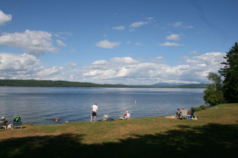
Photo: Paul Schultz, CC BY 2.0
Photo: Doug Kerr, CC BY-SA 2.0

Photo: Anthony Quintano, CC BY 2.0
What Mainers ask about the water in Piscataquis County
Does the MDIFW map any public ramps in Piscataquis County?
Maine boat launch data puts 60 ramps within these lines.
What pond or reservoir leads Piscataquis County on size?
Size order puts Moosehead Lake first: 75,528 acres.
Which species keep appearing in lists near Piscataquis County?
MDIFW lists brook trout on the most waters in the county, then white sucker, creek chub and golden shiner; a listing shows presence, not a catch.
Which Maine shops in Piscataquis County carry tackle?
Maine Guide Fly Shop counts among 8 here.
Which Maine town is the county seat of Piscataquis County?
County government sits at Dover-Foxcroft.
Do I need a Maine license to fish around Piscataquis County?
Inland fishing in Maine takes a license from age 16: the MDIFW fees page lists $30 for a resident season license and $83 for a nonresident season license, before agent fees.
Which Maine county pages sit near Piscataquis County?
Check Penobscot County, Somerset County and Aroostook County next.
Does a Maine daily limit apply in Piscataquis County?
Limits come from the law book's statewide rows unless the water has its own entry, and an entry replaces the statewide limit for the fish it names; each lake and river page on this site prints its entry. Source for the rules: MDIFW statewide fishing law pages, Nov. 18, 2026 reading; undated pages, a 2026 law book good through Dec. 31, 2026, and no 2027 numbers.
Are the small ponds and brooks of Piscataquis County listed here?
Table rows stand in for pageless waters; 1,507 waters exist in the county.
When does the MDIFW stock water in Piscataquis County?
The MDIFW pages log 1 dated event for the county; the newest are in the stocking band above, and a count appears only where a source printed one.
Are there Maine fishing tournaments in Piscataquis County?
1 entry on file; nothing is dated later.
Work the ponds and streams of Piscataquis County
Every ramp in the lists links to driving directions.