Fishing in Somerset County, Maine
County seat: Skowhegan. Census 2020 residents: 50,477.
- 1,217named waters
- 48ramps
- 3river pages
 Pick for troutPiscifun Carbon X ultralight spinning reel28% OFFSale $57.99
Photo of Kennebec River: Paul VanDerWerf, CC BY 2.0
Somerset County water by the agency numbers
Skowhegan serves as the seat of Somerset County, which on record 50,477 residents in the 2020 Census. The 2023 Gazetteer measures 3,924 square miles of land and 169.1 square miles of water between the Maine county lines. Across the 1,217 waters MDIFW and USGS list for Somerset County, Flagstaff Lake is the broadest. A wader could try Kennebec River, Sandy River and Heald Stream (Moose River, Somerset County).
A boater can pick among 48 boat ramps; the data adds 0 other fishing points sites with no launch. MDIFW flags 139 waters of its waters here as Heritage Fish locations, kept for wild native fish.
U.S. Census Bureau, 2020 Census counts (TIGERweb) and the 2023 Gazetteer, read November 18, 2026. Maine GeoLibrary boat launches layer (ArcGIS service), read November 18, 2026.
Where the MDIFW places waters and landings inside Somerset County
Maine GeoLibrary boat launches layer (ArcGIS service), read November 18, 2026. Water pins sit at the point MDIFW or the USGS gives for each water.
Lakes worth a look in Somerset County
| Lake | Size | Access points | Kind | Fish the MDIFW lists |
|---|---|---|---|---|
| Flagstaff Lake | 17,377 acres | 5 | lake | none listed |
| Brassua Lake | 9,457 acres | 1 | lake | fallfish, rainbow smelt, golden shiner |
| Moose Pond (Hartland, Somerset County) | 3,858 acres | 1 | pond | none listed |
| Attean Pond | 2,890 acres | 1 | pond | none listed |
| Moxie Pond (Somerset County) | 2,221 acres | 1 | pond | none listed |
| Wyman Lake | 1,820 acres | 2 | lake | brook trout, fallfish, lake trout (togue) |
| Spencer Lake | 1,670 acres | 0 | lake | none listed |
| Embden Pond | 1,543 acres | 1 | pond | none listed |
| Pierce Pond (Somerset County) | 1,527 acres | 2 | pond | none listed |
| Wesserunsett Lake | 1,407 acres | 1 | lake | none listed |
| Big Indian Pond (Somerset County) | 1,145 acres | 1 | pond | none listed |
| Holeb Pond | 1,103 acres | 1 | pond | none listed |
| Parlin Pond | 586 acres | 0 | pond | longnose sucker, brook trout, rainbow smelt |
| Kingsbury Pond | 433 acres | 0 | pond | landlocked salmon, blacknose dace, brook trout |
| Lake George | 318 acres | 1 | lake | brown trout, brook trout, golden shiner |
| Hancock Pond (Somerset County) | 314 acres | 0 | pond | landlocked salmon, lake trout (togue), white sucker |
| Crocker Pond (Somerset County) | 250 acres | 1 | pond | white sucker, creek chub, golden shiner |
| Wentworth Pond | 224 acres | 0 | pond | landlocked salmon, brown trout, golden shiner |
| Rowe Pond (Somerset County) | 205 acres | 0 | pond | landlocked salmon, fathead minnow, brook trout |
| Fahi Pond | 186 acres | 1 | pond | brook trout, white perch, creek chub |
| Demo Pond | 169 acres | 0 | pond | brook trout, white sucker, creek chub |
| Morrill Pond | 145 acres | 0 | pond | brown trout, brook trout, golden shiner |
| Luther Pond | 138 acres | 0 | pond | brook trout, white sucker, common shiner |
| Little Austin Pond | 128 acres | 0 | pond | brook trout, creek chub, rainbow smelt |
| Sandy Pond (Somerset County) | 110 acres | 0 | pond | brown trout, smallmouth bass, golden shiner |
| Chase Pond (Moscow, Somerset County) | 109 acres | 0 | pond | brook trout, creek chub, white sucker |
| Kilgore Pond | 102 acres | 0 | pond | brook trout, chain pickerel, finescale dace |
| Mosquito Pond (Somerset County) | 100 acres | 0 | pond | landlocked salmon, redbelly dace, brook trout |
| Supply Pond | 93 acres | 0 | pond | brook trout, creek chub |
| Basin Pond (Somerset County) | 84 acres | 0 | pond | brook trout, finescale dace, blacknose dace |
| Otter Pond (Bowtown Twp, Somerset County) | 80 acres | 0 | pond | brook trout, redbelly dace, rainbow smelt |
| North Otter Pond | 68 acres | 0 | pond | brook trout, redbelly dace, rainbow smelt |
| Spruce Pond (Somerset County) | 62 acres | 0 | pond | brook trout, golden shiner |
| Lower Shaw Pond-South | 62 acres | 0 | pond | yellow perch, chain pickerel, white sucker |
| Baker Pond (Solon, Somerset County) | 58 acres | 0 | pond | brook trout, smallmouth bass, white sucker |
| Long Pond (King & Bartlett Twp, Somerset County) | 44 acres | 0 | pond, Heritage Fish location | brook trout, lake chub, finescale dace |
| Clearwater Pond (Attean Twp, Somerset County) | 43 acres | 0 | pond | brook trout, brown bullhead, redbelly dace |
| Little Dimmick Pond | 40 acres | 0 | pond | landlocked salmon, brook trout, redbelly dace |
| Loon Pond (Somerset County) | 38 acres | 0 | pond | brook trout, finescale dace, fathead minnow |
| Moore Pond | 37 acres | 0 | pond | brook trout, white sucker, common shiner |
| Hale Pond (Somerset County) | 37 acres | 0 | pond | brook trout, lake chub, white sucker |
| Palmer Pond | 37 acres | 0 | pond | brook trout, redbelly dace, creek chub |
| Roderique Pond | 36 acres | 0 | pond | brook trout |
| Rancourt Pond | 31 acres | 0 | pond | brook trout, finescale dace |
| Chub Pond (Hobbstown Twp, Somerset County) | 30 acres | 0 | pond | brook trout, yellow perch, creek chub |
| Bean Pond (Somerset County) | 28 acres | 0 | pond | brook trout, finescale dace, rainbow smelt |
| Black Hill Pond | 25 acres | 0 | pond | brook trout, blacknose dace, creek chub |
| Sugar Berth Pond | 23 acres | 0 | pond | brook trout, creek chub, finescale dace |
| King Pond (Somerset County) | 22 acres | 0 | pond | brook trout, banded killifish, finescale dace |
| Bill Morris Pond | 22 acres | 0 | pond | brook trout, finescale dace, blacknose dace |
| Little Chase Stream Pond | 22 acres | 0 | pond | brook trout, white sucker, redbelly dace |
| Little Indian Pond (Squaretown Twp, Somerset County) | 22 acres | 0 | pond | brook trout, redbelly dace, creek chub |
| McKenney Pond | 22 acres | 0 | pond | brook trout, white sucker, blacknose dace |
| Trickey Pond (Somerset County) | 21 acres | 0 | pond | brook trout, white sucker, blacknose dace |
| Lost Pond (Pleasant Ridge Plt, Somerset County) | 21 acres | 0 | pond | brook trout, fathead minnow |
| Smith Pond (Parlin Pond Twp, Somerset County) | 17 acres | 0 | pond | brook trout |
| Little Lane Pond (Hammond Twp, Somerset County) | 16 acres | 0 | pond | brook trout, finescale dace |
| Upper Kilgore Pond | 14 acres | 0 | pond | brook trout |
| Horseshoe Pond (Pierce Pond Twp, Somerset County) | 11 acres | 0 | pond | brook trout, chain pickerel |
| Daymond Pond | 11 acres | 0 | pond | brook trout, redbelly dace, finescale dace |
Surface acres from the MDIFW MaineLakes polygon layer for this water (ArcGIS service; geodesic acres of the mapped outline), read November 18, 2026. Waters with no acreage in the MDIFW record show their mapped outline instead. MDIFW MaineLakes layer record for this water (ArcGIS service), read November 18, 2026.
 For the trout herePiscifun Carbon XT ultralight spinning reel25% OFFSale $59.99
Brooks winding through Somerset County
- Kennebec River11 access points, 4 USGS gauges, dated stocking rows
- Sandy River1 access point, 3 USGS gauges, dated stocking rows
- Heald Stream (Moose River, Somerset County)dated stocking rows
Gauge sites placed inside Somerset County
USGS has no current reading for these gauges.
USGS National Hydrography Dataset record for this river (NHD service), read November 18, 2026. Length is the NHD flowline length inside Maine, not a fishable length. USGS Water Data for the Nation, live through the site, retrieved on page view.
Which fish lead the MDIFW lists for Somerset County
Of 197 county waters with a species list, brook trout shows up most.
MDIFW Popular Fish Species lists, counted per water; presence in the list is not a catch survey. Species named on the MDIFW lake survey map (map PDF), read November 18, 2026. A listed species was recorded for that survey, not reported as a catch.
Down East or North Woods: public ramps in Somerset County
- Attean Pond (T5 R1 NBKP) Fishing Areatrailer ramp, freshwater, gravel surface; Somerset County
- Baker Lake (T7 R17 WELS) Fishing Areatrailer ramp, freshwater, gravel surface; Somerset County
- Big Indian Lake (St Albans) Fishing Area on Big Indian Pond (Somerset County)trailer ramp, freshwater, hard surface; Somerset County
- Brassua Lake (T1 R1 NBKP) Fishing Areatrailer ramp, freshwater, hard surface; Somerset County
- Canada Falls Lake (Pittston Academy Grant) Fishing Areatrailer ramp, freshwater, gravel surface; Somerset County
- Crocker Pond (Dennistown Plt) Fishing Areatrailer ramp, freshwater, gravel surface; Somerset County
- DEAD RIVER (T3 R4 BKP WKR) Fishing Area on Dead Stream (Somerset County)carry-in access; Somerset County
- Embden Pond (Embden) Fishing Areatrailer ramp, freshwater, hard surface; Somerset County
- Fahi Pond (Embden) Fishing Areacarry-in access; Somerset County
- Flagstaff Lake (Bigelow Twp) Fishing Areacarry-in access; Somerset County
- Flagstaff Lake (Dead River Twp) Fishing Area (east)trailer ramp, freshwater, gravel surface; Somerset County
- Flagstaff Lake (Dead River Twp) Fishing Area (west)carry-in access; Somerset County
- Flagstaff Lake (Flagstaff Twp) Fishing Areacarry-in access; Somerset County
- Flagstaff Lake (T3 R4 BKP WKR) Fishing Areatrailer ramp, freshwater, gravel surface; Somerset County
- Grace Pond (Upper Enchanted Twp) Fishing Areacarry-in access; Somerset County
- Great Moose Lake (Hartland) Fishing Area on Moose Pond (Hartland, Somerset County)trailer ramp, freshwater, hard surface; Somerset County
- Holeb Pond (T6 R1 NBKP) Fishing Areatrailer ramp, freshwater, gravel surface; Somerset County
- Indian Pond (Indian Stream Twp) Fishing Areatrailer ramp, freshwater, hard surface; Somerset County
- Ironbound Pond (Solon) Fishing Areatrailer ramp, freshwater, gravel surface; Somerset County
- Kennebec River (Fairfield) Fishing Area (north)trailer ramp, freshwater, hard surface; Somerset County
- Kennebec River (Fairfield) Fishing Area (south)trailer ramp, freshwater, gravel surface; Somerset County
- Kennebec River (Madison) Fishing Areatrailer ramp, freshwater, hard surface; Somerset County
- Kennebec River (Norridgewock) Fishing Areatrailer ramp, freshwater, hard surface; Somerset County
- Kennebec River (Skowhegan) Fishing Areatrailer ramp, freshwater, hard surface; Somerset County
Maine GeoLibrary boat launches layer (ArcGIS service), read November 18, 2026.
Remaining Maine ponds, brooks and bays of Somerset County, a row apiece
Maine lakes and ponds in Somerset County
| Water | Kind | Size | Fish the MDIFW lists | Access | Map pin |
|---|---|---|---|---|---|
| Seboomook Lake | lake, Heritage Fish location | 6,728 acres | brook trout, yellow perch, blacknose dace, round whitefish | 2 | 45.9129, -69.8504 |
| Indian Pond (Chase Stream Twp, Somerset County) | pond | 3,459 acres | white sucker, brook trout, longnose sucker, lake trout (togue) | 1 | 45.5231, -69.8103 |
| Long Pond (Long Pond Twp, Somerset County) | pond | 2,952 acres | none listed | 0 | 45.6264, -70.0871 |
| Canada Falls Lake | lake, Heritage Fish location | 2,306 acres | brook trout, round whitefish, common shiner, white sucker | 1 | 45.8411, -70.0384 |
| North Pond (Somerset County) | pond | 2,241 acres | none listed | 1 | 44.6258, -69.8424 |
| Big Wood Pond | pond, dated stocking rows | 2,162 acres | none listed | 0 | 45.6197, -70.2773 |
| East Pond | pond | 1,718 acres | none listed | 0 | 44.6099, -69.7834 |
| Baker Lake | lake | 1,256 acres | none listed | 1 | 46.2673, -69.9114 |
| Penobscot Lake | lake, Heritage Fish location | 1,162 acres | brook trout, lake chub | 0 | 45.9372, -70.2171 |
| Bald Mountain Pond | pond | 1,147 acres | brook trout, white sucker, banded killifish, redbreast sunfish | 0 | 45.2595, -69.7290 |
| Pleasant Pond (Somerset County) | pond | 1,037 acres | none listed | 1 | 45.2543, -69.9206 |
| Spring Lake (Somerset County) | lake, dated stocking rows | 730 acres | none listed | 0 | 45.2363, -70.2645 |
| West Carry Pond | pond, Heritage Fish location | 727 acres | none listed | 0 | 45.1690, -70.1112 |
| Little Big Wood Pond | pond | 717 acres | none listed | 1 | 45.6355, -70.3556 |
| Fifth Saint John Pond | pond | 680 acres | yellow perch, blacknose dace, brown bullhead, common shiner | 0 | 46.1306, -69.9024 |
| Austin Pond (Bald Mountain Twp T2 R3, Somerset County) | pond | 658 acres | none listed | 0 | 45.2091, -69.7462 |
| Long Pond (Dole Brook Twp, Somerset County) | pond, Heritage Fish location | 651 acres | none listed | 0 | 45.9655, -70.1562 |
| Solon Flowage | reservoir | 646 acres | none listed | 0 | 45.0086, -69.8726 |
| King and Bartlett Lake | lake, Heritage Fish location | 538 acres | none listed | 0 | 45.3644, -70.3644 |
| Douglas Pond (Somerset County) | pond | 446 acres | none listed | 0 | 44.8172, -69.3881 |
| Gilman Pond (Somerset County) | pond | 408 acres | brown trout, brown bullhead, chain pickerel, pumpkinseed sunfish | 0 | 44.9580, -70.0543 |
| Sibley Pond (Somerset County) | pond | 396 acres | smallmouth bass, white sucker, largemouth bass, brown bullhead | 0 | 44.7955, -69.5222 |
| Saint Francis Lake | lake, Heritage Fish location | 351 acres | yellow perch, lake chub, lake whitefish, common shiner | 0 | 46.3204, -69.7539 |
| Black Brook Pond (Moxie Gore, Somerset County) | pond | 346 acres | brook trout, redbelly dace, finescale dace, lake chub | 0 | 45.4008, -69.8956 |
| Enchanted Pond | pond, Heritage Fish location | 334 acres | brook trout, white sucker, blacknose dace, lake chub | 0 | 45.4340, -70.1849 |
| Dole Pond | pond, Heritage Fish location | 308 acres | brook trout, lake whitefish, blacknose dace, white sucker | 0 | 46.0010, -70.2045 |
| East Carry Pond | pond, Heritage Fish location | 292 acres | brook trout, rainbow smelt, golden shiner | 0 | 45.1825, -70.0502 |
| Baker Pond (T5 R6 BKP WKR, Somerset County) | pond, Heritage Fish location | 248 acres | landlocked salmon, brook trout, blacknose dace, creek chub | 0 | 45.3928, -70.3748 |
| Ripley Pond | pond | 248 acres | brook trout, largemouth bass, common shiner, white perch | 1 | 45.0052, -69.3763 |
| Elm Pond | pond | 248 acres | none listed | 0 | 46.0235, -69.8079 |
| Fish Pond (Thorndike Twp, Somerset County) | pond | 222 acres | none listed | 0 | 45.7450, -70.1287 |
| Third Saint John Pond | pond, Heritage Fish location | 221 acres | brook trout, yellow perch, common shiner, white sucker | 0 | 46.0375, -69.9479 |
| Wyman Pond | pond | 220 acres | white perch, white sucker, chain pickerel, pumpkinseed sunfish | 0 | 45.0239, -69.7197 |
| Fish Pond (Hobbstown Twp, Somerset County) | pond | 219 acres | brook trout, rainbow smelt, lake chub, redbelly dace | 0 | 45.4430, -70.2972 |
| Cold Stream Pond (Somerset County) | pond, Heritage Fish location | 207 acres | brook trout, blacknose dace | 0 | 45.5274, -70.0103 |
| Tomhegan Pond | pond, Heritage Fish location | 204 acres | brook trout, brown bullhead, creek chub, white sucker | 0 | 45.7984, -69.8897 |
| Baker Pond (Caratunk, Somerset County) | pond, Heritage Fish location | 199 acres | landlocked salmon, redbelly dace, brook trout, blacknose dace | 0 | 45.2357, -69.8387 |
| Fourth Saint John Pond | pond, Heritage Fish location | 194 acres | brook trout, yellow perch, common shiner, lake whitefish | 0 | 46.0572, -69.9086 |
| Mayfield Pond | pond | 188 acres | landlocked salmon, brook trout, golden shiner, splake | 0 | 45.0983, -69.6842 |
| Heald Pond (Moose River, Somerset County) | pond, Heritage Fish location | 188 acres | brook trout, blacknose dace, creek chub, white sucker | 0 | 45.7287, -70.2310 |
| Whipple Pond | pond | 186 acres | brook trout, creek chub, common shiner | 0 | 45.4938, -70.2968 |
| Grace Pond | pond, Heritage Fish location | 168 acres | brook trout, lake chub | 1 | 45.4774, -70.1777 |
| Whites Pond | pond | 166 acres | smallmouth bass, white sucker, white perch, brown bullhead | 0 | 44.8550, -69.3611 |
| Smith Pond (Brighton Plt, Somerset County) | pond, dated stocking rows | 166 acres | none listed | 0 | 45.0626, -69.7109 |
| Frost Pond (Somerset County) | pond, Heritage Fish location | 160 acres | brook trout, white sucker, fallfish | 0 | 46.0030, -70.2733 |
| Foley Pond | pond, Heritage Fish location | 150 acres | brook trout, creek chub, pearl dace | 0 | 45.9353, -70.0533 |
| Long Pond (Taunton & Raynham Academy Grant, Somerset County) | pond | 150 acres | brook trout, common shiner, rainbow smelt, round whitefish | 0 | 45.6424, -69.7611 |
| Pug Pond (Somerset County) | pond | 148 acres | brook trout, common shiner, lake trout (togue), creek chub | 0 | 45.8598, -70.2467 |
| Rock Pond (Somerset County) | pond, Heritage Fish location | 146 acres | white sucker, creek chub, blacknose dace | 0 | 45.4599, -70.3904 |
| Little Indian Pond (Saint Albans, Somerset County) | pond | 139 acres | smallmouth bass, white sucker, largemouth bass, brown bullhead | 0 | 44.9592, -69.3579 |
| Stafford Pond | pond | 134 acres | brook trout, white sucker, white perch, brown bullhead | 0 | 44.8912, -69.5038 |
| Jones Pond (Somerset County) | pond, Heritage Fish location | 134 acres | brook trout, white sucker, blacknose dace, redbelly dace | 0 | 45.8096, -70.2094 |
| Middle Carry Pond | pond, Heritage Fish location | 128 acres | brook trout, finescale dace, blacknose dace, golden shiner | 0 | 45.1703, -70.0607 |
| Turner Pond (Forsyth Twp, Somerset County) | pond, Heritage Fish location | 127 acres | brook trout, yellow perch, common shiner, white sucker | 0 | 45.6352, -70.4929 |
| Knights Pond (Squaretown Twp, Somerset County) | pond, dated stocking rows | 125 acres | none listed | 0 | 45.4102, -69.8641 |
| Mercer Bog | lake | 124 acres | none listed | 0 | 44.6596, -69.9284 |
| Benjamin Pond | pond | 119 acres | none listed | 0 | 45.5976, -70.3626 |
| Turner Pond (T7 R16 WELS, Somerset County) | pond | 119 acres | none listed | 0 | 46.2774, -69.7948 |
| Muskrat Pond (Somerset County) | pond | 115 acres | none listed | 0 | 45.7413, -70.1106 |
| Russell Pond (Somerset County) | pond, Heritage Fish location | 113 acres | brook trout, round whitefish, creek chub, lake chub | 0 | 46.0843, -69.8225 |
| Second Saint John Pond | pond, Heritage Fish location | 112 acres | brook trout, yellow perch, common shiner, white sucker | 0 | 46.0147, -69.9676 |
| Alder Pond (T3 R5 BKP WKR, Somerset County) | pond | 110 acres | none listed | 0 | 45.3310, -70.2162 |
| Barker Pond (Somerset County) | pond | 110 acres | smallmouth bass, white sucker, largemouth bass, brown bullhead | 0 | 44.9074, -69.6341 |
| Starbird Pond | pond | 108 acres | white perch, chain pickerel, yellow perch, pumpkinseed sunfish | 0 | 44.8952, -69.5600 |
| Gammon Pond | pond | 104 acres | yellow perch, white sucker, chain pickerel, brown bullhead | 0 | 44.8627, -70.1328 |
| Saint Albans Game Management Pond | pond | 102 acres | none listed | 0 | 44.8992, -69.3273 |
| Ellis Pond (Somerset County) | pond, Heritage Fish location | 101 acres | brook trout, finescale dace, creek chub | 0 | 45.4500, -69.9482 |
| Cheney Pond | pond, Heritage Fish location | 98 acres | lake chub, redbelly dace | 0 | 45.9010, -70.2052 |
| Big Grenier Pond | pond, Heritage Fish location | 97 acres | brook trout, redbelly dace | 0 | 45.9710, -70.2424 |
| Mainstream Pond | pond | 92 acres | none listed | 0 | 44.9854, -69.4955 |
| Bog Pond (Attean Twp, Somerset County) | pond | 92 acres | none listed | 0 | 45.5417, -70.3026 |
| Little King Lake | lake, Heritage Fish location | 91 acres | landlocked salmon, brook trout, blacknose dace, rainbow smelt | 0 | 45.3399, -70.3776 |
| Little Saint John Lake | lake | 88 acres | yellow perch, brown bullhead, fallfish, white sucker | 0 | 46.0991, -70.2534 |
| Oaks Pond | pond | 88 acres | brook trout, brown trout, golden shiner, rainbow smelt | 0 | 44.7575, -69.6025 |
| Big Dimmock Pond | pond | 83 acres | brook trout, white sucker, redbelly dace, creek chub | 0 | 45.2193, -69.8602 |
| Long Pond (Forsyth Twp, Somerset County) | pond | 82 acres | brook trout, white sucker, creek chub | 0 | 45.6119, -70.4773 |
| Baker Pond (Moxie Gore, Somerset County) | pond | 80 acres | fathead minnow | 0 | 45.3837, -69.8670 |
| Baker Pond (Tomhegan Twp, Somerset County) | pond | 79 acres | brook trout, white sucker, creek chub | 0 | 45.7263, -69.8458 |
| Mud Pond (Attean Twp, Somerset County) | pond | 77 acres | none listed | 0 | 45.6164, -70.3107 |
| Parker Pond (Somerset County) | pond, Heritage Fish location | 73 acres | brook trout, finescale dace, creek chub, lake chub | 0 | 45.3288, -70.2906 |
| Desolation Pond | pond, Heritage Fish location | 71 acres | brook trout, blacknose dace, blacknose shiner, creek chub | 0 | 46.3855, -69.7425 |
| Little Moxie Pond | pond, Heritage Fish location | 70 acres | brook trout, white sucker, golden shiner, creek chub | 0 | 45.3090, -69.7241 |
| Grass Pond (Pierce Pond Twp, Somerset County) | pond, Heritage Fish location | 68 acres | none listed | 0 | 45.3103, -70.0936 |
| Corner Pond | pond | 68 acres | none listed | 0 | 46.3945, -69.7316 |
| Fletcher Pond 1 | pond | 68 acres | none listed | 0 | 45.6807, -69.9413 |
| Dingley Pond | pond, Heritage Fish location | 66 acres | brook trout, redbelly dace | 0 | 45.9471, -70.2344 |
| Dead Stream Pond | pond, Heritage Fish location | 65 acres | brook trout, creek chub | 0 | 45.4423, -69.9134 |
| Horseshoe Pond (Attean Twp, Somerset County) | pond | 64 acres | none listed | 0 | 45.6044, -70.3677 |
| Big Fish Pond | pond | 63 acres | brook trout, creek chub, blacknose dace | 0 | 45.5509, -70.4539 |
| Black Brook Pond (Pierce Pond Twp, Somerset County) | pond | 58 acres | none listed | 0 | 45.2387, -70.1645 |
| Clayton Pond | pond | 57 acres | none listed | 0 | 46.1701, -69.8816 |
| Center Pond (Somerset County) | pond, Heritage Fish location | 56 acres | brook trout, white sucker, lake chub, redbelly dace | 0 | 45.7998, -69.9786 |
| Fogg Pond (Somerset County) | pond, Heritage Fish location | 55 acres | brook trout, white sucker, creek chub, finescale dace | 0 | 45.5927, -70.0746 |
| Indian Pond (Lexington Twp, Somerset County) | pond | 55 acres | chain pickerel, redbreast sunfish, pumpkinseed sunfish, blacknose dace | 0 | 44.9670, -70.0960 |
| Hall Pond (T5 R7 BKP WKR, Somerset County) | pond | 54 acres | none listed | 0 | 45.4927, -70.3216 |
| Little Turner Pond | pond, Heritage Fish location | 54 acres | brook trout, lake chub, creek chub | 0 | 45.6442, -70.4637 |
| Como Lake | lake | 52 acres | none listed | 0 | 44.9516, -69.5020 |
| Summit Pond | pond, Heritage Fish location | 52 acres | brook trout, yellow perch | 0 | 46.0280, -69.8812 |
| Lost Pond (Russell Pond Twp, Somerset County) | pond, Heritage Fish location | 52 acres | none listed | 0 | 46.1121, -69.7913 |
| Madawaska Brook WLMA | lake | 52 acres | none listed | 0 | 44.8328, -69.3740 |
| Fletcher Pond 2 | pond | 51 acres | none listed | 0 | 45.6799, -69.9351 |
| Frost Pond Flowage | reservoir | 50 acres | none listed | 0 | 45.9938, -70.2569 |
| Big Heald Pond | pond, Heritage Fish location | 50 acres | brook trout, blacknose dace, creek chub, white sucker | 0 | 45.1912, -69.8764 |
| Blakeslee Lake | lake, Heritage Fish location | 48 acres | brook trout, blacknose dace | 0 | 45.3878, -70.4318 |
| Round Pond (Squaretown Twp, Somerset County) | pond, Heritage Fish location | 45 acres | brook trout, golden shiner, finescale dace | 0 | 45.4141, -69.7599 |
| Truesdale Pond | pond | 44 acres | none listed | 0 | 46.0215, -70.0435 |
| Felker Pond | pond, Heritage Fish location | 44 acres | brook trout, white sucker, redbelly dace, blacknose dace | 0 | 45.3384, -70.4162 |
| Hurricane Pond (Somerset County) | pond | 44 acres | brook trout, white sucker, creek chub, blacknose dace | 0 | 46.0760, -70.2597 |
| Ten Thousand Acre Pond | pond, Heritage Fish location | 43 acres | brook trout, lake chub, finescale dace, redbelly dace | 0 | 45.5065, -69.9534 |
| Austin Pond (T5 R17 WELS, Somerset County) | pond | 43 acres | landlocked salmon, creek chub, brook trout, fallfish | 0 | 46.0528, -69.9504 |
| Mountain Dimmock Pond | pond | 43 acres | brook trout, redbelly dace, finescale dace, lake chub | 0 | 45.2049, -69.8743 |
| Shaw Pond | pond | 43 acres | white sucker | 0 | 45.2857, -70.2769 |
| Cambridge Pond | pond | 43 acres | none listed | 0 | 45.0205, -69.4791 |
| Little Elm Pond | pond, Heritage Fish location | 43 acres | none listed | 0 | 46.0209, -69.7716 |
| Butler Pond (King & Bartlett Twp, Somerset County) | pond, Heritage Fish location | 43 acres | brook trout, lake chub, finescale dace | 0 | 45.2934, -70.4407 |
| Upper Welman Pond | pond, Heritage Fish location | 43 acres | white sucker, common shiner, creek chub, finescale dace | 0 | 45.8802, -70.2304 |
| Sweeney Bog | lake | 42 acres | none listed | 0 | 46.2070, -69.9034 |
| Safford Pond (Somerset County) | pond | 42 acres | chain pickerel, blacknose dace, pumpkinseed sunfish | 0 | 45.0000, -70.1102 |
| Tobey Pond #1 | pond | 41 acres | none listed | 0 | 45.5226, -70.3647 |
| Little Enchanted Pond | pond, Heritage Fish location | 39 acres | brook trout | 0 | 45.4347, -70.2392 |
| Socatean Pond #1 | pond | 39 acres | none listed | 0 | 45.8764, -69.8596 |
| Robinson Pond (Caratunk, Somerset County) | pond, Heritage Fish location | 39 acres | none listed | 0 | 45.1914, -69.9003 |
| Ironbound Pond | pond, Heritage Fish location | 39 acres | brook trout, white sucker, lake chub, redbelly dace | 1 | 45.7668, -70.0852 |
| Spectacle Pond (Somerset County) | pond, Heritage Fish location | 38 acres | landlocked salmon, blacknose dace, brook trout, creek chub | 0 | 45.3334, -70.4601 |
| Misery Pond | pond, Heritage Fish location | 38 acres | brook trout, white sucker, creek chub, lake chub | 0 | 45.5349, -69.9444 |
| Big Bartley Pond | pond | 37 acres | brook trout, white sucker, yellow perch, finescale dace | 0 | 45.5521, -70.4282 |
| Beck Pond | pond | 37 acres | brook trout, white sucker, blacknose dace, creek chub | 0 | 45.3730, -70.3392 |
| Lang Pond | pond, Heritage Fish location | 37 acres | brook trout, blacknose dace | 0 | 45.5306, -70.0248 |
| Barrett Pond | pond, Heritage Fish location | 37 acres | brook trout, lake chub, creek chub | 0 | 45.5207, -70.4887 |
| Deer Pond (King & Bartlett Twp, Somerset County) | pond, Heritage Fish location | 36 acres | brook trout, lake chub, finescale dace | 0 | 45.3000, -70.4186 |
| Round Pond (Chase Stream Twp, Somerset County) | pond, Heritage Fish location | 36 acres | brook trout, finescale dace | 0 | 45.4681, -69.9449 |
| Robinson Pond (T4 R17 WELS, Somerset County) | pond | 35 acres | brook trout, finescale dace, fathead minnow, lake chub | 0 | 46.0294, -69.9581 |
| Round Pond (Sapling Twp, Somerset County) | pond | 34 acres | none listed | 0 | 45.5829, -69.7718 |
| Coburn Pond | pond | 33 acres | none listed | 0 | 45.6885, -70.2616 |
| Big Berry Pond | pond, Heritage Fish location | 33 acres | none listed | 0 | 45.5057, -70.0396 |
| Dority Pond | pond, Heritage Fish location | 33 acres | brook trout, white sucker, creek chub, finescale dace | 0 | 45.8692, -70.1953 |
| Mud Pond (Thorndike Twp, Somerset County) | pond | 33 acres | none listed | 0 | 45.7308, -70.1256 |
| Long Pond (Attean Twp, Somerset County) | pond | 32 acres | none listed | 0 | 45.6063, -70.3404 |
| Halfmoon Pond (Somerset County) | pond | 32 acres | white perch, white sucker, yellow perch, brown bullhead | 0 | 44.9815, -69.3331 |
| Alder Pond (Alder Brook Twp, Somerset County) | pond, Heritage Fish location | 32 acres | brook trout, creek chub, longnose sucker, finescale dace | 0 | 45.7923, -70.1068 |
| Spaulding Pond (Somerset County) | pond | 32 acres | brook trout, lake chub, finescale dace | 0 | 45.9858, -70.1529 |
| Jackson Pond (Somerset County) | pond | 31 acres | brook trout, fathead minnow, creek chub, golden shiner | 0 | 45.0169, -69.9031 |
| Horseshoe Pond (Chase Stream Twp, Somerset County) | pond, Heritage Fish location | 31 acres | brook trout, redbelly dace, finescale dace, creek chub | 0 | 45.4581, -69.9331 |
| Little Fish Pond (Alder Brook Twp, Somerset County) | pond, Heritage Fish location | 31 acres | brook trout | 0 | 45.7945, -70.1621 |
| Butler Pond (Lexington Twp, Somerset County) | pond, Heritage Fish location | 30 acres | brook trout, blacknose dace, white sucker | 0 | 45.0211, -70.1265 |
| Tobey Pond #2 | pond | 30 acres | none listed | 0 | 45.5118, -70.3611 |
| Little Bog | lake | 30 acres | none listed | 0 | 46.1617, -69.9561 |
| Upper First St John Pond | pond, Heritage Fish location | 30 acres | brook trout, yellow perch, creek chub, redbelly dace | 0 | 46.0335, -69.9836 |
| Frypan Pond | pond, Heritage Fish location | 28 acres | brook trout, golden shiner, redbelly dace | 0 | 45.4051, -69.7725 |
| Iron Pond (Somerset County) | pond, Heritage Fish location | 28 acres | blacknose dace | 0 | 45.4579, -70.3776 |
| Little Mosquito Pond | pond | 27 acres | brook trout, creek chub, white sucker, golden shiner | 0 | 45.3044, -69.8762 |
| Lower First Saint John Pond | pond, Heritage Fish location | 26 acres | none listed | 0 | 46.0265, -69.9790 |
| Bog Pond (Hartland, Somerset County) | pond | 26 acres | none listed | 0 | 44.8857, -69.5744 |
| Horseshoe Pond (Parlin Pond Twp, Somerset County) | pond, Heritage Fish location | 26 acres | brook trout | 0 | 45.5639, -70.0907 |
| Boulder Pond | pond | 26 acres | none listed | 0 | 45.5113, -70.3230 |
| Bobs Pond | pond, Heritage Fish location | 26 acres | brook trout, finescale dace | 0 | 46.0209, -69.8647 |
| Clear Pond (Somerset County) | pond, Heritage Fish location | 25 acres | brook trout, redbelly dace, fathead minnow | 0 | 45.1103, -69.9873 |
| Island Pond (Somerset County) | pond, Heritage Fish location | 25 acres | brook trout, finescale dace | 0 | 45.4705, -69.9327 |
| Lewiston Pond | pond | 24 acres | none listed | 0 | 45.9645, -70.1689 |
| Lily Pond (Concord Twp, Somerset County) (MIDAS 0180) | pond | 24 acres | none listed | 0 | 45.0155, -69.8693 |
| Horseshoe Pond (T3 R5 BKP WKR, Somerset County) | pond, Heritage Fish location | 24 acres | brook trout, creek chub, white sucker, redbelly dace | 0 | 45.3223, -70.3338 |
| Jewett Pond (Somerset County) | pond | 24 acres | brook trout, white sucker, golden shiner, brown bullhead | 0 | 45.1327, -70.0049 |
| Lane Pond | pond, Heritage Fish location | 24 acres | brook trout, creek chub, golden shiner | 0 | 45.9459, -70.0780 |
| Gordon Pond | pond, Heritage Fish location | 23 acres | brook trout, white sucker | 0 | 45.4022, -70.2315 |
| Upper Dingley Pond | pond, Heritage Fish location | 23 acres | brook trout, redbelly dace | 0 | 45.9600, -70.2489 |
| Cape Horn Pond | pond, Heritage Fish location | 23 acres | none listed | 0 | 45.8482, -70.3213 |
| Rowell Pond | pond | 23 acres | golden shiner, fathead minnow, finescale dace, white sucker | 0 | 44.9569, -69.7592 |
| Chase Stream Pond (Chase Stream Twp, Somerset County) (MIDAS 4093) | pond, Heritage Fish location | 23 acres | brook trout, finescale dace | 0 | 45.5119, -69.9776 |
| Little Heald Pond | pond | 23 acres | brook trout, blacknose dace, creek chub, white sucker | 0 | 45.1845, -69.8619 |
| Long Pond (The Forks Plt, Somerset County) | pond, dated stocking rows | 23 acres | brook trout | 0 | 45.2703, -69.9945 |
| Smith Pond (Cornville, Somerset County) | pond | 22 acres | none listed | 0 | 44.8218, -69.7108 |
| Roberts Pond (Somerset County) | pond | 22 acres | none listed | 0 | 46.0591, -70.2689 |
| LIttle Foley Pond | pond | 22 acres | none listed | 0 | 45.9494, -70.0630 |
| Prescott Pond (Somerset County) | pond | 22 acres | none listed | 0 | 45.3698, -69.8957 |
| Wilson Hill Pond | pond, Heritage Fish location | 21 acres | none listed | 0 | 45.4325, -69.9696 |
| Moxie Bog | lake | 21 acres | none listed | 0 | 45.2266, -69.8200 |
| Hicks Pond (Somerset County) | pond | 21 acres | none listed | 0 | 44.8703, -69.3445 |
| Clish Pond | pond, Heritage Fish location | 20 acres | brook trout, blacknose dace | 0 | 46.0198, -70.2579 |
| Dubois Pond | pond, Heritage Fish location | 20 acres | brook trout, lake chub, white sucker | 0 | 45.8849, -70.2211 |
| Long Bog (Somerset County) | lake | 20 acres | none listed | 0 | 45.6005, -70.3967 |
| Lower Enchanted Pond | pond, Heritage Fish location | 20 acres | none listed | 0 | 45.3566, -70.1253 |
| Hall Pond (Prentiss Twp T4 R4 NBKP, Somerset County) | pond, Heritage Fish location | 20 acres | none listed | 0 | 45.8750, -70.2534 |
| Baker Flowage | reservoir, Heritage Fish location | 19 acres | none listed | 0 | 45.1450, -69.7293 |
| Dixon Pond | pond, Heritage Fish location | 19 acres | brook trout, rainbow smelt, finescale dace, banded killifish | 0 | 45.2808, -70.0969 |
| Unnamed Pond (Seboomook Twp, Somerset County) (MIDAS 7862) | pond | 19 acres | none listed | 0 | 45.9093, -69.7164 |
| Little Palmer Pond | pond | 18 acres | none listed | 0 | 45.1774, -69.7368 |
| Withee Pond | pond | 18 acres | none listed | 0 | 45.0867, -69.7733 |
| Otter Pond (Mayfield Twp, Somerset County) | pond | 18 acres | none listed | 0 | 45.0972, -69.6936 |
| Unnamed Pond (Fairfield, Somerset County) (MIDAS 4811) | pond | 18 acres | none listed | 0 | 44.6037, -69.6527 |
| Moores Bog | lake, Heritage Fish location | 17 acres | none listed | 0 | 45.2304, -69.9578 |
| Call Pond | pond | 17 acres | none listed | 0 | 45.3423, -70.1631 |
| Helen Pond | pond, Heritage Fish location | 17 acres | brook trout, blacknose dace | 0 | 45.2681, -70.1255 |
| Unnamed Pond (Elm Stream Twp, Somerset County) (MIDAS 9770) | pond | 17 acres | none listed | 0 | 45.9794, -69.8166 |
| Unnamed Pond (Starks, Somerset County) (MIDAS 7364) | pond | 17 acres | none listed | 0 | 44.7020, -69.9799 |
| Upper Misery Pond | pond, Heritage Fish location | 17 acres | brook trout, creek chub | 0 | 45.5424, -69.9623 |
| Chase Stream Pond (Chase Stream Twp, Somerset County) (MIDAS 4080) | pond | 16 acres | none listed | 0 | 45.4661, -69.9027 |
| Long Pond (Chase Stream Twp, Somerset County) | pond, Heritage Fish location | 16 acres | brook trout, creek chub | 0 | 45.4690, -69.9687 |
| Chase Bog | lake, Heritage Fish location | 16 acres | none listed | 0 | 45.1755, -69.8882 |
| Mud Pond (Holeb Twp, Somerset County) | pond | 16 acres | none listed | 0 | 45.6131, -70.4519 |
| Horseshoe Pond (East Moxie Twp, Somerset County) | pond, Heritage Fish location | 16 acres | none listed | 0 | 45.3649, -69.7718 |
| Otter Pond (Carrying Place Town Twp, Somerset County) | pond, Heritage Fish location | 16 acres | none listed | 0 | 45.1983, -70.1030 |
| Spencer Pond (Somerset County) | pond | 15 acres | brook trout, finescale dace | 0 | 46.0026, -70.0285 |
| Tobey Pond #3 | pond | 15 acres | none listed | 0 | 45.5072, -70.3594 |
| Pennell Pond | pond | 15 acres | none listed | 0 | 44.9350, -70.1069 |
| Smith Pond (Forsyth Twp, Somerset County) | pond | 15 acres | brook trout, finescale dace | 0 | 45.6533, -70.4178 |
| Little Berry Pond (Somerset County) | pond, Heritage Fish location | 15 acres | brook trout | 0 | 45.5070, -70.0283 |
| Leith Pond | pond | 15 acres | none listed | 0 | 45.7398, -69.9094 |
| Cunningham Pond | pond | 15 acres | creek chub, blacknose dace | 0 | 45.8938, -70.0637 |
| Decker Pond #2 | pond, Heritage Fish location | 15 acres | none listed | 0 | 45.1955, -69.9370 |
| Toby Pond | pond | 15 acres | none listed | 0 | 45.4742, -70.3069 |
| Unnamed Pond (Anson, Somerset County) (MIDAS 7342) | pond | 15 acres | none listed | 0 | 44.8460, -69.9512 |
| Unnamed Pond (Seboomook Twp, Somerset County) (MIDAS 7864) | pond | 15 acres | none listed | 0 | 45.8968, -69.7866 |
| Unnamed Pond (Highland Plt, Somerset County) (MIDAS 7314) | pond | 15 acres | none listed | 0 | 45.0505, -70.0613 |
| Unnamed Pond (Norridgewock, Somerset County) | pond | 15 acres | none listed | 0 | 44.7767, -69.7797 |
| Upper Tobey Pond | pond | 15 acres | none listed | 0 | 45.4833, -70.3038 |
| Redmond Pond | pond | 14 acres | none listed | 0 | 45.3651, -70.2043 |
| Unnamed Pond (T8 R19 WELS, Somerset County) (MIDAS 9778) | pond | 14 acres | none listed | 0 | 46.3658, -70.1322 |
| Round Pond (Skowhegan, Somerset County) | pond | 14 acres | none listed | 0 | 44.7644, -69.6085 |
| Socatean Pond #2 | pond | 14 acres | none listed | 0 | 45.8761, -69.8831 |
| Elvis Pond | pond | 14 acres | none listed | 0 | 45.3446, -70.4253 |
| Lard Pond (Somerset County) | pond | 14 acres | none listed | 0 | 46.0027, -69.7972 |
| Mud Pond (Moxie Gore, Somerset County) | pond | 14 acres | none listed | 0 | 45.3866, -69.9152 |
| Durgin Pond | pond, Heritage Fish location | 14 acres | blacknose dace | 0 | 45.5128, -70.0302 |
| Otter Pond (Sandwich Academy Grant Twp, Somerset County) | pond | 14 acres | brook trout, redbelly dace, pearl dace | 0 | 45.6035, -69.9068 |
| Rache Pond | pond | 14 acres | none listed | 0 | 45.7157, -70.3140 |
| Butler Pond (Flagstaff Twp, Somerset County) | pond | 14 acres | none listed | 0 | 45.2413, -70.4252 |
| Little Hale Pond | pond | 13 acres | none listed | 0 | 45.8331, -70.1723 |
| Little Wilson Hill Pond | pond, Heritage Fish location | 13 acres | none listed | 0 | 45.4369, -70.0069 |
| Scribner Bog | lake, Heritage Fish location | 13 acres | none listed | 0 | 45.4018, -69.8504 |
| Mud Pond (Harmony, Somerset County) | pond | 13 acres | none listed | 0 | 45.0047, -69.5004 |
| Unnamed Pond (Starks, Somerset County) (MIDAS 6478) | pond | 13 acres | none listed | 0 | 44.7540, -69.9565 |
| Beaver Pond (Forsyth Twp, Somerset County) | pond, dated stocking rows | 13 acres | none listed | 0 | 45.6737, -70.4313 |
| Fish Pond (Moxie Gore, Somerset County) | pond | 13 acres | none listed | 0 | 45.3786, -69.9222 |
| Middle Heald Pond | pond | 13 acres | none listed | 0 | 45.1899, -69.8665 |
| Mule Pond | pond, Heritage Fish location | 13 acres | none listed | 0 | 46.0653, -69.7551 |
| Unnamed Pond (Elm Stream Twp, Somerset County) (MIDAS 9772) | pond | 13 acres | none listed | 0 | 45.9939, -69.7817 |
| Little Gordon Pond | pond | 13 acres | brook trout, creek chub | 0 | 45.3943, -70.2086 |
| Moose Pond (Bowtown Twp, Somerset County) | pond, dated stocking rows | 12 acres | none listed | 0 | 45.2930, -70.0265 |
| Log Landing Pond | pond | 12 acres | none listed | 0 | 45.2151, -69.9470 |
| Unnamed Pond (Holeb Twp, Somerset County) (MIDAS 8940) | pond | 12 acres | none listed | 0 | 45.5971, -70.4138 |
| Baker Stream Pond | pond | 12 acres | none listed | 0 | 45.2450, -69.8283 |
| Blair Pond | pond | 12 acres | none listed | 0 | 45.6341, -70.1657 |
| Lower Welman Pond | pond, Heritage Fish location | 12 acres | none listed | 0 | 45.8753, -70.2315 |
| Hutch Pond | pond, Heritage Fish location | 12 acres | finescale dace | 0 | 45.8695, -70.1727 |
| Chase Pond (Solon, Somerset County) | pond | 12 acres | none listed | 0 | 44.9799, -69.7612 |
| Dipper Pond (Somerset County) | pond | 12 acres | none listed | 0 | 45.8525, -69.9282 |
| Perry Pond (Somerset County) | pond | 12 acres | none listed | 0 | 44.9494, -69.5712 |
| Unnamed Pond (Attean Twp, Somerset County) (MIDAS 6506) | pond | 12 acres | none listed | 0 | 45.5476, -70.3674 |
| Unnamed Pond (Bradstreet Twp, Somerset County) (MIDAS 8874) | pond | 12 acres | none listed | 0 | 45.5296, -70.2628 |
| Unnamed Pond (T5 R7 BKP WKR, Somerset County) (MIDAS 8980) | pond, Heritage Fish location | 12 acres | none listed | 0 | 45.5275, -70.3701 |
| Little Dingley Pond | pond, Heritage Fish location | 12 acres | brook trout, redbelly dace | 0 | 45.9522, -70.2363 |
| Little Fish Pond (Holeb Twp, Somerset County) | pond, Heritage Fish location | 12 acres | brook trout | 0 | 45.5470, -70.4762 |
| Unnamed Pond (Athens, Somerset County) (MIDAS 7164) | pond | 12 acres | none listed | 0 | 44.9747, -69.6312 |
| Davis Pond (Somerset County) | pond, Heritage Fish location | 12 acres | none listed | 0 | 45.3929, -70.3987 |
| Sears Pond | pond | 12 acres | none listed | 0 | 45.9701, -70.1868 |
| Clearwater Pond (Prentiss Twp T4 R4 NBKP, Somerset County) | pond | 12 acres | none listed | 0 | 45.8906, -70.2283 |
| Pickerel Pond (Somerset County) | pond, Heritage Fish location | 11 acres | landlocked salmon, brook trout, finescale dace, chain pickerel | 0 | 45.2924, -70.0904 |
| Unnamed Pond (Starks, Somerset County) (MIDAS 7360) | pond | 11 acres | none listed | 0 | 44.6922, -69.9960 |
| Joe Pokum Pond | pond | 11 acres | none listed | 0 | 45.3070, -70.3957 |
| Trout Pond (Somerset County) | pond | 11 acres | brook trout, white sucker, largemouth bass, brown bullhead | 0 | 45.0416, -69.6676 |
| Unnamed Pond (Harmony, Somerset County) | pond | 11 acres | none listed | 0 | 45.0054, -69.5042 |
| Beaver Pond (Alder Brook Twp, Somerset County) | pond | 11 acres | none listed | 0 | 45.8342, -70.1047 |
| Everett Pond | pond, Heritage Fish location | 11 acres | brook trout, lake chub | 0 | 45.3030, -70.4527 |
| Lone Jack Pond | pond, Heritage Fish location | 11 acres | none listed | 0 | 45.5013, -70.0257 |
| Unnamed Pond (Comstock Twp, Somerset County) (MIDAS 8416) | pond, Heritage Fish location | 11 acres | none listed | 0 | 45.9537, -70.0672 |
| Unnamed Pond (Rockwood Strip T2 R1 NBKP, Somerset County) | pond | 11 acres | none listed | 0 | 45.6502, -69.9220 |
| Heald Pond (T3 R5 BKP WKR, Somerset County) | pond | 11 acres | none listed | 0 | 45.3623, -70.2442 |
| Lily Pond (Solon, Somerset County) | pond | 11 acres | none listed | 0 | 44.9558, -69.7473 |
| Lost Pond (T3 R5 BKP WKR, Somerset County) | pond | 11 acres | brook trout, lake chub, pearl dace | 0 | 45.3543, -70.2913 |
| Unnamed Pond (Holeb Twp, Somerset County) (MIDAS 6508) | pond | 11 acres | none listed | 0 | 45.5232, -70.5078 |
| Unnamed Pond (Moscow, Somerset County) (MIDAS 0168) | pond | 11 acres | none listed | 0 | 45.0941, -69.8326 |
| Reservoir (Somerset County) | reservoir | 11 acres | none listed | 0 | 44.5839, -69.6435 |
| Tobey Pond | pond, Heritage Fish location | 11 acres | brook trout | 0 | 45.4452, -69.9872 |
| Ladd Pond | pond | 11 acres | brook trout, finescale dace, brown bullhead | 0 | 44.6229, -69.9006 |
| Little Lang Pond | pond, Heritage Fish location | 11 acres | none listed | 0 | 45.5353, -70.0246 |
| Unnamed Pond (Embden, Somerset County) (MIDAS 6476) | pond | 11 acres | none listed | 0 | 44.9369, -69.9723 |
| McKenney Pond #1 | pond | 10 acres | none listed | 0 | 45.4560, -70.2019 |
| Moores Pond (Somerset County) | pond | 10 acres | none listed | 0 | 45.0379, -70.0552 |
| Mary Petuche Pond | pond, Heritage Fish location | 10 acres | brook trout, creek chub | 0 | 45.8798, -70.2477 |
| Unnamed Pond (T9 R17 WELS, Somerset County) (MIDAS 6540) | pond | 10 acres | none listed | 0 | 46.4096, -69.9327 |
| Snake Pond (Somerset County) | pond, Heritage Fish location | 10 acres | none listed | 0 | 45.5117, -70.0467 |
| Unnamed Pond (T3 R5 BKP WKR, Somerset County) (MIDAS 6966) | pond | 9.9 acres | none listed | 0 | 45.3614, -70.3399 |
| Hill Pond (Somerset County) | pond | 9.8 acres | none listed | 0 | 45.9271, -70.2313 |
| Mud Pond (Chase Stream Twp, Somerset County) | pond, Heritage Fish location | 9.8 acres | none listed | 0 | 45.4460, -69.9203 |
| Unnamed Pond (Bradstreet Twp, Somerset County) (MIDAS 8870) | pond | 9.8 acres | none listed | 0 | 45.5312, -70.2357 |
| Unnamed Pond (Palmyra, Somerset County) (MIDAS 2289) | pond | 9.8 acres | none listed | 0 | 44.8283, -69.2872 |
| Unnamed Pond (Squaretown Twp, Somerset County) (MIDAS 7390) | pond | 9.8 acres | none listed | 0 | 45.3938, -69.7360 |
| Nevin Pond | pond | 9.7 acres | none listed | 0 | 44.7963, -69.9490 |
| Unnamed Pond (King & Bartlett Twp, Somerset County) (MIDAS 7016) | pond | 9.7 acres | none listed | 0 | 45.3272, -70.3848 |
| Unnamed Pond (T8 R19 WELS, Somerset County) (MIDAS 6334) | pond | 9.7 acres | none listed | 0 | 46.3544, -70.1727 |
| John's Pond (Somerset County) | pond | 9.6 acres | none listed | 0 | 45.3845, -70.1511 |
| Lower Paradise Pond | pond, Heritage Fish location | 9.4 acres | none listed | 0 | 45.5666, -70.0764 |
| Wounded Deer Pond | pond, Heritage Fish location | 9.4 acres | none listed | 0 | 45.8738, -70.2124 |
| Unnamed Pond (T5 R20 WELS, Somerset County) (MIDAS 2453) | pond, Heritage Fish location | 9.3 acres | none listed | 0 | 46.0165, -70.2376 |
| Mud Pond (Hartland, Somerset County) | pond | 9.2 acres | none listed | 0 | 44.8882, -69.5090 |
| Line Pond (Somerset County) | pond | 9.1 acres | none listed | 0 | 46.0547, -70.2759 |
| Unnamed Pond (Attean Twp, Somerset County) (MIDAS 9746) | pond, Heritage Fish location | 9.1 acres | none listed | 0 | 45.5784, -70.3581 |
| Hayden Pond | pond | 8.8 acres | none listed | 0 | 45.1399, -69.6990 |
| Mud Pond (Bald Mountain Twp T4 R3, Somerset County) | pond | 8.8 acres | none listed | 0 | 45.7390, -70.2541 |
| Palin Pond | pond | 8.8 acres | none listed | 0 | 45.0778, -69.7076 |
| Unnamed Pond (Squaretown Twp, Somerset County) (MIDAS 7394) | pond | 8.8 acres | none listed | 0 | 45.3957, -69.8440 |
| Stony Brook Pond | pond, Heritage Fish location | 8.7 acres | none listed | 0 | 45.3633, -70.1951 |
| Unnamed Pond (Palmyra, Somerset County) (MIDAS 2287) | pond | 8.7 acres | none listed | 0 | 44.8590, -69.3063 |
| Campbell Pond (Somerset County) | pond | 8.5 acres | none listed | 0 | 45.8167, -70.3679 |
| Pooler Ponds | pond | 8.5 acres | none listed | 0 | 45.2911, -69.9899 |
| Unnamed Pond (Alder Brook Twp, Somerset County) (MIDAS 6234) | pond | 8.3 acres | none listed | 0 | 45.7744, -70.0949 |
| Boynton Pond | pond | 8.2 acres | none listed | 0 | 44.9160, -69.8950 |
| Unnamed Pond (Dole Brook Twp, Somerset County) (MIDAS 9762) | pond | 8.2 acres | none listed | 0 | 45.9401, -70.1580 |
| Little Mucalsea Pond | pond | 8 acres | none listed | 0 | 46.0935, -69.7372 |
| Lost Pond (Thorndike Twp, Somerset County) | pond | 8 acres | none listed | 0 | 45.7488, -70.0896 |
| Mose Holden Pond | pond | 8 acres | none listed | 0 | 45.6927, -70.2858 |
| Unnamed Pond (Forsyth Twp, Somerset County) (MIDAS 8918) | pond | 8 acres | none listed | 0 | 45.6318, -70.4985 |
| Unnamed Pond (Soldiertown Twp T2 R3 NBKP, Somerset County) (MIDAS 8890) | pond | 8 acres | none listed | 0 | 45.7733, -70.0432 |
| Prentiss Pond (Somerset County) | pond | 7.9 acres | none listed | 0 | 45.0275, -69.6917 |
| Rowell Bog | lake | 7.9 acres | none listed | 0 | 44.8256, -69.7336 |
| Smith Pond (Smithfield, Somerset County) | pond | 7.8 acres | brown trout, chain pickerel, brook trout, white sucker | 0 | 44.6277, -69.8191 |
| Fisher Pond #2 | pond, Heritage Fish location | 7.7 acres | none listed | 0 | 45.9826, -70.2882 |
| Huston Brook Pond | pond, Heritage Fish location | 7.7 acres | brook trout, finescale dace | 0 | 45.1152, -70.2602 |
| Mud-Fahi Pond Thoroughfare | pond | 7.7 acres | none listed | 0 | 44.9139, -69.8987 |
| Campstove Pond | pond | 7.6 acres | none listed | 0 | 45.4966, -70.0479 |
| Unnamed Pond (Fairfield, Somerset County) (MIDAS 4807) | pond | 7.6 acres | none listed | 0 | 44.6814, -69.6816 |
| Unnamed Pond (T5 R7 BKP WKR, Somerset County) (MIDAS 8886) | pond | 7.6 acres | none listed | 0 | 45.4939, -70.2657 |
| Unnamed Pond (T5 R7 BKP WKR, Somerset County) (MIDAS 9668) | pond | 7.6 acres | none listed | 0 | 45.4876, -70.2796 |
| Eagle Pond (Somerset County) | pond | 7.5 acres | none listed | 0 | 45.3370, -70.2296 |
| Fernald Pond (Johnson Mountain Twp, Somerset County) | pond | 7.5 acres | none listed | 0 | 45.5157, -70.0468 |
| Grassy Pond (Somerset County) | pond | 7.5 acres | brook trout | 0 | 45.5477, -70.4689 |
| High Pond (Somerset County) | pond, Heritage Fish location | 7.5 acres | brook trout | 0 | 45.2678, -70.1197 |
| Jackman Mill Pond | pond | 7.5 acres | none listed | 0 | 45.6522, -70.2441 |
| Bradley Pond (Somerset County) | pond | 7.4 acres | none listed | 0 | 46.0170, -69.8288 |
| Unnamed Pond (Prentiss Twp T4 R4 NBKP, Somerset County) (MIDAS 9758) | pond | 7.4 acres | none listed | 0 | 45.8782, -70.2192 |
| Fitzgerald Pond (Somerset County) | pond | 7.2 acres | none listed | 0 | 45.8895, -70.0808 |
| Unnamed Pond (Hobbstown Twp, Somerset County) (MIDAS 6864) | pond | 7.2 acres | none listed | 0 | 45.4776, -70.2653 |
| Burntland Pond (Somerset County) | pond | 7.1 acres | none listed | 0 | 45.6938, -70.3241 |
| Unnamed Pond (Carrying Place Town Twp, Somerset County) (MIDAS 7348) | pond | 7.1 acres | none listed | 0 | 45.2048, -70.1095 |
| Unnamed Pond (Mayfield Twp, Somerset County) (MIDAS 7124) | pond | 7 acres | none listed | 0 | 45.1351, -69.8007 |
| Unnamed Pond (T5 R17 WELS, Somerset County) (MIDAS 8650) | pond | 7 acres | none listed | 0 | 46.0679, -69.9328 |
| Loon Stream Deadwater | lake | 6.9 acres | finescale dace | 0 | 46.1393, -69.7772 |
| Unnamed Pond (Moscow, Somerset County) (MIDAS 0210) | pond | 6.9 acres | none listed | 0 | 45.1443, -69.9002 |
| Unnamed Pond (T5 R7 BKP WKR, Somerset County) (MIDAS 8976) | pond | 6.9 acres | none listed | 0 | 45.5341, -70.2892 |
| Unnamed Pond (T5 R7 BKP WKR, Somerset County) (MIDAS 8978) | pond | 6.9 acres | none listed | 0 | 45.5151, -70.3407 |
| Mud Pond (Embden, Somerset County) | pond | 6.8 acres | none listed | 0 | 44.9189, -69.9019 |
| Chub Pond (Chase Stream Twp, Somerset County) | pond | 6.7 acres | none listed | 0 | 45.4937, -69.9682 |
| Unnamed Pond (Dennistown Plt, Somerset County) (MIDAS 9738) | pond | 6.7 acres | none listed | 0 | 45.6811, -70.3710 |
| Unnamed Pond (Carrying Place Town Twp, Somerset County) (MIDAS 7350) | pond | 6.6 acres | none listed | 0 | 45.1675, -70.0675 |
| No Name Pond (Somerset County) | pond | 6.5 acres | none listed | 0 | 45.7648, -70.2937 |
| Potter Bog Pond | pond | 6.5 acres | none listed | 0 | 45.0769, -69.6426 |
| Temple Pond | pond | 6.5 acres | none listed | 0 | 45.0759, -69.8985 |
| Grass Pond (Forsyth Twp, Somerset County) | pond | 6.4 acres | landlocked salmon, brook trout, finescale dace, chain pickerel | 0 | 45.6235, -70.4857 |
| Mud Pond (Solon, Somerset County) | pond | 6.4 acres | none listed | 0 | 44.9807, -69.7514 |
| Squirtgun Flowage | reservoir | 6.4 acres | none listed | 0 | 45.4897, -69.9457 |
| Unnamed Pond (Dole Brook Twp, Somerset County) (MIDAS 8356) | pond | 6.4 acres | none listed | 0 | 45.9845, -70.1920 |
| Porter Pond (Somerset County) | pond | 6.3 acres | none listed | 0 | 45.3858, -70.3617 |
| Unnamed Pond (New Portland, Somerset County) | pond | 6.3 acres | none listed | 0 | 44.8630, -70.0893 |
| Unnamed Pond (T7 R19 WELS, Somerset County) (MIDAS 8722) | pond | 6.3 acres | none listed | 0 | 46.2561, -70.1979 |
| Upper Paradise Pond | pond, dated stocking rows | 6.3 acres | none listed | 0 | 45.5666, -70.0796 |
| Fernald Pond (Pierce Pond Twp, Somerset County) | pond | 6.2 acres | none listed | 0 | 45.2849, -70.1012 |
| Unnamed Pond (Thorndike Twp, Somerset County) (MIDAS 6118) | pond | 6.2 acres | none listed | 0 | 45.6811, -70.1157 |
| Unnamed Pond (Hobbstown Twp, Somerset County) (MIDAS 6880) | pond | 6 acres | none listed | 0 | 45.4583, -70.3221 |
| Devils Bog | lake | 5.9 acres | none listed | 0 | 44.8297, -69.6896 |
| Unnamed Pond (Moxie Gore, Somerset County) | pond | 5.9 acres | none listed | 0 | 45.4169, -69.8728 |
| Deer Pond (Caratunk, Somerset County) | pond | 5.8 acres | none listed | 0 | 45.2060, -69.9195 |
| Little Pond (Somerset County) | pond | 5.8 acres | none listed | 0 | 44.6658, -69.8140 |
| Unnamed Pond (Chase Stream Twp, Somerset County) (MIDAS 7814) | pond | 5.7 acres | none listed | 0 | 45.4842, -69.9169 |
| Decker Pond #1 | pond, Heritage Fish location | 5.6 acres | none listed | 0 | 45.1957, -69.9416 |
| Lily Pond (Concord Twp, Somerset County) (MIDAS 0178) | pond | 5.6 acres | none listed | 0 | 45.0078, -69.9320 |
| Mud Pond (King & Bartlett Twp, Somerset County) | pond, Heritage Fish location | 5.6 acres | none listed | 0 | 45.3598, -70.4172 |
| Unnamed Pond (Bald Mountain Twp T2 R3, Somerset County) | pond, Heritage Fish location | 5.6 acres | brook trout | 0 | 45.2471, -69.7538 |
| Little Fish Pond #1 | pond | 5.5 acres | none listed | 0 | 45.9077, -70.2474 |
| Unnamed Pond (Alder Brook Twp, Somerset County) (MIDAS 8398) | pond | 5.4 acres | none listed | 0 | 45.7919, -70.1021 |
| Unnamed Pond (Hobbstown Twp, Somerset County) (MIDAS 6908) | pond | 5.4 acres | none listed | 0 | 45.4099, -70.3249 |
| Unnamed Pond (Soldiertown Twp T2 R3 NBKP, Somerset County) (MIDAS 8972) | pond | 5.4 acres | none listed | 0 | 45.7932, -70.0209 |
| Little Bartley Pond | pond | 5.3 acres | none listed | 0 | 45.5461, -70.4394 |
| Lost Pond (Attean Twp, Somerset County) | pond | 5.3 acres | none listed | 0 | 45.5839, -70.3566 |
| Unnamed Pond (Alder Brook Twp, Somerset County) (MIDAS 8382) | pond | 5.3 acres | none listed | 0 | 45.8104, -70.1304 |
| Unnamed Pond (Mayfield Twp, Somerset County) (MIDAS 0259) | pond | 5.3 acres | none listed | 0 | 45.1249, -69.7232 |
| Lost Pond (King & Bartlett Twp, Somerset County) | pond, Heritage Fish location | 5.2 acres | none listed | 0 | 45.3647, -70.4137 |
| Unnamed Pond (Comstock Twp, Somerset County) (MIDAS 7115) | pond, Heritage Fish location | 5.2 acres | none listed | 0 | 45.9458, -70.0676 |
| Unnamed Pond (Hobbstown Twp, Somerset County) (MIDAS 6900) | pond | 5.2 acres | none listed | 0 | 45.3967, -70.2763 |
| Unnamed Pond (Long Pond Twp, Somerset County) (MIDAS 6120) | pond | 5.2 acres | none listed | 0 | 45.6354, -70.0982 |
| Unnamed Pond (T4 R17 WELS, Somerset County) (MIDAS 8620) | pond | 5.2 acres | none listed | 0 | 46.0381, -69.9326 |
| Woodlot Pond | pond | 5.2 acres | finescale dace | 0 | 45.5942, -70.4528 |
| Kingsley Bog | lake | 5.1 acres | none listed | 0 | 45.1661, -69.6998 |
| Unnamed Pond (Mayfield Twp, Somerset County) (MIDAS 0161) | pond | 5.1 acres | none listed | 0 | 45.1672, -69.7691 |
| Unnamed Pond (Russell Pond Twp, Somerset County) (MIDAS 9774) | pond | 5.1 acres | none listed | 0 | 46.0786, -69.7888 |
| Unnamed Pond (T5 R20 WELS, Somerset County) (MIDAS 8554) | pond | 5.1 acres | none listed | 0 | 46.0508, -70.2665 |
| Big Mucalsea Pond | pond, Heritage Fish location | 5 acres | none listed | 0 | 46.0830, -69.7379 |
| Unnamed Pond (Concord Twp, Somerset County) (MIDAS 7158) | pond | 5 acres | none listed | 0 | 45.0106, -69.9343 |
| Unnamed Pond (Prentiss Twp T4 R4 NBKP, Somerset County) (MIDAS 8342) | pond | 5 acres | none listed | 0 | 45.8820, -70.2076 |
| Unnamed Pond (Sandy Bay Twp, Somerset County) | pond, Heritage Fish location | 5 acres | none listed | 0 | 45.7362, -70.3035 |
| Bear Pond (Somerset County) | pond | 4.9 acres | none listed | 0 | 45.3775, -70.3433 |
| Luther Pond Flowage | reservoir | 4.9 acres | none listed | 0 | 45.7251, -70.1030 |
| Rush Pond (Somerset County) | pond | 4.9 acres | none listed | 0 | 45.2945, -70.4293 |
| Unnamed Pond (Hobbstown Twp, Somerset County) (MIDAS 6898) | pond | 4.9 acres | none listed | 0 | 45.4154, -70.3320 |
| Unnamed Pond (Long Pond Twp, Somerset County) (MIDAS 6124) | pond | 4.9 acres | none listed | 0 | 45.6363, -70.1198 |
| Unnamed Pond (Sandwich Academy Grant Twp, Somerset County) (MIDAS 6142) | pond | 4.9 acres | none listed | 0 | 45.6171, -69.8985 |
| Cold Pond | pond | 4.8 acres | none listed | 0 | 44.7610, -69.9499 |
| Unnamed Pond (Misery Twp, Somerset County) (MIDAS 8956) | pond | 4.8 acres | none listed | 0 | 45.5530, -69.8792 |
| Unnamed Pond (Alder Brook Twp, Somerset County) (MIDAS 8892) | pond | 4.7 acres | none listed | 0 | 45.7683, -70.0567 |
| Unnamed Pond (Bradstreet Twp, Somerset County) (MIDAS 8888) | pond | 4.7 acres | none listed | 0 | 45.4901, -70.2623 |
| Unnamed Pond (Dennistown Plt, Somerset County) (MIDAS 9742) | pond | 4.7 acres | none listed | 0 | 45.7111, -70.3797 |
| Unnamed Pond (Lexington Twp, Somerset County) | pond | 4.7 acres | none listed | 0 | 45.0281, -70.0867 |
| Unnamed Pond (Lower Enchanted Twp, Somerset County) (MIDAS 6092) | pond | 4.7 acres | none listed | 0 | 45.3622, -70.1156 |
| Mink Pond #1 | pond | 4.6 acres | none listed | 0 | 45.1311, -69.8950 |
| Unnamed Pond (Elm Stream Twp, Somerset County) (MIDAS 7085) | pond | 4.6 acres | none listed | 0 | 45.9688, -69.8548 |
| Unnamed Pond (Lower Enchanted Twp, Somerset County) (MIDAS 7470) | pond | 4.6 acres | none listed | 0 | 45.3786, -70.1372 |
| Unnamed Pond (T5 R6 BKP WKR, Somerset County) (MIDAS 6926) | pond | 4.6 acres | none listed | 0 | 45.3834, -70.3998 |
| Kingsley Flowage | reservoir | 4.5 acres | none listed | 0 | 45.1627, -69.7144 |
| Middle Grenier Pond | pond | 4.5 acres | none listed | 0 | 45.9686, -70.2584 |
| Unnamed Pond (Prentiss Twp T4 R4 NBKP, Somerset County) (MIDAS 8340) | pond | 4.5 acres | none listed | 0 | 45.8884, -70.2064 |
| Unnamed Pond (Taunton & Raynham Academy Grant, Somerset County) (MIDAS 8962) | pond | 4.5 acres | none listed | 0 | 45.6199, -69.8357 |
| Unnamed Pond (Chase Stream Twp, Somerset County) (MIDAS 7818) | pond | 4.4 acres | none listed | 0 | 45.4947, -69.9183 |
| Unnamed Pond (Hobbstown Twp, Somerset County) (MIDAS 6904) | pond | 4.4 acres | none listed | 0 | 45.4157, -70.3402 |
| Unnamed Pond (Lower Enchanted Twp, Somerset County) (MIDAS 7514) | pond | 4.4 acres | none listed | 0 | 45.3356, -70.1824 |
| Doughnut Pond (Somerset County) | pond | 4.3 acres | none listed | 0 | 45.1872, -69.9006 |
| Unnamed Pond (T8 R19 WELS, Somerset County) (MIDAS 8806) | pond | 4.3 acres | none listed | 0 | 46.3382, -70.1384 |
| Gander Pond | pond, Heritage Fish location | 4.2 acres | none listed | 0 | 45.6657, -70.3554 |
| Little Fish Pond #2 | pond | 4.2 acres | none listed | 0 | 45.9055, -70.2407 |
| Unnamed Pond (Alder Brook Twp, Somerset County) (MIDAS 8380) | pond | 4.2 acres | none listed | 0 | 45.8102, -70.1079 |
| Unnamed Pond (Chase Stream Twp, Somerset County) (MIDAS 6090) | pond | 4.2 acres | none listed | 0 | 45.4976, -69.9370 |
| Little Indian Pond (Lexington Twp, Somerset County) | pond | 4.1 acres | none listed | 0 | 44.9650, -70.1081 |
| Flatiron Pond (Somerset County) | pond, Heritage Fish location | 4 acres | none listed | 0 | 45.4619, -69.9786 |
| Unnamed Pond (Parlin Pond Twp, Somerset County) (MIDAS 8862) | pond | 4 acres | none listed | 0 | 45.5546, -70.0957 |
| Unnamed Pond (Skowhegan, Somerset County) (MIDAS 2295) | pond | 4 acres | none listed | 0 | 44.7819, -69.7290 |
| Johns Pond (Somerset County) | pond | 3.9 acres | none listed | 0 | 45.8472, -70.2849 |
| Unnamed Pond (Embden, Somerset County) (MIDAS 7184) | pond | 3.9 acres | none listed | 0 | 44.9468, -69.8739 |
| Unnamed Pond (Mayfield Twp, Somerset County) (MIDAS 0156) | pond | 3.9 acres | none listed | 0 | 45.1451, -69.7864 |
| Unnamed Pond (Squaretown Twp, Somerset County) (MIDAS 7382) | pond | 3.9 acres | none listed | 0 | 45.4431, -69.7520 |
| Unnamed Pond (West Middlesex Canal Grant Twp, Somerset County) (MIDAS 7744) | pond | 3.9 acres | none listed | 0 | 45.8514, -69.9080 |
| Cedar Pond (Holeb Twp, Somerset County) | pond | 3.8 acres | none listed | 0 | 45.6024, -70.4201 |
| Egg Pond (Somerset County) | pond | 3.8 acres | none listed | 0 | 45.4933, -70.2506 |
| Fisher Pond #1 | pond | 3.8 acres | none listed | 0 | 45.9793, -70.3015 |
| Mud Pond (Canaan, Somerset County) | pond | 3.8 acres | none listed | 0 | 44.7592, -69.5383 |
| Unnamed Pond (Lower Enchanted Twp, Somerset County) (MIDAS 7486) | pond | 3.8 acres | none listed | 0 | 45.3564, -70.1970 |
| Little Lane Pond (T4 R17 WELS, Somerset County) | pond | 3.7 acres | none listed | 0 | 46.0028, -69.9797 |
| Unnamed Pond (Dennistown Plt, Somerset County) (MIDAS 8916) | pond | 3.7 acres | none listed | 0 | 45.6643, -70.3273 |
| Unnamed Pond (Misery Twp, Somerset County) (MIDAS 8958) | pond | 3.7 acres | none listed | 0 | 45.5478, -69.9475 |
| Unnamed Pond (West Forks Plt, Somerset County) (MIDAS 7410) | pond | 3.7 acres | none listed | 0 | 45.4382, -69.9234 |
| Nye Bog | lake | 3.6 acres | none listed | 0 | 45.1549, -69.7391 |
| Unnamed Pond (Bowtown Twp, Somerset County) (MIDAS 7050) | pond | 3.6 acres | none listed | 0 | 45.3343, -69.9953 |
| Unnamed Pond (Elm Stream Twp, Somerset County) (MIDAS 7088) | pond | 3.6 acres | none listed | 0 | 45.9784, -69.8193 |
| Unnamed Pond (Russell Pond Twp, Somerset County) (MIDAS 8432) | pond | 3.6 acres | none listed | 0 | 46.0742, -69.8308 |
| Unnamed Pond (T3 R5 BKP WKR, Somerset County) (MIDAS 6958) | pond | 3.6 acres | none listed | 0 | 45.3558, -70.3006 |
| Unnamed Pond (West Forks Plt, Somerset County) (MIDAS 7462) | pond | 3.6 acres | none listed | 0 | 45.3714, -70.0649 |
| Little Grenier Pond | pond | 3.5 acres | none listed | 0 | 45.9652, -70.2658 |
| Unnamed Pond (Attean Twp, Somerset County) (MIDAS 8934) | pond, Heritage Fish location | 3.5 acres | none listed | 0 | 45.6110, -70.3541 |
| Unnamed Pond (Bradstreet Twp, Somerset County) (MIDAS 6104) | pond | 3.5 acres | none listed | 0 | 45.4983, -70.2553 |
| Unnamed Pond (King & Bartlett Twp, Somerset County) (MIDAS 7014) | pond | 3.5 acres | none listed | 0 | 45.3000, -70.4340 |
| Unnamed Pond (Mayfield Twp, Somerset County) (MIDAS 0258) | pond | 3.5 acres | none listed | 0 | 45.1475, -69.7182 |
| Unnamed Pond (Parlin Pond Twp, Somerset County) (MIDAS 9732) | pond | 3.5 acres | none listed | 0 | 45.5637, -70.0958 |
| Unnamed Pond (T5 R6 BKP WKR, Somerset County) (MIDAS 6916) | pond | 3.5 acres | none listed | 0 | 45.4603, -70.3812 |
| Unnamed Pond (T5 R6 BKP WKR, Somerset County) (MIDAS 6930) | pond | 3.5 acres | none listed | 0 | 45.4257, -70.3998 |
| Markham Pond | pond, Heritage Fish location | 3.4 acres | none listed | 0 | 45.4690, -70.0706 |
| Unnamed Pond (Chase Stream Twp, Somerset County) (MIDAS 6134) | pond | 3.4 acres | none listed | 0 | 45.5032, -69.9809 |
| Unnamed Pond (Hobbstown Twp, Somerset County) (MIDAS 6108) | pond | 3.4 acres | none listed | 0 | 45.4832, -70.2645 |
| Unnamed Pond (Johnson Mountain Twp, Somerset County) (MIDAS 7898) | pond | 3.4 acres | none listed | 0 | 45.5157, -70.0197 |
| Unnamed Pond (Soldiertown Twp T2 R3 NBKP, Somerset County) (MIDAS 8580) | pond | 3.4 acres | none listed | 0 | 45.8312, -70.0523 |
| Unnamed Pond (Squaretown Twp, Somerset County) (MIDAS 7388) | pond | 3.4 acres | none listed | 0 | 45.3980, -69.7562 |
| Unnamed Pond (T4 R17 WELS, Somerset County) (MIDAS 7105) | pond | 3.4 acres | none listed | 0 | 45.9941, -69.9547 |
| Unnamed Pond (T5 R20 WELS, Somerset County) (MIDAS 8556) | pond | 3.4 acres | none listed | 0 | 46.0505, -70.2612 |
| Round Pond (Appleton Twp, Somerset County) | pond, Heritage Fish location | 3.3 acres | none listed | 0 | 45.5112, -70.4932 |
| Unnamed Pond (Chase Stream Twp, Somerset County) (MIDAS 7800) | pond | 3.3 acres | none listed | 0 | 45.4625, -69.9053 |
| Unnamed Pond (T5 R20 WELS, Somerset County) (MIDAS 8552) | pond | 3.3 acres | none listed | 0 | 46.0536, -70.2491 |
| Fairfield Rec Pond | pond, dated stocking rows | 3.2 acres | none listed | 0 | 44.5877, -69.6135 |
| Sunday Pond (Somerset County) | pond | 3.2 acres | none listed | 0 | 45.2333, -69.9158 |
| Unnamed Pond (Alder Brook Twp, Somerset County) (MIDAS 6236) | pond | 3.2 acres | none listed | 0 | 45.8176, -70.1031 |
| Unnamed Pond (Chase Stream Twp, Somerset County) (MIDAS 7796) | pond | 3.2 acres | none listed | 0 | 45.4584, -69.9156 |
| Unnamed Pond (Comstock Twp, Somerset County) (MIDAS 8426) | pond | 3.2 acres | none listed | 0 | 46.0117, -69.9996 |
| Unnamed Pond (Concord Twp, Somerset County) (MIDAS 7166) | pond | 3.2 acres | none listed | 0 | 44.9956, -69.9286 |
| Unnamed Pond (Johnson Mountain Twp, Somerset County) (MIDAS 7906) | pond | 3.2 acres | none listed | 0 | 45.4784, -70.1020 |
| Knights Pond (Chase Stream Twp, Somerset County) | pond | 3.1 acres | brook trout, redbelly dace, creek chub, common shiner | 0 | 45.4932, -69.9259 |
| Parker Bog Pond #2 | pond | 3.1 acres | none listed | 0 | 45.3517, -70.2314 |
| Unnamed Pond (Bingham, Somerset County) (MIDAS 0174) | pond | 3.1 acres | none listed | 0 | 45.0703, -69.8211 |
| McKenney Pond #2 | pond | 3 acres | none listed | 0 | 45.4588, -70.1999 |
| Unnamed Pond (King & Bartlett Twp, Somerset County) (MIDAS 7002) | pond | 3 acres | none listed | 0 | 45.2927, -70.3663 |
| Unnamed Pond (Pierce Pond Twp, Somerset County) (MIDAS 6844) | pond | 3 acres | none listed | 0 | 45.2298, -70.1676 |
| Unnamed Pond (T3 R5 BKP WKR, Somerset County) (MIDAS 6972) | pond | 3 acres | none listed | 0 | 45.3434, -70.3280 |
| Unnamed Pond (T8 R19 WELS, Somerset County) (MIDAS 8802) | pond | 3 acres | none listed | 0 | 46.3423, -70.1451 |
| Unnamed Pond (T8 R19 WELS, Somerset County) (MIDAS 8804) | pond | 3 acres | none listed | 0 | 46.3405, -70.1433 |
| Lizzies Bog | lake | 2.9 acres | none listed | 0 | 45.8866, -70.2484 |
| Unnamed Pond (Concord Twp, Somerset County) (MIDAS 7156) | pond | 2.9 acres | none listed | 0 | 45.0040, -69.9349 |
| Unnamed Pond (Lower Enchanted Twp, Somerset County) (MIDAS 7508) | pond | 2.9 acres | none listed | 0 | 45.3425, -70.1805 |
| Unnamed Pond (Prentiss Twp T4 R4 NBKP, Somerset County) (MIDAS 8344) | pond | 2.9 acres | none listed | 0 | 45.8571, -70.2212 |
| Unnamed Pond (Solon, Somerset County) (MIDAS 7212) | pond | 2.9 acres | none listed | 0 | 44.9382, -69.7353 |
| Brandy Pond (Somerset County) | pond | 2.8 acres | none listed | 0 | 45.1314, -69.9959 |
| Lower Pond (Somerset County) | pond | 2.8 acres | none listed | 0 | 44.7758, -69.7113 |
| Mountain Pond #2 | pond, Heritage Fish location | 2.8 acres | none listed | 0 | 45.4788, -70.1148 |
| Mud Pond (East Moxie Twp, Somerset County) | pond | 2.8 acres | none listed | 0 | 45.3474, -69.7325 |
| Unnamed Pond (Dennistown Plt, Somerset County) (MIDAS 8914) | pond | 2.8 acres | none listed | 0 | 45.6489, -70.3537 |
| Unnamed Pond (East Moxie Twp, Somerset County) (MIDAS 7054) | pond | 2.8 acres | none listed | 0 | 45.3717, -69.7614 |
| Unnamed Pond (Hobbstown Twp, Somerset County) (MIDAS 6862) | pond | 2.8 acres | none listed | 0 | 45.3994, -70.2801 |
| Unnamed Pond (T3 R5 BKP WKR, Somerset County) (MIDAS 6858) | pond | 2.8 acres | none listed | 0 | 45.3531, -70.2709 |
| Unnamed Pond (T5 R7 BKP WKR, Somerset County) (MIDAS 7770) | pond | 2.8 acres | none listed | 0 | 45.4895, -70.3383 |
| Unnamed Pond (West Middlesex Canal Grant Twp, Somerset County) (MIDAS 7932) | pond | 2.8 acres | none listed | 0 | 45.8033, -69.8289 |
| Unnamed Pond (Flagstaff Twp, Somerset County) (MIDAS 7292) | pond | 2.7 acres | none listed | 0 | 45.2437, -70.4433 |
| Unnamed Pond (Holeb Twp, Somerset County) (MIDAS 2933) | pond | 2.7 acres | none listed | 0 | 45.5469, -70.5001 |
| Unnamed Pond (Pierce Pond Twp, Somerset County) (MIDAS 6848) | pond | 2.7 acres | none listed | 0 | 45.2442, -70.1574 |
| Unnamed Pond (Pittston Academy Grant, Somerset County) | pond | 2.7 acres | none listed | 0 | 45.8816, -70.0411 |
| Unnamed Pond (Russell Pond Twp, Somerset County) (MIDAS 8436) | pond | 2.7 acres | none listed | 0 | 46.0824, -69.8035 |
| Unnamed Pond (T5 R7 BKP WKR, Somerset County) (MIDAS 8884) | pond | 2.7 acres | none listed | 0 | 45.4778, -70.3356 |
| Unnamed Pond (Appleton Twp, Somerset County) (MIDAS 7776) | pond | 2.6 acres | none listed | 0 | 45.4765, -70.4149 |
| Unnamed Pond (Hobbstown Twp, Somerset County) (MIDAS 6890) | pond | 2.6 acres | none listed | 0 | 45.4127, -70.3392 |
| Unnamed Pond (Solon, Somerset County) (MIDAS 7176) | pond | 2.6 acres | none listed | 0 | 44.9448, -69.7501 |
| Little Fish Pond (Pierce Pond Twp, Somerset County) | pond | 2.5 acres | none listed | 0 | 45.2619, -70.1189 |
| Morse Pond | pond, Heritage Fish location | 2.5 acres | none listed | 0 | 45.0734, -69.8120 |
| Unnamed Pond (Parlin Pond Twp, Somerset County) (MIDAS 8858) | pond | 2.5 acres | none listed | 0 | 45.5599, -70.0789 |
| Unnamed Pond (Prentiss Twp T4 R4 NBKP, Somerset County) (MIDAS 8348) | pond | 2.5 acres | none listed | 0 | 45.8488, -70.2791 |
| Unnamed Pond (T3 R5 BKP WKR, Somerset County) (MIDAS 6964) | pond | 2.5 acres | none listed | 0 | 45.3586, -70.3469 |
| Higher Pond | pond | 2.4 acres | none listed | 0 | 45.2732, -70.1168 |
| Unnamed Pond (Athens, Somerset County) (MIDAS 7190) | pond | 2.4 acres | none listed | 0 | 44.9709, -69.7361 |
| Unnamed Pond (Chase Stream Twp, Somerset County) (MIDAS 7808) | pond | 2.4 acres | none listed | 0 | 45.4798, -69.9289 |
| Unnamed Pond (Hobbstown Twp, Somerset County) (MIDAS 6878) | pond | 2.4 acres | none listed | 0 | 45.4579, -70.3168 |
| Unnamed Pond (Long Pond Twp, Somerset County) (MIDAS 6122) | pond | 2.4 acres | none listed | 0 | 45.6393, -70.1173 |
| Unnamed Pond (Plymouth Twp, Somerset County) (MIDAS 7874) | pond | 2.4 acres | none listed | 0 | 45.8996, -69.8099 |
| Unnamed Pond (Prentiss Twp T4 R4 NBKP, Somerset County) (MIDAS 6238) | pond | 2.4 acres | none listed | 0 | 45.8759, -70.2594 |
| Unnamed Pond (T5 R20 WELS, Somerset County) (MIDAS 8544) | pond | 2.4 acres | none listed | 0 | 46.0348, -70.2776 |
| Unnamed Pond (Upper Enchanted Twp, Somerset County) (MIDAS 7562) | pond | 2.4 acres | none listed | 0 | 45.4209, -70.1778 |
| Little Chase Pond | pond | 2.3 acres | none listed | 0 | 45.1450, -69.8926 |
| Unnamed Pond (Carrying Place Town Twp, Somerset County) (MIDAS 7346) | pond | 2.3 acres | none listed | 0 | 45.2099, -70.0682 |
| Unnamed Pond (Moscow, Somerset County) (MIDAS 7120) | pond | 2.3 acres | none listed | 0 | 45.1753, -69.8210 |
| Unnamed Pond (Russell Pond Twp, Somerset County) (MIDAS 7036) | pond | 2.3 acres | none listed | 0 | 46.0773, -69.7403 |
| Unnamed Pond (T3 R5 BKP WKR, Somerset County) (MIDAS 6970) | pond | 2.3 acres | none listed | 0 | 45.3339, -70.3197 |
| Little Grass Pond | pond | 2.2 acres | none listed | 0 | 45.2372, -70.0460 |
| Unnamed Pond (Chase Stream Twp, Somerset County) (MIDAS 7790) | pond | 2.2 acres | none listed | 0 | 45.4517, -69.9174 |
| Unnamed Pond (Hammond Twp, Somerset County) (MIDAS 8326) | pond | 2.2 acres | none listed | 0 | 45.9094, -70.1635 |
| Upper Heald Pond | pond | 2.2 acres | none listed | 0 | 45.1930, -69.8859 |
| Williams Pond (Somerset County) | pond | 2.2 acres | none listed | 0 | 45.8331, -70.3339 |
| Unnamed Pond (Chase Stream Twp, Somerset County) (MIDAS 7798) | pond | 2.1 acres | none listed | 0 | 45.4578, -69.8957 |
| Unnamed Pond (Forsyth Twp, Somerset County) (MIDAS 8920) | pond | 2.1 acres | none listed | 0 | 45.6133, -70.4941 |
| Unnamed Pond (Long Pond Twp, Somerset County) (MIDAS 8852) | pond | 2.1 acres | none listed | 0 | 45.5832, -70.1005 |
| Unnamed Pond (Lower Enchanted Twp, Somerset County) (MIDAS 7472) | pond | 2.1 acres | none listed | 0 | 45.3771, -70.1485 |
| Unnamed Pond (Lower Enchanted Twp, Somerset County) (MIDAS 7524) | pond | 2.1 acres | none listed | 0 | 45.3753, -70.1333 |
| Unnamed Pond (Upper Enchanted Twp, Somerset County) (MIDAS 7580) | pond | 2.1 acres | none listed | 0 | 45.4828, -70.2570 |
| Unnamed Pond (Carrying Place Town Twp, Somerset County) (MIDAS 7070) | pond | 2 acres | none listed | 0 | 45.2016, -70.1085 |
| Unnamed Pond (Dead River Twp, Somerset County) (MIDAS 7308) | pond | 2 acres | none listed | 0 | 45.1223, -70.2426 |
| Unnamed Pond (Hammond Twp, Somerset County) (MIDAS 8368) | pond | 2 acres | none listed | 0 | 45.9289, -70.1089 |
| Unnamed Pond (Hobbstown Twp, Somerset County) (MIDAS 6906) | pond | 2 acres | none listed | 0 | 45.4017, -70.3208 |
| Unnamed Pond (Pierce Pond Twp, Somerset County) (MIDAS 6852) | pond | 2 acres | none listed | 0 | 45.2477, -70.1339 |
| Unnamed Pond (Pierce Pond Twp, Somerset County) (MIDAS 7258) | pond | 2 acres | none listed | 0 | 45.2757, -70.1616 |
| Unnamed Pond (Prentiss Twp T4 R4 NBKP, Somerset County) (MIDAS 8354) | pond | 2 acres | none listed | 0 | 45.8508, -70.3096 |
| Unnamed Pond (T8 R19 WELS, Somerset County) (MIDAS 8800) | pond | 2 acres | none listed | 0 | 46.3316, -70.1441 |
| Unnamed Pond (The Forks Plt, Somerset County) | pond | 2 acres | none listed | 0 | 45.2641, -69.9921 |
| Unnamed Pond (West Forks Plt, Somerset County) (MIDAS 7412) | pond | 2 acres | none listed | 0 | 45.4411, -69.9051 |
| Mountain Pond #1 | pond | 1.9 acres | none listed | 0 | 45.4810, -70.1143 |
| Old Point Pond | pond | 1.9 acres | none listed | 0 | 44.7719, -69.8710 |
| Unnamed Pond (Big Ten Twp, Somerset County) | pond | 1.9 acres | none listed | 0 | 46.5255, -69.9419 |
| Unnamed Pond (Bowtown Twp, Somerset County) (MIDAS 6096) | pond | 1.9 acres | none listed | 0 | 45.2844, -70.0236 |
| Unnamed Pond (Bowtown Twp, Somerset County) (MIDAS 7256) | pond | 1.9 acres | none listed | 0 | 45.3106, -70.0431 |
| Unnamed Pond (Brighton Plt, Somerset County) (MIDAS 7180) | pond | 1.9 acres | none listed | 0 | 45.0499, -69.7035 |
| Unnamed Pond (Concord Twp, Somerset County) (MIDAS 7162) | pond | 1.9 acres | none listed | 0 | 45.0013, -69.9344 |
| Unnamed Pond (King & Bartlett Twp, Somerset County) (MIDAS 6998) | pond | 1.9 acres | none listed | 0 | 45.3281, -70.3722 |
| Unnamed Pond (Moose River, Somerset County) | pond | 1.9 acres | none listed | 0 | 45.6961, -70.2063 |
| Unnamed Pond (Parlin Pond Twp, Somerset County) (MIDAS 6126) | pond | 1.9 acres | none listed | 0 | 45.5530, -70.0906 |
| Unnamed Pond (Pierce Pond Twp, Somerset County) (MIDAS 6854) | pond | 1.9 acres | none listed | 0 | 45.2355, -70.1151 |
| Unnamed Pond (T3 R5 BKP WKR, Somerset County) (MIDAS 6974) | pond | 1.9 acres | none listed | 0 | 45.3201, -70.3275 |
| Unnamed Pond (T5 R7 BKP WKR, Somerset County) (MIDAS 7780) | pond | 1.9 acres | none listed | 0 | 45.4784, -70.3168 |
| Unnamed Pond (T9 R18 WELS, Somerset County) | pond | 1.9 acres | none listed | 0 | 46.4001, -70.0086 |
| Horse Pond | pond | 1.8 acres | none listed | 0 | 46.1027, -69.7645 |
| Mink Pond #2 | pond | 1.8 acres | none listed | 0 | 45.1336, -69.8929 |
| Unnamed Pond (Attean Twp, Somerset County) (MIDAS 8936) | pond | 1.8 acres | none listed | 0 | 45.5867, -70.3182 |
| Unnamed Pond (Chase Stream Twp, Somerset County) (MIDAS 7812) | pond | 1.8 acres | none listed | 0 | 45.4832, -69.9151 |
| Unnamed Pond (Hobbstown Twp, Somerset County) (MIDAS 6872) | pond | 1.8 acres | none listed | 0 | 45.4716, -70.2826 |
| Unnamed Pond (Mayfield Twp, Somerset County) (MIDAS 7134) | pond | 1.8 acres | none listed | 0 | 45.1610, -69.6766 |
| Unnamed Pond (T5 R6 BKP WKR, Somerset County) (MIDAS 6928) | pond | 1.8 acres | none listed | 0 | 45.3899, -70.3983 |
| Unnamed Pond (T7 R19 WELS, Somerset County) (MIDAS 8726) | pond | 1.8 acres | none listed | 0 | 46.2380, -70.2004 |
| Unnamed Pond (Upper Enchanted Twp, Somerset County) (MIDAS 7548) | pond | 1.8 acres | none listed | 0 | 45.4110, -70.1670 |
| Unnamed Pond (Upper Enchanted Twp, Somerset County) (MIDAS 7578) | pond | 1.8 acres | none listed | 0 | 45.4775, -70.2582 |
| Unnamed Pond (Alder Brook Twp, Somerset County) (MIDAS 8390) | pond | 1.7 acres | none listed | 0 | 45.8457, -70.1247 |
| Unnamed Pond (Hammond Twp, Somerset County) (MIDAS 8414) | pond | 1.7 acres | none listed | 0 | 45.8621, -70.1114 |
| Unnamed Pond (Johnson Mountain Twp, Somerset County) (MIDAS 7896) | pond | 1.7 acres | none listed | 0 | 45.5107, -70.0240 |
| Unnamed Pond (Lower Enchanted Twp, Somerset County) (MIDAS 7464) | pond | 1.7 acres | none listed | 0 | 45.3221, -70.2058 |
| Unnamed Pond (Misery Twp, Somerset County) (MIDAS 6138) | pond | 1.7 acres | none listed | 0 | 45.5492, -69.9439 |
| Unnamed Pond (T5 R6 BKP WKR, Somerset County) (MIDAS 6934) | pond | 1.7 acres | none listed | 0 | 45.4554, -70.4527 |
| Unnamed Pond (Taunton & Raynham Academy Grant, Somerset County) (MIDAS 7762) | pond | 1.7 acres | none listed | 0 | 45.6217, -69.7324 |
| Unnamed Pond (West Forks Plt, Somerset County) (MIDAS 7446) | pond | 1.7 acres | none listed | 0 | 45.3957, -70.0528 |
| White Deer Pond | pond | 1.7 acres | none listed | 0 | 45.9169, -70.2457 |
| Cedar Pond (T3 R5 BKP WKR, Somerset County) | pond, Heritage Fish location | 1.6 acres | none listed | 0 | 45.3672, -70.3408 |
| Unnamed Pond (Chase Stream Twp, Somerset County) (MIDAS 6088) | pond | 1.6 acres | none listed | 0 | 45.4980, -69.9202 |
| Unnamed Pond (Comstock Twp, Somerset County) (MIDAS 8410) | pond | 1.6 acres | none listed | 0 | 46.0022, -70.0474 |
| Unnamed Pond (Hobbstown Twp, Somerset County) (MIDAS 6896) | pond | 1.6 acres | none listed | 0 | 45.4158, -70.3614 |
| Unnamed Pond (Mayfield Twp, Somerset County) (MIDAS 7136) | pond | 1.6 acres | none listed | 0 | 45.1357, -69.7069 |
| Unnamed Pond (Plymouth Twp, Somerset County) (MIDAS 7876) | pond | 1.6 acres | none listed | 0 | 45.8956, -69.8037 |
| Unnamed Pond (T8 R19 WELS, Somerset County) (MIDAS 8794) | pond | 1.6 acres | none listed | 0 | 46.3503, -70.1767 |
| Unnamed Pond (Hobbstown Twp, Somerset County) (MIDAS 6882) | pond | 1.5 acres | none listed | 0 | 45.4629, -70.3114 |
| Unnamed Pond (Holeb Twp, Somerset County) (MIDAS 8938) | pond | 1.5 acres | none listed | 0 | 45.5877, -70.5260 |
| Unnamed Pond (Lower Enchanted Twp, Somerset County) (MIDAS 7474) | pond | 1.5 acres | none listed | 0 | 45.3740, -70.1462 |
| Unnamed Pond (Russell Pond Twp, Somerset County) (MIDAS 8608) | pond | 1.5 acres | none listed | 0 | 46.0680, -69.7314 |
| Unnamed Pond (T3 R5 BKP WKR, Somerset County) (MIDAS 6968) | pond | 1.5 acres | none listed | 0 | 45.3303, -70.3244 |
| Unnamed Pond (T5 R6 BKP WKR, Somerset County) (MIDAS 6922) | pond | 1.5 acres | none listed | 0 | 45.4092, -70.3837 |
| Unnamed Pond (T8 R18 WELS, Somerset County) (MIDAS 8780) | pond | 1.5 acres | none listed | 0 | 46.3628, -70.0603 |
| Parker Bog Pond #4 | pond | 1.4 acres | none listed | 0 | 45.3519, -70.2248 |
| Unnamed Pond (Brighton Plt, Somerset County) (MIDAS 7178) | pond | 1.4 acres | none listed | 0 | 45.0408, -69.6647 |
| Unnamed Pond (Elm Stream Twp, Somerset County) (MIDAS 8366) | pond | 1.4 acres | none listed | 0 | 45.9877, -69.8569 |
| Unnamed Pond (Hammond Twp, Somerset County) (MIDAS 8328) | pond | 1.4 acres | none listed | 0 | 45.8684, -70.1140 |
| Unnamed Pond (Hobbstown Twp, Somerset County) (MIDAS 6874) | pond | 1.4 acres | none listed | 0 | 45.4699, -70.3343 |
| Unnamed Pond (Lower Enchanted Twp, Somerset County) (MIDAS 6102) | pond | 1.4 acres | none listed | 0 | 45.3620, -70.1788 |
| Unnamed Pond (Lower Enchanted Twp, Somerset County) (MIDAS 7476) | pond | 1.4 acres | none listed | 0 | 45.3808, -70.1350 |
| Unnamed Pond (Misery Twp, Somerset County) (MIDAS 6136) | pond | 1.4 acres | none listed | 0 | 45.5276, -69.9405 |
| Unnamed Pond (Plymouth Twp, Somerset County) (MIDAS 7878) | pond | 1.4 acres | none listed | 0 | 45.8972, -69.8159 |
| Unnamed Pond (Prentiss Twp T4 R4 NBKP, Somerset County) (MIDAS 8346) | pond | 1.4 acres | none listed | 0 | 45.8808, -70.2606 |
| Unnamed Pond (T5 R20 WELS, Somerset County) (MIDAS 8548) | pond | 1.4 acres | none listed | 0 | 46.0302, -70.2614 |
| Unnamed Pond (T7 R16 WELS, Somerset County) (MIDAS 8842) | pond | 1.4 acres | none listed | 0 | 46.2626, -69.7458 |
| Unnamed Pond (West Forks Plt, Somerset County) (MIDAS 7460) | pond | 1.4 acres | none listed | 0 | 45.3834, -70.0469 |
| Unnamed Pond (Chase Stream Twp, Somerset County) (MIDAS 7816) | pond | 1.3 acres | none listed | 0 | 45.4888, -69.9175 |
| Unnamed Pond (Hobbstown Twp, Somerset County) (MIDAS 6870) | pond | 1.3 acres | none listed | 0 | 45.4764, -70.2859 |
| Unnamed Pond (Lower Enchanted Twp, Somerset County) (MIDAS 7478) | pond | 1.3 acres | none listed | 0 | 45.3508, -70.1929 |
| Unnamed Pond (T5 R7 BKP WKR, Somerset County) (MIDAS 7768) | pond | 1.3 acres | none listed | 0 | 45.4859, -70.3469 |
| Unnamed Pond (Upper Enchanted Twp, Somerset County) (MIDAS 7568) | pond | 1.3 acres | none listed | 0 | 45.4333, -70.2172 |
| Otter Pond (King & Bartlett Twp, Somerset County) | pond | 1.2 acres | none listed | 0 | 45.3425, -70.4517 |
| Unnamed Pond (Bowtown Twp, Somerset County) (MIDAS 6098) | pond | 1.2 acres | none listed | 0 | 45.2508, -70.0380 |
| Unnamed Pond (Bradstreet Twp, Somerset County) (MIDAS 6106) | pond | 1.2 acres | none listed | 0 | 45.4982, -70.2606 |
| Unnamed Pond (Chase Stream Twp, Somerset County) (MIDAS 7846) | pond | 1.2 acres | none listed | 0 | 45.4982, -69.9863 |
| Unnamed Pond (Dead River Twp, Somerset County) (MIDAS 7306) | pond | 1.2 acres | none listed | 0 | 45.1282, -70.2407 |
| Unnamed Pond (King & Bartlett Twp, Somerset County) (MIDAS 6110) | pond | 1.2 acres | none listed | 0 | 45.2998, -70.3571 |
| Unnamed Pond (Madison, Somerset County) (MIDAS 7228) | pond | 1.2 acres | none listed | 0 | 44.7950, -69.8668 |
| Unnamed Pond (Saint John Twp, Somerset County) (MIDAS 8660) | pond | 1.2 acres | none listed | 0 | 46.1597, -69.7953 |
| Unnamed Pond (Skowhegan, Somerset County) (MIDAS 7248) | pond | 1.2 acres | none listed | 0 | 44.8046, -69.6378 |
| Unnamed Pond (T5 R7 BKP WKR, Somerset County) (MIDAS 7766) | pond | 1.2 acres | none listed | 0 | 45.4844, -70.3459 |
| Unnamed Pond (T5 R7 BKP WKR, Somerset County) (MIDAS 8982) | pond | 1.2 acres | none listed | 0 | 45.4809, -70.3201 |
| Unnamed Pond (T6 R17 WELS, Somerset County) (MIDAS 8676) | pond | 1.2 acres | none listed | 0 | 46.1904, -69.9630 |
| Unnamed Pond (T8 R19 WELS, Somerset County) (MIDAS 8796) | pond | 1.2 acres | none listed | 0 | 46.3315, -70.1408 |
| Unnamed Pond (Upper Enchanted Twp, Somerset County) (MIDAS 7564) | pond | 1.2 acres | none listed | 0 | 45.4322, -70.2190 |
| Unnamed Pond (Upper Enchanted Twp, Somerset County) (MIDAS 7566) | pond | 1.2 acres | none listed | 0 | 45.4466, -70.1943 |
| Unnamed Pond (West Middlesex Canal Grant Twp, Somerset County) (MIDAS 7922) | pond | 1.2 acres | none listed | 0 | 45.8497, -69.8513 |
| Upper Pond (Somerset County) | pond | 1.2 acres | none listed | 0 | 44.7776, -69.7116 |
| Goose Pond (Somerset County) | pond | 1.1 acres | none listed | 0 | 45.3476, -69.8409 |
| Unnamed Pond (Alder Brook Twp, Somerset County) (MIDAS 8386) | pond | 1.1 acres | none listed | 0 | 45.8206, -70.0633 |
| Unnamed Pond (Appleton Twp, Somerset County) (MIDAS 7772) | pond | 1.1 acres | none listed | 0 | 45.4882, -70.4041 |
| Unnamed Pond (Concord Twp, Somerset County) (MIDAS 7160) | pond | 1.1 acres | none listed | 0 | 45.0067, -69.9375 |
| Unnamed Pond (Hobbstown Twp, Somerset County) (MIDAS 6888) | pond | 1.1 acres | none listed | 0 | 45.4358, -70.2546 |
| Unnamed Pond (Johnson Mountain Twp, Somerset County) (MIDAS 7900) | pond | 1.1 acres | none listed | 0 | 45.4680, -69.9926 |
| Unnamed Pond (Madison, Somerset County) (MIDAS 7224) | pond | 1.1 acres | none listed | 0 | 44.8607, -69.7987 |
| Unnamed Pond (Moscow, Somerset County) (MIDAS 7118) | pond | 1.1 acres | none listed | 0 | 45.1019, -69.8054 |
| Unnamed Pond (Pierce Pond Twp, Somerset County) (MIDAS 7260) | pond | 1.1 acres | none listed | 0 | 45.2706, -70.1647 |
| Unnamed Pond (Plymouth Twp, Somerset County) (MIDAS 7872) | pond | 1.1 acres | none listed | 0 | 45.8599, -69.8823 |
| Unnamed Pond (Prentiss Twp T4 R4 NBKP, Somerset County) (MIDAS 8336) | pond | 1.1 acres | none listed | 0 | 45.8856, -70.2292 |
| Unnamed Pond (Sandwich Academy Grant Twp, Somerset County) (MIDAS 6140) | pond | 1.1 acres | none listed | 0 | 45.6010, -69.9030 |
| Unnamed Pond (Squaretown Twp, Somerset County) (MIDAS 7386) | pond | 1.1 acres | none listed | 0 | 45.4019, -69.7539 |
| Unnamed Pond (T5 R6 BKP WKR, Somerset County) (MIDAS 6936) | pond | 1.1 acres | none listed | 0 | 45.4536, -70.4655 |
| Unnamed Pond (T7 R18 WELS, Somerset County) (MIDAS 8708) | pond | 1.1 acres | none listed | 0 | 46.2422, -70.0192 |
| Unnamed Pond (T7 R19 WELS, Somerset County) (MIDAS 8714) | pond | 1.1 acres | none listed | 0 | 46.2962, -70.1955 |
| Unnamed Pond (T8 R17 WELS, Somerset County) (MIDAS 8750) | pond | 1.1 acres | none listed | 0 | 46.3485, -69.9379 |
| Unnamed Pond (West Middlesex Canal Grant Twp, Somerset County) (MIDAS 7940) | pond | 1.1 acres | none listed | 0 | 45.8405, -69.8525 |
| Unnamed Pond (Chase Stream Twp, Somerset County) (MIDAS 7752) | pond | 1 acres | none listed | 0 | 45.5020, -69.9219 |
| Unnamed Pond (Hobbstown Twp, Somerset County) (MIDAS 6892) | pond | 1 acres | none listed | 0 | 45.4145, -70.3637 |
| Unnamed Pond (Lower Enchanted Twp, Somerset County) (MIDAS 7506) | pond | 1 acres | none listed | 0 | 45.3411, -70.1781 |
| Unnamed Pond (Lower Enchanted Twp, Somerset County) (MIDAS 7516) | pond | 1 acres | none listed | 0 | 45.3104, -70.2051 |
| Unnamed Pond (Misery Twp, Somerset County) (MIDAS 6130) | pond | 1 acres | none listed | 0 | 45.5447, -69.9993 |
| Unnamed Pond (Saint John Twp, Somerset County) (MIDAS 8668) | pond | 1 acres | none listed | 0 | 46.1252, -69.8347 |
| Unnamed Pond (T4 R17 WELS, Somerset County) (MIDAS 7097) | pond | 1 acres | none listed | 0 | 45.9980, -69.9820 |
| Unnamed Pond (T7 R18 WELS, Somerset County) (MIDAS 8712) | pond | 1 acres | none listed | 0 | 46.2434, -70.0208 |
| Unnamed Pond (T7 R19 WELS, Somerset County) (MIDAS 8724) | pond | 1 acres | none listed | 0 | 46.2412, -70.2012 |
| Unnamed Pond (West Forks Plt, Somerset County) (MIDAS 7438) | pond | 1 acres | none listed | 0 | 45.3799, -70.0942 |
| Unnamed Pond (Alder Brook Twp, Somerset County) (MIDAS 8378) | pond | 0.9 acres | none listed | 0 | 45.8145, -70.1282 |
| Unnamed Pond (Alder Brook Twp, Somerset County) (MIDAS 8392) | pond | 0.9 acres | none listed | 0 | 45.8223, -70.1746 |
| Unnamed Pond (East Moxie Twp, Somerset County) (MIDAS 7398) | pond | 0.9 acres | none listed | 0 | 45.3660, -69.7395 |
| Unnamed Pond (Hobbstown Twp, Somerset County) (MIDAS 6876) | pond | 0.9 acres | none listed | 0 | 45.4670, -70.3190 |
| Unnamed Pond (Misery Twp, Somerset County) (MIDAS 8948) | pond | 0.9 acres | none listed | 0 | 45.5404, -69.9561 |
| Unnamed Pond (T5 R20 WELS, Somerset County) (MIDAS 8558) | pond | 0.9 acres | none listed | 0 | 46.0809, -70.2195 |
| Unnamed Pond (T5 R7 BKP WKR, Somerset County) (MIDAS 7778) | pond | 0.9 acres | none listed | 0 | 45.4776, -70.3670 |
| Unnamed Pond (T7 R18 WELS, Somerset County) (MIDAS 8704) | pond | 0.9 acres | none listed | 0 | 46.2373, -70.0102 |
| Helen-Brown Pond | pond | 0.8 acres | none listed | 0 | 45.2667, -70.1242 |
| Unnamed Pond (Bowtown Twp, Somerset County) (MIDAS 7046) | pond | 0.8 acres | none listed | 0 | 45.2775, -70.0089 |
| Unnamed Pond (Hartland, Somerset County) | pond | 0.8 acres | none listed | 0 | 44.8678, -69.5226 |
| Unnamed Pond (Highland Plt, Somerset County) (MIDAS 7318) | pond | 0.8 acres | none listed | 0 | 45.0895, -70.0987 |
| Unnamed Pond (Misery Twp, Somerset County) (MIDAS 8954) | pond | 0.8 acres | none listed | 0 | 45.5841, -69.9151 |
| Unnamed Pond (Saint John Twp, Somerset County) (MIDAS 8666) | pond | 0.8 acres | none listed | 0 | 46.1649, -69.7850 |
| Unnamed Pond (Soldiertown Twp T2 R3 NBKP, Somerset County) (MIDAS 7918) | pond | 0.8 acres | none listed | 0 | 45.8493, -69.9293 |
| Unnamed Pond (Solon, Somerset County) (MIDAS 7202) | pond | 0.8 acres | none listed | 0 | 44.9597, -69.8465 |
| Unnamed Pond (T4 R17 WELS, Somerset County) (MIDAS 7102) | pond | 0.8 acres | none listed | 0 | 46.0134, -69.8959 |
| Unnamed Pond (T4 R17 WELS, Somerset County) (MIDAS 7107) | pond | 0.8 acres | none listed | 0 | 46.0073, -69.8678 |
| Unnamed Pond (Thorndike Twp, Somerset County) (MIDAS 8906) | pond | 0.8 acres | none listed | 0 | 45.7481, -70.1571 |
| Unnamed Pond (Upper Enchanted Twp, Somerset County) (MIDAS 7550) | pond | 0.8 acres | none listed | 0 | 45.4150, -70.1673 |
| Unnamed Pond (West Middlesex Canal Grant Twp, Somerset County) (MIDAS 7934) | pond | 0.8 acres | none listed | 0 | 45.7974, -69.8207 |
| Parker Bog Pond #1 | pond | 0.7 acres | none listed | 0 | 45.3490, -70.2311 |
| Unnamed Pond (Comstock Twp, Somerset County) (MIDAS 8422) | pond | 0.7 acres | none listed | 0 | 46.0054, -69.9925 |
| Unnamed Pond (Elm Stream Twp, Somerset County) (MIDAS 8362) | pond | 0.7 acres | none listed | 0 | 45.9851, -69.8513 |
| Unnamed Pond (Elm Stream Twp, Somerset County) (MIDAS 8364) | pond | 0.7 acres | none listed | 0 | 45.9862, -69.8534 |
| Unnamed Pond (Highland Plt, Somerset County) (MIDAS 7316) | pond | 0.7 acres | none listed | 0 | 45.1350, -70.0621 |
| Unnamed Pond (Hobbstown Twp, Somerset County) (MIDAS 6886) | pond | 0.7 acres | none listed | 0 | 45.4085, -70.2510 |
| Unnamed Pond (King & Bartlett Twp, Somerset County) (MIDAS 7012) | pond | 0.7 acres | none listed | 0 | 45.3000, -70.4295 |
| Unnamed Pond (Long Pond Twp, Somerset County) (MIDAS 8850) | pond | 0.7 acres | none listed | 0 | 45.5901, -70.0539 |
| Unnamed Pond (Lower Enchanted Twp, Somerset County) (MIDAS 7490) | pond | 0.7 acres | none listed | 0 | 45.3632, -70.1477 |
| Unnamed Pond (Solon, Somerset County) (MIDAS 7210) | pond | 0.7 acres | none listed | 0 | 44.9323, -69.8567 |
| Unnamed Pond (Squaretown Twp, Somerset County) (MIDAS 7042) | pond | 0.7 acres | none listed | 0 | 45.3985, -69.8488 |
| Unnamed Pond (T4 R17 WELS, Somerset County) (MIDAS 7096) | pond | 0.7 acres | none listed | 0 | 45.9949, -69.9345 |
| Unnamed Pond (T5 R7 BKP WKR, Somerset County) (MIDAS 7782) | pond | 0.7 acres | none listed | 0 | 45.4987, -70.3267 |
| Unnamed Pond (T7 R16 WELS, Somerset County) (MIDAS 8844) | pond | 0.7 acres | none listed | 0 | 46.2823, -69.7380 |
| Unnamed Pond (T7 R16 WELS, Somerset County) (MIDAS 8846) | pond | 0.7 acres | none listed | 0 | 46.3011, -69.7477 |
| Unnamed Pond (T7 R18 WELS, Somerset County) (MIDAS 8682) | pond | 0.7 acres | none listed | 0 | 46.2372, -70.0391 |
| Unnamed Pond (T7 R18 WELS, Somerset County) (MIDAS 8690) | pond | 0.7 acres | none listed | 0 | 46.2197, -70.0161 |
| Unnamed Pond (T8 R16 WELS, Somerset County) (MIDAS 8744) | pond | 0.7 acres | none listed | 0 | 46.3851, -69.8093 |
| Unnamed Pond (T8 R18 WELS, Somerset County) (MIDAS 8786) | pond | 0.7 acres | none listed | 0 | 46.3041, -70.0433 |
| Unnamed Pond (West Forks Plt, Somerset County) (MIDAS 7426) | pond | 0.7 acres | none listed | 0 | 45.3653, -70.0874 |
| Big Bog | lake | 0.6 acres | none listed | 0 | 46.1133, -69.9822 |
| Unnamed Pond (Big W Twp, Somerset County) | pond | 0.6 acres | none listed | 0 | 45.8589, -69.7578 |
| Unnamed Pond (Caratunk, Somerset County) | pond | 0.6 acres | none listed | 0 | 45.1916, -69.9448 |
| Unnamed Pond (Cornville, Somerset County) | pond | 0.6 acres | none listed | 0 | 44.8427, -69.6843 |
| Unnamed Pond (Holeb Twp, Somerset County) (MIDAS 2931) | pond | 0.6 acres | none listed | 0 | 45.5593, -70.5114 |
| Unnamed Pond (Russell Pond Twp, Somerset County) (MIDAS 8504) | pond | 0.6 acres | none listed | 0 | 46.1012, -69.8565 |
| Unnamed Pond (Solon, Somerset County) (MIDAS 7204) | pond | 0.6 acres | none listed | 0 | 44.9627, -69.8440 |
| Unnamed Pond (T5 R20 WELS, Somerset County) (MIDAS 8542) | pond | 0.6 acres | none listed | 0 | 46.0340, -70.2710 |
| Unnamed Pond (T6 R17 WELS, Somerset County) (MIDAS 8634) | pond | 0.6 acres | none listed | 0 | 46.1582, -69.9785 |
| Unnamed Pond (T8 R16 WELS, Somerset County) (MIDAS 8738) | pond | 0.6 acres | none listed | 0 | 46.3607, -69.8524 |
| Unnamed Pond (T8 R17 WELS, Somerset County) (MIDAS 8754) | pond | 0.6 acres | none listed | 0 | 46.3039, -69.9625 |
| Unnamed Pond (T8 R18 WELS, Somerset County) (MIDAS 8776) | pond | 0.6 acres | none listed | 0 | 46.3288, -70.0432 |
| Unnamed Pond (T8 R18 WELS, Somerset County) (MIDAS 8784) | pond | 0.6 acres | none listed | 0 | 46.3371, -70.0983 |
| Unnamed Pond (Thorndike Twp, Somerset County) (MIDAS 8902) | pond | 0.6 acres | none listed | 0 | 45.7600, -70.0744 |
| Unnamed Pond (West Middlesex Canal Grant Twp, Somerset County) (MIDAS 7930) | pond | 0.6 acres | none listed | 0 | 45.8018, -69.8252 |
| Parker Bog Pond #3 | pond | 0.5 acres | none listed | 0 | 45.3537, -70.2318 |
| Unnamed Lake | lake, Heritage Fish location | 0.5 acres | none listed | 0 | 45.5962, -70.4177 |
| Unnamed Pond (Appleton Twp, Somerset County) (MIDAS 7774) | pond | 0.5 acres | none listed | 0 | 45.4773, -70.3940 |
| Unnamed Pond (Athens, Somerset County) (MIDAS 7186) | pond | 0.5 acres | none listed | 0 | 44.9683, -69.7321 |
| Unnamed Pond (Bigelow Twp, Somerset County) | pond | 0.5 acres | none listed | 0 | 45.1884, -70.3450 |
| Unnamed Pond (Bingham, Somerset County) (MIDAS 7168) | pond | 0.5 acres | none listed | 0 | 45.0030, -69.8310 |
| Unnamed Pond (Embden, Somerset County) (MIDAS 7334) | pond | 0.5 acres | none listed | 0 | 44.9127, -69.9978 |
| Unnamed Pond (Lower Enchanted Twp, Somerset County) (MIDAS 7494) | pond | 0.5 acres | none listed | 0 | 45.3627, -70.1371 |
| Unnamed Pond (Madison, Somerset County) (MIDAS 7222) | pond | 0.5 acres | none listed | 0 | 44.8244, -69.8693 |
| Unnamed Pond (Plymouth Twp, Somerset County) (MIDAS 7880) | pond | 0.5 acres | none listed | 0 | 45.8962, -69.8024 |
| Unnamed Pond (Prentiss Twp T4 R4 NBKP, Somerset County) (MIDAS 6240) | pond | 0.5 acres | none listed | 0 | 45.8832, -70.2632 |
| Unnamed Pond (Saint John Twp, Somerset County) (MIDAS 8662) | pond | 0.5 acres | none listed | 0 | 46.1489, -69.7951 |
| Unnamed Pond (Solon, Somerset County) (MIDAS 7200) | pond | 0.5 acres | none listed | 0 | 44.9584, -69.8465 |
| Unnamed Pond (T5 R18 WELS, Somerset County) (MIDAS 8536) | pond | 0.5 acres | none listed | 0 | 46.0534, -70.1097 |
| Unnamed Pond (T5 R6 BKP WKR, Somerset County) (MIDAS 6920) | pond | 0.5 acres | none listed | 0 | 45.4127, -70.3783 |
| Unnamed Pond (T5 R6 BKP WKR, Somerset County) (MIDAS 6924) | pond | 0.5 acres | none listed | 0 | 45.4067, -70.3863 |
| Unnamed Pond (T6 R17 WELS, Somerset County) (MIDAS 8638) | pond | 0.5 acres | none listed | 0 | 46.1483, -69.9827 |
| Unnamed Pond (T6 R18 WELS, Somerset County) (MIDAS 8600) | pond | 0.5 acres | none listed | 0 | 46.1922, -70.0359 |
| Unnamed Pond (T8 R16 WELS, Somerset County) (MIDAS 8732) | pond | 0.5 acres | none listed | 0 | 46.3799, -69.8201 |
| Unnamed Pond (Upper Enchanted Twp, Somerset County) (MIDAS 7560) | pond | 0.5 acres | none listed | 0 | 45.4537, -70.1589 |
| Unnamed Pond (West Middlesex Canal Grant Twp, Somerset County) (MIDAS 7938) | pond | 0.5 acres | none listed | 0 | 45.8274, -69.8456 |
| Hight Pond | pond, dated stocking rows | 0.4 acres | none listed | 0 | 44.7725, -69.7210 |
| Unnamed Pond (Anson, Somerset County) (MIDAS 7218) | pond | 0.4 acres | none listed | 0 | 44.7845, -69.9962 |
| Unnamed Pond (Appleton Twp, Somerset County) (MIDAS 7850) | pond | 0.4 acres | none listed | 0 | 45.4885, -70.4029 |
| Unnamed Pond (Chase Stream Twp, Somerset County) (MIDAS 6086) | pond | 0.4 acres | none listed | 0 | 45.4681, -69.9078 |
| Unnamed Pond (Chase Stream Twp, Somerset County) (MIDAS 7836) | pond | 0.4 acres | none listed | 0 | 45.4976, -69.8692 |
| Unnamed Pond (Embden, Somerset County) (MIDAS 7132) | pond | 0.4 acres | none listed | 0 | 44.9353, -69.8937 |
| Unnamed Pond (Flagstaff Twp, Somerset County) (MIDAS 7288) | pond | 0.4 acres | none listed | 0 | 45.2671, -70.3535 |
| Unnamed Pond (Hammond Twp, Somerset County) (MIDAS 8316) | pond | 0.4 acres | none listed | 0 | 45.8733, -70.1198 |
| Unnamed Pond (Lower Enchanted Twp, Somerset County) (MIDAS 7492) | pond | 0.4 acres | none listed | 0 | 45.3631, -70.1451 |
| Unnamed Pond (Madison, Somerset County) (MIDAS 7226) | pond | 0.4 acres | none listed | 0 | 44.8857, -69.8109 |
| Unnamed Pond (Russell Pond Twp, Somerset County) (MIDAS 8434) | pond | 0.4 acres | none listed | 0 | 46.1141, -69.8021 |
| Unnamed Pond (Russell Pond Twp, Somerset County) (MIDAS 8502) | pond | 0.4 acres | none listed | 0 | 46.0727, -69.7904 |
| Unnamed Pond (Russell Pond Twp, Somerset County) (MIDAS 8618) | pond | 0.4 acres | none listed | 0 | 46.1152, -69.7343 |
| Unnamed Pond (Soldiertown Twp T2 R3 NBKP, Somerset County) (MIDAS 7916) | pond | 0.4 acres | none listed | 0 | 45.8493, -69.9205 |
| Unnamed Pond (Soldiertown Twp T2 R3 NBKP, Somerset County) (MIDAS 8970) | pond | 0.4 acres | none listed | 0 | 45.7806, -69.9505 |
| Unnamed Pond (T3 R4 BKP WKR, Somerset County) | pond | 0.4 acres | none listed | 0 | 45.2729, -70.3245 |
| Unnamed Pond (T5 R18 WELS, Somerset County) (MIDAS 8528) | pond | 0.4 acres | none listed | 0 | 46.0569, -70.0394 |
| Unnamed Pond (T8 R16 WELS, Somerset County) (MIDAS 8742) | pond | 0.4 acres | none listed | 0 | 46.3623, -69.8538 |
| Unnamed Pond (T8 R17 WELS, Somerset County) (MIDAS 8756) | pond | 0.4 acres | none listed | 0 | 46.3149, -69.8730 |
| Unnamed Pond (T9 R17 WELS, Somerset County) (MIDAS 8822) | pond | 0.4 acres | none listed | 0 | 46.4279, -69.8922 |
| Unnamed Pond (West Forks Plt, Somerset County) (MIDAS 7450) | pond | 0.4 acres | none listed | 0 | 45.4072, -70.0500 |
| Del Barker Pond | pond | 0.3 acres | none listed | 0 | 44.9261, -69.6359 |
| Unnamed Pond (Alder Brook Twp, Somerset County) (MIDAS 8396) | pond | 0.3 acres | none listed | 0 | 45.7940, -70.1071 |
| Unnamed Pond (Alder Brook Twp, Somerset County) (MIDAS 8408) | pond | 0.3 acres | none listed | 0 | 45.8320, -70.0902 |
| Unnamed Pond (Big Six Twp, Somerset County) | pond | 0.3 acres | none listed | 0 | 46.1953, -70.2120 |
| Unnamed Pond (Bowtown Twp, Somerset County) (MIDAS 7044) | pond | 0.3 acres | none listed | 0 | 45.2571, -70.0423 |
| Unnamed Pond (Chase Stream Twp, Somerset County) (MIDAS 7834) | pond | 0.3 acres | none listed | 0 | 45.4951, -69.8654 |
| Unnamed Pond (Comstock Twp, Somerset County) (MIDAS 8418) | pond | 0.3 acres | none listed | 0 | 46.0230, -70.0191 |
| Unnamed Pond (Comstock Twp, Somerset County) (MIDAS 8420) | pond | 0.3 acres | none listed | 0 | 46.0341, -70.0031 |
| Unnamed Pond (Embden, Somerset County) (MIDAS 7182) | pond | 0.3 acres | none listed | 0 | 44.9490, -69.8723 |
| Unnamed Pond (Hobbstown Twp, Somerset County) (MIDAS 6868) | pond | 0.3 acres | none listed | 0 | 45.4777, -70.2834 |
| Unnamed Pond (Hobbstown Twp, Somerset County) (MIDAS 6884) | pond | 0.3 acres | none listed | 0 | 45.3906, -70.3296 |
| Unnamed Pond (Johnson Mountain Twp, Somerset County) (MIDAS 8878) | pond | 0.3 acres | none listed | 0 | 45.4747, -70.0533 |
| Unnamed Pond (Misery Twp, Somerset County) (MIDAS 6132) | pond | 0.3 acres | none listed | 0 | 45.5154, -69.9786 |
| Unnamed Pond (Parlin Pond Twp, Somerset County) (MIDAS 6128) | pond | 0.3 acres | none listed | 0 | 45.5387, -70.0793 |
| Unnamed Pond (Pierce Pond Twp, Somerset County) (MIDAS 6842) | pond | 0.3 acres | none listed | 0 | 45.2304, -70.1730 |
| Unnamed Pond (Plymouth Twp, Somerset County) (MIDAS 7870) | pond | 0.3 acres | none listed | 0 | 45.8865, -69.8189 |
| Unnamed Pond (Russell Pond Twp, Somerset County) (MIDAS 8428) | pond | 0.3 acres | none listed | 0 | 46.0403, -69.8473 |
| Unnamed Pond (Saint John Twp, Somerset County) (MIDAS 8656) | pond | 0.3 acres | none listed | 0 | 46.1633, -69.7924 |
| Unnamed Pond (Saint John Twp, Somerset County) (MIDAS 8670) | pond | 0.3 acres | none listed | 0 | 46.1279, -69.8420 |
| Unnamed Pond (T3 R5 BKP WKR, Somerset County) (MIDAS 6962) | pond | 0.3 acres | none listed | 0 | 45.3441, -70.2398 |
| Unnamed Pond (T4 R17 WELS, Somerset County) (MIDAS 7109) | pond | 0.3 acres | none listed | 0 | 45.9684, -69.8693 |
| Unnamed Pond (T5 R17 WELS, Somerset County) (MIDAS 8644) | pond | 0.3 acres | none listed | 0 | 46.0459, -69.8628 |
| Unnamed Pond (T6 R17 WELS, Somerset County) (MIDAS 8628) | pond | 0.3 acres | none listed | 0 | 46.1478, -69.8992 |
| Unnamed Pond (T6 R18 WELS, Somerset County) (MIDAS 8602) | pond | 0.3 acres | none listed | 0 | 46.1924, -70.0383 |
| Unnamed Pond (T7 R16 WELS, Somerset County) (MIDAS 8836) | pond | 0.3 acres | none listed | 0 | 46.2610, -69.7385 |
| Unnamed Pond (T7 R16 WELS, Somerset County) (MIDAS 8838) | pond | 0.3 acres | none listed | 0 | 46.3024, -69.7430 |
| Unnamed Pond (T8 R18 WELS, Somerset County) (MIDAS 8772) | pond | 0.3 acres | none listed | 0 | 46.3024, -70.0512 |
| Unnamed Pond (T9 R16 WELS, Somerset County) (MIDAS 8808) | pond | 0.3 acres | none listed | 0 | 46.4273, -69.8216 |
| Harmony Fire Pond | pond, dated stocking rows | 0.2 acres | none listed | 0 | 44.9781, -69.5468 |
| Unnamed Pond (Alder Brook Twp, Somerset County) (MIDAS 8400) | pond | 0.2 acres | none listed | 0 | 45.7959, -70.1513 |
| Unnamed Pond (Athens, Somerset County) (MIDAS 7194) | pond | 0.2 acres | none listed | 0 | 44.9755, -69.6333 |
| Unnamed Pond (Bingham, Somerset County) (MIDAS 7170) | pond | 0.2 acres | none listed | 0 | 45.0354, -69.7804 |
| Unnamed Pond (Chase Stream Twp, Somerset County) (MIDAS 7828) | pond | 0.2 acres | none listed | 0 | 45.4921, -69.8525 |
| Unnamed Pond (Lower Enchanted Twp, Somerset County) (MIDAS 7484) | pond | 0.2 acres | none listed | 0 | 45.3744, -70.1833 |
| Unnamed Pond (Plymouth Twp, Somerset County) (MIDAS 7882) | pond | 0.2 acres | none listed | 0 | 45.9003, -69.8025 |
| Unnamed Pond (Plymouth Twp, Somerset County) (MIDAS 7884) | pond | 0.2 acres | none listed | 0 | 45.8960, -69.8015 |
| Unnamed Pond (Russell Pond Twp, Somerset County) (MIDAS 8430) | pond | 0.2 acres | none listed | 0 | 46.1045, -69.7330 |
| Unnamed Pond (Russell Pond Twp, Somerset County) (MIDAS 8614) | pond | 0.2 acres | none listed | 0 | 46.0704, -69.7411 |
| Unnamed Pond (Russell Pond Twp, Somerset County) (MIDAS 8616) | pond | 0.2 acres | none listed | 0 | 46.1050, -69.7339 |
| Unnamed Pond (Soldiertown Twp T2 R3 NBKP, Somerset County) (MIDAS 8964) | pond | 0.2 acres | none listed | 0 | 45.7725, -69.9505 |
| Unnamed Pond (T7 R18 WELS, Somerset County) (MIDAS 8684) | pond | 0.2 acres | none listed | 0 | 46.2802, -70.0241 |
| Unnamed Pond (T8 R16 WELS, Somerset County) (MIDAS 8734) | pond | 0.2 acres | none listed | 0 | 46.3894, -69.8539 |
| Unnamed Pond (T8 R16 WELS, Somerset County) (MIDAS 8736) | pond | 0.2 acres | none listed | 0 | 46.3885, -69.8562 |
| Unnamed Pond (T8 R17 WELS, Somerset County) (MIDAS 8748) | pond | 0.2 acres | none listed | 0 | 46.3820, -69.9510 |
| Unnamed Pond (T8 R17 WELS, Somerset County) (MIDAS 8758) | pond | 0.2 acres | none listed | 0 | 46.3158, -69.8736 |
| Unnamed Pond (T8 R18 WELS, Somerset County) (MIDAS 8774) | pond | 0.2 acres | none listed | 0 | 46.3337, -70.0392 |
| Unnamed Pond (T8 R18 WELS, Somerset County) (MIDAS 8792) | pond | 0.2 acres | none listed | 0 | 46.3853, -70.0810 |
| Unnamed Pond (T9 R16 WELS, Somerset County) (MIDAS 8816) | pond | 0.2 acres | none listed | 0 | 46.4303, -69.7832 |
| Unnamed Pond (T9 R16 WELS, Somerset County) (MIDAS 8820) | pond | 0.2 acres | none listed | 0 | 46.4783, -69.8056 |
| Unnamed Pond (Chase Stream Twp, Somerset County) (MIDAS 7820) | pond | 0.1 acres | none listed | 0 | 45.4854, -69.8649 |
| Unnamed Pond (Chase Stream Twp, Somerset County) (MIDAS 7822) | pond | 0.1 acres | none listed | 0 | 45.4887, -69.8522 |
| Unnamed Pond (Chase Stream Twp, Somerset County) (MIDAS 7832) | pond | 0.1 acres | none listed | 0 | 45.4943, -69.8544 |
| Unnamed Pond (Lower Enchanted Twp, Somerset County) (MIDAS 7504) | pond | 0.1 acres | none listed | 0 | 45.3806, -70.2114 |
| Unnamed Pond (Pierce Pond Twp, Somerset County) (MIDAS 7264) | pond | 0.1 acres | none listed | 0 | 45.2577, -70.1663 |
| Unnamed Pond (Saint John Twp, Somerset County) (MIDAS 8664) | pond | 0.1 acres | none listed | 0 | 46.1329, -69.8410 |
| Unnamed Pond (T6 R17 WELS, Somerset County) (MIDAS 8586) | pond | 0.1 acres | none listed | 0 | 46.1532, -69.9730 |
MDIFW MaineLakes layer record for this water (ArcGIS service), read November 18, 2026. Outline area from the Maine DEP MIDAS lakes basemap (ArcGIS service; mapped polygon area, not a surface-acre figure from a survey), read November 18, 2026.
Brooks, streams and rivers in Somerset County
| Water | Kind | Size | Fish the MDIFW lists | Access | Map pin |
|---|---|---|---|---|---|
| Abacotnetic Stream | water | no size printed | none listed | 0 | 46.1797, -69.9924 |
| Addition Brook | water | no size printed | none listed | 0 | 44.9968, -69.3916 |
| Alder Brook (Alder Brook Twp, Somerset County) | water | no size printed | none listed | 0 | 45.7918, -70.0889 |
| Alder Brook (Dennistown Plt, Somerset County) | water | no size printed | none listed | 0 | 45.7077, -70.3520 |
| Alder Brook (Lexington Twp, Somerset County) | water | no size printed | none listed | 0 | 44.9974, -70.0649 |
| Alder Brook (Norridgewock, Somerset County) | water | no size printed | none listed | 0 | 44.6809, -69.7640 |
| Alder Pond Brook | water | no size printed | none listed | 0 | 45.3131, -70.2086 |
| Alder Stream (Somerset County) | water | no size printed | none listed | 0 | 45.3724, -69.7615 |
| Austin Brook (Cambridge, Somerset County) | water | no size printed | none listed | 0 | 45.0544, -69.3856 |
| Austin Brook (T4 R17 WELS, Somerset County) | water | no size printed | none listed | 0 | 46.0384, -69.9344 |
| Austin Stream | water | no size printed | none listed | 0 | 45.0898, -69.8705 |
| Baker Branch Saint John River | river reach | no size printed | none listed | 0 | 46.1297, -69.9052 |
| Baker Brook (Somerset County) | water | no size printed | none listed | 0 | 45.7218, -69.8148 |
| Baker Stream (Bald Mountain Twp T2 R3, Somerset County) | water | no size printed | none listed | 0 | 45.2396, -69.8274 |
| Baker Stream (T4 R17 WELS, Somerset County) | water | no size printed | none listed | 0 | 46.0223, -69.9484 |
| Baker Stream (T5 R6 BKP WKR, Somerset County) | water | no size printed | none listed | 0 | 45.4610, -70.3913 |
| Bald Mountain Brook (Somerset County) | water | no size printed | none listed | 0 | 45.2587, -69.7827 |
| Barker Brook (Somerset County) | water | no size printed | none listed | 0 | 45.1223, -70.0886 |
| Barrett Brook | water | no size printed | none listed | 0 | 45.5467, -70.4198 |
| Barton Brook | water | no size printed | none listed | 0 | 45.6713, -70.1355 |
| Bassett Brook | water | no size printed | none listed | 0 | 45.1364, -69.8574 |
| Bean Brook (Somerset County) | water | no size printed | none listed | 0 | 45.5498, -70.1422 |
| Bear Brook (East Moxie Twp, Somerset County) | water | no size printed | none listed | 0 | 45.2816, -69.7836 |
| Bear Brook (Lexington Twp, Somerset County) | water | no size printed | none listed | 0 | 45.0194, -70.0733 |
| Beaver Brook (Holeb Twp, Somerset County) | water | no size printed | none listed | 0 | 45.5578, -70.4960 |
| Beaver Brook (T6 R17 WELS, Somerset County) | water | no size printed | none listed | 0 | 46.1234, -69.8638 |
| Benjamin Brook | water | no size printed | none listed | 0 | 45.6061, -70.3340 |
| Big Sandy Stream | water | no size printed | none listed | 0 | 45.3064, -69.7822 |
| Bigelow Brook | water | no size printed | none listed | 0 | 45.1015, -69.6886 |
| Bitter Brook | water | no size printed | none listed | 0 | 45.5042, -70.2551 |
| Black Brook (Big Six Twp, Somerset County) | water | no size printed | none listed | 0 | 46.1790, -70.2119 |
| Black Brook (Brassua Twp, Somerset County) | water | no size printed | none listed | 0 | 45.6674, -69.9650 |
| Black Brook (Pierce Pond Twp, Somerset County) | water | no size printed | none listed | 0 | 45.2297, -70.1680 |
| Black Brook (Squaretown Twp, Somerset County) | water | no size printed | none listed | 0 | 45.4161, -69.8691 |
| Black Hill Stream | water | no size printed | none listed | 0 | 44.9063, -69.9594 |
| Black Stream (Canaan, Somerset County) | water | no size printed | none listed | 0 | 44.8090, -69.5458 |
| Black Stream (Hartland, Somerset County) | water | no size printed | none listed | 0 | 44.9077, -69.5931 |
| Bog Brook (Athens, Somerset County) | water | no size printed | none listed | 0 | 44.9736, -69.7110 |
| Bog Brook (Cornville, Somerset County) | water | no size printed | none listed | 0 | 44.8912, -69.6829 |
| Bog Brook (Dead River Twp, Somerset County) | water | no size printed | none listed | 0 | 45.1290, -70.1643 |
| Bog Brook (Jackman, Somerset County) | water | no size printed | none listed | 0 | 45.6471, -70.1601 |
| Bog Brook (Lowelltown Twp, Somerset County) | water | no size printed | none listed | 0 | 45.5227, -70.5053 |
| Bog Brook (Saint Albans, Somerset County) | water | no size printed | none listed | 0 | 44.9684, -69.3383 |
| Bog Brook (Sapling Twp, Somerset County) | water | no size printed | none listed | 0 | 45.5665, -69.8024 |
| Bog Stream (Mercer, Somerset County) (GNIS 562697) | water | no size printed | none listed | 0 | 44.6444, -69.8646 |
| Bog Stream (Mercer, Somerset County) (GNIS 562698) | water | no size printed | none listed | 0 | 44.6540, -69.9253 |
| Bombazee Brook | water | no size printed | none listed | 0 | 44.7483, -69.8483 |
| Bradbury Brook (Somerset County) | water | no size printed | none listed | 0 | 45.2463, -70.4394 |
| Brailey Brook | water | no size printed | none listed | 0 | 46.3645, -69.9948 |
| Brandy Brook (Somerset County) | water | no size printed | none listed | 0 | 45.5126, -69.8922 |
| Brassua Stream | water | no size printed | none listed | 0 | 45.7271, -69.9010 |
| Brown Brook (Somerset County) | water | no size printed | none listed | 0 | 44.9542, -69.5518 |
| Budworm Brook | water | no size printed | none listed | 0 | 46.0288, -70.1085 |
| Butler Brook (Somerset County) | water | no size printed | none listed | 0 | 45.2477, -70.3881 |
| Camp Brook | water | no size printed | none listed | 0 | 46.0683, -69.9822 |
| Campbell Brook (Sandy Bay Twp, Somerset County) | water | no size printed | none listed | 0 | 45.7953, -70.3354 |
| Campbell Brook (T7 R16 WELS, Somerset County) | water | no size printed | none listed | 0 | 46.2425, -69.7997 |
| Carney Brook | water | no size printed | none listed | 0 | 45.1528, -69.9485 |
| Carrabassett River | river reach, dated stocking rows | no size printed | none listed | 0 | 44.9061, -70.0385 |
| Carrabassett Stream | water, dated stocking rows | no size printed | none listed | 0 | 44.7142, -69.5967 |
| Carry Brook (Moxie Gore, Somerset County) | water | no size printed | none listed | 0 | 45.4249, -69.8886 |
| Carry Brook (Seboomook Twp, Somerset County) | water | no size printed | none listed | 0 | 45.8869, -69.7575 |
| Carry Brook (T7 R17 WELS, Somerset County) | water | no size printed | none listed | 0 | 46.2236, -69.9786 |
| Carrying Place Stream | water | no size printed | none listed | 0 | 45.1687, -69.9995 |
| Chase Stream (Chase Stream Twp, Somerset County) | water | no size printed | none listed | 0 | 45.4861, -69.9159 |
| Chase Stream (Moscow, Somerset County) | water | no size printed | none listed | 0 | 45.1347, -69.8838 |
| Churchill Stream | water | no size printed | none listed | 0 | 45.5725, -69.8511 |
| Clark Brook (Somerset County) | water | no size printed | none listed | 0 | 44.6447, -69.8026 |
| Coburn Brook (Somerset County) | water | no size printed | none listed | 0 | 45.4945, -69.8635 |
| Cold Brook (Somerset County) | water | no size printed | none listed | 0 | 44.7830, -69.7243 |
| Cold Stream (Somerset County) | water | no size printed | none listed | 0 | 45.4753, -70.0232 |
| Comstock Brook (Somerset County) | water | no size printed | none listed | 0 | 46.4677, -69.7314 |
| Corson Brook | water | no size printed | none listed | 0 | 44.9796, -69.6965 |
| Craigin Brook | water | no size printed | none listed | 0 | 44.6906, -69.6544 |
| Cunningham Brook | water | no size printed | none listed | 0 | 45.8779, -70.0533 |
| Currier Brook (Somerset County) | water | no size printed | none listed | 0 | 44.7638, -69.7168 |
| DEP Watcode = 8940 | water | no size printed | none listed | 0 | no point printed |
| Davis Brook (Somerset County) | water | no size printed | none listed | 0 | 45.3913, -70.3986 |
| Dead River (Somerset County) | river reach, dated stocking rows | no size printed | none listed | 0 | 45.2333, -70.1962 |
| Dead Stream (Somerset County) | water | no size printed | none listed | 1 | 45.4477, -69.9169 |
| Decker Brook (Somerset County) | water | no size printed | none listed | 0 | 45.1645, -69.9210 |
| Demo Brook | water | no size printed | none listed | 0 | 45.6344, -69.9494 |
| Desolation Brook | water | no size printed | none listed | 0 | 46.3584, -69.7780 |
| Devils Bog Brook | water | no size printed | none listed | 0 | 44.8292, -69.6905 |
| Dickey Brook (Somerset County) | water | no size printed | none listed | 0 | 44.9945, -69.4581 |
| Dimmick Stream | water | no size printed | none listed | 0 | 45.2453, -69.8577 |
| Dole Brook | water | no size printed | none listed | 0 | 45.9965, -70.1070 |
| Doucie Brook | water | no size printed | none listed | 0 | 46.4949, -69.8465 |
| Durgin Brook (T5 R6 BKP WKR, Somerset County) | water | no size printed | none listed | 0 | 45.4125, -70.4328 |
| Durgin Brook (West Forks Plt, Somerset County) | water | no size printed | none listed | 0 | 45.3612, -69.9913 |
| East Branch Barrett Brook | water | no size printed | none listed | 0 | 45.5301, -70.4215 |
| East Branch Black Stream | water | no size printed | none listed | 0 | 44.8176, -69.5489 |
| East Branch Enchanted Stream | water | no size printed | none listed | 0 | 45.4215, -70.1487 |
| East Branch Gulf Stream | water | no size printed | none listed | 0 | 45.6259, -70.5182 |
| East Branch Gulliver Brook | water | no size printed | none listed | 0 | 45.9627, -69.9092 |
| East Branch Norris Brook | water | no size printed | none listed | 0 | 46.0720, -70.0808 |
| East Branch Rainey Brook | water | no size printed | none listed | 0 | 46.1235, -70.0722 |
| East Branch Salmon Stream | water | no size printed | none listed | 0 | 45.3837, -70.0476 |
| East Branch Sandy Stream | water | no size printed | none listed | 0 | 45.7054, -70.2970 |
| East Branch Wesserunsett Stream | water | no size printed | none listed | 0 | 45.0155, -69.6738 |
| Eastman Brook | water | no size printed | none listed | 0 | 46.5669, -69.8942 |
| Elm Stream | water | no size printed | none listed | 0 | 45.9642, -69.7415 |
| Emery Brook | water | no size printed | none listed | 0 | 44.6127, -69.6053 |
| Enchanted Stream | water | no size printed | none listed | 0 | 45.3812, -70.1396 |
| Fahi Brook | water | no size printed | none listed | 0 | 44.8744, -69.8877 |
| Fall Brook (Somerset County) | water | no size printed | none listed | 0 | 45.0001, -69.8011 |
| Falls Brook (Chase Stream Twp, Somerset County) | water | no size printed | none listed | 0 | 45.4916, -69.8524 |
| Falls Brook (Starks, Somerset County) | water | no size printed | none listed | 0 | 44.7631, -69.9995 |
| Farnham Brook (Somerset County) | water | no size printed | none listed | 0 | 44.7528, -69.3890 |
| Ferguson Stream | water | no size printed | none listed | 0 | 45.0091, -69.4566 |
| Fish Brook (Alder Brook Twp, Somerset County) | water | no size printed | none listed | 0 | 45.7894, -70.0991 |
| Fish Brook (Fairfield, Somerset County) | water | no size printed | none listed | 0 | 44.5862, -69.6638 |
| Fish Brook (T5 R20 WELS, Somerset County) | water | no size printed | none listed | 0 | 46.0187, -70.2778 |
| Fisher Ponds | water | no size printed | none listed | 0 | no point printed |
| Fogg Brook (Somerset County) | water | no size printed | none listed | 0 | 44.8316, -69.3409 |
| Fourmile Brook (Bradstreet Twp, Somerset County) | water | no size printed | none listed | 0 | 45.5137, -70.1994 |
| Fourmile Brook (Prentiss Twp T4 R4 NBKP, Somerset County) | water | no size printed | none listed | 0 | 45.8376, -70.3020 |
| Gander Brook | water | no size printed | none listed | 0 | 45.6443, -70.3073 |
| Getchell Brook (Somerset County) | water | no size printed | none listed | 0 | 44.7984, -69.8881 |
| Gilbert Brook (Somerset County) | water | no size printed | none listed | 0 | 44.8300, -69.8744 |
| Gilman Brook (Somerset County) | water | no size printed | none listed | 0 | 44.8122, -69.8914 |
| Gilman Stream | water | no size printed | none listed | 0 | 44.9054, -70.0189 |
| Gilroy Brook | water | no size printed | none listed | 0 | 45.3046, -69.9842 |
| Gold Brook (Appleton Twp, Somerset County) | water | no size printed | none listed | 0 | 45.4639, -70.4233 |
| Gold Brook (Chase Stream Twp, Somerset County) | water | no size printed | none listed | 0 | 45.5226, -69.8410 |
| Goodwin Brook (Somerset County) | water | no size printed | none listed | 0 | 44.9449, -69.4498 |
| Grant Brook (Somerset County) | water | no size printed | none listed | 0 | 45.0137, -69.6430 |
| Gray Brook (Somerset County) | water | no size printed | none listed | 0 | 46.2150, -69.7605 |
| Gulf Stream (Somerset County) | water | no size printed | none listed | 0 | 45.0876, -69.7780 |
| Gulliver Brook (Somerset County) | water | no size printed | none listed | 0 | 45.9231, -69.8867 |
| Hale Brook (Somerset County) | water | no size printed | none listed | 0 | 45.8162, -70.1287 |
| Haley Brook (Somerset County) | water | no size printed | none listed | 0 | 44.8911, -69.7499 |
| Halfway Brook (Jackman, Somerset County) | water | no size printed | none listed | 0 | 45.6250, -70.2194 |
| Halfway Brook (T3 R4 BKP WKR, Somerset County) | water | no size printed | none listed | 0 | 45.2681, -70.2334 |
| Hancock Stream | water | no size printed | none listed | 0 | 44.9381, -69.9758 |
| Hanson Brook (Somerset County) | water | no size printed | none listed | 0 | 44.8680, -69.3688 |
| Harris Brook (Somerset County) | water | no size printed | none listed | 0 | 44.9272, -70.0196 |
| Harrison White Brook | water | no size printed | none listed | 0 | 44.9389, -69.3282 |
| Heald Stream (Moscow, Somerset County) | water | no size printed | none listed | 0 | 45.1623, -69.8175 |
| Healey Brook | water | no size printed | none listed | 0 | 44.9944, -70.0363 |
| Higgins Stream | water, dated stocking rows | no size printed | none listed | 0 | 45.0149, -69.5806 |
| Hilton Brook (Anson, Somerset County) | water | no size printed | none listed | 0 | 44.8686, -69.9847 |
| Hilton Brook (Mercer, Somerset County) | water | no size printed | none listed | 0 | 44.6316, -69.9277 |
| Hilton Brook (Starks, Somerset County) | water | no size printed | none listed | 0 | 44.7610, -69.9364 |
| Holeb Stream | water | no size printed | none listed | 0 | 45.5820, -70.4338 |
| Holly Brook | water | no size printed | none listed | 0 | 45.2550, -69.9916 |
| Hood Brook | water | no size printed | none listed | 0 | 44.7786, -69.4895 |
| Horse Brook (Somerset County) | water | no size printed | none listed | 0 | 45.4844, -70.2144 |
| Houston Brook (Somerset County) | water | no size printed | none listed | 0 | 45.0548, -69.9571 |
| Hunniwell Brook | water | no size printed | none listed | 0 | 44.9759, -69.9661 |
| Hurricane Brook (Somerset County) | water | no size printed | none listed | 0 | 46.0231, -70.1616 |
| Huston Brook (Somerset County) | water | no size printed | none listed | 0 | no point printed |
| Hutchins Brook | water | no size printed | none listed | 0 | 44.8944, -69.9981 |
| Ike Brook | water | no size printed | none listed | 0 | 45.0536, -69.4796 |
| Indian Stream (Mercer, Somerset County) | water | no size printed | none listed | 0 | 44.7107, -69.9048 |
| Indian Stream (New Portland, Somerset County) | water | no size printed | none listed | 0 | 44.9653, -70.1078 |
| Indian Stream (Saint Albans, Somerset County) | water, dated stocking rows | no size printed | none listed | 0 | 44.8843, -69.4359 |
| Indian Stream (Squaretown Twp, Somerset County) | water | no size printed | none listed | 0 | 45.5001, -69.8121 |
| Jackin Brook | water | no size printed | none listed | 0 | 44.8860, -69.8609 |
| Jackson Brook (Somerset County) | water | no size printed | none listed | 0 | 45.0610, -69.8626 |
| Jerome Brook | water | no size printed | none listed | 0 | 45.1462, -70.1499 |
| Jewett Stream | water | no size printed | none listed | 0 | 45.1416, -70.0217 |
| Jimmy Brook (Somerset County) | water | no size printed | none listed | 0 | 45.0543, -69.4655 |
| Joaquin Brook | water | no size printed | none listed | 0 | 44.9077, -69.5931 |
| Johnson Brook (Bingham, Somerset County) | water | no size printed | none listed | 0 | 45.0725, -69.8123 |
| Johnson Brook (Brassua Twp, Somerset County) | water | no size printed | none listed | 0 | 45.7318, -69.9159 |
| Johnson Brook (Pittsfield, Somerset County) | water | no size printed | none listed | 0 | 44.7024, -69.4551 |
| Johnson Brook (Soldiertown Twp T2 R3 NBKP, Somerset County) | water | no size printed | none listed | 0 | 45.7748, -69.9476 |
| Johonnett Brook | water | no size printed | none listed | 0 | 44.8473, -69.4078 |
| Jones Brook (Madison, Somerset County) | water | no size printed | none listed | 0 | 44.7881, -69.8745 |
| Jones Brook (Norridgewock, Somerset County) | water | no size printed | none listed | 0 | 44.7266, -69.7785 |
| Josiah Brook | water | no size printed | none listed | 0 | 44.6894, -69.9740 |
| Kelly Brook (Somerset County) | water | no size printed | none listed | 0 | 45.2998, -69.9797 |
| Kimball Brook (Somerset County) | water | no size printed | none listed | 0 | 45.6931, -70.2182 |
| Kincaid Stream | water | no size printed | none listed | 0 | 44.8951, -69.7461 |
| Knowles Brook (Somerset County) | water | no size printed | none listed | 0 | 46.5001, -69.7959 |
| Lambert Brook | water | no size printed | none listed | 0 | 44.7634, -69.6079 |
| Lane Brook (Somerset County) | water | no size printed | none listed | 0 | 45.9067, -69.9869 |
| Lang Stream | water | no size printed | none listed | 0 | 45.5296, -70.0352 |
| Ledge Brook (Somerset County) | water | no size printed | none listed | 0 | 44.7542, -69.7387 |
| Leech Brook | water | no size printed | none listed | 0 | 44.6603, -69.8480 |
| Lemon Stream (Harmony, Somerset County) | water | no size printed | none listed | 0 | 44.9285, -69.5949 |
| Lemon Stream (Starks, Somerset County) | water | no size printed | none listed | 0 | 44.7629, -69.9958 |
| Little Alder Brook | water | no size printed | none listed | 0 | 44.9974, -70.0649 |
| Little Ferguson Brook | water | no size printed | none listed | 0 | 45.0003, -69.5368 |
| Little Fish Ponds | water | no size printed | none listed | 0 | no point printed |
| Little Heald Brook | water | no size printed | none listed | 0 | 45.1716, -69.8198 |
| Little Houston Brook | water | no size printed | none listed | 0 | 45.0467, -69.9652 |
| Little Indian Stream | water | no size printed | none listed | 0 | 45.4430, -69.8250 |
| Little Lane Brook | water | no size printed | none listed | 0 | 45.9973, -69.9781 |
| Little Moxie Brook | water | no size printed | none listed | 0 | 45.2974, -69.7053 |
| Little Penobscot Brook | water | no size printed | none listed | 0 | 45.8924, -70.1170 |
| Little Russell Stream | water | no size printed | none listed | 0 | 46.0492, -69.7672 |
| Little Sandy Stream | water | no size printed | none listed | 0 | 45.2741, -69.8532 |
| Little Southwest Branch Saint John River | river reach | no size printed | none listed | 0 | 46.2394, -70.1717 |
| Little Spencer Stream | water | no size printed | none listed | 0 | 45.3585, -70.2721 |
| Logan Brook (Somerset County) | water | no size printed | none listed | 0 | 45.9663, -69.8705 |
| Long Brook (Somerset County) | water | no size printed | none listed | 0 | 45.8050, -69.8059 |
| Longley Brook (Somerset County) | water | no size printed | none listed | 0 | 44.9199, -69.7293 |
| Lost Brook | water | no size printed | none listed | 0 | 44.6477, -69.7180 |
| Lost Pond Brook | water | no size printed | none listed | 0 | 46.1347, -69.8003 |
| Luther Brook | water | no size printed | none listed | 0 | 45.9187, -69.6809 |
| Lyshornes Brook | water | no size printed | none listed | 0 | 44.9804, -69.4960 |
| Madawaska Brook | water | no size printed | none listed | 1 | 44.8447, -69.3619 |
| Magoon Brook | water | no size printed | none listed | 0 | 44.9095, -69.6234 |
| Main Stream Sebasticook River | river reach | no size printed | none listed | 0 | 45.0734, -69.3415 |
| Mansell Brook (Somerset County) | water | no size printed | none listed | 0 | 45.7654, -69.7513 |
| Martin Stream (Concord Twp, Somerset County) | water | no size printed | none listed | 0 | 45.0138, -69.9313 |
| Martin Stream (Fairfield, Somerset County) | water | no size printed | none listed | 0 | 44.6588, -69.6941 |
| McDonald Brook | water | no size printed | none listed | 0 | 46.1133, -69.9934 |
| McKain Brook | water | no size printed | none listed | 0 | 45.8224, -70.3452 |
| McKenney Brook (Holeb Twp, Somerset County) | water | no size printed | none listed | 0 | 45.5798, -70.4816 |
| McKenney Brook (Jackman, Somerset County) | water | no size printed | none listed | 0 | 45.5894, -70.2528 |
| Meadow Brook (Brighton Plt, Somerset County) | water | no size printed | none listed | 0 | 45.0086, -69.7460 |
| Meadow Brook (Pittsfield, Somerset County) | water | no size printed | none listed | 0 | 44.8595, -69.4398 |
| Meloon Brook | water | no size printed | none listed | 0 | 44.9522, -69.4098 |
| Michael Stream (Lexington Twp, Somerset County) | water | no size printed | none listed | 0 | 45.0456, -70.0609 |
| Michael Stream (Solon, Somerset County) | water | no size printed | none listed | 0 | 44.9429, -69.8148 |
| Middle Branch Norris Brook | water | no size printed | none listed | 0 | 46.0919, -70.1822 |
| Mill Stream (Embden, Somerset County) (GNIS 571362) | water | no size printed | none listed | 0 | 44.8549, -69.8993 |
| Mill Stream (Embden, Somerset County) (GNIS 571363) | water | no size printed | none listed | 0 | 45.0001, -69.8973 |
| Mill Stream (Madison, Somerset County) | water | no size printed | none listed | 0 | 44.8565, -69.7495 |
| Mill Stream (Norridgewock, Somerset County) | water | no size printed | none listed | 0 | 44.6917, -69.8108 |
| Mink Brook (Somerset County) | water | no size printed | none listed | 0 | 45.0917, -69.8813 |
| Misere Brook | water | no size printed | none listed | 0 | 46.0320, -70.0289 |
| Misery Stream | water | no size printed | none listed | 0 | 45.5971, -69.8908 |
| Moose Brook (Somerset County) | water | no size printed | none listed | 0 | 45.7976, -69.7468 |
| Moose River | river reach | no size printed | none listed | 0 | 45.5293, -70.2452 |
| Mosquito Stream | water | no size printed | none listed | 0 | 45.3015, -69.8660 |
| Mountain Brook (Johnson Mountain Twp, Somerset County) | water | no size printed | none listed | 0 | 45.4727, -70.0721 |
| Mountain Brook (Long Pond Twp, Somerset County) | water | no size printed | none listed | 0 | 45.6068, -70.0591 |
| Moxie Stream | water | no size printed | none listed | 0 | 45.3657, -69.8919 |
| Mud Brook (Somerset County) | water | no size printed | none listed | 0 | 45.8882, -70.1559 |
| Mullen Brook (Somerset County) | water | no size printed | none listed | 0 | 45.8672, -70.0702 |
| Negro Brook | water | no size printed | none listed | 0 | 45.9215, -69.7296 |
| Norris Brook | water | no size printed | none listed | 0 | 46.0366, -70.0781 |
| North Branch Brassau Stream | water | no size printed | none listed | 0 | 45.8071, -69.9928 |
| North Branch Campbell Brook | water | no size printed | none listed | 0 | 46.2626, -69.7540 |
| North Branch Carry Brook | water | no size printed | none listed | 0 | 45.8962, -69.7858 |
| North Branch Carrying Place Stream | water | no size printed | none listed | 0 | 45.1968, -70.0328 |
| North Branch Chase Stream | water | no size printed | none listed | 0 | 45.5151, -69.9392 |
| North Branch Misery Stream | water | no size printed | none listed | 0 | 45.5799, -69.9222 |
| North Branch Penobscot River | river reach | no size printed | none listed | 0 | 46.1015, -69.9995 |
| North Branch Spruce Brook | water | no size printed | none listed | 0 | 46.1966, -69.7885 |
| North Branch Wood Stream | water | no size printed | none listed | 0 | 45.7069, -70.3974 |
| Nulhedus Stream | water | no size printed | none listed | 0 | 45.9808, -69.8173 |
| Oak Stream | water | no size printed | none listed | 0 | 44.7427, -69.5865 |
| Otter Pond Stream | water | no size printed | none listed | 0 | 45.2583, -70.0447 |
| Page Brook (Somerset County) | water | no size printed | none listed | 0 | 45.0038, -69.4393 |
| Paine Brook | water | no size printed | none listed | 0 | 44.8943, -69.7091 |
| Palmer Stream | water | no size printed | none listed | 0 | 45.1462, -69.7267 |
| Parker Bog Brook | water | no size printed | none listed | 0 | 45.3497, -70.2302 |
| Parker Brook | water | no size printed | none listed | 0 | 45.3256, -70.2530 |
| Parlin Stream | water | no size printed | none listed | 0 | 45.6114, -70.0571 |
| Pattee Brook (Somerset County) | water | no size printed | none listed | 0 | 44.6406, -69.8821 |
| Pease Brook (Somerset County) | water | no size printed | none listed | 0 | 45.0021, -70.0432 |
| Pelton Brook | water | no size printed | none listed | 0 | 44.7678, -69.9103 |
| Penobscot Brook | water | no size printed | none listed | 0 | 45.8945, -70.1881 |
| Piel Brook | water | no size printed | none listed | 0 | 45.5138, -70.0910 |
| Pierce Pond Stream | water | no size printed | none listed | 0 | 45.2356, -70.0016 |
| Pleasant Pond Stream | water | no size printed | none listed | 0 | 45.2337, -69.9995 |
| Pond Stream (Somerset County) | water | no size printed | none listed | 0 | 45.1986, -70.1419 |
| Pooler Brook | water | no size printed | none listed | 0 | 44.8409, -69.8496 |
| Post Brook | water | no size printed | none listed | 0 | 46.1433, -69.7462 |
| Pratt Brook (Somerset County) | water | no size printed | none listed | 0 | 44.8755, -69.4401 |
| Prouty Brook (Somerset County) | water | no size printed | none listed | 0 | 46.1387, -69.9883 |
| Public Lot Brook | water | no size printed | none listed | 0 | 45.8402, -69.8526 |
| Railbridge Brook | water | no size printed | none listed | 0 | 45.0001, -69.5038 |
| Rainey Brook (Somerset County) | water | no size printed | none listed | 0 | 46.1042, -70.0109 |
| Rattling Brook | water | no size printed | none listed | 0 | 45.9790, -70.0763 |
| Ray Brook | water | no size printed | none listed | 0 | 44.8894, -69.4394 |
| Ripley Stream | water | no size printed | none listed | 0 | 44.9835, -69.3709 |
| Roberts Brook | water | no size printed | none listed | 0 | 46.0435, -70.2617 |
| Robinson Brook (Somerset County) | water | no size printed | none listed | 0 | 44.9935, -69.3450 |
| Rogers Brook (Somerset County) | water | no size printed | none listed | 0 | 44.7352, -69.7687 |
| Saddle Brook (Somerset County) | water | no size printed | none listed | 0 | 46.1004, -69.8312 |
| Saint Francis Brook | water | no size printed | none listed | 0 | 46.3205, -69.7739 |
| Salmon Stream (Somerset County) | water | no size printed | none listed | 0 | 45.3613, -70.0240 |
| Sandy Stream (Somerset County) | water, dated stocking rows | no size printed | none listed | 0 | 44.9666, -70.0544 |
| Sheehan Brook | water | no size printed | none listed | 0 | 46.0854, -69.9666 |
| Smith Brook (Somerset County) | water | no size printed | none listed | 0 | 44.8680, -69.3688 |
| Snell Brook | water | no size printed | none listed | 0 | 44.9012, -69.3274 |
| Socatean Stream | water | no size printed | none listed | 0 | 45.8091, -69.8306 |
| South Branch Austin Stream | water | no size printed | none listed | 0 | 45.1320, -69.7436 |
| South Branch Brassua Stream | water | no size printed | none listed | 0 | 45.7182, -69.9843 |
| South Branch Carry Brook | water | no size printed | none listed | 0 | 45.8722, -69.8064 |
| South Branch Norris Brook | water | no size printed | none listed | 0 | 46.0483, -70.1559 |
| South Branch Palmer Stream | water | no size printed | none listed | 0 | 45.1637, -69.7146 |
| South Branch Penobscot River | river reach | no size printed | none listed | 0 | 45.8724, -70.1167 |
| South Branch Spruce Brook | water | no size printed | none listed | 0 | 46.1883, -69.8035 |
| Southwest Branch Saint John River | river reach | no size printed | none listed | 0 | 46.5001, -69.9471 |
| Span Brook | water | no size printed | none listed | 0 | 46.0977, -69.8693 |
| Spencer Brook (Somerset County) | water | no size printed | none listed | 0 | 45.9868, -70.0164 |
| Spencer Stream (Somerset County) | water | no size printed | none listed | 0 | 45.3421, -70.4006 |
| Spring Lake Brook | water | no size printed | none listed | 0 | 45.2543, -70.2239 |
| Spruce Brook (Somerset County) | water | no size printed | none listed | 0 | 46.2146, -69.8334 |
| Stafford Brook | water | no size printed | none listed | 0 | 44.7507, -69.6192 |
| Stag Brook | water | no size printed | none listed | 0 | 45.6036, -69.7572 |
| Stony Brook (Forsyth Twp, Somerset County) | water | no size printed | none listed | 0 | 45.6887, -70.4673 |
| Stony Brook (Highland Plt, Somerset County) | water | no size printed | none listed | 0 | 45.0962, -70.0752 |
| Stony Brook (Lower Enchanted Twp, Somerset County) | water | no size printed | none listed | 0 | 45.3617, -70.1978 |
| Stony Brook (T4 R5 NBKP, Somerset County) | water | no size printed | none listed | 0 | 45.9786, -70.2699 |
| Stony Brook (Thorndike Twp, Somerset County) | water | no size printed | none listed | 0 | 45.6271, -69.9538 |
| Sucker Brook (Somerset County) | water | no size printed | none listed | 0 | 44.6572, -69.8202 |
| Summit Brook | water | no size printed | none listed | 0 | 46.0293, -69.8856 |
| Supply Stream | water | no size printed | none listed | 0 | 45.6381, -70.1751 |
| Sweeney Brook (Somerset County) | water | no size printed | none listed | 0 | 46.2031, -69.9126 |
| Thompson Brook (Attean Twp, Somerset County) | water | no size printed | none listed | 0 | 45.5468, -70.1729 |
| Thompson Brook (Hartland, Somerset County) | water | no size printed | none listed | 0 | 44.8695, -69.4628 |
| Threemile Brook (Somerset County) | water | no size printed | none listed | 0 | 45.8430, -70.3323 |
| Tobey Brook | water | no size printed | none listed | 0 | 44.6944, -69.7634 |
| Tom Fletcher Stream | water | no size printed | none listed | 0 | 45.6695, -69.9323 |
| Tomhegan Stream (Soldiertown Twp T2 R3 NBKP, Somerset County) | water | no size printed | none listed | 0 | 45.7544, -69.8662 |
| Tomhegan Stream (West Forks Plt, Somerset County) | water | no size printed | none listed | 0 | 45.4628, -69.9763 |
| Tower Stream | water | no size printed | none listed | 0 | 46.0851, -69.7818 |
| Trout Brook (Bigelow Twp, Somerset County) | water | no size printed | none listed | 0 | 45.1687, -70.3777 |
| Trout Brook (Long Pond Twp, Somerset County) | water | no size printed | none listed | 0 | 45.6144, -69.9964 |
| Trout Brook (Saint John Twp, Somerset County) | water | no size printed | none listed | 0 | 46.1512, -69.7996 |
| Trout Stream | water | no size printed | none listed | 0 | 45.4446, -69.7579 |
| Turner Brook (Holeb Twp, Somerset County) | water | no size printed | none listed | 0 | 45.6077, -70.4312 |
| Turner Brook (Norridgewock, Somerset County) | water | no size printed | none listed | 0 | 44.7449, -69.7538 |
| Turner Brook (T7 R16 WELS, Somerset County) | water | no size printed | none listed | 0 | 46.2849, -69.8477 |
| Tuttle Brook | water | no size printed | none listed | 0 | 44.8852, -69.6075 |
| Twomile Brook (Somerset County) | water | no size printed | none listed | 0 | 45.4938, -70.0740 |
| Upper Churchill Stream | water | no size printed | none listed | 0 | 45.6888, -70.1782 |
| Viles Brook | water | no size printed | none listed | 0 | 45.2378, -70.4053 |
| Wesserunsett Stream | water, dated stocking rows | no size printed | none listed | 0 | 44.7662, -69.6749 |
| West Branch Black Stream | water | no size printed | none listed | 0 | 44.8322, -69.5993 |
| West Branch Cold Brook | water | no size printed | none listed | 0 | 44.8205, -69.7096 |
| West Branch Gulliver Brook | water | no size printed | none listed | 0 | 45.9420, -69.9089 |
| West Branch Misery Stream | water | no size printed | none listed | 0 | 45.5369, -69.9529 |
| West Branch Rainey Brook | water | no size printed | none listed | 0 | 46.1380, -70.1106 |
| West Branch Sandy Stream | water | no size printed | none listed | 0 | 45.7161, -70.3355 |
| West Branch Wesserunsett Stream | water | no size printed | none listed | 0 | 44.9297, -69.6799 |
| Whit Brook | water | no size printed | none listed | 0 | 45.3737, -70.4312 |
| Whitcombe Brook | water | no size printed | none listed | 0 | 44.8172, -69.5106 |
| Wild Brook (Somerset County) | water | no size printed | none listed | 0 | 45.2112, -69.8127 |
| Williams Brook (Big W Twp, Somerset County) | water | no size printed | none listed | 0 | 45.8557, -69.7434 |
| Williams Brook (Jackman, Somerset County) | water | no size printed | none listed | 0 | 45.5617, -70.2340 |
| Witham Brook (Concord Twp, Somerset County) | water | no size printed | none listed | 0 | 44.9861, -69.9580 |
| Witham Brook (Mercer, Somerset County) | water | no size printed | none listed | 0 | 44.7113, -69.8951 |
| Withee Brook | water | no size printed | none listed | 0 | 44.8947, -69.5251 |
| Wood Stream | water | no size printed | none listed | 0 | 45.6348, -70.3739 |
MDIFW MaineLakes layer record for this water (ArcGIS service), read November 18, 2026. Outline area from the Maine DEP MIDAS lakes basemap (ArcGIS service; mapped polygon area, not a surface-acre figure from a survey), read November 18, 2026.
MDIFW record-list fish pulled from Somerset County water
| Species | Size as listed | Water | Year | Category |
|---|---|---|---|---|
| Striped Bass | 67.0 lbs | Sheepscot River | 1978 | Maine saltwater state record – Rod and reel |
Maine saltwater state records from the Department of Marine Resources list (DMR PDF), current January 2024, read November 18, 2026. Freshwater records are not published in a form this site could read, and angler names are not printed.
Maine tackle shops and guides in Somerset County
Where to buy shiners and worms near Somerset County
- Bishop's Store, Inc.bait and tackle shop, Jackman
- Kennebec River Outfittersfly shop, Madison
- Williams General Storebait and tackle shop, Bingham
- Cedar Ridge Outfitterssporting camp, Jackman
- Enchanted Outfitters and Lodgesporting camp, West Forks
- Moosehead Marinamarina, Rockwood
- The Last Resort Sporting Campssporting camp, Jackman
Registered Maine guide listings that fish Somerset County
- C. Moxie Gore Outfitters, Incoutfitter, West Forks
- Cedar Ridge Outfittersfishing guide, Jackman
- Dead River Expectationsfishing guide, West Forks
- Fins and Furs Adventuresfishing guide, Skowhegan
- Inn by the River Outdoor Adventuresoutfitter, The Forks Plantation
- Kennebec River Anglerfishing guide, Caratunk
- North Country Riversoutfitter, Bingham
- Pine Grove Lodge and Guide Servicefly fishing guide, Bingham
Yellow Pages and operator listings (city of business), read November 18, 2026. Guides appear as businesses; no license or permit status is implied.
Minutes from Somerset County by tote road and pavement
Home bases for fishing Somerset County across the Pine Tree State
- Skowhegan2020 count 8,620
- Fairfield2020 count 6,484
- Madison2020 count 4,726
- Pittsfield2020 count 3,908
- Norridgewock2020 count 3,278
- Anson2020 count 2,291
- Canaan2020 count 2,193
- St. Albans2020 count 2,045
- Palmyra2020 count 1,924
- Hartland2020 count 1,705
- Cornville2020 count 1,317
Down East or North Woods: the counties around Somerset County
- Franklin County43 miles out, heading southwest
- Piscataquis County50 miles out, heading northeast
- Penobscot County63 miles out, heading east
- Kennebec County76 miles out, heading south
What store listings say about Somerset County
For shop lists the county belongs to the northwest Maine grouping, drawn by this site from map coordinates.
Scheduled pages worth opening for Somerset County
Maine fishing this week
Maine stocking by date
Maine fish advisories
Piscifun rods and pliers to pack before heading toward Somerset County


Piscifun and Amazon links are affiliate links; the site earns a commission on qualifying purchases.
Maine shoreline worth a frame near Somerset County
Photo: Doug Kerr, CC BY-SA 2.0
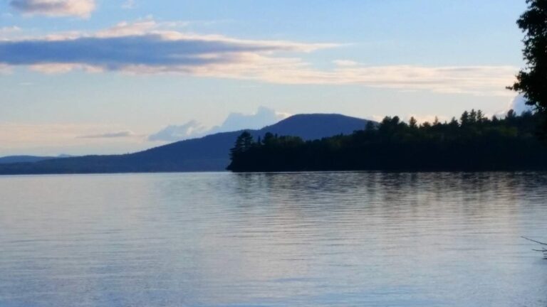
Photo: Paul Schultz, CC BY 2.0
Photo: Doug Kerr, CC BY-SA 2.0

Photo: Paul VanDerWerf, CC BY 2.0
Short replies about fishing around Somerset County
Where can a canoe or skiff go in around Somerset County?
The MDIFW Fishing Atlas lists 48 ramps, named above with directions.
Which Maine lake carries the largest acre figure in Somerset County?
Flagstaff Lake: 17,377 acres.
Which fish does MDIFW list near Somerset County?
MDIFW lists brook trout on the most waters in the county, then white sucker, creek chub and finescale dace; a listing shows presence, not a catch.
Does a Maine tackle shop have a listing in Somerset County?
7 altogether, Bishop's Store, Inc. among them.
Which Maine town serves as seat for Somerset County?
Offices for the county are in Skowhegan.
How much does the MDIFW charge to fish in Somerset County?
Residents and nonresidents who are 16 or older buy a license for inland fishing; the season price on the MDIFW fee page is $30 for residents and $83 for nonresidents, agent fees extra.
Which Maine counties lie next to Somerset County?
Measured from county centers: Franklin County, Piscataquis County and Penobscot County.
What do Maine limits look like for Somerset County water?
Limits come from the law book's statewide rows unless the water has its own entry, and an entry replaces the statewide limit for the fish it names; each lake and river page on this site prints its entry. Every rule on this page was read from the MDIFW statewide law pages on Nov. 18, 2026; no revision date is shown, the 2026 law book they cite lapses on Dec. 31, 2026, and nothing for 2027 appears here.
Can I look up a named pond of Somerset County on this page?
Waters lacking their own page are the rows listed above, each with a pin; 1,217 waters are on file overall.
Choose a brook, pond or river bend in Somerset County
Each pinned row gives where the water is, how big it is and which fish it lists.