Fishing in Franklin County, Maine
County seat: Farmington. Census 2020 residents: 29,456.
- 469named waters
- 21ramps
- 2river pages
 Pick for brook troutPiscifun Carbon X ultralight spinning reel28% OFFSale $57.99
Photo of Rangeley Lake: Paul Schultz, CC BY 2.0
An overview of the Maine ponds and rivers in Franklin County
The 2020 Census found 29,456 residents across Franklin County; its seat is Farmington. Bureau figures for the county read 1,697 square miles of land and 46.8 square miles of water. The county map holds 469 waters; Rangeley Lake takes the most room. Brooks and rivers with their own page here include Androscoggin River and Sandy River.
Within county bounds the layers show 21 boat ramps, besides 0 other fishing points mapped sites that lack a ramp. The Heritage Fish program counts 43 waters inside the county line. The MDIFW schedule and the MDIFW reports give stocking dates for 1 event in Franklin County.
U.S. Census Bureau, 2020 Census counts (TIGERweb) and the 2023 Gazetteer, read November 18, 2026. Maine GeoLibrary boat launches layer (ArcGIS service), read November 18, 2026.
Stocking dates on record for Franklin County
- Crowell PondNov. 10, 2026, Brook trout, 25 printed, 18 in., New Sharon, stocked, per the 2026 year-to-date report (preliminary receipt data)
Maine stocking this week and the week-ahead outlook
MDIFW 2026 year-to-date stocking report (MDIFW report), preliminary receipt data as of Nov. 17, 2026, read November 18, 2026. Dates, sizes and counts are as printed; the report may be corrected after review.
 For the brook trout herePiscifun Carbon XT ultralight spinning reel25% OFFSale $59.99
Each mapped pond, brook and ramp across Franklin County
Maine GeoLibrary boat launches layer (ArcGIS service), read November 18, 2026. Water pins sit at the point MDIFW or the USGS gives for each water.
Still water in Franklin County, woods road to coast
| Lake | Size | Access points | Kind | Fish the MDIFW lists |
|---|---|---|---|---|
| Rangeley Lake | 6,304 acres | 3 | lake | none listed |
| Webb Lake | 2,195 acres | 1 | lake | none listed |
| Clearwater Lake | 796 acres | 1 | lake | none listed |
| Wilson Pond (Franklin County) | 569 acres | 1 | pond | none listed |
| Porter Lake | 524 acres | 1 | lake | none listed |
| Saddleback Lake | 336 acres | 0 | lake | brook trout, redbelly dace, chain pickerel |
| Varnum Pond | 331 acres | 0 | pond | landlocked salmon, blacknose dace, lake trout (togue) |
| Gull Pond | 283 acres | 0 | pond | landlocked salmon, blacknose dace, brook trout |
| Dodge Pond (Franklin County) | 214 acres | 0 | pond | landlocked salmon, finescale dace, brook trout |
| Crowell Pond | 201 acres | 0 | pond | brook trout, smallmouth bass, golden shiner |
| Loon Lake (Franklin County) | 171 acres | 0 | lake | landlocked salmon, redbelly dace, brook trout |
| Haley Pond (Franklin County) | 164 acres | 0 | pond | landlocked salmon, blacknose dace, brook trout |
| Quimby Pond | 157 acres | 1 | pond | brook trout, rainbow smelt, redbelly dace |
| Mount Blue Pond | 142 acres | 0 | pond | brown trout, brook trout, blacknose dace |
| Round Pond (Rangeley, Franklin County) | 134 acres | 0 | pond | landlocked salmon, common shiner, brook trout |
| Norcross Pond | 113 acres | 0 | pond | brown trout, brook trout, golden shiner |
| Tea Pond (Franklin County) | 90 acres | 0 | pond | landlocked salmon, lake trout (togue), redbelly dace |
| Big Indian Pond (Franklin County) | 85 acres | 0 | pond | brook trout, white sucker, creek chub |
| Little Jim Pond | 77 acres | 0 | pond | lake trout (togue), brook trout, lake chub |
| Middle Sandy River Pond | 69 acres | 1 | pond | brook trout, blacknose dace, rainbow smelt |
| Boundary Pond | 66 acres | 0 | pond | brook trout |
| Long Pond (Seven Ponds Twp, Franklin County) | 58 acres | 0 | pond, Heritage Fish location | brook trout, lake chub, blacknose dace |
| Podunk Pond | 45 acres | 0 | pond | brook trout, brown bullhead, banded killifish |
| Lufkin Pond | 44 acres | 0 | pond | brown trout, brook trout, golden shiner |
| Round Pond (Township E, Franklin County) | 43 acres | 0 | pond | brook trout |
| Beal Pond | 30 acres | 0 | pond | brook trout, american eel, rainbow smelt |
| Rock Pond (Chain of Ponds Twp, Franklin County) | 29 acres | 0 | pond, Heritage Fish location | brook trout, lake chub |
| Beaver Pond (Seven Ponds Twp, Franklin County) | 25 acres | 0 | pond, Heritage Fish location | brook trout, lake chub, blacknose dace |
| Otter Pond (Franklin County) | 25 acres | 0 | pond | brook trout, longnose sucker, white sucker |
| Greenbush Pond | 24 acres | 0 | pond | brook trout, redbelly dace, yellow perch |
| Toothaker Pond | 23 acres | 0 | pond | brook trout, rainbow smelt, golden shiner |
| Hills Pond | 23 acres | 0 | pond | brook trout, golden shiner |
| Barnard Pond | 20 acres | 0 | pond | brook trout, redbelly dace, creek chub |
| Hurricane Pond (Franklin County) | 20 acres | 0 | pond | brook trout |
| Dutton Pond (Franklin County) | 19 acres | 0 | pond | brook trout, creek chub, american eel |
| South Pond (Franklin County) | 16 acres | 0 | pond | brook trout |
| Spencer Pond (Franklin County) | 15 acres | 0 | pond | brook trout, rainbow smelt |
| Stetson Pond | 15 acres | 0 | pond | brook trout, redbreast sunfish, american eel |
| Eddy Pond | 14 acres | 0 | pond | brook trout, brook stickleback |
| Long Cove Pond | 10 acres | 0 | pond | brook trout, white sucker |
| Harvey Pond (Franklin County) | 9.8 acres | 0 | pond | brook trout, white sucker, brown bullhead |
| Swift River Pond | 9.7 acres | 0 | pond | brook trout |
| Tumbledown Pond | 8 acres | 0 | pond | brook trout |
| Grindstone Pond (Franklin County) | 7.8 acres | 0 | pond | brook trout, blacknose dace, white sucker |
| Midway Pond | 7.4 acres | 0 | pond | brook trout |
| Moxie Pond (Franklin County) | 6.9 acres | 0 | pond | brook trout |
| Caribou Bog | 6.8 acres | 0 | lake | brook trout, redbelly dace |
| Blanchard Pond (Franklin County) | 6.6 acres | 0 | pond | brook trout, golden shiner, finescale dace |
| Schoolhouse Pond (Franklin County) | 4.3 acres | 0 | pond | brook trout |
| Ledge Pond (Franklin County) | 4.1 acres | 0 | pond | brook trout |
| Pinnacle Pond | 3.6 acres | 0 | pond | brook trout, redbreast sunfish, brown bullhead |
| The Horns Pond | 3.3 acres | 0 | pond | brook trout |
| Little Tea Pond | 2.5 acres | 0 | pond | brook trout |
Surface acres from the MDIFW MaineLakes polygon layer for this water (ArcGIS service; geodesic acres of the mapped outline), read November 18, 2026. Waters with no acreage in the MDIFW record show their mapped outline instead. MDIFW MaineLakes layer record for this water (ArcGIS service), read November 18, 2026.
In Maine, moving water in Franklin County
- Androscoggin River14 access points, 3 USGS gauges, dated stocking rows
- Sandy River1 access point, 3 USGS gauges, dated stocking rows
Gauges and tide stations in Franklin County
USGS has no current reading for these gauges.
USGS National Hydrography Dataset record for this river (NHD service), read November 18, 2026. Length is the NHD flowline length inside Maine, not a fishable length. USGS Water Data for the Nation, live through the site, retrieved on page view.
What MDIFW names most often in Franklin County
Bars count the 110 waters here where MDIFW lists the fish as present; brook trout leads.
MDIFW Popular Fish Species lists, counted per water; presence in the list is not a catch survey. Species named on the MDIFW lake survey map (map PDF), read November 18, 2026. A listed species was recorded for that survey, not reported as a catch.
In Maine, launch ramps across Franklin County
- Bag Pond (Chain of Ponds Twp) Fishing Areacarry-in access; Franklin County
- Bauds (Stump) Pond (New Vineyard) Fishing Areacarry-in access; Franklin County
- Carrabasset River (Salem Twp) Fishing Areacarry-in access; Franklin County
- Clearwater Pond (Industry) Fishing Area on Clearwater Laketrailer ramp, freshwater, hard surface; Franklin County
- Egypt Pond (Chesterville) Fishing Areacarry-in access; Franklin County
- Flagstaff Lake (Eustis) Fishing Areatrailer ramp, freshwater, hard surface; Franklin County
- Little Norridgewock Stream (Chesterville) Fishing Areacarry-in access; Franklin County
- Long Pond (Chain of Ponds Twp) Fishing Areacarry-in access; Franklin County
- Middle Sandy River Pond (Sandy River Plt) Fishing Areacarry-in access; Franklin County
- Mooselookmeguntic Lake (Rangeley) Fishing Areatrailer ramp, freshwater, hard surface; Franklin County
- Muddy Brook (New Sharon) Fishing Areacarry-in access; Franklin County
- Natanis Pond (Chain of Ponds Twp) Fishing Areatrailer ramp, freshwater, hard surface; Franklin County
- Porter Lake (Strong) Fishing Areatrailer ramp, freshwater, hard surface; Franklin County
- Quimby Pond (Rangeley) Fishing Areacarry-in access; Franklin County
- Rangeley Lake (Rangeley) Fishing Area (east)trailer ramp, freshwater, hard surface; Franklin County
- Rangeley Lake (Rangeley) Fishing Area (south)trailer ramp, freshwater, hard surface; Franklin County
- Rangeley Lake (Rangeley) Fishing Area (west)trailer ramp, freshwater, hard surface; Franklin County
- Sandy River (New Sharon) Fishing Areacarry-in access; Franklin County
- Stratton Brook Pond (Wyman Twp) Fishing Areacarry-in access; Franklin County
- Webb Lake (Weld) Fishing Areatrailer ramp, freshwater, hard surface; Franklin County
- Wilson Pond (Wilton) Fishing Areatrailer ramp, freshwater, hard surface; Franklin County
Maine GeoLibrary boat launches layer (ArcGIS service), read November 18, 2026.
Waters in Franklin County that sit on this page instead of having their own
Maine lakes and ponds in Franklin County
| Water | Kind | Size | Fish the MDIFW lists | Access | Map pin |
|---|---|---|---|---|---|
| Kennebago Lake | lake, Heritage Fish location | 1,908 acres | none listed | 0 | 45.0948, -70.7221 |
| Beaver Mountain Lake | lake, Heritage Fish location | 499 acres | none listed | 0 | 44.8868, -70.6023 |
| Jim Pond | pond | 349 acres | landlocked salmon, redbelly dace, lake trout (togue), blacknose dace | 0 | 45.2641, -70.5027 |
| Big Island Pond | pond, Heritage Fish location | 340 acres | brook trout, lake chub, blacknose dace | 0 | 45.2824, -70.7477 |
| Tim Pond | pond, Heritage Fish location | 271 acres | brook trout | 0 | 45.1621, -70.6264 |
| Long Pond (Township E, Franklin County) | pond | 264 acres | none listed | 0 | 44.8433, -70.6743 |
| John's Pond (Franklin County) | pond, Heritage Fish location | 252 acres | landlocked salmon, blacknose shiner, brook trout, redbelly dace | 0 | 45.0738, -70.7713 |
| Massachusetts Bog | lake, Heritage Fish location | 218 acres | brook trout, blacknose dace, creek chub, lake chub | 0 | 45.3445, -70.7898 |
| Long Pond (Chain of Ponds Twp, Franklin County) | pond | 217 acres | brook trout, lake chub, rainbow smelt | 1 | 45.3399, -70.6711 |
| Natanis Pond | pond | 215 acres | landlocked salmon, redbelly dace, lake trout (togue), blacknose dace | 1 | 45.3518, -70.6929 |
| North Pond (Franklin County) | pond | 173 acres | largemouth bass, white sucker, white perch, brown bullhead | 0 | 44.5392, -70.1207 |
| Little Kennebago Lake | lake | 166 acres | landlocked salmon, brook trout, lake chub, rainbow smelt | 0 | 45.1345, -70.7711 |
| Crosby Pond | pond, Heritage Fish location | 152 acres | brook trout, finescale dace, creek chub, lake chub | 0 | 45.3970, -70.7691 |
| Arnold Pond | pond, Heritage Fish location | 148 acres | landlocked salmon, redbelly dace, brook trout, blacknose dace | 0 | 45.3836, -70.7892 |
| Lower Pond (Franklin County) | pond | 142 acres | none listed | 0 | 45.3205, -70.6366 |
| Locke Pond | pond | 135 acres | largemouth bass, white sucker, golden shiner, yellow perch | 0 | 44.5793, -70.1186 |
| Pease Pond | pond | 110 acres | brook trout, smallmouth bass, golden shiner, largemouth bass | 0 | 44.5982, -70.1783 |
| Parker Pond (Franklin County) | pond | 103 acres | landlocked salmon, chain pickerel, rainbow smelt, largemouth bass | 0 | 44.5085, -70.1418 |
| L Pond | pond, Heritage Fish location | 97 acres | brook trout, lake chub, blacknose dace | 0 | 45.2683, -70.7418 |
| Bag Pond | pond | 89 acres | none listed | 1 | 45.3277, -70.6538 |
| Twin Island Pond | pond, Heritage Fish location | 87 acres | brook trout, white sucker, lake chub, creek chub | 0 | 45.5238, -70.5238 |
| Sand Pond (Franklin County) | pond | 79 acres | smallmouth bass, largemouth bass, golden shiner, white perch | 0 | 44.5688, -70.1185 |
| Unnamed Pond (Farmington, Franklin County) (MIDAS 0103000302) | pond | 75 acres | none listed | 0 | 44.6926, -70.1657 |
| Round Mountain Pond (Franklin County) | pond, Heritage Fish location | 75 acres | none listed | 0 | 45.2661, -70.6455 |
| Sabbath Day Pond | pond, Heritage Fish location | 65 acres | brook trout, rainbow smelt, lake chub | 0 | 44.8393, -70.6583 |
| Little Island Pond | pond, Heritage Fish location | 59 acres | brook trout, lake chub | 0 | 45.2709, -70.7848 |
| Staples Pond (Franklin County) | pond | 56 acres | brown trout, brook trout, golden shiner, rainbow smelt | 0 | 44.7206, -70.2353 |
| Lily Pond (Franklin County) | pond | 56 acres | yellow perch, redbelly dace, chain pickerel, creek chub | 0 | 44.7995, -70.1341 |
| Tufts Pond | pond | 56 acres | brown trout, brook trout, blacknose dace, splake | 0 | 44.9967, -70.2000 |
| Trout Pond (Franklin County) | pond | 55 acres | none listed | 0 | 45.5551, -70.5364 |
| Halfmoon Pond (Franklin County) | pond | 54 acres | brook trout, white sucker, chain pickerel, pumpkinseed sunfish | 0 | 44.6033, -70.5006 |
| Shallow Pond | pond | 51 acres | yellow perch, blacknose shiner, finescale dace, golden shiner | 0 | 45.2609, -70.5343 |
| Horseshoe Pond (Chesterville, Franklin County) | pond | 50 acres | smallmouth bass, yellow perch, brown bullhead, chain pickerel | 0 | 44.5346, -70.0855 |
| Kamankeag Pond | pond, Heritage Fish location | 50 acres | brook trout, white sucker, slimy sculpin, lake chub | 0 | 45.0329, -70.7557 |
| Mud Pond (Tim Pond Twp, Franklin County) | pond | 49 acres | none listed | 0 | 45.1653, -70.6117 |
| Cow Pond (Franklin County) | pond | 48 acres | brook trout, blacknose dace, rainbow smelt, creek chub | 0 | 45.0374, -70.6422 |
| Redington Pond (Carrabassett Valley, Franklin County) | pond | 47 acres | none listed | 0 | 45.0628, -70.2436 |
| Round Pond (Chain of Ponds Twp, Franklin County) | pond | 44 acres | none listed | 0 | 45.3570, -70.7049 |
| Northwest Pond (Franklin County) | pond, Heritage Fish location | 43 acres | brook trout, blacknose dace | 0 | 45.2985, -70.7884 |
| Greely Pond | pond | 40 acres | brook trout, finescale dace, blacknose dace, lake chub | 0 | 45.0228, -70.6151 |
| Redington Pond (Redington Twp, Franklin County) | pond, Heritage Fish location | 36 acres | brook trout, creek chub, white sucker | 0 | 44.9845, -70.4211 |
| Upper Sandy River Pond | pond | 34 acres | brook trout, blacknose dace, rainbow smelt, creek chub | 0 | 44.8948, -70.5659 |
| Drury Pond | pond | 32 acres | brook trout, creek chub, yellow perch, white sucker | 0 | 44.7042, -70.2405 |
| Unnamed Pond (New Sharon, Franklin County) (MIDAS 8843) | pond | 32 acres | none listed | 0 | 44.6837, -70.0819 |
| Bauds Pond | pond | 31 acres | none listed | 1 | 44.8213, -70.1153 |
| Flatiron Pond (Franklin County) | pond, Heritage Fish location | 30 acres | brook trout, rainbow smelt, blacknose dace | 0 | 45.0682, -70.6970 |
| Mountain Pond (Franklin County) | pond, Heritage Fish location | 29 acres | brook trout | 0 | 44.8950, -70.6446 |
| Taylor Hill Pond | pond | 29 acres | none listed | 0 | 44.8343, -70.1752 |
| Horseshoe Pond (Coburn Gore, Franklin County) | pond | 28 acres | landlocked salmon, redbelly dace, brook trout, finescale dace | 0 | 45.3792, -70.7648 |
| Robinson Pond (Franklin County) | pond | 27 acres | none listed | 0 | 44.5606, -70.1248 |
| Upper Hathan Bog | lake | 25 acres | none listed | 0 | 45.4046, -70.7558 |
| Beattie Pond | pond, Heritage Fish location | 25 acres | brook trout | 0 | 45.5024, -70.6337 |
| Stratton Brook Pond | pond | 24 acres | brook trout, redbelly dace, chain pickerel, blacknose dace | 1 | 45.1112, -70.3246 |
| Mill Pond (Franklin County) | pond | 24 acres | none listed | 0 | 44.8007, -70.1247 |
| Jones Pond (Franklin County) | pond | 24 acres | creek chub | 0 | 45.1193, -70.3556 |
| Fellows Pond | pond | 23 acres | largemouth bass, fallfish, yellow perch, white sucker | 0 | 44.5264, -70.0833 |
| Sapet Pond | pond | 23 acres | none listed | 0 | 45.5508, -70.5906 |
| Cloutman Pond | pond | 22 acres | none listed | 0 | 45.0097, -70.8052 |
| Clear Pond (Franklin County) | pond, Heritage Fish location | 21 acres | none listed | 0 | 45.5610, -70.6391 |
| Ross Pond (Franklin County) | pond, Heritage Fish location | 21 acres | brook trout, white sucker, brown bullhead, redbelly dace | 0 | 44.9790, -70.6713 |
| Beaver Pond (Township D, Franklin County) | pond | 20 acres | brook trout, golden shiner | 0 | 44.8121, -70.6882 |
| Mosher Pond (Franklin County) | pond | 20 acres | none listed | 0 | 44.7462, -70.1088 |
| Grants Pond (Massachusetts Gore, Franklin County) | pond, Heritage Fish location | 19 acres | none listed | 0 | 45.2885, -70.7833 |
| Mud Pond (Coburn Gore, Franklin County) | pond | 17 acres | none listed | 0 | 45.3797, -70.7743 |
| Waltons Mill Pond | pond | 17 acres | none listed | 0 | 44.6606, -70.1699 |
| Perk Pond | pond | 16 acres | none listed | 0 | 45.0014, -70.6775 |
| Day Mountain Pond | pond, Heritage Fish location | 16 acres | brook trout, blacknose dace, creek chub | 0 | 44.7768, -70.2483 |
| Douglas Pond (Franklin County) | pond, Heritage Fish location | 16 acres | none listed | 0 | 45.3816, -70.4999 |
| Little Greely Pond | pond | 16 acres | finescale dace, white sucker, lake chub | 0 | 45.0284, -70.6175 |
| Lower Hathan Bog | lake | 16 acres | none listed | 0 | 45.3835, -70.7468 |
| Beaver Pond (Rangeley Plt, Franklin County) | pond | 15 acres | none listed | 0 | 44.8745, -70.6598 |
| Mud Pond (Jim Pond Twp, Franklin County) | pond | 15 acres | landlocked salmon, blacknose dace, brook trout, creek chub | 0 | 45.2518, -70.4943 |
| Chase Pond (Franklin County) | pond | 15 acres | brook trout, finescale dace, yellow perch, fathead minnow | 0 | 45.2597, -70.5549 |
| Saddleback Pond (Franklin County) | pond | 15 acres | brook trout, blacknose dace | 0 | 44.9132, -70.4991 |
| Third Greely Pond | pond | 14 acres | none listed | 0 | 45.0141, -70.6236 |
| Lower Sandy River Pond | pond | 14 acres | brook trout, rainbow smelt, creek chub, longnose sucker | 0 | 44.8962, -70.5435 |
| Unnamed Pond (Farmington, Franklin County) (MIDAS 8770) | pond | 13 acres | none listed | 0 | 44.6265, -70.1012 |
| Little Northwest Pond | pond, Heritage Fish location | 13 acres | brook trout, blacknose dace | 0 | 45.3011, -70.7955 |
| Gile Logan | lake | 13 acres | none listed | 0 | 45.0131, -70.6666 |
| Hid Pond | pond, Heritage Fish location | 13 acres | brook trout | 0 | 45.0068, -70.1317 |
| Unnamed Pond (Carrabassett Valley, Franklin County) (MIDAS 8623) | pond | 13 acres | none listed | 0 | 45.1171, -70.1785 |
| Mud Pond (Beattie Twp, Franklin County) | pond | 12 acres | none listed | 0 | 45.5234, -70.6802 |
| McIntire Pond | pond | 12 acres | brook trout, redbelly dace, blacknose dace, golden shiner | 0 | 44.5823, -69.9595 |
| Round Pond (Chesterville, Franklin County) | pond | 12 acres | yellow perch | 0 | 44.5242, -70.0885 |
| Wethern Pond | pond | 12 acres | white sucker, chain pickerel, blacknose dace, creek chub | 0 | 45.2131, -70.4937 |
| Dill Pond | pond, Heritage Fish location | 11 acres | none listed | 0 | 45.0139, -70.5710 |
| Elaine Pond | pond | 11 acres | none listed | 0 | 45.5477, -70.5796 |
| Unknown Pond (Franklin County) | pond, Heritage Fish location | 11 acres | none listed | 0 | 45.6045, -70.6334 |
| Jessie Pond | pond | 10 acres | none listed | 0 | 44.7482, -70.2505 |
| Reed Pond (Franklin County) | pond | 10 acres | none listed | 0 | 45.1550, -70.5032 |
| Unnamed Pond (Jay, Franklin County) (MIDAS 8797) | pond | 10 acres | none listed | 0 | 44.5733, -70.2538 |
| Unnamed Pond (Jay, Franklin County) (MIDAS 8801) | pond | 10 acres | none listed | 0 | 44.5009, -70.1375 |
| Snow Mountain Pond | pond, Heritage Fish location | 10 acres | none listed | 0 | 45.2767, -70.7026 |
| Unnamed Pond (Freeman Twp, Franklin County) (MIDAS 0091) | pond | 9.9 acres | none listed | 0 | 44.8549, -70.2360 |
| Secret Pond (Franklin County) | pond, Heritage Fish location | 9.6 acres | brook trout, lake chub | 0 | 45.2508, -70.7745 |
| Sipun Pond | pond | 9.4 acres | none listed | 0 | 45.5297, -70.6155 |
| Unnamed Pond (Strong, Franklin County) (MIDAS 8861) | pond | 9.2 acres | none listed | 0 | 44.7310, -70.2233 |
| Unnamed Pond (Coburn Gore, Franklin County) (MIDAS 8824) | pond | 9 acres | none listed | 0 | 45.3890, -70.7951 |
| Unnamed Pond (Madrid Twp, Franklin County) | pond | 9 acres | none listed | 0 | 44.8988, -70.4295 |
| Unnamed Pond (Rangeley, Franklin County) (MIDAS 8753) | pond | 8.9 acres | none listed | 0 | 45.0071, -70.7074 |
| Bugeye Pond | pond | 8.6 acres | brook trout | 0 | 45.3094, -70.6102 |
| Nutting Pond | pond | 8.6 acres | none listed | 0 | 44.9966, -70.7521 |
| Mud Pond (Rangeley Plt, Franklin County) | pond | 8.5 acres | none listed | 0 | 44.8989, -70.6407 |
| Perry Pond (Franklin County) | pond | 8.4 acres | brook trout, redbreast sunfish, pumpkinseed sunfish, golden shiner | 0 | 44.8764, -70.5024 |
| Mud Pond (Township 6 North of Weld, Franklin County) | pond | 8.3 acres | brook trout | 0 | 44.8444, -70.4879 |
| Viles Pond | pond | 8.3 acres | none listed | 0 | 45.2822, -70.5577 |
| Long Logan | lake | 8.2 acres | none listed | 0 | 45.0209, -70.6658 |
| Unnamed Pond (New Vineyard, Franklin County) (MIDAS 8867) | pond | 8.2 acres | none listed | 0 | 44.7463, -70.1601 |
| Unnamed Pond (Jay, Franklin County) (MIDAS 8799) | pond | 8.1 acres | none listed | 0 | 44.5573, -70.2549 |
| Little Barnard Pond | pond | 7.9 acres | none listed | 0 | 45.2208, -70.5567 |
| Unnamed Pond (Carrabassett Valley, Franklin County) (MIDAS 8621) | pond | 7.7 acres | none listed | 0 | 45.1206, -70.1718 |
| Grants Pond (Temple, Franklin County) | pond | 7.6 acres | brook trout, lake chub, blacknose dace | 0 | 44.7324, -70.2573 |
| Moose Pond (Franklin County) | pond | 7.6 acres | none listed | 0 | 45.5025, -70.5879 |
| White Cap Pond | pond | 7.6 acres | none listed | 0 | 45.2452, -70.8198 |
| Little Swift River Pond | pond, Heritage Fish location | 7.2 acres | brook trout | 0 | 44.8505, -70.5893 |
| Mud Pond (Temple, Franklin County) | pond | 7.2 acres | none listed | 0 | 44.7111, -70.2331 |
| Unnamed Pond (Lowelltown Twp, Franklin County) (MIDAS 5075) | pond | 7.2 acres | none listed | 0 | 45.5383, -70.5945 |
| South Boundary Pond | pond, Heritage Fish location | 7.1 acres | brook trout, blacknose dace | 0 | 45.2919, -70.7967 |
| Holman Pond | pond | 7 acres | none listed | 0 | 44.7147, -70.2836 |
| Cranberry Pond (Franklin County) | pond | 6.9 acres | none listed | 0 | 45.1390, -70.3601 |
| Unnamed Pond (Carrabassett Valley, Franklin County) (MIDAS 8617) | pond | 6.5 acres | none listed | 0 | 45.0929, -70.2785 |
| Quill Pond | pond, Heritage Fish location | 6.4 acres | none listed | 0 | 45.0283, -70.5347 |
| Ballard Pond | pond | 6.3 acres | chain pickerel, white sucker, creek chub, blacknose dace | 0 | 44.7185, -70.2266 |
| Unnamed Pond (Farmington, Franklin County) (MIDAS 5191) | pond | 6.2 acres | none listed | 0 | 44.7263, -70.1251 |
| Unnamed Pond (New Sharon, Franklin County) (MIDAS 8777) | pond | 6 acres | none listed | 0 | 44.6438, -70.0529 |
| Caribou Pond (Franklin County) | pond, Heritage Fish location | 5.8 acres | none listed | 0 | 45.0065, -70.3592 |
| Southwest Pond (Franklin County) | pond | 5.8 acres | none listed | 0 | 44.8045, -70.5787 |
| Unnamed Pond (Farmington, Franklin County) (MIDAS 5193) | pond | 5.6 acres | none listed | 0 | 44.6969, -70.0926 |
| Beaver Bog | lake | 5.4 acres | none listed | 0 | 45.0074, -70.7381 |
| Yorks Logan | lake | 5.4 acres | none listed | 0 | 45.0248, -70.6713 |
| Unnamed Pond (Phillips, Franklin County) (MIDAS 2327) | pond | 5.3 acres | none listed | 0 | 44.8356, -70.4551 |
| Pearl Pond | pond | 5.1 acres | none listed | 0 | 44.8264, -70.4811 |
| Adley Pond | pond | 4.9 acres | none listed | 0 | 44.8301, -70.3818 |
| Rock Pond (Sandy River Plt, Franklin County) | pond | 4.9 acres | brook trout | 0 | 44.9363, -70.5379 |
| Tory Hill Pond | pond, Heritage Fish location | 4.8 acres | none listed | 0 | 44.8621, -70.2980 |
| Hammond Pond (Franklin County) | pond | 4.7 acres | none listed | 0 | 45.0456, -70.2012 |
| Ben Gile Pond | pond, Heritage Fish location | 4.5 acres | none listed | 0 | 45.0616, -70.6347 |
| Unnamed Pond (Avon, Franklin County) | pond | 4.5 acres | none listed | 0 | 44.7738, -70.2585 |
| Unnamed Pond (Township 6 North of Weld, Franklin County) (MIDAS 8689) | pond | 4.5 acres | none listed | 0 | 44.7418, -70.5768 |
| Roland Pond | pond | 4.4 acres | none listed | 0 | 45.0140, -70.6301 |
| Unnamed Pond (Lowelltown Twp, Franklin County) (MIDAS 5083) | pond | 4.4 acres | none listed | 0 | 45.5576, -70.5699 |
| Blanchard Pond #1 | pond, Heritage Fish location | 4.3 acres | none listed | 0 | 45.0730, -70.6582 |
| Unnamed Pond (Phillips, Franklin County) (MIDAS 8763) | pond | 4.3 acres | none listed | 0 | 44.8571, -70.3823 |
| Unnamed Pond (Farmington, Franklin County) (MIDAS 5201) | pond | 4.2 acres | none listed | 0 | 44.6519, -70.1465 |
| Unnamed Pond (Lowelltown Twp, Franklin County) (MIDAS 5089) | pond | 4.2 acres | none listed | 0 | 45.5740, -70.5453 |
| Unnamed Pond (Lowelltown Twp, Franklin County) (MIDAS 5067) | pond | 4.1 acres | none listed | 0 | 45.5207, -70.5947 |
| Unnamed Pond (Lowelltown Twp, Franklin County) (MIDAS 5087) | pond | 4.1 acres | none listed | 0 | 45.5779, -70.5570 |
| Blanchard Pond #2 | pond | 4 acres | none listed | 0 | 45.0740, -70.6616 |
| Unnamed Pond (Skinner Twp, Franklin County) (MIDAS 8661) | pond | 3.9 acres | none listed | 0 | 45.5081, -70.5288 |
| Nash Pond | pond | 3.8 acres | none listed | 0 | 44.7983, -70.2323 |
| Unnamed Pond (Kingfield, Franklin County) (MIDAS 8766) | pond | 3.8 acres | none listed | 0 | 44.9856, -70.1975 |
| Witham Pond | pond, Heritage Fish location | 3.8 acres | none listed | 0 | 44.8488, -70.5819 |
| Moose & Deer Pond | pond | 3.7 acres | none listed | 0 | 44.9196, -70.5138 |
| Unnamed Pond (New Sharon, Franklin County) (MIDAS 8771) | pond | 3.7 acres | none listed | 0 | 44.5902, -69.9548 |
| Lost Pond (Franklin County) | pond | 3.6 acres | none listed | 0 | 45.3729, -70.7408 |
| Unnamed Pond (Kingfield, Franklin County) (MIDAS 8768) | pond | 3.5 acres | none listed | 0 | 44.9918, -70.2122 |
| Unnamed Pond (Rangeley Plt, Franklin County) | pond | 3.5 acres | none listed | 0 | 44.9240, -70.7601 |
| Prick Pond | pond, Heritage Fish location | 3.3 acres | none listed | 0 | 45.4449, -70.5165 |
| Unnamed Pond (Beattie Twp, Franklin County) (MIDAS 5091) | pond | 3.3 acres | none listed | 0 | 45.5219, -70.6489 |
| Unnamed Pond (Lowelltown Twp, Franklin County) (MIDAS 6001) | pond | 3.3 acres | none listed | 0 | 45.5714, -70.5773 |
| Unnamed Pond (Lowelltown Twp, Franklin County) (MIDAS 6007) | pond | 3.3 acres | none listed | 0 | 45.5627, -70.6042 |
| Unnamed Pond (Farmington, Franklin County) (MIDAS 5195) | pond | 3.1 acres | none listed | 0 | 44.7449, -70.1218 |
| Unnamed Pond (Jim Pond Twp, Franklin County) (MIDAS 8677) | pond | 3.1 acres | none listed | 0 | 45.2581, -70.5449 |
| Little Hammond Pond | pond, Heritage Fish location | 3 acres | brook trout | 0 | 45.0535, -70.2259 |
| Little Reddington Pond | pond | 3 acres | none listed | 0 | 45.0683, -70.2488 |
| Unnamed Pond (Rangeley, Franklin County) (MIDAS 8751) | pond | 3 acres | none listed | 0 | 45.0038, -70.7134 |
| Unnamed Pond (Skinner Twp, Franklin County) (MIDAS 8651) | pond | 3 acres | none listed | 0 | 45.4443, -70.5085 |
| Little Viles Pond | pond, dated stocking rows | 2.9 acres | none listed | 0 | 45.2821, -70.5410 |
| Unnamed Pond (Lowelltown Twp, Franklin County) (MIDAS 8647) | pond | 2.9 acres | none listed | 0 | 45.5156, -70.6304 |
| Chittenden Pond | pond | 2.8 acres | none listed | 0 | 45.3026, -70.4618 |
| East Beaver Pond | pond | 2.8 acres | none listed | 0 | 44.8347, -70.3110 |
| Unnamed Pond (Rangeley, Franklin County) (MIDAS 8741) | pond | 2.8 acres | none listed | 0 | 45.0014, -70.7861 |
| Unnamed Pond (Beattie Twp, Franklin County) (MIDAS 5095) | pond | 2.7 acres | none listed | 0 | 45.5242, -70.6398 |
| Unnamed Pond (Lowelltown Twp, Franklin County) (MIDAS 5071) | pond | 2.7 acres | none listed | 0 | 45.5232, -70.5847 |
| Unnamed Pond (Lowelltown Twp, Franklin County) (MIDAS 5081) | pond | 2.7 acres | none listed | 0 | 45.5567, -70.5791 |
| Day Pond | pond | 2.6 acres | none listed | 0 | 44.9880, -70.2276 |
| Unnamed Pond (Lowelltown Twp, Franklin County) (MIDAS 5099) | pond | 2.6 acres | none listed | 0 | 45.5859, -70.5566 |
| Unnamed Pond (Township 6 North of Weld, Franklin County) (MIDAS 8721) | pond | 2.6 acres | none listed | 0 | 44.7287, -70.5555 |
| Unnamed Pond (Beattie Twp, Franklin County) (MIDAS 5093) | pond | 2.5 acres | none listed | 0 | 45.5247, -70.6445 |
| Unnamed Pond (Kibby Twp, Franklin County) (MIDAS 8665) | pond | 2.5 acres | none listed | 0 | 45.3998, -70.5700 |
| Unnamed Pond (Lowelltown Twp, Franklin County) (MIDAS 6005) | pond | 2.5 acres | none listed | 0 | 45.5655, -70.6022 |
| Unnamed Pond (Township D, Franklin County) (MIDAS 8701) | pond | 2.5 acres | none listed | 0 | 44.8099, -70.7085 |
| Unnamed Pond (Lowelltown Twp, Franklin County) (MIDAS 5085) | pond | 2.4 acres | none listed | 0 | 45.5587, -70.5710 |
| Unnamed Pond (Township D, Franklin County) (MIDAS 8707) | pond | 2.4 acres | none listed | 0 | 44.7887, -70.7470 |
| Bog Pond (Franklin County) | pond | 2.3 acres | none listed | 0 | 44.8477, -70.4090 |
| Unnamed Pond (Lowelltown Twp, Franklin County) (MIDAS 5077) | pond | 2.3 acres | none listed | 0 | 45.5407, -70.5925 |
| Jackson Pond (Franklin County) | pond | 2.2 acres | none listed | 0 | 44.7629, -70.5308 |
| Lost Logan | lake | 2.2 acres | none listed | 0 | 45.0157, -70.6936 |
| Hayno Bog Pond | pond | 2.1 acres | none listed | 0 | 44.9834, -70.7479 |
| Unnamed Pond (Jim Pond Twp, Franklin County) (MIDAS 8679) | pond | 2.1 acres | none listed | 0 | 45.2650, -70.4871 |
| Unnamed Pond (Lowelltown Twp, Franklin County) (MIDAS 5097) | pond | 2.1 acres | none listed | 0 | 45.5851, -70.5628 |
| Secret Bog | lake | 2 acres | none listed | 0 | 45.0040, -70.7313 |
| Unnamed Pond (Davis Twp, Franklin County) | pond | 2 acres | none listed | 0 | 45.0929, -70.7951 |
| Unnamed Pond (Phillips, Franklin County) (MIDAS 8761) | pond | 2 acres | none listed | 0 | 44.7969, -70.4359 |
| Unnamed Pond (Rangeley, Franklin County) (MIDAS 8747) | pond | 2 acres | none listed | 0 | 44.9808, -70.6397 |
| Unnamed Pond (Wyman Twp, Franklin County) | pond | 2 acres | none listed | 0 | 45.1208, -70.3629 |
| City Pond | pond | 1.9 acres | none listed | 0 | 44.9258, -70.5816 |
| Ellis Pond (Franklin County) | pond | 1.9 acres | none listed | 0 | 44.9781, -70.7576 |
| Unnamed Pond (Chain of Ponds Twp, Franklin County) (MIDAS 8625) | pond | 1.9 acres | none listed | 0 | 45.3621, -70.7200 |
| Unnamed Pond (Chesterville, Franklin County) (MIDAS 8841) | pond | 1.9 acres | none listed | 0 | 44.5673, -70.1321 |
| Unnamed Pond (Lang Twp, Franklin County) | pond | 1.9 acres | none listed | 0 | 45.0327, -70.6356 |
| Unnamed Pond (New Sharon, Franklin County) (MIDAS 8775) | pond | 1.9 acres | none listed | 0 | 44.6412, -70.0231 |
| Unnamed Pond (Temple, Franklin County) (MIDAS 8728) | pond | 1.9 acres | none listed | 0 | 44.7519, -70.2471 |
| Unnamed Pond (Chesterville, Franklin County) (MIDAS 8839) | pond | 1.7 acres | none listed | 0 | 44.5615, -70.1400 |
| Unnamed Pond (Jim Pond Twp, Franklin County) (MIDAS 8685) | pond | 1.7 acres | none listed | 0 | 45.2526, -70.4747 |
| Unnamed Pond (Kingfield, Franklin County) (MIDAS 8783) | pond | 1.7 acres | none listed | 0 | 45.0113, -70.2019 |
| Unnamed Pond (Lowelltown Twp, Franklin County) (MIDAS 5079) | pond | 1.7 acres | none listed | 0 | 45.5425, -70.5904 |
| Unnamed Pond (Township E, Franklin County) | pond | 1.7 acres | none listed | 0 | 44.8541, -70.6378 |
| Unnamed Pond (Farmington, Franklin County) (MIDAS 5203) | pond | 1.6 acres | none listed | 0 | 44.6298, -70.1517 |
| Unnamed Pond (Freeman Twp, Franklin County) (MIDAS 0093) | pond | 1.6 acres | none listed | 0 | 44.8512, -70.2445 |
| Unnamed Pond (Freeman Twp, Franklin County) (MIDAS 8809) | pond | 1.5 acres | none listed | 0 | 44.8817, -70.2152 |
| Unnamed Pond (Jim Pond Twp, Franklin County) (MIDAS 5055) | pond | 1.5 acres | none listed | 0 | 45.2509, -70.5027 |
| Unnamed Pond (Lowelltown Twp, Franklin County) (MIDAS 5069) | pond | 1.5 acres | none listed | 0 | 45.5216, -70.5909 |
| Winslow Pond | pond | 1.5 acres | none listed | 0 | 44.8824, -70.4644 |
| Unnamed Pond (Lowelltown Twp, Franklin County) (MIDAS 6003) | pond | 1.4 acres | none listed | 0 | 45.5665, -70.5765 |
| Little Saddleback Pond | pond | 1.3 acres | none listed | 0 | 44.9061, -70.5042 |
| Unnamed Pond (Chain of Ponds Twp, Franklin County) (MIDAS 8627) | pond | 1.3 acres | none listed | 0 | 45.3516, -70.7151 |
| Unnamed Pond (Eustis, Franklin County) (MIDAS 8815) | pond | 1.3 acres | none listed | 0 | 45.2116, -70.4779 |
| Unnamed Pond (Temple, Franklin County) (MIDAS 8859) | pond | 1.3 acres | none listed | 0 | 44.7316, -70.2465 |
| Ethel Pond | pond | 1.2 acres | none listed | 0 | 44.9092, -70.5235 |
| Unnamed Pond (Chain of Ponds Twp, Franklin County) (MIDAS 8633) | pond | 1.2 acres | none listed | 0 | 45.3709, -70.7156 |
| Unnamed Pond (Lowelltown Twp, Franklin County) (MIDAS 5073) | pond | 1.2 acres | none listed | 0 | 45.5241, -70.5717 |
| Unnamed Pond (Lowelltown Twp, Franklin County) (MIDAS 6009) | pond | 1.2 acres | none listed | 0 | 45.5226, -70.5889 |
| Unnamed Pond (Sandy River Plt, Franklin County) | pond | 1.2 acres | none listed | 0 | 44.9143, -70.5269 |
| West Beaver Pond | pond | 1.2 acres | none listed | 0 | 44.8344, -70.3176 |
| Mill Pond on Muddy Brook | pond | 1.1 acres | none listed | 0 | 44.7153, -70.0812 |
| Reservoir (Franklin County) | reservoir | 1.1 acres | none listed | 0 | 44.6780, -70.1517 |
| Unnamed Pond (Chain of Ponds Twp, Franklin County) (MIDAS 8631) | pond | 1.1 acres | none listed | 0 | 45.3683, -70.7050 |
| Unnamed Pond (New Vineyard, Franklin County) (MIDAS 8769) | pond | 1.1 acres | none listed | 0 | 44.8460, -70.0768 |
| Unnamed Pond (Skinner Twp, Franklin County) (MIDAS 6116) | pond | 1.1 acres | none listed | 0 | 45.5003, -70.6105 |
| Unnamed Pond (Skinner Twp, Franklin County) (MIDAS 8653) | pond | 1.1 acres | none listed | 0 | 45.4911, -70.5204 |
| Industrial Waste Pond (Franklin County) | pond | 1 acres | none listed | 0 | 44.5027, -70.2339 |
| Unnamed Pond (Kingfield, Franklin County) (MIDAS 8764) | pond | 1 acres | none listed | 0 | 44.9508, -70.1974 |
| Unnamed Pond (Skinner Twp, Franklin County) (MIDAS 8655) | pond | 1 acres | none listed | 0 | 45.4958, -70.6179 |
| Witham Bog | lake | 1 acres | none listed | 0 | 44.8440, -70.6013 |
| Poison Pond | pond | 0.9 acres | none listed | 0 | 45.2615, -70.5660 |
| Unnamed Pond (Freeman Twp, Franklin County) (MIDAS 0095) | pond | 0.9 acres | none listed | 0 | 44.8473, -70.2394 |
| Unnamed Pond (Freeman Twp, Franklin County) (MIDAS 8807) | pond | 0.9 acres | none listed | 0 | 44.8997, -70.1953 |
| Unnamed Pond (Jim Pond Twp, Franklin County) (MIDAS 8681) | pond | 0.9 acres | none listed | 0 | 45.2531, -70.5268 |
| Unnamed Pond (Skinner Twp, Franklin County) (MIDAS 6011) | pond | 0.9 acres | none listed | 0 | 45.5006, -70.5327 |
| Little Greenbush Pond | pond | 0.8 acres | none listed | 0 | 45.2509, -70.5302 |
| Unnamed Pond (Alder Stream Twp, Franklin County) (MIDAS 8635) | pond | 0.8 acres | none listed | 0 | 45.2768, -70.5971 |
| Unnamed Pond (Chain of Ponds Twp, Franklin County) (MIDAS 8629) | pond | 0.8 acres | none listed | 0 | 45.3177, -70.7077 |
| Unnamed Pond (Kibby Twp, Franklin County) (MIDAS 8667) | pond | 0.8 acres | none listed | 0 | 45.3400, -70.5796 |
| Unnamed Pond (Coburn Gore, Franklin County) (MIDAS 8827) | pond | 0.7 acres | none listed | 0 | 45.3869, -70.7662 |
| Mount Blue High School | lake, dated stocking rows | 0.6 acres | none listed | 0 | 44.6414, -70.1343 |
| Unnamed Pond (Alder Stream Twp, Franklin County) (MIDAS 8637) | pond | 0.6 acres | none listed | 0 | 45.2796, -70.5966 |
| Rangeley Guides Sportsmans Association Pond | pond | 0.5 acres | none listed | 0 | 44.9617, -70.7771 |
| Unnamed Pond (Eustis, Franklin County) (MIDAS 8821) | pond | 0.5 acres | none listed | 0 | 45.1537, -70.4744 |
| Unnamed Pond (New Sharon, Franklin County) (MIDAS 8779) | pond | 0.5 acres | none listed | 0 | 44.6309, -70.0072 |
| Unnamed Pond (Township D, Franklin County) (MIDAS 8709) | pond | 0.5 acres | none listed | 0 | 44.8356, -70.7625 |
| Unnamed Pond (Wilton, Franklin County) | pond | 0.5 acres | none listed | 0 | 44.5998, -70.1922 |
| Unnamed Pond (Phillips, Franklin County) (MIDAS 8765) | pond | 0.4 acres | none listed | 0 | 44.8637, -70.3786 |
| Unnamed Pond (Skinner Twp, Franklin County) (MIDAS 6114) | pond | 0.4 acres | none listed | 0 | 45.4988, -70.5346 |
| Unnamed Pond (Strong, Franklin County) (MIDAS 8863) | pond | 0.4 acres | none listed | 0 | 44.7326, -70.2240 |
| Unnamed Pond (Township 6 North of Weld, Franklin County) (MIDAS 8693) | pond | 0.4 acres | none listed | 0 | 44.7875, -70.6038 |
| Unnamed Pond (Township D, Franklin County) (MIDAS 8703) | pond | 0.4 acres | none listed | 0 | 44.7801, -70.7265 |
| Unnamed Pond (Township D, Franklin County) (MIDAS 8705) | pond | 0.4 acres | none listed | 0 | 44.7889, -70.7490 |
| Unnamed Pond (Freeman Twp, Franklin County) (MIDAS 0099) | pond | 0.3 acres | none listed | 0 | 44.8417, -70.2405 |
| Unnamed Pond (Kibby Twp, Franklin County) (MIDAS 8663) | pond | 0.3 acres | none listed | 0 | 45.4031, -70.4890 |
| Unnamed Pond (Kingfield, Franklin County) (MIDAS 8789) | pond | 0.3 acres | none listed | 0 | 44.9349, -70.2389 |
| Blanchard Pond #3 | pond | 0.2 acres | none listed | 0 | 45.0708, -70.6605 |
| Unnamed Pond (Coburn Gore, Franklin County) (MIDAS 8829) | pond | 0.2 acres | none listed | 0 | 45.3815, -70.7615 |
| Unnamed Pond (Coburn Gore, Franklin County) (MIDAS 8831) | pond | 0.2 acres | none listed | 0 | 45.4175, -70.7723 |
| Unnamed Pond (Kingfield, Franklin County) (MIDAS 8791) | pond | 0.2 acres | none listed | 0 | 44.9332, -70.2358 |
MDIFW MaineLakes layer record for this water (ArcGIS service), read November 18, 2026. Outline area from the Maine DEP MIDAS lakes basemap (ArcGIS service; mapped polygon area, not a surface-acre figure from a survey), read November 18, 2026.
Brooks, streams and rivers in Franklin County
| Water | Kind | Size | Fish the MDIFW lists | Access | Map pin |
|---|---|---|---|---|---|
| Adams Brook (Franklin County) | water | no size printed | none listed | 0 | 44.7459, -70.1585 |
| Alder Brook (Kingfield, Franklin County) | water | no size printed | none listed | 0 | 44.9722, -70.2243 |
| Alder Brook (Perkins Twp, Franklin County) | water | no size printed | none listed | 0 | 44.6819, -70.3615 |
| Alder Stream (Jim Pond Twp, Franklin County) | water | no size printed | none listed | 0 | 45.2543, -70.5665 |
| Alder Stream (Kingfield, Franklin County) | water | no size printed | none listed | 0 | 44.9540, -70.1853 |
| Bachelor Brook | water | no size printed | none listed | 0 | 44.7207, -70.4737 |
| Baker Brook (Franklin County) | water | no size printed | none listed | 0 | 45.0694, -70.6011 |
| Barker Brook (Franklin County) | water | no size printed | none listed | 0 | 44.8454, -70.1017 |
| Barker Stream | water | no size printed | none listed | 0 | 44.7424, -70.1356 |
| Beales Brook | water | no size printed | none listed | 0 | 44.6413, -70.1016 |
| Bean Brook (Franklin County) | water | no size printed | none listed | 0 | 44.8408, -70.2349 |
| Bear Brook (Chain of Ponds Twp, Franklin County) | water | no size printed | none listed | 0 | 45.3784, -70.7078 |
| Bear Brook (Stetsontown Twp, Franklin County) | water | no size printed | none listed | 0 | 45.1877, -70.7855 |
| Beaver Bog Brook | water | no size printed | none listed | 0 | 45.1543, -70.6673 |
| Bemis Stream | water | no size printed | none listed | 0 | 44.8457, -70.7231 |
| Berry Brook (Franklin County) | water | no size printed | none listed | 0 | 44.6388, -70.3943 |
| Big Sag Brook | water | no size printed | none listed | 0 | 45.1263, -70.6615 |
| Black Brook (Franklin County) | water | no size printed | none listed | 0 | 45.1306, -70.7197 |
| Blanchard Brook | water | no size printed | none listed | 0 | 45.0764, -70.6757 |
| Boundary Brook | water | no size printed | none listed | 0 | 45.5449, -70.6671 |
| Bragdon Brook (Franklin County) | water | no size printed | none listed | 0 | 44.6371, -70.0406 |
| Cascade Brook (Franklin County) | water | no size printed | none listed | 0 | 44.6628, -70.1260 |
| Cascade Stream | water | no size printed | none listed | 0 | 44.9180, -70.5601 |
| Chandler Mill Stream | water | no size printed | none listed | 0 | 44.8421, -70.5501 |
| Clearwater Brook (Franklin County) | water | no size printed | none listed | 0 | 45.3583, -70.6429 |
| Conant Stream | water | no size printed | none listed | 0 | 44.8857, -70.4304 |
| Cottle Brook | water | no size printed | none listed | 0 | 44.8254, -70.4089 |
| Coubers Brook | water | no size printed | none listed | 0 | 44.5911, -70.2133 |
| Crossman Stream | water | no size printed | none listed | 0 | 44.8411, -70.5040 |
| Dead River (Franklin County) | river reach, dated stocking rows | no size printed | none listed | 0 | no point printed |
| Dickey Brook (Franklin County) | water | no size printed | none listed | 0 | 44.7913, -70.2457 |
| Durgin Brook (Franklin County) | water | no size printed | none listed | 0 | 44.6007, -70.4372 |
| East Branch Kibby Stream | water | no size printed | none listed | 0 | 45.3523, -70.5220 |
| East Branch Moose River | river reach | no size printed | none listed | 0 | 45.4451, -70.5155 |
| East Brook | water | no size printed | none listed | 0 | 44.7424, -70.4275 |
| Fillibrown Brook | water | no size printed | none listed | 0 | 44.6528, -69.9727 |
| Fish Brook (Franklin County) | water | no size printed | none listed | 0 | 44.7531, -70.0407 |
| Flatiron Brook | water | no size printed | none listed | 0 | 45.0768, -70.6878 |
| Four Ponds Brook | water | no size printed | none listed | 0 | 44.8291, -70.7061 |
| Geneva Bog Brook | water | no size printed | none listed | 0 | 44.9596, -70.5728 |
| Gilkey Brook | water | no size printed | none listed | 0 | 44.8536, -70.1875 |
| Gold Brook (Franklin County) | water | no size printed | none listed | 0 | 45.3283, -70.6138 |
| Goodrich Brook | water | no size printed | none listed | 0 | 44.7058, -70.0558 |
| Green Brook (Franklin County) | water | no size printed | none listed | 0 | 44.6273, -70.4168 |
| Gulf Stream (Franklin County) | water | no size printed | none listed | 0 | 45.5893, -70.5198 |
| Hale Brook (Franklin County) | water | no size printed | none listed | 0 | 44.6564, -69.9922 |
| Haley Brook (Franklin County) | water, dated stocking rows | no size printed | none listed | 0 | 44.9696, -70.5542 |
| Halfmile Brook | water | no size printed | none listed | 0 | 45.3564, -70.7284 |
| Hall Brook (Franklin County) | water | no size printed | none listed | 0 | 44.8567, -70.0400 |
| Hammond Field Brook | water | no size printed | none listed | 0 | 45.0399, -70.2021 |
| Hanscom Brook | water | no size printed | none listed | 0 | 44.6453, -70.5194 |
| Hardy Stream | water | no size printed | none listed | 0 | 44.9294, -70.4423 |
| Hatchery Brook | water | no size printed | none listed | 0 | 44.9655, -70.6572 |
| Hogans Brook | water | no size printed | none listed | 0 | 45.5455, -70.6389 |
| Horseshoe Stream | water | no size printed | none listed | 0 | 45.3748, -70.7483 |
| Houghton Brook | water | no size printed | none listed | 0 | 44.7080, -70.3915 |
| Huckleberry Stream | water | no size printed | none listed | 0 | 44.5440, -70.1229 |
| Hurricane Brook (Franklin County) | water | no size printed | none listed | 0 | 45.3443, -70.4728 |
| Huston Brook (Franklin County) | water | no size printed | none listed | 0 | 45.1048, -70.2303 |
| Hutchinson Brook | water | no size printed | none listed | 0 | 44.6313, -70.4780 |
| Indian Brook (Franklin County) | water | no size printed | none listed | 0 | 45.5426, -70.5889 |
| Indian Stream (Franklin County) | water | no size printed | none listed | 0 | 45.3282, -70.6818 |
| James Brook (Franklin County) | water | no size printed | none listed | 0 | 44.5119, -70.1429 |
| Jim Pond Brook (Jim Pond Twp, Franklin County) (GNIS 568836) | water | no size printed | none listed | 0 | 45.2531, -70.4924 |
| Jim Pond Brook (Jim Pond Twp, Franklin County) (GNIS 568837) | water | no size printed | none listed | 0 | 45.3018, -70.4647 |
| Jont Stream | water | no size printed | none listed | 0 | 44.8159, -70.5033 |
| Kennebago River | river reach | no size printed | none listed | 0 | 45.1623, -70.7723 |
| Kibby Stream | water | no size printed | none listed | 0 | 45.3332, -70.4792 |
| Ledge Brook (Franklin County) | water | no size printed | none listed | 0 | 44.9974, -70.1694 |
| Lemon Stream (Franklin County) | water | no size printed | none listed | 0 | 44.8702, -70.1195 |
| Little Alder Stream | water | no size printed | none listed | 0 | 45.2672, -70.6272 |
| Little Gulf Stream | water | no size printed | none listed | 0 | 45.5846, -70.5587 |
| Little Norridgewock Stream | water | no size printed | none listed | 1 | 44.5408, -70.0970 |
| Long Pond Stream (Franklin County) | water | no size printed | none listed | 0 | 44.9213, -70.6130 |
| Lost Logan | water | no size printed | none listed | 0 | no point printed |
| Luce Brook (Franklin County) | water | no size printed | none listed | 0 | 44.8842, -70.1437 |
| Lutton Brook | water | no size printed | none listed | 0 | 45.1459, -70.4812 |
| Massachusetts Bog Stream | water | no size printed | none listed | 0 | 45.3511, -70.7919 |
| McGurdy Stream | water | no size printed | none listed | 0 | 44.6203, -70.0552 |
| McLeary Brook | water | no size printed | none listed | 0 | 44.7692, -70.2095 |
| Meadow Brook (Franklin County) | water | no size printed | none listed | 0 | 44.5817, -70.1915 |
| Middle Branch Kibby Stream | water | no size printed | none listed | 0 | 45.3742, -70.5555 |
| Mill Brook (Franklin County) | water | no size printed | none listed | 0 | 45.5126, -70.6903 |
| Mitchell Brook | water | no size printed | none listed | 0 | 44.7902, -70.0457 |
| Mosquito Brook (Franklin County) | water | no size printed | none listed | 0 | 44.4989, -70.2091 |
| Mott Stream | water | no size printed | none listed | 0 | 44.7951, -70.6493 |
| Mount Blue Stream | water | no size printed | none listed | 0 | 44.7731, -70.3056 |
| Mountain Brook (Franklin County) | water | no size printed | none listed | 0 | 44.7853, -70.7034 |
| Muddy Brook (Franklin County) | water, dated stocking rows | no size printed | none listed | 1 | 44.6528, -70.0362 |
| Nash Stream | water | no size printed | none listed | 0 | 45.1371, -70.4764 |
| North Branch Alder Stream | water | no size printed | none listed | 0 | 45.2319, -70.6695 |
| North Branch Dead River | river reach | no size printed | none listed | 0 | 45.2231, -70.4810 |
| Number One Brook (Franklin County) | water | no size printed | none listed | 0 | 45.5168, -70.6505 |
| Number Six Brook | water | no size printed | none listed | 0 | 45.4164, -70.5993 |
| Orbeton Stream | water | no size printed | none listed | 0 | 44.9612, -70.4068 |
| Otter Brook (Franklin County) | water | no size printed | none listed | 0 | 45.1257, -70.7823 |
| Perham Stream | water | no size printed | none listed | 0 | 44.9497, -70.3647 |
| Poplar Brook (Franklin County) | water | no size printed | none listed | 0 | 45.0492, -70.1724 |
| Poplar Stream | water | no size printed | none listed | 0 | 45.1099, -70.1643 |
| Quick Stream | water | no size printed | none listed | 0 | 44.8965, -70.2716 |
| Quill Pond Brook | water | no size printed | none listed | 0 | 45.0268, -70.5343 |
| Quimby Brook | water | no size printed | none listed | 0 | 44.9758, -70.7176 |
| Rand Brook (Franklin County) | water | no size printed | none listed | 0 | 44.7309, -70.4593 |
| Rangeley River | river reach | no size printed | none listed | 0 | 44.9758, -70.7830 |
| Rapid Stream | water | no size printed | none listed | 0 | 44.9808, -70.2717 |
| Redington Stream | water | no size printed | none listed | 0 | 44.9962, -70.4952 |
| Reed Brook (Eustis, Franklin County) | water | no size printed | none listed | 0 | 45.1598, -70.5014 |
| Reed Brook (Kingfield, Franklin County) | water | no size printed | none listed | 0 | 45.0145, -70.1857 |
| Saddleback Stream | water | no size printed | none listed | 0 | 44.8997, -70.4970 |
| Sawyer Brook (Franklin County) | water | no size printed | none listed | 0 | 45.2023, -70.5608 |
| Sevenmile Stream | water | no size printed | none listed | 0 | 44.5520, -70.2654 |
| Smart Brook (Franklin County) | water | no size printed | none listed | 0 | 45.5001, -70.6035 |
| Smith Brook (Franklin County) | water | no size printed | none listed | 0 | 45.5790, -70.5993 |
| South Bog Stream | water | no size printed | none listed | 0 | 44.9106, -70.6995 |
| South Branch Alder Stream | water | no size printed | none listed | 0 | 45.2244, -70.6556 |
| South Branch Carrabasset River | river reach | no size printed | none listed | 0 | 45.0507, -70.3434 |
| South Branch Dead River | river reach | no size printed | none listed | 0 | 44.9947, -70.5418 |
| South Branch Moose River | river reach | no size printed | none listed | 0 | 45.4592, -70.5609 |
| South Branch Sandy River | river reach | no size printed | none listed | 0 | 44.8491, -70.4391 |
| South Brook (Franklin County) | water | no size printed | none listed | 0 | 45.0878, -70.1755 |
| Stanley Stream | water | no size printed | none listed | 0 | 44.9797, -70.1257 |
| Stoney Brook | water | no size printed | none listed | 0 | 45.1050, -70.3688 |
| Stratton Brook (Franklin County) | water | no size printed | none listed | 0 | 45.1167, -70.3737 |
| Swett Brook | water | no size printed | none listed | 0 | 44.6725, -70.4737 |
| Taylor Brook (Franklin County) | water | no size printed | none listed | 0 | 44.9235, -70.1523 |
| Tea Brook | water | no size printed | none listed | 0 | 45.2321, -70.4977 |
| Temple Brook | water | no size printed | none listed | 0 | 44.6327, -70.2910 |
| Temple Stream | water, dated stocking rows | no size printed | none listed | 0 | 44.6601, -70.1654 |
| Tim Brook | water | no size printed | none listed | 0 | 45.2218, -70.4865 |
| Tufts Pond Brook | water | no size printed | none listed | 0 | 44.9783, -70.2133 |
| Tumbledown Brook | water | no size printed | none listed | 0 | 44.7218, -70.5099 |
| Valley Brook | water | no size printed | none listed | 0 | 44.8030, -70.2250 |
| Varnum Stream | water | no size printed | none listed | 0 | 44.6174, -70.2314 |
| Webb River | river reach, dated stocking rows | no size printed | none listed | 0 | 44.5308, -70.4590 |
| West Branch Alder Stream | water | no size printed | none listed | 0 | 45.2170, -70.6646 |
| West Branch Carrabassett River | river reach | no size printed | none listed | 0 | 44.9476, -70.1873 |
| West Branch Gulf Stream | water | no size printed | none listed | 0 | 45.6019, -70.5427 |
| West Branch Moose River | river reach | no size printed | none listed | 0 | 45.4458, -70.6251 |
| West Branch Nash Stream | water | no size printed | none listed | 0 | 45.0278, -70.5026 |
| West Branch Spencer Stream | water | no size printed | none listed | 0 | 45.3951, -70.4887 |
| West Branch Swift River | river reach | no size printed | none listed | 0 | 44.7609, -70.7143 |
| West Brook (Franklin County) | water | no size printed | none listed | 0 | 44.7105, -70.5419 |
| Whetstone Brook (Franklin County) | water | no size printed | none listed | 0 | 45.0001, -70.7646 |
| Whittier Brook (Franklin County) | water | no size printed | none listed | 0 | 44.5933, -70.0265 |
| Wiggle Brook | water | no size printed | none listed | 0 | 45.1623, -70.7723 |
| Wilson Stream (Farmington, Franklin County) | water | no size printed | none listed | 0 | 44.6010, -70.2077 |
| Wilson Stream (Washington Twp, Franklin County) | water | no size printed | none listed | 0 | 44.6158, -70.2635 |
| Winship Stream | water | no size printed | none listed | 0 | 44.9182, -70.4484 |
| Winter Brook | water | no size printed | none listed | 0 | 44.7371, -70.1911 |
MDIFW MaineLakes layer record for this water (ArcGIS service), read November 18, 2026. Outline area from the Maine DEP MIDAS lakes basemap (ArcGIS service; mapped polygon area, not a surface-acre figure from a survey), read November 18, 2026.
Saltwater records near Franklin County
| Species | Size as listed | Water | Year | Category |
|---|---|---|---|---|
| Striped Bass | 67.0 lbs | Sheepscot River | 1978 | Maine saltwater state record – Rod and reel |
Maine saltwater state records from the Department of Marine Resources list (DMR PDF), current January 2024, read November 18, 2026. Freshwater records are not published in a form this site could read, and angler names are not printed.
Gear stores in Franklin County across the Pine Tree State
Counters that sell bait close to Franklin County
- BackWoods Bait & Tacklebait and tackle shop, Chesterville
- Grants Kennebago Campssporting camp, Rangeley
- Kennebago River Kampssporting camp, Rangeley
- Lakewood Campssporting camp, Rangeley
- Tim Pond Campssporting camp, Eustis
Guides listed near Franklin County across the Pine Tree State
- Driftboat, Maine!fishing guide, Farmington
- Kingfisher River Guidesfishing guide, Kingfield
- Rangeley Region Guide Servicefly fishing guide, Rangeley
- Western Mountains Flyfishingfishing guide, Kingfield
Yellow Pages and operator listings (city of business), read November 18, 2026. Guides appear as businesses; no license or permit status is implied.
In Maine close to Franklin County
Places to stay in Franklin County, woods road to coast
- Farmington2020 count 7,592
- Jay2020 count 4,620
- Wilton2020 count 3,835
- New Sharon2020 count 1,458
- Chesterville2020 count 1,328
- Rangeley2020 count 1,222
- Strong2020 count 1,122
In Maine, neighbors of Franklin County
- Oxford County37 miles out, heading southwest
- Somerset County43 miles out, heading northeast
- Kennebec County50 miles out, heading southeast
- Androscoggin County57 miles out, heading south
Finding bait around Franklin County
This site files the county in its northwest Maine grouping, a map quadrant of our own and not an MDIFW district.
Week-ahead links for Franklin County
Maine fishing this week
Maine stocking by date
Maine fish advisories
Piscifun spinning reels with spare line for a trip to Franklin County


Piscifun and Amazon links are affiliate links; the site earns a commission on qualifying purchases.
Camp docks and tidal flats by Franklin County through a lens
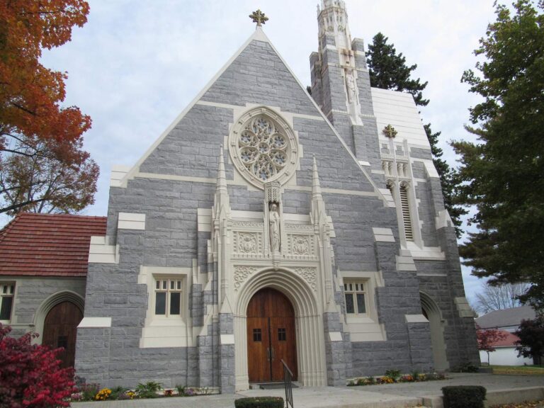
Photo: Doug Kerr, CC BY-SA 2.0
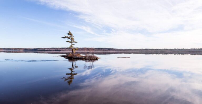
Photo: Paul VanDerWerf, CC BY 2.0
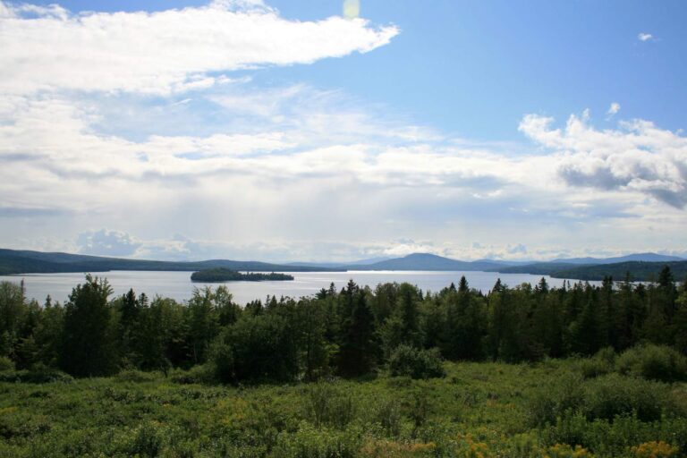
Photo: Paul Schultz, CC BY 2.0
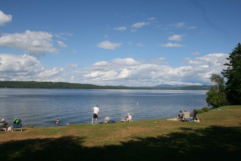
Photo: Paul Schultz, CC BY 2.0
Fishing inside Franklin County, Maine: the common asks
Where can I put a boat in the water in Maine's Franklin County?
The table above already includes 21 ramps.
Which lake is the biggest in Maine's Franklin County?
Rangeley Lake is the biggest, 6,304 acres.
What fish turn up on Maine water records in Franklin County?
MDIFW lists brook trout on the most waters in the county, then white sucker, blacknose dace and creek chub; a listing shows presence, not a catch.
Where do Maine anglers in Franklin County go for crankbaits and line?
5 entries, BackWoods Bait & Tackle included.
What Maine town serves Franklin County as its seat?
Farmington is the seat.
What does a Maine fishing license cost for Franklin County?
Anglers 16 and older need a Maine fishing license for inland waters; the MDIFW fee page prints $30 for a resident season license and $83 for a nonresident one, agent fees not included.
What Maine counties are closest to Franklin County?
Ordered by distance: Oxford County, Somerset County and Kennebec County.
Which Maine law book limits govern the water of Franklin County?
Limits come from the law book's statewide rows unless the water has its own entry, and an entry replaces the statewide limit for the fish it names; each lake and river page on this site prints its entry. The statewide MDIFW law pages, read on Nov. 18, 2026, supply every rule here; they carry no revision date, they cite the 2026 law book valid through Dec. 31, 2026, and no 2027 rule or fee is given.
Where do Franklin County ponds with no page of their own show up?
This page lists the 469 waters names; a water without a page gets a row and pin.
Is stocking noted for waters in Maine's Franklin County?
The MDIFW pages log 1 dated event for the county; the newest are in the stocking band above, and a count appears only where a source printed one.
A spruce-edge morning in Franklin County
River pages list public access and the nearest USGS gauges.