Fishing in Lincoln County, Maine
County seat: Wiscasset. Census 2020 residents: 35,237.
- 177named waters
- 13ramps
- 1river pages
 Pick for troutPiscifun Carbon X ultralight spinning reel28% OFFSale $57.99
Photo of Camden: Librarygroover, CC BY 2.0
A quick tour of the water in Lincoln County
Lincoln County counted 35,237 residents in 2020, and the courthouse stands in Wiscasset. Lincoln County covers 456 square miles of land and 243.7 square miles of water by the Census gazetteer. Damariscotta Lake is first by size among the 177 waters mapped for Lincoln County. Streamside choices open with Kennebec River.
Totals for the county layer: 13 boat ramps plus 38 other fishing points sites without a ramp.
U.S. Census Bureau, 2020 Census counts (TIGERweb) and the 2023 Gazetteer, read November 18, 2026. Maine GeoLibrary boat launches layer (ArcGIS service), read November 18, 2026.
Down East anglers: a Lincoln County map of waters
Maine GeoLibrary boat launches layer (ArcGIS service), read November 18, 2026. Water pins sit at the point MDIFW or the USGS gives for each water.
 For the trout herePiscifun Carbon XT ultralight spinning reel25% OFFSale $59.99
Lakes spread across Lincoln County across the Pine Tree State
| Lake | Size | Access points | Kind | Fish the MDIFW lists |
|---|---|---|---|---|
| Damariscotta Lake | 4,669 acres | 1 | lake | none listed |
| Pemaquid Pond | 1,562 acres | 1 | pond | none listed |
| Biscay Pond | 382 acres | 0 | pond | brown trout, chain pickerel, brook trout |
| McCurdy Pond | 194 acres | 0 | pond | smallmouth bass, rainbow smelt, white perch |
| Knickerbocker Ponds | 109 acres | 0 | pond | brook trout, white sucker, brown trout |
| Kalers Pond | 89 acres | 0 | pond | brown trout, pumpkinseed sunfish, chain pickerel |
| Little Pond (Damariscotta, Lincoln County) | 83 acres | 0 | pond | none listed |
| Adams Pond (Lincoln County) | 78 acres | 0 | pond | brown trout, white sucker, brook trout |
| Little Medomak Pond | 77 acres | 0 | pond | none listed |
| Wiley Pond (Lincoln County) | 23 acres | 0 | pond | brown trout, brook trout, golden shiner |
| Pinkham Pond (Lincoln County) | 22 acres | 0 | pond | brook trout, white sucker, golden shiner |
| Ross Pond (Lincoln County) | 16 acres | 0 | pond | brown trout, banded killifish, brook trout |
| Peter's Pond | 12 acres | 0 | pond | brook trout, brown trout, golden shiner |
| Upper Pond (Lincoln County) | 10 acres | 0 | pond | brook trout, pumpkinseed sunfish, chain pickerel |
Surface acres from the MDIFW MaineLakes polygon layer for this water (ArcGIS service; geodesic acres of the mapped outline), read November 18, 2026. Waters with no acreage in the MDIFW record show their mapped outline instead. MDIFW MaineLakes layer record for this water (ArcGIS service), read November 18, 2026.
Stream fishing in Lincoln County
- Kennebec River11 access points, 4 USGS gauges, dated stocking rows
Height and discharge gauges on Lincoln County streams
USGS has no current reading for these gauges.
USGS National Hydrography Dataset record for this river (NHD service), read November 18, 2026. Length is the NHD flowline length inside Maine, not a fishable length. USGS Water Data for the Nation, live through the site, retrieved on page view.
Species tallied from the MDIFW lists in Lincoln County
american eel leads the species lists across 36 waters.
MDIFW Popular Fish Species lists, counted per water; presence in the list is not a catch survey. Species named on the MDIFW lake survey map (map PDF), read November 18, 2026. A listed species was recorded for that survey, not reported as a catch.
Put-ins listed for Lincoln County, woods road to coast
- Back River (Boothbay) Fishing Areatrailer ramp, all-tide ramp, hard surface; Lincoln County
- Back River (Westport Island) Fishing Areatrailer ramp, all-tide ramp, hard surface; Lincoln County
- Clary Lake (Jefferson) Fishing Areatrailer ramp, freshwater, hard surface; Lincoln County
- Damariscotta Lake (Jefferson) Fishing Areatrailer ramp, freshwater, hard surface; Lincoln County
- Damariscotta River (Damariscotta) Fishing Areatrailer ramp, all-tide ramp, hard surface; Lincoln County
- Dyer Long Pond (Jefferson) Fishing Areacarry-in access; Lincoln County
- Linekin Bay (Boothbay) Fishing Areatrailer ramp, part-tide ramp, hard surface; Lincoln County
- Long Pond (Jefferson) Fishing Areatrailer ramp, freshwater, hard surface; Lincoln County
- Medomak River (Waldoboro) Fishing Area (north)trailer ramp, all-tide ramp, hard surface; Lincoln County
- Medomak River (Waldoboro) Fishing Area (south)trailer ramp, part-tide ramp, hard surface; Lincoln County
- Pemaquid Pond (Nobleboro) Fishing Areatrailer ramp, freshwater, hard surface; Lincoln County
- Pemaquid River (Bristol) Fishing Areatrailer ramp, part-tide ramp, hard surface; Lincoln County
- Round Pond Harbor (Bristol)trailer ramp, all-tide ramp, hard surface; Lincoln County
Access points in Lincoln County
- Bass Rock Preserve Fishing Area on Round Pond Harborcoastal public access site; Lincoln County
- Bremen Town Landingcoastal public access site, pier or wharf; Lincoln County
- Colonial Pemaquid State Historic Site on Pemaquid Rivercoastal public access site; Lincoln County
- Cozy Harbor Wharfcoastal public access site, pier or wharf; Lincoln County
- Dodge Point Public Reserved Landcoastal public access site; Lincoln County
- Eugley Landing on Linekin Baycoastal public access site, pier or wharf; Lincoln County
- Ferry Road Landing on Back Rivercoastal public access site; Lincoln County
- Glidden Street Right-of-Way Fishing Area on Damariscotta Rivercoastal public access site; Lincoln County
- Green Point Farm Wildlife Management Areacoastal public access site; Lincoln County
- Griggs Preserve Fishing Areacoastal public access site; Lincoln County
- Hanna Landing on Pemaquid Rivercoastal public access site, pier or wharf; Lincoln County
- Heron Island Landingcoastal public access site, pier or wharf; Lincoln County
- Hiatt Farm Fishing Areacoastal public access site; Lincoln County
- Hunters Landingcoastal public access site, pier or wharf; Lincoln County
- Huston Landing on Damariscotta Rivercoastal public access site; Lincoln County
- Knickercane Island Park on Back Rivercoastal public access site; Lincoln County
- La Verna Preserve Fishing Areacoastal public access site; Lincoln County
- Library Park Preserve on Linekin Baycoastal public access site; Lincoln County
- Marsh River Preserve Fishing Areacoastal public access site; Lincoln County
- Moxie Cove Picnic Area on Round Pond Harborcoastal public access site; Lincoln County
- Murray Hill Public Float and Ramp on Linekin Baycoastal public access site; Lincoln County
- Newagen Town Landingcoastal public access site, pier or wharf; Lincoln County
- Oak Point Farmcoastal public access site; Lincoln County
- Osborn Finch Wildlife Sanctuary Fishing Area on Medomak Rivercoastal public access site; Lincoln County
Maine GeoLibrary boat launches layer (ArcGIS service), read November 18, 2026.
Ponds, brooks and streams logged for Lincoln County
Maine lakes and ponds in Lincoln County
| Water | Kind | Size | Fish the MDIFW lists | Access | Map pin |
|---|---|---|---|---|---|
| Clary Lake | lake | 675 acres | none listed | 1 | 44.2170, -69.5580 |
| Long Pond (Lincoln County) | pond | 504 acres | none listed | 1 | 44.2907, -69.5146 |
| Dyer Long Pond | pond | 425 acres | smallmouth bass, white sucker, largemouth bass, brown bullhead | 1 | 44.1863, -69.5211 |
| Dresden Bog | lake | 337 acres | none listed | 0 | 44.0951, -69.6860 |
| Duckpuddle Pond | pond | 296 acres | brown trout, golden shiner, smallmouth bass, white sucker | 0 | 44.0888, -69.4411 |
| Medomak Pond | pond | 239 acres | brook trout, smallmouth bass, golden shiner, largemouth bass | 0 | 44.1960, -69.3701 |
| Webber Pond (Lincoln County) | pond | 220 acres | white sucker, smallmouth bass, white perch, brown bullhead | 0 | 43.9921, -69.4435 |
| Sherman Lake | lake | 215 acres | smallmouth bass, white sucker, largemouth bass, black crappie | 0 | 44.0049, -69.5943 |
| Paradise Pond | pond | 169 acres | chain pickerel, brown bullhead, yellow perch, golden shiner | 0 | 44.0242, -69.4876 |
| Sidensparker Pond | pond | 155 acres | largemouth bass, white sucker, white perch, brown bullhead | 0 | 44.0916, -69.3084 |
| Little Dyer Pond | pond | 112 acres | smallmouth bass, white sucker, largemouth bass, brown bullhead | 0 | 44.1648, -69.5619 |
| Boyd Pond (Lincoln County) | pond | 94 acres | brown trout, brown bullhead, smallmouth bass, banded killifish | 0 | 43.9324, -69.4995 |
| Travel Pond | pond | 92 acres | largemouth bass, white sucker, white perch, brown bullhead | 0 | 44.2543, -69.5321 |
| Havener Pond | pond | 84 acres | largemouth bass, brown bullhead, chain pickerel, pumpkinseed sunfish | 0 | 44.0686, -69.2880 |
| West Harbor Pond | pond | 80 acres | brown trout, white sucker, largemouth bass, white perch | 0 | 43.8569, -69.6464 |
| Gardiner Pond | pond | 79 acres | smallmouth bass, white sucker, yellow perch, pumpkinseed sunfish | 0 | 44.0648, -69.7000 |
| Three Corner Pond | pond | 74 acres | rainbow smelt, largemouth bass, golden shiner, white perch | 0 | 44.2116, -69.5245 |
| Cooks Pond | pond | 74 acres | smallmouth bass, white sucker, white perch, brown bullhead | 0 | 44.1560, -69.4482 |
| Lily Pond (Lincoln County) | pond | 65 acres | largemouth bass, chain pickerel, white perch, white sucker | 0 | 43.9702, -69.6386 |
| James Pond (Lincoln County) | pond | 56 acres | landlocked salmon, brown trout, golden shiner, smallmouth bass | 0 | 44.3231, -69.4797 |
| Deer Meadow Pond | pond | 51 acres | brook trout, rainbow smelt, golden shiner, white perch | 0 | 44.1412, -69.5197 |
| Weary Pond | pond | 43 acres | smallmouth bass, pumpkinseed sunfish, white sucker, american eel | 0 | 44.1784, -69.5867 |
| Unnamed Pond (Westport Island, Lincoln County) (MIDAS 5852) | pond | 41 acres | none listed | 0 | 43.9020, -69.7142 |
| Unnamed Pond (Alna, Lincoln County) (MIDAS 7903) | pond | 37 acres | none listed | 0 | 44.1214, -69.6660 |
| Unnamed Pond (Alna, Lincoln County) (MIDAS 9801) | pond | 35 acres | none listed | 0 | 44.0771, -69.6334 |
| Mill Pond (Lincoln County) | pond | 30 acres | none listed | 0 | 44.3049, -69.4485 |
| Clark Cove Pond | pond | 30 acres | brown trout, ninespine stickleback, largemouth bass, american eel | 0 | 43.9334, -69.5641 |
| Musquash Pond | pond | 30 acres | white perch, golden shiner, yellow perch, brown bullhead | 0 | 44.1609, -69.5268 |
| Unnamed Pond (Bristol, Lincoln County) (MIDAS 9835) | pond | 25 acres | none listed | 0 | 43.9956, -69.5274 |
| Givens Pond | pond | 23 acres | chain pickerel, brown bullhead, american eel, golden shiner | 0 | 44.2741, -69.6327 |
| Unnamed Pond (Boothbay, Lincoln County) (MIDAS 7885) | pond | 23 acres | none listed | 0 | 43.8701, -69.5999 |
| Unnamed Pond (Waldoboro, Lincoln County) (MIDAS 7835) | pond | 22 acres | none listed | 0 | 44.1296, -69.3597 |
| Heal Pond | pond | 22 acres | none listed | 0 | 43.8955, -69.7289 |
| Horn Pond (Lincoln County) | pond | 20 acres | banded killifish, lake chub, white sucker, american eel | 0 | 44.1299, -69.5309 |
| Unnamed Pond (Nobleboro, Lincoln County) (MIDAS 0105000300) | pond | 19 acres | none listed | 0 | 44.1025, -69.4747 |
| Little Pond (Bristol, Lincoln County) | pond | 15 acres | brook trout, rainbow smelt, golden shiner, smallmouth bass | 0 | 43.9726, -69.4958 |
| Unnamed Pond (Whitefield, Lincoln County) | pond | 15 acres | none listed | 0 | 44.1974, -69.5887 |
| French Pond | pond | 14 acres | none listed | 0 | 44.3109, -69.5072 |
| Unnamed Pond (Somerville, Lincoln County) (MIDAS 6460) | pond | 14 acres | none listed | 0 | 44.3144, -69.4816 |
| Unnamed Pond (Waldoboro, Lincoln County) (MIDAS 7827) | pond | 13 acres | none listed | 0 | 44.0463, -69.3101 |
| Unnamed Pond (Waldoboro, Lincoln County) (MIDAS 7839) | pond | 13 acres | none listed | 0 | 44.0851, -69.3097 |
| Unnamed Pond (Edgecomb, Lincoln County) (MIDAS 5836) | pond | 13 acres | none listed | 0 | 43.9411, -69.5940 |
| Tobias Pond | pond | 11 acres | none listed | 0 | 44.1340, -69.4387 |
| Kimballtown Pond | pond | 10 acres | none listed | 0 | 43.8821, -69.6807 |
| Flood Pond | pond | 9.9 acres | none listed | 0 | 44.1680, -69.5246 |
| Appalachie Pond | pond | 9.8 acres | none listed | 0 | 43.8537, -69.6089 |
| Unnamed Pond (Westport Island, Lincoln County) (MIDAS 9809) | pond | 9.8 acres | none listed | 0 | 43.8907, -69.7112 |
| Unnamed Pond (Westport Island, Lincoln County) (MIDAS 7889) | pond | 9.6 acres | none listed | 0 | 43.8826, -69.7073 |
| Hastings Pond | pond | 9.3 acres | brook trout, golden shiner | 0 | 43.9120, -69.4923 |
| Unnamed Pond (Boothbay, Lincoln County) (MIDAS 7875) | pond | 9.3 acres | none listed | 0 | 43.8893, -69.6367 |
| Sawyers Pond | pond | 8.6 acres | none listed | 0 | 43.8313, -69.6544 |
| Ice Pond (Lincoln County) | pond | 8.1 acres | largemouth bass, american eel, pumpkinseed sunfish | 0 | 43.8789, -69.4954 |
| Unnamed Pond (Newcastle, Lincoln County) (MIDAS 5277) | pond | 8 acres | none listed | 0 | 44.0461, -69.6055 |
| Unnamed Pond (Edgecomb, Lincoln County) (MIDAS 5271) | pond | 7.7 acres | none listed | 0 | 44.0139, -69.6356 |
| Unnamed Pond (Somerville, Lincoln County) (MIDAS 7907) | pond | 7.5 acres | none listed | 0 | 44.2622, -69.5026 |
| Unnamed Pond (Boothbay, Lincoln County) (MIDAS 7879) | pond | 6.1 acres | none listed | 0 | 43.8600, -69.5877 |
| Unnamed Pond (Southport, Lincoln County) (MIDAS 5856) | pond | 5.7 acres | none listed | 0 | 43.8296, -69.6818 |
| Unnamed Pond (Alna, Lincoln County) (MIDAS 7901) | pond | 5.5 acres | none listed | 0 | 44.0741, -69.6172 |
| Unnamed Pond (Bristol, Lincoln County) (MIDAS 5830) | pond | 5.2 acres | none listed | 0 | 43.9540, -69.4842 |
| Unnamed Pond (Boothbay Harbor, Lincoln County) (MIDAS 7895) | pond | 4.8 acres | none listed | 0 | 43.8692, -69.6116 |
| Unnamed Pond (Hibberts Gore, Lincoln County) | pond | 4.8 acres | none listed | 0 | 44.3305, -69.4334 |
| Lower Pond (Lincoln County) | pond | 4.3 acres | none listed | 0 | 43.9939, -69.5126 |
| Unnamed Pond (Alna, Lincoln County) (MIDAS 9805) | pond | 4.3 acres | none listed | 0 | 44.0973, -69.6015 |
| Unnamed Pond (Wiscasset, Lincoln County) (MIDAS 7805) | pond | 3.8 acres | none listed | 0 | 43.9904, -69.6759 |
| Kerr Pond | pond | 3.7 acres | none listed | 0 | 44.1809, -69.5415 |
| Unnamed Pond (Dresden, Lincoln County) (MIDAS 7899) | pond | 3.6 acres | none listed | 0 | 44.0690, -69.7357 |
| Unnamed Pond (Jefferson, Lincoln County) (MIDAS 7905) | pond | 3.6 acres | none listed | 0 | 44.2082, -69.4519 |
| Unnamed Pond (Nobleboro, Lincoln County) (MIDAS 7845) | pond | 3.6 acres | none listed | 0 | 44.1087, -69.4771 |
| Unnamed Pond (Waldoboro, Lincoln County) (MIDAS 7825) | pond | 3.5 acres | none listed | 0 | 44.0295, -69.3576 |
| Dicks Pond | pond | 3.3 acres | none listed | 0 | 43.9054, -69.4982 |
| Unnamed Pond (Edgecomb, Lincoln County) (MIDAS 7887) | pond | 3.3 acres | none listed | 0 | 43.9535, -69.6351 |
| Unnamed Pond (Jefferson, Lincoln County) (MIDAS 5275) | pond | 3.2 acres | none listed | 0 | 44.1128, -69.5199 |
| Unnamed Pond (Dresden, Lincoln County) (MIDAS 9807) | pond | 3 acres | none listed | 0 | 44.0402, -69.7287 |
| Unnamed Pond (Southport, Lincoln County) (MIDAS 5858) | pond | 2.8 acres | none listed | 0 | 43.8441, -69.6626 |
| Unnamed Pond (Boothbay, Lincoln County) (MIDAS 5838) | pond | 2.7 acres | none listed | 0 | 43.8928, -69.6180 |
| Unnamed Pond (Boothbay, Lincoln County) (MIDAS 7881) | pond | 2.5 acres | none listed | 0 | 43.8236, -69.5991 |
| Unnamed Pond (Newcastle, Lincoln County) (MIDAS 5281) | pond | 2.5 acres | none listed | 0 | 44.0513, -69.5987 |
| Unnamed Pond (Boothbay, Lincoln County) (MIDAS 5840) | pond | 2.4 acres | none listed | 0 | 43.8974, -69.5929 |
| Unnamed Pond (Newcastle, Lincoln County) (MIDAS 5279) | pond | 2.4 acres | none listed | 0 | 44.0520, -69.6026 |
| Unnamed Pond (Waldoboro, Lincoln County) (MIDAS 7829) | pond | 2.2 acres | none listed | 0 | 44.0757, -69.2901 |
| Unnamed Pond (Wiscasset, Lincoln County) (MIDAS 7809) | pond | 2.2 acres | none listed | 0 | 43.9903, -69.6782 |
| Unnamed Pond (Waldoboro, Lincoln County) (MIDAS 7831) | pond | 2 acres | none listed | 0 | 44.1784, -69.3486 |
| Unnamed Pond (Boothbay, Lincoln County) (MIDAS 7883) | pond | 1.9 acres | none listed | 0 | 43.9263, -69.6375 |
| Unnamed Pond (Wiscasset, Lincoln County) (MIDAS 5269) | pond | 1.9 acres | none listed | 0 | 44.0240, -69.6571 |
| Unnamed Pond (Damariscotta, Lincoln County) (MIDAS 7851) | pond | 1.8 acres | none listed | 0 | 44.0240, -69.4659 |
| Unnamed Pond (Nobleboro, Lincoln County) (MIDAS 7843) | pond | 1.6 acres | none listed | 0 | 44.0932, -69.4824 |
| Unnamed Pond (Wiscasset, Lincoln County) (MIDAS 7807) | pond | 1.6 acres | none listed | 0 | 43.9933, -69.6795 |
| Dodge Pond (Lincoln County) | pond | 1.4 acres | none listed | 0 | 44.3051, -69.5090 |
| Unnamed Pond (Dresden, Lincoln County) (MIDAS 5261) | pond | 1.4 acres | none listed | 0 | 44.0546, -69.7630 |
| Unnamed Pond (Waldoboro, Lincoln County) (MIDAS 7823) | pond | 1.4 acres | none listed | 0 | 44.0546, -69.3022 |
| Unnamed Pond (Wiscasset, Lincoln County) (MIDAS 7817) | pond | 1.4 acres | none listed | 0 | 44.0020, -69.6770 |
| Unnamed Pond (Boothbay, Lincoln County) (MIDAS 5862) | pond | 1.2 acres | none listed | 0 | 43.8486, -69.5859 |
| Unnamed Pond (Damariscotta, Lincoln County) (MIDAS 7853) | pond | 1.2 acres | none listed | 0 | 44.0529, -69.4875 |
| Unnamed Pond (Bristol, Lincoln County) (MIDAS 7869) | pond | 1.1 acres | none listed | 0 | 43.9616, -69.4616 |
| Unnamed Pond (Waldoboro, Lincoln County) (MIDAS 7837) | pond | 1.1 acres | none listed | 0 | 44.1326, -69.3676 |
| Unnamed Pond (Waldoboro, Lincoln County) (MIDAS 7819) | pond | 1 acres | none listed | 0 | 44.1436, -69.3901 |
| Unnamed Pond (Waldoboro, Lincoln County) (MIDAS 7821) | pond | 1 acres | none listed | 0 | 44.1150, -69.3886 |
| Thompsons Ice Pond | pond, dated stocking rows | 0.9 acres | none listed | 0 | 43.8793, -69.5599 |
| Unnamed Pond (Boothbay, Lincoln County) (MIDAS 7873) | pond | 0.9 acres | none listed | 0 | 43.8222, -69.6022 |
| Unnamed Pond (Bremen, Lincoln County) (MIDAS 7855) | pond | 0.9 acres | none listed | 0 | 44.0058, -69.4609 |
| Unnamed Pond (Bristol, Lincoln County) (MIDAS 5832) | pond | 0.9 acres | none listed | 0 | 43.9785, -69.5343 |
| Unnamed Pond (Bristol, Lincoln County) (MIDAS 7859) | pond | 0.9 acres | none listed | 0 | 43.9332, -69.4560 |
| Unnamed Pond (Wiscasset, Lincoln County) (MIDAS 7813) | pond | 0.9 acres | none listed | 0 | 43.9810, -69.6883 |
| Unnamed Pond (Nobleboro, Lincoln County) (MIDAS 7847) | pond | 0.8 acres | none listed | 0 | 44.0674, -69.4927 |
| Pat's Pond | pond | 0.7 acres | none listed | 0 | 43.8567, -69.6216 |
| Unnamed Pond (Boothbay Harbor, Lincoln County) (MIDAS 5864) | pond | 0.7 acres | none listed | 0 | 43.8478, -69.6227 |
| Unnamed Pond (Bremen, Lincoln County) (MIDAS 7857) | pond | 0.7 acres | none listed | 0 | 43.9804, -69.4486 |
| Unnamed Pond (Bristol, Lincoln County) (MIDAS 5834) | pond | 0.7 acres | none listed | 0 | 43.9776, -69.5330 |
| Unnamed Pond (Bristol, Lincoln County) (MIDAS 5846) | pond | 0.7 acres | none listed | 0 | 43.9309, -69.5141 |
| Unnamed Pond (Wiscasset, Lincoln County) (MIDAS 5848) | pond | 0.7 acres | none listed | 0 | 43.9907, -69.6817 |
| Unnamed Pond (Bristol, Lincoln County) (MIDAS 7865) | pond | 0.6 acres | none listed | 0 | 43.9283, -69.4819 |
| Unnamed Pond (Wiscasset, Lincoln County) (MIDAS 7815) | pond | 0.6 acres | none listed | 0 | 43.9798, -69.7072 |
| Unnamed Pond (Boothbay, Lincoln County) (MIDAS 7893) | pond | 0.5 acres | none listed | 0 | 43.8383, -69.5915 |
| Unnamed Pond (Bristol, Lincoln County) (MIDAS 7861) | pond | 0.5 acres | none listed | 0 | 43.8960, -69.4718 |
| Unnamed Pond (Monhegan Island Plt, Lincoln County) | pond | 0.5 acres | none listed | 0 | 43.7669, -69.3166 |
| Unnamed Pond (Somerville, Lincoln County) (MIDAS 7909) | pond | 0.5 acres | none listed | 0 | 44.2823, -69.4663 |
| Unnamed Pond (Bristol, Lincoln County) (MIDAS 5844) | pond | 0.4 acres | none listed | 0 | 43.9299, -69.5167 |
| Unnamed Pond (Nobleboro, Lincoln County) (MIDAS 7841) | pond | 0.4 acres | none listed | 0 | 44.0833, -69.4854 |
| Unnamed Pond (Bristol, Lincoln County) (MIDAS 5842) | pond | 0.3 acres | none listed | 0 | 43.9380, -69.5185 |
| Unnamed Pond (Bristol, Lincoln County) (MIDAS 7867) | pond | 0.1 acres | none listed | 0 | 43.9091, -69.4628 |
MDIFW MaineLakes layer record for this water (ArcGIS service), read November 18, 2026. Outline area from the Maine DEP MIDAS lakes basemap (ArcGIS service; mapped polygon area, not a surface-acre figure from a survey), read November 18, 2026.
Brooks, streams and rivers in Lincoln County
| Water | Kind | Size | Fish the MDIFW lists | Access | Map pin |
|---|---|---|---|---|---|
| Alford Brook | water | no size printed | none listed | 0 | 44.1723, -69.3341 |
| Back Brook (Lincoln County) | water | no size printed | none listed | 0 | 44.1064, -69.3627 |
| Back Meadow Brook | water | no size printed | none listed | 0 | 44.0712, -69.4667 |
| Back River | water | no size printed | none listed | 5 | 43.9192, -69.6738 |
| Beaverdam Brook | water | no size printed | none listed | 0 | 44.0684, -69.4459 |
| Ben Brook | water | no size printed | none listed | 0 | 44.1347, -69.5954 |
| Benner Brook | water | no size printed | none listed | 0 | 44.1296, -69.3663 |
| Black Brook (Lincoln County) | water | no size printed | none listed | 0 | 44.2827, -69.4916 |
| Brann Brook (Lincoln County) | water | no size printed | none listed | 0 | 44.2461, -69.5163 |
| Carlton Brook (Lincoln County) | water | no size printed | none listed | 0 | 44.1853, -69.6130 |
| Cross River | river reach | no size printed | none listed | 0 | 43.9354, -69.6367 |
| Crummett Brook | water | no size printed | none listed | 0 | 44.3197, -69.4453 |
| Damariscotta River | river reach | no size printed | none listed | 0 | 44.0623, -69.5286 |
| Damariscotta River | water | no size printed | none listed | 6 | 44.0325, -69.5332 |
| Deer Meadow Brook | water | no size printed | none listed | 0 | 44.0422, -69.5820 |
| Demuth Brook | water | no size printed | none listed | 0 | 44.0956, -69.3331 |
| Dyer River | river reach | no size printed | none listed | 0 | 44.1823, -69.5264 |
| East Branch Eastern River | river reach | no size printed | none listed | 0 | 44.2049, -69.6352 |
| Eastern River | river reach | no size printed | none listed | 0 | 44.1224, -69.7112 |
| Farnsworth Brook | water | no size printed | none listed | 0 | 44.0631, -69.3336 |
| Finn Brook (Lincoln County) | water | no size printed | none listed | 0 | 44.2230, -69.5937 |
| Goose River (Lincoln County) | river reach | no size printed | none listed | 0 | 44.0468, -69.2984 |
| Levensaler Brook | water | no size printed | none listed | 0 | 44.1221, -69.3292 |
| Linekin Bay | water | no size printed | none listed | 5 | 43.8619, -69.5905 |
| Little Falls Brook | water | no size printed | none listed | 0 | 43.9005, -69.5143 |
| Lovejoy Stream | water | no size printed | none listed | 0 | 44.3130, -69.5077 |
| Meadow Brook (Boothbay Harbor, Lincoln County) | water | no size printed | none listed | 0 | 43.8677, -69.6118 |
| Meadow Brook (Waldoboro, Lincoln County) | water | no size printed | none listed | 0 | 44.2020, -69.4048 |
| Medomak River | water | no size printed | none listed | 3 | 44.0665, -69.3743 |
| Montsweag Brook | water, dated stocking rows | no size printed | none listed | 0 | 44.0262, -69.7083 |
| Pemaquid River | river reach, dated stocking rows | no size printed | none listed | 0 | 43.9831, -69.5037 |
| Pemaquid River | water | no size printed | none listed | 4 | 43.8799, -69.5202 |
| Poly Clark Brook | water, dated stocking rows | no size printed | none listed | 0 | no point printed |
| Round Pond Harbor | water | no size printed | none listed | 4 | 43.9452, -69.4582 |
| Sheepscot River | river reach | no size printed | none listed | 0 | 44.0987, -69.5952 |
| Slaigo Brook | water | no size printed | none listed | 0 | 44.0729, -69.3465 |
| Travel Brook | water | no size printed | none listed | 0 | 44.2688, -69.5340 |
| Trout Brook (Lincoln County) | water | no size printed | none listed | 0 | 44.0881, -69.6485 |
| Waterman Brook | water | no size printed | none listed | 0 | 44.0502, -69.3084 |
| West Branch Davis Stream | water | no size printed | none listed | 0 | 44.2413, -69.4506 |
| West Branch Eastern River | river reach | no size printed | none listed | 0 | 44.2584, -69.6155 |
| Wiley Brook (Lincoln County) | water | no size printed | none listed | 0 | 43.9608, -69.5512 |
MDIFW MaineLakes layer record for this water (ArcGIS service), read November 18, 2026. Outline area from the Maine DEP MIDAS lakes basemap (ArcGIS service; mapped polygon area, not a surface-acre figure from a survey), read November 18, 2026.
Maine record entries from Lincoln County
| Species | Size as listed | Water | Year | Category |
|---|---|---|---|---|
| Striped Bass | 67.0 lbs | Sheepscot River | 1978 | Maine saltwater state record – Rod and reel |
Maine saltwater state records from the Department of Marine Resources list (DMR PDF), current January 2024, read November 18, 2026. Freshwater records are not published in a form this site could read, and angler names are not printed.
Organized bass and ice-fishing days fishing Lincoln County
| Date | Event | Water | Organizer |
|---|---|---|---|
| Aug. 17, 2025 | Maine TBF High School State Championship (2025) | Damariscotta Lake | The Bass Federation / Student Angler Federation |
Event as listed by the organizer (source), read November 18, 2026.
In Maine, bait counters around Lincoln County
Tackle stops worth a detour before Lincoln County
- Tightline Tackle Cobait and tackle shop, Damariscotta
- Boothbay Harbor Marina-Pier 1marina, Boothbay Harbor
- Carousel Marinamarina, Boothbay Harbor
- Ocean Point Marinamarina, East Boothbay
- Wotton's Wharfmarina, Boothbay Harbor
In Maine, hiring a guide for Lincoln County
- James Eddy Smelt Camp Rentalsmelt camp rental, Dresden
Yellow Pages and operator listings (city of business), read November 18, 2026. Guides appear as businesses; no license or permit status is implied.
Sharing the same Maine watershed as Lincoln County
Towns of Lincoln County
- Waldoboro2020 count 5,154
- Wiscasset2020 count 3,742
- Boothbay2020 count 3,003
- Bristol2020 count 2,834
- Jefferson2020 count 2,551
- Whitefield2020 count 2,408
- Damariscotta2020 count 2,297
- Boothbay Harbor2020 count 2,027
- Newcastle2020 count 1,848
- Nobleboro2020 count 1,791
- Dresden2020 count 1,725
- Edgecomb2020 count 1,188
- South Bristol2020 count 1,127
Maine counties a short drive from Lincoln County
- Sagadahoc County17 miles out, heading west
- Knox County24 miles out, heading east
- Kennebec County32 miles out, heading northwest
- Androscoggin County36 miles out, heading west
Tackle shop directory for Lincoln County
The southeast Maine grouping is a quadrant this site drew, and Lincoln County falls inside it.
This week around Lincoln County
Maine fishing this week
Maine stocking by date
Maine fish advisories
Piscifun tackle picked for a spruce-shore morning at Lincoln County


Piscifun and Amazon links are affiliate links; the site earns a commission on qualifying purchases.
Ponds, brooks and rocky coves around Lincoln County, pictured
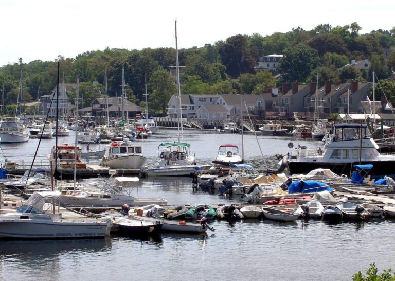
Photo: laredawg, Public domain
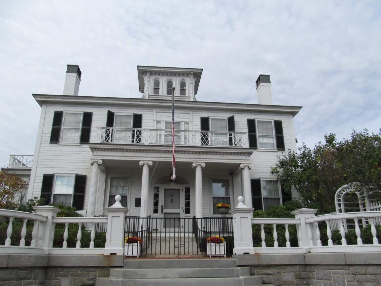
Photo: Doug Kerr, CC BY-SA 2.0
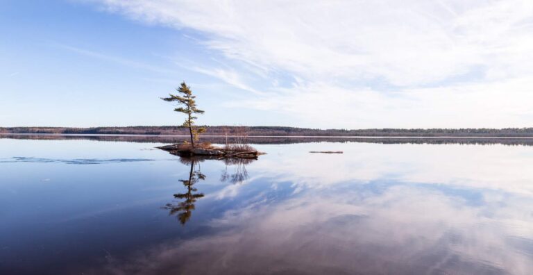
Photo: Paul VanDerWerf, CC BY 2.0
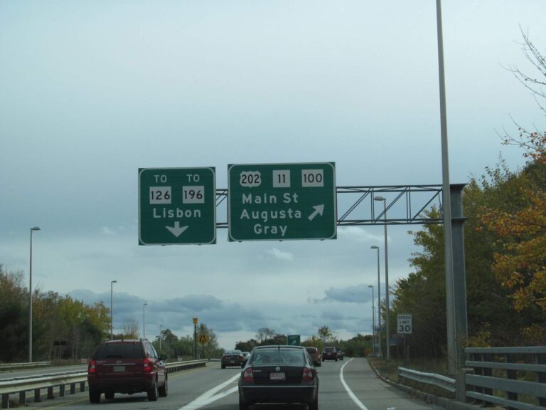
Photo: Doug Kerr, CC BY-SA 2.0
Clearing up the usual doubts about Lincoln County
Which Maine ramps serve Lincoln County?
The launch layer places 13 ramps in the county.
Which Maine water has the most acreage in Lincoln County?
Damariscotta Lake (4,669 acres).
What species does the MDIFW list for waters in Lincoln County?
MDIFW lists american eel on the most waters in the county, then golden shiner, pumpkinseed sunfish and white sucker; a listing shows presence, not a catch.
Which Maine stores in Lincoln County sell fishing gear?
Tightline Tackle Co opens the list of 5.
Which Maine town holds the Lincoln County offices?
Its seat: Wiscasset.
Which Maine license goes in my wallet for Lincoln County?
MDIFW sets the season license at $30 for residents and $83 for nonresidents, agent fees not included, and anglers from age 16 need one for inland waters.
Which Maine counties should I check near Lincoln County?
County pages nearest by distance: Sagadahoc County, Knox County and Kennebec County.
What is the Maine trout limit in Lincoln County?
Limits come from the law book's statewide rows unless the water has its own entry, and an entry replaces the statewide limit for the fish it names; each lake and river page on this site prints its entry. MDIFW statewide law pages, read Nov. 18, 2026, are the only source for these rules; they show no revision date and refer to the 2026 law book that ends Dec. 31, 2026, so 2027 rules and fees are left out.
What of the waters in Lincoln County sit in the table above?
Yes. All 177 waters MDIFW and USGS names for the county sit on this page, linked or pinned.
Which Maine events fish Lincoln County lakes?
1 entry on file; nothing is dated later.
Which MDIFW records tie to Lincoln County?
Striped Bass, 67.0 lbs, from Sheepscot River (1978).
Plan a Maine fishing day in Lincoln County
Access rows repeat MDIFW details with directions.