Fishing in Penobscot County, Maine
County seat: Bangor. Census 2020 residents: 152,199.
- 821named waters
- 46ramps
- 5river pages
 Pick for brook troutPiscifun Carbon X ultralight spinning reel28% OFFSale $57.99
Photo of Aroostook River: Britt Fuller, Public domain
An overview of the Maine ponds and rivers in Penobscot County
The 2020 Census found 152,199 residents across Penobscot County; its seat is Bangor. Bureau figures for the county read 3,397 square miles of land and 159.9 square miles of water. The county map holds 821 waters; Millinocket Lake (Penobscot County) takes the most room. Brooks and rivers with their own page here include Aroostook River, Piscataquis River and Kenduskeag Stream.
Within county bounds the layers show 46 boat ramps, besides 4 other fishing points mapped sites that lack a ramp. The Heritage Fish program counts 16 waters inside the county line. The MDIFW schedule and the MDIFW reports give stocking dates for 4 events in Penobscot County.
U.S. Census Bureau, 2020 Census counts (TIGERweb) and the 2023 Gazetteer, read November 18, 2026. Maine GeoLibrary boat launches layer (ArcGIS service), read November 18, 2026.
Stocking dates on record for Penobscot County
- Upper Pond (Penobscot County)Nov. 13, 2026, Brook trout, 100 printed, 14 in., Lincoln, stocked, per the 2026 year-to-date report (preliminary receipt data)
- Mud Pond (Old Town, Penobscot County)Nov. 12, 2026, Brook trout, 400 printed, 13 in., Old Town, stocked, per the 2026 year-to-date report (preliminary receipt data)
- Cold Stream Pond (Penobscot County)Nov. 11, 2026, Brook trout, 385 printed, 13 in., Enfield, stocked, per the 2026 year-to-date report (preliminary receipt data)
- Edwards Family Kids Fishing PondNov. 11, 2026, Brook trout, 125 printed, 13 in., Lincoln, stocked, per the 2026 year-to-date report (preliminary receipt data)
Maine stocking this week and the week-ahead outlook
MDIFW 2026 year-to-date stocking report (MDIFW report), preliminary receipt data as of Nov. 17, 2026, read November 18, 2026. Dates, sizes and counts are as printed; the report may be corrected after review.
 For the brook trout herePiscifun Carbon XT ultralight spinning reel25% OFFSale $59.99
Each mapped pond, brook and ramp across Penobscot County
Maine GeoLibrary boat launches layer (ArcGIS service), read November 18, 2026. Water pins sit at the point MDIFW or the USGS gives for each water.
Still water in Penobscot County, woods road to coast
| Lake | Size | Access points | Kind | Fish the MDIFW lists |
|---|---|---|---|---|
| Millinocket Lake (Penobscot County) | 8,578 acres | 0 | lake | white sucker, brook trout, longnose sucker |
| Cold Stream Pond (Penobscot County) | 3,623 acres | 1 | pond | none listed |
| Endless Lake | 1,440 acres | 1 | lake | none listed |
| Millimagassett Lake | 1,400 acres | 0 | lake | none listed |
| Brewer Lake | 959 acres | 0 | lake | none listed |
| Scraggly Lake | 836 acres | 1 | lake | none listed |
| Upper Pond (Penobscot County) | 731 acres | 0 | pond | none listed |
| Lower Shin Pond | 658 acres | 1 | pond | none listed |
| Cedar Lake | 655 acres | 1 | lake | none listed |
| Hay Lake | 626 acres | 0 | lake | none listed |
| Upper Shin Pond | 590 acres | 0 | pond | none listed |
| Silver Lake (Penobscot County) | 530 acres | 0 | lake | none listed |
| Hermon Pond | 462 acres | 1 | pond | brook trout, common shiner, rainbow smelt |
| Hopkins Pond (Penobscot County) | 429 acres | 0 | pond | lake trout (togue), white sucker, brook trout |
| Mud Pond (Old Town, Penobscot County) | 366 acres | 0 | pond | none listed |
| Etna Pond | 362 acres | 0 | pond | smallmouth bass, blacknose dace, largemouth bass |
| Flatiron Pond (Penobscot County) | 286 acres | 0 | pond | white perch, yellow perch, fallfish |
| Lunksoos Lake | 270 acres | 0 | lake | brook trout, white sucker, blacknose dace |
| Jerry Pond (T5 R7 WELS, Penobscot County) | 236 acres | 0 | pond, Heritage Fish location | brook trout, brown bullhead, blacknose dace |
| Smith Pond (Penobscot County) | 198 acres | 0 | pond | brook trout, brown bullhead, redbreast sunfish |
| Puffers Pond | 115 acres | 0 | pond | brook trout, smallmouth bass, common shiner |
| Fitts Pond | 112 acres | 0 | pond | brook trout, ninespine stickleback, chain pickerel |
| LIttle Round Pond (Penobscot County) | 81 acres | 0 | pond | none listed |
| Davis Pond (Penobscot County) | 65 acres | 0 | pond | none listed |
| Ireland Pond | 43 acres | 0 | pond | brook trout, finescale dace, blacknose dace |
| Wiley Pond (Penobscot County) | 28 acres | 0 | pond | brook trout, yellow perch, golden shiner |
| Carry Pond (Penobscot County) | 19 acres | 0 | pond | finescale dace, brook trout |
| Trout Pond (Grand Falls Twp, Penobscot County) | 7.5 acres | 0 | pond, Heritage Fish location | brook trout, creek chub, golden shiner |
| Green Mountain Pond | 4 acres | 0 | pond | brook trout |
Surface acres from the MDIFW MaineLakes polygon layer for this water (ArcGIS service; geodesic acres of the mapped outline), read November 18, 2026. Waters with no acreage in the MDIFW record show their mapped outline instead. MDIFW MaineLakes layer record for this water (ArcGIS service), read November 18, 2026.
In Maine, moving water in Penobscot County
- Aroostook River9 access points, 2 USGS gauges
- Piscataquis River6 access points, 3 USGS gauges, dated stocking rows
- Kenduskeag Stream1 access point, 1 USGS gauge, dated stocking rows
- Mattawamkeag River1 access point, 1 USGS gauge, dated stocking rows
- Souadabscook Stream1 access point, dated stocking rows
Gauges and tide stations in Penobscot County
USGS has no current reading for these gauges.
USGS National Hydrography Dataset record for this river (NHD service), read November 18, 2026. Length is the NHD flowline length inside Maine, not a fishable length. USGS Water Data for the Nation, live through the site, retrieved on page view.
What MDIFW names most often in Penobscot County
Bars count the 96 waters here where MDIFW lists the fish as present; white sucker leads.
MDIFW Popular Fish Species lists, counted per water; presence in the list is not a catch survey. Species named on the MDIFW lake survey map (map PDF), read November 18, 2026. A listed species was recorded for that survey, not reported as a catch.
In Maine, launch ramps across Penobscot County
- Cedar Lake (TA R8 & R9) Fishing Areatrailer ramp, freshwater, gravel surface; Penobscot County
- Cold Stream Pond (Enfield) Fishing Areatrailer ramp, freshwater, hard surface; Penobscot County
- Dolby Pond (Millinocket) Fishing Area (north)trailer ramp, freshwater, gravel surface; Penobscot County
- Dolby Pond (Millinocket) Fishing Area (south)trailer ramp, freshwater, hard surface; Penobscot County
- Dwinal Pond (Winn) Fishing Areacarry-in access; Penobscot County
- Endless Lake (T3 R9 NWP) Fishing Areacarry-in access; Penobscot County
- Folsom Pond (Lincoln) Fishing Areatrailer ramp, freshwater, hard surface; Penobscot County
- Great Works Stream (Bradley) Fishing Areatrailer ramp, freshwater, gravel surface; Penobscot County
- Hermon Pond (Hermon) Fishing Areatrailer ramp, freshwater, hard surface; Penobscot County
- Kenduskeag Stream (Kenduskeag) Fishing Areacarry-in access; Penobscot County
- Long Pond (Lincoln) Fishing Areatrailer ramp, freshwater, hard surface; Penobscot County
- Lower Shin Pond (Mount Chase Plt) Fishing Areacarry-in access; Penobscot County
- Mattakeunk (Silver) Lake (Lee) Fishing Areatrailer ramp, freshwater, hard surface; Penobscot County
- Mattanawcook Pond (Lincoln) Fishing Areatrailer ramp, freshwater, hard surface; Penobscot County
- Mattawamkeag River (Drew Plt) Fishing Areatrailer ramp, freshwater, gravel surface; Penobscot County
- Old Farm Pond (Howland) Fishing Areacarry-in access; Penobscot County
- Passadumkeag River (Passadumkeag) Fishing Areatrailer ramp, freshwater, gravel surface; Penobscot County
- Penobscot River (Bangor) Fishing Arealanding facility; Penobscot County
- Penobscot River (Brewer) Fishing Areatrailer ramp, freshwater, hard surface; Penobscot County
- Penobscot River (Eddington) Fishing Area (north)trailer ramp, freshwater, hard surface; Penobscot County
- Penobscot River (Eddington) Fishing Area (south)carry-in access; Penobscot County
- Penobscot River (Greenbush) Fishing Areatrailer ramp, freshwater, hard surface; Penobscot County
- Penobscot River (Hampden) Fishing Areatrailer ramp, all-tide ramp, hard surface; Penobscot County
- Penobscot River (Howland) Fishing Areatrailer ramp, freshwater, hard surface; Penobscot County
Down East or North Woods: docks and piers in Penobscot County
- Bangor Waterfront Fishing Area on Penobscot Rivercoastal public access site, pier or wharf; Penobscot County
- Hampden Boat Ramp on Penobscot Rivercoastal public access site, pier or wharf; Penobscot County
- Kenduskeag Stream Trail Fishing Area on Penobscot Rivercoastal public access site; Penobscot County
- North Main Street Boat Rampcoastal public access site, pier or wharf; Penobscot County
Maine GeoLibrary boat launches layer (ArcGIS service), read November 18, 2026.
Waters in Penobscot County that sit on this page instead of having their own
Maine lakes and ponds in Penobscot County
| Water | Kind | Size | Fish the MDIFW lists | Access | Map pin |
|---|---|---|---|---|---|
| Pushaw Lake | lake | 4,683 acres | none listed | 1 | 44.9330, -68.8010 |
| Sebasticook Lake | lake | 4,541 acres | none listed | 1 | 44.8577, -69.2418 |
| Junior Lake | lake | 4,003 acres | round whitefish, lake trout (togue), white sucker, smallmouth bass | 0 | 45.3052, -68.0076 |
| North Twin Lake | lake | 3,131 acres | none listed | 0 | 45.6414, -68.8333 |
| South Twin Lake | lake | 2,976 acres | none listed | 1 | 45.6207, -68.8606 |
| Grand Lake Sebois | lake | 2,604 acres | smallmouth bass, golden shiner, yellow perch, common shiner | 0 | 46.2965, -68.6503 |
| First Matagamon Lakes | lake | 2,529 acres | fallfish, lake trout (togue), creek chub, yellow perch | 0 | 46.1665, -68.8040 |
| South Branch Lake | lake | 1,983 acres | smallmouth bass, white perch, common shiner, yellow perch | 1 | 45.3845, -68.6836 |
| Dolby Pond | pond | 1,943 acres | none listed | 2 | 45.6569, -68.6225 |
| Pleasant Lake (Stetson, Penobscot County) | lake | 1,246 acres | smallmouth bass, white sucker, largemouth bass, brown bullhead | 0 | 44.8847, -69.1049 |
| Chemo Pond | pond | 1,224 acres | none listed | 0 | 44.8233, -68.5731 |
| East Branch Lake | lake | 1,122 acres | none listed | 0 | 45.5191, -68.7342 |
| Mattamiscontis Lake | lake | 1,080 acres | none listed | 0 | 45.4907, -68.6768 |
| Upper Sysladobsis Lake | lake | 1,061 acres | none listed | 0 | 45.3015, -68.1261 |
| Quakish Lake | lake | 1,056 acres | none listed | 1 | 45.6354, -68.7512 |
| Saponac Pond | pond | 894 acres | smallmouth bass, white perch, yellow perch, blacknose dace | 1 | 45.1746, -68.3831 |
| Eskutassis Pond | pond | 886 acres | none listed | 0 | 45.2534, -68.4549 |
| Big Madagascal Pond | pond | 867 acres | none listed | 0 | 45.2961, -68.3478 |
| Big Wassookeag Lake | lake | 859 acres | none listed | 0 | 45.0272, -69.3161 |
| Mattanawcook Pond | pond | 830 acres | none listed | 1 | 45.3582, -68.4793 |
| Elbow Twin Lake | lake | 768 acres | none listed | 0 | 45.6410, -68.7916 |
| Middle Jo-Mary Lake | lake | 767 acres | white sucker, brook trout, white perch, common shiner | 0 | 45.6438, -68.9479 |
| Snowshoe Lake | lake | 677 acres | none listed | 0 | 46.2510, -68.6304 |
| Plymouth Pond | pond | 662 acres | smallmouth bass, largemouth bass, golden shiner, white perch | 0 | 44.7580, -69.1919 |
| Katahdin Lake | lake, Heritage Fish location | 650 acres | none listed | 0 | 45.9244, -68.7933 |
| Nollesemic Lake | lake | 650 acres | none listed | 0 | 45.5629, -68.7050 |
| Number Three Pond | pond | 642 acres | none listed | 0 | 45.3194, -68.2586 |
| Salmon Stream Lake | lake | 623 acres | none listed | 0 | 45.7269, -68.4864 |
| Eddington Pond | pond | 533 acres | none listed | 0 | 44.7851, -68.5937 |
| Upper Cold Stream Pond West | pond | 454 acres | none listed | 1 | 45.2999, -68.4758 |
| Caribou Pond (Penobscot County) | pond | 431 acres | smallmouth bass, white sucker, white perch, brown bullhead | 0 | 45.3899, -68.4015 |
| Little Pushaw Pond | pond | 424 acres | brook trout, smallmouth bass, white sucker, white perch | 0 | 45.0183, -68.9402 |
| Turkey Tail Lake | lake | 382 acres | none listed | 0 | 45.6255, -68.9269 |
| Folsom Pond | pond | 378 acres | brook trout, brown bullhead, white perch, pumpkinseed sunfish | 1 | 45.3438, -68.4474 |
| Keg Lake | lake | 372 acres | smallmouth bass, rainbow smelt, white perch, white sucker | 0 | 45.3229, -68.0528 |
| Pleasant Lake (T6 R6 WELS, Penobscot County) | lake, Heritage Fish location | 327 acres | brook trout, fallfish, creek chub, common shiner | 0 | 46.1606, -68.4651 |
| Holbrook Pond (Penobscot County) | pond | 317 acres | smallmouth bass, white perch, white sucker, yellow perch | 0 | 44.7599, -68.6165 |
| Cut Lake | lake | 296 acres | brook trout, golden shiner, creek chub, white sucker | 0 | 46.2869, -68.5290 |
| Little Wassookeag Lake | lake | 294 acres | none listed | 0 | 45.0384, -69.2880 |
| Pug Lake (Penobscot County) | lake | 290 acres | none listed | 0 | 45.2774, -67.9553 |
| Lombard Lake | lake | 278 acres | white sucker, redbelly dace, white perch, banded killifish | 0 | 45.3400, -68.1340 |
| Little Mattamiscontis Lak | lake | 263 acres | none listed | 0 | 45.4539, -68.6889 |
| Duck Lake (Penobscot County) | lake | 263 acres | brook trout, white sucker, smallmouth bass, white perch | 0 | 45.3411, -68.0471 |
| Long Pond (Penobscot County) | pond | 261 acres | none listed | 1 | 45.4056, -68.4184 |
| Bottle Lake | lake | 258 acres | rainbow smelt, brook trout, smallmouth bass, white sucker | 0 | 45.3111, -68.0579 |
| Ferguson Lake | lake | 255 acres | none listed | 0 | 45.6444, -68.7205 |
| Horseshoe Lake (Penobscot County) | lake | 248 acres | smallmouth bass, chain pickerel, white perch, brown bullhead | 0 | 45.2630, -68.0059 |
| Crooked Pond | pond | 248 acres | brook trout, brown bullhead, smallmouth bass, white perch | 0 | 45.3529, -68.4448 |
| Mud Pond (Drew Twp, Penobscot County) | pond | 241 acres | none listed | 0 | 45.5482, -68.1212 |
| Mud Pond (T6 R8 WELS, Penobscot County) | pond | 233 acres | none listed | 0 | 46.2021, -68.7107 |
| White Horse Lake | lake | 228 acres | yellow perch, chain pickerel, lake chub, golden shiner | 0 | 46.2285, -68.5975 |
| Corundel Bog | lake | 225 acres | none listed | 0 | 44.9353, -69.2663 |
| La Pomkeag Lake | lake | 217 acres | brook trout, yellow perch, common shiner, brown bullhead | 0 | 46.3666, -68.5803 |
| Cambolasse Pond | pond | 211 acres | white perch, yellow perch, common shiner, chain pickerel | 0 | 45.4097, -68.4529 |
| Rush Pond (Penobscot County) | pond | 208 acres | white sucker, chain pickerel, brown bullhead | 0 | 45.8098, -68.4365 |
| Center Pond (Lincoln, Penobscot County) | pond | 202 acres | white perch, yellow perch, common shiner, chain pickerel | 0 | 45.3853, -68.4487 |
| Snag Pond | pond | 202 acres | white perch, yellow perch, common shiner, chain pickerel | 0 | 45.3889, -68.4697 |
| Upper Cold Stream Pond East | pond | 194 acres | none listed | 1 | 45.3042, -68.4510 |
| Fields Pond | pond | 192 acres | white sucker, white perch, yellow perch, golden shiner | 0 | 44.7321, -68.7376 |
| Nokomis Pond | pond | 186 acres | smallmouth bass, brown bullhead, white perch, pumpkinseed sunfish | 0 | 44.8697, -69.2976 |
| Pickett Mountain Pond | pond | 182 acres | brook trout, redbelly dace, white sucker, blacknose dace | 0 | 46.1342, -68.4433 |
| Sawtelle Deadwater | lake | 181 acres | yellow perch, blacknose dace, white sucker, redbelly dace | 0 | 46.1715, -68.6800 |
| Sawtelle Pond | pond | 165 acres | none listed | 0 | 46.2831, -68.6983 |
| Shad Pond | pond | 161 acres | none listed | 0 | 45.6238, -68.6787 |
| Partridge Brk Flowage | reservoir | 154 acres | none listed | 0 | 45.6599, -68.6071 |
| Parks Pond | pond | 154 acres | brown trout, smallmouth bass, white sucker, white perch | 0 | 44.8138, -68.4988 |
| Gristmill Pond | pond | 150 acres | none listed | 0 | 45.2159, -68.4502 |
| Pond Farm Pond | pond | 139 acres | none listed | 0 | 45.2981, -68.7048 |
| Egg Pond (Lincoln, Penobscot County) | pond | 132 acres | none listed | 0 | 45.3982, -68.4153 |
| Norway Lake | lake | 130 acres | none listed | 0 | 45.2728, -67.9662 |
| Garland Pond (Penobscot County) | pond | 128 acres | white perch, white sucker, yellow perch, brown bullhead | 0 | 45.0332, -69.1729 |
| Little Salmon Stream Lake | lake | 127 acres | yellow perch, chain pickerel, fallfish, brown bullhead | 0 | 45.7513, -68.4612 |
| Round Pond (Plymouth, Penobscot County) | pond | 125 acres | largemouth bass, white sucker, white perch, brown bullhead | 0 | 44.7403, -69.2229 |
| Swetts Pond | pond | 124 acres | brown bullhead, white perch, yellow perch, white sucker | 0 | 44.6994, -68.7799 |
| Lowell Pond | pond | 123 acres | chain pickerel | 0 | 45.3763, -68.0930 |
| Bowlin Pond | pond | 120 acres | brook trout, pearl dace, white sucker, redbelly dace | 0 | 46.0601, -68.7084 |
| Hay Pond (Penobscot County) | pond, Heritage Fish location | 119 acres | none listed | 0 | 46.1672, -68.7516 |
| Little Eskutassis Pond | pond | 117 acres | none listed | 0 | 45.2711, -68.4208 |
| Green Pond (T3 R1 NBPP, Penobscot County) | pond | 114 acres | none listed | 0 | 45.3199, -68.3155 |
| Mill Privilege Lake | lake | 112 acres | brook trout, smallmouth bass, creek chub, white perch | 0 | 45.3429, -68.0180 |
| Weymouth Pond (Penobscot County) | pond | 108 acres | largemouth bass, white sucker, yellow perch, brown bullhead | 0 | 44.9713, -69.3237 |
| Lower Pug Lake | lake | 104 acres | brook trout, redbreast sunfish, rainbow smelt, pumpkinseed sunfish | 0 | 45.3096, -68.1124 |
| Hammond Pond (Penobscot County) | pond | 100 acres | smallmouth bass, white sucker, white perch, brown bullhead | 0 | 44.7584, -68.9190 |
| Wadleigh Pond (Penobscot County) | pond | 97 acres | yellow perch, chain pickerel, redbreast sunfish | 0 | 45.6720, -68.8291 |
| Lower La Pomkeag Lake | lake | 95 acres | brook trout, yellow perch, common shiner, brown bullhead | 0 | 46.3742, -68.5993 |
| Carey Lake | lake | 90 acres | none listed | 0 | 46.3466, -68.5482 |
| Davidson Pond | pond | 84 acres | none listed | 0 | 45.8374, -68.4924 |
| Mountain Catcher Pond | pond, Heritage Fish location | 81 acres | brook trout, yellow perch, creek chub, fathead minnow | 0 | 46.2006, -68.8178 |
| Holland Pond (Penobscot County) | pond | 80 acres | yellow perch | 0 | 45.0452, -68.7506 |
| Pickerel Pond (Alton, Penobscot County) | pond | 78 acres | none listed | 0 | 45.0466, -68.7701 |
| Greenbush Swamp | lake | 78 acres | none listed | 0 | 44.9192, -69.1672 |
| Alder Stream Pond | pond | 71 acres | none listed | 0 | 44.9194, -69.2481 |
| Marble Pond (Penobscot County) | pond | 70 acres | none listed | 0 | 46.1174, -68.7086 |
| Hot Pond | pond | 68 acres | yellow perch, chain pickerel, white sucker, brown bullhead | 0 | 46.1628, -68.5660 |
| Upper Pug Lake | lake | 66 acres | white sucker, yellow perch, chain pickerel, pumpkinseed sunfish | 0 | 45.3208, -68.1116 |
| Jerry Pond (Millinocket, Penobscot County) | pond | 65 acres | none listed | 0 | 45.6696, -68.6815 |
| Medunkenuk Lake | lake | 62 acres | brook trout, white sucker, pearl dace, redbreast sunfish | 0 | 45.5448, -68.5738 |
| Peaked Mountain Pond (Penobscot County) | pond, Heritage Fish location | 59 acres | brook trout, ninespine stickleback, golden shiner | 0 | 46.0122, -68.6348 |
| Unnamed Pond (Newport, Penobscot County) (MIDAS 0053) | pond | 53 acres | none listed | 0 | 44.9005, -69.2249 |
| Weir Pond | pond | 51 acres | brook trout, white sucker, yellow perch, chain pickerel | 0 | 45.3388, -68.2280 |
| George Pond (Hermon, Penobscot County) | pond | 49 acres | none listed | 0 | 44.7780, -68.8994 |
| Kimball Pond (Penobscot County) | pond | 49 acres | brook trout, white sucker, golden shiner, blacknose shiner | 0 | 46.0984, -68.7487 |
| Cranberry Pond #1 | pond | 49 acres | none listed | 0 | 46.3271, -68.4457 |
| Mower Pond | pond | 48 acres | smallmouth bass, white sucker, white perch, brown bullhead | 0 | 44.9846, -69.3184 |
| Bog Pond (Penobscot County) | pond | 48 acres | none listed | 0 | 45.4597, -68.7598 |
| Patten Pond (Penobscot County) | pond | 48 acres | white perch, white sucker, yellow perch, brown bullhead | 0 | 44.7545, -68.9550 |
| Tracy Pond (Penobscot County) | pond | 47 acres | smallmouth bass, white sucker, white perch, brown bullhead | 0 | 44.7895, -68.9190 |
| Eagle Pond (Penobscot County) | pond | 47 acres | none listed | 0 | 45.5703, -68.1195 |
| Upper Springy Pond | pond | 47 acres | none listed | 0 | 44.7710, -68.4927 |
| Upper West Ragged Pond | pond | 47 acres | none listed | 0 | 45.5818, -68.9184 |
| West Merrill Pond | pond | 44 acres | none listed | 0 | 45.3567, -68.2931 |
| Jones Pond (Penobscot County) | pond | 44 acres | fathead minnow, redbelly dace, finescale dace | 0 | 46.3053, -68.7214 |
| Soldier Pond (Penobscot County) | pond | 42 acres | none listed | 0 | 45.8061, -68.6416 |
| Atwood Pond | pond, Heritage Fish location | 39 acres | none listed | 0 | 46.1048, -68.7688 |
| Webster Pond | pond | 39 acres | none listed | 0 | 45.4464, -68.1888 |
| Little Madagascal Pond | pond | 38 acres | none listed | 0 | 45.3090, -68.3337 |
| Lost Pond (T7 R7 WELS, Penobscot County) | pond, Heritage Fish location | 37 acres | none listed | 0 | 46.2909, -68.6113 |
| Ben Annis Pond | pond | 37 acres | white perch, brown bullhead, yellow perch, pumpkinseed sunfish | 0 | 44.7736, -68.9438 |
| Unnamed Pond (Alton, Penobscot County) | pond | 36 acres | none listed | 0 | 45.0865, -68.7673 |
| Middle Springy Pond | pond | 33 acres | none listed | 0 | 44.7644, -68.4919 |
| Lower West Ragged Pond | pond | 33 acres | none listed | 0 | 45.5836, -68.9083 |
| Morrell Pond | pond | 33 acres | none listed | 0 | 46.2152, -68.8024 |
| Brooks Pond | pond | 33 acres | largemouth bass, brown bullhead, chain pickerel, pumpkinseed sunfish | 0 | 44.9122, -69.1983 |
| Gray Ledge Deadwater | lake | 32 acres | none listed | 0 | 45.4753, -68.7453 |
| Trout Pond (Lowell, Penobscot County) | pond | 32 acres | brook trout, brown bullhead, white sucker, banded killifish | 0 | 45.2425, -68.4885 |
| Lincoln Pond (Penobscot County) | pond | 32 acres | none listed | 0 | 45.6462, -68.8983 |
| Cranberry Pond (Penobscot County) | pond | 32 acres | chain pickerel, white sucker | 0 | 44.8032, -68.4771 |
| Lane Brook Pond | pond, Heritage Fish location | 32 acres | none listed | 0 | 46.1981, -68.4460 |
| Dwinal Pond | pond | 31 acres | none listed | 1 | 45.4186, -68.2815 |
| West Garland Pond | pond | 31 acres | yellow perch, chain pickerel, creek chub, brown bullhead | 0 | 45.0252, -69.2046 |
| Unnamed Pond (Corinna, Penobscot County) (MIDAS 2283) | pond | 30 acres | none listed | 0 | 44.9435, -69.2033 |
| Back Settlement Pond | pond | 30 acres | none listed | 0 | 45.5532, -68.3133 |
| Boody Pond (Penobscot County) | pond | 29 acres | none listed | 0 | 46.3219, -68.7345 |
| Little Messer Pond | pond | 28 acres | none listed | 0 | 46.0591, -68.7630 |
| Little Bowlin Pond | pond | 28 acres | brook trout, creek chub, white sucker, fallfish | 0 | 46.0394, -68.6744 |
| Lower East Ragged Pond | pond | 28 acres | none listed | 0 | 45.5944, -68.8778 |
| Wadleigh Deadwater | lake | 26 acres | none listed | 0 | 45.6845, -68.4972 |
| Messer Pond | pond, Heritage Fish location | 26 acres | brook trout, redbreast sunfish, white sucker, pumpkinseed sunfish | 0 | 46.0475, -68.7765 |
| Unnamed Pond (T7 R8 WELS, Penobscot County) (MIDAS 9898) | pond | 26 acres | none listed | 0 | 46.2291, -68.7216 |
| Mud Pond (Stetson, Penobscot County) | pond | 24 acres | white perch, yellow perch, white sucker, chain pickerel | 0 | 44.8285, -69.1456 |
| Center Pond (Dixmont, Penobscot County) | pond | 24 acres | brook trout, white sucker, yellow perch, pumpkinseed sunfish | 0 | 44.6901, -69.1066 |
| Green Pond (T7 R8 WELS, Penobscot County) | pond | 24 acres | white perch, yellow perch, golden shiner, chain pickerel | 0 | 46.2404, -68.7946 |
| Mud Brook Flowage | reservoir | 24 acres | none listed | 0 | 45.8115, -68.7504 |
| McGilvry Pond | pond | 24 acres | none listed | 0 | 46.3569, -68.4926 |
| Unnamed Pond (Springfield, Penobscot County) (MIDAS 4710) | pond | 23 acres | none listed | 0 | 45.4256, -68.1379 |
| Holt Pond (Penobscot County) | pond | 23 acres | none listed | 0 | 45.3783, -68.2088 |
| Unnamed Pond (T2 R8 WELS, Penobscot County) (MIDAS 9218) | pond | 23 acres | none listed | 0 | 45.7821, -68.7870 |
| Gardner Pond (Penobscot County) | pond | 23 acres | none listed | 0 | 46.0744, -68.6648 |
| Unnamed Pond (Stetson, Penobscot County) (MIDAS 0102000500) | pond | 23 acres | none listed | 0 | 44.8455, -69.1508 |
| Cranberry Pond #2 | pond | 22 acres | none listed | 0 | 46.3452, -68.5109 |
| Black Cat Pond | pond | 22 acres | brook trout, redbreast sunfish, pearl dace, redbelly dace | 0 | 46.3148, -68.4598 |
| Little Smith Pond | pond | 21 acres | none listed | 0 | 45.7092, -68.7447 |
| Millinocket Disposal Pond | pond | 20 acres | none listed | 0 | 45.6370, -68.6855 |
| Otter Chain Pond #10 | pond | 20 acres | none listed | 0 | 44.9516, -68.6041 |
| Cedar Swamp Pond | pond | 20 acres | none listed | 0 | 44.7922, -68.4908 |
| Unnamed Pond (Plymouth, Penobscot County) | pond | 19 acres | none listed | 0 | 44.7899, -69.2227 |
| Deasey Pond | pond | 18 acres | none listed | 0 | 45.8781, -68.6800 |
| Isthmus Pond | pond | 18 acres | none listed | 0 | 46.3459, -68.7432 |
| Unnamed Pond (Holden, Penobscot County) (MIDAS 6480) | pond | 18 acres | none listed | 0 | 44.7888, -68.6459 |
| Upper Jo-Mary Lake Deadwater | lake | 18 acres | none listed | 0 | 45.6096, -68.9417 |
| Unnamed Pond (Drew Twp, Penobscot County) | pond | 18 acres | none listed | 0 | 45.5617, -68.1005 |
| Soule Pond | pond | 17 acres | none listed | 0 | 46.2748, -68.8165 |
| Unnamed Pond (Exeter, Penobscot County) | pond | 17 acres | none listed | 0 | 44.9552, -69.1925 |
| Little Mud Pond (Penobscot County) | pond | 17 acres | none listed | 0 | 46.1636, -68.7035 |
| Spring Pond (Penobscot County) | pond | 17 acres | golden shiner | 0 | 46.1795, -68.5837 |
| Unnamed Pond (T2 R8 WELS, Penobscot County) (MIDAS 6200) | pond | 15 acres | none listed | 0 | 45.7842, -68.7814 |
| Mill Pond (Lincoln, Penobscot County) | pond | 15 acres | none listed | 0 | 45.3662, -68.5075 |
| Unnamed Pond (Kingman Twp, Penobscot County) (MIDAS 6500) | pond | 15 acres | none listed | 0 | 45.5684, -68.2285 |
| Hathorn Pond | pond, Heritage Fish location | 15 acres | none listed | 0 | 46.0072, -68.7669 |
| Little Soldier Pond | pond | 15 acres | none listed | 0 | 45.7977, -68.6386 |
| Trout Pond (Soldiertown Twp T2 R7 WELS, Penobscot County) | pond | 15 acres | none listed | 0 | 45.8488, -68.6884 |
| Unnamed Pond (T3 Indian Purchase Twp, Penobscot County) (MIDAS 6504) | pond | 14 acres | none listed | 0 | 45.6415, -68.7788 |
| Olamon Pond | pond | 14 acres | none listed | 0 | 45.0271, -68.3936 |
| Ackley Pond (Penobscot County) | pond | 14 acres | brook trout, white sucker, banded killifish, blacknose dace | 0 | 46.0883, -68.5321 |
| Rocky Pond (Penobscot County) | pond, Heritage Fish location | 14 acres | none listed | 0 | 45.9191, -68.7719 |
| Pug Pond (Alton, Penobscot County) | pond | 14 acres | none listed | 0 | 45.0373, -68.7785 |
| Unnamed Pond (Corinna, Penobscot County) (MIDAS 0057) | pond | 13 acres | none listed | 0 | 44.9380, -69.2148 |
| Chamberlain Lake (Penobscot County) | lake | 13 acres | none listed | 0 | 46.2535, -68.5483 |
| Unnamed Pond (T3 R8 WELS, Penobscot County) (MIDAS 9083) | pond, Heritage Fish location | 13 acres | none listed | 0 | 45.8845, -68.7962 |
| Unnamed Pond (T6 R7 WELS, Penobscot County) (MIDAS 9950) | pond | 13 acres | none listed | 0 | 46.1299, -68.5861 |
| Egg Pond (Lee, Penobscot County) | pond | 13 acres | none listed | 0 | 45.3633, -68.2427 |
| Rocky Bog | lake | 13 acres | none listed | 0 | 45.5096, -68.7621 |
| Unnamed Pond (T4 R8 WELS, Penobscot County) (MIDAS 9055) | pond | 13 acres | none listed | 0 | 45.9793, -68.7967 |
| Unnamed Pond (Seboeis Plt, Penobscot County) (MIDAS 9748) | pond | 13 acres | none listed | 0 | 45.3598, -68.7218 |
| Little Mountain Catcher Pond | pond | 13 acres | none listed | 0 | 46.2114, -68.7663 |
| Mill Pond (Lee, Penobscot County) | pond | 13 acres | none listed | 0 | 45.3691, -68.2733 |
| Round Pond (Lee, Penobscot County) | pond | 13 acres | brook trout, chain pickerel | 0 | 45.3360, -68.2302 |
| Otter Chain Pond #4 | pond | 12 acres | none listed | 0 | 44.9451, -68.6103 |
| George Pond (Holden, Penobscot County) | pond | 12 acres | smallmouth bass, white sucker, white perch, brown bullhead | 0 | 44.7375, -68.6343 |
| Wellmans Pond | pond | 12 acres | none listed | 0 | 44.6976, -69.0940 |
| Gilmore Meadows Pond | pond | 11 acres | none listed | 0 | 44.6841, -69.0079 |
| Unnamed Pond (Edinburg, Penobscot County) (MIDAS 6488) | pond | 11 acres | none listed | 0 | 45.2121, -68.6851 |
| Unnamed Pond (Kingman Twp, Penobscot County) (MIDAS 6498) | pond | 11 acres | none listed | 0 | 45.5484, -68.2323 |
| Hobart Pond | pond | 11 acres | none listed | 0 | 46.2035, -68.6377 |
| Little Burnt Pond (Penobscot County) | pond | 11 acres | white sucker, banded killifish, ninespine stickleback, golden shiner | 0 | 44.7615, -68.5382 |
| Upper East Ragged Pond | pond | 11 acres | none listed | 0 | 45.5813, -68.8743 |
| Soper Logan | lake | 11 acres | none listed | 0 | 46.1948, -68.7439 |
| Unnamed Pond (Greenbush, Penobscot County) | pond | 11 acres | none listed | 0 | 45.0574, -68.5922 |
| House Pond | pond | 10 acres | brook trout, blacknose shiner, white sucker, fathead minnow | 0 | 45.3439, -68.2966 |
| Unnamed Pond (T5 R7 WELS, Penobscot County) (MIDAS 9019) | pond | 10 acres | none listed | 0 | 46.1195, -68.5825 |
| Unnamed Pond (Etna, Penobscot County) (MIDAS 2277) | pond | 10 acres | none listed | 0 | 44.7832, -69.1691 |
| Unnamed Pond (T4 R8 WELS, Penobscot County) (MIDAS 9069) | pond | 9.8 acres | none listed | 0 | 45.9497, -68.7179 |
| Pickerel Pond (Lowell, Penobscot County) | pond | 9.7 acres | yellow perch, chain pickerel, brown bullhead, golden shiner | 0 | 45.2362, -68.4681 |
| Unnamed Pond (Newport, Penobscot County) (MIDAS 2291) | pond | 9.6 acres | none listed | 0 | 44.8208, -69.2729 |
| Gould Pond (Penobscot County) | pond | 9.5 acres | yellow perch, white sucker, chain pickerel, brown bullhead | 0 | 44.9927, -69.3186 |
| Unnamed Pond (Soldiertown Twp T2 R7 WELS, Penobscot County) (MIDAS 2310) | pond | 9.5 acres | none listed | 0 | 45.7996, -68.6691 |
| Unnamed Pond (T6 R7 WELS, Penobscot County) (MIDAS 9924) | pond | 9.1 acres | none listed | 0 | 46.1558, -68.6573 |
| Trout Pond (Orrington, Penobscot County) | pond | 8.9 acres | brook trout, golden shiner, finescale dace | 0 | 44.6674, -68.7492 |
| Tack Pond | pond | 8.8 acres | none listed | 0 | 45.4781, -68.7342 |
| Unnamed Pond (T4 R8 WELS, Penobscot County) (MIDAS 9071) | pond | 8.6 acres | none listed | 0 | 46.0014, -68.7290 |
| Unnamed Pond (T5 R7 WELS, Penobscot County) (MIDAS 9015) | pond | 8.5 acres | none listed | 0 | 46.0520, -68.5703 |
| Lost Pond (Stetson, Penobscot County) | pond | 8.3 acres | none listed | 0 | 44.8383, -69.1240 |
| Unnamed Pond (Orono, Penobscot County) | pond | 8.3 acres | none listed | 0 | 44.9036, -68.7206 |
| Little Sawtelle Pond | pond | 8.2 acres | none listed | 0 | 46.2950, -68.7149 |
| Twin Pond #1 (Penobscot County) | pond | 8.1 acres | none listed | 0 | 46.0333, -68.5837 |
| Unnamed Pond (Lincoln, Penobscot County) (MIDAS 9564) | pond | 8 acres | none listed | 0 | 45.3273, -68.5842 |
| Unnamed Pond (Winn, Penobscot County) | pond | 8 acres | none listed | 0 | 45.4618, -68.2574 |
| Bear Pond (Penobscot County) | pond | 7.9 acres | none listed | 0 | 45.4446, -68.7177 |
| Snowshoe Pond (Penobscot County) | pond | 7.9 acres | none listed | 0 | 44.7740, -68.5460 |
| Horseback Pond | pond | 7.7 acres | none listed | 0 | 46.2254, -68.6217 |
| Unnamed Pond (T5 R7 WELS, Penobscot County) (MIDAS 9017) | pond | 7.7 acres | none listed | 0 | 46.0618, -68.5671 |
| Lily Pond (Penobscot County) | pond | 7.5 acres | none listed | 0 | 45.0612, -69.2654 |
| Unnamed Pond (Woodville, Penobscot County) | pond | 7.4 acres | none listed | 0 | 45.5413, -68.4215 |
| Unnamed Pond (Hopkins Academy Grant Twp, Penobscot County) (MIDAS 9292) | pond | 6.9 acres | none listed | 0 | 45.5758, -68.6456 |
| Unnamed Pond (T2 R8 WELS, Penobscot County) (MIDAS 9306) | pond | 6.9 acres | none listed | 0 | 45.8310, -68.8076 |
| Unnamed Pond (T4 Indian Purchase Twp, Penobscot County) (MIDAS 6168) | pond | 6.9 acres | none listed | 0 | 45.6145, -68.9372 |
| Marden Pond | pond | 6.7 acres | brown bullhead | 0 | 45.6947, -68.7957 |
| Oak Knoll Bog Ddwtr | lake | 6.7 acres | none listed | 0 | 45.5214, -68.7550 |
| Mansell Pond | pond | 6.4 acres | yellow perch, brown bullhead | 0 | 45.0404, -68.7348 |
| Unnamed Pond (Stetson, Penobscot County) (MIDAS 2271) | pond | 6.1 acres | none listed | 0 | 44.8616, -69.0895 |
| Unnamed Pond (T3 Indian Purchase Twp, Penobscot County) (MIDAS 9626) | pond | 6.1 acres | none listed | 0 | 45.6586, -68.7858 |
| Howes Pond | pond | 6 acres | none listed | 0 | 44.6729, -69.1410 |
| Unnamed Pond (T7 R7 WELS, Penobscot County) (MIDAS 9908) | pond | 6 acres | none listed | 0 | 46.2211, -68.6104 |
| North Garland Pond | pond | 5.9 acres | none listed | 0 | 45.0473, -69.2336 |
| Lost Pond (T4 Indian Purchase Twp, Penobscot County) | pond | 5.8 acres | none listed | 0 | 45.6111, -68.8919 |
| Holts Mill Pond | pond | 5.6 acres | none listed | 0 | 45.0257, -69.1099 |
| Rollins Mill Pond | pond | 5.6 acres | none listed | 0 | 45.0514, -69.0318 |
| Unnamed Pond (Mount Chase, Penobscot County) (MIDAS 6258) | pond | 5.6 acres | none listed | 0 | 46.0518, -68.5224 |
| Unnamed Pond (T2 R8 NWP, Penobscot County) | pond | 5.6 acres | none listed | 0 | 45.4430, -68.6781 |
| Moose Pond (T3 R8 WELS, Penobscot County) | pond, Heritage Fish location | 5.5 acres | none listed | 0 | 45.8837, -68.7114 |
| Unnamed Pond (T2 R8 WELS, Penobscot County) (MIDAS 6196) | pond | 5.5 acres | none listed | 0 | 45.8051, -68.7411 |
| Lawton Pond | pond | 5.3 acres | brook trout, white sucker, creek chub | 0 | 46.0385, -68.4625 |
| Unnamed Pond (Enfield, Penobscot County) (MIDAS 2148) | pond | 5.1 acres | none listed | 0 | 45.3104, -68.5797 |
| Unnamed Pond (T3 R8 WELS, Penobscot County) (MIDAS 6214) | pond | 5.1 acres | none listed | 0 | 45.8719, -68.7614 |
| Unnamed Pond (Springfield, Penobscot County) (MIDAS 9528) | pond | 4.9 acres | none listed | 0 | 45.3659, -68.1004 |
| West Sawtelle Pond | pond | 4.9 acres | none listed | 0 | 46.2685, -68.7555 |
| Unnamed Pond (T7 R8 WELS, Penobscot County) (MIDAS 9886) | pond | 4.8 acres | none listed | 0 | 46.2449, -68.7882 |
| Big Robar Pond | pond | 4.7 acres | none listed | 0 | 45.9904, -68.7476 |
| Unnamed Pond (T3 R7 WELS, Penobscot County) (MIDAS 9047) | pond | 4.7 acres | none listed | 0 | 45.8590, -68.6701 |
| Unnamed Pond (T3 R8 WELS, Penobscot County) (MIDAS 9085) | pond | 4.7 acres | none listed | 0 | 45.9075, -68.7929 |
| Cole Pond (Penobscot County) | pond | 4.6 acres | none listed | 0 | 45.4496, -68.1666 |
| Little Hathorn Pond | pond, Heritage Fish location | 4.6 acres | brook trout, redbelly dace | 0 | 45.9833, -68.7298 |
| Unnamed Pond (Long A Twp, Penobscot County) (MIDAS 7970) | pond | 4.5 acres | none listed | 0 | 45.5481, -68.8812 |
| Unnamed Pond (T2 R8 WELS, Penobscot County) (MIDAS 6198) | pond | 4.5 acres | none listed | 0 | 45.7811, -68.7907 |
| Unnamed Pond (T3 R8 WELS, Penobscot County) (MIDAS 9077) | pond | 4.5 acres | none listed | 0 | 45.8879, -68.7344 |
| Unnamed Pond (Cedar Lake Twp, Penobscot County) (MIDAS 7968) | pond | 4.3 acres | none listed | 0 | 45.5264, -68.7796 |
| Unnamed Pond (Lee, Penobscot County) (MIDAS 9550) | pond | 4.3 acres | none listed | 0 | 45.3845, -68.3321 |
| Dipper Pond (Penobscot County) | pond | 4.2 acres | none listed | 0 | 45.3980, -67.9809 |
| Unnamed Pond (Long A Twp, Penobscot County) (MIDAS 7976) | pond | 4.1 acres | none listed | 0 | 45.5525, -68.8365 |
| Unnamed Pond (T5 R8 WELS, Penobscot County) (MIDAS 9986) | pond | 4.1 acres | none listed | 0 | 46.0896, -68.7962 |
| Unnamed Pond (T7 R7 WELS, Penobscot County) (MIDAS 9900) | pond | 4.1 acres | none listed | 0 | 46.2532, -68.5732 |
| Unnamed Pond (Seboeis Plt, Penobscot County) (MIDAS 7950) | pond | 4 acres | none listed | 0 | 45.4196, -68.8233 |
| Unnamed Pond (T7 R8 WELS, Penobscot County) (MIDAS 9896) | pond | 4 acres | none listed | 0 | 46.2258, -68.8043 |
| Oak Knoll Brook Deadwater | lake | 3.8 acres | none listed | 0 | 45.5269, -68.7658 |
| Unnamed Pond (T3 R7 WELS, Penobscot County) (MIDAS 9041) | pond | 3.8 acres | none listed | 0 | 45.8653, -68.6811 |
| Manton Pond | pond | 3.7 acres | none listed | 0 | 46.2672, -68.7494 |
| Unnamed Pond (Long A Twp, Penobscot County) (MIDAS 7972) | pond | 3.7 acres | none listed | 0 | 45.5496, -68.8951 |
| Unnamed Pond (Pukakon Twp, Penobscot County) | pond | 3.7 acres | none listed | 0 | 45.3016, -67.9565 |
| Unnamed Pond (T3 R7 WELS, Penobscot County) (MIDAS 9043) | pond | 3.7 acres | none listed | 0 | 45.8679, -68.6694 |
| Unnamed Pond (T6 R7 WELS, Penobscot County) (MIDAS 9948) | pond | 3.7 acres | none listed | 0 | 46.1903, -68.6759 |
| Grant Brook Deadwater | lake | 3.6 acres | none listed | 0 | 45.5856, -68.7881 |
| Miller Bog | lake | 3.6 acres | none listed | 0 | 45.4511, -68.7898 |
| Twin Pond #2 (Penobscot County) | pond | 3.6 acres | none listed | 0 | 46.0340, -68.5862 |
| Unnamed Pond (T2 R8 WELS, Penobscot County) (MIDAS 9296) | pond | 3.6 acres | none listed | 0 | 45.7874, -68.7000 |
| Potter Pond | pond | 3.5 acres | none listed | 0 | 45.9663, -68.5518 |
| Unnamed Pond (Bradford, Penobscot County) (MIDAS 9176) | pond | 3.5 acres | none listed | 0 | 45.0554, -68.9418 |
| Unnamed Pond (Clifton, Penobscot County) (MIDAS 9558) | pond | 3.5 acres | none listed | 0 | 44.8037, -68.4811 |
| Unnamed Pond (Mount Chase, Penobscot County) (MIDAS 9860) | pond | 3.5 acres | none listed | 0 | 46.0782, -68.5281 |
| Unnamed Pond (T2 R8 WELS, Penobscot County) (MIDAS 9304) | pond | 3.4 acres | none listed | 0 | 45.8280, -68.7998 |
| Unnamed Pond (Edinburg, Penobscot County) (MIDAS 9192) | pond | 3.3 acres | none listed | 0 | 45.1762, -68.7260 |
| Unnamed Pond (T4 R7 WELS, Penobscot County) (MIDAS 9031) | pond | 3.3 acres | none listed | 0 | 46.0160, -68.5701 |
| Unnamed Pond (T6 R7 WELS, Penobscot County) (MIDAS 9933) | pond | 3.3 acres | none listed | 0 | 46.1757, -68.5782 |
| Unnamed Pond (T7 R7 WELS, Penobscot County) (MIDAS 9906) | pond | 3.3 acres | none listed | 0 | 46.2350, -68.6307 |
| Unnamed Pond (T5 R8 WELS, Penobscot County) (MIDAS 9992) | pond | 3.2 acres | none listed | 0 | 46.0758, -68.7885 |
| Spaulding Pond (Penobscot County) | pond | 3.1 acres | none listed | 0 | 45.3514, -68.1163 |
| Unnamed Pond (Grindstone Twp, Penobscot County) (MIDAS 9274) | pond | 3 acres | none listed | 0 | 45.7118, -68.5631 |
| Unnamed Pond (Lincoln, Penobscot County) (MIDAS 9560) | pond | 3 acres | none listed | 0 | 45.3843, -68.4616 |
| Unnamed Pond (T3 R7 WELS, Penobscot County) (MIDAS 9045) | pond | 3 acres | none listed | 0 | 45.8627, -68.6760 |
| Unnamed Pond (T5 R8 WELS, Penobscot County) (MIDAS 9988) | pond | 3 acres | none listed | 0 | 46.1208, -68.8042 |
| Batch Pond | pond | 2.9 acres | none listed | 0 | 46.2846, -68.5486 |
| Chapman Pond (Penobscot County) | pond | 2.9 acres | none listed | 0 | 44.6687, -69.0423 |
| Unnamed Pond (Mount Chase, Penobscot County) (MIDAS 9864) | pond | 2.9 acres | none listed | 0 | 46.0775, -68.5038 |
| Unnamed Pond (T2 R8 WELS, Penobscot County) (MIDAS 9302) | pond | 2.9 acres | none listed | 0 | 45.8108, -68.7638 |
| Unnamed Pond (T5 R8 WELS, Penobscot County) (MIDAS 9990) | pond | 2.9 acres | none listed | 0 | 46.0948, -68.8046 |
| Unnamed Pond (T6 R7 WELS, Penobscot County) (MIDAS 9946) | pond | 2.9 acres | none listed | 0 | 46.1486, -68.6233 |
| Round Pond (Soldiertown Twp T2 R7 WELS, Penobscot County) | pond | 2.8 acres | none listed | 0 | 45.7694, -68.5800 |
| Unnamed Pond (Grindstone Twp, Penobscot County) (MIDAS 9280) | pond | 2.8 acres | none listed | 0 | 45.7098, -68.5642 |
| Unnamed Pond (Mount Chase, Penobscot County) (MIDAS 9866) | pond | 2.8 acres | none listed | 0 | 46.0839, -68.5066 |
| Unnamed Pond (Seboeis Plt, Penobscot County) (MIDAS 7960) | pond | 2.8 acres | none listed | 0 | 45.4062, -68.7941 |
| Unnamed Pond (T3 R1 NBPP, Penobscot County) | pond | 2.8 acres | none listed | 0 | 45.3265, -68.2273 |
| Unnamed Pond (Seboeis Plt, Penobscot County) (MIDAS 7958) | pond | 2.7 acres | none listed | 0 | 45.4093, -68.7979 |
| Unnamed Pond (T3 Indian Purchase Twp, Penobscot County) (MIDAS 6176) | pond | 2.7 acres | none listed | 0 | 45.6893, -68.7409 |
| Unnamed Pond (T5 R8 WELS, Penobscot County) (MIDAS 6250) | pond | 2.7 acres | none listed | 0 | 46.0794, -68.7907 |
| Unnamed Pond (T5 R8 WELS, Penobscot County) (MIDAS 6252) | pond | 2.7 acres | none listed | 0 | 46.1130, -68.8168 |
| Unnamed Pond (Orrington, Penobscot County) | pond | 2.6 acres | none listed | 0 | 44.7092, -68.7629 |
| Unnamed Pond (T1 R8 WELS, Penobscot County) | pond | 2.6 acres | none listed | 0 | 45.7085, -68.7531 |
| Hocter Pond | pond | 2.5 acres | none listed | 0 | 45.8460, -68.4359 |
| Unnamed Pond (Argyle Twp, Penobscot County) (MIDAS 9188) | pond | 2.5 acres | none listed | 0 | 45.1178, -68.6876 |
| Unnamed Pond (Cedar Lake Twp, Penobscot County) (MIDAS 7962) | pond | 2.5 acres | none listed | 0 | 45.4430, -68.7910 |
| Unnamed Pond (Enfield, Penobscot County) (MIDAS 2108) | pond | 2.5 acres | none listed | 0 | 45.3053, -68.5823 |
| Unnamed Pond (Long A Twp, Penobscot County) (MIDAS 7974) | pond | 2.4 acres | none listed | 0 | 45.5440, -68.8390 |
| Unnamed Pond (T2 R8 WELS, Penobscot County) (MIDAS 6202) | pond | 2.4 acres | none listed | 0 | 45.8202, -68.8029 |
| Unnamed Pond (T7 R8 WELS, Penobscot County) (MIDAS 9884) | pond | 2.4 acres | none listed | 0 | 46.2470, -68.7744 |
| Lard Pond (Penobscot County) | pond | 2.3 acres | none listed | 0 | 45.3937, -68.8161 |
| Unnamed Pond (Seboeis Plt, Penobscot County) (MIDAS 7954) | pond | 2.3 acres | none listed | 0 | 45.4132, -68.8018 |
| Unnamed Pond (T4 R8 WELS, Penobscot County) (MIDAS 9067) | pond | 2.3 acres | none listed | 0 | 45.9599, -68.7317 |
| Oaks Bog Pond | pond | 2.2 acres | none listed | 0 | 45.2244, -68.3438 |
| Unnamed Pond (Soldiertown Twp T2 R7 WELS, Penobscot County) (MIDAS 6192) | pond | 2.2 acres | none listed | 0 | 45.8541, -68.6215 |
| Unnamed Pond (T4 R8 WELS, Penobscot County) (MIDAS 9065) | pond | 2.2 acres | none listed | 0 | 46.0119, -68.7372 |
| Unnamed Pond (T5 R8 WELS, Penobscot County) (MIDAS 9974) | pond | 2.2 acres | none listed | 0 | 46.1182, -68.7510 |
| Unnamed Pond (T7 R8 WELS, Penobscot County) (MIDAS 9892) | pond | 2.2 acres | none listed | 0 | 46.2537, -68.7546 |
| Unnamed Pond (Argyle Twp, Penobscot County) (MIDAS 9190) | pond | 2.1 acres | none listed | 0 | 45.0936, -68.7295 |
| Unnamed Pond (Seboeis Plt, Penobscot County) (MIDAS 7948) | pond | 2.1 acres | none listed | 0 | 45.3794, -68.7821 |
| Unnamed Pond (T2 R8 WELS, Penobscot County) (MIDAS 9294) | pond | 2.1 acres | none listed | 0 | 45.7954, -68.7579 |
| Otter Chain Pond #13 | pond | 2 acres | none listed | 0 | 44.9577, -68.5927 |
| Robar Pond | pond | 2 acres | none listed | 0 | 45.9766, -68.7519 |
| Skunk Pond (Penobscot County) | pond | 2 acres | none listed | 0 | 45.0049, -68.3959 |
| Unnamed Pond (Hopkins Academy Grant Twp, Penobscot County) (MIDAS 9290) | pond | 2 acres | none listed | 0 | 45.5875, -68.6719 |
| Unnamed Pond (Seboeis Plt, Penobscot County) (MIDAS 7952) | pond | 2 acres | none listed | 0 | 45.4109, -68.8138 |
| Unnamed Pond (Soldiertown Twp T2 R7 WELS, Penobscot County) (MIDAS 6190) | pond | 2 acres | none listed | 0 | 45.8102, -68.6205 |
| Unnamed Pond (T5 R8 WELS, Penobscot County) (MIDAS 9980) | pond | 2 acres | none listed | 0 | 46.0840, -68.7952 |
| Unnamed Pond (T7 R8 WELS, Penobscot County) (MIDAS 9880) | pond | 2 acres | none listed | 0 | 46.2318, -68.7986 |
| Unnamed Pond (T3 Indian Purchase Twp, Penobscot County) (MIDAS 9324) | pond | 1.9 acres | none listed | 0 | 45.6282, -68.7859 |
| Unnamed Pond (T7 R6 WELS, Penobscot County) | pond | 1.9 acres | none listed | 0 | 46.2675, -68.5420 |
| Schoodic Deadwater | lake | 1.8 acres | none listed | 0 | 45.7149, -68.6730 |
| Unnamed Pond (Mount Chase, Penobscot County) (MIDAS 9858) | pond | 1.8 acres | none listed | 0 | 46.0665, -68.5576 |
| Unnamed Pond (Soldiertown Twp T2 R7 WELS, Penobscot County) (MIDAS 6194) | pond | 1.8 acres | none listed | 0 | 45.8089, -68.6355 |
| Unnamed Pond (T2 R8 WELS, Penobscot County) (MIDAS 9298) | pond | 1.8 acres | none listed | 0 | 45.8219, -68.7652 |
| Moose Pond (T6 R7 WELS, Penobscot County) | pond | 1.7 acres | none listed | 0 | 46.1934, -68.6376 |
| Mud Pond (Lagrange, Penobscot County) | pond | 1.7 acres | none listed | 0 | 45.2113, -68.8224 |
| Pug Pond (Hermon, Penobscot County) | pond | 1.7 acres | chain pickerel, brown bullhead, golden shiner | 0 | 44.7888, -68.8986 |
| Unnamed Pond (Grindstone Twp, Penobscot County) (MIDAS 9640) | pond | 1.7 acres | none listed | 0 | 45.7339, -68.6656 |
| Unnamed Pond (T4 R8 WELS, Penobscot County) (MIDAS 9051) | pond | 1.7 acres | none listed | 0 | 45.9585, -68.7690 |
| Unnamed Pond (T4 Indian Purchase Twp, Penobscot County) (MIDAS 9308) | pond | 1.6 acres | none listed | 0 | 45.6061, -68.8711 |
| Unnamed Pond (T4 Indian Purchase Twp, Penobscot County) (MIDAS 9312) | pond | 1.6 acres | none listed | 0 | 45.6159, -68.9007 |
| Unnamed Pond (T5 R8 WELS, Penobscot County) (MIDAS 9964) | pond | 1.6 acres | none listed | 0 | 46.1112, -68.8139 |
| Unnamed Pond (T7 R8 WELS, Penobscot County) (MIDAS 9878) | pond | 1.6 acres | none listed | 0 | 46.2616, -68.7776 |
| Unnamed Pond (T7 R8 WELS, Penobscot County) (MIDAS 9882) | pond | 1.6 acres | none listed | 0 | 46.2370, -68.8123 |
| Penobscot Club Pond | pond, dated stocking rows | 1.5 acres | none listed | 0 | 44.8069, -68.7444 |
| Unnamed Pond (Grindstone Twp, Penobscot County) (MIDAS 9276) | pond | 1.5 acres | none listed | 0 | 45.7401, -68.6939 |
| Bennoch Pond | pond | 1.4 acres | none listed | 0 | 44.9572, -68.6971 |
| Contrary Brook Bog | lake | 1.4 acres | none listed | 0 | 45.4667, -68.2661 |
| Harveys Pond | pond | 1.4 acres | none listed | 0 | 44.9009, -69.0293 |
| Martin Bog | lake | 1.4 acres | none listed | 0 | 44.9970, -69.2983 |
| Unnamed Pond (Hopkins Academy Grant Twp, Penobscot County) (MIDAS 9330) | pond | 1.4 acres | none listed | 0 | 45.6058, -68.7097 |
| Unnamed Pond (Medway, Penobscot County) (MIDAS 9214) | pond | 1.4 acres | none listed | 0 | 45.6070, -68.4337 |
| Unnamed Pond (Patten, Penobscot County) (MIDAS 9870) | pond | 1.4 acres | none listed | 0 | 46.0163, -68.5435 |
| Unnamed Pond (T5 R7 WELS, Penobscot County) (MIDAS 9013) | pond | 1.4 acres | none listed | 0 | 46.0556, -68.5898 |
| Unnamed Pond (Clifton, Penobscot County) (MIDAS 9520) | pond | 1.3 acres | none listed | 0 | 44.7730, -68.5043 |
| Unnamed Pond (Grindstone Twp, Penobscot County) (MIDAS 9282) | pond | 1.3 acres | none listed | 0 | 45.7108, -68.5613 |
| Unnamed Pond (Holden, Penobscot County) (MIDAS 9556) | pond | 1.3 acres | none listed | 0 | 44.7197, -68.6483 |
| Unnamed Pond (Medway, Penobscot County) (MIDAS 9212) | pond | 1.3 acres | none listed | 0 | 45.6295, -68.5137 |
| Unnamed Pond (Seboeis Plt, Penobscot County) (MIDAS 7956) | pond | 1.3 acres | none listed | 0 | 45.4202, -68.8100 |
| Unnamed Pond (Soldiertown Twp T2 R7 WELS, Penobscot County) (MIDAS 9838) | pond | 1.3 acres | none listed | 0 | 45.7976, -68.6051 |
| Unnamed Pond (T5 R8 WELS, Penobscot County) (MIDAS 9962) | pond | 1.3 acres | none listed | 0 | 46.0667, -68.7523 |
| Unnamed Pond (Cedar Lake Twp, Penobscot County) (MIDAS 7966) | pond | 1.2 acres | none listed | 0 | 45.5137, -68.8444 |
| Unnamed Pond (Seboeis Plt, Penobscot County) (MIDAS 7946) | pond | 1.2 acres | none listed | 0 | 45.4163, -68.7199 |
| Unnamed Pond (T4 R8 WELS, Penobscot County) (MIDAS 9053) | pond | 1.2 acres | none listed | 0 | 45.9846, -68.8006 |
| Park Pond | pond | 1.1 acres | none listed | 0 | 45.3622, -68.2893 |
| Unnamed Pond (Grindstone Twp, Penobscot County) (MIDAS 9636) | pond | 1.1 acres | none listed | 0 | 45.7275, -68.6635 |
| Unnamed Pond (Patten, Penobscot County) (MIDAS 9868) | pond | 1.1 acres | none listed | 0 | 46.0145, -68.5479 |
| Unnamed Pond (Soldiertown Twp T2 R7 WELS, Penobscot County) (MIDAS 9840) | pond | 1.1 acres | none listed | 0 | 45.7849, -68.6587 |
| Unnamed Pond (T5 R8 WELS, Penobscot County) (MIDAS 9976) | pond | 1.1 acres | none listed | 0 | 46.0822, -68.7880 |
| Unnamed Pond (T4 Indian Purchase Twp, Penobscot County) (MIDAS 6170) | pond | 1 acres | none listed | 0 | 45.6772, -68.8425 |
| Unnamed Pond (T5 R8 WELS, Penobscot County) (MIDAS 6248) | pond | 1 acres | none listed | 0 | 46.0793, -68.7836 |
| Unnamed Pond (T5 R8 WELS, Penobscot County) (MIDAS 9984) | pond | 1 acres | none listed | 0 | 46.0434, -68.7763 |
| Unnamed Pond (T6 R6 WELS, Penobscot County) | pond | 1 acres | none listed | 0 | 46.1523, -68.5561 |
| Unnamed Pond (T7 R8 WELS, Penobscot County) (MIDAS 9876) | pond | 1 acres | none listed | 0 | 46.2661, -68.7802 |
| Unnamed Pond (Charleston, Penobscot County) | pond | 0.9 acres | none listed | 0 | 45.0880, -69.0488 |
| Unnamed Pond (Lee, Penobscot County) (MIDAS 9542) | pond | 0.9 acres | none listed | 0 | 45.3575, -68.2364 |
| Unnamed Pond (T4 R8 WELS, Penobscot County) (MIDAS 9059) | pond | 0.9 acres | none listed | 0 | 45.9755, -68.8014 |
| Unnamed Pond (T5 R7 WELS, Penobscot County) (MIDAS 9011) | pond | 0.9 acres | none listed | 0 | 46.0485, -68.6189 |
| Unnamed Pond (T5 R8 WELS, Penobscot County) (MIDAS 9958) | pond | 0.9 acres | none listed | 0 | 46.0810, -68.7908 |
| Unnamed Pond (T5 R8 WELS, Penobscot County) (MIDAS 9960) | pond | 0.9 acres | none listed | 0 | 46.0693, -68.7897 |
| Unnamed Pond (T5 R8 WELS, Penobscot County) (MIDAS 9978) | pond | 0.9 acres | none listed | 0 | 46.0567, -68.7798 |
| Unnamed Pond (Soldiertown Twp T2 R7 WELS, Penobscot County) (MIDAS 9844) | pond | 0.8 acres | none listed | 0 | 45.8069, -68.6700 |
| Unnamed Pond (T3 Indian Purchase Twp, Penobscot County) (MIDAS 9328) | pond | 0.8 acres | none listed | 0 | 45.6298, -68.7267 |
| Unnamed Pond (TA R7 WELS, Penobscot County) | pond | 0.8 acres | none listed | 0 | 45.6244, -68.6168 |
| Bangor Municipal Golf Course Trout Pond | pond | 0.7 acres | none listed | 0 | 44.7892, -68.7887 |
| Beer Logan | lake | 0.7 acres | none listed | 0 | 45.7623, -68.5767 |
| Unnamed Pond (T5 R7 WELS, Penobscot County) (MIDAS 9009) | pond | 0.7 acres | none listed | 0 | 46.0463, -68.6109 |
| Unnamed Pond (T7 R7 WELS, Penobscot County) (MIDAS 6312) | pond | 0.7 acres | none listed | 0 | 46.2520, -68.6805 |
| Unnamed Pond (T8 R8 WELS, Penobscot County) | pond | 0.7 acres | none listed | 0 | 46.3148, -68.7385 |
| Cobb Pond | pond | 0.6 acres | none listed | 0 | 45.3444, -68.2732 |
| Unnamed Pond (East Millinocket, Penobscot County) | pond | 0.6 acres | none listed | 0 | 45.6422, -68.6071 |
| Unnamed Pond (T3 R7 WELS, Penobscot County) (MIDAS 9850) | pond | 0.6 acres | none listed | 0 | 45.9402, -68.6406 |
| Unnamed Pond (T4 Indian Purchase Twp, Penobscot County) (MIDAS 9314) | pond | 0.6 acres | none listed | 0 | 45.6619, -68.8888 |
| Bangor Health Institute Pond | pond | 0.5 acres | none listed | 0 | 44.8195, -68.7455 |
| Edwards Family Kids Fishing Pond | pond, dated stocking rows | 0.5 acres | none listed | 0 | 45.3569, -68.5352 |
| Lost Pond (Alton, Penobscot County) | pond | 0.5 acres | brook trout, yellow perch, blacknose dace, creek chub | 0 | 45.0664, -68.8069 |
| Unnamed Pond (Bradford, Penobscot County) (MIDAS 9178) | pond | 0.5 acres | none listed | 0 | 45.0732, -68.9404 |
| Unnamed Pond (Hopkins Academy Grant Twp, Penobscot County) (MIDAS 6174) | pond | 0.5 acres | none listed | 0 | 45.6004, -68.6566 |
| Unnamed Pond (Hopkins Academy Grant Twp, Penobscot County) (MIDAS 9286) | pond | 0.5 acres | none listed | 0 | 45.5942, -68.6585 |
| Unnamed Pond (Mount Chase, Penobscot County) (MIDAS 6256) | pond | 0.5 acres | none listed | 0 | 46.0476, -68.5461 |
| Unnamed Pond (Seboeis Plt, Penobscot County) (MIDAS 7944) | pond | 0.5 acres | none listed | 0 | 45.4192, -68.7213 |
| Unnamed Pond (Etna, Penobscot County) (MIDAS 2275) | pond | 0.4 acres | none listed | 0 | 44.8116, -69.1093 |
| Unnamed Pond (Mount Chase, Penobscot County) (MIDAS 9862) | pond | 0.4 acres | none listed | 0 | 46.0520, -68.5402 |
| Unnamed Pond (Summit Twp, Penobscot County) | pond | 0.4 acres | none listed | 0 | 45.1099, -68.4454 |
| Unnamed Pond (T7 R8 WELS, Penobscot County) (MIDAS 9888) | pond | 0.4 acres | none listed | 0 | 46.2378, -68.8026 |
| Mountain View Youth Development Center Pond | pond | 0.3 acres | none listed | 0 | 45.0913, -69.0906 |
| Unnamed Pond (Grindstone Twp, Penobscot County) (MIDAS 9270) | pond | 0.3 acres | none listed | 0 | 45.7464, -68.6943 |
| Giles Pond (Penobscot County) | pond, dated stocking rows | 0.2 acres | none listed | 0 | 46.0158, -68.4542 |
| Unnamed Pond (Mount Chase, Penobscot County) (MIDAS 6260) | pond | 0.2 acres | none listed | 0 | 46.1173, -68.5240 |
| Unnamed Pond (Springfield, Penobscot County) (MIDAS 9534) | pond | 0.2 acres | none listed | 0 | 45.3573, -68.2011 |
| Unnamed Pond (T4 R7 WELS, Penobscot County) (MIDAS 9039) | pond | 0.2 acres | none listed | 0 | 45.9828, -68.6920 |
| Burlington Fire Pond | pond, dated stocking rows | 0.1 acres | none listed | 0 | 45.2093, -68.4248 |
| Unnamed Pond (Chester, Penobscot County) | pond | 0.1 acres | none listed | 0 | 45.3641, -68.5807 |
| Unnamed Pond (Kingman Twp, Penobscot County) (MIDAS 9103) | pond | 0.1 acres | none listed | 0 | 45.6124, -68.1902 |
MDIFW MaineLakes layer record for this water (ArcGIS service), read November 18, 2026. Outline area from the Maine DEP MIDAS lakes basemap (ArcGIS service; mapped polygon area, not a surface-acre figure from a survey), read November 18, 2026.
Brooks, streams and rivers in Penobscot County
| Water | Kind | Size | Fish the MDIFW lists | Access | Map pin |
|---|---|---|---|---|---|
| Alder Brook (Penobscot County) | water | no size printed | none listed | 0 | 45.8081, -68.5646 |
| Alder Stream (Penobscot County) | water | no size printed | none listed | 0 | 44.9129, -69.2489 |
| Allen Stream (Penobscot County) | water | no size printed | none listed | 0 | 44.9877, -69.1211 |
| Avery Brook (Penobscot County) | water | no size printed | none listed | 0 | 45.0407, -68.4097 |
| Ayers Brook (Penobscot County) | water | no size printed | none listed | 0 | 45.1777, -68.5678 |
| Baker Brook (Kenduskeag, Penobscot County) | water | no size printed | none listed | 0 | 44.9277, -68.9079 |
| Baker Brook (Medway, Penobscot County) | water | no size printed | none listed | 0 | 45.6144, -68.4859 |
| Baker Brook (Milford, Penobscot County) | water | no size printed | none listed | 0 | 44.9405, -68.5626 |
| Balm of Gilead Brook | water | no size printed | none listed | 0 | 45.8650, -68.8030 |
| Barker Brook (Penobscot County) | water | no size printed | none listed | 0 | 45.3613, -68.0248 |
| Barnes Brook (Penobscot County) | water | no size printed | none listed | 0 | 45.2837, -68.6152 |
| Bartlett Stream (Penobscot County) | water | no size printed | none listed | 0 | 45.3567, -68.1853 |
| Batch Brook | water | no size printed | none listed | 0 | 46.2794, -68.5916 |
| Bear Brook (Bradford, Penobscot County) | water | no size printed | none listed | 0 | 45.1295, -68.8542 |
| Bear Brook (Corinth, Penobscot County) | water | no size printed | none listed | 0 | 45.0065, -68.9569 |
| Bear Brook (Greenfield Twp, Penobscot County) | water | no size printed | none listed | 0 | 45.0494, -68.4998 |
| Bear Brook (Lagrange, Penobscot County) | water | no size printed | none listed | 0 | 45.1331, -68.8046 |
| Bear Brook (Penobscot County) | water | no size printed | none listed | 0 | 45.3147, -68.3605 |
| Bear Brook (Seboeis Plt, Penobscot County) | water | no size printed | none listed | 0 | 45.4440, -68.7191 |
| Bear Brook (Woodville, Penobscot County) | water | no size printed | none listed | 0 | 45.5583, -68.4726 |
| Beaver Brook (Lee, Penobscot County) | water | no size printed | none listed | 0 | 45.3771, -68.2958 |
| Beaver Brook (Passadumkeag, Penobscot County) | water | no size printed | none listed | 0 | 45.2015, -68.6166 |
| Beaver Brook (T7 R8 WELS, Penobscot County) | water | no size printed | none listed | 0 | 46.2598, -68.7937 |
| Beaver Pond Brook (Penobscot County) | water | no size printed | none listed | 0 | 46.3700, -68.4419 |
| Big Spring Brook | water | no size printed | none listed | 0 | 46.0321, -68.7306 |
| Billfish Brook | water | no size printed | none listed | 0 | 46.1333, -68.7995 |
| Birch Stream (Penobscot County) | water | no size printed | none listed | 0 | 45.1056, -68.7708 |
| Black Stream (Carmel, Penobscot County) | water | no size printed | none listed | 0 | 44.8420, -68.9995 |
| Black Stream (Levant, Penobscot County) | water | no size printed | none listed | 0 | 44.8799, -68.9335 |
| Blackman Brook | water | no size printed | none listed | 0 | 45.2935, -68.2682 |
| Blackman Stream | water | no size printed | none listed | 0 | 44.8878, -68.6463 |
| Blood Brook (Penobscot County) | water | no size printed | none listed | 0 | 45.4762, -68.4510 |
| Bog Brook (Cedar Lake Twp, Penobscot County) | water | no size printed | none listed | 0 | 45.4516, -68.7604 |
| Bog Brook (Mattawamkeag, Penobscot County) | water | no size printed | none listed | 0 | 45.5700, -68.3445 |
| Bog Brook (Springfield, Penobscot County) | water | no size printed | none listed | 0 | 45.3833, -68.1170 |
| Bog Brook (Stacyville, Penobscot County) | water | no size printed | none listed | 0 | 45.8699, -68.4622 |
| Bonnie Brook | water | no size printed | none listed | 0 | 45.2726, -68.7792 |
| Boody Brook (Penobscot County) | water | no size printed | none listed | 0 | 46.3193, -68.7426 |
| Boombridge Brook | water | no size printed | none listed | 0 | 45.0464, -68.6472 |
| Bowers Brook | water | no size printed | none listed | 0 | 45.1923, -68.3295 |
| Bowlin Brook | water | no size printed | none listed | 0 | 46.0831, -68.7134 |
| Boynton Brook (Penobscot County) | water | no size printed | none listed | 0 | 44.9134, -68.6185 |
| Bradbury Brook (Penobscot County) | water | no size printed | none listed | 0 | 44.8323, -68.4901 |
| Brady Brook | water | no size printed | none listed | 0 | 45.2541, -68.5781 |
| Brown Brook (Argyle Twp, Penobscot County) | water | no size printed | none listed | 0 | 45.0222, -68.7021 |
| Brown Brook (Hampden, Penobscot County) | water | no size printed | none listed | 0 | 44.7122, -68.8978 |
| Brown Brook (T3 R1 NBPP, Penobscot County) | water | no size printed | none listed | 0 | 45.2761, -68.2133 |
| Buck Brook | water | no size printed | none listed | 0 | 45.1916, -68.4852 |
| Burnham Brook (Penobscot County) | water | no size printed | none listed | 0 | 45.0272, -69.1151 |
| Buzzell Stream | water | no size printed | none listed | 0 | 44.8306, -69.1446 |
| Buzzy Brook | water | no size printed | none listed | 0 | 45.0059, -68.5606 |
| Cambolasse Stream | water | no size printed | none listed | 0 | 45.3844, -68.4772 |
| Carey Brook | water | no size printed | none listed | 0 | 46.3290, -68.5448 |
| Carlisle Brook (Penobscot County) | water | no size printed | none listed | 0 | 45.5428, -68.2376 |
| Carry Brook (Penobscot County) | water | no size printed | none listed | 0 | 46.3759, -68.6525 |
| Cedar Brook (Penobscot County) | water | no size printed | none listed | 0 | 45.4952, -68.7465 |
| Chamberlain Brook | water | no size printed | none listed | 0 | 46.2537, -68.5750 |
| Chesley Brook | water | no size printed | none listed | 0 | 45.3305, -68.6255 |
| Clark Brook (Burlington, Penobscot County) | water | no size printed | none listed | 0 | 45.2238, -68.4356 |
| Clark Brook (Springfield, Penobscot County) | water | no size printed | none listed | 0 | 45.4038, -68.1555 |
| Cleaves Brook | water | no size printed | none listed | 0 | 45.4813, -68.1043 |
| Coffin Brook (Carroll Plt, Penobscot County) | water | no size printed | none listed | 0 | 45.4331, -68.0684 |
| Coffin Brook (Drew Twp, Penobscot County) | water | no size printed | none listed | 0 | 45.5612, -68.0604 |
| Coffin Brook (Lincoln, Penobscot County) | water | no size printed | none listed | 0 | 45.3180, -68.3568 |
| Cold Stream (Lagrange, Penobscot County) | water | no size printed | none listed | 0 | 45.2303, -68.8317 |
| Cold Stream (Passadumkeag, Penobscot County) | water, dated stocking rows | no size printed | none listed | 0 | 45.2420, -68.5757 |
| Comstock Brook (Penobscot County) | water | no size printed | none listed | 0 | 45.6206, -68.7181 |
| Contrary Brook | water | no size printed | none listed | 0 | 45.4613, -68.2570 |
| Coombs Brook (Penobscot County) | water | no size printed | none listed | 0 | 46.3377, -68.6491 |
| Costigan Brook (Alton, Penobscot County) | water | no size printed | none listed | 0 | 45.0198, -68.7413 |
| Costigan Brook (Milford, Penobscot County) | water | no size printed | none listed | 0 | 45.0131, -68.6412 |
| Cranberry Brook (Penobscot County) | water | no size printed | none listed | 0 | 45.2626, -68.0681 |
| Crane Ridge Brook | water | no size printed | none listed | 0 | 45.4240, -68.2004 |
| Crocker Brook (Penobscot County) | water | no size printed | none listed | 0 | 45.4017, -68.2719 |
| Crommett Brook | water | no size printed | none listed | 0 | 46.1425, -68.5996 |
| Crooked Brook | water | no size printed | none listed | 0 | 45.0225, -69.0532 |
| Crossuntic Stream | water | no size printed | none listed | 0 | 45.5872, -68.2029 |
| Cut Brook | water | no size printed | none listed | 0 | 46.2663, -68.5061 |
| Dairy Brook | water | no size printed | none listed | 0 | 45.0106, -68.7910 |
| Davidson Brook | water | no size printed | none listed | 0 | 45.8285, -68.4794 |
| Davis Brook (Charleston, Penobscot County) | water | no size printed | none listed | 0 | 45.0795, -68.9995 |
| Davis Brook (Lowell, Penobscot County) | water | no size printed | none listed | 0 | 45.1881, -68.4587 |
| Davis Brook (T5 R7 WELS, Penobscot County) | water | no size printed | none listed | 0 | 46.0821, -68.6142 |
| Dead Brook (Penobscot County) | water | no size printed | none listed | 0 | 46.3324, -68.6962 |
| Dead Stream (Alton, Penobscot County) | water | no size printed | none listed | 0 | 45.0641, -68.8312 |
| Dead Stream (Lincoln, Penobscot County) | water | no size printed | none listed | 0 | 45.3589, -68.4111 |
| Dean Brook | water | no size printed | none listed | 0 | 45.5294, -68.8449 |
| Dill Brook | water | no size printed | none listed | 0 | 45.3175, -68.0678 |
| Dry Brook (Penobscot County) | water | no size printed | none listed | 0 | 45.9177, -68.5911 |
| Dudley Brook (Penobscot County) | water | no size printed | none listed | 0 | 45.0109, -68.6008 |
| Eagle Stream (Penobscot County) | water | no size printed | none listed | 0 | 45.5557, -68.3889 |
| East Branch Birch Stream | water | no size printed | none listed | 0 | 45.1350, -68.7725 |
| East Branch Mattakeunk Stream | water | no size printed | none listed | 0 | 45.4114, -68.2021 |
| East Branch Medunkeunk Stream | water | no size printed | none listed | 0 | 45.5001, -68.5553 |
| East Branch Mud Brook (T2 R8 WELS, Penobscot County) | water | no size printed | none listed | 0 | 45.8474, -68.7227 |
| East Branch Mud Brook (T3 R7 WELS, Penobscot County) | water | no size printed | none listed | 0 | 45.8608, -68.5595 |
| East Branch Passadumkeag River | river reach | no size printed | none listed | 0 | 45.3313, -68.2175 |
| East Branch Penobscot River | river reach | no size printed | none listed | 0 | 46.0234, -68.7267 |
| East Branch Sebasticook River | river reach | no size printed | none listed | 0 | 45.0149, -69.2788 |
| East Branch Seboeis Stream | water | no size printed | none listed | 0 | 45.4879, -68.7393 |
| East Branch Swift Brook | water | no size printed | none listed | 0 | 45.9395, -68.5177 |
| East Branch Trout Brook | water | no size printed | none listed | 0 | 45.5001, -68.5223 |
| East Ragged Brook | water | no size printed | none listed | 0 | 45.6101, -68.8793 |
| Eaton Brook (Penobscot County) | water | no size printed | none listed | 0 | 44.7741, -68.6932 |
| Ebhorse Stream | water | no size printed | none listed | 0 | 45.4777, -68.4668 |
| Ephriam Brook | water | no size printed | none listed | 0 | 45.1151, -68.6723 |
| Eskutassis Stream | water | no size printed | none listed | 0 | 45.2050, -68.4496 |
| Felts Brook | water | no size printed | none listed | 0 | 44.7863, -68.7186 |
| Flemming Brook | water | no size printed | none listed | 0 | 46.1425, -68.5996 |
| Flowers Brook | water | no size printed | none listed | 0 | 45.4343, -68.3843 |
| Fogg Brook (Penobscot County) | water | no size printed | none listed | 0 | 45.1725, -68.4574 |
| Folsom Brook | water | no size printed | none listed | 0 | 44.6877, -69.0728 |
| Footman Brook | water | no size printed | none listed | 0 | 44.9817, -69.2006 |
| Forbes Brook | water | no size printed | none listed | 0 | 45.0543, -68.9168 |
| French Stream | water | no size printed | none listed | 0 | 44.9544, -69.1538 |
| Getchell Brook (Penobscot County) | water | no size printed | none listed | 0 | 45.3470, -68.0419 |
| Goodwin Brook (Penobscot County) | water | no size printed | none listed | 0 | 44.8350, -68.4818 |
| Gordon Brook (Howland, Penobscot County) | water | no size printed | none listed | 0 | 45.3078, -68.6485 |
| Gordon Brook (Webster Plt, Penobscot County) | water | no size printed | none listed | 0 | 45.4826, -68.2135 |
| Gott Brook (Penobscot County) | water | no size printed | none listed | 0 | 45.3802, -68.2086 |
| Grant Brook (Penobscot County) | water | no size printed | none listed | 0 | 45.5970, -68.8040 |
| Great Works Stream | water | no size printed | none listed | 1 | 44.8551, -68.5486 |
| Greenland Brook (Penobscot County) | water | no size printed | none listed | 0 | 45.0709, -68.8374 |
| Halfway Brook (Greenbush, Penobscot County) | water | no size printed | none listed | 0 | 45.0427, -68.5466 |
| Halfway Brook (T2 R8 NWP, Penobscot County) | water | no size printed | none listed | 0 | 45.4101, -68.6039 |
| Hardy Brook | water | no size printed | none listed | 0 | 45.2935, -68.7653 |
| Harvey Stream | water | no size printed | none listed | 0 | 44.8121, -69.0395 |
| Hathaway Brook (Penobscot County) | water | no size printed | none listed | 0 | 45.6259, -68.5430 |
| Hay Brook (Grindstone Twp, Penobscot County) | water | no size printed | none listed | 0 | 45.7678, -68.5736 |
| Hay Brook (T6 R8 WELS, Penobscot County) | water | no size printed | none listed | 0 | 46.1774, -68.7092 |
| Hay Brook (T7 R6 WELS, Penobscot County) | water | no size printed | none listed | 0 | 46.2196, -68.5455 |
| Hemlock Stream | water | no size printed | none listed | 0 | 45.1719, -68.7716 |
| Hobart Brook | water | no size printed | none listed | 0 | 46.2094, -68.6290 |
| Hodgeson Brook | water | no size printed | none listed | 0 | 45.1031, -68.4396 |
| Hot Brook (Penobscot County) | water | no size printed | none listed | 0 | 46.1541, -68.5542 |
| Houston Brook (Mount Chase, Penobscot County) | water | no size printed | none listed | 0 | 46.0710, -68.4009 |
| Houston Brook (Winn, Penobscot County) | water | no size printed | none listed | 0 | 45.4898, -68.3624 |
| Hoyt Brook (Penobscot County) | water | no size printed | none listed | 0 | 45.1799, -68.7165 |
| Hudson Brook (Penobscot County) | water | no size printed | none listed | 0 | 45.0537, -68.9931 |
| Intervale Brook (Penobscot County) | water | no size printed | none listed | 0 | 44.8508, -68.5083 |
| Isthmus Brook | water | no size printed | none listed | 0 | 46.3452, -68.7488 |
| Jackson Brook (Penobscot County) | water | no size printed | none listed | 0 | 45.3661, -68.2619 |
| Jerry Brook (Millinocket, Penobscot County) | water | no size printed | none listed | 0 | 45.6550, -68.6686 |
| Jerry Brook (T5 R7 WELS, Penobscot County) | water | no size printed | none listed | 0 | 46.1002, -68.6436 |
| Johnny Ayers Brook | water | no size printed | none listed | 0 | 45.4723, -68.6534 |
| Johnson Brook (Penobscot County) | water | no size printed | none listed | 0 | 44.9934, -68.5270 |
| Jones Brook (Penobscot County) | water | no size printed | none listed | 0 | 46.3078, -68.6903 |
| Jordan Brook (Penobscot County) | water | no size printed | none listed | 0 | 44.6705, -69.0293 |
| Judkins Brook | water | no size printed | none listed | 0 | 45.0007, -68.7165 |
| Katahdin Brook | water | no size printed | none listed | 0 | 45.9333, -68.7142 |
| Keyser Brook | water | no size printed | none listed | 0 | 45.0020, -68.9398 |
| Kidder Brook | water | no size printed | none listed | 0 | 44.7476, -68.6116 |
| Kimball Brook (T4 R7 WELS, Penobscot County) | water | no size printed | none listed | 0 | 46.0101, -68.5692 |
| Kimball Brook (T5 R8 WELS, Penobscot County) | water | no size printed | none listed | 0 | 46.0816, -68.7170 |
| LaPomkeag Stream | water | no size printed | none listed | 0 | 46.3810, -68.6306 |
| Lancaster Brook (Glenburn, Penobscot County) | water | no size printed | none listed | 0 | 44.9453, -68.8811 |
| Lancaster Brook (Passadumkeag, Penobscot County) | water | no size printed | none listed | 0 | 45.1421, -68.6168 |
| Lane Brook (Penobscot County) | water | no size printed | none listed | 0 | 46.2115, -68.4975 |
| Ledge Cut Brook | water | no size printed | none listed | 0 | 45.6660, -68.7114 |
| Lindsey Brook (Penobscot County) | water | no size printed | none listed | 0 | 45.4191, -67.9995 |
| Little Birch Stream | water | no size printed | none listed | 0 | 44.9575, -68.5362 |
| Little Bowlin Brook | water | no size printed | none listed | 0 | 46.0623, -68.6902 |
| Little Buzzy Brook | water | no size printed | none listed | 0 | 44.9901, -68.5755 |
| Little Cold Stream | water | no size printed | none listed | 0 | 45.1980, -68.5378 |
| Little Ebhorse Stream | water | no size printed | none listed | 0 | 45.5185, -68.4581 |
| Little Gordon Brook | water | no size printed | none listed | 0 | 45.5001, -68.2831 |
| Little Hay Brook | water | no size printed | none listed | 0 | 46.1701, -68.7240 |
| Little Meadow Brook (Penobscot County) | water | no size printed | none listed | 0 | 45.5851, -68.0906 |
| Little Mud Brook | water | no size printed | none listed | 0 | 45.7800, -68.7264 |
| Little Pattagumpus Stream | water | no size printed | none listed | 0 | 45.5785, -68.4818 |
| Little Salmon Stream | water | no size printed | none listed | 0 | 45.5885, -68.4521 |
| Little Seboeis River | river reach | no size printed | none listed | 0 | 45.9559, -68.5823 |
| Little Smith Brook (Penobscot County) | water | no size printed | none listed | 0 | 45.6642, -68.7156 |
| Little Spring Brook | water | no size printed | none listed | 0 | 45.9962, -68.7144 |
| Little Taylor Brook | water | no size printed | none listed | 0 | 45.2819, -68.1453 |
| Little Whitten Brook | water | no size printed | none listed | 0 | 45.5339, -68.2712 |
| Logan Brook (Penobscot County) | water | no size printed | none listed | 0 | 45.0458, -68.8543 |
| Lombard Stream | water | no size printed | none listed | 0 | 45.3125, -68.1429 |
| Lowell Brook (Penobscot County) | water | no size printed | none listed | 0 | 45.3593, -68.0868 |
| Lower Lord Brook | water | no size printed | none listed | 0 | 45.1358, -68.4827 |
| Lower Pug Stream | water | no size printed | none listed | 0 | 45.3132, -68.1351 |
| Lower Sand Brook | water | no size printed | none listed | 0 | 45.1545, -68.3812 |
| Lunksoos Stream | water | no size printed | none listed | 0 | 45.9782, -68.6653 |
| Madagascal Stream | water | no size printed | none listed | 0 | 45.2582, -68.3724 |
| Martin Stream (Penobscot County) | water | no size printed | none listed | 0 | 44.7666, -69.2094 |
| Mattagodus Stream | water, dated stocking rows | no size printed | none listed | 0 | 45.4922, -68.1309 |
| Mattakeunk Stream | water | no size printed | none listed | 0 | 45.3583, -68.2861 |
| Mattamiscontis Stream | water | no size printed | none listed | 0 | 45.4016, -68.6422 |
| Mattanawcook Stream | water | no size printed | none listed | 0 | 45.3736, -68.5199 |
| Mattaseunk Stream | water | no size printed | none listed | 0 | 45.5574, -68.3661 |
| Maxy Brook | water | no size printed | none listed | 0 | 45.3164, -68.7176 |
| Meadow Brook (Bangor, Penobscot County) | water | no size printed | none listed | 0 | 44.8250, -68.7352 |
| Meadow Brook (Drew Twp, Penobscot County) | water | no size printed | none listed | 0 | 45.5951, -68.1029 |
| Meadow Brook (Eddington, Penobscot County) | water | no size printed | none listed | 0 | 44.8502, -68.6629 |
| Meadow Brook (Grindstone Twp, Penobscot County) | water | no size printed | none listed | 0 | 45.7308, -68.6046 |
| Meadow Brook (Howland, Penobscot County) | water | no size printed | none listed | 0 | 45.2378, -68.7037 |
| Meadow Brook (Woodville, Penobscot County) | water | no size printed | none listed | 0 | 45.4943, -68.3885 |
| Medunkeunk Stream | water | no size printed | none listed | 0 | 45.4733, -68.5598 |
| Merrill Brook (Penobscot County) | water | no size printed | none listed | 0 | 45.2918, -68.3066 |
| Merriman Brook | water | no size printed | none listed | 0 | 45.5412, -68.2316 |
| Middle Branch Swift Brook | water | no size printed | none listed | 0 | 45.8970, -68.5127 |
| Mill Brook (Eddington, Penobscot County) | water | no size printed | none listed | 0 | 44.8045, -68.5679 |
| Mill Brook (Mount Chase, Penobscot County) | water | no size printed | none listed | 0 | 46.0993, -68.4381 |
| Millimagassett Stream | water | no size printed | none listed | 0 | 46.3071, -68.7854 |
| Millinocket Stream (Millinocket, Penobscot County) | water, dated stocking rows | no size printed | none listed | 0 | 45.7062, -68.7177 |
| Millinocket Stream (T8 R8 WELS, Penobscot County) | water | no size printed | none listed | 0 | 46.3398, -68.8022 |
| Miner Brook (T1 R6 WELS, Penobscot County) | water | no size printed | none listed | 0 | 45.6885, -68.4977 |
| Miner Brook (TA R7 WELS, Penobscot County) | water | no size printed | none listed | 0 | 45.6244, -68.6165 |
| Mohawk Stream | water | no size printed | none listed | 0 | 45.0355, -68.9346 |
| Moody Brook (Penobscot County) | water | no size printed | none listed | 0 | 45.7612, -68.4562 |
| Moose Brook (Penobscot County) | water | no size printed | none listed | 0 | 46.0167, -68.6177 |
| Mountain Brook (Cedar Lake Twp, Penobscot County) | water | no size printed | none listed | 0 | 45.4683, -68.6988 |
| Mountain Brook (Summit Twp, Penobscot County) | water | no size printed | none listed | 0 | 45.1239, -68.4083 |
| Mud Brook (Herseytown Twp, Penobscot County) (GNIS 571845) | water | no size printed | none listed | 0 | 45.7866, -68.5477 |
| Mud Brook (Herseytown Twp, Penobscot County) (GNIS 571850) | water | no size printed | none listed | 0 | 45.7628, -68.4850 |
| Mud Brook (Prentiss Twp T7 R3 NBPP, Penobscot County) | water | no size printed | none listed | 0 | 45.5317, -68.1076 |
| Mud Brook (TA R7 WELS, Penobscot County) | water | no size printed | none listed | 0 | 45.5831, -68.6630 |
| Mud Stream | water | no size printed | none listed | 0 | 44.9709, -68.7973 |
| Mulligan Stream | water | no size printed | none listed | 0 | 44.9041, -69.3161 |
| Neally Brook | water | no size printed | none listed | 0 | 45.8138, -68.5276 |
| Nine Meadow Brook | water | no size printed | none listed | 0 | 45.4438, -68.5405 |
| Nollesemic Stream | water | no size printed | none listed | 0 | 45.6093, -68.6766 |
| North Branch Olamon Stream | water | no size printed | none listed | 0 | 45.0340, -68.4068 |
| North Branch Wadleigh Brook | water | no size printed | none listed | 0 | 46.3120, -68.5974 |
| Oak Knoll Brook | water | no size printed | none listed | 0 | 45.5201, -68.7529 |
| Oaks Bog Brook | water | no size printed | none listed | 0 | 45.2197, -68.3613 |
| Olamon Stream | water | no size printed | none listed | 0 | 45.0589, -68.5185 |
| Oliver Brook | water | no size printed | none listed | 0 | 44.9012, -68.6187 |
| Onemile Brook | water | no size printed | none listed | 0 | 45.1892, -68.5938 |
| Osgood Brook | water | no size printed | none listed | 0 | 44.8408, -68.8348 |
| Otter Brook (Greenbush, Penobscot County) | water | no size printed | none listed | 0 | 45.0751, -68.5284 |
| Otter Brook (T3 R8 WELS, Penobscot County) | water | no size printed | none listed | 0 | 45.8968, -68.8020 |
| Otter Stream | water | no size printed | none listed | 0 | 44.9544, -68.6140 |
| Parker Meadow Brook | water | no size printed | none listed | 0 | 45.0949, -68.5262 |
| Parks Pond Brook | water | no size printed | none listed | 0 | 44.8311, -68.5371 |
| Partridge Brook (Kenduskeag, Penobscot County) | water | no size printed | none listed | 0 | 44.8971, -68.9400 |
| Partridge Brook (T4 Indian Purchase Twp, Penobscot County) | water | no size printed | none listed | 0 | 45.5953, -68.8250 |
| Passadumkeag River | river reach | no size printed | none listed | 1 | 45.1848, -68.4417 |
| Pattagumpus Stream | water | no size printed | none listed | 0 | 45.5789, -68.4653 |
| Patten Stream (Penobscot County) | water | no size printed | none listed | 0 | 44.7763, -68.9460 |
| Peavey Brook | water | no size printed | none listed | 0 | 46.0072, -68.4744 |
| Penjajawoc Stream | water | no size printed | none listed | 0 | 44.8202, -68.7303 |
| Penobscot River | river reach | no size printed | none listed | 11 | 44.9751, -68.6369 |
| Penobscot River | water | no size printed | none listed | 16 | 44.6473, -68.8092 |
| Pierre Paul Brook | water | no size printed | none listed | 0 | 44.9517, -69.0551 |
| Piper Brook (Penobscot County) | water | no size printed | none listed | 0 | 44.9216, -68.9871 |
| Pollack Brook | water | no size printed | none listed | 0 | 45.3241, -68.5761 |
| Pollard Brook (Edinburg, Penobscot County) | water | no size printed | none listed | 0 | 45.1700, -68.6521 |
| Pollard Brook (Lincoln, Penobscot County) | water | no size printed | none listed | 0 | 45.3398, -68.5709 |
| Pool Brook | water | no size printed | none listed | 0 | 45.3531, -68.3256 |
| Poplar Brook (Penobscot County) | water | no size printed | none listed | 0 | 45.0788, -68.5539 |
| Potter Brook (Penobscot County) | water | no size printed | none listed | 0 | 45.4224, -68.3297 |
| Prescott Brook (Penobscot County) | water | no size printed | none listed | 0 | 45.4677, -68.0794 |
| Pug Brook (Penobscot County) | water | no size printed | none listed | 0 | 45.0332, -68.7740 |
| Pug Hole Brook | water | no size printed | none listed | 0 | 45.1004, -68.3190 |
| Pushaw Stream | water | no size printed | none listed | 0 | 44.9867, -68.7782 |
| Quakish Brook | water | no size printed | none listed | 0 | 45.5968, -68.7601 |
| Ragged Brook (Penobscot County) | water | no size printed | none listed | 0 | 46.0544, -68.5904 |
| Raketail Brook | water | no size printed | none listed | 0 | 45.3934, -68.5812 |
| Rand Brook (Penobscot County) | water | no size printed | none listed | 0 | 45.3022, -68.1895 |
| Rawlins Brook | water | no size printed | none listed | 0 | 45.1212, -68.7933 |
| Reeds Brook | water | no size printed | none listed | 0 | 44.7363, -68.8346 |
| Ring Brook | water | no size printed | none listed | 0 | 44.9220, -69.2930 |
| Roaring Brook (Penobscot County) | water | no size printed | none listed | 0 | 45.4191, -68.8085 |
| Robar Brook | water | no size printed | none listed | 0 | 45.9717, -68.7655 |
| Rockabema Stream | water | no size printed | none listed | 0 | 45.6067, -68.5458 |
| Rocky Brook (Penobscot County) | water, dated stocking rows | no size printed | none listed | 0 | 45.3322, -68.4896 |
| Rollins Brook | water | no size printed | none listed | 0 | 45.0523, -69.0337 |
| Rowe Brook (Penobscot County) | water | no size printed | none listed | 0 | 46.0005, -68.4756 |
| Saddleback Brook | water | no size printed | none listed | 0 | 44.8788, -68.4978 |
| Sally Ayers Brook | water | no size printed | none listed | 0 | 45.4622, -68.5960 |
| Salmon Stream (Medway, Penobscot County) | water | no size printed | none listed | 0 | 45.7378, -68.4732 |
| Salmon Stream (Winn, Penobscot County) | water | no size printed | none listed | 0 | 45.4475, -68.4018 |
| Sam Ayers Stream | water | no size printed | none listed | 0 | 45.5198, -68.6297 |
| Sandbank Stream | water | no size printed | none listed | 0 | 45.8621, -68.6335 |
| Sandy Brook (Stacyville, Penobscot County) | water | no size printed | none listed | 0 | 45.9273, -68.4655 |
| Sandy Brook (T4 Indian Purchase Twp, Penobscot County) | water | no size printed | none listed | 0 | 45.6101, -68.8793 |
| Sandy Stream (Penobscot County) | water | no size printed | none listed | 0 | 45.8588, -68.8124 |
| Sargent Brook (Penobscot County) | water | no size printed | none listed | 0 | 46.0586, -68.4545 |
| Savage Brook (Penobscot County) | water | no size printed | none listed | 0 | 45.4676, -68.5094 |
| Sawtelle Brook | water | no size printed | none listed | 0 | 46.1958, -68.6912 |
| Schoodic Stream (Penobscot County) | water | no size printed | none listed | 0 | 45.7680, -68.6636 |
| Scraggy Brook | water | no size printed | none listed | 0 | 46.2134, -68.7308 |
| Sebasticook River (Penobscot County) | river reach, dated stocking rows | no size printed | none listed | 0 | no point printed |
| Seboeis River | river reach | no size printed | none listed | 0 | 45.9533, -68.6204 |
| Seboeis Stream | water, dated stocking rows | no size printed | none listed | 0 | 45.3143, -68.6959 |
| Sedgeunkedunk Stream | water | no size printed | none listed | 0 | 44.7348, -68.7660 |
| Shaw Brook (Penobscot County) | water | no size printed | none listed | 0 | 44.7958, -68.8382 |
| Shin Brook (T6 R6 WELS, Penobscot County) | water | no size printed | none listed | 0 | 46.1645, -68.5111 |
| Shin Brook (T6 R7 WELS, Penobscot County) | water | no size printed | none listed | 0 | 46.1330, -68.5852 |
| Sibley Brook | water | no size printed | none listed | 0 | 44.8051, -68.5272 |
| Slate Quarry Brook | water | no size printed | none listed | 0 | 44.7816, -68.9840 |
| Smart Brook (Penobscot County) | water | no size printed | none listed | 0 | 45.0918, -68.5423 |
| Smelt Brook (Penobscot County) | water | no size printed | none listed | 0 | 45.2872, -68.5192 |
| Smith Brook (Lincoln, Penobscot County) | water | no size printed | none listed | 0 | 45.4305, -68.4344 |
| Smith Brook (Prentiss Twp T7 R3 NBPP, Penobscot County) | water | no size printed | none listed | 0 | 45.4685, -68.0090 |
| Soldier Brook | water | no size printed | none listed | 0 | 45.7972, -68.6072 |
| Soper Brook (Penobscot County) | water | no size printed | none listed | 0 | 46.2006, -68.7188 |
| South Branch Brook | water | no size printed | none listed | 0 | 45.5245, -68.8493 |
| South Branch Medunkeunk Stream | water | no size printed | none listed | 0 | 45.4739, -68.5682 |
| South Branch Stream | water | no size printed | none listed | 0 | 45.3844, -68.6348 |
| South Branch Wadleigh Brook | water | no size printed | none listed | 0 | 46.3068, -68.5828 |
| South Gate Brook | water | no size printed | none listed | 0 | 45.0757, -69.0221 |
| South Turner Brook | water | no size printed | none listed | 0 | 45.9292, -68.8153 |
| Spaulding Brook (Penobscot County) | water | no size printed | none listed | 0 | 45.3598, -68.1218 |
| Spruce Brook (Penobscot County) | water | no size printed | none listed | 0 | 45.4460, -68.0614 |
| Squirrel Brook (Penobscot County) | water | no size printed | none listed | 0 | 45.4683, -68.6988 |
| Stetson Stream | water | no size printed | none listed | 0 | 44.8887, -69.1438 |
| Stevens Brook (Penobscot County) | water | no size printed | none listed | 0 | 45.0832, -68.5921 |
| Stillwater River | river reach, dated stocking rows | no size printed | none listed | 1 | no point printed |
| Stony Brook (Penobscot County) | water | no size printed | none listed | 0 | 45.0703, -68.4987 |
| Sucker Brook (Lee, Penobscot County) | water | no size printed | none listed | 0 | 45.3136, -68.3262 |
| Sucker Brook (T5 R7 WELS, Penobscot County) | water | no size printed | none listed | 0 | 46.0630, -68.5679 |
| Sunken Bog Brook | water | no size printed | none listed | 0 | 45.5536, -68.3517 |
| Sunkhaze Stream | water | no size printed | none listed | 0 | 44.9985, -68.5417 |
| Swift Brook | water | no size printed | none listed | 0 | 45.8836, -68.5072 |
| Tate Brook | water | no size printed | none listed | 0 | 45.2742, -68.6388 |
| Taylor Brook (Penobscot County) | water | no size printed | none listed | 0 | 45.2513, -68.0932 |
| Tenmile Brook (Penobscot County) | water | no size printed | none listed | 0 | 45.0814, -68.7825 |
| Thompson Brook (Penobscot County) | water | no size printed | none listed | 0 | 45.1882, -68.3890 |
| Thurlow Brook (Lee, Penobscot County) | water | no size printed | none listed | 0 | 45.3221, -68.2440 |
| Thurlow Brook (Newburgh, Penobscot County) | water | no size printed | none listed | 0 | 44.7351, -69.0273 |
| Tobin Brook | water | no size printed | none listed | 0 | 45.3842, -68.3974 |
| Tolman Brook | water | no size printed | none listed | 0 | 45.4446, -68.0291 |
| Torrie Brook | water | no size printed | none listed | 0 | 45.8856, -68.4820 |
| Tots Brook | water | no size printed | none listed | 0 | 45.6415, -68.5387 |
| Tracy Brook (Penobscot County) | water | no size printed | none listed | 0 | 44.7811, -69.0682 |
| Trapper Brook | water | no size printed | none listed | 0 | 45.6184, -68.6747 |
| Traveler Brook | water | no size printed | none listed | 0 | 46.0536, -68.7796 |
| Tribou Brook | water | no size printed | none listed | 0 | 45.3506, -68.4041 |
| Trout Brook (Soldiertown Twp T2 R7 WELS, Penobscot County) | water | no size printed | none listed | 0 | 45.8249, -68.6918 |
| Trout Brook (T2 R9 NWP, Penobscot County) | water | no size printed | none listed | 0 | 45.4634, -68.5316 |
| Turkloin Brook | water | no size printed | none listed | 0 | 45.2705, -68.2206 |
| Twin Pond Brook | water | no size printed | none listed | 0 | 45.9696, -68.7858 |
| Twin Ponds (Penobscot County) | water | no size printed | none listed | 0 | no point printed |
| Upper Jo-Mary Stream | water | no size printed | none listed | 0 | 45.6229, -68.9382 |
| Upper Pug Stream | water | no size printed | none listed | 0 | 45.3091, -68.1061 |
| Upper Sand Brook | water | no size printed | none listed | 0 | 45.1397, -68.3376 |
| Upper Sysladobsis Stream | water | no size printed | none listed | 0 | 45.2816, -68.0705 |
| Wadleigh Brook (T4 Indian Purchase Twp, Penobscot County) | water | no size printed | none listed | 0 | 45.6826, -68.8359 |
| Wadleigh Brook (T8 R7 WELS, Penobscot County) | water | no size printed | none listed | 0 | 46.3091, -68.6188 |
| Wallace Brook | water | no size printed | none listed | 0 | 45.3626, -67.9995 |
| Ward Stream | water | no size printed | none listed | 0 | 44.7445, -68.9691 |
| Wassataquoik Stream | water | no size printed | none listed | 0 | 45.9769, -68.7904 |
| Webb Brook (Penobscot County) | water | no size printed | none listed | 0 | 46.0001, -68.4467 |
| Weeks Brook (Patten, Penobscot County) | water | no size printed | none listed | 0 | 46.0381, -68.4644 |
| Weeks Brook (T7 R6 WELS, Penobscot County) | water | no size printed | none listed | 0 | 46.2305, -68.4957 |
| West Branch Carry Brook | water | no size printed | none listed | 0 | 46.3550, -68.6584 |
| West Branch Dead Stream | water | no size printed | none listed | 0 | 45.1277, -68.9796 |
| West Branch Mattagodus Stream | water | no size printed | none listed | 0 | 45.4722, -68.1562 |
| West Branch Molunkus Stream | water | no size printed | none listed | 0 | 45.9191, -68.4410 |
| West Branch Mud Brook | water | no size printed | none listed | 0 | 45.8480, -68.5603 |
| West Branch Passadumkeag River | river reach | no size printed | none listed | 0 | 45.3145, -68.2213 |
| West Branch Sawtelle Brook | water | no size printed | none listed | 0 | 46.2659, -68.7350 |
| West Branch Seboeis Stream | water | no size printed | none listed | 0 | 45.4305, -68.7961 |
| West Branch Souadabscook Stream | water | no size printed | none listed | 0 | 44.7068, -68.9724 |
| West Branch Swift Brook | water | no size printed | none listed | 0 | 45.8689, -68.5246 |
| West Branch Umcolcus Stream | water | no size printed | none listed | 0 | 46.3751, -68.5101 |
| West Ragged Brook | water | no size printed | none listed | 0 | 45.6101, -68.9099 |
| Weymouth Brook (Penobscot County) | water | no size printed | none listed | 0 | 45.3291, -68.0613 |
| Wheeler Brook | water | no size printed | none listed | 0 | 45.2519, -68.2392 |
| Wheeler Stream | water | no size printed | none listed | 0 | 44.8238, -68.8898 |
| Whitney Brook (Penobscot County) | water | no size printed | none listed | 0 | 45.0422, -68.5739 |
| Whitten Brook | water | no size printed | none listed | 0 | 45.5285, -68.2491 |
| Widden Brook | water | no size printed | none listed | 0 | 45.5335, -68.7453 |
| Willett Brook (Penobscot County) | water | no size printed | none listed | 0 | 46.0588, -68.4634 |
| Woodman Brook (Penobscot County) | water | no size printed | none listed | 0 | 44.7859, -69.1567 |
| Wrights Mill Stream | water | no size printed | none listed | 0 | 45.3943, -68.1630 |
| Wyman Brook (Penobscot County) | water | no size printed | none listed | 0 | 45.2364, -68.2944 |
MDIFW MaineLakes layer record for this water (ArcGIS service), read November 18, 2026. Outline area from the Maine DEP MIDAS lakes basemap (ArcGIS service; mapped polygon area, not a surface-acre figure from a survey), read November 18, 2026.
Saltwater records near Penobscot County
| Species | Size as listed | Water | Year | Category |
|---|---|---|---|---|
| Striped Bass | 67.0 lbs | Sheepscot River | 1978 | Maine saltwater state record – Rod and reel |
Maine saltwater state records from the Department of Marine Resources list (DMR PDF), current January 2024, read November 18, 2026. Freshwater records are not published in a form this site could read, and angler names are not printed.
Gear stores in Penobscot County across the Pine Tree State
Counters that sell bait close to Penobscot County
- Bite Me Bait & Tacklebait and tackle shop, Lee
- Dick's Sporting Goods (Bangor)bait and tackle shop, Bangor
- Eddie's Flies & Tacklebait and tackle shop, Bangor
- Hamlin's Marinamarina, Hampden
- Nahmakanta Lake Campssporting camp, Millinocket
Guides listed near Penobscot County across the Pine Tree State
- Bub and Dug's Guide Servicefishing guide, Millinocket
- Fish Stalker Guide Servicefishing guide, Brewer
- J.R. Mabee (guide service)fly fishing guide, Bangor
- Maine Wilderness Fishingfishing guide, Stetson
- Salmon Pro Charterscharter, Hampden
- Tracewski Fishingfishing guide, Old Town
- Twin Maple Outdoorsfishing guide, Bradford
- Wild Ferns Guide Servicefishing guide, Howland
Yellow Pages and operator listings (city of business), read November 18, 2026. Guides appear as businesses; no license or permit status is implied.
In Maine close to Penobscot County
Places to stay in Penobscot County, woods road to coast
- Bangor2020 count 31,753
- Orono2020 count 11,183
- Brewer2020 count 9,672
- Hampden2020 count 7,709
- Old Town2020 count 7,431
- Hermon2020 count 6,461
- Lincoln2020 count 4,853
- Glenburn2020 count 4,648
- Millinocket2020 count 4,114
- Orrington2020 count 3,812
- Dexter2020 count 3,803
- Holden2020 count 3,277
- Newport2020 count 3,133
- Milford2020 count 3,069
- Levant2020 count 2,940
- Corinth2020 count 2,900
In Maine, neighbors of Penobscot County
- Piscataquis County41 miles out, heading northwest
- Washington County60 miles out, heading southeast
- Hancock County60 miles out, heading south
- Somerset County63 miles out, heading west
Finding bait around Penobscot County
This site files the county in its northeast Maine grouping, a map quadrant of our own and not an MDIFW district.
Week-ahead links for Penobscot County
Maine fishing this week
Maine stocking by date
Maine fish advisories
Piscifun spinning reels with spare line for a trip to Penobscot County


Piscifun and Amazon links are affiliate links; the site earns a commission on qualifying purchases.
Camp docks and tidal flats by Penobscot County through a lens
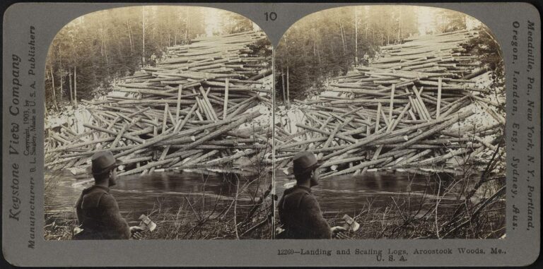
Photo: Boston Public Library, CC BY 2.0

Photo: David Wilson, CC BY 2.0
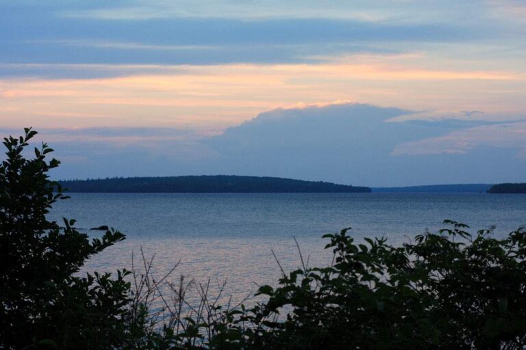
Photo: Dana Moos, CC BY-SA 2.0
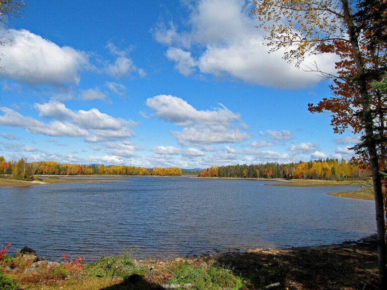
Photo: pfly, CC BY-SA 2.0
Fishing inside Penobscot County, Maine: the common asks
Where can I put a boat in the water in Maine's Penobscot County?
The table above already includes 46 ramps.
Which lake is the biggest in Maine's Penobscot County?
Millinocket Lake (Penobscot County) is the biggest, 8,578 acres.
What fish turn up on Maine water records in Penobscot County?
MDIFW lists white sucker on the most waters in the county, then yellow perch, chain pickerel and pumpkinseed sunfish; a listing shows presence, not a catch.
Where do Maine anglers in Penobscot County go for crankbaits and line?
5 entries, Bite Me Bait & Tackle included.
What Maine town serves Penobscot County as its seat?
Bangor is the seat.
What does a Maine fishing license cost for Penobscot County?
Anglers 16 and older need a Maine fishing license for inland waters; the MDIFW fee page prints $30 for a resident season license and $83 for a nonresident one, agent fees not included.
What Maine counties are closest to Penobscot County?
Ordered by distance: Piscataquis County, Washington County and Hancock County.
Which Maine law book limits govern the water of Penobscot County?
Limits come from the law book's statewide rows unless the water has its own entry, and an entry replaces the statewide limit for the fish it names; each lake and river page on this site prints its entry. The statewide MDIFW law pages, read on Nov. 18, 2026, supply every rule here; they carry no revision date, they cite the 2026 law book valid through Dec. 31, 2026, and no 2027 rule or fee is given.
Where do Penobscot County ponds with no page of their own show up?
This page lists the 821 waters names; a water without a page gets a row and pin.
Is stocking noted for waters in Maine's Penobscot County?
The MDIFW pages log 4 dated events for the county; the newest are in the stocking band above, and a count appears only where a source printed one.
A spruce-edge morning in Penobscot County
River pages list public access and the nearest USGS gauges.