South Fork Shenandoah River Fishing
River and creek fishing in Clarke County and 3 other localities.
 Pick for troutPiscifun Carbon X ultralight spinning reel28% OFFSale $57.99
Photo: crudmucosa, CC BY 2.0
The South Fork Shenandoah River, sized up for Virginia anglers
Look for the South Fork Shenandoah River, a river, in Clarke County and 3 other localities. The closest Census place is Shenandoah Farms, about 5 miles from the mapped point.
It has 15 access sites on DWR records. 3 USGS gauges measure it.
Virginia DWR waterbody pages, Stocked Trout Reaches and Cold Water Stream Survey layers and Boating Access Locations; USGS gauges; read November 6, 2026.
 For the trout herePiscifun Carbon XT ultralight spinning reel25% OFFSale $59.99
The South Fork Shenandoah River in the words of Virginia DWR
The South Fork Shenandoah River begins at the confluence of the North River and South River near Port Republic and flows north 97 miles to meet the North Fork Shenandoah at the Town of Front Royal. The South Fork Shenandoah watershed covers 1,650 square miles. Surface runoff from the western slope of the Blue Ridge Mountains, parts of the Allegheny Mountains, Massanutten Mountain, and ground water from the karst regions of the Shenandoah Valley and Page Valley make up the flow of the river.
DWR directions to South Fork Shenandoah River
Note: All float descriptions are based on normal river flow conditions. Difficulty and safety considerations may vary according to changes in water level and flow. Port Republic to Island Ford Distance: 10 miles A boat ramp was constructed by DWR at Port Republic at the confluence of the North River and South River.
For South Fork Shenandoah River, the block above is DWR text cut to whole sentences.
Virginia DWR waterbody page (updated 11/17/2023), read November 6, 2026.
Streamflow on the South Fork Shenandoah River today
| USGS gauge | Latest reading | Time (ET) |
|---|---|---|
| S F Shenandoah River Near Lynnwood, Va | 186 cfs, 2.24 ft gage height | Nov 8 6:45 pm |
| S F Shenandoah River Near Luray, Va | 324 cfs, 1.88 ft gage height | Nov 8 6:45 pm |
| S F Shenandoah River At Front Royal, Va | 354 cfs, 1.14 ft gage height | Nov 8 7:15 pm |
US Geological Survey provisional data, retrieved Nov 8, 2026 7:32 pm ET. Provisional readings can be revised.
USGS posts these South Fork Shenandoah River values live; they are provisional.
| USGS site | Name |
|---|---|
| 01628500 | S F SHENANDOAH RIVER NEAR LYNNWOOD, VA |
| 01629500 | S F SHENANDOAH RIVER NEAR LURAY, VA |
| 01631000 | S F SHENANDOAH RIVER AT FRONT ROYAL, VA |
USGS instantaneous values, provisional.
DWR-listed fish in the South Fork Shenandoah River
For South Fork Shenandoah River, the species follow DWR wording, not angler reports.
Virginia DWR waterbody page (updated 11/17/2023), read November 6, 2026.
Boating access along the South Fork Shenandoah River
| Site | Recorded attributes | Owner | Location (DWR) |
|---|---|---|---|
| Alma boat ramp on South Fork Shenandoah River | dock and ramp, freshwater | Page County | Rt 650 South of Alma (.5) |
| Bentonville boat ramp on South Fork Shenandoah River | gravel access, freshwater | DWR | From Bentonville, West on Rt 613 (1) |
| Berry's boat ramp on South Fork Shenandoah River | dock and ramp, 1 ramp, freshwater | VDOT | Rt 50 East of Rt 340 (5.5) |
| Elkton boat ramp on South Fork Shenandoah River | dock and ramp, freshwater | Town of Elkton | From Elkton, North on Rt 33 Business (.2) |
| Fosters boat ramp on South Fork Shenandoah River | concrete ramp (no ramp), 1 ramp, freshwater | DWR | From Luray, Rt 675 North (2.7); R on Rt R-684 (6) |
| Grove Hill boat ramp on South Fork Shenandoah River | gravel access, freshwater | DWR | From Shenandoah, Rt 340 North (2); R on Rt 650 (1.1) |
| Inskeep boat ramp on South Fork Shenandoah River | concrete ramp, freshwater | DWr | From Luray, Rt 684 North (2.5) at the Rt 675 Bridge |
| Island Ford boat ramp on South Fork Shenandoah River | gravel access, freshwater | VDOT | From Island Ford Rt. 340, W. Rt 649, Left Rt. 642, ramp on right |
| Karo boat ramp on South Fork Shenandoah River | gravel access, freshwater | DWR | From Front Royal, West on Rt 340 (5) at Karo |
| Massanutten boat ramp on South Fork Shenandoah River | dock and ramp, 1 ramp, freshwater | DWR | From Luray, Rt. 211 West (3.8); R on Rt 615 (2.8) |
| Newport boat ramp on South Fork Shenandoah River | dock and ramp, freshwater | DWR | Northeast on Rt 340 (7) of Shenandoah |
| Port Republic boat ramp on South Fork Shenandoah River | dock and ramp, freshwater | DWR | From Grottoes, Rt. 340 N.; W. Rt. 659, R. bef. river, Ramp on left. |
| Shenandoah Riverside boat ramp on South Fork Shenandoah River | hand launch (boat slide), 1 ramp, barrier-free, freshwater | Town of Shenandoah | Town of Shenandoah, Morrison Street |
| Simpson's boat ramp on South Fork Shenandoah River | concrete ramp (no dock), freshwater | Warren County | From Front Royal, West on Rt 340 (.3); R on Rt 619 (4.3); L on Rt 673 (.7); L on Rt 623 |
| White House boat ramp on South Fork Shenandoah River | dock and ramp, 1 ramp, freshwater | VDOT | From Luray, Rt 211 East (2.8); R on Rt 646 (.1) |
Neighbouring boat ramps around South Fork Shenandoah River
- Lockes boat ramp on Shenandoah RiverShenandoah River, 5 miles northeast
- Castleman's Ferry boat ramp on Shenandoah RiverShenandoah River, 8 miles northeast
- Lake Frederick boat rampLake Frederick, 8 miles west
- Morgan's Ford boat ramp on Shenandoah RiverShenandoah River, 9 miles southwest
- Riverton boat ramp on North Fork Shenandoah RiverNorth Fork Shenandoah River, 12 miles southwest
Virginia DWR Boating Access Locations layer (attributes as recorded; lanes, fees and hours are not in the layer), read November 6, 2026.
How many fish leave the South Fork Shenandoah River with you
| Species as printed | Applies to | Creel | Length |
|---|---|---|---|
| Largemouth, Smallmouth Bass | statewide | 5 per day in the aggregate (combined) | No statewide length limits |
| Alabama, Spotted Bass | statewide | No statewide daily limit | No statewide length limit |
| Landlocked Striped Bass and Landlocked Striped Bass X White Bass Hybrids | statewide | 4 per day in the aggregate | No fish less than 20 inches |
| Striped Bass | Anadromous (coastal) striped bass above the fall line in all coastal rivers of the Chesapeake Bay and Crane Lake (City of Suffolk) | Creel and length limits shall be as set by the Virginia Marine Resources Commission for recreational fishing in tidal waters | no length limit printed |
| Striped Bass | Striped bass in the Meherrin, Nottoway, Blackwater (Chowan Drainage), North Landing and Northwest rivers and their tributaries plus Back Bay | No possession | no length limit printed |
| Walleye, Saugeye | statewide | 5 per day in the aggregate | No walleye or saugeye less than 18 inches |
| Sauger | statewide | 2 per day | No statewide length limits |
| White Bass | statewide | 5 per day | No statewide length limits |
| Chain Pickerel and Northern Pike | statewide | 5 per day | No statewide length limits |
| Muskellunge | statewide | 1 per day | No muskellunge less than 40 inches |
| Bluegill (bream) and other sunfish excluding Crappie, Rock Bass (redeye) and Roanoke Bass | statewide | 50 per day in the aggregate (combined) | No statewide length limits |
| Crappie (black or white) | statewide | 25 per day in the aggregate (combined) | No statewide length limits |
| Rock Bass (redeye) | statewide | 25 per day in the aggregate with Roanoke bass | No statewide length limits |
| Roanoke Bass | statewide | 25 per day in the aggregate with rock bass | No statewide length limits |
| Perch (yellow and white) | statewide | No statewide daily limit | No statewide length limit |
| Trout | statewide | 6 per day | 7 inch minimum size |
| Channel, White, and Flathead | statewide | 20 per day | No length limits |
| Blue | statewide | 20 per day | No statewide length limits |
Start from the statewide table on South Fork Shenandoah River, then read any water line.
- From the confluence of the North and South Rivers in Port Republic to the confluence of the North Fork and South Fork Shenandoah in Front Royal.
- Black Bass (Smallmouth and Largemouth):
- 5 per day. No bass 11-14 inches can be harvested.
- Sunfish:
- 50 per day. No length limit
- Rock Bass:
- 25 per day. No length limit
- Crappie:
- 25 per day. No length limit
- Muskellunge:
- 1 per day. Minimum size 40 inches
- Channel Catfish:
- 20 per day. No length limit
- Flathead Catfish:
Virginia DWR waterbody page (updated 11/17/2023), read November 6, 2026.
Digest departures from statewide rows on South Fork Shenandoah River
| Water as printed | Species | Rule as printed |
|---|---|---|
| North Fork, South Fork and Mainstem Shenandoah River | Largemouth, Smallmouth Bass | No largemouth or smallmouth bass 11 to 14 inches |
Water-specific exceptions as printed, 2026 Freshwater Fishing in Virginia digest (eRegulations, linked from the Virginia DWR regulations page), read November 6, 2026.
A Virginia freshwater license is $23 a year for residents and $47 for nonresidents 16 and older.
Statewide creel and length limits as printed (page updated August 17, 2026), 2026 Freshwater Fishing in Virginia digest (eRegulations, linked from the Virginia DWR regulations page), read November 6, 2026. Virginia license fees in the 2026 Freshwater Fishing in Virginia digest (licenses run one year from purchase unless noted), read November 6, 2026.
Moving water around the South Fork Shenandoah River, in a table
| Stream | Distance | DWR access sites | USGS gauges | Stocked reaches |
|---|---|---|---|---|
| South Fork Shenandoah River | this stream | 15 | 3 | 0 |
| Shenandoah River | 5 miles northeast | 4 | 0 | 0 |
| Happy Creek | 12 miles southwest | 0 | 0 | 1 |
| Passage Creek | 17 miles west | 0 | 1 | 2 |
| Hogue Creek | 20 miles northwest | 0 | 1 | 1 |
| Peters Mill Run | 27 miles southwest | 0 | 0 | 1 |
Virginia DWR Boating Access Locations and Stocked Trout Reaches, USGS gauges; read November 6, 2026.
Close to South Fork Shenandoah River on the Commonwealth map
More Virginia lakes within reach of South Fork Shenandoah River
- Lake Thompson6 miles
- Lake Frederick9 miles
- Wilkins Lake12 miles
- Sleeter Lake14 miles
Stores with hooks, line and lures around South Fork Shenandoah River
- Sportsman's Warehouse, 190 Delco Plzsporting goods store, Winchester, 12 miles
- Jake's Bait & Tacklebait and tackle shop, Winchester, 15 miles
- Bridgewater Rod & Reelbait and tackle shop, Bridgewater
- Heartland Outfittersbait and tackle shop, Dayton
- Gregory's Lakeside Bait & Tacklebait and tackle shop, Front Royal
A bed and a breakfast counter near South Fork Shenandoah River
- Shenandoah Farms5 miles, Warren County
- Berryville7 miles, Clarke County
- Stephens City12 miles, Frederick County
Locality pages that take in South Fork Shenandoah River
- Clarke Countycounty seat Berryville
- Page Countycounty seat Luray
- Rockingham Countycounty seat Harrisonburg
- Warren Countycounty seat Front Royal
Other Commonwealth streams by the South Fork Shenandoah River
- Shenandoah River5 miles
- Happy Creek12 miles
- Passage Creek17 miles
- Hogue Creek20 miles
- Peters Mill Run27 miles
Piscifun tackle that suits South Fork Shenandoah River


Piscifun and Amazon links are affiliate links; the site earns a commission on qualifying purchases.
Commonwealth fish worth recognizing at South Fork Shenandoah River
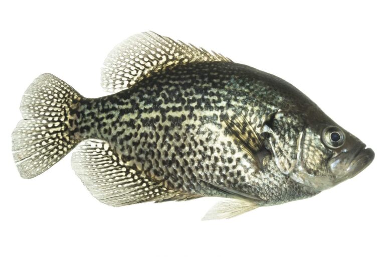
Photo: USFWS Mountain-Prairie, Public domain
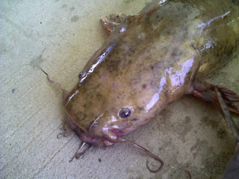
Photo: ted_rocket, CC BY-SA 2.0
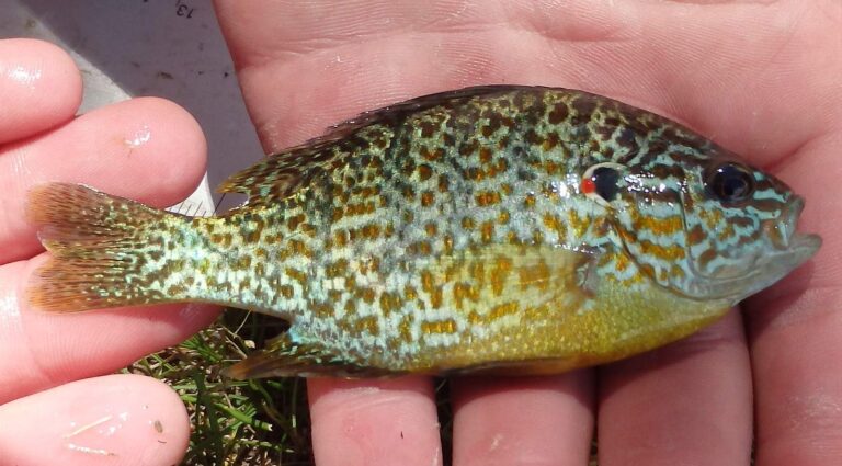
Photo: USFWS Mountain-Prairie, Public domain
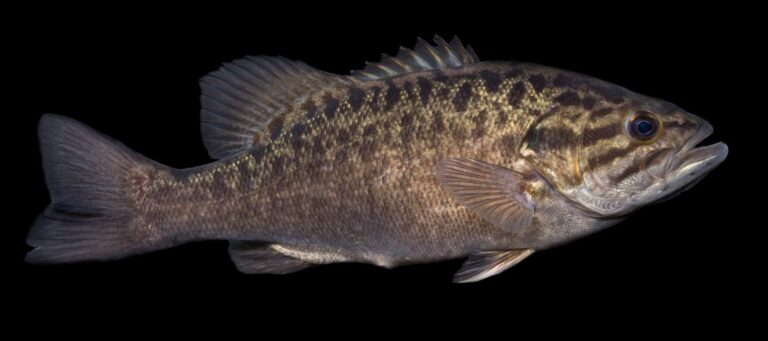
Photo: USFWS Mountain-Prairie, Public domain
The South Fork Shenandoah River, asked and answered for Virginia anglers
Which localities does the South Fork Shenandoah River cross?
Our records put it in Clarke County and 3 other localities, about 5 miles from Shenandoah Farms.
Where can I put a boat into the South Fork Shenandoah River?
15 access sites are on the DWR list, including Alma boat ramp on South Fork Shenandoah River.
What swims in the South Fork Shenandoah River?
The DWR list includes black crappie, bluegill, bullhead, common carp, channel catfish, crappie and flathead catfish.
When is the South Fork Shenandoah River stocked?
No DWR trout stocking or wild trout reach is listed for it.
Is there a length limit on smallmouth in the South Fork Shenandoah River?
The statewide digest row for largemouth and smallmouth bass reads: 5 per day in the aggregate (combined); No statewide length limits. The limits band adds its exception.
Can visitors fish the South Fork Shenandoah River?
A Virginia freshwater license is $23 a year for residents and $47 for nonresidents 16 and older. Under-16 anglers are exempt.
What is the South Fork Shenandoah River running at on the USGS gauge?
See 3 USGS gauges above, live.
Which Virginia bait counter sits closest to the South Fork Shenandoah River?
Nearest in our list: Sportsman's Warehouse (about 12 miles away).
Spend a cool Blue Ridge morning on the South Fork Shenandoah River
Buy the license online first.