Shenandoah River Fishing
Moving water in Clarke and Warren counties.
 Pick for troutPiscifun Carbon X ultralight spinning reel28% OFFSale $57.99
Photo of Winchester: m01229, CC BY 2.0
First notes on the Shenandoah River
Clarke and Warren counties carries the Shenandoah River, a river. Budget about 3 miles of driving to Berryville.
DWR maps 4 access sites along its banks.
Virginia DWR waterbody pages, Stocked Trout Reaches and Cold Water Stream Survey layers and Boating Access Locations; USGS gauges; read November 6, 2026.
 For the trout herePiscifun Carbon XT ultralight spinning reel25% OFFSale $59.99
The DWR description of the Shenandoah River
The Main Stem Shenandoah River is formed when the North Fork and South Fork converge at Front Royal, Virginia. The Shenandoah flows for 57 miles until it empties into the Potomac River at Harpers Ferry, West Virginia. The section of the Shenandoah which will be discussed is the 35 miles of river that lies within the state of Virginia. The section of the Shenandoah flowing through Clarke County is designated as a state scenic river.
Access notes DWR gives for Shenandoah River
Riverton to Morgan’s Ford Distance: 13 miles Put in at DWR ramp located off of Rt. 340 beside the bridge over the North Fork in Front Royal. Takeout at DWR ramp at Morgan’s Ford on the right by the low-water bridge (Rt. 642). This section of the river is slow-moving and deep, producing quality catfish, bluegill, largemouth bass and carp fishing. A dam four miles downstream requires a portage.
The quoted passages are Virginia DWR wording about Shenandoah River, unedited.
Virginia DWR waterbody page (updated 11/17/2023), read November 6, 2026.
Fish DWR names on the Shenandoah River
Fish listed for Shenandoah River come from DWR pages, trout layers, the stocking schedule or the record list; this is not a catch report.
Virginia DWR waterbody page (updated 11/17/2023), read November 6, 2026.
DWR access points along the Shenandoah River
| Site | Recorded attributes | Owner | Location (DWR) |
|---|---|---|---|
| Castleman's Ferry boat ramp on Shenandoah River | concrete ramp (no dock), 1 ramp, freshwater | VDOT | From Berryville East on Rt 7; R on Rt 606 |
| Front Royal boat ramp on Shenandoah River | concrete ramp (no dock), freshwater | DWR | Front Royal on Luray Avenue |
| Lockes boat ramp on Shenandoah River | concrete ramp (no dock), 1 ramp, freshwater | DWR | From Berryville, East on Rt 7 (3);R on Rt 621 (8.4) |
| Morgan's Ford boat ramp on Shenandoah River | gravel access, freshwater | DWR | From Front Royal, East on 6th. Street to Rt 624 (3) |
Alternate DWR ramps when Shenandoah River overflows
- Berry's boat ramp on South Fork Shenandoah RiverSouth Fork Shenandoah River, 5 miles southwest
- Lake Frederick boat rampLake Frederick, 11 miles west
Virginia DWR Boating Access Locations layer (attributes as recorded; lanes, fees and hours are not in the layer), read November 6, 2026.
Virginia limits in force on the Shenandoah River
| Species as printed | Applies to | Creel | Length |
|---|---|---|---|
| Largemouth, Smallmouth Bass | statewide | 5 per day in the aggregate (combined) | No statewide length limits |
| Alabama, Spotted Bass | statewide | No statewide daily limit | No statewide length limit |
| Landlocked Striped Bass and Landlocked Striped Bass X White Bass Hybrids | statewide | 4 per day in the aggregate | No fish less than 20 inches |
| Striped Bass | Anadromous (coastal) striped bass above the fall line in all coastal rivers of the Chesapeake Bay and Crane Lake (City of Suffolk) | Creel and length limits shall be as set by the Virginia Marine Resources Commission for recreational fishing in tidal waters | no length limit printed |
| Striped Bass | Striped bass in the Meherrin, Nottoway, Blackwater (Chowan Drainage), North Landing and Northwest rivers and their tributaries plus Back Bay | No possession | no length limit printed |
| Walleye, Saugeye | statewide | 5 per day in the aggregate | No walleye or saugeye less than 18 inches |
| Sauger | statewide | 2 per day | No statewide length limits |
| White Bass | statewide | 5 per day | No statewide length limits |
| Chain Pickerel and Northern Pike | statewide | 5 per day | No statewide length limits |
| Muskellunge | statewide | 1 per day | No muskellunge less than 40 inches |
| Bluegill (bream) and other sunfish excluding Crappie, Rock Bass (redeye) and Roanoke Bass | statewide | 50 per day in the aggregate (combined) | No statewide length limits |
| Crappie (black or white) | statewide | 25 per day in the aggregate (combined) | No statewide length limits |
| Rock Bass (redeye) | statewide | 25 per day in the aggregate with Roanoke bass | No statewide length limits |
| Roanoke Bass | statewide | 25 per day in the aggregate with rock bass | No statewide length limits |
| Perch (yellow and white) | statewide | No statewide daily limit | No statewide length limit |
| Trout | statewide | 6 per day | 7 inch minimum size |
| Channel, White, and Flathead | statewide | 20 per day | No length limits |
| Blue | statewide | 20 per day | No statewide length limits |
An exception for Shenandoah River would override the row above.
- From the confluence with the North Fork and the South Fork Shenandoah Rivers to the Virginia / West Virginia State Line.
- Black Bass (Smallmouth and Largemouth):
- 5 per day. No bass 11-14 inches can be harvested.
- Sunfish:
- 50 per day. No length limit
- Rock Bass:
- 25 per day. No length limit
- Crappie:
- 25 per day. No length limit
- Walleye:
- 5 per day. Minimum size 18 inches
- Muskellunge:
- 1 per day. Minimum size 40 inches
- Channel catfish:
Virginia DWR waterbody page (updated 11/17/2023), read November 6, 2026.
Water-specific limits for Shenandoah River
| Water as printed | Species | Rule as printed |
|---|---|---|
| North Fork, South Fork and Mainstem Shenandoah River | Largemouth, Smallmouth Bass | No largemouth or smallmouth bass 11 to 14 inches |
Water-specific exceptions as printed, 2026 Freshwater Fishing in Virginia digest (eRegulations, linked from the Virginia DWR regulations page), read November 6, 2026.
A Virginia freshwater license is $23 a year for residents and $47 for nonresidents 16 and older.
Statewide creel and length limits as printed (page updated August 17, 2026), 2026 Freshwater Fishing in Virginia digest (eRegulations, linked from the Virginia DWR regulations page), read November 6, 2026. Virginia license fees in the 2026 Freshwater Fishing in Virginia digest (licenses run one year from purchase unless noted), read November 6, 2026.
The Shenandoah River and its closest Virginia neighbours
| Stream | Distance | DWR access sites | USGS gauges | Stocked reaches |
|---|---|---|---|---|
| Shenandoah River | this stream | 4 | 0 | 0 |
| South Fork Shenandoah River | 5 miles southwest | 15 | 3 | 0 |
| Happy Creek | 17 miles southwest | 0 | 0 | 1 |
| Hogue Creek | 19 miles northwest | 0 | 1 | 1 |
| Passage Creek | 21 miles southwest | 0 | 1 | 2 |
| Paddy Run | 30 miles west | 0 | 0 | 1 |
Virginia DWR Boating Access Locations and Stocked Trout Reaches, USGS gauges; read November 6, 2026.
Within a tank of gas of Shenandoah River
Lakes in the same corner of Virginia as Shenandoah River
- Lake Thompson10 miles
- Sleeter Lake11 miles
- Lake Frederick11 miles
- Wilkins Lake11 miles
Picking up minnows and bloodworms near Shenandoah River
- Sportsman's Warehouse, 190 Delco Plzsporting goods store, Winchester, 11 miles
- Jake's Bait & Tacklebait and tackle shop, Winchester, 13 miles
- Gregory's Lakeside Bait & Tacklebait and tackle shop, Front Royal
Old Dominion towns a quick hop from Shenandoah River
- Berryville3 miles, Clarke County
- Shenandoah Farms10 miles, Warren County
- Winchester12 miles, City of Winchester
County and city guides tied to Shenandoah River
- Clarke Countycounty seat Berryville
- Warren Countycounty seat Front Royal
Virginia rivers neighbouring the Shenandoah River
- South Fork Shenandoah River5 miles
- Happy Creek17 miles
- Hogue Creek19 miles
- Passage Creek21 miles
- Paddy Run30 miles
Piscifun kit lined up for a day on Shenandoah River


Piscifun and Amazon links are affiliate links; the site earns a commission on qualifying purchases.
Old Dominion water near Shenandoah River, on camera
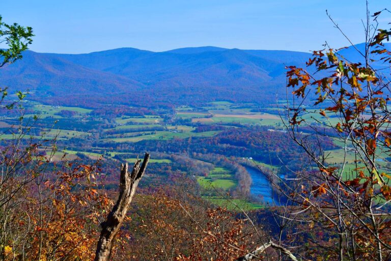
Photo: crudmucosa, CC BY 2.0
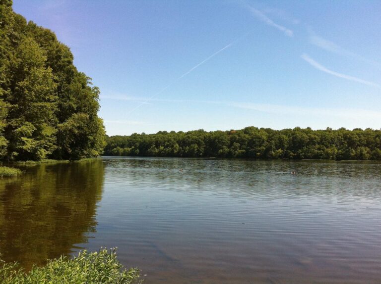
Photo: Blake Patterson, CC BY 2.0
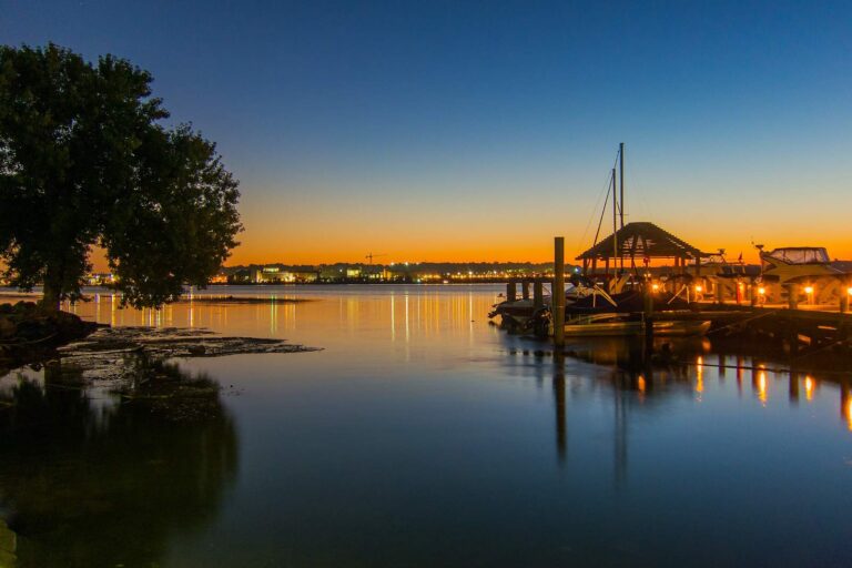
Photo: Mark Fischer, CC BY-SA 2.0
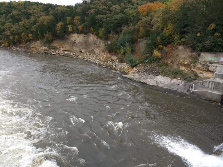
Photo: Wilbur Ince, CC BY 2.0
Straight replies on the Shenandoah River from the Virginia rule books
What town is near the Shenandoah River?
It runs through Clarke and Warren counties, about 3 miles from Berryville.
Can I launch a canoe on the Shenandoah River?
Use Castleman's Ferry boat ramp on Shenandoah River or another of 4 access sites.
Does DWR name smallmouth bass for the Shenandoah River?
DWR lists black crappie, bluegill, bullhead, common carp, channel catfish, crappie and flathead catfish.
Does DWR stock trout in the Shenandoah River?
No trout data for it in DWR layers.
How many black bass may leave the Shenandoah River in a Virginia cooler?
The statewide digest row for largemouth and smallmouth bass reads: 5 per day in the aggregate (combined); No statewide length limits. Its own digest line may change that.
Does a teenager need a DWR license on the Shenandoah River?
A Virginia freshwater license is $23 a year for residents and $47 for nonresidents 16 and older. Youth under 16 are exempt.
Is the Shenandoah River too high to float?
No USGS gauge is matched to it; check the state water levels page.
Where do anglers fishing the Shenandoah River buy tackle?
Our list starts with Sportsman's Warehouse (about 11 miles away).
Float a Commonwealth stretch of the Shenandoah River
Licenses, trout rules and exceptions sit on the regulations page.