Utah Shore Fishing Access
DWR shore access points and fishing piers on Utah waters, county by county.
 Angler pickPiscifun Viper X spinning reel50% OFFSale $39.99
Photo of Flaming Gorge Reservoir: Ken Lund, CC BY-SA 2.0
Utah shore and pier access from DWR
DWR lists shore access points and fishing piers on the Fish Utah page of each water. 157 of them have a page here, 6 of them piers, in 22 counties. Many DWR points have no map position, so their pages use the water’s location for directions.
Amenities are printed as DWR lists them; nothing is added.
the DWR Fish Utah access list, read November 11, 2026.
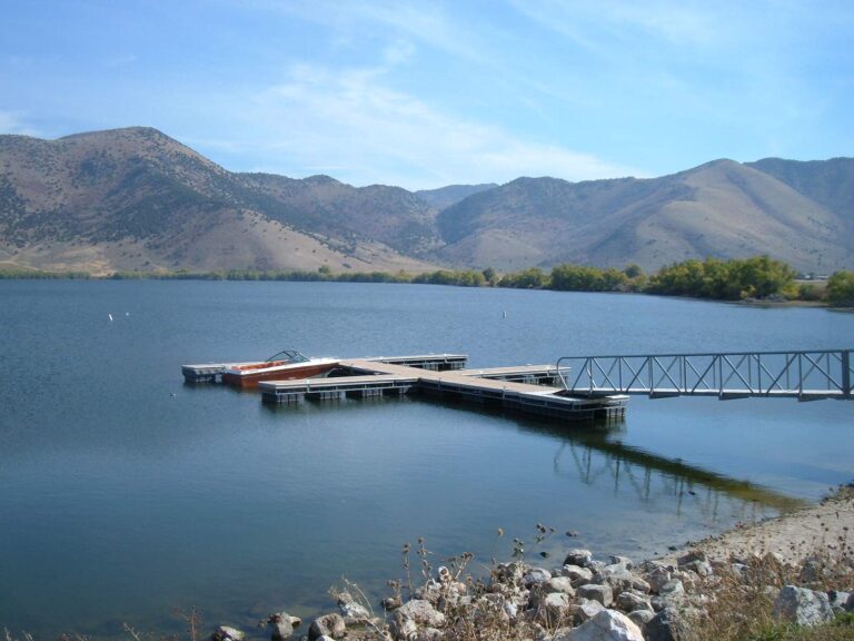
Photo of Mantua Reservoir: Christopher Eugene Lee, Public domain
Utah shore fishing sites county by county
Beaver County
- Little Cottonwood Campgroundshore access, Beaver River, Upper
- Little Reservoirfishing pier, Tushar (Beaver) Mountain Lakes
- Mahogany Cove Campgroundshore access, Beaver River, Upper
- Merchant Valley Reservoirshore access, Tushar (Beaver) Mountain Lakes
- Ponderosa Picnic Areafishing pier, Beaver River, Upper
Box Elder County
- Freeway Bayshore access, Willard Bay Reservoir
- Northwest Cornershore access, Willard Bay Reservoir
- Southwest Cornershore access, Willard Bay Reservoir
Cache County
- Chokecherry Picnic Areashore access, Logan River
- Franklin Basin Road Bridgeshore access, Logan River
- Green Canyonshore access, Blacksmith Fork River
- Lower Twin Bridgeshore access, Logan River
- Mouth of Blacksmith Fork Canyoshore access, Blacksmith Fork River
- Old Reservoir Accessshore access, Blacksmith Fork River
- Red Banks Campgroundshore access, Logan River
- Reservoir Accessshore access, Blacksmith Fork River
- Temple Forkshore access, Logan River
- USU Forestry Field Statioshore access, Logan River
- Wapiti Camping Areashore access, Blacksmith Fork River
- Wood Camp Campgroundshore access, Logan River
Carbon County
- Ivy Street access and walking trailheadshore access, Price River
- Lower Fish Creek damshore access, Lower Fish Creek
- Lower Fish Creek roadshore access, Lower Fish Creek
- Parking Areafishing pier, Gigliotti Pond
- Parking Areafishing pier, Knight-Ideal Pond
- Restroom and fish cleaning stationshore access, Carbon County Community Fishing Pond
Daggett County
- Boar's Tusk Boat Campshore access, Flaming Gorge Reservoir
- Hideoutshore access, Flaming Gorge Reservoir
- Jarvies Boat Campshore access, Flaming Gorge Reservoir
- Kingfisher Islandshore access, Flaming Gorge Reservoir
Duchesne County
- Duchesne River #1shore access, Duchesne River, Hanna Upstream to North Fork Duchesne River Confluence
- Duchesne River #2shore access, Duchesne River, Hanna Upstream to North Fork Duchesne River Confluence
- Duchesne River #3shore access, Duchesne River, Hanna Upstream to North Fork Duchesne River Confluence
- Duchesne River #4shore access, Duchesne River, Hanna Upstream to North Fork Duchesne River Confluence
- Duchesne River #5shore access, Duchesne River, Hanna Upstream to North Fork Duchesne River Confluence
- Duchesne River #6shore access, Duchesne River, Hanna Upstream to North Fork Duchesne River Confluence
- Primitive rampshore access, Lake Canyon Lake
- West Fork Duchesne River #1shore access, Duchesne River, West Fork, Downstream of Wolf Creek
- West Fork Duchesne River #2shore access, Duchesne River, West Fork, Downstream of Wolf Creek
- West Fork Duchesne River #3shore access, Duchesne River, West Fork, Upstream of Wolf Creek
Emery County
- Bear Creek Campgroundshore access, Huntington Creek
- Bridges campgroundshore access, Huntington Creek, Right Fork
- Fee areashore access, Huntington Creek, Right Fork
- Forest service campgroundshore access, Cleveland Reservoir
- Little Bear Campgroundshore access, Huntington Creek
- Old Folks Flatshore access, Huntington Creek, Right Fork
- Parking area (west side)shore access, Huntington North Reservoir
- Potters Pond Campgroundshore access, Potters Ponds
- Primitive Campground 1shore access, Huntington Creek
- Pull-off 1shore access, Huntington Creek
- South Hughes Groupshore access, Huntington Creek, Right Fork
- Staker Canyon Trailheadshore access, Huntington Creek, Left Fork
- The Forks Campgroundshore access, Huntington Creek, Right Fork
- The Forks Campground (Left Fork)shore access, Huntington Creek, Left Fork
- Turnout 1shore access, Huntington Creek, Right Fork
- Turnout 2shore access, Huntington Creek, Right Fork
- Turnout 3shore access, Huntington Creek, Right Fork
Garfield County
- Black Canyon WMA pull-out #1shore access, East Fork Sevier River, Black Canyon
- Black Canyon WMA pull-out #2shore access, East Fork Sevier River, Black Canyon
- Black Canyon WMA pull-out #3shore access, East Fork Sevier River, Black Canyon
- Black Canyon pull-out #4shore access, East Fork Sevier River, Black Canyon
- Panguitch Lake North Campgroundshore access, Panguitch Lake
- Panguitch Lake South Campgroundshore access, Panguitch Lake
- Pine Lake Recreation Areashore access, Pine Lake
Iron County
- Paragonah Reservoir Damshore access, Paragonah (Red Creek) Reservoir
Kane County
- Dangling Ropeshore access, Lake Powell
- Duck Creek Campgroundshore access, Duck Creek Pond / Aspen Mirror Lake
- Navajo Lake Loop Trail – East Trailheadshore access, Navajo Lake
- Navajo Lake Loop Trail – North Shore Trailheadshore access, Navajo Lake
- Podunk Guard Stationshore access, East Fork Sevier River, Upper
- Spruces Campgroundshore access, Navajo Lake
- Stanton Creekshore access, Lake Powell
- Te-Ah Campgroundshore access, Navajo Lake
Millard County
- Adelaide Campgroundshore access, Millard County Streams
- Copley's Cove Picnic Siteshore access, Millard County Streams
- Maple Grove Campgroundshore access, Millard County Streams
- Oak Creek Campgroundshore access, Millard County Streams
- Pistol Rock Picnic Siteshore access, Millard County Streams
- Shingle Mill Picnic Siteshore access, Millard County Streams
Morgan County
- Taylor Hollow Fishing Accessshore access, East Canyon Reservoir
- Weber River at Petersonshore access, Weber River
Piute County
- Pull-off #1shore access, East Fork Sevier River, Kingston Canyon
- Pull-off #2shore access, East Fork Sevier River, Kingston Canyon
- Pull-off #3shore access, East Fork Sevier River, Kingston Canyon
- Pull-off #4shore access, East Fork Sevier River, Kingston Canyon
San Juan County
- Kens Lake campgroundshore access, Kens Lake
Sanpete County
- Eagle View (Boat Access Only Campground)shore access, Yuba Reservoir & State Park
- Ferron reservoir campgroundshore access, Ferron Reservoir
- Fishing piersfishing pier, Duck Fork Reservoir
- Forest Service campground (Fee area)shore access, Willow Lake
- Gravel parking areasshore access, Petes Hole Reservoir
- Parking areashore access, Wrigley Springs Reservoir
- Primitive Campgroundshore access, Boulger Reservoir
- Upstream pull-offshore access, Huntington (Mammoth) Reservoir
- Wooden Boardwalkshore access, Benches Pond
Sevier County
- "Bowery" Pull-outshore access, Fish Lake
- Bowery Creek Campgroundshore access, Fish Lake
- Doctor Creek Campgroundshore access, Fish Lake
- Fremont Indian State Parkshore access, Clear Creek
- Frying Pan Campgroundshore access, Fish Lake
- Mackinaw Campgroundshore access, Fish Lake
- Mamoit Springshore access, Upper Fremont River
- Mill Meadow parking areashore access, Upper Fremont River
- Paiute Campgroundshore access, Johnson Reservoir
- Pole Canyonshore access, Upper Fremont River
- Pullout # 1shore access, Upper Fremont River
- Pullout # 2shore access, Upper Fremont River
- Twin Creeks Day-use Areashore access, Fish Lake
Uintah County
- BLM Rampshore access, Pelican Lake
- Highway 191 pull-offshore access, Steinaker Reservoir
- Main Rampshore access, Red Fleet Reservoir
- North Side Access Point Primitiveshore access, Brough Reservoir
- UDWR Sportsman Accessshore access, Pelican Lake
Utah County
- Eagle Parkshore access, Utah Lake
- Frazier Pull-offshore access, Provo River, Lower, Olmstead Diversion Dam upstream to Deer Creek Dam
- Hobble Creek WMAshore access, Utah Lake
- Inlet Parkshore access, Utah Lake
- Loch Lomond Parkshore access, Utah Lake
- Vineyard Beachshore access, Utah Lake
Wasatch County
- Chicken Creek Westshore access, Strawberry Reservoir
- Deer Creek Parkshore access, Provo River, Lower, Olmstead Diversion Dam upstream to Deer Creek Dam
- Deer Creek Trailshore access, Deer Creek Reservoir
- Haws Pointshore access, Strawberry Reservoir
- Jordanelleshore access, Provo River, Middle, Legacy Bridge (SR-113) upstream to Jordanelle Dam
- Legacy Bridge (Midway Lane North)shore access, Provo River, Middle, Legacy Bridge (SR-113) upstream to Jordanelle Dam
- Mosquito Bayshore access, Strawberry Reservoir
- Primitive Pull-off 2shore access, Provo River, Lower, Olmstead Diversion Dam upstream to Deer Creek Dam
- Rainbow Bay Day-Useshore access, Deer Creek Reservoir
- River Road Northshore access, Provo River, Middle, Legacy Bridge (SR-113) upstream to Jordanelle Dam
- River Road Southshore access, Provo River, Middle, Legacy Bridge (SR-113) upstream to Jordanelle Dam
- US-189 Northeast Cornershore access, Deer Creek Reservoir
- Wallsburg Bay Walk-Inshore access, Deer Creek Reservoir
- West Fork Duchesne River #4shore access, Duchesne River, West Fork, Upstream of Wolf Creek
- White Bridge or Cottonwoodshore access, Provo River, Middle, Legacy Bridge (SR-113) upstream to Jordanelle Dam
Washington County
- Baker Dam Campgroundshore access, Baker Reservoir
- Honeycomb Rocks Campgroundshore access, Enterprise Reservoirs
- Pine Valley Recreation Areafishing pier, Pine Valley Reservoir
Wayne County
- Deep Creek Lakeshore access, Thousand Lake Mountain
- Deep Creek Lake/Grass Lake Trailheadshore access, Thousand Lake Mountain
- Elkhorn Campgroundshore access, Thousand Lake Mountain
- Grass Lakeshore access, Thousand Lake Mountain
Weber County
- 12th Streetshore access, Ogden River
- Botts Campgroundshore access, Ogden River, South Fork
- Browning Pointshore access, Pineview Reservoir
- Magpie campgroundshore access, Ogden River, South Fork
- Meadows Campgroundshore access, Ogden River, South Fork
- Memorial Parkshore access, Ogden River, South Fork
- Memorial Park Campgroundshore access, Ogden River, South Fork
- Monroe Blvdshore access, Ogden River
- Narrowsshore access, Pineview Reservoir
- SR 39 pull-outshore access, Ogden River, South Fork
- Skull Crack Accessshore access, Causey Reservoir
- South Arm Accessshore access, Causey Reservoir
- South Fork Campgroundshore access, Ogden River, South Fork
- Wall Avenueshore access, Ogden River
- Washington Blvdshore access, Ogden River
- Wheat Grass Canyon Accessshore access, Causey Reservoir
the DWR Fish Utah access list, read November 11, 2026.
Utah shore sites with a mapped point
Utah shore fishing, answered
How many Utah shore fishing sites are listed?
157 DWR shore and pier points with pages.
How many are fishing piers?
6.
Which water has the most shore sites?
Huntington Creek, Right Fork, with 8.
Why do some sites lack a map pin?
DWR publishes no coordinates for many access points; directions then use the water’s point.
Are restrooms listed?
Where DWR lists them among the amenities.
Does bank fishing in Utah need a license?
Yes, from age 12, except on Free Fishing Day.
Are fees listed?
Only where DWR mentions one in its access text.
Where are boat launches?
Launch points have their own Utah directory, sorted by county.