Fishing in Duchesne County, Utah
County seat: Duchesne. Census 2020 residents: 19,596.
- 5lake pages
- 5launches
- 3river pages
 Pick for troutPiscifun Carbon X ultralight spinning reel28% OFFSale $57.99
Photo of Duchesne River: Ken Lund, CC BY-SA 2.0
Duchesne County: the Utah short version
Duchesne County keeps its county offices in Duchesne, and the 2020 Census found 19,596 people across the county. Census Gazetteer figures give it 3,236 square miles of land and 15 square miles of water. The county has 5 Utah lakes and reservoirs with pages, and the largest is Starvation Reservoir. The Blue Ribbon list includes Starvation Reservoir, Lake Canyon Lake and Lower Stillwater Ponds in this county.
County totals: 5 launches from the launch layers and 31 shore or pier points from DWR. The county's DWR stream reaches include Duchesne River (Hanna to the North Fork), West Fork Duchesne River below Wolf Creek and Big Sand Wash. DWR's 2026 stocking table shows 233 stocking rows in the county, 636,427 fish across 110 waters.
U.S. Census Bureau, 2020 Census counts (TIGERweb) and the 2023 Gazetteer, read November 11, 2026. UGRC Boat Ramps layer (ArcGIS service) and the DWR Fish Utah access list, read November 11, 2026.
A Beehive State water map of Duchesne County
UGRC Boat Ramps layer (ArcGIS service) and the DWR Fish Utah access list, read November 11, 2026. Lake pins are the DWR map point for each water.
Reservoirs and ponds in Duchesne County, Utah
| Lake | Size | Launches | Status | DWR lists |
|---|---|---|---|---|
| Starvation Reservoir | 3310 | 2 | Blue Ribbon fishery | brown trout, rainbow trout, walleye, yellow perch |
| Moon Lake | about 768 acres of mapped outline | 0 | natural lake | brook trout, mountain whitefish, rainbow trout, splake, walleye |
| Red Creek Reservoir | 142 | 0 | reservoir | rainbow trout, bonneville cutthroat trout |
| Lake Canyon Lake | no DWR figure | 1 | Blue Ribbon fishery | colorado River cutthroat trout, tiger trout, bonneville cutthroat trout |
| Lower Stillwater Ponds | Various | 0 | Blue Ribbon fishery | brook trout, brown trout, rainbow trout, tiger trout, bonneville cutthroat trout |
Size as the DWR Fish Utah page for this water prints it (DWR), read November 11, 2026. Waters with no DWR acreage print their mapped outline instead. Utah DWR Fish Utah planner (dwrapps.utah.gov), read November 11, 2026.
 For the trout herePiscifun Carbon XT ultralight spinning reel25% OFFSale $59.99
Fish DWR rates most often around Duchesne County
Lake lists inside 40 miles of Duchesne name rainbow trout as likely or possible most often.
DWR Fish Utah species lists (likely or possible), counted per lake page within 40 miles; DWR’s ratings, not a catch survey. Utah DWR Fish Utah planner (dwrapps.utah.gov), read November 11, 2026.
Wasatch-style high lake areas of Duchesne County
- Uinta Mountains, Dry Gulchbrook trout, colorado River cutthroat trout, rainbow trout, bonneville cutthroat trout, 40 recent stocking rows
- Uinta Mountains, Duchesne Riverbrook trout, bonneville cutthroat trout, grayling Arctic, rainbow trout, 40 recent stocking rows
- Uinta Mountains, Lake Forkbrook trout, colorado River cutthroat trout, bonneville cutthroat trout, grayling Arctic, 40 recent stocking rows
- Uinta Mountains, Rock Creekbrook trout, colorado River cutthroat trout, bonneville cutthroat trout, grayling Arctic, 40 recent stocking rows
- Uinta Mountains, Uinta Riverbrook trout, colorado River cutthroat trout, bonneville cutthroat trout, grayling Arctic, tiger trout, 40 recent stocking rows
- Uinta Mountains, Whiterocksbrook trout, colorado River cutthroat trout, bonneville cutthroat trout, grayling Arctic, rainbow trout, muskie Tiger, 40 recent stocking rows
- Uinta Mountains, Yellowstone/Swift Creekbrook trout, colorado River cutthroat trout, bonneville cutthroat trout, grayling Arctic, muskie Tiger, 40 recent stocking rows
Utah DWR Fish Utah planner (dwrapps.utah.gov), read November 11, 2026.
Named Utah ponds of Duchesne County still missing a write-up
DWR and the UGRC lakes layer name 120 more waters in Duchesne County without enough published facts for a page of their own.
| Water | Size | Listed by |
|---|---|---|
| Strawberry River, Starvation Reservoir through Duchesne | about 2,742 acres of mapped outline | DWR Fish Utah |
| Big Sand Wash Reservoir | about 577 acres of mapped outline | UGRC lakes layer |
| Lake Boreham | about 405 acres of mapped outline | UGRC lakes layer |
| Upper Stillwater Reservoir | about 294 acres of mapped outline | UGRC lakes layer |
| Lake Atwood | about 206 acres of mapped outline | UGRC lakes layer |
| Kidney Lake | about 189 acres of mapped outline | UGRC lakes layer |
| Grandaddy Lake | about 168 acres of mapped outline | UGRC lakes layer |
| Browns Draw Reservoir | about 151 acres of mapped outline | UGRC lakes layer |
| Chepeta Lake | about 140 acres of mapped outline | UGRC lakes layer |
| Cedar View Reservoir | about 90 acres of mapped outline | UGRC lakes layer |
| Fox Lake | about 88 acres of mapped outline | UGRC lakes layer |
| Pine Island Lake | about 82 acres of mapped outline | UGRC lakes layer |
| Five Point Lake | about 82 acres of mapped outline | UGRC lakes layer |
| Clement Lake | about 72 acres of mapped outline | UGRC lakes layer |
| Island Lake | about 66 acres of mapped outline | UGRC lakes layer |
| Cliff Lake | about 61 acres of mapped outline | UGRC lakes layer |
| Lower Chain Lake | about 60 acres of mapped outline | UGRC lakes layer |
| Queant Lake | about 55 acres of mapped outline | UGRC lakes layer |
| Upper Chain Lake | about 49 acres of mapped outline | UGRC lakes layer |
| Farmers Lake | about 48 acres of mapped outline | UGRC lakes layer |
| Mohawk Lake | about 47 acres of mapped outline | UGRC lakes layer |
| Pinto Lake | about 46 acres of mapped outline | UGRC lakes layer |
| Doll Lake | about 44 acres of mapped outline | UGRC lakes layer |
| East Timothy Lake | about 42 acres of mapped outline | UGRC lakes layer |
| Bluebell Lake | about 38 acres of mapped outline | UGRC lakes layer |
| West Timothy Lake | about 37 acres of mapped outline | UGRC lakes layer |
| Superior Lake | about 36 acres of mapped outline | UGRC lakes layer |
| Rainbow Lake | about 35 acres of mapped outline | UGRC lakes layer |
| Upper Rock Lake | about 34 acres of mapped outline | UGRC lakes layer |
| Betsy Lake | about 33 acres of mapped outline | UGRC lakes layer |
| Allred Lake | about 32 acres of mapped outline | UGRC lakes layer |
| Carrol Lake | about 32 acres of mapped outline | UGRC lakes layer |
| Governor Dern Lake | about 32 acres of mapped outline | UGRC lakes layer |
| Brown Duck Lake | about 32 acres of mapped outline | UGRC lakes layer |
| Atwine Lake | about 32 acres of mapped outline | UGRC lakes layer |
| Fish Hatchery Lake | about 30 acres of mapped outline | UGRC lakes layer |
| Crescent Lake | about 30 acres of mapped outline | UGRC lakes layer |
| Pole Creek Lake | about 29 acres of mapped outline | UGRC lakes layer |
| Crater Lake | about 29 acres of mapped outline | UGRC lakes layer |
| Upper Carroll Lake | about 29 acres of mapped outline | UGRC lakes layer |
| Grant Hansen Reservoir Number Three | about 26 acres of mapped outline | UGRC lakes layer |
| Elbow Lake | about 25 acres of mapped outline | UGRC lakes layer |
| Powell Lake | about 25 acres of mapped outline | UGRC lakes layer |
| Palisade Lake | about 24 acres of mapped outline | UGRC lakes layer |
| Rudolph Lake | about 24 acres of mapped outline | UGRC lakes layer |
| Dean Lake | about 23 acres of mapped outline | UGRC lakes layer |
| Daynes Lake | about 23 acres of mapped outline | UGRC lakes layer |
| Jordan Lake | about 23 acres of mapped outline | UGRC lakes layer |
| Jean Lake | about 22 acres of mapped outline | UGRC lakes layer |
| Roberts Lake | about 22 acres of mapped outline | UGRC lakes layer |
| Water Lily Lake | about 22 acres of mapped outline | UGRC lakes layer |
| Taylor Lake | about 22 acres of mapped outline | UGRC lakes layer |
| Cleveland Lake | about 22 acres of mapped outline | UGRC lakes layer |
| Kidney Lakes | about 22 acres of mapped outline | UGRC lakes layer |
| Horseshoe Lake | about 22 acres of mapped outline | UGRC lakes layer |
| Thompson Lake | about 22 acres of mapped outline | UGRC lakes layer |
| Tworoose Lake | about 22 acres of mapped outline | UGRC lakes layer |
| Workman Lake | about 21 acres of mapped outline | UGRC lakes layer |
| Continent Lake | about 20 acres of mapped outline | UGRC lakes layer |
| Spider Lake | about 20 acres of mapped outline | UGRC lakes layer |
| Marshall Lake | about 20 acres of mapped outline | UGRC lakes layer |
| Hoover Lake | about 19 acres of mapped outline | UGRC lakes layer |
| Lodgepole Lake | about 19 acres of mapped outline | UGRC lakes layer |
| Lower Rock Lake | about 19 acres of mapped outline | UGRC lakes layer |
| Picture Lake | about 19 acres of mapped outline | UGRC lakes layer |
| Divide Lake | about 19 acres of mapped outline | UGRC lakes layer |
| Fern Lake | about 19 acres of mapped outline | UGRC lakes layer |
| Echo Lake | about 19 acres of mapped outline | UGRC lakes layer |
| B-29 Lake | about 18 acres of mapped outline | UGRC lakes layer |
| Picturesque Lake | about 18 acres of mapped outline | UGRC lakes layer |
| Blue Lake | about 18 acres of mapped outline | UGRC lakes layer |
| Rainbow Lake | about 18 acres of mapped outline | UGRC lakes layer |
| Docs Lake | about 17 acres of mapped outline | UGRC lakes layer |
| Lost Lake | about 17 acres of mapped outline | UGRC lakes layer |
| Walk-Up Lake | about 17 acres of mapped outline | UGRC lakes layer |
| Rasmussen Lakes | about 16 acres of mapped outline | UGRC lakes layer |
| Allen Lake | about 16 acres of mapped outline | UGRC lakes layer |
| Lightning Lake | about 16 acres of mapped outline | UGRC lakes layer |
| Point Lake | about 16 acres of mapped outline | UGRC lakes layer |
| Milk Lake | about 16 acres of mapped outline | UGRC lakes layer |
| Phinney Lake | about 16 acres of mapped outline | UGRC lakes layer |
| Shamrock Lake | about 16 acres of mapped outline | UGRC lakes layer |
| Watkins Lake | about 16 acres of mapped outline | UGRC lakes layer |
| Wigwam Lake | about 15 acres of mapped outline | UGRC lakes layer |
| Hancock Reservoir | about 15 acres of mapped outline | UGRC lakes layer |
| Lower Lake | about 15 acres of mapped outline | UGRC lakes layer |
| Margo Lake | about 15 acres of mapped outline | UGRC lakes layer |
| Marsell Lake | about 15 acres of mapped outline | UGRC lakes layer |
| Little Superior Lake | about 15 acres of mapped outline | UGRC lakes layer |
| Drift Lake | about 15 acres of mapped outline | UGRC lakes layer |
| Pyramid Lake | about 15 acres of mapped outline | UGRC lakes layer |
| Fourth Chain Lake | about 14 acres of mapped outline | UGRC lakes layer |
| North Star Lake | about 14 acres of mapped outline | UGRC lakes layer |
| Dale Lake | about 14 acres of mapped outline | UGRC lakes layer |
| Middle Chain Lake | about 14 acres of mapped outline | UGRC lakes layer |
| Allen Lake | about 14 acres of mapped outline | UGRC lakes layer |
| Milk Lake | about 14 acres of mapped outline | UGRC lakes layer |
| Papoose Lake | about 14 acres of mapped outline | UGRC lakes layer |
| Shepard Lake | about 14 acres of mapped outline | UGRC lakes layer |
| Brook Lake | about 13 acres of mapped outline | UGRC lakes layer |
| Hidden Lake | about 13 acres of mapped outline | UGRC lakes layer |
Outline area from the UGRC Utah Lakes NHD layer (ArcGIS service; mapped polygon area, not a DWR surface-acre figure), read November 11, 2026. Listed waters are not claimed to hold fish. Utah DWR Fish Utah planner (dwrapps.utah.gov), read November 11, 2026.
Rivers and creeks running through Duchesne County
- Duchesne River (Hanna to the North Fork)Blue Ribbon water, 14 DWR access points, 3 USGS gauges
- West Fork Duchesne River below Wolf CreekBlue Ribbon water, 4 DWR access points, 3 USGS gauges
- Big Sand Wash9 DWR access points
More Duchesne County streams on Fish Utah (1)
- Duchesne River4 USGS gauges
Live river gauges in Duchesne County
| USGS gauge | Latest reading | Time (ET) |
|---|---|---|
| Duchesne River Near Hanna, Ut | 77 cfs, 3.89 ft gage height | Nov 14 6:15 pm |
| Duchesne River Near Tabiona, Ut | 125 cfs, 1.23 ft gage height | Nov 14 5:30 pm |
| Rock Creek Near Mountain Home, Ut | 73 cfs, 2.08 ft gage height | Nov 14 6:00 pm |
| Strawberry River At Pinnacles Near Fruitland, Ut | 29 cfs, 1.85 ft gage height | Nov 14 6:25 pm |
| Strawberry River Near Duchesne, Ut | 99 cfs, 5.67 ft gage height | Nov 14 6:00 pm |
| Lake Fork River Ab Moon Lake, Nr Mountain Home, Ut | 125 cfs, 2.66 ft gage height | Nov 14 5:45 pm |
US Geological Survey provisional data, retrieved Nov 14, 2026 6:32 pm ET. Provisional readings can be revised.
Utah DWR Fish Utah planner (dwrapps.utah.gov), read November 11, 2026. USGS Water Data for the Nation, live through the site, retrieved on page view.
Boat launches inside Duchesne County
- Big Sand State Park Boat Ramp at Big Sand WashBig Sand Wash, boat ramp, for any vessel class, administered by a private operator in the UGRC layer
- Lake Canyon Lake Dam Hand LaunchLake Canyon Lake, hand launch, cycling, hand launch, hiking
- Starvation State Park Boat RampStarvation Reservoir, boat ramp, for any vessel class, administered by Utah State Parks in the UGRC layer
- State Park Main Boat Ramp at Starvation ReservoirStarvation Reservoir, boat ramp, cabins, camp host, covered Picnic ares
- Main Launch Ramp at Big Sand WashBig Sand Wash, boat ramp
Utah piers and bank access across Duchesne County
- Duchesne River #1 Shore AccessDuchesne River (Hanna to the North Fork), shore access
- Duchesne River #2 Shore AccessDuchesne River (Hanna to the North Fork), shore access
- Duchesne River #3 Shore AccessDuchesne River (Hanna to the North Fork), shore access
- Duchesne River #4 Shore AccessDuchesne River (Hanna to the North Fork), shore access
- Duchesne River #5 Shore AccessDuchesne River (Hanna to the North Fork), shore access
- Duchesne River #6 Shore AccessDuchesne River (Hanna to the North Fork), shore access
- Primitive ramp Shore Access at Lake Canyon LakeLake Canyon Lake, shore access
- West Fork Duchesne River #1 Shore AccessWest Fork Duchesne River below Wolf Creek, shore access
- West Fork Duchesne River #2 Shore AccessWest Fork Duchesne River below Wolf Creek, shore access
- West Fork Duchesne River #3 Shore AccessWest Fork Duchesne River above Wolf Creek, shore access
- Bell Pond at Lower Stillwater PondsLower Stillwater Ponds, shore access
- Cutthroat Pond at Lower Stillwater PondsLower Stillwater Ponds, shore access
- Duchesne River #6a<img class="imageLayout" alt="Kiosk at access point." src="https://dwrapps.utah.gov/FishingImages/IMG_0273.JPG">Duchesne River (Hanna to the North Fork), shore access
- Ghost Pond at Lower Stillwater PondsLower Stillwater Ponds, shore access
- Highline Trailhead on Mirror Lake Highway Shore Access at Uinta Mountains, Duchesne RiverUinta Mountains, Duchesne River, shore access
- Hourglass Pond at Lower Stillwater PondsLower Stillwater Ponds, shore access
- Indian Bay Shore Access at Starvation ReservoirStarvation Reservoir, shore access
- Juniper Bay Shore Access at Starvation ReservoirStarvation Reservoir, shore access
- Knight Hollow Shore Access at Starvation ReservoirStarvation Reservoir, shore access
- Naturalist Basin Shore Access at Uinta Mountains, Duchesne RiverUinta Mountains, Duchesne River, shore access
- North Pond at Lower Stillwater PondsLower Stillwater Ponds, shore access
- Pier Pond at Lower Stillwater PondsLower Stillwater Ponds, shore access
- Rabbit Gulch Shore Access at Starvation ReservoirStarvation Reservoir, shore access
- River Park at Strawberry River, Starvation Reservoir through DuchesneStrawberry River, Starvation Reservoir through Duchesne, shore access
- SR 311 bridge Shore Access at Strawberry River, Starvation Reservoir through DuchesneStrawberry River, Starvation Reservoir through Duchesne, shore access
- SR 311 pull-out Shore Access at Strawberry River, Starvation Reservoir through DuchesneStrawberry River, Starvation Reservoir through Duchesne, shore access
- South Pond at Lower Stillwater PondsLower Stillwater Ponds, shore access
- Sportsmans Access Point at Big Sand WashBig Sand Wash, shore access
- Tiger Pond at Lower Stillwater PondsLower Stillwater Ponds, shore access
- Vault Toilet Shore Access at Big Sand WashBig Sand Wash, shore access
- Wedge ramp for boat launching Shore Access at Big Sand WashBig Sand Wash, shore access
UGRC Boat Ramps layer (ArcGIS service) and the DWR Fish Utah access list, read November 11, 2026. Neither layer publishes fees or opening hours.
Reclamation readings for reservoirs in Duchesne County
Moon Lake
Reclamation daily values for Moon Lake, November 10, 2026.
Bureau of Reclamation Upper Colorado Region reservoir data (hydrodata), latest daily values, read November 11, 2026. Provisional.
Starvation Reservoir
Reclamation daily values for Starvation Reservoir, November 10, 2026.
Bureau of Reclamation Upper Colorado Region reservoir data (hydrodata), latest daily values, read November 11, 2026. Provisional.
Utah hatchery fish released in Duchesne County
Latest first, the county's 2026 rows keep DWR's abbreviated water names.
| Date | Water as DWR prints it | County | Fish | Species |
|---|---|---|---|---|
| October 28, 2026 | BIG SANDWASH RES | Duchesne | 5,499 | Rainbow |
| October 28, 2026 | BIG SANDWASH RES | Duchesne | 3,740 | Cutbow ctbl*rtwv |
| October 15, 2026 | STARVATION RES | Duchesne | 10,710 | Rainbow |
| October 9, 2026 | RED CR | Duchesne | 1,801 | Cutthroat |
| October 6, 2026 | MIRROR L Z-3 | Duchesne | 735 | Tiger trout |
| September 22, 2026 | BUTTERFLY L Z-1 | Duchesne | 248 | Tiger trout |
| September 22, 2026 | PASS L Z-5 | Duchesne | 248 | Tiger trout |
| September 21, 2026 | ANDERSON L X-117 | Duchesne | 580 | Cutthroat |
| September 21, 2026 | CABIN L RC-42 | Duchesne | 504 | Cutthroat |
| September 21, 2026 | CARROL L, EAST X-21 | Duchesne | 802 | Cutthroat |
DWR fish stocking table for 2026, year to date (DWR stocking report; water names are DWR abbreviations), read November 11, 2026.
Nearest listed Utah tackle to Duchesne County
- Uintah Angler Supplybait and tackle shop, Vernal, 50 miles
- Sportsman's Warehouse, 2015 W Highway 40bait and tackle shop, Vernal, 50 miles
- Fishwestbait and tackle shop, Kamas, 57 miles
- Fish Heads Fly Shopfly shop, Heber City, 58 miles
- Four Seasons Fly Fishersfly shop, Heber City, 58 miles
Yellow Pages and park listings; straight-line miles only where the listing has an exact address point.
Utah daily limits applied across Duchesne County
The limits here are from the 2027 Utah Fishing Guidebook, which takes effect January 1, 2027; the 2026 Utah Fishing Guidebook stays in force through December 31, 2026 and differs only where a row says so. Anglers in Duchesne County use these statewide numbers unless the guidebook names the water. A 365-day Utah fishing license for an adult resident is $40; a nonresident adult pays $120, the same in the 2026 and 2027 guidebooks.
| Species group | 2027 daily limit | 2026 daily limit | Guidebook note |
|---|---|---|---|
| Baitfish (common carp, fathead minnow, redside shiner, Utah sucker, Utah chub, white sucker) | No limit | same | (NEW) Formerly called "nongame species"; baitfish species are listed on page 20. |
| Black crappie and white crappie (a combined total) | 50 | same | – |
| Bluegill and green sunfish (a combined total) | 50 | same | – |
| Bonneville cisco | 30 | same | – |
| Bullhead | 24 | same | – |
| Burbot | No limit | same | REMINDER: Do not release any burbot you catch. All burbot caught must be immediately killed. |
| Channel catfish | 8 | same | – |
| Community fisheries | 2 | 2 | The limit includes fish of most species. All tiger muskellunge must be released. NEW: There are restrictions for largemouth bass at some waters. See page 39. |
| Crayfish | No limit | same | REMINDER: You may use bait to catch crayfish on waters where bait use is prohibited for fish, as long as none of the lines have hooks attached. |
| Kokanee salmon | See trout limit | same | Kokanee salmon are part of the total trout limit. Anglers may not possess kokanee salmon at any waterbody statewide from Sept. 10 through Nov. 30. |
| Largemouth and smallmouth bass (a combined total) | 6 | same | – |
| Northern pike | 20, only 1 over 36 inches | same | – |
Guidebook entries for Duchesne County waters
- Big Sand WashYellow Perch — 10 fish any size. (Fish Utah page)
- Lake Canyon LakeLimit 2 trout, only 1 may be a cutthroat trout over 22 inches. (2027 guidebook, p. 44)
- Lower Stillwater PondsAll ponds in the complex. (new in the 2027 guidebook, in force from January 1, 2027)
- Moon LakeLimit 2 splake (goes toward the statewide trout limit). (2027 guidebook, p. 46)
- Starvation ReservoirLimit 10 bluegill, green sunfish, black crappie and yellow perch (a combined total). (new in the 2027 guidebook, in force from January 1, 2027)
- West Fork Duchesne River below Wolf CreekStatewide regulations apply to this section of the West Fork Duchesne. (Fish Utah page)
Utah special-regulation waters
2027 Utah Fishing Guidebook (effective January 1, 2027; DWR PDF), read November 11, 2026. License prices as printed in the 2027 Utah Fishing Guidebook, p. 8 (the 2026 guidebook prints the same prices; checked against the DWR fees page), read November 11, 2026.
Utah record weights linked to Duchesne County
| Species | Weight or length as listed | Water | Year | Category |
|---|---|---|---|---|
| Utah chub | 1 lb. 15 oz. | Starvation Reservoir | 2009 | catch and keep |
| Carp | 38 ½" | Starvation Reservoir | 2018 | catch and release (length) |
| Utah chub | 1 lb. | Starvation Reservoir | 2005 | spearfishing |
Utah state record fish as DWR lists them (records page), read November 11, 2026.
Utah tackle shops and guides in Duchesne County
Guided Utah trips based in Duchesne County
- Flying J Outfittersfly fishing guide, Myton, (435) 646-3208
Yellow Pages, Utah State Parks and NPS listings (city of business), read November 11, 2026.
Mapped beside Duchesne County
Lodging towns across Duchesne County
- Roosevelt2020 count 6,747
- Duchesne2020 count 1,588
Utah counties sharing a line with Duchesne County
- Wasatch County39 miles west
- Carbon County43 miles south
- Summit County49 miles northwest
- Uintah County49 miles east
A Piscifun bundle sized for a trip to Duchesne County


Piscifun and Amazon links are affiliate links; the site earns a commission on qualifying purchases.
Canyon walls and alpine shorelines by Duchesne County through a lens
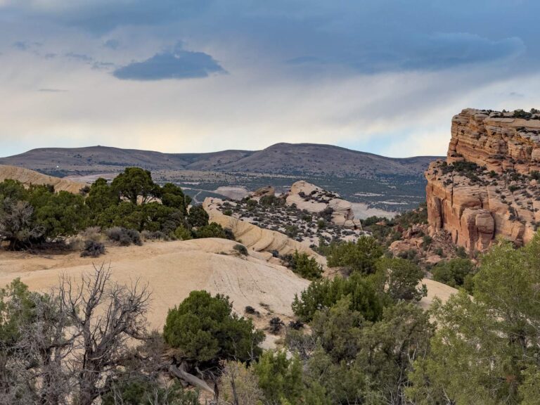
Photo: Tony Webster, CC BY-SA 4.0

Photo: rick kloeppel, CC BY 2.0
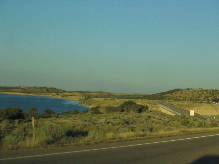
Photo: Ken Lund, CC BY-SA 2.0
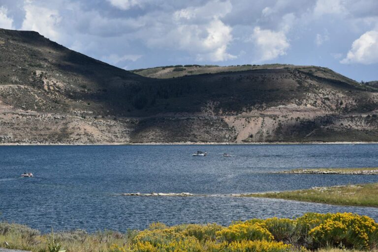
Photo: Bureau of Reclamation, CC BY-SA 2.0
Short replies about fishing Duchesne County
How many boat launches does Duchesne County have in the Utah data?
The launch layers list 5 launches.
Which Duchesne County lake tops the size figures?
On size, Starvation Reservoir: 3310.
Which species keep appearing in DWR lists around Duchesne County?
Fish Utah rates rainbow trout likely or possible on the most lakes within 40 miles, then brown trout, tiger trout and bluegill.
Does Duchesne County have a Utah marina or bait counter?
None inside the county; the Utah list above holds the closest.
Which Utah town is the seat for Duchesne County?
County offices sit in Duchesne.
Do I need a Utah license to fish in Duchesne County?
Plan on $40 with Utah residency or $120 without it for an adult 365-day license; anglers under 12 need none.
Which Utah counties lie closest to Duchesne County?
Wasatch County, Carbon County and Summit County sit nearest.
What trout figures apply to Duchesne County water?
Statewide, the trout, kokanee and grayling row sets a daily limit 4 under the 2027 guidebook; the 2026 guidebook prints the same number. Waters with their own entry can differ.
Which waters in Duchesne County break from the statewide rows?
6 waters with a page here carry their own rules, beginning with Big Sand Wash.
Is there Blue Ribbon water in Duchesne County?
Starvation Reservoir, Lake Canyon Lake and Lower Stillwater Ponds, on DWR's Blue Ribbon list.
Does DWR stock fish in Duchesne County?
The 2026 DWR table lists 636,427 fish in 233 rows across 110 waters in the county.
Has a Utah record fish come from Duchesne County?
Utah chub, 1 lb. 15 oz., from Starvation Reservoir (2009).
Hitch the boat for Utah water in Duchesne County
Open a lake for its launches, limits and Reclamation readings.