All Utah Fishing Pages A to Z
Every Utah reservoir, mountain area, stream, county, town and fish page in one alphabetical list.
 Pick for troutPiscifun Carbon X ultralight spinning reel28% OFFSale $57.99
Photo of Bear Lake: David Wilson, CC BY 2.0
Every Utah page on the site, alphabetized
Every Utah reservoir, lake, pond, mountain area, stream, county, town and fish page on statefishingspots.com, alphabetical inside each group. Launches, shore sites and tackle shops have their own directories, linked at the foot of this page.
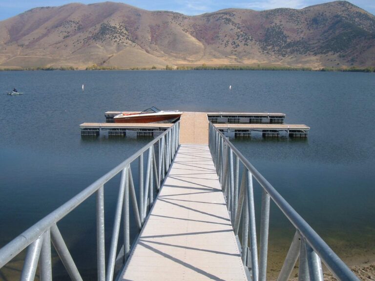
Photo of Mantua Reservoir: Christopher Eugene Lee, Public domain
Reservoirs, lakes and ponds across Utah: 206 pages
- Academy Mill Reservoir6 acres
- Andy Adams Reservoir50 acres
- Baker Reservoir63 acres
- Bear Lakeabout 70,008 acres of mapped outline in Utah
- Bee Tree (Manti Mountains)1 acres
- Benches Pond
- Big East Reservoir (Payson Lakes)
- Birch Creek Reservoir30 acres
- Blanding Reservoir No. 4
- Blue Lakeabout 8 acres of mapped outline
- Boulger Reservoir3 acres
- Bountiful Lake50 acres
- Box Lake (Payson Lakes)3 acres
- Brad's Secret (Manti Mountains)0.5 acres
- Bristlecone (Brian Head) Pond4 acres
- Brough Reservoir
- Browne Lake54 acres
- Bullock Reservoirabout 80 acres of mapped outline
- Burraston Ponds30 acres
- Calder Reservoirabout 91 acres of mapped outline
- Canyon View Park Pond0.8 acres
- Carbon County Community Fishing Pond3 acres
- Causey Reservoirabout 161 acres of mapped outline
- Cleveland Reservoir185 acres
- Clinton Park Pond4 acres
- Cottonwood Reservoir
- Cove Pond1.2 acres
- Crouse Reservoirabout 110 acres of mapped outline
- Currant Creek Reservoirabout 290 acres of mapped outline
- Cutler Reservoirabout 1,527 acres of mapped outline
- Danny R. Crump Fishing Pond (Riverton City Pond)7.6 acres
- Deep Lake (Manti Mountains)4.6 acres
- Deer Creek Reservoir2,965 acres
- Deer Valley Ponds3 acres
- Deseret Reservoir (Rainbow Reservoir)
- Dons Lake3 acres
- Duck Creek Pond / Aspen Mirror Lakeabout 3 acres of mapped outline
- Duck Fork Reservoir47 acres
- East Canyon Reservoirabout 659 acres of mapped outline
- East Park Reservoirabout 178 acres of mapped outline
- East Parley's (Manti Mountains)
- Echo Reservoirabout 1,424 acres of mapped outline
- Electric Lake425 acres
- Emerald Lake3 acres
- Enterprise Reservoirs
- Fairmont Park Pond1 acres
- Fairview Lakesabout 122 acres of mapped outline
- Farmington Pond3.5 acres
- Ferron Reservoir40 acres
- First Dam – Logan River
- Fish Lake2,500 acres
- Flaming Gorge Reservoir42,000 acres
- Forsyth Reservoirabout 166 acres of mapped outline
- Fort Buenaventura Pond2 acres
- Foy Lake5 acres
- Garden City Pond3 acres
- Gigliotti Pond1 acres
- Glassmans Pond2 acres
- Goode Ski Lake (21st Street Pond)29 acres
- Gooseberry Reservoir57 acres
- Grandpas Pond (Sandy Community Fishery)3 acres
- Grantsville Reservoir
- Grassy Lake11 acres
- Gunlock Reservoirabout 252 acres of mapped outline
- Gunnison Bend and DMAD Reservoirs
- Hidden Lake2 acres
- Highland Glen Park Pond3 acres
- Hobbs Reservoir65 acres
- Holmes Creek Reservoir35 acres
- Huntington (Mammoth) Reservoir120 acres
- Huntington Game Farm Pond3 acres
- Huntington North Reservoir225 acres
- Hyrum Reservoirabout 432 acres of mapped outline
- Jensen Nature Park Pond7 acres
- Joes Valley Reservoir1,200 acres
- Johnson Reservoir700 acres
- Jordan River Reservoir (Willow Creek Pond)4 acres
- Jordanelle Reservoirabout 2,972 acres of mapped outline
- Kaysville Ponds5 acres
- Kens Lakeabout 52 acres of mapped outline
- Kidney Pond1 acres
- Knight-Ideal Pond3 acres
- Kolob Reservoir250 acres
- Koosharem Reservoirabout 346 acres of mapped outline
- Lake at the Hills (Leigh Hill)8 acres
- Lake Blanche8 acres
- Lake Canyon Lake
- Lake Catherineabout 3 acres of mapped outline
- Lake Florence2 acres
- Lake Lillian3 acres
- Lake Mary25 acres
- Lake Powellabout 112,709 acres of mapped outline in Utah
- Laketown Reservoir4 acres
- Little Dell Reservoir250 acres
- Little Montes Reservoir
- Lloyds Lake100 acres
- Loggers Fork Reservoir (Manti Mountains)11 acres
- Long Park Reservoir, North Slope380 acres
- Lost Creek Reservoirabout 360 acres of mapped outline
- Lower Bowns Reservoirabout 108 acres of mapped outline
- Lower Stillwater Ponds
- Lower WPA Pond (Manti Mountains)1 acres
- Mabey Pond3.8 acres
- Manila Creek Pond7 acres
- Mantua Reservoirabout 515 acres of mapped outline
- Maple Lake5 acres
- Matt Warner Reservoirabout 346 acres of mapped outline
- May Day Pond
- Mayors Pond1.5 acres
- McClellan Lake (Payson Lakes)3.5 acres
- Meadow Creek Pond4 acres
- Midas Pond1 acres
- Mill Hollow Reservoir18 acres
- Mill Meadow Reservoirabout 161 acres of mapped outline
- Miller Flat Reservoir160 acres
- Millrace Park Pond3 acres
- Millsite Reservoir435 acres
- Minersville Reservoirabout 1,139 acres of mapped outline
- Mona Reservoir1,250 acres
- Monroe Pond2 acres
- Monticello Lake3 acres
- Moon Lakeabout 768 acres of mapped outline
- Moose Pond2 acres
- Mount Pleasant Pond (Parleys Pond)5 acres
- Navajo Lakeabout 709 acres of mapped outline
- New Canyon Reservoir (Manti Mountains)6 acres
- Newcastle Reservoirabout 151 acres of mapped outline
- Newton Reservoir290 acres
- Nine Mile Reservoir
- Northwest Sunset Pond
- Old Fort Ponds
- Oowah Lakeabout 3 acres of mapped outline
- Otter Creek Reservoirabout 2,519 acres of mapped outline
- Palisade Reservoir & State Park76 acres
- Panguitch Lakeabout 1,052 acres of mapped outline
- Paragonah (Red Creek) Reservoir
- Parowan Pond0.5 acres
- Pelican Lakeabout 1,119 acres of mapped outline
- Petes Hole Reservoir13 acres
- Pine Lakeabout 80 acres of mapped outline
- Pine Valley Reservoir
- Pineview Reservoirabout 2,500 acres of mapped outline
- Pioneer Park Pond2.5 acres
- Piute Reservoirabout 2,226 acres of mapped outline
- Porcupine Reservoir190 acres
- Potters Ponds16 acres
- Quail Creek Reservoirabout 616 acres of mapped outline
- Razor Ridge Pond0.9 acres
- Recapture Reservoirabout 221 acres of mapped outline
- Red Creek Reservoirabout 93 acres of mapped outline
- Red Fleet Reservoirabout 501 acres of mapped outline
- Red Pine Lakesabout 10 acres of mapped outline
- Riverfront Pond1 acres
- Rockport Reservoirabout 1,056 acres of mapped outline
- Salem Pond11 acres
- Salina City Pond3 acres
- Sand Hollow Reservoir
- Scofield Reservoir2,815 acres
- Second Dam – Logan River
- Settlement Canyon Reservoir29 acres
- Sheep Creek Lake82 acres
- Shingle Mill Reservoir (Manti Mountains)
- Silver Lake (Big Cottonwood Canyon)10 acres
- Silver Lake Flat Reservoir (American Fork Canyon)45 acres
- Skylars Pond (West Willow Pond)1 acres
- Skyline Pond1.2 acres
- Smith Family Park Pond
- Soup Bowl Reservoir2 acres
- Spanish Oaks Reservoir5 acres
- Spirit Lake41 acres
- Spring Lake6 acres
- Starvation Reservoirabout 2,742 acres of mapped outline
- Stateline Resabout 263 acres of mapped outline
- Steed Pond2.5 acres
- Steinaker Reservoirabout 684 acres of mapped outline
- Stratton Pond (Grandpa's Pond)15 acres
- Strawberry Reservoir17,200 acres
- Sullivan Virgin River Park Pond0.4 acres
- Sunset Pond1 acres
- Tawa Ponds1.3 acres
- Theodore Ahlin Park Pond (Pole Canyon Pond)
- Third Dam – Logan River6 acres
- Tibble Fork Reservoir21 acres
- Tony Grove Lake
- Town Reservoir (Manti Mountains)6 acres
- Tropic Reservoirabout 178 acres of mapped outline
- Twin Lakes Reservoir29 acres
- Upper WPA Pond (Manti Mountains)5.7 acres
- Utah Lake96,600 acres
- Vernon Reservoir35 acres
- Vivian Park Pond (Provo Canyon)1 acres
- Wasatch Mtn State Park Pond1.5 acres
- Wayne Bartholomew Family Park Pond3.3 acres
- Wellsville Reservoir7 acres
- White Pine Lake12 acres
- Wide Hollow Reservoirabout 147 acres of mapped outline
- Willard Bay Reservoirabout 9,991 acres of mapped outline
- Willard Peak Pond10 acres
- Willow Lakeabout 17 acres of mapped outline
- Willow Pond4 acres
- Woodruff Reservoirabout 86 acres of mapped outline
- Woods Ranch Pond (Kids Pond)1 acres
- Wrigley Springs Reservoirabout 10 acres of mapped outline
- Yankee Meadow Reservoirabout 29 acres of mapped outline
- Yearns Reservoir (Manti Mountains)3 acres
- Yuba Reservoir & State Park
Mountain lake areas across Utah: 24 pages
- Boulder Mountain Lakes
- Millard County Streams
- Monroe Mountain Lakes
- Thousand Lake Mountain
- Tushar (Beaver) Mountain Lakes
- Uinta Mountains, Bear River
- Uinta Mountains, Beaver Creek Forks
- Uinta Mountains, Blacks Fork
- Uinta Mountains, Burnt Fork
- Uinta Mountains, Dry Gulch
- Uinta Mountains, Duchesne River
- Uinta Mountains, Henrys Fork
- Uinta Mountains, Lake Fork
- Uinta Mountains, Mirror Lake Highway
- Uinta Mountains, North Slope East
- Uinta Mountains, North Slope Roadside Lakes
- Uinta Mountains, Provo River
- Uinta Mountains, Rock Creek
- Uinta Mountains, Smiths Fork
- Uinta Mountains, South Slope East
- Uinta Mountains, Uinta River
- Uinta Mountains, Weber River
- Uinta Mountains, Whiterocks
- Uinta Mountains, Yellowstone/Swift Creek
Rivers, creeks and reaches across Utah: 50 pages
- American Fork Creek
- Basin Creek (Deep Creek Mountains)
- Big Sand Wash
- Blacksmith Fork River
- Clear Creek
- Colorado River
- Diamond Fork River
- Duchesne River (Hanna to the North Fork)
- East Fork Sevier River (Black Canyon)
- East Fork Sevier River (Kingston Canyon)
- Ferron Creek
- George Creek
- Granite Creek (Deep Creek Mountains)
- Green River Below Flaming Gorge Dam
- Green River in northeastern Utah
- Green River in southeastern Utah
- Huntington Creek
- Indian Farms Creek (Deep Creek Mountains)
- Johnson Creek
- Jordan River
- Left Fork Huntington Creek
- Logan River
- Lower Beaver River
- Lower Fish Creek
- Lower Provo River (Center Street Bridge to I-15)
- Lower Provo River (I-15 to Olmstead Diversion)
- Lower Provo River (Olmstead Diversion to Deer Creek Dam)
- Mammoth Creek
- Middle Provo River (Legacy Bridge to Jordanelle Dam)
- North Fork of Birch Creek (Deep Creek Mountains)
- Ogden River
- Onemile Creek / Sawmill Canyon
- Price River
- Red Cedar Creek (Deep Creek Mountains)
- Right Fork Huntington Creek
- Salt Creek
- Sevier River In Marysvale Canyon
- South Fork Ogden River
- Straight Canyon Creek
- Tom's Creek (Deep Creek Mountains)
- Trout Creek (Deep Creek Mountains)
- Upper Beaver River
- Upper East Fork Sevier River
- Upper Fremont River
- Weber River
- West Fork Bear River
- West Fork Duchesne River above Wolf Creek
- West Fork Duchesne River below Wolf Creek
- White River
- Wildcat Creek
 For the trout herePiscifun Carbon XT ultralight spinning reel25% OFFSale $59.99
Counties across Utah: 29 pages
- Beaver County
- Box Elder County
- Cache County
- Carbon County
- Daggett County
- Davis County
- Duchesne County
- Emery County
- Garfield County
- Grand County
- Iron County
- Juab County
- Kane County
- Millard County
- Morgan County
- Piute County
- Rich County
- Salt Lake County
- San Juan County
- Sanpete County
- Sevier County
- Summit County
- Tooele County
- Uintah County
- Utah County
- Wasatch County
- Washington County
- Wayne County
- Weber County
Towns across Utah: 156 pages
- Alpine
- American Fork
- Ballard
- Beaver
- Blanding
- Bluffdale
- Bountiful
- Brigham City
- Castle Dale
- Cedar City
- Cedar Hills
- Centerfield
- Centerville
- Clearfield
- Clinton
- Coalville
- Cottonwood Heights
- Delta
- Draper
- Duchesne
- Eagle Mountain
- East Basin
- East Carbon
- Elk Ridge
- Elwood
- Emigration Canyon
- Enoch
- Enterprise
- Ephraim
- Erda
- Fairview
- Farmington
- Farr West
- Ferron
- Fillmore
- Fountain Green
- Francis
- Fruit Heights
- Garland
- Genola
- Grantsville
- Gunnison
- Harrisville
- Heber City
- Helper
- Herriman
- Highland
- Hildale
- Holladay
- Honeyville
- Hooper
- Huntington
- Hurricane
- Hyde Park
- Hyrum
- Ivins
- Kamas
- Kanab
- Kaysville
- Kearns
- La Verkin
- Layton
- Lehi
- Lewiston
- Lindon
- Logan
- Maeser
- Magna
- Manti
- Mantua
- Mapleton
- Marriott-Slaterville
- Mendon
- Midvale
- Midway
- Milford
- Millcreek
- Millville
- Moab
- Mona
- Monroe
- Monticello
- Morgan
- Moroni
- Mount Pleasant
- Mountain Green
- Murray
- Naples
- Nephi
- Nibley
- North Logan
- North Ogden
- North Salt Lake
- Oakley
- Ogden
- Orangeville
- Orem
- Panguitch
- Park City
- Parowan
- Payson
- Perry
- Plain City
- Pleasant Grove
- Pleasant View
- Price
- Providence
- Provo
- Richfield
- Richmond
- River Heights
- Riverdale
- Riverton
- Roosevelt
- Roy
- Salem
- Salina
- Salt Lake City
- Sandy
- Santa Clara
- Santaquin
- Saratoga Springs
- Smithfield
- Snyderville
- South Jordan
- South Ogden
- South Salt Lake
- South Weber
- Spanish Fork
- Springville
- St. George
- Stansbury Park
- Summit Park
- Sunset
- Syracuse
- Taylorsville
- Tooele
- Toquerville
- Tremonton
- Uintah
- Vernal
- Vineyard
- Washington
- Washington Terrace
- Wellington
- Wellsville
- Wendover
- West Bountiful
- West Haven
- West Jordan
- West Point
- West Valley City
- White City
- Willard
- Woodland Hills
- Woods Cross
Species across Utah: 38 pages
- Arctic grayling
- Bear Lake cutthroat trout
- Bear Lake whitefish
- Black crappie
- Bluegill
- Bonneville cisco
- Bonneville cutthroat trout
- Bonneville whitefish
- Brook trout
- Brown trout
- Bullhead
- Burbot
- Channel catfish
- Colorado River cutthroat trout
- Common carp
- Flannelmouth sucker
- Golden trout
- Green sunfish
- Kokanee salmon
- Lake trout
- Largemouth bass
- Mountain whitefish
- Northern pike
- Rainbow trout
- Roundtail chub
- Smallmouth bass
- Splake
- Striped bass
- Tiger muskellunge
- Tiger trout
- Utah chub
- Utah sucker
- Walleye
- White bass
- White crappie
- Wiper
- Yellow perch
- Yellowstone cutthroat trout
Utah directories and rule pages
- Every Utah fishing page, A to Zreservoirs, mountain areas, streams, counties, towns and fish together
- Utah license prices and statewide limitsDWR fees plus the 2027 and 2026 guidebook limits side by side
- Rules for specific Utah watersevery heading in the guidebook list, linked where a page exists
- Utah border-water licensingBear Lake, Lake Powell and Flaming Gorge
- What the 2027 Utah guidebook changesnative game fish, the baitfish rename, NEW water entries
- Blue Ribbon fisheries of Utahreservoirs and streams DWR flags as Blue Ribbon
- Utah community fisheriescity and park ponds under the shared two-fish rule
- Ice fishing notes for Utahwhat DWR writes about winter ice on each water
- Utah Free Fishing Daythe one June Saturday with no license needed
- Utah state record fishfive DWR record categories, weights and lengths
- Utah stocking in 2026the DWR year-to-date table by county and species
- Utah reservoir levels and stream gaugesdated Reclamation values and live USGS readings
- Utah boat rampsUGRC and DWR launch points by county
- Utah shore fishing accessDWR bank and pier points
- Utah bait and tackle shopscounters, fly shops and marinas in four map quadrants
- Utah fishing guideslisted guide services with towns and phones
- Utah fishing tournamentsDWR-authorized events and posted results
- Protected and prohibited fish in Utahmust-release natives and fish you may not let go
Utah A to Z questions
How many Utah lakes and reservoirs are listed?
206.
How many Utah streams?
50 rivers, creeks and DWR reaches.
Are the mountain lake areas separate?
Yes, 24 area pages for the Uinta drainages and other high country.
Are boat launches on this list?
No. Utah launches sit in their own county-sorted directory.
Why is my lake missing?
It may be a named lake on its county page without enough DWR facts for its own page, or it waits in the release queue.
Are Utah counties included?
Yes, 29 county pages.
Can I search instead?
Yes, the find box on the Utah page takes a lake, stream, county or town name.
When does the Utah A to Z list get refreshed?
Whenever a Utah page is published or rebuilt, the list is regenerated.