Fishing in Lane County, Oregon
County seat: Eugene. Population 382,971.
- 29lake pages
- 118open launches
- 11river pages
 Pick for bullheadPiscifun LumiCat II catfish rod48% OFFSale $114.99
Photo of Waldo Lake: Bonnie Moreland, Public domain
The short version of fishing in Lane County
At the 2020 count Lane County held 382,971 residents, and its courthouse is in Eugene. Most waters ODFW lists in Lane County fall under the ODFW Willamette Zone table, though zone lines follow drainages rather than county lines.
The largest of 29 paged lakes in Lane County is Fern Ridge Lake. Tidewater and ocean water here include Berry Creek estuary, Big Creek (Lane County) estuary, Cape Creek estuary and Siltcoos River. The OSMB access layer lists 118 open launches here, 80 for trailer launching. No boat is needed at 7 mapped shore sites, 6 of them a pier or jetty.
Census 2020 population; BLM Oregon NHD lake outlines; OSMB Boating Access Sites; DLCD and ODFW shore access layers; 2026 Oregon Sport Fishing Regulations zone lists; read November 2, 2026.
Where the put-ins of Lane County are
OSMB launch points, DLCD and ODFW shore sites, NHD lake points, PMEP estuary points; read November 2, 2026.
Still water across Lane County
| Lake | Acres | Kind | OSMB launches | Fish mapped |
|---|---|---|---|---|
| Fern Ridge Lake | 6,576 (outline) | lake | 5 | bluegill, brown bullhead, chiselmouth |
| Waldo Lake | 6,061 (outline) | lake | 3 | brook trout, rainbow trout |
| Lookout Point Lake | 4,083 (outline) | lake | 4 | brown bullhead, chiselmouth, largemouth bass |
| Siltcoos Lake | 3,286 (outline) | lake | 8 | black crappie, bluegill, brown bullhead |
| Hills Creek Lake | 2,590 (outline) | lake | 4 | brown bullhead, largemouth bass, rainbow trout |
| Fall Creek Lake | 1,764 (outline) | lake | 3 | black crappie, bluegill, cutthroat trout |
| Dorena Lake | 1,662 (outline) | lake | 2 | black crappie, bluegill, brown bullhead |
| Cougar Reservoir | 1,129 (outline) | reservoir | 3 | rainbow trout |
| Cottage Grove Lake | 1,075 (outline) | lake | 2 | black crappie, bluegill, brown bullhead |
| Dexter Reservoir | 884 (outline) | reservoir | 3 | bluegill, brown bullhead, chiselmouth |
| Blue River Lake | 813 (outline) | lake | 2 | bluegill, cutthroat trout, largemouth bass |
| Woahink Lake | 784 (outline) | lake | 2 | bluegill, brown bullhead, cutthroat trout |
| Mercer Lake | 350 (outline) | lake | 2 | black crappie, brown bullhead, largemouth bass |
| Triangle Lake | 304 (outline) | lake | 1 | bluegill, brown bullhead, cutthroat trout |
| Sutton Lake | 114 (outline) | lake | 1 | bluegill, brown bullhead, largemouth bass |
| Munsel Lake | 105 (outline) | lake | 1 | bluegill, brown bullhead, coho salmon |
| Gold Lake | 87 (outline) | lake | 1 | brook trout, brown trout, rainbow trout |
| Cleawox Lake | 79 (outline) | lake | 1 | black crappie, bluegill, brown bullhead |
| Walterville Reservoir | 63 (outline) | reservoir | 0 | black crappie, brown bullhead, largemouth bass |
| Hult Log Storage Reservoir | 41 (outline) | reservoir | 1 | bluegill, brown bullhead, cutthroat trout |
| Betty Lake | 40 (outline) | lake | 1 | rainbow trout |
| Scott Lake | 36 (outline) | lake | 1 | cutthroat trout |
| Blair Lake | 24 (outline) | lake | 1 | brook trout |
| Hidden Lake | 21 (outline) | lake | 1 | cutthroat trout |
| Benson Lake | 19 (outline) | lake | 0 | brook trout, cutthroat trout, rainbow trout |
| Alameda Lake | 4 (outline) | lake | 1 | cutthroat trout |
| Loon Lake | 3 (outline) | lake | 0 | rainbow trout |
| Dune Lake | 3 (outline) | lake | 1 | rainbow trout |
| Alder Lake | 2 (outline) | lake | 0 | rainbow trout |
BLM Oregon hydrography lake outlines (NHD), summed by GNIS name (layer), read November 2, 2026. Species: ODFW Fish Habitat Distribution layers (ODFW ArcGIS), read November 2, 2026; a mapped species is habitat use ODFW records, not a catch report. ODFW publishes no lake depths in these layers.
 For the bullhead herePiscifun Chaos XS round baitcaster36% OFFSale $57.99
Estuaries of Lane County
Along Lane County the guide covers 7 saltwater waters.
| Water | Kind | OSMB launches | Piers and shore sites | Marinas |
|---|---|---|---|---|
| Berry Creek estuary | estuary | 0 | 0 | 0 |
| Big Creek (Lane County) estuary | estuary | 0 | 0 | 0 |
| Cape Creek estuary | estuary | 0 | 0 | 0 |
| Siltcoos River | estuary | 0 | 0 | 0 |
| Siuslaw River | estuary | 7 | 7 | 3 |
| Sutton Creek estuary | estuary | 0 | 0 | 0 |
| Tenmile Creek (Lane County) estuary | estuary | 0 | 0 | 0 |
ODFW ocean management areas, PMEP estuaries, OSMB launches and marinas, DLCD shore sites; read November 2, 2026.
Species on the water pages near Lane County
Within 40 miles of Eugene the most-listed fish is rainbow trout.
Species from ODFW Fish Habitat Distribution layers, booklet exceptions and ODFW records, counted per water page within 40 miles; habitat mapping, not a catch survey.
Further lakes on the Lane County outline map
The outline map shows 126 further named lakes in Lane County, listed by mapped acreage.
| Water | Acres (outline) | Nearest place |
|---|---|---|
| Clear Lake (Lane County) | 153 | Florence |
| Mink Lake | 146 | Three Rivers |
| Lower Eddeeleo Lake | 106 | Oakridge |
| Linton Lake | 81 | Sisters |
| Torrey Lake | 65 | Oakridge |
| Wahanna Lake | 47 | Oakridge |
| Upper Eddeeleo Lake | 44 | Oakridge |
| Gander Lake | 44 | Oakridge |
| Collard Lake | 41 | Florence |
| Lower Erma Bell Lake | 41 | Oakridge |
| Middle Erma Bell Lake | 41 | Oakridge |
| McFarland Lake | 38 | Three Rivers |
| Chambers Lakes | 36 | Sisters |
| Horse Lake | 32 | Three Rivers |
| Porky Lake | 32 | Three Rivers |
| Long Lake | 32 | Oakridge |
| Corner Lake | 28 | Three Rivers |
| Upper Rigdon Lake | 26 | Oakridge |
| Little Lake | 26 | Veneta |
| Nash Lake | 24 | Sisters |
| Round Lake | 24 | Oakridge |
| Hand Lake | 23 | Sisters |
| Lake Kiwa | 23 | Oakridge |
| Melakwa Lake | 22 | Sisters |
| Heceta Junction Lake | 22 | Florence |
| Lower Marilyn Lake | 21 | Oakridge |
| Upper Marilyn Lake | 21 | Oakridge |
| Mac Lake | 21 | Three Rivers |
| Cliff Lake | 20 | Three Rivers |
| Forcia and Larsen Reservoir | 20 | Veneta |
| Booth-Kelly Lumber Company Log Pond | 20 | Cottage Grove |
| Junction Lake | 19 | Three Rivers |
| Lake Chetlo | 19 | Oakridge |
| Clear Lake (Lane County) | 18 | Santa Clara |
| Horseshoe Lake | 18 | Three Rivers |
| Lake Louise | 17 | Cottage Grove |
| Lower Rigdon Lake | 17 | Oakridge |
| Vivian Lake | 17 | Oakridge |
| Harvey Lake | 16 | Oakridge |
| Lily Lake | 16 | Florence |
| Lower Horse Lake | 15 | Three Rivers |
| Otter Lake | 14 | Oakridge |
| Upper Quinn Lake | 14 | Oakridge |
| Upper Erma Bell Lake | 14 | Oakridge |
| Blue Lake (Lane County) | 14 | Oakridge |
| Sunset Lake | 14 | Three Rivers |
| Penn Lake | 13 | Three Rivers |
| Gosling Lakes | 13 | Oakridge |
| Top Lake | 13 | Sisters |
| Whig Lake | 13 | Oakridge |
| Ackerley Lake | 12 | Florence |
| Sandy Lake | 12 | Three Rivers |
| Vogel Lake | 12 | Three Rivers |
| Lucas Lake | 11 | Oakridge |
| Rock Lake | 11 | Three Rivers |
| Ford Farms Reservoir | 11 | Veneta |
| Lower Quinn Lake | 11 | Oakridge |
| Nightshade Lakes | 11 | Three Rivers |
| Slipper Lake | 11 | Three Rivers |
| Spirit Lake | 11 | Oakridge |
| Eastern Brook Lake | 11 | Oakridge |
| Moolack Lake | 11 | Oakridge |
| Upper Salmon Lake | 10 | Oakridge |
| Happy Lake | 10 | Oakridge |
| Midnight Lake | 10 | Oakridge |
| Swan Lake | 10 | Oakridge |
| Plumb Lake | 9 | Three Rivers |
| Cervus Lake | 9 | Oakridge |
| Honey Lake | 9 | Sisters |
| Marie Lake | 8 | Oakridge |
| Lorin Lake | 8 | Oakridge |
| Dumbbell Lake | 8 | Three Rivers |
| Elbow Lake | 8 | Oakridge |
| Martin Lake | 8 | Three Rivers |
| Copepod Lake | 7 | Three Rivers |
| Jo Ann Lake | 7 | Oakridge |
| Kidney Lake | 7 | Sisters |
| Bongo Lake | 7 | Oakridge |
| Campers Lake | 7 | Sisters |
| Photo Lake | 7 | Oakridge |
| Denude Lake | 7 | Sisters |
| Questionmark Lake | 7 | Three Rivers |
| Helen Lake | 6 | Oakridge |
| Shadow Lake | 6 | Oakridge |
| Upper Island Lake | 6 | Oakridge |
| Mile Lake | 6 | Three Rivers |
| Boot Lake | 6 | Three Rivers |
| Merrill Lake | 6 | Three Rivers |
| Prince Lake | 6 | Sisters |
| Moonlight Lake | 5 | Three Rivers |
| Tenas Lakes | 5 | Sisters |
| Lower Island Lake | 5 | Oakridge |
| Platt Lake | 5 | Three Rivers |
| Moody Lake | 5 | Three Rivers |
| Separation Lake | 5 | Sisters |
| Bingo Lake | 5 | Oakridge |
| Abernethy Lake | 4 | Oakridge |
| Piper Lake | 4 | Oakridge |
| Cardiac Lake | 4 | Oakridge |
| Smith Lake | 4 | Oakridge |
| Buck Lake | 4 | Florence |
| Mickey Lake | 4 | Oakridge |
| Middle Horse Lake | 4 | Three Rivers |
| Zircon Lake | 4 | Oakridge |
| Spy Lake | 4 | Three Rivers |
| Crawfish Lake | 4 | Oakridge |
| Lopez Lake | 3 | Oakridge |
| Conim Lake | 3 | Oakridge |
| Aerial Lake | 3 | Three Rivers |
| Island Lake | 3 | Three Rivers |
| Gnat Lake | 3 | Three Rivers |
| Notch Lake | 3 | Oakridge |
| Rockpile Lake | 3 | Oakridge |
| Birthday Lake | 3 | Oakridge |
| Emma Lake | 3 | Oakridge |
| Irish Camp Lake | 3 | Sisters |
| Boo Boo Lake | 2 | Oakridge |
| Brittany Lake | 2 | Oakridge |
| Edna Lake | 2 | Oakridge |
| Erhart Lake | 2 | Dunes City |
BLM Oregon hydrography lake outlines (NHD), summed by GNIS name (layer), read November 2, 2026.
Moving water in Lane County
- McKenzie RiverODFW maps spring chinook and summer steelhead runs, 27 OSMB launches, 8 USGS gauges, 20 booklet exceptions
- Middle Fork Willamette RiverODFW maps spring chinook, summer steelhead and winter steelhead runs, 8 OSMB launches, 2 USGS gauges
- North Fork Middle Fork Willamette RiverODFW maps spring chinook runs, 1 OSMB launch
- North Fork Siuslaw RiverODFW maps chum, coho and fall chinook runs, 2 OSMB launches
- Row RiverODFW maps spring chinook, summer steelhead and winter steelhead runs, 1 OSMB launch, 2 USGS gauges, 5 booklet exceptions
- Siltcoos RiverODFW maps coho, fall chinook and winter steelhead runs, tidewater at Siltcoos River, 1 OSMB launch
- Siuslaw RiverODFW maps chum, coho and fall chinook runs, tidewater at Siuslaw River, 14 OSMB launches, 2 USGS gauges, 12 booklet exceptions
- Blue RiverODFW maps spring chinook and summer steelhead runs, 2 USGS gauges, 4 booklet exceptions
- Coast Fork Willamette RiverODFW maps spring chinook, summer steelhead and winter steelhead runs, 1 USGS gauge
- Mohawk RiverODFW maps spring chinook and summer steelhead runs, 1 USGS gauge, 3 booklet exceptions
- South Fork McKenzie RiverODFW maps spring chinook and summer steelhead runs, 1 USGS gauge
Rivers of Lane County still without a page (7)
- Big Riverstream
- East Fork Green RiverODFW maps coho, fall chinook and winter steelhead runs
- East Fork South Fork McKenzie Riverstream
- Green RiverODFW maps coho, fall chinook and winter steelhead runs
- North Fork Mohawk Riverstream
- South Fork Mohawk Riverstream
- South Fork Siuslaw RiverODFW maps coho and winter steelhead runs
How fast the rivers of Lane County are running
| USGS gauge | Latest reading | Time (ET) |
|---|---|---|
| Middle Fork Willamette River At Jasper, Or | 1,860 cfs, 2.78 ft gage height | Nov 12 11:20 pm |
| Mckenzie River Near Coburg, Or | 2,040 cfs, 7.22 ft gage height | Nov 12 11:20 pm |
| Mckenzie River Near Vida, Or | 1,910 cfs, 1.03 ft gage height | Nov 12 11:15 pm |
| Mckenzie River Near Walterville, Or | 1,920 cfs, 2.02 ft gage height | Nov 12 10:45 pm |
| Mckenzie River Blw Leaburg Dam, Nr Leaburg, Or | 1,950 cfs, 4.51 ft gage height | Nov 12 10:30 pm |
| Mckenzie River Abv Hayden Br, At Springfield,or | 1,940 cfs, 52.92 ft gage height | Nov 12 11:15 pm |
US Geological Survey provisional data, retrieved Nov 12, 2026 11:32 pm ET. Provisional readings can be revised.
ODFW Fish Habitat Distribution stream names and runs, OSMB launches, booklet exceptions and USGS gauges; read November 2, 2026.
Launch sites across Lane County
- Ada County Ramp on Siltcoos LakeSiltcoos Lake, 1 lane, trailered launch
- Alameda Lake AccessAlameda Lake, hand carry launch
- Alder Dune Campground launchDune Lake, hand carry launch
- Alton Baker Park on Willamette RiverWillamette River, 1 lane, trailered launch
- Armitage Park on McKenzie RiverMcKenzie River, 1 lane, trailered launch
- Austa Boat Ramp on Siuslaw RiverSiuslaw River, 1 lane, trailered launch
- Baker Bay Ramp on Dorena LakeDorena Lake, 1 lane, trailered launch
- Bellinger Landing on McKenzie RiverMcKenzie River, 1 lane, trailered launch
- Ben and Kay Dorris State Park on McKenzie RiverMcKenzie River, 1 lane, trailered launch
- Bender Landing on North Fork Siuslaw RiverNorth Fork Siuslaw River, 1 lane, trailered launch
- Betty Lake AccessBetty Lake, 1 lane, hand carry launch
- Bingham Boat Launch on Hills Creek LakeHills Creek Lake, 1 lane, hand carry launch
- Browns Landing on Willamette RiverWillamette River, hand carry launch
- Brukart Landing on McKenzie RiverMcKenzie River, 1 lane, trailered launch
- CT Beach Boat Launch on Hills Creek LakeHills Creek Lake, 1 lane, trailered launch
- Canoe Launch on Willamette RiverWillamette River, 1 lane, hand carry launch
- Charlton Lake AccessCharlton Lake, 1 lane, hand carry launch
- Christensens Landing on Willamette RiverWillamette River, 1 lane, trailered launch
- Clearwater Park Boat Ramp on Middle Fork Willamette RiverMiddle Fork Willamette River, 1 lane, trailered launch
- Clearwater Park Paddle Access on Middle Fork Willamette RiverMiddle Fork Willamette River, 1 lane, hand carry launch
- Coyote Creek AccessCoyote Creek, 1 lane, hand carry launch
- Darlings Resort boat ramp on Siltcoos LakeSiltcoos Lake, 2 lanes, trailered launch
- Dead Dog Hole boat ramp on Lake CreekLake Creek, trailered launch
- Deadmonds Ferry Landing on McKenzie RiverMcKenzie River, 1 lane, boat slide
- Deadwood Landing on Lake CreekLake Creek, 1 lane, trailered launch
- Deerhorn Landing on McKenzie RiverMcKenzie River, 1 lane, trailered launch
- Dexter Hand LaunchDexter Reservoir, hand carry launch
- Dexter State ParkDexter Reservoir, 2 lanes, trailered launch
- Dilley Landing on Willamette River Coast ForkWillamette River Coast Fork, trailered launch
- Elijah Bristow Hand Launch on Middle Fork Willamette RiverMiddle Fork Willamette River, hand carry launch
- Emmerich Landing Slide on McKenzie RiverMcKenzie River, 1 lane, boat slide
- Farnham Landing Slide on Siuslaw RiverSiuslaw River, 1 lane, boat slide
- Fern Ridge Shores RV ParkFern Ridge Lake, 1 lane, trailered launch
- Finn Rock Landing on McKenzie RiverMcKenzie River, 1 lane, trailered launch
- Fish Mill Lodges launch on Siltcoos LakeSiltcoos Lake, hand carry launch
- Ford Access on Siuslaw RiverSiuslaw River, 1 lane, trailered launch
- Forest Glen Landing on McKenzie RiverMcKenzie River, 1 lane, trailered launch
- French Pete Campground boat ramp on McKenzie River South Fork (Above Cougar)McKenzie River South Fork (Above Cougar), trailered launch
- Frissel Boat Ramp on McKenzie RiverMcKenzie River, 1 lane, trailered launch
- Garden Lake ParkGarden Lake, 1 lane, hand carry launch
- Gold Lake Day Use Area launchGold Lake, 1 lane, hand carry launch
- Goodpasture Boat Ramp on Leaburg LakeLeaburg Lake, trailered launch
- Greenwaters Park on Middle Fork Willamette RiverMiddle Fork Willamette River, 1 lane, trailered launch
- Greenwood Landing on McKenzie RiverMcKenzie River, 1 lane, trailered launch
- Hamlin Park on McKenzie RiverMcKenzie River, trailered launch
- Hampton Boat Launch on Lookout Point LakeLookout Point Lake, 1 lane, trailered launch, OSMB status: restricted
- Hayden Bridge boat ramp on McKenzie RiverMcKenzie River, 1 lane, trailered launch
- Helfrich Landing on McKenzie RiverMcKenzie River, 1 lane, trailered launch
- Hendricks Bridge boat ramp on McKenzie RiverMcKenzie River, 1 lane, trailered launch
- Hidden Lake launchHidden Lake, hand carry launch
- Hileman Landing on Willamette RiverWillamette River, hand carry launch
- Honeyman State Park on Cleawox LakeCleawox Lake, 1 lane, trailered launch
- Houghton Landing County Park on North Fork Siuslaw RiverNorth Fork Siuslaw River, trailered launch
- Howard Buford Recreation Area launch on Willamette River Coast ForkWillamette River Coast Fork, 1 lane, hand carry launch
- Hult Reservoir boat ramp on Hult Log Storage ReservoirHult Log Storage Reservoir, trailered launch
- Island Park on Willamette RiverWillamette River, 1 lane, trailered launch
- Jacksons Mini Marina on Siltcoos LakeSiltcoos Lake, hand carry launch
- Jasper State Park Hand Launch on Middle Fork Willamette RiverMiddle Fork Willamette River, hand carry launch
- Konnie Fishing Access on Lake CreekLake Creek, 1 lane, trailered launch
- Lakeside Park on Cottage Grove LakeCottage Grove Lake, 1 lane, trailered launch
- Larison Cove Canoe Launch on Hills Creek LakeHills Creek Lake, 1 lane, hand carry launch
- Leaburg Dam Poleslide boat ramp on McKenzie RiverMcKenzie River, 1 lane, boat slide
- Leaburg Landing on McKenzie RiverMcKenzie River, trailered launch
- Linslaw Park on Siuslaw RiverSiuslaw River, 1 lane, trailered launch
- Lloyd Knox Park on Leaburg LakeLeaburg Lake, trailered launch
- Lookout Boat Ramp on Blue River LakeBlue River Lake, 1 lane, trailered launch
- Lowell Park on Dexter ReservoirDexter Reservoir, 4 lanes, trailered launch
- Lynx Hollow Access on Willamette River Coast ForkWillamette River Coast Fork, trailered launch
- Maple Lane RV Park & Marina on Siuslaw RiverSiuslaw River, hand carry launch
- Mapleton Landing on Siuslaw RiverSiuslaw River, 1 lane, trailered launch
- Marshall Island Access on Willamette RiverWillamette River, 1 lane, trailered launch
- McMullens Landing on McKenzie RiverMcKenzie River, 1 lane, boat slide
- Mercer Lake LandingMercer Lake, 1 lane, trailered launch
- Mercer Lake Resort boat rampMercer Lake, 1 lane, trailered launch
- Meridian Park on Lookout Point LakeLookout Point Lake, 1 lane, trailered launch
- Middle Fork Boat Launch on Middle Fork Willamette RiverMiddle Fork Willamette River, 1 lane, trailered launch
- Munsel LandingMunsel Lake, 1 lane, trailered launch
- Nightingales Fish Camp boat ramp on Siltcoos LakeSiltcoos Lake, trailered launch
- North Shore Fall Creek boat rampFall Creek Lake, 2 lanes, trailered launch
- Ollalie Campground launch on McKenzie RiverMcKenzie River, hand carry launch
- Orchard Point Marina on Fern Ridge LakeFern Ridge Lake, 2 lanes, trailered launch
- Packard Creek Campground boat ramp on Hills Creek LakeHills Creek Lake, 2 lanes, trailered launch
- Pengra Access on Middle Fork Willamette RiverMiddle Fork Willamette River, 1 lane, trailered launch
- Perkins Peninsula boat ramp on Fern Ridge LakeFern Ridge Lake, 2 lanes, trailered launch
- Port of Siuslaw RampSiuslaw River, 3 lanes, trailered launch
- Rennies Landing on McKenzie RiverMcKenzie River, 1 lane, trailered launch
- Richardson Park Marina on Fern Ridge LakeFern Ridge Lake, 2 lanes, trailered launch
- Richardsons Pole Slide boat ramp on Siuslaw RiverSiuslaw River, 1 lane, boat slide
- Rodakowski boat ramp on McKenzie RiverMcKenzie River, 1 lane, trailered launch
- Row River Nature ParkRow River, 1 lane, trailered launch
- Salmon Creek Falls Campground launchSalmon Creek, 1 lane, hand carry launch
- Schindler Landing on Lake CreekLake Creek, 1 lane, trailered launch
- Scott Lake Campground launchScott Lake, 1 lane, hand carry launch
- Shadow Bay Campground boat ramp on Waldo LakeWaldo Lake, 1 lane, trailered launch
- Siltcoos Lake Resort boat rampSiltcoos Lake, 1 lane, trailered launch
- Silver Creek Landing on McKenzie RiverMcKenzie River, 1 lane, trailered launch
- Siuslaw River RV Park & MarinaSiuslaw River, 1 lane, trailered launch
- Taylor Landing on McKenzie RiverMcKenzie River, 1 lane, trailered launch
- Tide Wayside on Siuslaw RiverSiuslaw River, 1 lane, trailered launch
- Tiernan Ramp on Siuslaw RiverSiuslaw River, 1 lane, trailered launch
- Timpanogas Campground launchTimpanogas Lake, hand carry launch
- Triangle Lake LandingTriangle Lake, 1 lane, trailered launch
- Turtle Island Park on North Fork Middle Fork Willamette RiverNorth Fork Middle Fork Willamette River, 1 lane, hand carry launch
- Tyee Campground boat ramp on Siltcoos RiverSiltcoos River, 1 lane, trailered launch
- Umpqua Lighthouse State Park Campground on Lake MarieLake Marie, hand carry launch
- Upper Big Creek Reservoir Access on Newport ReservoirNewport Reservoir, 1 lane, hand carry launch
- Valley River launch on Willamette RiverWillamette River, hand carry launch
- Walterville boat ramp on McKenzie RiverMcKenzie River, 1 lane, trailered launch
- West D Boat Ramp on Willamette RiverWillamette River, 1 lane, trailered launch
- West Kirk Park on Fern Ridge LakeFern Ridge Lake, 1 lane, hand carry launch
- Westlake County Park on Siltcoos LakeSiltcoos Lake, trailered launch
- Whitely Landing on Willamette RiverWillamette River, 1 lane, trailered launch
- Whittaker Creek boat ramp on Siuslaw RiverSiuslaw River, 1 lane, trailered launch
- Wilson Creek Park on Cottage Grove LakeCottage Grove Lake, 1 lane, trailered launch
- Woahink Lake East boat rampWoahink Lake, 2 lanes, trailered launch
- Woahink Lake West boat rampWoahink Lake, trailered launch
- Maple Street Landing on Siuslaw RiverSiuslaw River, hand carry launch
- Mapleton Transient Float launch on Siuslaw RiverSiuslaw River, hand carry launch
- Black Canyon Day Use boat ramp on Lookout Point LakeLookout Point Lake, closed per OSMB
- Blair Lake Campground launchBlair Lake, closed per OSMB
- Cascara Campground boat ramp on Fall Creek LakeFall Creek Lake, closed per OSMB
- Cougar Crossing Day Use boat rampCougar Reservoir, closed per OSMB
- Echo Ramp on Cougar ReservoirCougar Reservoir, closed per OSMB
- Harms Park on Dorena LakeDorena Lake, closed per OSMB
- Islet Boat Launch on Waldo LakeWaldo Lake, closed per OSMB
- Jasper Bridge Access on Middle Fork Willamette RiverMiddle Fork Willamette River, closed per OSMB
- McKenzie Bridge Campground boat rampMcKenzie River, closed per OSMB
- McKenzie Bridge Day Use Area boat rampMcKenzie River, closed per OSMB
- North Waldo Boat LaunchWaldo Lake, closed per OSMB
- Paradise Campground boat ramp on McKenzie RiverMcKenzie River, closed per OSMB
- Saddle Dam Boat Ramp on Blue River LakeBlue River Lake, closed per OSMB
- Signal Point Boat Ramp on Lookout Point LakeLookout Point Lake, closed per OSMB
- Slide Creek Campground boat ramp on Cougar ReservoirCougar Reservoir, closed per OSMB
- Sutton LaunchSutton Lake, closed per OSMB
- Winberry Boat Ramp on Fall Creek LakeFall Creek Lake, closed per OSMB
Status comes straight from OSMB, and closed launches are rows only.
Shore access in Lane County
- Harbor St. Ramp on Siuslaw Riverfishing pier, Port of Siuslaw
- South Jetty Crab Dock Parking on Siuslaw Riverfishing pier, Lane County
- Pedestrian Plaza on Siuslaw Riverfishing pier, City of Florence
- Port of Siuslawfishing pier, Siuslaw Port
- Port of Siuslaw Dockfishing pier, Port of Siuslaw
- Siuslaw River Interpretive Pierfishing pier, City of Florence
- Siuslaw River North Jettyshore site
Oregon State Marine Board Boating Access Sites layer (OSMB ArcGIS), read November 2, 2026; status as OSMB publishes it. Oregon Coastal Management Program (DLCD) Shoreline Access Inventory (layer) and the ODFW shore access map, read November 2, 2026.
Trout stocking in Lane County
The ODFW schedule plans 195 trout releases for 17 waters in Lane County, 489,387 fish in all as printed.
- Siltcoos Lake4 releases planned, next listed: Apr. 12, 2027 – Apr. 16, 2027: 1,000 legal-size trout
- Hills Creek Lake10 releases planned, next listed: Sep. 27, 2027 – Oct. 01, 2027: 3,000 legal-size trout
- Fall Creek Lake14 releases planned, next listed: Jun. 14, 2027 – Jun. 18, 2027: 1,200 legal-size trout
- Dorena Lake8 releases planned, next listed: Oct. 04, 2027 – Oct. 08, 2027: 2,700 legal-size trout
- Cottage Grove Lake8 releases planned, next listed: Apr. 12, 2027 – Apr. 16, 2027: 3,750 trophy trout
- Dexter Reservoir12 releases planned, next listed: Oct. 04, 2027 – Oct. 08, 2027: 5,060 legal-size trout
- Blue River Lake24 releases planned, next listed: Jun. 21, 2027 – Jun. 25, 2027: 600 legal-size trout
- Woahink Lake4 releases planned, next listed: Apr. 05, 2027 – Apr. 09, 2027: 1,000 legal-size trout
- Mercer Lake4 releases planned, next listed: Apr. 12, 2027 – Apr. 16, 2027: 2,500 legal-size trout
- Sutton Lake4 releases planned, next listed: Apr. 26, 2027 – Apr. 30, 2027: 1,332 legal-size trout
- Munsel Lake10 releases planned, next listed: Apr. 26, 2027 – Apr. 30, 2027: 1,500 legal-size, 150 trophy trout
- Cleawox Lake16 releases planned, next listed: May. 31, 2027 – Jun. 04, 2027: 2,000 legal-size trout
- Benson Lake4 releases planned, next listed: May. 31, 2027 – Jun. 04, 2027: 400 trophy trout
- Loon Lake6 releases planned, next listed: May. 10, 2027 – May. 15, 2027: 3,750 legal-size trout
- Dune Lake10 releases planned, next listed: May. 17, 2027 – May. 21, 2027: 500 legal-size, 36 trophy trout
- Alder Lake12 releases planned, next listed: May. 17, 2027 – May. 21, 2027: 566 legal-size, 36 trophy trout
- McKenzie River45 releases planned, next listed: Sep. 06, 2027 – Sep. 10, 2027: 2,000 legal-size trout
ODFW weekly trout stocking schedule (planned releases; ODFW prints size classes, not species), myodfw.com, read November 2, 2026.
Bag rows for a day in Lane County
Waters in Lane County without an exception of their own follow the zone rows below. Oregon residents pay $50 for the annual angling license, visitors $138. Add the Combined Angling Tag, $69 resident, before keeping salmon or steelhead. Bottomfish, halibut and other ocean trips need the $9 Ocean Endorsement as well.
| Species | Limit | Season |
|---|---|---|
| Trout | Lakes: 5 per day, 3 daily limits in possession. Streams: catch-and-release only, unless noted under Exceptions; 8-inch minimum | Lakes: Open all year. Streams: Open May 22 – Oct 31 unless noted under Exceptions. |
| Kokanee | 10 per day unless noted under Exceptions. | Open all year. |
| Salmon and Steelhead below Willamette Falls and Columbia River Tributa. | In the aggregate: 2 adult salmon or steelhead per day, 20 per year. 5 jacks per day, 2 daily jack limits in possession. | Closed in all waters unless noted under Exceptions. |
| Salmon above Willamette Falls | 2 adult salmon per day, 5 jacks per day, 2 daily jack limits in possession. 20 salmon and steelhead per year in aggregate. | Closed in all waters unless noted under Exceptions. |
| Steelhead above Willamette Falls | 3 adult steelhead per day (in addition to daily salmon bag limit). 20 salmon and steelhead per year in aggregate. | Closed in all waters unless noted under Exceptions. |
| Sturgeon | Catch-and-release only, unless noted under Exceptions. | Catch-and-release: Open all year, except as noted under Exceptions. |
| Bass | Lakes: 5 per day, 3 daily limits in possession unless noted under Exceptions. Streams: No limit. | Lakes: Open all year. Streams: Open during trout, salmon or steelhead seasons, except mainstem Willamette River and sloughs and tidewater areas of Columbia. |
| Bluegill, Catfish, Crappie, Other Sunfish, Walleye, Yellow Perch, Stri. | No limit, unless noted under Exceptions. | Lakes: Open all year. Streams: Open during trout, salmon or steelhead seasons, except mainstem Willamette River and sloughs and tidewater areas of Columbia. |
| Pacific Lamprey | Refer to General (Statewide) Regulations for regulations covering the harvest of Pacific lamprey. | Refer to General (Statewide) Regulations for regulations covering the harvest of Pacific lamprey. |
| Smelt | Closed. | Closed. |
| Species | Limit | Season |
|---|---|---|
| General Marine Species: Rockfish ("sea bass", "snapper"), Greenling (“. | Bag limits are set after this book is printed. Check current regulations before fishing on the Sport Bottomfish Seasons page. Retention of yelloweye and quillback rockfishes is prohibited. | Waters are open 24 hours per day. The offshore long-leader fishery is limited to fishing seaward of the 40-fathom regulatory line. |
| Lingcod (including green-colored lingcod) | 3 fish. | Waters are open 24 hours per day. The offshore long-leader fishery is limited to fishing seaward of the 40-fathom regulatory line. |
| Sablefish (black cod) | 10 fish. | Waters are open 24 hours per day. The offshore long-leader fishery is limited to fishing seaward of the 40-fathom regulatory line. |
| Flatfish (flounders, soles, sanddabs, turbots, and halibuts except Pac. | 25 fish in aggregate. | Waters are open 24 hours per day. The offshore long-leader fishery is limited to fishing seaward of the 40-fathom regulatory line. |
| Surfperch (includes all marine perch species) | 15 fish in aggregate. | Waters open all year, 24 hours per day, unless noted under Management Designations for Marine Areas. |
| Herring, Anchovy, Sardine, Topsmelt, Jacksmelt, and true smelts | 25 pounds in aggregate. | Waters open all year, 24 hours per day, unless noted under Management Designations for Marine Areas. |
| Offshore Pelagic Species: Includes all tuna and mackerel species, swor. | 25 fish in aggregate. White shark, basking shark, mega-mouth shark, and oceanic whitetip shark are prohibited and must be immediately released unharmed. | Waters open all year, 24 hours per day, unless noted under Management Designations for Marine Areas. |
| Striped Bass and/or Hybrid Bass | No limit | Waters open all year, 24 hours per day, unless noted under Management Designations for Marine Areas. |
| Sturgeon | Catch-and-release only. | Open all year. |
| Salmon and Steelhead | Ocean salmon and steelhead seasons and restrictions are set each April by the Pacific Fishery Management Council. Regulations are published each May and are available from license agents. | Ocean salmon and steelhead seasons and restrictions are set each April by the Pacific Fishery Management Council. |
| Pacific Halibut | May be taken by angling with a single line, no more than 2 hooks; and by spear. Pacific halibut seasons are managed and enforced based on port of landing. | May be taken by angling with a single line, no more than 2 hooks; and by spear. Pacific halibut seasons are managed and enforced based on port of landing. |
| Razor Clams | First 15 dug (no sorting or releasing). | Waters open all year, 24 hours per day Exceptions: Razor clams are closed Jul 15 to Sep 30 north of Tillamook Head (Clatsop County) Shellfish harvests may be cl. |
Booklet rows naming Lane County waters (56)
| Water | Species | Rule | Booklet |
|---|---|---|---|
| Siltcoos Lake (Above Hwy 101 bridge, below RR trestle on Maple Cr Arm, and below Fivemile Rd crossing on the Fiddle Cr Arm) | coho, salmon | Open for coho salmon Oct 1 – Dec 31 (Wild Coho Aggregate Bag Limit applies). | p. 26 |
| Siltcoos Lake (Above Hwy 101 bridge, below RR trestle on Maple Cr Arm, and below Fivemile Rd crossing on the Fiddle Cr Arm) | coho, salmon | Closed to two rod angling for all species during coho salmon season. | p. 26 |
| Siuslaw River (Mainstem) and Bay (Up to Lake Cr) | hatchery steelhead | Open for hatchery steelhead Jan 1 – Mar 31 and Aug 1 – Dec 31. | |
| Siuslaw River (Mainstem) and Bay (Up to Lake Cr) | chinook, salmon | Open for Chinook salmon Aug 1 – Dec 31. | |
| Siuslaw River (Mainstem) and Bay (Up to Lake Cr) | Open all year for other fish (see Northwest Zone) in tidewater. | ||
| Siuslaw River (Mainstem) and Bay (Lake Cr to Whittaker Cr) | hatchery steelhead | Open for hatchery steelhead Jan 1 – Mar 31 and Dec 1-31. | |
| Siuslaw River (Mainstem) and Bay (Lake Cr to Whittaker Cr) | chinook, salmon | Closed for Chinook salmon. | |
| Siuslaw River (Mainstem) and Bay (Above Whittaker Cr) | hatchery steelhead | Open for hatchery steelhead Jan 1 – Mar 31 and Dec 1-31. | |
| Siuslaw River (Mainstem) and Bay (Above Whittaker Cr) | Closed Oct 1 – Nov 30. | ||
| Siuslaw River (Mainstem) and Bay (Above Whittaker Cr) | chinook, salmon | Closed for Chinook salmon. | |
| Siuslaw River, North Fork (Mouth to Meadows Bridge at MP 11) | hatchery steelhead | Open for hatchery steelhead Jan 1 – Mar 31 and Aug 1 – Dec 31. | p. 30 |
| Siuslaw River, North Fork (Mouth to Meadows Bridge at MP 11) | chinook, salmon | Open for Chinook salmon Aug 1 – Dec 31. | p. 30 |
| Siuslaw River, North Fork (Above Meadows Bridge at MP 11) | hatchery steelhead | Open for hatchery steelhead Jan 1 – Mar 31 and Dec 1-31. | p. 30 |
| Siuslaw River, North Fork (All tributaries) | Closed. | p. 30 | |
| Blue River and Tributaries | hatchery steelhead, wild steelhead, trout | Open all year for trout, hatchery steelhead, and wild steelhead over 24 inches in length. | p. 44 |
| Blue River and Tributaries | trout | 2 wild trout per day may be harvested above Blue River Dam only, 8 inch minimum length. | p. 44 |
| Blue River and Tributaries | trout | 5 hatchery trout per day, no minimum length. | p. 44 |
| Blue River and Tributaries | Use of bait allowed Apr 22 – Oct 31. | p. 44 | |
| Gold Lake | Open May 22 – Oct 31. | p. 45 | |
| Gold Lake | trout | Catch-and-release for rainbow trout. | p. 45 |
Limits as printed in the 2026 Oregon Sport Fishing Regulations (ODFW, eRegulations edition) (Willamette Zone page), read November 2, 2026. Limits as printed in the 2026 Oregon Sport Fishing Regulations (ODFW, eRegulations edition) (Marine Zone page), read November 2, 2026. Water exceptions as printed in the 2026 Oregon Sport Fishing Regulations (ODFW, eRegulations edition) (booklet PDF; printed page shown), read November 2, 2026. In-season changes from ODFW override them. Fees as printed on the ODFW license, tag and permit fee page of the 2026 Oregon Sport Fishing Regulations (ODFW, eRegulations edition) (fees page), read November 2, 2026.
Record weights from Lane County waters
| Species | Weight | Water | Date |
|---|---|---|---|
| Coho Salmon | 25 lb 5.25 oz | Siltcoos Lake | 1966 |
Oregon record fish as listed by Oregon Department of Fish and Wildlife (record fish article, dated March 4, 2026), read November 2, 2026.
Derbies and weigh-ins in Lane County
Derby and tournament organizers list 2 events in Lane County, 0 not yet held.
| Date | Event | Water | Organizer |
|---|---|---|---|
| May 9, 2026 | KFNW/OKBF Spring Open Dorena Lake 2026 | Dorena Lake | Kayak Fishing Northwest / Oregon Kayak Bass Fishing (OKBF) |
| May 10, 2025 | KFNW/OKBF Season Kickoff Open Dorena Lake 2025 | Dorena Lake | Kayak Fishing Northwest (KFNW) / Oregon Kayak Bass Fishing (OKBF) |
Organizer schedule and results pages (ODFW publishes no tournament calendar), checked November 2026.
Bait counters around Lane County
Bait counters of Lane County
- Angler's Manufacturing Incfly shop, Florence
- Bert-Fish-N-Stuffbait and tackle shop, Oakridge
- Bridgeport Marketbait and tackle shop, Florence
- Danz Outdoorsbait and tackle shop, Springfield
- Home Waters Fly Fishingfly shop, Eugene
- Mazama Fishing PRO Shopbait and tackle shop, Eugene
- North Country Lures & Fliesbait and tackle shop, Florence
- Oregon Rod Reel & Tacklebait and tackle shop, Eugene
- Sportsmanbait and tackle shop, Florence
- Bass Pro Shops Springfieldsporting goods store, Springfield
- Bi-Mart (Cottage Grove)sporting goods store, Cottage Grove
- Bi-Mart (Creswell)sporting goods store, Creswell
- Bi-Mart (Eugene/18th & Chambers)sporting goods store, Eugene
- Bi-Mart (Eugene/River Road)sporting goods store, Eugene
- Bi-Mart (Eugene/Royal)sporting goods store, Eugene
- Bi-Mart (Eugene/Willakenzie)sporting goods store, Eugene
- Bi-Mart (Florence)sporting goods store, Florence
- Bi-Mart (Junction City)sporting goods store, Junction City
- Bi-Mart (Springfield/Mohawk)sporting goods store, Springfield
- Bi-Mart (Springfield/Thurston)sporting goods store, Springfield
- Bi-Mart (Veneta)sporting goods store, Veneta
- Darlings Marina & RV Resortmarina, Florence
- Dick's Sporting Goods Eugenesporting goods store, Eugene
- Siuslaw Marina & RV Parkmarina, Florence
- Y Marina, 2520 Highway 101marina, Florence
- Y Marina of Florencemarina, Florence
Captains based in Lane County
- Fishing With Ferris Guide Servicecharter, Eugene, (541) 514-5489
- Hooked for Life Guide Servicecharter, Eugene, (541) 359-8370
- Linklater Todd Fishing Trips Unlimitedcharter, Eugene, (541) 484-5557
Yellow Pages and store-locator listings, guide and charter business listings (county of the business), read November 2, 2026.
Around Lane County
Communities around Lane County
- Eugenepop. 176,654
- Springfieldpop. 61,851
- Santa Clarapop. 11,239
- Cottage Grovepop. 10,574
- Florencepop. 9,396
- River Roadpop. 8,732
- Junction Citypop. 6,787
- Creswellpop. 5,641
- Venetapop. 5,214
- Oakridgepop. 3,206
- Dunes Citypop. 1,428
- Coburgpop. 1,306
- Lowellpop. 1,196
Counties touching Lane County
- Linn County43 miles northeast
- Douglas County46 miles south
- Benton County48 miles northwest
- Marion County69 miles north
Piscifun gear an angler could carry out to Lane County


Piscifun and Amazon links are affiliate links; the site earns a commission on qualifying purchases.
Know the Lane County catch by sight
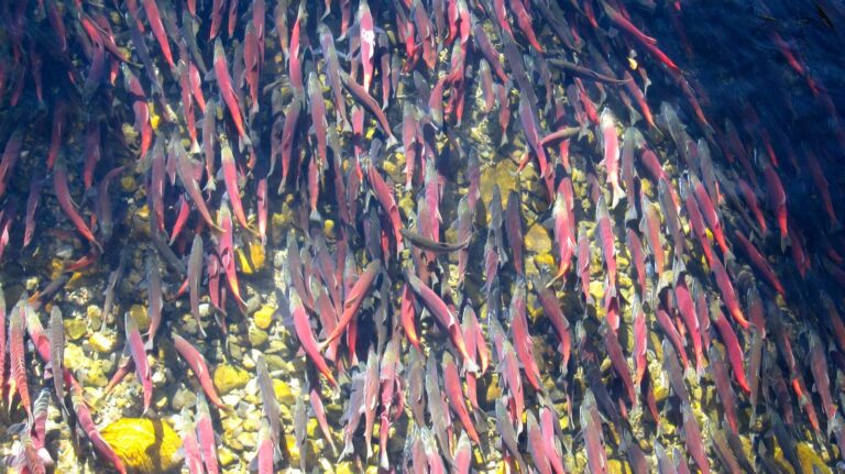
Photo: Jonathan Cook-Fisher, CC BY 2.0

Photo: gailhampshire, CC BY 2.0
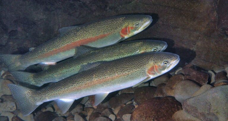
Photo: Oregon State University, CC BY-SA 2.0
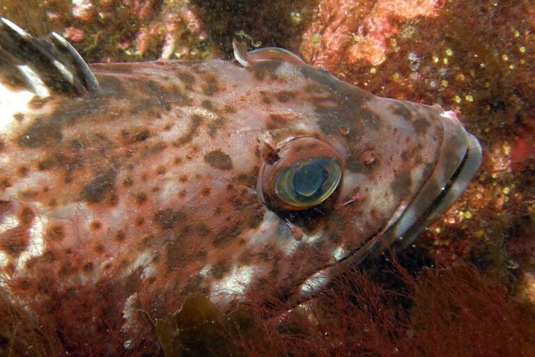
Photo: Ed Bierman, CC BY 2.0
Short answers on fishing Lane County
Where can I put a boat in around Lane County?
There are 118 open launches, 80 with a trailer ramp.
Which Lane County lake spreads over the most mapped acres?
Fern Ridge Lake, about 6,576 acres on its mapped outline.
What fish show up most near Lane County?
Rainbow trout lead the count of water pages within 40 miles, then cutthroat trout, largemouth bass and chinook salmon.
Which Lane County stores carry fishing gear?
26 listed, including Angler's Manufacturing Inc.
Are there charter or guide listings in Lane County?
3 guides and charters name this county.
In which town does Lane County hold court?
Eugene is the seat.
What does ODFW charge to fish in Lane County?
Annual angling runs $50 for residents of Oregon and $138 for everyone else in 2026. Retained salmonids, sturgeon and halibut are logged on the $69 resident Combined Angling Tag. Beach, jetty and boat anglers on the ocean add the Ocean Endorsement at $9, apart from salmon-only and steelhead-only trips.
Which counties border Lane County?
Linn County, Douglas County and Benton County lie closest.
Which regulation zone fits Lane County?
ODFW files most of the Lane County waters it names under the ODFW Willamette Zone rows, with drainages, not county lines, setting the edges.
When is the next event on Lane County water?
2 events on file from organizer pages, none ahead yet.
Does the booklet set exceptions in Lane County?
The 2026 booklet prints 56 water exceptions reaching this county, starting with Siltcoos Lake; the table above shows each.
Which bays or estuaries lie in Lane County?
Berry Creek estuary, Big Creek (Lane County) estuary, Cape Creek estuary and Siltcoos River; the coastal table above links the pages.
Which Lane County waters get hatchery trout?
Yes: 17 waters on the ODFW schedule, such as Siltcoos Lake, Hills Creek Lake and Fall Creek Lake; releases are planned, not confirmed.
Which ODFW record fish came out of Lane County water?
Coho Salmon, 25 lb 5.25 oz, from Siltcoos Lake (1966).
Give Lane County a weekend of fishing
Launch pages give lanes, amenities and directions.