Fishing in Linn County, Oregon
County seat: Albany. Population 128,610.
- 13lake pages
- 39open launches
- 5river pages
 Pick for troutPiscifun Carbon X ultralight spinning reel28% OFFSale $57.99
Photo of Detroit Lake: Bonnie Moreland, CC0 1.0
First look at fishing in Linn County
Census 2020 placed 128,610 people in Linn County, governed from Albany. In the booklet, the bulk of Linn County waters sit in the ODFW Willamette Zone pages, since zones track watersheds.
Detroit Lake leads the 13 paged lakes reaching into Linn County by outline acreage. OSMB maps 39 open launches here, 26 of them built for trailered boats.
Census 2020 population; BLM Oregon NHD lake outlines; OSMB Boating Access Sites; DLCD and ODFW shore access layers; 2026 Oregon Sport Fishing Regulations zone lists; read November 2, 2026.
Launches, lakes and shore spots of Linn County on one map
OSMB launch points, DLCD and ODFW shore sites, NHD lake points, PMEP estuary points; read November 2, 2026.
Reservoirs inside Linn County
| Lake | Acres | Kind | OSMB launches | Fish mapped |
|---|---|---|---|---|
| Detroit Lake | 3,590 (outline) | lake | 12 | brook trout, brown bullhead, cutthroat trout |
| Foster Lake | 1,051 (outline) | lake | 5 | bluegill, largemouth bass, northern pikeminnow |
| Big Lake | 236 (outline) | lake | 1 | brook trout, cutthroat trout, rainbow trout |
| Smith Reservoir (Linn County) | 152 (outline) | reservoir | 2 | brook trout, rainbow trout |
| Clear Lake (Linn County) | 151 (outline) | lake | 3 | brook trout, rainbow trout |
| Big Cliff Reservoir | 101 (outline) | reservoir | 1 | rainbow trout |
| Lost Lake (Linn County) | 79 (outline) | lake | 1 | brook trout, rainbow trout |
| Cheadle Lake | 72 (outline) | lake | 1 | |
| Trail Bridge Reservoir | 63 (outline) | reservoir | 1 | brook trout, cutthroat trout, rainbow trout |
| Carmen Reservoir | 28 (outline) | reservoir | 1 | brook trout, cutthroat trout, rainbow trout |
| Lake Ann | 21 (outline) | lake | 1 | brook trout |
| Waverly Lake | 10 (outline) | lake | 1 | bluegill, brown bullhead, largemouth bass |
| Timber-Linn Lake | 6 (outline) | lake | 0 | bluegill, brown bullhead, largemouth bass |
BLM Oregon hydrography lake outlines (NHD), summed by GNIS name (layer), read November 2, 2026. Species: ODFW Fish Habitat Distribution layers (ODFW ArcGIS), read November 2, 2026; a mapped species is habitat use ODFW records, not a catch report. ODFW publishes no lake depths in these layers.
 For the trout herePiscifun Carbon XT ultralight spinning reel25% OFFSale $59.99
The species tally near Linn County
Each bar counts the lake, river and bay pages within 40 miles of Albany that list the fish; rainbow trout shows up most.
Species from ODFW Fish Habitat Distribution layers, booklet exceptions and ODFW records, counted per water page within 40 miles; habitat mapping, not a catch survey.
Lakes of Linn County listed here only
58 smaller lakes in Linn County are listed here only.
| Water | Acres (outline) | Nearest place |
|---|---|---|
| Marion Lake | 352 | Sisters |
| Lava Lake | 131 | Sisters |
| Fish Lake (Linn County) | 118 | Sisters |
| Snow Peak Log Pond | 61 | Lebanon |
| Fisher Island Pond | 57 | Corvallis |
| Mowich Lake | 53 | Sisters |
| Pamelia Lake | 53 | Sisters |
| Willamette Log Pond | 52 | Sweet Home |
| Second Lake | 50 | Millersburg |
| Western Log Pond | 42 | Lebanon |
| Jorn Lake | 31 | Sisters |
| Duffy Lake | 26 | Sisters |
| Colorado Lake | 24 | Corvallis |
| Nan-Scott Lake | 21 | Mill City |
| Indian Prairie Lake | 19 | Mill City |
| Patjens Lakes | 17 | Sisters |
| Wilson Lake | 17 | Millersburg |
| Santiam Lake | 16 | Sisters |
| Helms Reservoir | 15 | Jefferson |
| Schneider Log Pond | 15 | Brownsville |
| Rainbow Lake | 15 | Mill City |
| Gordon Lakes | 12 | Sweet Home |
| Daly Lake | 11 | Mill City |
| Swan Lakes | 11 | Albany |
| Robinson Lake | 11 | Sisters |
| Teto Lake | 10 | Sisters |
| Blue Lake (Linn County) | 10 | Sisters |
| First Lake | 10 | Albany |
| Heart Lake | 9 | Sisters |
| Turpentine Lake | 8 | Sisters |
| Temple Lake | 8 | Sisters |
| Fay Lake | 8 | Sisters |
| Fir Lake | 8 | Sisters |
| Tule Lake | 7 | Mill City |
| Parish Lake | 7 | Mill City |
| Hunts Lake | 7 | Sisters |
| Hanks Lake | 7 | Sisters |
| Lower Berley Lake | 7 | Sisters |
| Upper Berley Lake | 6 | Sisters |
| Bowerman Lake | 6 | Sisters |
| Pine Ridge Lake | 6 | Sisters |
| Kuitan Lake | 5 | Sisters |
| Prill Lake | 5 | Sisters |
| Lake of the Woods | 5 | Sisters |
| Pinet Lake | 4 | Sisters |
| Red Butte Lake | 4 | Sisters |
| Melis Lake | 4 | Sisters |
| Alforja Lake | 4 | Sisters |
| Widgeon Lake | 3 | Sisters |
| Chiquito Lake | 3 | Sisters |
| Riggs Lake | 3 | Mill City |
| North Dixie Lake | 2 | Sisters |
| Presley Lake | 2 | Sisters |
| Pika Lake | 2 | Sisters |
| Jo Jo Lake | 2 | Mill City |
| Don Lake | 2 | Mill City |
| Cincha Lake | 1 | Sisters |
| Little Cincha Lake | 1 | Sisters |
BLM Oregon hydrography lake outlines (NHD), summed by GNIS name (layer), read November 2, 2026.
River guides for Linn County
- Calapooia RiverODFW maps spring chinook and winter steelhead runs, 1 OSMB launch, 1 USGS gauge
- North Santiam RiverODFW maps coho, fall chinook and spring chinook runs, 12 OSMB launches, 4 USGS gauges
- South Santiam RiverODFW maps fall chinook, spring chinook and summer steelhead runs, 7 OSMB launches, 5 USGS gauges
- Middle Santiam RiverODFW maps spring chinook and winter steelhead runs, 1 USGS gauge
- Smith River8 OSMB launches, 2 USGS gauges, 20 booklet exceptions
More river names in Linn County (4)
- Dead Riverstream
- Little Willamette Riverstream
- North Fork Calapooia RiverODFW maps winter steelhead runs
- South Roaring Riverstream
Gauge stations around Linn County
| USGS gauge | Latest reading | Time (ET) |
|---|---|---|
| Willamette River At Albany, Or | 6,300 cfs, 3.90 ft gage height | Nov 11 9:20 pm |
| Willamette River At Harrisburg, Or | 4,530 cfs, 2.04 ft gage height | Nov 11 9:20 pm |
| Santiam River At Jefferson, Or | 3,470 cfs, 3.53 ft gage height | Nov 11 9:15 pm |
| South Santiam River At Waterloo, Or | 1,290 cfs, 3.27 ft gage height | Nov 11 9:20 pm |
| North Santiam River At Niagara, Or | 2,990 cfs, 4.49 ft gage height | Nov 11 9:20 pm |
| South Santiam River Near Foster, Or | 1,430 cfs, 10.66 ft gage height | Nov 11 9:20 pm |
US Geological Survey provisional data, retrieved Nov 11, 2026 9:33 pm ET. Provisional readings can be revised.
ODFW Fish Habitat Distribution stream names and runs, OSMB launches, booklet exceptions and USGS gauges; read November 2, 2026.
OSMB launches in Linn County
- Andrew Wiley Park on South Santiam RiverSouth Santiam River, 1 lane, trailered launch
- Big Lake Day Use boat rampBig Lake, 1 lane, trailered launch
- Billings Park on Green Peter LakeGreen Peter Lake, 1 lane, hand carry launch
- Bowman Park on Willamette RiverWillamette River, 2 lanes, trailered launch
- Bryant Park River Access on Willamette RiverWillamette River, hand carry launch
- Buell Miller boat ramp on North Santiam RiverNorth Santiam River, 1 lane, trailered launch
- Calkins Park on Foster LakeFoster Lake, 2 lanes, trailered launch
- Claude Cox Day Use Ramp on South Santiam RiverSouth Santiam River, 1 lane, trailered launch
- Clear Lake Day Use boat rampClear Lake, trailered launch
- Clear Lake Resort launchClear Lake, hand carry launch
- Freeway Lakes boat rampFreeway Lakes, trailered launch
- Gedney Creek boat ramp on Foster LakeFoster Lake, 2 lanes, trailered launch
- Gills Landing on South Santiam RiverSouth Santiam River, 1 lane, trailered launch
- Greens Bridge boat ramp on North Santiam RiverNorth Santiam River, trailered launch
- Harrisburg Landing on Willamette RiverWillamette River, 1 lane, trailered launch
- John Neal Memorial Park on North Santiam RiverNorth Santiam River, trailered launch
- Lake Ann launchLake Ann, hand carry launch
- Lakes End Campground launch on Smith ReservoirSmith Reservoir, hand carry launch
- Lewis Creek Park on Foster LakeFoster Lake, hand carry launch
- Lost Lake Campground boat rampLost Lake, trailered launch
- Lyons-Mehama Launch on North Santiam RiverNorth Santiam River, 1 lane, hand carry launch
- McCartney Park on Willamette RiverWillamette River, 1 lane, trailered launch
- McKercher Park on Calapooia RiverCalapooia River, 1 lane, hand carry launch
- Monteith Park River Access on Willamette RiverWillamette River, hand carry launch
- North Side Lebanon Dam boat ramp on South Santiam RiverSouth Santiam River, 1 lane, trailered launch
- Peoria Park on Willamette RiverWillamette River, 1 lane, trailered launch
- Pleasant Valley Boat Ramp on South Santiam RiverSouth Santiam River, 1 lane, trailered launch
- River Bend County Park on South Santiam RiverSouth Santiam River, 1 lane, hand carry launch
- Smith Reservoir boat rampSmith Reservoir, trailered launch
- Stayton Bridge boat ramp on North Santiam RiverNorth Santiam River, 1 lane, trailered launch
- Sunnyside Park on Foster LakeFoster Lake, 3 lanes, trailered launch
- Thistle Creek Lower Ramp on Green Peter LakeGreen Peter Lake, 1 lane, trailered launch
- Thistle Creek Upper Ramp on Green Peter LakeGreen Peter Lake, 1 lane, trailered launch
- Trail Bridge Campground boat rampTrail Bridge Reservoir, trailered launch
- Waterloo County Park Ramp on South Santiam RiverSouth Santiam River, 1 lane, trailered launch
- Waverly ParkWaverly Lake, hand carry launch
- Whitcomb Creek County Park on Green Peter LakeGreen Peter Lake, 2 lanes, trailered launch
- Bond Butte Pond launchBond Butte Pond, hand carry launch
- Edgewater County Marina on Foster LakeFoster Lake, launch
- Carmen Reservoir RampCarmen Reservoir, closed per OSMB
- Cheadle Lake boat rampCheadle Lake, closed per OSMB
- Cold Water Cove Boat Slide boat ramp on Clear LakeClear Lake, closed per OSMB
- Cove Creek Campground boat ramp on Detroit LakeDetroit Lake, closed per OSMB
- Hoover Campground boat ramp on Detroit LakeDetroit Lake, closed per OSMB
- Southshore Day Use Area boat ramp on Detroit LakeDetroit Lake, closed per OSMB
Launches marked closed on the OSMB layer get no page; restricted ones carry the OSMB note on theirs.
Oregon State Marine Board Boating Access Sites layer (OSMB ArcGIS), read November 2, 2026; status as OSMB publishes it. Oregon Coastal Management Program (DLCD) Shoreline Access Inventory (layer) and the ODFW shore access map, read November 2, 2026.
Planned trout plants across Linn County
ODFW lists 82 planned plants across 4 waters of Linn County, adding up to 129,880 trout.
- Foster Lake20 releases planned, next listed: Sep. 20, 2027 – Sep. 24, 2027: 3,000 legal-size trout
- Carmen Reservoir10 releases planned, next listed: Jul. 12, 2027 – Jul. 16, 2027: 600 legal-size trout
- Waverly Lake19 releases planned, next listed: Dec. 20, 2027 – Dec. 24, 2027: 800 legal-size trout
- Timber-Linn Lake33 releases planned, next listed: Dec. 20, 2027 – Dec. 24, 2027: 900 legal-size trout
ODFW weekly trout stocking schedule (planned releases; ODFW prints size classes, not species), myodfw.com, read November 2, 2026.
Daily limits for Linn County waters
Begin with the zone rows for Linn County, then check the exception list for the water you fish. Budget $50 if you live in Oregon, $138 if not, for the annual angling license. Salmon, steelhead, sturgeon and halibut also go on a Combined Angling Tag ($69 resident).
| Species | Limit | Season |
|---|---|---|
| Trout | Lakes: 5 per day, 3 daily limits in possession. Streams: catch-and-release only, unless noted under Exceptions; 8-inch minimum | Lakes: Open all year. Streams: Open May 22 – Oct 31 unless noted under Exceptions. |
| Kokanee | 10 per day unless noted under Exceptions. | Open all year. |
| Salmon and Steelhead below Willamette Falls and Columbia River Tributa. | In the aggregate: 2 adult salmon or steelhead per day, 20 per year. 5 jacks per day, 2 daily jack limits in possession. | Closed in all waters unless noted under Exceptions. |
| Salmon above Willamette Falls | 2 adult salmon per day, 5 jacks per day, 2 daily jack limits in possession. 20 salmon and steelhead per year in aggregate. | Closed in all waters unless noted under Exceptions. |
| Steelhead above Willamette Falls | 3 adult steelhead per day (in addition to daily salmon bag limit). 20 salmon and steelhead per year in aggregate. | Closed in all waters unless noted under Exceptions. |
| Sturgeon | Catch-and-release only, unless noted under Exceptions. | Catch-and-release: Open all year, except as noted under Exceptions. |
| Bass | Lakes: 5 per day, 3 daily limits in possession unless noted under Exceptions. Streams: No limit. | Lakes: Open all year. Streams: Open during trout, salmon or steelhead seasons, except mainstem Willamette River and sloughs and tidewater areas of Columbia. |
| Bluegill, Catfish, Crappie, Other Sunfish, Walleye, Yellow Perch, Stri. | No limit, unless noted under Exceptions. | Lakes: Open all year. Streams: Open during trout, salmon or steelhead seasons, except mainstem Willamette River and sloughs and tidewater areas of Columbia. |
| Pacific Lamprey | Refer to General (Statewide) Regulations for regulations covering the harvest of Pacific lamprey. | Refer to General (Statewide) Regulations for regulations covering the harvest of Pacific lamprey. |
| Smelt | Closed. | Closed. |
Water-by-water rules in Linn County (27)
| Water | Species | Rule | Booklet |
|---|---|---|---|
| Smith River (Mainstem, Douglas Co.) (Mouth to Spencer Cr) | trout | Open for trout, May 22 – Sep 15, catch-and-release only. | p. 39 |
| Smith River (Mainstem, Douglas Co.) (Mouth to Spencer Cr) | hatchery steelhead | Open all year for hatchery steelhead. | p. 39 |
| Smith River (Mainstem, Douglas Co.) (Mouth to Spencer Cr) | chinook | Open for Chinook Jul 1 – Nov 30. | p. 39 |
| Smith River (Mainstem, Douglas Co.) (Spencer Cr to Sisters Cr) | trout | Open for trout, May 22 – Sep 15, catch-and-release only. | p. 39 |
| Smith River (Mainstem, Douglas Co.) (Spencer Cr to Sisters Cr) | Artificial flies and lures only May 22 – Sep 15. | p. 39 | |
| Smith River (Mainstem, Douglas Co.) (Spencer Cr to Sisters Cr) | hatchery steelhead | Open for hatchery steelhead Jan 1 – Apr 30 and Dec 1-31. | p. 39 |
| Smith River (Mainstem, Douglas Co.) (Mainstem above Sisters Cr and all tributaries) | trout | Open for trout May 22 – Sep 15, 2 per day, 8 inch minimum length. | p. 39 |
| Smith River (Mainstem, Douglas Co.) (Mainstem above Sisters Cr and all tributaries) | Use of bait allowed only in tidewater. | p. 39 | |
| Smith River (Mainstem, Douglas Co.) (Mainstem above Sisters Cr and all tributaries) | See Smith River, North Fork. | p. 39 | |
| Smith River, North Fork (Douglas Co.) (Mouth to Johnson Cr) | trout | Open for trout, May 22 – Sep 15, catch-and-release only. | p. 39 |
| Smith River, North Fork (Douglas Co.) (Mouth to Johnson Cr) | hatchery steelhead | Open all year for hatchery steelhead. | p. 39 |
| Smith River, North Fork (Douglas Co.) (Mouth to Johnson Cr) | chinook | Open for Chinook Jul 1 – Nov 30. | p. 39 |
| Smith River, North Fork (Douglas Co.) (Johnson Cr to Bridge 10) | trout | Open for trout, May 22 – Sep 15, catch-and-release only. | p. 39 |
| Smith River, North Fork (Douglas Co.) (Johnson Cr to Bridge 10) | hatchery steelhead | Open for hatchery steelhead Jan 1 – Apr 30 and Dec 1-31. | p. 39 |
| Smith River, North Fork (Douglas Co.) (Johnson Cr to Bridge 10) | Artificial flies and lures only May 22 – Sep 15. | p. 39 | |
| Smith River, North Fork (Douglas Co.) (Mainstem above Bridge 10 and all tributaries) | trout | Open for trout May 22 – Sep 15, 2 per day, 8 inch minimum length. | p. 39 |
| Smith River, North Fork (Douglas Co.) (Mainstem above Bridge 10 and all tributaries) | Use of bait allowed only in tidewater. | p. 39 | |
| Detroit Reservoir | All Zone Regulations apply. | p. 44 | |
| Foster Reservoir | trout | 5 hatchery trout per day, 8 inch minimum length. | p. 45 |
| Foster Reservoir | kokanee | Zone regulations apply for kokanee. | p. 45 |
Limits as printed in the 2026 Oregon Sport Fishing Regulations (ODFW, eRegulations edition) (Willamette Zone page), read November 2, 2026. Water exceptions as printed in the 2026 Oregon Sport Fishing Regulations (ODFW, eRegulations edition) (booklet PDF; printed page shown), read November 2, 2026. In-season changes from ODFW override them. Fees as printed on the ODFW license, tag and permit fee page of the 2026 Oregon Sport Fishing Regulations (ODFW, eRegulations edition) (fees page), read November 2, 2026.
Record-book catches around Linn County
For Linn County, the closest record waters sit inside 80 miles.
| Species | Weight | Water | Date |
|---|---|---|---|
| White Catfish | 15 lb 0 oz | Tualatin River | 1989 |
| Pumpkinseed Sunfish | 0 lb 7.68 oz | Lake Oswego | 1996 |
| Smallmouth Bass | 8 lb 1.76 oz | Henry Hagg Lake | 2005 |
| Bullhead Catfish | 3 lb 7 oz | Henry Hagg Lake | 2001 |
Oregon record fish as listed by Oregon Department of Fish and Wildlife (record fish article, dated March 4, 2026), read November 2, 2026.
Gear stores across Linn County
Linn County bait and tackle
- Dey's Bait & Tacklebait and tackle shop, Lebanon
- Jimiley Custom Rodsbait and tackle shop, Lyons
- M2 Outdoor Sportsbait and tackle shop, Lebanon
- Santiam Sports Centerbait and tackle shop, Mill City
- Two Rivers Fly Shopfly shop, Albany
- Bi-Mart (Albany)sporting goods store, Albany
- Bi-Mart (Lebanon)sporting goods store, Lebanon
- Bi-Mart (Sweet Home)sporting goods store, Sweet Home
- Sportsman's Warehouse Albanysporting goods store, Albany
Linn County guides and charters
- FISHERMAN MIKE'S GUIDE SERVICEfishing guide, Mill City, (971) 273-3422
Yellow Pages and store-locator listings, guide and charter business listings (county of the business), read November 2, 2026.
Close by Linn County
Town guides for Linn County
- Albanypop. 56,472
- Lebanonpop. 18,447
- Sweet Homepop. 9,828
- Harrisburgpop. 3,652
- Millersburgpop. 2,919
- Mill Citypop. 1,971
- Brownsvillepop. 1,694
- Tangentpop. 1,231
- Lyonspop. 1,202
Neighbours of Linn County
- Marion County29 miles north
- Lane County43 miles southwest
- Benton County43 miles west
- Clackamas County49 miles north
Piscifun tackle that suits a trip to Linn County


Piscifun and Amazon links are affiliate links; the site earns a commission on qualifying purchases.
Photographs from the shoreline near Linn County

Photo: Bonnie Moreland, Public domain
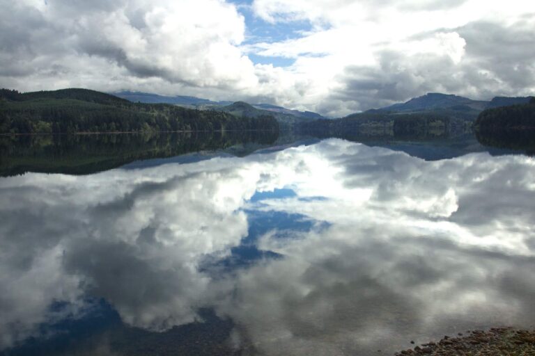
Photo: Bonnie Moreland, Public domain
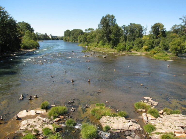
Photo: Kris Arnold, CC BY-SA 2.0
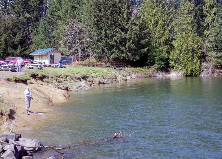
Photo: Oregon Department of Fish & Wildlife, CC BY-SA 2.0
Fishing in Linn County: the questions that come up
Can I launch a trailered boat in Linn County?
Count 39 open launches, 26 for trailers.
Which Linn County lake has the widest outline?
Detroit Lake, about 3,590 acres on its mapped outline.
What species live in water around Linn County?
Rainbow trout lead the count of water pages within 40 miles, then cutthroat trout, largemouth bass and chinook salmon.
Where can Linn County anglers buy roe, shrimp or worms?
Try Dey's Bait & Tackle; 9 are listed.
How many guide or charter listings give Linn County as home port?
The listings show 1 guide or charter here.
Where is Linn County governed from?
The seat is Albany.
What does ODFW charge an out-of-state angler in Linn County?
A year of Oregon angling privileges costs $50 in state and $138 from out of state this season. For salmon and steelhead the booklet adds the Combined Angling Tag at $69 resident.
Which Oregon counties are a short drive from Linn County?
Try Marion County, Lane County and Benton County.
Which booklet zone applies in Linn County?
Most waters ODFW lists in Linn County fall under the ODFW Willamette Zone table, though zone lines follow drainages rather than county lines.
Are there water-specific limits in Linn County?
The 2026 booklet prints 27 water exceptions reaching this county, starting with Smith River (Mainstem, Douglas Co.); the table above shows each.
Where are stocked lakes in Linn County?
Yes: 4 waters on the ODFW schedule, such as Foster Lake, Carmen Reservoir and Waverly Lake; releases are planned, not confirmed.
Point the rig toward Linn County
Each Oregon river page shows its USGS gauges live.