Chaffee Creek Fishing
Marquette County and Waushara County, classified trout water.
 Pick for troutPiscifun Carbon X ultralight spinning reel28% OFFSale $57.99
Photo, nearby stand in for Chaffee Creek: Warren LeMay, CC BY-SA 2.0
The Chaffee Creek, the essentials
Through Marquette County and Waushara County the Chaffee Creek follows its channel as a stream. WDNR assessment units add up to about 16 miles of it. From the midpoint, Coloma lies roughly 6 miles away.
Trout classes cover about 15.6 miles of it. State water rules designate reaches as 14 miles of Outstanding Resource Water. It is measured by 1 active gauge.
 For the trout herePiscifun Carbon XT ultralight spinning reel25% OFFSale $59.99
Classified trout miles of the Chaffee Creek
WDNR trout classes on the Chaffee Creek: I means self-sustaining, II means some natural reproduction with stocking, III means stocked fish.
| Class | From mile | To mile | Miles |
|---|---|---|---|
| CLASS II | 0 | 1.66 | 1.66 |
| CLASS I | 1.66 | 15.62 | 13.96 |
The Chaffee Creek in the trout regulations
| Water | Bag and size | Season | Early season and gear |
|---|---|---|---|
| Chaffee Creek | 3 in total: rainbow trout over 12"; brown and brook trout over 8". | First Saturday in April at 5:00 a.m. to Oct. 15. | First Saturday in January to First Saturday in April all trout shall be immediately released. Only artificial lures may be used. |
Trout anglers on the Chaffee Creek need the $10 inland trout stamp along with a fishing license.
WDNR TROUT layer and trout regulation layer; 2026-2027 Guide to Wisconsin Trout Fishing Regulations. Wisconsin trout streams.
Fish the DNR lists for the Chaffee Creek
WDNR fisheries designation layers (musky, sturgeon, smallmouth bass and trout streams); not a full species survey.
River level on the Chaffee Creek
| USGS gauge | Latest reading | Time (ET) |
|---|---|---|
| Chaffee Creek At I-39 Near Coloma, Wi | 10 cfs, 3.61 ft gage height | Nov 12 12:00 pm |
US Geological Survey provisional data, retrieved Nov 12, 2026 12:33 pm ET. Provisional readings can be revised.
Landings along the Chaffee Creek
Expect walk-in fishing on the Chaffee Creek; no landing is mapped.
WDNR Boat Access and Shore Fishing layers, USGS gauges.
Seasons and bag limits for the Chaffee Creek
| Species | Limit | Season |
|---|---|---|
| Walleye and sauger | 3 in total; minimum length 15 inches | May 2, 2026 – March 7, 2027 |
| Northern pike (south of Hwy 10) | 2; minimum length 26 inches | May 2, 2026 – March 7, 2027 |
| Largemouth bass | 5; minimum length 14 inches | May 2, 2026 – March 7, 2027 |
| Smallmouth bass (Southern Bass Zone) | 5 in total with largemouth bass; minimum length 14 inches | May 2, 2026 – March 7, 2027 |
| Muskellunge | 1; minimum length 40 inches | May 2, 2026 – Dec. 31, 2026 (open water only) |
| Panfish | 25 in total; no minimum length | Open all year |
| Catfish | 10 in total; no minimum length | Open all year |
| Cisco and whitefish | 10 in total; no minimum length | Open all year |
| Rock, yellow and white bass | No bag limit; no minimum length | Open all year |
| Bullheads and rough fish | No bag limit; no minimum length | Open all year |
These are the statewide inland rows for the Chaffee Creek by its position south of Hwy 10; county exceptions in the guide can change them.
2026-2027 Guide to Wisconsin Hook and Line Fishing Regulations. All Wisconsin limits.
Next to the Chaffee Creek
Nearby lakes to try after the Chaffee Creek
- Curtis Lake, Waushara County2 miles
- Lake Sharon3 miles
- Wood Lake, Marquette County4 miles
- Crystal Lake, Marquette County4 miles
Bait counters near the Chaffee Creek
- D & R Luresbait and tackle shop, Neshkoro, 10 miles
- The Minnow Bucket, 321 S Franklin Avebait and tackle shop, Oxford, 15 miles
- Lewies Unlimited Outdoorssporting goods store, Adams, 19 miles
- Norton's Dry Dockmarina, Princeton, 21 miles
- Larry Smith Outdoorsbait and tackle shop, Berlin, 23 miles
Overnight towns handy to the Chaffee Creek
- Coloma6 miles
- Harrisville6 miles
- Westfield7 miles
- Wautoma10 miles
Neighboring streams of the Chaffee Creek
- South Branch Wedde Creek2 miles
- North Branch Wedde Creek2 miles
- Tagatz Creek2 miles
- Caves Creek5 miles
Which counties the Chaffee Creek touches
- Marquette County
- Waushara County
Reels and a scale grip to bring to the Chaffee Creek


Piscifun and Amazon links are affiliate links; the site earns a commission on qualifying purchases.
Know the fish of Chaffee Creek
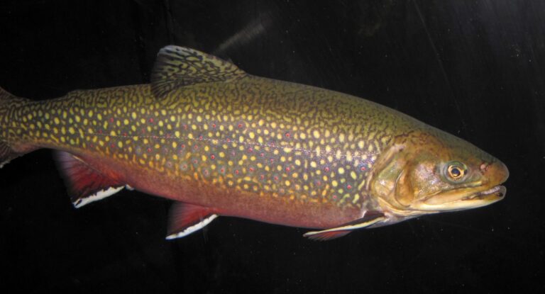
Photo: James St. John, CC BY 2.0

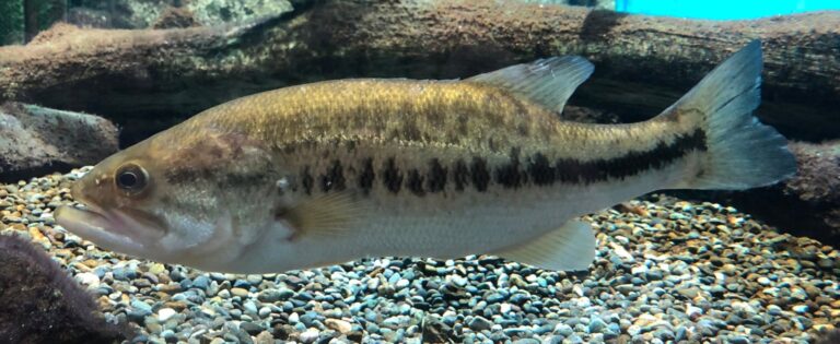
Photo: Totti, CC BY-SA 4.0

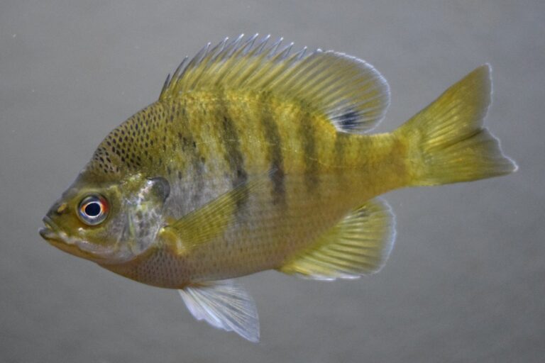
Photo: Scott Harden, CC BY-SA 4.0

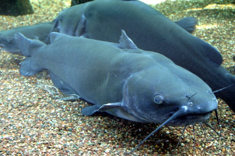
Photo: Ryan Somma, CC BY-SA 2.0

Short answers for a day on the Chaffee Creek
Through which counties does the Chaffee Creek flow?
Search the map of Marquette County and Waushara County for it.
May I keep trout from the Chaffee Creek under WDNR rules?
Yes; about 15.6 miles carry a WDNR trout class (class i and class ii).
What does the gauge on the Chaffee Creek read?
Scroll up for the 1 USGS gauge on the river.
Is there a boat landing on the Chaffee Creek?
No access point names it.
What WDNR limits apply on the Chaffee Creek?
Bag: 3 in total: rainbow trout over 12"; brown and brook trout over 8". Season: First Saturday in April at 5:00 a.m. to Oct. 15.
Do I need a Wisconsin license for the Chaffee Creek?
Classified trout water calls for a Wisconsin fishing license ($20 resident, $55 nonresident a year) and the $10 inland trout stamp when you fish for trout.
Is there a tackle store near the Chaffee Creek?
D & R Lures, roughly 10 miles from the midpoint.
Which fish does the WDNR list for the Chaffee Creek?
WDNR designations name trout.
Which Wisconsin town neighbors the Chaffee Creek?
Census data make Coloma the closest place, around 6 miles away.
Spend a Wisconsin morning on the Chaffee Creek
Check the gauge and the rules before you go.