Fishing in Price County, Wisconsin
Seat: Phillips. WDNR Northern region.
- 92lake pages
- 73landings
- 71trout streams
 Pick for walleyePiscifun Viper X spinning reel50% OFFSale $39.99
Photo of Chippewa River: Tony Webster, CC BY 2.0
Fishing Price County at a glance
From the seat in Phillips, Price County sits inside the Northern region of the Wisconsin DNR. Census 2020 put the population at 14,054; land area is 1,254 square miles and water area 24.
Of 92 lakes with pages here (13,257 acres combined), Butternut Lake, Price County covers the most water. Find a Lake rates walleye common or better on 24 lake pages here; musky are listed on 33. The county has 73 public landings totaling 47 lanes on the WDNR list. The TROUT layer classes 71 streams here, with 92.9 miles of Class I water. For fishing without a boat, the county has 2 shore fishing sites.
 For the walleye herePiscifun AlumiX spinning reel46% OFFSale $64.99
Mapped fishing access in Price County
WDNR Boat Access and Shore Fishing layers and Find a Lake records, checked October 2026.
Named lakes with pages in Price County
| Lake | Acres | Max depth ft | Landings | DNR lake class | Top fish (WDNR rating) |
|---|---|---|---|---|---|
| Butternut Lake, Price County | 983 | 32 | 4 | complex cool dark | musky (abundant) |
| Solberg Lake | 844 | 16 | 2 | complex cool dark | panfish (abundant) |
| Round Lake near Lac du Flambeau, Price County | 748 | 24 | 2 | complex cool dark | walleye (abundant) |
| Pike Lake, Price County | 741 | 17 | 1 | complex cool dark | walleye (abundant) |
| Big Pine Lake, Iron County | 642 | 22 | 0 | complex warm dark | northern pike (abundant) |
| Lac Sault Dore | 601 | 21 | 2 | complex riverine | musky (common) |
| Musser Flowage | 503 | 15 | 2 | complex riverine | panfish (abundant) |
| Cranberry Lake, Price County | 466 | 18 | 1 | complex cool dark | largemouth bass (common) |
| Long Lake near Phillips, Price County | 419 | 54 | 0 | complex riverine | walleye (abundant) |
| Crowley Flowage 802 | 354 | 23 | 1 | complex riverine | trout (abundant) |
| Duroy Lake | 350 | 18 | 0 | complex riverine | walleye (abundant) |
| Wilson Lake, Price County | 348 | 11 | 2 | complex cool dark | walleye (abundant) |
| Upper Park Falls Flowage 760 | 310 | 17 | 3 | complex riverine | northern pike (abundant) |
| Blockhouse Lake | 241 | 8 | 1 | complex cool dark | walleye (abundant) |
| Long Lake near Park Falls, Price County | 238 | 49 | 0 | complex cool clear | largemouth bass (common) |
| North Spirit Lake | 224 | 22 | 0 | complex cool dark | walleye (abundant) |
| Sailor Creek Flowage | 201 | 8 | 1 | simple riverine | northern pike (abundant) |
| Riley Lake, Price County | 184 | 5 | 1 | simple cool dark | largemouth bass (common) |
| Hultman Lake | 182 | 14 | 0 | simple warm dark | panfish (abundant) |
| Pixley Flowage | 182 | 23 | 0 | complex riverine | panfish (abundant) |
| Sailor Lake | 168 | 7 | 1 | simple cool clear | panfish (abundant) |
| Wilson Flowage near Phillips, Price County, 162 acres | 162 | 6 | 2 | simple harsh has fishery | northern pike (common) |
| Turner Lake | 159 | 12 | 0 | complex cool dark | walleye (abundant) |
| Schnur Lake | 154 | 27 | 0 | complex cool dark | walleye (abundant) |
| Deer Lake near Phillips, Price County | 143 | 18 | 1 | simple cool dark | musky (abundant) |
| Big Dardis Lake | 140 | 23 | 1 | complex cool dark | largemouth bass (common) |
| Spirit Lake, Taylor County | 137 | 9 | 1 | complex cool dark | largemouth bass (common) |
| Le Tourneau Lake | 120 | 16 | 1 | simple cool dark | largemouth bass (common) |
| Thompson Lake, Price County | 114 | 25 | 0 | complex cool dark | panfish (common) |
| Cochran Lake, Price County | 111 | 20 | 0 | complex cool clear | largemouth bass (abundant) |
| Tucker Lake, Price County | 107 | 32 | 2 | complex cool clear | northern pike (common) |
| Lake Sixteen, Price County | 104 | 5 | 0 | simple harsh has fishery | northern pike (present) |
| Hay Lake, Iron County | 102 | 5 | 1 | simple harsh has fishery | northern pike (common) |
| Worcester Lake | 101 | 37 | 1 | complex cool clear | panfish (common) |
| Wilson Flowage near Phillips, Price County, 95 acres | 95 | 1 | |||
| Bass Lake near Phillips, Price County, 93 acres | 93 | 45 | 1 | simple cool clear | largemouth bass (common) |
| Newman Lake | 90 | 45 | 1 | simple cool clear | largemouth bass (common) |
| Price Lake, Price County | 89 | 27 | 0 | simple cool clear | northern pike (common) |
| Schmuland Flowage | 89 | 8 | 1 | simple harsh has fishery | panfish (present) |
| Crane and Chase Lake | 88 | 22 | 1 | complex cool dark | largemouth bass (common) |
| Elk Lake | 87 | 25 | 1 | complex riverine | musky (common) |
| Gates Lake, Price County | 87 | 5 | 1 | simple cool dark | panfish (common) |
| Stone Lake, Price County | 87 | 16 | 1 | simple cool dark | panfish (common) |
| Aabajijiwang Flowage | 84 | 7 | 0 | simple harsh has fishery | panfish (common) |
| Bass Lake near Butternut, Price County | 84 | 46 | 0 | complex cool clear | musky (common) |
| Smith Lake, Price County | 76 | 1 | |||
| Davis Lake, Price County | 73 | 8 | 0 | simple warm dark | largemouth bass (present) |
| Grassy Lake, Price County | 72 | 7 | 1 | complex riverine | musky (common) |
| Byhre Lake | 70 | 24 | 0 | ||
| Kabol Lake | 69 | 20 | 0 | simple warm dark | largemouth bass (common) |
| Patterson Lake, Price County | 65 | 34 | 1 | simple cool clear | trout (common) |
| Lower Park Falls Flowage 762 | 62 | 16 | 1 | complex riverine | northern pike (common) |
| Spring Creek Flowage | 58 | 6 | 1 | simple harsh has fishery | northern pike (present) |
| Bass Lake near Park Falls, Price County | 57 | 41 | 0 | complex cool clear | musky (common) |
| Pond Lake, Price County | 55 | 5 | 0 | simple harsh has fishery | northern pike (present) |
| Whitcomb Lake | 55 | 30 | 0 | complex cool dark | walleye (common) |
| Middle Price Lake | 50 | 5 | 0 | simple cool clear | northern pike (common) |
| Wintergreen Lake, Price County | 50 | 15 | 0 | simple cool clear | panfish (common) |
| Sweeney Lake | 44 | 14 | 0 | simple warm dark | largemouth bass (common) |
| Foulds Creek Flowage | 43 | 8 | 0 | simple harsh has fishery | panfish (common) |
- Lake Ten, Price County42 acres
- Nettie B Lake39 acres
- McArthur Lake38 acres
- Miles Lake, Price County36 acres
- Buckman Lake34 acres
- McIlquham Lake34 acres
- Perch Lake near Park Falls, Price County34 acres
- Upper Price Lake34 acres
- Dog Lake, Price County33 acres
- Big Briens Lake31 acres
- Priest Lake, Price County31 acres
- South Lake, Price County31 acres
- Island Lake, Price County29 acres
- LeClaire Lake29 acres
- Deer Lake near Lac du Flambeau, Price County27 acres
- Gardner Lake, Price County25 acres
- Lake Three, Price County24 acres
- Murphy Lake, Price County24 acres
- Hansen Lake22 acres
- Mud Lake near Park Falls, Price County22 acres
- Pearson Lake22 acres
- Nichols Lake, Price County21 acres
- Bass Lake near Ogema, Price County20 acres
- Peters Lake, Price County20 acres
- Dave Lake19 acres
- Bass Lake near Phillips, Price County, 18 acres18 acres
- Prentice Flowage16 acres
- Twin Lakes, Price County16 acres
- Niebauer Springs12 acres
- Jupa Lake9 acres
- Newman Springs6 acres
- Camp Four Springs4 acres
WDNR Find a Lake pages (area, depth, landings, fish abundance) and WDNR lake classification layer.
Additional waters in Price County
These 74 Price County lakes have a WDNR record but thin data, so they appear in this table only.
| Lake | Acres | Max depth ft | WBIC | Landings |
|---|---|---|---|---|
| Rice Creek (Pike Lake Chain) | 113 | 2268400 | 0 | |
| Upper Pixley Flowage | 84 | 2225000 | 0 | |
| Mud Lake near Phillips, Price County, 42 acres | 42 | 5 | 1867900 | 0 |
| Bergeson Lake | 24 | 14 | 1513700 | 0 |
| Timms Lake, Price County | 19 | 38 | 2206300 | 0 |
| Homestead Lake, Price County | 17 | 25 | 1854000 | 0 |
| Little Dardis Lake | 16 | 12 | 2244400 | 0 |
| Axels Lake | 15 | 24 | 2251400 | 0 |
| Quimette Lake | 15 | 15 | 1872000 | 0 |
| Beaver Lake, Price County | 14 | 12 | 2253100 | 0 |
| Granger Lake, Price County | 14 | 5 | 1851400 | 0 |
| Tracy Lake | 14 | 15 | 2257600 | 0 |
| Fickle Lake | 13 | 26 | 1515100 | 0 |
| Planet Lake | 12 | 32 | 2256400 | 0 |
| Spur Lake, Price County | 12 | 25 | 2253400 | 0 |
| Steve Creek Flowage, Lower | 12 | 8 | 2191400 | 0 |
| Thirtyfive | 11 | 5583780 | 0 | |
| Johnson Lake, Price County | 11 | 35 | 2202500 | 0 |
| Little Briens Lake | 11 | 6 | 2208600 | 0 |
| Mill Pond, Price County | 11 | 20 | 1866400 | 0 |
| Lake Annie | 10 | 12 | 2279400 | 0 |
| Lower Aabajijiwang Flowage | 10 | 7 | 2242900 | 0 |
| Risberg Lake | 10 | 44 | 1511400 | 0 |
| Lost Lake near Park Falls, Price County | 9 | 15 | 1863500 | 0 |
| Minnow Lake, Price County | 9 | 30 | 1866700 | 0 |
| Pot Lake near Phillips, Price County, 9 acres | 9 | 14 | 1875700 | 0 |
| Bear Lake, Price County | 8 | 5 | 1833900 | 0 |
| Coolidge Lake | 8 | 14 | 1841700 | 0 |
| Mink Spring | 8 | 18 | 2238900 | 0 |
| Mud Lake near Butternut, Price County, 8 acres | 8 | 16 | 1868100 | 0 |
| Perch Lake near Catawba, Price County | 8 | 15 | 1873300 | 0 |
| Thirty Five Lakes | 8 | 10 | 2207900 | 0 |
| Lake Seven, Price County | 7 | 10 | 1859300 | 0 |
| Mud Lake near Phillips, Price County, 7 acres | 7 | 18 | 2234500 | 0 |
| Township Corners Flowage | 7 | 5 | 2214900 | 0 |
| Constellation Lake | 6 | 16 | 2277800 | 0 |
| Mud Lake near Butternut, Price County, 6 acres | 6 | 18 | 1868200 | 0 |
| Ogema Millpond | 6 | 9 | 2205600 | 0 |
| Pot Lake near Phillips, Price County, 6 acres | 6 | 40 | 1839800 | 0 |
| Betsy Lake | 5 | 5 | 2288600 | 0 |
| Cooley Lake, Price County | 5 | 21 | 2283700 | 0 |
| Meadow Lake, Price County | 5 | 35 | 1004100 | 0 |
| Oxbo Lake | 5 | 14 | 2281400 | 0 |
| Tackle Lake | 5 | 12 | 2264700 | 0 |
| Bullhead Lake, Price County | 4 | 9 | 2257000 | 0 |
| Donavan Lake | 4 | 14 | 2243700 | 0 |
| Lake Alice, Price County | 4 | 22 | 2279600 | 0 |
| Lost Lake near Phillips, Price County | 4 | 16 | 2244900 | 0 |
| Ottertail Springs | 4 | 6 | 2206700 | 0 |
| Anderson Lake, Price County | 3 | 42 | 2206200 | 0 |
| Carp Lake | 3 | 25 | 2281900 | 0 |
| Little Bass Lake, Price County | 3 | 11 | 1860600 | 0 |
| Round Lake near Butternut, Price County | 3 | 16 | 2280200 | 0 |
| Foulds Springs (Lower Pond) | 3 | 5512616 | 0 | |
| Camp C Springs | 2 | 5 | 2261000 | 0 |
| Dankes Lake | 2 | 12 | 2248600 | 0 |
| Warner Lake, Price County | 2 | 14 | 2045300 | 0 |
| Hogback Springs (Spur) | 2 | 2253500 | 0 | |
| Cat Lake, Price County | 1 | 30 | 2043100 | 0 |
| Ferry Springs | 1 | 6 | 2264500 | 0 |
| Iodine Lake | 1 | 17 | 1855500 | 0 |
| Jackson Springs | 1 | 1 | 2235100 | 0 |
| Lindberg Lake | 1 | 47 | 1860300 | 0 |
| Penny Lake, Price County | 1 | 10 | 1873200 | 0 |
| Beaverdam Lake, Price County | 1 | 7 | 2253800 | 0 |
| Willow Springs, Price County | 1 | 6 | 1532100 | 0 |
| Camp Nine Springs | 1 | 6 | 2258100 | 0 |
| Leonards Lakes near Park Falls, Price County, 1 acres | 1 | 5 | 1846300 | 0 |
| Oles Lake | 0 | 8 | 1871600 | 0 |
| Foulds Springs (Upper Pond) | 0 | 5512712 | 0 | |
| Leonards Lakes near Park Falls, Price County, 0 acres | 0 | 16 | 2044500 | 0 |
| Betsy Creek Springs | 0 | 2 | 2288300 | 0 |
| Foulds Springs | 0 | 6 | 2273900 | 0 |
| Janacek Springs | 0 | 8 | 2238600 | 0 |
WDNR Find a Lake and 24K hydrography, checked October 2026.
Rivers and streams of Price County
- Spirit Riverriver, 14.4 trout miles, 1 landing
- Somo Riverriver, 1 landing
- Willow Riverriver, 7 trout miles, 2 landings
- Disappearing Creekstream, 1 landing
- Upper S. Fork Flambeau Riverriver
- Lower South Fork Jump Riverriver
- North Fork Jump Riverriver
- Elk Riverriver, 14.4 trout miles
- South Fork Main Creekstream, 6.1 trout miles
- Butternut Creekstream, 26.2 trout miles
- Jump River (Lower Main Stem)river
- Silver Creek, Taylor Countystream, 13.2 trout miles
- Douglas Creek, Price Countystream, 12.3 trout miles
- Pine Creek, Price Countystream, 18.7 trout miles
- Price Creekstream, 10.2 trout miles
- Mondeaux Riverriver
- Little Elk Riverriver, 15.7 trout miles
- Scott Creekstream, 7.5 trout miles
- Smith Creek (Twn Of Lake)stream, 6.2 trout miles
- Carpenter Creek, Price Countystream, 9.9 trout miles
- Spirit Creek (T34n R4e S3)stream, 9.2 trout miles
- Ritchie Creekstream, 9 trout miles
- Thunder Creekstream, 8.4 trout miles
- Spiller Creekstream, 6.4 trout miles
- Worchester Creekstream, 7.4 trout miles
- Murray Creekstream, 6.7 trout miles
- Hay Creek, Price Countystream, 6.6 trout miles
- Marheime Creekstream, 6.4 trout miles
- Smith Creek (Flambeau)stream, 6.4 trout miles
- Rocky Creek (Gus Johnson)stream, 3.5 trout miles
- Little Willow Creek, Price Countystream, 5.4 trout miles
- Ninemile Creek (Georgetown Cr)stream, 4.5 trout miles
- Stony Creek, Price Countystream, 4.2 trout miles
- Cedar Creek, Price Countystream, 3.6 trout miles
Trout water of Price County
Class I streams hold wild trout that sustain themselves, Class II streams get some stocking, and Class III water depends on stocking; here the split is 92.9, 158.1 and 119.3 miles.
- N. Fk. Spirit River12.8 trout mi, near Prentice
- Elk River (North Branch)6.3 trout mi, near Phillips
- Pinkerton Creek5.2 trout mi, near Park Falls
- Rock Creek4.6 trout mi, near Park Falls
- Nelson Creek4 trout mi, near Phillips
- Camp C Creek4 trout mi, near Park Falls
- Dalrymple Creek4 trout mi, near Park Falls
- Spring Creek (Twn Of Emery)3.9 trout mi, near Phillips
- Horton Creek3.9 trout mi, near Phillips
- Ottertail Creek3.9 trout mi, near Prentice
- Foulds Creek3.5 trout mi, near Phillips
- Flood Creek3.5 trout mi, near Park Falls
- Twin Creek3.5 trout mi, near Rib Lake
- Newman Creek3.3 trout mi, near Park Falls
- Elk River Tributary (S25-26)3 trout mi, near Phillips
- Ninemile Creek (Flambeau Creek)3 trout mi, near Park Falls
- Mt. Pelee Creek2.8 trout mi, near Phillips
- Hackett Creek2.8 trout mi, near Phillips
- Beaver Creek2.7 trout mi, near Butternut
- Maiden Creek2.7 trout mi, near Park Falls
- Camp Seven Creek2.6 trout mi, near Butternut
- Coolidge Creek2.6 trout mi, near Park Falls
- Pixley Flowage Tributary (S28)2.4 trout mi, near Park Falls
- E Fork Hay Creek2.4 trout mi, near Park Falls
- Sixmile Creek2.3 trout mi, near Park Falls
- Little Murray Creek2 trout mi, near Park Falls
- Sieverson Creek1.9 trout mi, near Phillips
- Camp Nine Creek1.7 trout mi, near Park Falls
- Spring Creek (Flambeau Creek)1.7 trout mi, near Phillips
- Mcilquham Lake Creek1.7 trout mi, near Phillips
- Camp Four Creek1.6 trout mi, near Park Falls
- Creek 19-3 (T34N, R4E)1.6 trout mi, near Rib Lake
- Smith Creek Tributary (S14-15)1.4 trout mi, near Park Falls
- Murray Creek Tributary S311.3 trout mi, near Park Falls
- Elk River Tributary (S34-23)1.3 trout mi, near Phillips
- Gus Johnson Creek1.3 trout mi, near Rib Lake
- Flambeau River Trib (S Frk) S9,T38n,R1w1.3 trout mi, near Phillips
- Butternut Creek Tributary (S27-34)1.2 trout mi, near Park Falls
- Hesher Creek1.1 trout mi, near Park Falls
- Foytik Creek1 trout mi, near Phillips
- Weber Creek0.8 trout mi, near Butternut
- Smith Creek Tributary (S11-15)0.7 trout mi, near Park Falls
- Camp C Creek Tributary (S20-21, T40n, R2e)0.6 trout mi, near Park Falls
- Niebauer Springs0.1 trout mi, near Phillips
Price County river gauges
| USGS gauge | Latest reading | Time (ET) |
|---|---|---|
| South Fork Flambeau River Near Phillips, Wi | 197 cfs, 4.96 ft gage height | Nov 10 11:45 pm |
US Geological Survey provisional data, retrieved Nov 11, 2026 12:32 am ET. Provisional readings can be revised.
WDNR TROUT layer (trout stream classes), checked October 2026.
Boat landings in Price County
- Bass Lake Carry-In AccessBass Lake, carry-in, 1 to 5 trailer stalls
- Bass Lake Landing near PrenticeBass Lake, 1 lane, 1 to 5 trailer stalls
- Bass Lake Launch near PhillipsBass Lake, 1 lane, 1 trailer stalls
- Big Dardis Lake LandingBig Dardis Lake, 1 lane, 1 to 5 trailer stalls
- Blockhouse Lake AccessBlockhouse Lake, 1 lane, 6 to 10 trailer stalls, boarding dock, restroom
- Butternut Lake Carry-In Boat LandingButternut Lake, 1 lane
- Camp Four Springs AccessCamp Four Springs, carry-in
- Cranberry Lake Public Boat AccessCranberry Lake, 1 lane, 11 to 15 trailer stalls, boarding dock, restroom
- Crane & Chase Lake AccessCrane & Chase Lake, 1 lane, 6 to 10 trailer stalls
- Deer Lake Access near PhillipsDeer Lake, 1 lane, 1 to 5 trailer stalls
- Demars Bridge Carry-in Boat LandingFlambeau River, carry-in
- Disappearing Creek Boat LandingDisappearing Creek, 1 lane, 1 to 5 trailer stalls, boarding dock
- Elk Lake LandingElk Lake, 2 lanes, more than 25 trailer stalls, boarding dock, restroom
- Flambeau River Boat Launch (Sixmile LandingFlambeau River, 1 lane, 1 to 5 trailer stalls, boarding dock
- Flambeau River Boat RampFlambeau River, 1 lane, 1 to 5 trailer stalls
- Flambeau River Carry-in Boat LandingSouth Fork Flambeau River, carry-in
- Gates Lake Access near Park FallsGates Lake, carry-in, restroom
- Grants LandingButternut Lake, 1 lane
- Grassy Lake Access near PhillipsGrassy Lake, 1 lane, 1 to 5 trailer stalls
- Hay Lake AccessHay Lake, carry-in, 1 to 5 trailer stalls, restroom
- Hines Park AccessFlambeau River, 1 lane, 11 to 15 trailer stalls, boarding dock, restroom
- Jupa Lake Walk-in AccessJupa Lake, carry-in, 1 to 5 trailer stalls
- Lac Sault Dore Boat LandingLac Sault Dore Lake, 1 lane, 1 to 5 trailer stalls, boarding dock
- Lac Sault Dore Public Boat AccessLac Sault Dore/Soo Lakes, 1 lane, 16 to 20 trailer stalls, boarding dock, restroom
- Lake Ten AccessLake Ten, 1 lane, 1 to 5 trailer stalls, boarding dock
- Le Tourneau Lake RampLe Tourneau Lake, 1 lane, 1 to 5 trailer stalls
- LeClaire Lake AccessLeClaire Lake, 1 lane
- Lower Wilson Flowage AccessLower Wilson Flowage, carry-in
- Lower Wilson Flowage Carry-in Boat LandingLower Wilson Flowage, carry-in, 1 to 5 trailer stalls
- Musser Lake AccessMusser Lake, 1 lane, 11 to 15 trailer stalls, boarding dock, restroom
- Musser Lake Boat RampMusser Flowage, 1 lane, 1 to 5 trailer stalls, boarding dock
- Newman Lake AccessNewman Lake, 1 lane, 6 to 10 trailer stalls, restroom
- Newman Springs AccessNewman Springs, carry-in
- Niebauer Springs Fishing Area Canoe LandingNiebauer Springs, 1 lane, 1 to 5 trailer stalls
- Nine Mile LandingFlambeau River, 1 lane, 1 to 5 trailer stalls, restroom
- Park Falls Boat RampFlambeau River, 1 lane, 6 to 10 trailer stalls, boarding dock, restroom
- Park Falls Carry-inFlambeau River, carry-in
- Patterson Lake AccessPatterson Lake, 1 lane, 1 to 5 trailer stalls
- Pike Lake Access on Pike-Round Lake ChainPike-Round Lake Chain, carry-in
- Pixley Dam Public Wayside Boat LandingCrowley Flowage, carry-in, restroom
- Prentice Flowage LandingSouth Fork Jump River, 1 lane, 6 to 10 trailer stalls
- Riley Lake RampRiley Lake, 1 lane, 1 to 5 trailer stalls
- Round Lake Boat Ramp on Pike-Round Lake ChainPike-Round Lake Chain, 1 lane, 21 to 25 trailer stalls, boarding dock, restroom
- Round Lake Public Boat LandingPike-Round Lake Chain, 1 lane, 1 to 5 trailer stalls, boarding dock
- SOUTH FORK FLAMBEAU RIVER Carry-in Boat Landing near PhillipsSouth Fork Flambeau River, carry-in
- Sailor Creek Flowage AccessSailor Creek Flowage, 1 lane, 1 to 5 trailer stalls
- Sailor Lake AccessSailor Lake, 1 lane, 1 to 5 trailer stalls, boarding dock, restroom
- Schmuland Flowage AccessSchmuland Flowage, carry-in, restroom
- Smith Lake County Park Boat LandingSmith Lake, 1 lane, 1 to 5 trailer stalls, boarding dock
- Solberg Lake County Park Boat RampSolberg Lake, 1 lane, 6 to 10 trailer stalls, boarding dock, restroom
- Solberg Lake Landing EastSolberg Lake, 1 lane, 1 to 5 trailer stalls, boarding dock
- South Fork AccessSouth Fork Jump River, carry-in
- South Fork Canoe LaunchSouth Fork Flambeau River, carry-in
- South Fork Carry-in AccessSouth Fork Flambeau River, carry-in
- South Fork Carry-in Boat Landing on South Fork Flambeau River near Phillips (WDNR 3638)South Fork Flambeau River, carry-in
- South Fork Carry-in Boat Landing on South Fork Flambeau River near Phillips (WDNR 3641)South Fork Flambeau River, carry-in, restroom
- South Fork Flambeau River Access near Park Falls (WDNR 3595)South Fork Flambeau River, carry-in, restroom
- South Fork Flambeau River Access near Park Falls (WDNR 3609)South Fork Flambeau River, 1 lane
- South Fork Flambeau River Access near Park Falls (WDNR 3610)South Fork Flambeau River, carry-in
- South Fork Flambeau River Carry-in Boat Landing near Park FallsSouth Fork Flambeau River, carry-in, restroom
- South Fork Flambeau River LandingSouth Fork Flambeau River, 1 lane, 11 to 15 trailer stalls, restroom
- Spring Creek Flowage AccessSpring Creek Flowage, 1 lane, 1 to 5 trailer stalls
- Spur Lake Carry-in AccessSpur Lake, 1 lane
- Squaw Creek Carry-in Boat LandingSquaw Creek, 1 lane
- Stone Lake Access near Rib LakeStone Lake, 1 lane, 1 to 5 trailer stalls, boarding dock, restroom
- Tucker Lake Walk-In Access near Park Falls (WDNR 3599)Tucker Lake, carry-in, 6 to 10 trailer stalls, restroom
- Tucker Lake Walk-In Access near Park Falls (WDNR 3600)Tucker Lake, carry-in
- Twin Lake Boat LaunchTwin Lake, 1 lane, 1 to 5 trailer stalls, restroom
- Upper Wilson Flowage Carry-In Boat LandingUpper Wilson Flowage, carry-in, restroom
- Wilson Flowage Boat LandingLower Wilson Flowage, carry-in, 1 to 5 trailer stalls, restroom
- Wilson Flowage Public Boat AccessWilson Lake, 1 lane, 11 to 15 trailer stalls, boarding dock, restroom
- Wilson Lake Landing near PhillipsWilson Lake, 1 lane, 1 to 5 trailer stalls
- Worcester Lake LandingWorcester Lake, 1 lane, 6 to 10 trailer stalls, boarding dock
Shore access in Price County (2)
- De Mars Bridge Fishing Pierfishing pier, North Fork Flambeau River
- Hines Park Fishing Pierfishing pier, North Fork Flambeau River
WDNR Boat Access and Shore Fishing layers.
Hatchery releases and records, Price County
Across 2023 to 2025, the WDNR reported 113 county stocking rows, and walleye made up the most fish at 3,591,498.
Fish released into Price County waters
| Water | Species | Size | Number | Year |
|---|---|---|---|---|
| Solberg Lake | Walleye | fry | 1,750,000 | 2025 |
| Long Lake | Fathead minnow | adult | 219,950 | 2025 |
| Bass Lake | Fathead minnow | adult | 131,975 | 2025 |
| Dog Lake | Fathead minnow | adult | 87,990 | 2025 |
| Byhre Lake | Fathead minnow | adult | 72,000 | 2025 |
| Dave Lake | Fathead minnow | adult | 65,994 | 2025 |
| Solberg Lake | Walleye | large fingerling | 12,620 | 2025 |
| Patterson Lake | Brown trout | yearling | 3,701 | 2025 |
| Long Lake | Yellow perch | yearling | 3,490 | 2025 |
| Long Lake | White sucker | yearling | 3,200 | 2025 |
| Bass Lake | Yellow perch | yearling | 2,000 | 2025 |
| Lac Sault Dore | Black crappie | yearling | 2,000 | 2025 |
| Butternut Lake | Black crappie | adult | 1,999 | 2025 |
| Deer Lake | Walleye | large fingerling | 1,419 | 2025 |
WDNR Fish Stocking Summary (2023 to 2025) and the Wisconsin Record Fish List, revised September 2026.
Price County rules from the WDNR guide
Price County is in the ceded territory (see page 13 for additional ceded territory information). Motor trolling is permitted countywide (three hooks, baits or lures per person). With the exceptions below, Northern Bass Zone rules apply (see page 12).
| Species | Limit | Season |
|---|---|---|
| Walleye and sauger (ceded territory) | 3 in total; minimum length 15 inches but less than 20 inches may be kept; one may be over 24 inches | May 2, 2026 – March 7, 2027 |
| Northern pike (north of Hwy 10) | 5; no minimum length | May 2, 2026 – March 7, 2027 |
| Largemouth bass | 5; minimum length 14 inches | May 2, 2026 – March 7, 2027 |
| Smallmouth bass (Northern Bass Zone) | 5 in total with largemouth bass; minimum length 14 inches | June 20, 2026 – March 7, 2027 |
| Muskellunge | 1; minimum length 40 inches | May 2, 2026 – Dec. 31, 2026 (open water only) |
| Panfish | 25 in total; no minimum length | Open all year |
| Catfish | 10 in total; no minimum length | Open all year |
| Cisco and whitefish | 10 in total; no minimum length | Open all year |
| Rock, yellow and white bass | No bag limit; no minimum length | Open all year |
| Bullheads and rough fish | No bag limit; no minimum length | Open all year |
Around Phillips the Northern Zone (north of US Highway 10) applies for northern pike.
Special regulation waters, Price County (15)
| Water | Rule |
|---|---|
| Bass Lake (T40N, R2W, S15—West of Park Falls) | Walleye of any length may be kept. |
| Butternut Lake (Price County) | Walleye of any length may be kept, but only one fish can be over 14”. |
| Cochran Lake | Largemouth and smallmouth bass of any length may be kept. |
| Cranberry Lake | Only 10 panfish may be kept. |
| Elk River and its impoundments, sloughs and tributaries upstream to the first dam or lake (each of the following river segments is treated as a separate water) | Elk river upstream from the Lac Sault Dore Dam (including Lac Sault Dore (Soo Lake) and Grassy Lake) to Jobes Dam: Walleye 15” but less than 20” may be kept, except one fish may be over 24”. Elk river upstream from Jobes Dam to Musser Flowage Dam (including Phillips Chain of lakes: Duroy, Elk, Long, |
| Flambeau River and its impoundments, sloughs and tributaries upstream to the first dam or lake (each of the following river segments or flowage is treated as a separate water) | Upper Park Falls Flowage Dam upstream to the fish refuge below the TurtleFlambeau Dam in Iron County: Walleye from 15” but less than 20” may be kept, except one fish may be over 24”. Lower Park Falls Flowage Dam upstream to the fish refuge below the Upper Park Falls Flowage Dam: Walleye from 15” but |
| Flambeau River, South Fork and its impoundments, sloughs and tributaries upstream to the first dam or lake (including Elk River upstream from its confluence with the South Fork Flambeau River to Lac Sault Dore Dam) | Walleye from 15” but less than 20” may be kept, except one fish may be over 24”. |
| Jump River (and its tributaries upstream to the first dam or lake) | Walleye of at least 13” may be kept, except walleye from 16” to 24” must be released, and only one may be over 24”. |
| Newman Lake | Only 10 panfish may be kept. |
| Pike Lake Chain (includes Pike, Round, Turner, Amik lakes and connecting waters combined) | Walleye from 15” but less than 20” may be kept, except one fish may be over 24”. Motor trolling is allowed with three hooks, baits or lures per person in Pike, Round, Turner and Amik lakes. |
| Riley Lake | Largemouth and smallmouth bass of any length may be kept. |
| Sailor Lake | Only one largemouth or smallmouth bass may be kept and it must be at least 18”. |
| Solberg Lake (including tributaries up to the first dam or lake) | Walleye from 15” but less than 20” may be kept, except one fish may be over 24”. Muskellunge must be at least 28”. |
| Twin Lake | Largemouth and smallmouth bass of any length may be kept. |
| Wilson Flowage (in Chequamegon-Nicolet National Forest east of Phillips) | Five northern pike of any length may be kept, except pike from 25”-35” must be released. |
2026-2027 Guide to Wisconsin Hook and Line Fishing Regulations, county pages and statewide tables; lake pages carry each lake rule from the WDNR Lake Regulation app.
Permitted tournaments in Price County
9 tournament permits name the county on the WDNR calendar; 3 have not been held yet.
| Date | Event | Water | Fish |
|---|---|---|---|
| 2027-01-16 | Bsla Annual Ice Fisheree | Butternut Lake | Crappies, Northern Pike, Walleye, Yellow Perch |
| 2027-01-23 | Pacc Winterfest Ice Fishing Tournament | Long Lake | Bluegill, Crappies, Northern Pike, Panfish, Walleye |
| 2027-02-06 | Sno-Gypsies Winterfest | Butternut Lake | Crappies, Northern Pike, Pikes Unsp., Walleye |
| 2026-08-15 | Phillips Area Charity Classic Musky Tournament | Long Lake | Muskellunge |
| 2026-08-01 | Bobbers on the Lake Musky Tournament | Butternut Lake | Muskellunge |
| 2026-02-21 | Sunset Bay Hard Water Classic | Solberg Lake | Bluegill, Crappies, Northern Pike, Walleye, Yellow Perch |
| 2026-02-07 | Sno-Gypsies Winterfest | Butternut Lake | Crappies, Northern Pike, Yellow Perch |
| 2026-01-17 | Bsla Annual Ice Fisheree | Butternut Lake | Crappies, Northern Pike, Walleye, Yellow Perch |
| 2026-01-10 | Sunset Bay Hardwater Tournament | Solberg Lake | Bluegill, Crappies, Northern Pike, Walleye, Yellow Perch |
WDNR Calendar of Permitted Tournaments, checked October 2026.
Bait counters across Price County
Tackle counters of Price County
- Chase Creek Outfittersbait and tackle shop, Phillips
- Elk River Custom Rodsbait and tackle shop, Phillips
- Northwoods Camping Suppliesbait and tackle shop, Phillips
- Sleepy Hollow Outfittersbait and tackle shop, Phillips
- St Croix Rodsbait and tackle shop, Park Falls
- The Warehouse Shopper, LLCbait and tackle shop, Phillips
- Baders Sports Centersporting goods store, Phillips, license agent
- Flambeau Sports General Storesporting goods store, Phillips, license agent
- Ross Sport Shopsporting goods store, Phillips, license agent
Charter captains and guides, Price County
- Black Creature Guidesfishing guide, Prentice, (715) 428-2321
- David A. Kelly Guide Servicefishing guide, Phillips, (715) 780-0054
- Hoffer's Elite Guide Servicefishing guide, Flambeau, Phillips, (262) 544-1868
- Ides Guidesfishing guide, Fifield, (715) 762-4007
- Northland Guide Servicefishing guide, Butternut, (715) 762-4381
- Outdoor Adventure Guide Servicefishing guide, Park Falls, (715) 762-1373
- Peterson Guide Servicefishing guide, Brantwood, (715) 564-2631
- Ross's Sport Shop and Fishing Guide Servicefishing guide, Phillips, (715) 339-3625
- Back Forty Guide Serviceice fishing guide, Phillips, (715) 339-2823
- Lake X Lures and Guide Serviceice fishing guide, Park Falls, (715) 773-0175
Around the area of Price County
Cities and villages of Price County
- Park Fallspop. 2,410
- Phillipspop. 1,533
- Prenticepop. 563
- Ogemapop. 188
- Kennanpop. 143
- Catawbapop. 141
Counties next to Price County
- Taylor County33 miles south
- Lincoln County39 miles southeast
- Oneida County40 miles east
- Sawyer County40 miles west
- Rusk County40 miles west
Piscifun spinning and casting reels for Price County


Piscifun and Amazon links are affiliate links; the site earns a commission on qualifying purchases.
Photographs from waters near Price County
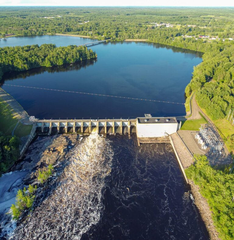
Photo: Wikideas1, CC0 1.0


Photo: Joshua Mayer, CC BY-SA 2.0
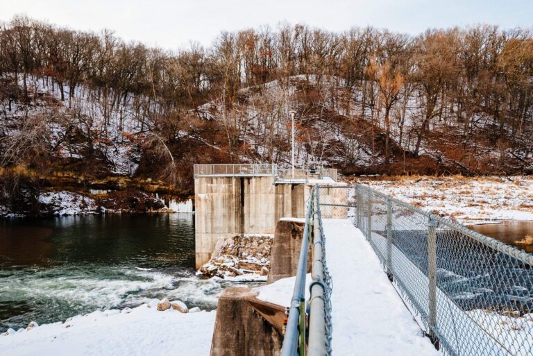
Photo: Tony Webster, CC BY-SA 2.0

Photo: Jonwurl, CC0 1.0

Before you fish Price County, the answers
How many WDNR boat landings does Price County have?
There are 73 public landings with 47 lanes between them.
Which lake in Price County spreads over the most acres?
Butternut Lake, Price County, at 983 acres.
Is there wild trout water in Price County?
Trout water covers 71 streams, Class I 92.9 miles.
Which pike rules apply in Price County?
Around Phillips it is the Northern Zone (north of US Highway 10), with lake rules taking priority.
Where do anglers buy tackle in Price County?
9 listings, Chase Creek Outfitters among them.
Are charter captains based in Price County?
The guide list has 10 guides and charters here.
Is Price County in the ceded territory?
The guide places it in the ceded territory: three walleye a day on most waters under the 15 to 20 inch rule with one over 24.
Where are the Price County courthouse offices?
Phillips holds the courthouse.
Do I need a stamp to fish Price County?
Anglers 16 and older need a Wisconsin fishing license: $20 a year for residents and $55 for nonresidents, with a $5 first-time buyer rate for residents. Classified trout water calls for a Wisconsin fishing license ($20 resident, $55 nonresident a year) and the $10 inland trout stamp when you fish for trout.
Are fishing tournaments held in Price County?
9 permitted events on file; next is Bsla Annual Ice Fisheree on Butternut Lake, 2027-01-16.
Pick your water in Price County
Every listed lake has depth, fish ratings and rules.