Fishing in King County, Washington
County seat: Seattle. Population 2,269,675.
- 64lake pages
- 34launches
- 16river pages
 Pick for salmonPiscifun Viper X spinning reel50% OFFSale $39.99
Photo of Lake Washington: Doug Kerr, CC BY-SA 2.0
The fishing picture across King County, start to finish
King County runs its county business from Seattle, and the 2020 Census found 2,269,675 people living inside its lines. WDFW hatchery plants in this county are logged under WDFW Region 4 in the 2026 report. Hikers can aim for 213 lakes on the WDFW high lakes list.
Lake guides cover 64 waters totalling 31,286 acres; Lake Washington is the largest of them. Salt water within the county belongs to Seattle-Bremerton, Tacoma-Vashon Island, Colvos Passage and Commencement Bay. WDFW SWIFD distribution data maps salmon or steelhead in Snoqualmie River, Raging River, Sammamish River and Tolt River. Agency maps show 34 boat launches: 22 WDFW, 6 State Parks and 6 other agencies. WDFW maps 89 shore or access sites for bank anglers, 56 of them built piers.
Census 2020 population; WDFW Fish Washington lake layers, WDFW facilities and State Parks launch layers (WDFW GIS); WDFW marine areas; retrieved October 31, 2026.
 For the salmon herePiscifun AlumiX spinning reel46% OFFSale $64.99
One map of the King County water access
WDFW and State Parks launch layers, WDFW facilities, WDFW lake points, NHD river midpoints and WDFW marine area points. Checked November 2026.
Lakes of King County ranked by WDFW surface acres
| Lake | Acres | Launches | WDFW program | Fish WDFW maps |
|---|---|---|---|---|
| Lake Washington | 21,934 | 0 | Mixed species – Trout emphasis | coastal cutthroat trout, kokanee, largemouth bass |
| Lake Sammamish | 4,853 | 6 | Mixed species – Trout emphasis | coastal cutthroat trout, kokanee, largemouth bass |
| Lake Union | 1,030 | 0 | Mixed species – Trout emphasis | coastal cutthroat trout, largemouth bass, smallmouth bass |
| Lake Sawyer | 286 | 0 | Mixed species – Warmwater emphasis | rainbow trout, coastal cutthroat trout, largemouth bass |
| Dorothy Lake | 261 | 0 | WDFW high lake, getting started lakes | coastal cutthroat trout |
| Green Lake (King County) | 250 | 0 | Mixed species – Trout emphasis | rainbow trout, brown trout, largemouth bass |
| Snow Lake | 153 | 0 | WDFW high lake, getting started lakes | rainbow trout |
| Lake Meridian | 150 | 1 | Mixed species – Trout emphasis | rainbow trout, kokanee, largemouth bass |
| Copper Lake | 132 | 0 | WDFW high lake, getting started lakes | brook trout, coastal cutthroat trout, rainbow trout |
| Marmot Lake | 128 | 0 | WDFW high lake, getting started lakes | coastal cutthroat trout |
| Lake Philippa | 122 | 0 | WDFW high lake, getting started lakes | coastal cutthroat trout, rainbow trout |
| Rattlesnake Lake | 108 | 0 | Trout emphasis | rainbow trout |
| Angle Lake | 103 | 0 | Mixed species – Trout emphasis | rainbow trout, kokanee, largemouth bass |
| Pine Lake (King County) | 86 | 0 | Mixed species – Trout emphasis | rainbow trout, largemouth bass, brown bullhead |
| Lake Desire | 69 | 1 | Mixed species – Trout emphasis | rainbow trout, largemouth bass, yellow perch |
| Lake Morton | 66 | 1 | Mixed species – Trout emphasis | rainbow trout, largemouth bass |
| Wilderness Lake | 66 | 1 | Mixed species – Trout emphasis | rainbow trout, kokanee, largemouth bass |
| Spring Lake | 65 | 1 | Mixed species – Trout emphasis | rainbow trout, largemouth bass, brown bullhead |
| Hester Lake | 65 | 0 | WDFW high lake, getting started lakes | rainbow trout |
| Phantom Lake | 64 | 0 | Warmwater emphasis | largemouth bass, brown bullhead, yellow perch |
| Cottage Lake | 63 | 0 | Mixed species – Trout emphasis | rainbow trout, coastal cutthroat trout, largemouth bass |
| Beaver Lake – Sammamish | 60 | 1 | Mixed species – Trout emphasis | rainbow trout, largemouth bass, brown bullhead |
| Fisher Lake | 56 | 0 | WDFW high lake, getting started lakes | coastal cutthroat trout, golden trout, rainbow trout |
| Lake Margaret | 52 | 1 | Mixed species – Trout emphasis | rainbow trout, coastal cutthroat trout, largemouth bass |
| North Lake | 51 | 1 | Mixed species – Trout emphasis | rainbow trout, largemouth bass, yellow perch |
| Glacier Lake | 50 | 0 | WDFW high lake, getting started lakes | brook trout, coastal cutthroat trout, rainbow trout |
| Lower Loch Katrine Lake | 50 | 0 | WDFW high lake, getting started lakes | coastal cutthroat trout, golden trout, rainbow trout |
| Shadow Lake | 49 | 1 | Mixed species – Trout emphasis | rainbow trout, largemouth bass, yellow perch |
| Steele Lake | 46 | 1 | Mixed species – Trout emphasis | rainbow trout, largemouth bass, brown bullhead |
| Bear Lake (King County) | 46 | 0 | WDFW high lake, getting started lakes | coastal cutthroat trout, lake trout, rainbow trout |
| Kaleetan Lake | 42 | 0 | WDFW high lake, getting started lakes | brook trout |
| Lake Number 12 | 41 | 1 | Mixed species – Trout emphasis | rainbow trout, largemouth bass, brown bullhead |
| Langlois Lake | 41 | 1 | Mixed species – Trout emphasis | rainbow trout, kokanee, largemouth bass |
| Deep Lake (King County) | 39 | 0 | Mixed species – Trout emphasis | rainbow trout, coastal cutthroat trout, kokanee |
| Marten Lake | 38 | 0 | WDFW high lake, getting started lakes | coastal cutthroat trout, rainbow trout |
| Fivemile Lake | 36 | 0 | Mixed species – Trout emphasis | rainbow trout, largemouth bass, bluegill |
| Sunday Lake (King County) | 35 | 0 | Trout emphasis | coastal cutthroat trout |
| Star Lake | 33 | 0 | Mixed species – Trout emphasis | rainbow trout, largemouth bass |
| Lake Alice | 32 | 1 | Mixed species – Trout emphasis | rainbow trout, largemouth bass |
| Lower Tuscohatchie Lake | 31 | 0 | WDFW high lake, getting started lakes | coastal cutthroat trout, rainbow trout |
| Lake Killarney | 29 | 1 | Mixed species – Warmwater emphasis | rainbow trout, largemouth bass, brown bullhead |
| Lake Geneva | 28 | 1 | Mixed species – Trout emphasis | rainbow trout, largemouth bass, bluegill |
| Bass Lake | 24 | 1 | Mixed species – Warmwater emphasis | largemouth bass, yellow perch, black crappie |
| Horseshoe Lake (King County) | 23 | 0 | WDFW high lake, fish stocking | rainbow trout |
| Surprise Lake | 23 | 0 | WDFW high lake, getting started lakes | brook trout, coastal cutthroat trout, rainbow trout |
| Shady Lake | 21 | 1 | Trout emphasis | rainbow trout, largemouth bass, pumpkinseed |
| Lake Dolloff | 20 | 1 | Mixed species – Trout emphasis | rainbow trout, coastal cutthroat trout, largemouth bass |
| Holm Lake | 20 | 1 | Mixed species – Trout emphasis | rainbow trout, largemouth bass |
| Annette Lake | 18 | 0 | WDFW high lake, getting started lakes | rainbow trout |
| Deception Lakes | 18 | 0 | WDFW high lake, getting started lakes | coastal cutthroat trout, rainbow trout |
| Tradition Lake | 17 | 0 | Warmwater emphasis | largemouth bass, yellow perch |
| Lake Fenwick | 17 | 1 | Mixed species – Trout emphasis | rainbow trout, largemouth bass, brown bullhead |
| Lake Boren | 16 | 0 | Mixed species – Trout emphasis | rainbow trout, coastal cutthroat trout, largemouth bass |
| Bitter Lake | 16 | 0 | Mixed species – Trout emphasis | rainbow trout, largemouth bass, brown bullhead |
| Trout Lake (King County) near Lakeland South | 16 | 0 | Mixed species – Trout emphasis | rainbow trout, largemouth bass, black crappie |
| Trout Lake (King County) near Riverbend | 15 | 0 | Trout emphasis | rainbow trout |
| Fish Lake (King County) | 14 | 1 | Mixed species – Trout emphasis | rainbow trout, coastal cutthroat trout, largemouth bass |
| Haller Lake | 14 | 0 | Mixed species – Trout emphasis | rainbow trout, largemouth bass, yellow perch |
| Walker Lake | 12 | 1 | Mixed species – Trout emphasis | rainbow trout, largemouth bass |
| Echo Lake (King County) | 11 | 0 | Mixed species – Trout emphasis | rainbow trout |
WDFW Fish Washington lowland and high lake layers (surface acres as published, management emphasis, mapped species); WDFW publishes no lake depths in these layers. Retrieved October 31, 2026.
Marine areas and inlets that touch King County
Count 6 marine areas and regional waters along King County.
| Water | Kind | Launches | Piers and shore | Marine area |
|---|---|---|---|---|
| Seattle-Bremerton (Marine Area 10) | WDFW marine area | 3 | 22 | 10 |
| Tacoma-Vashon Island (Marine Area 11) | WDFW marine area | 0 | 8 | 11 |
| Colvos Passage | regional marine water | 0 | 2 | 11 |
| Commencement Bay | regional marine water | 0 | 5 | 11 |
| Elliott Bay | regional marine water | 0 | 5 | 10 |
| Puget Sound | regional marine water | 34 | 52 | 8-1, 8-2, 9, 10, 11, 12, 13 |
Tide gauge readings for King County
NOAA CO-OPS water level, preliminary reading at retrieval (October 31, 2026); station page for live data.
Dated NOAA ESI data (2003 to 2006) place 11 marinas along this shore.
WDFW Recreational Marine Areas (WAC 220-300-160 boundaries), WDFW and State Parks marine launches, WDFW piers and USGS GNIS bay names; retrieved October 31, 2026.
Which fish WDFW ties to water near King County
Within 50 miles of Seattle, rainbow trout shows up on the most lake and marine pages.
Species mapped in the WDFW Fish Washington layers, WDFW state records and the 2026 WDFW trout plants, counted per water page within 50 miles; not a survey.
More named lakes of King County still without a page
Another 198 named lakes in King County have too few published facts for a page of their own and are listed by size.
| Water | Acres | WDFW program | Nearest town |
|---|---|---|---|
| Angeline Lake | 184 | WDFW high lake, fish stocking | Riverbend |
| Heart – Big Lake | 176 | WDFW high lake, fish stocking | Riverbend |
| Snoqualmie Lake | 124 | WDFW high lake, fish stocking | Riverbend |
| Lake Malachite | 72 | WDFW high lake, fish stocking | Riverbend |
| Lake Kulla Kulla | 59 | WDFW high lake, fish stocking | Riverbend |
| Lake Caroline | 56 | WDFW high lake, fish stocking | Riverbend |
| Nordrum Lake | 53 | WDFW high lake, fish stocking | Riverbend |
| Upper Wildcat Lake | 52 | WDFW high lake, fish stocking | Riverbend |
| Delta Lake | 46 | WDFW high lake, overabundant lakes | Riverbend |
| Thompson Lake | 45 | WDFW high lake, fish stocking | Riverbend |
| Lake Ilswoot | 44 | WDFW high lake, fish stocking | Riverbend |
| Lake Moolock | 43 | WDFW high lake, fish stocking | North Bend |
| SMC Lake | 43 | WDFW high lake, fish stocking | North Bend |
| Deer Lake (King County) | 40 | WDFW high lake, fish stocking | Riverbend |
| Francis Lake | 37 | WDFW high lake, fish stocking | North Bend |
| Panther Lake (King County) | 34 | NHD-mapped lake | Kent |
| Dream Lake | 33 | WDFW high lake, fish stocking | North Bend |
| Loop Lake | 32 | WDFW high lake, fish stocking | Carnation |
| Mason Lake | 32 | WDFW high lake, fish stocking | Riverbend |
| Black Lake (King County) | 24 | WDFW high lake, fish stocking | Carnation |
| Edds Lake | 24 | WDFW high lake, fish stocking | Riverbend |
| Upper Loch Katrine Lake | 23 | WDFW high lake, fish stocking | North Bend |
| Rock Lake | 23 | WDFW high lake, overabundant lakes | Gold Bar |
| Jade Lake | 23 | WDFW high lake, fish stocking | Leavenworth |
| Goat Lake | 20 | WDFW high lake, fish stocking | Riverbend |
| Lake Nadeau | 20 | WDFW high lake, fish stocking | North Bend |
| Cougar Lake (King County) | 18 | WDFW high lake, fish stocking | North Bend |
| Lower Wildcat Lake | 18 | WDFW high lake, fish stocking | Riverbend |
| Coney Lake | 18 | WDFW high lake, fish stocking | Gold Bar |
| Talapus Lake | 17 | WDFW high lake, fish stocking | Riverbend |
| Iceberg Lake | 17 | WDFW high lake, fish stocking | Riverbend |
| Island Lake (King County) | 17 | WDFW high lake, fish stocking | Riverbend |
| Crater Lake | 17 | WDFW high lake, fish stocking | Gold Bar |
| Pugsley (Dans) Lake | 17 | WDFW high lake, overabundant lakes | Riverbend |
| Mud Lake | 16 | WDFW high lake, fish stocking | Carnation |
| Upper Granite Lake | 15 | WDFW high lake, fish stocking | Riverbend |
| DKL Pond | 15 | WDFW high lake, fish stocking | Lake Marcel-Stillwater |
| Crawford Lake | 14 | WDFW high lake, fish stocking | Riverbend |
| Myrtle Lake | 14 | WDFW high lake, overabundant lakes | Riverbend |
| Denny Lake | 14 | WDFW high lake, fish stocking | Riverbend |
| Upper Ptarmigan Lake | 13 | WDFW high lake, fish stocking | Leavenworth |
| Olallie Lake | 13 | WDFW high lake, overabundant lakes | Riverbend |
| McLeod Lake | 13 | WDFW high lake, fish stocking | North Bend |
| Lake Isabella | 12 | WDFW high lake, fish stocking | North Bend |
| Overcoat Lake | 11 | WDFW high lake, fish stocking | Riverbend |
| Metcalf Lake | 11 | WDFW high lake, fish stocking | Snoqualmie |
| Lower Hardscrabble Lake | 10 | WDFW high lake, overabundant lakes | Riverbend |
| Gus Lake | 10 | WDFW high lake, overabundant lakes | Riverbend |
| Lake Marie | 10 | WDFW high lake, fish stocking | Snoqualmie |
| Honey Lake | 10 | WDFW high lake, fish stocking | North Bend |
| Embro Lake | 9 | WDFW high lake, overabundant lakes | Gold Bar |
| Nazanne Lake | 9 | WDFW high lake, fish stocking | Riverbend |
| Lower Granite Lake | 9 | WDFW high lake, fish stocking | Riverbend |
| Horseshoe Lake (King County) | 8 | WDFW high lake, fish stocking | Riverbend |
| Christmas Lake | 8 | WDFW high lake, fish stocking | Wilderness Rim |
| Gravel Lake | 8 | WDFW high lake, fish stocking | Riverbend |
| Panorama Lake | 8 | WDFW high lake, overabundant lakes | North Bend |
| Bonnie Lake | 8 | WDFW high lake, overabundant lakes | Riverbend |
| Lower Blethen Lake | 8 | WDFW high lake, fish stocking | North Bend |
| Jewel Lake | 8 | WDFW high lake, overabundant lakes | Riverbend |
| Jakes Lake | 8 | WDFW high lake, fish stocking | Gold Bar |
| Lower Melakwa Lake | 7 | WDFW high lake, fish stocking | Riverbend |
| Boundary Lake | 7 | WDFW high lake, fish stocking | Gold Bar |
| Purvis Lake | 7 | WDFW high lake, overabundant lakes | North Bend |
| Upper Hardscrabble Lake | 7 | WDFW high lake, overabundant lakes | Riverbend |
| Upper Murphy Lake | 6 | WDFW high lake, overabundant lakes | Leavenworth |
| Holoman Lake | 6 | WDFW high lake, fish stocking | Gold Bar |
| Hester – Little Lake | 6 | WDFW high lake, fish stocking | Riverbend |
| Blazer Lake | 6 | WDFW high lake, fish stocking | Riverbend |
| Rock Lake | 6 | WDFW high lake, fish stocking | Riverbend |
| Lower Garfield Mountain Lake | 6 | WDFW high lake, fish stocking | Riverbend |
| Rainbow Lake (King County) | 6 | WDFW high lake, fish stocking | Riverbend |
| Crystal Lake | 6 | WDFW high lake, fish stocking | Riverbend |
| Le Fay Lake | 6 | WDFW high lake, fish stocking | Riverbend |
| Lower Snoqualmie Lake Potholes | 6 | WDFW high lake, fish stocking | Riverbend |
| Merlin Lake | 6 | WDFW high lake, fish stocking | Riverbend |
| Scout Lake | 6 | WDFW high lake, fish stocking | Riverbend |
| Tusco Out-In Pot – Large Lake | 6 | WDFW high lake, overabundant lakes | Riverbend |
| Langendorfer Lake | 5 | WDFW high lake, fish stocking | Lake Marcel-Stillwater |
| Nine Hour Lake | 5 | WDFW high lake, fish stocking | Riverbend |
| Summit (Mosquito) Lake | 5 | WDFW high lake, overabundant lakes | Leavenworth |
| Windy Lake | 5 | WDFW high lake, fish stocking | Riverbend |
| Trico Lake | 5 | WDFW high lake, fish stocking | Leavenworth |
| Cecils Lake | 5 | WDFW high lake, fish stocking | Riverbend |
| Hi-Low Lake | 5 | WDFW high lake, fish stocking | Riverbend |
| Mason – Little Lake | 5 | WDFW high lake, fish stocking | Riverbend |
| Rachor Lake | 5 | WDFW high lake, fish stocking | North Bend |
| Butch Evans Slough Lake | 5 | WDFW high lake, fish stocking | Riverbend |
| Grotto Lake | 5 | WDFW high lake, fish stocking | Gold Bar |
| Peterson Lake | 4 | Trout emphasis | Shadow Lake |
| Talus Lake | 4 | WDFW high lake, fish stocking | Leavenworth |
| T'ahl (Tahl) Lake | 4 | WDFW high lake, fish stocking | Riverbend |
| Pratt – Little Lake | 4 | WDFW high lake, fish stocking | Riverbend |
| Jade Lake | 4 | WDFW high lake, overabundant lakes | Riverbend |
| Top Lake | 4 | WDFW high lake, fish stocking | Gold Bar |
| Easy Pond | 4 | WDFW high lake, fish stocking | Lake Marcel-Stillwater |
| Upper Snoqualmie Lake Potholes | 3 | WDFW high lake, fish stocking | Riverbend |
| Skyline Lake | 3 | WDFW high lake, fish stocking | Leavenworth |
| Souphole Lake | 3 | WDFW high lake, fish stocking | Duvall |
| Tye Lake | 3 | WDFW high lake, overabundant lakes | Leavenworth |
| Gus – Little Lake | 3 | WDFW high lake, overabundant lakes | Riverbend |
| Lunker Lake | 3 | WDFW high lake, fish stocking | Riverbend |
| Upper Blethen Lake | 3 | WDFW high lake, fish stocking | North Bend |
| Bench Lake | 3 | WDFW high lake, overabundant lakes | Gold Bar |
| Cherry Lake | 3 | Trout emphasis | Lake Marcel-Stillwater |
| Bengston Lake | 3 | WDFW high lake, fish stocking | Gold Bar |
| Drunken Charlie Lake | 3 | Trout emphasis | Lake Marcel-Stillwater |
| Hummingbird Lake | 3 | WDFW high lake, fish stocking | Gold Bar |
| June Lake | 3 | WDFW high lake, fish stocking | Leavenworth |
| Rockdale Lake | 3 | WDFW high lake, getting started lakes | Riverbend |
| Maloney Meadow Lake | 3 | WDFW high lake, fish stocking | Gold Bar |
| Emerald Lake | 3 | WDFW high lake, overabundant lakes | Riverbend |
| Smith Lake | 3 | WDFW high lake, fish stocking | North Bend |
| Lower Snow Lake Pot | 2 | WDFW high lake, fish stocking | Riverbend |
| Boner Lake | 2 | WDFW high lake, fish stocking | Gold Bar |
| Harris Lake | 2 | WDFW high lake, fish stocking | Wilderness Rim |
| Kulla – Little Lake | 2 | WDFW high lake, fish stocking | Riverbend |
| North Charlie Lake | 2 | WDFW high lake, fish stocking | Riverbend |
| Bertha Lake | 2 | WDFW high lake, overabundant lakes | Gold Bar |
| Hanks Lake | 2 | WDFW high lake, fish stocking | Wilderness Rim |
WDFW Fish Washington lowland and high lake layers and USGS NHD lake outlines, retrieved October 31, 2026.
Rivers, creeks and sloughs of King County
- Snoqualmie RiverSWIFD lists chinook, chum and coho, 4 mapped launches, 3 USGS gauges, 43 mi in Washington
- Raging RiverSWIFD lists chinook, chum and coho, 1 mapped launch, 1 USGS gauge, 16 mi in Washington
- Sammamish RiverSWIFD lists chinook, coho and kokanee, 1 mapped launch, 14 mi in Washington
- Tolt RiverSWIFD lists chinook, chum and coho, 1 mapped launch, 1 WDFW shore or access site, 1 USGS gauge, 8 mi in Washington
- Green River (King County)SWIFD lists chinook, chum and coho, 2 WDFW shore or access sites, 8 USGS gauges, 85 mi in Washington
- White River (Pierce County)SWIFD lists chinook, chum and coho, 9 USGS gauges, 71 mi in Washington
- Greenwater RiverSWIFD lists chinook, chum and coho, 1 USGS gauge, 24 mi in Washington
- South Fork Skykomish RiverSWIFD lists chinook, chum and coho, 1 USGS gauge, 20 mi in Washington
- North Fork Tolt RiverSWIFD lists chinook, chum and coho, 2 USGS gauges, 17 mi in Washington
- South Fork Tolt RiverSWIFD lists chinook, chum and coho, 3 USGS gauges, 17 mi in Washington
- Clearwater River (Pierce County)SWIFD lists chinook, chum and coho, 1 USGS gauge, 12 mi in Washington
- Duwamish RiverSWIFD lists chinook, chum and coho, 2 USGS gauges, 5 mi in Washington
- Middle Fork Snoqualmie River1 USGS gauge, 40 mi in Washington
- South Fork Snoqualmie River2 USGS gauges, 31 mi in Washington
- North Fork Snoqualmie River1 USGS gauge, 27 mi in Washington
- Rex River1 USGS gauge, 10 mi in Washington
King County creeks listed only here (14)
- Beckler RiverSWIFD lists chinook, chum and coho, 14 mi in Washington
- Black RiverSWIFD lists chinook, chum and coho, 3 mi in Washington
- East Fork Foss RiverSWIFD lists chinook, chum and coho, 9 mi in Washington
- East Fork Miller RiverSWIFD lists chinook, chum and coho, 7 mi in Washington
- Foss RiverSWIFD lists chinook, chum and coho, 6 mi in Washington
- Miller RiverSWIFD lists chinook, chum and coho, 4 mi in Washington
- North Fork Cedar River5 mi in Washington
- North Fork Green RiverSWIFD lists chinook, chum and coho, 12 mi in Washington
- Pratt RiverSWIFD lists kokanee, 10 mi in Washington
- South Fork Cedar River4 mi in Washington
- Taylor River11 mi in Washington
- Tye RiverSWIFD lists chinook, chum and coho, 15 mi in Washington
- West Fork Foss RiverSWIFD lists chinook, chum and coho, 7 mi in Washington
- West Fork Miller River7 mi in Washington
Live river readings in King County
| USGS gauge | Latest reading | Time (ET) |
|---|---|---|
| Duwamish River At Golf Course At Tukwila, Wa | 648 cfs, 8.21 ft gage height | Nov 12 6:45 pm |
| Snoqualmie River Near Carnation, Wa | 2,440 cfs, 45.94 ft gage height | Nov 12 7:15 pm |
| White River Near Buckley, Wa | 819 cfs, 800.79 ft gage height | Aug 8 2:45 am Not updated since Aug 8, 2003. |
| Snoqualmie River Near Snoqualmie, Wa | 1,630 cfs, 4.72 ft gage height | Nov 12 6:30 pm |
| Green River At 200th Street At Kent, Wa | 658 cfs, 12.62 ft gage height | Nov 12 7:15 pm |
| Green River Above S 277th St At Kent, Wa | 721 cfs, 38.19 ft gage height | Nov 12 6:30 pm |
US Geological Survey provisional data, retrieved Nov 12, 2026 7:33 pm ET. Provisional readings can be revised.
USGS NHD flowlines and Washington lengths, WDFW SWIFD salmon and steelhead distribution, WDFW and State Parks launches, USGS gauges; retrieved October 31, 2026.
The King County trout plant log for 2026
So far in 2026 the WDFW report shows 63 plants into King County water: 172,544 fish in 39 waters.
- Beaver Lakes T24Rainbow, 1,250 fish at 0.47 per pound, October 19, 2026, Issaquah Hatchery
- Lake DesireRainbow, 905 fish at 0.6 per pound, October 15, 2026, Tokul Cr Hatchery
- Lake AliceRainbow, 540 fish at 0.6 per pound, October 14, 2026, Tokul Cr Hatchery
- Green Lake (King County)Rainbow, 1,632 fish at 0.85 per pound, October 13, 2026, Whitehorse Pond
- Lake BorenRainbow, 1,350 fish at 2.2 per pound, May 26, 2026, Puyallup Hatchery
- Shadow LakeRainbow, 20 fish at 0.5 per pound, May 15, 2026, Puyallup Hatchery
- Shadow LakeRainbow, 3,800 fish at 2 per pound, May 15, 2026, Puyallup Hatchery
- Old Fishing Hole PondRainbow, 32 fish at 0.5 per pound, May 14, 2026, Puyallup Hatchery
- Old Fishing Hole PondRainbow, 1,500 fish at 2 per pound, May 14, 2026, Puyallup Hatchery
- Lake SawyerRainbow, 3,000 fish at 2.4 per pound, May 8, 2026, Puyallup Hatchery
- Lake KillarneyRainbow, 2,700 fish at 2.4 per pound, May 8, 2026, Puyallup Hatchery
- Lake FenwickRainbow, 1,700 fish at 2.4 per pound, May 8, 2026, Puyallup Hatchery
WDFW Trout Plants report (rows January 2 to October 27, 2026), read October 31, 2026; newest plants first.
Launches and shore sites listed for King County
- Beaver Lake boat launch on Beaver Lake – SammamishBeaver Lake – Sammamish, WDFW, 1 ramp, gravel surface, Discover Pass
- Kenmore Bridge boat launch on Sammamish RiverSammamish River, City of Kenmore, 1 ramp, concrete surface
- Lake Alice boat launchLake Alice, WDFW, 1 ramp, concrete surface, Discover Pass
- Lake Desire boat launchLake Desire, WDFW, 1 ramp, gravel surface, Discover Pass
- Lake Dolloff boat launchLake Dolloff, WDFW, 1 ramp, concrete surface, Discover Pass
- Lake Geneva boat launchLake Geneva, WDFW, 1 ramp, gravel surface, Discover Pass
- Lake Holm boat launchHolm Lake, WDFW, 1 ramp, unimproved surface surface, Discover Pass
- Lake Killarney boat launchLake Killarney, WDFW, 1 ramp, gravel surface, Discover Pass
- Lake Margaret boat launchLake Margaret, WDFW, 1 ramp, gravel surface, Discover Pass
- Lake Meridian boat launchLake Meridian, WDFW, 1 ramp, gravel surface, Discover Pass
- Lake Morton boat launchLake Morton, WDFW, 1 ramp, gravel surface, Discover Pass
- Lake Sammamish launchLake Sammamish, State Parks, Discover Pass
- Langlois Lake boat launchLanglois Lake, WDFW, 1 ramp, gravel surface, Discover Pass
- North Lake boat launchNorth Lake, WDFW, 1 ramp, concrete surface, Discover Pass
- Plum boat launch on Snoqualmie RiverSnoqualmie River, WDFW, 1 ramp, concrete surface, Discover Pass
- Raging River boat launchRaging River, WDFW, 1 ramp, concrete surface, Discover Pass
- Richter boat launch on Snoqualmie RiverSnoqualmie River, WDFW, 1 ramp, concrete surface, Discover Pass
- Shadow Lake boat launchShadow Lake, WDFW, 1 ramp, concrete surface, Discover Pass
- Shady Lake boat launchShady Lake, WDFW, 1 ramp, concrete surface, Discover Pass
- Spring Lake boat launchSpring Lake, WDFW, 1 ramp, gravel surface, Discover Pass
- Steel Lake boat launch on Steele LakeSteele Lake, City of Federal Way, 1 ramp, concrete surface
- Wilderness Lake boat launchWilderness Lake, City of Maple Valley, 1 ramp, concrete surface
- Bass Lake boat launchBass Lake, WDFW, 1 hand launch, Discover Pass
- Fish Lake boat launch (west)Fish Lake, WDFW, 1 hand launch, Discover Pass
- Lake Fenwick boat launchLake Fenwick, City of Kent, 1 hand launch
- Lake Number boat launch on Lake Number 12Lake Number 12, WDFW, 1 hand launch, Discover Pass
- Lake Sammamish launchLake Sammamish, State Parks, Discover Pass
- Lake Sammamish launchLake Sammamish, State Parks, Discover Pass
- Lake Sammamish launchLake Sammamish, State Parks, Discover Pass
- Lake Sammamish launchLake Sammamish, State Parks, Discover Pass
- Lake Sammamish launchLake Sammamish, State Parks, Discover Pass
- Lower Tolt boat launchTolt River, agency not given, concrete surface
- Taylor Landing on Snoqualmie RiverSnoqualmie River, agency not given, concrete surface
- Walker Lake boat launchWalker Lake, WDFW, 1 hand launch, Discover Pass
Vehicles at 28 of these sites must display a Discover Pass, per the layers.
Walk-in fishing sites of King County (89)
- Dash Point Park Pier on Commencement Bayfishing pier, Marine Area 11
- Des Moines Marina Pierfishing pier, Marine Area 11
- Dockton Park Pier on Colvos Passagefishing pier, Marine Area 11
- Elliott Bay Fishing Pier at Terminal 86fishing pier, Marine Area 10
- Redondo Pierfishing pier, Marine Area 11
- Seacrest Park Pier on Elliott Bayfishing pier, Marine Area 10
- Shilshole Marina (A-Dock) on Elliott Bayfishing pier, Marine Area 10
- Shilshole Marina Pier on Elliott Bayfishing pier, Marine Area 10
- Soos Creek Drift on Green Riverwater access area
- Spokane St. Bridge on Elliott Bayfishing pier, Marine Area 10
- Tramp Harbor Pier on Colvos Passagefishing pier, Marine Area 11
- Upper Toltwater access area
- Angle Lake fishing piershore fishing site, Public pier
- Beaver Lake – Sammamish shore accessshore fishing site, Over 100 feet of shore fishing
- Beaver Lake – Sammamish shore accessshore fishing site, Limited shore fishing near boat ramp
- Bitter Lake shore accessshore fishing site, Over 500 feet of shore fishing
- Cottage Lake fishing piershore fishing site, Public fishing dock
- Deep Lake shore accessshore fishing site, Shore fishing around swimming beach, Nolte Park Trail provid
- Dykstra on Green Riveraccess point (no launch)
- Echo Lake shore accessshore fishing site, Very limited shore fishing, boat loading area
- Fish Lake shore accessshore fishing site, Shore fishing at primitive boat launch
- Fishing pier on Lake Desirefishing pier
- Fivemile Lake fishing piershore fishing site, Public fishing dock
- Green Lake fishing piershore fishing site, Fishing pier, the Green Lake Trail provides almost 3 miles o
- Green Lake fishing piershore fishing site, The cement wall here provides a good casting platform, the G
- Green Lake fishing pier near Seattleshore fishing site, Fishing dock, the Green Lake Trail provides almost 3 miles o
- Haller Lake shore accessshore fishing site, Very limited shore fishing
- Holm Lake shore accessshore fishing site, Limited shore fishing at boat ramp
- Lake Alice shore accessshore fishing site, Very limited shore fishing at boat launch
- Lake Boren fishing piershore fishing site, Public fishing pier
- Lake Desire fishing piershore fishing site, Public dock, limited shore fishing at boat ramp
- Lake Dolloff shore accessshore fishing site, Very limited shore fishing at boat ramp
- Lake Fenwick shore accessshore fishing site, Limited shore fishing, unimproved foot path around north sid
- Lake Geneva fishing piershore fishing site, Fishing dock, over 200 feet of shore fishing
- Lake Killarney shore accessshore fishing site, Trails from Lake Killarney Open Space Park lead to limited s
- Lake Margaret shore accessshore fishing site, Shore fishing at boat launch
- Lake Meridian fishing piershore fishing site, Large public dock
- Lake Morton on Shady Lakeshore fishing site, Very limited shore fishing at boat ramp
- Lake Morton shore accessshore fishing site, Shore fishing at boat ramp
- Lake Sammamish fishing piershore fishing site, Public pier
- Lake Sammamish fishing pier near Issaquahshore fishing site, Boat ramp and loading docks provide limited shore fishing
- Lake Sawyer shore accessshore fishing site, About 200 feet of limited shore fishing
- Lake Sawyer shore access near Black Diamondshore fishing site, Limited shore fishing around tall vegetation
- Lake Union fishing piershore fishing site, Public dock
- Lake Union fishing pier near Seattleshore fishing site, Public pier
- Lake Union shore accessshore fishing site, Limited shore fishing
- Lake Washington fishing piershore fishing site, Large fishing pier with two arms, extends out beyond swimmin
- Lake Washington fishing piershore fishing site, Small public pier at the end of SE 15th Street, shallow wate
- Lake Washington fishing piershore fishing site, Pier that provides pier fishing and moorage for the Argosy
- Lake Washington fishing piershore fishing site, Public pier located just south of Anthony's restaurant
- Lake Washington fishing piershore fishing site, Public pier offers good fishing in the summer, can be crowde
- Lake Washington fishing piershore fishing site, Public pier offers good fishing in the summer, can be crowde
- Lake Washington fishing pier near Beaux Arts Village (east)shore fishing site, Large public pier with spacious fishing area, adjacent to sw
- Lake Washington fishing pier near Beaux Arts Village (north), King Countyshore fishing site, Public pier offers good fishing in the summer, can be crowde
- Lake Washington fishing pier near Beaux Arts Village (north), King Countyshore fishing site, Public pier, can be crowded with swimmers
- Lake Washington fishing pier near Beaux Arts Village (south)shore fishing site, Public pier, weedy in the summer, can be crowded with swimme
- Lake Washington fishing pier near Beaux Arts Village (west)shore fishing site, Public pier that extends to deep water, good summer fishing
- Lake Washington fishing pier near Bryn Mawr-Skywayshore fishing site, Expansive wrap-around dock serves as a spacious fishing plat
- Lake Washington fishing pier near Clyde Hillshore fishing site, Public pier, can be crowded with swimmers
- Lake Washington fishing pier near Kenmoreshore fishing site, Large pier that extends out from Log Boom park, spacious for
- Lake Washington fishing pier near Kirkland (east)shore fishing site, Public pier located outside swim area
- Lake Washington fishing pier near Kirkland (north)shore fishing site, Public pier over shallow water, weedy in the summer
- Lake Washington fishing pier near Kirkland (south)shore fishing site, Public pier located next to boat ramp
- Lake Washington fishing pier near Kirkland (west)shore fishing site, Multiple docks next to boat ramp, high use area, can be crow
- Lake Washington fishing pier near Medina (north)shore fishing site, Public fishing pier
- Lake Washington fishing pier near Medina (south)shore fishing site, Large fishing pier, good summer fishing spot
- Lake Washington fishing pier near Mercer Island (east)shore fishing site, Nice fishing pier built specifically for anglers, deep water
- Lake Washington fishing pier near Mercer Island (north)shore fishing site, Nice fishing pier that extends over deep water, good summer
- Lake Washington fishing pier near Mercer Island (west)shore fishing site, Nice fishing pier near deep water, good summer fishing
- Lake Washington fishing pier near Yarrow Point (east)shore fishing site, Public pier, can be crowded with swimmers
- Lake Washington fishing pier near Yarrow Point (north)shore fishing site, Public pier, no swimming allowed
- Lake Washington fishing pier near Yarrow Point (south), King Countyshore fishing site, Public pier, can be crowded with swimmers
- Lake Washington fishing pier near Yarrow Point (south), King Countyshore fishing site, Public pier, designated fishing area at west end
- Lake Washington shore accessshore fishing site, Trail provides leads to shore fishing spots along Marsh and
- Lake Wilderness fishing piershore fishing site, Public fishing dock with over 1000 feet of shore fishing, Ce
- Lake Wilderness shore accessshore fishing site, Over 1000 feet of shore fishing
- Langlois Lake shore accessshore fishing site, Very limited shore fishing around boat ramp
- North Lake shore accessshore fishing site, Limited shore fishing at boat ramp
- Panther Lake shore accesswater access area
- Phantom Lake fishing piershore fishing site, Public pier
WDFW Facilities layer (boat launches, piers, shore sites) and the State Parks boat launch layer; retrieved October 31, 2026. Lanes and per-launch fees are not published in these layers.
Fish an angler may bag across King County
For King County, check the statewide rows first and then the waters WDFW singles out. The Freshwater license is the base item here, $39.95 resident and $115.85 nonresident for the 2026-27 license year. Salmon and bottomfish trips on marine water take the $40.71 resident Saltwater license ($81.70 for nonresidents). The catch record card, issued with the license, logs every salmon, steelhead, sturgeon or halibut taken home.
| Species | Limit | Season |
|---|---|---|
| Largemouth Bass | No min. size in lakes, ponds, and reservoirs. Only largemouth bass less than 12" may be retained, except 1 over 17" may be retained. Daily limit 5. | Lakes, ponds, and reservoirs: year-round; rivers, streams and beaver ponds: Sat. before Memorial Day through Oct. 31 |
| Largemouth Bass | No size restriction/daily limit in rivers, streams, and beaver ponds. | Lakes, ponds, and reservoirs: year-round; rivers, streams and beaver ponds: Sat. before Memorial Day through Oct. 31 |
| Smallmouth Bass | No min. size in lakes, ponds, and reservoirs. Only 1 smallmouth bass over 14" may be retained. Daily limit 10. | Lakes, ponds, and reservoirs: year-round; rivers, streams and beaver ponds: Sat. before Memorial Day through Oct. 31 |
| Smallmouth Bass | No size restriction/daily limit in rivers, streams, and beaver ponds. | Lakes, ponds, and reservoirs: year-round; rivers, streams and beaver ponds: Sat. before Memorial Day through Oct. 31 |
| Walleye | Min. size 12" in lakes, ponds, and reservoirs. Daily limit 8. Only 1 over 22" may be retained. May be caught, retained, and released alive from a livewell until daily limit is in possession. | Lakes, ponds, and reservoirs: year-round; rivers, streams and beaver ponds: Sat. before Memorial Day through Oct. 31 |
| Walleye | No size restriction/daily limit in rivers, streams, and beaver ponds. | Lakes, ponds, and reservoirs: year-round; rivers, streams and beaver ponds: Sat. before Memorial Day through Oct. 31 |
| Channel Catfish | No min. size in lakes, ponds, and reservoirs. Daily limit 5. | Lakes, ponds, and reservoirs: year-round; rivers, streams and beaver ponds: Sat. before Memorial Day through Oct. 31 |
| Channel Catfish | No min. size/daily limit in rivers, streams, and beaver ponds. | Lakes, ponds, and reservoirs: year-round; rivers, streams and beaver ponds: Sat. before Memorial Day through Oct. 31 |
| Burbot (Freshwater Ling) | No min. size. Daily limit 5. | Lakes, ponds, and reservoirs: year-round; rivers, streams and beaver ponds: Sat. before Memorial Day through Oct. 31 (p.23 general rule for |
| Crappie, Northern Pikeminnow, Peamouth Chub, Perch, Suckers, Sunfish, | No min. size. No daily limit. | Lakes, ponds, and reservoirs: year-round; rivers, streams and beaver ponds: Sat. before Memorial Day through Oct. 31 |
| Grass Carp | Closed unless otherwise listed in Special Rules. | Closed |
| Kokanee | No min. size. Daily limit 10. When fishing with bait, all kokanee that are lawful to possess and are equal to or greater than the minimum size are counted as part of the daily limit whether kept or released. | Lakes, ponds, and reservoirs: year-round; rivers, streams and beaver ponds: Sat. before Memorial Day through Oct. 31 (p.23 general rule for |
| Tiger Muskellunge (Tiger Muskie) | Min. size 50". Daily limit 1. | Lakes, ponds, and reservoirs: year-round; rivers, streams and beaver ponds: Sat. before Memorial Day through Oct. 31 (p.23 general rule for |
| Whitefish | No min. size. Daily limit 15. | Lakes, ponds, and reservoirs: year-round; rivers, streams and beaver ponds: Sat. before Memorial Day through Oct. 31 (p.23 general rule for |
| Steelhead | Release all wild steelhead. Min. size 20". Daily limit 2. Open during salmon or game fish seasons unless as otherwise listed. | Open during salmon or game fish seasons unless as otherwise listed |
| Brown Trout, Cutthroat Trout, Rainbow Trout, Golden Trout, Tiger Trout | In rivers, streams, and beaver ponds: Min. size 8". Daily limit 2. | Sat. before Memorial Day-Oct. 31 (statewide river season, p.23) |
Salt water follows marine-area tables, printed on each marine page. Marine area rules
Water-specific limits in King County (224)
| Water and reach | Species | Rule |
|---|---|---|
| Big Soos Creek: from mouth to hatchery rack CRC (748) | Trout | Statewide min. sailize/dy limit. Except: Cutthroat trout and wild rainbow trout: min. size 14". (Sat. before Memorial Day-Aug. 31) |
| Big Soos Creek: from mouth to hatchery rack CRC (748) | Other game fish | Statewide min. size/daily limit. (Sat. before Memorial Day-Aug. 31) |
| Boise Creek: from mouth to Hwy. 410 crossing | All species | CLOSED WATERS. |
| Cascade Water Alliance Canal: from R St. Bridge to Hwy. 410 Bridge at Buckley CRC (808) | All species | CLOSED WATERS. |
| Cedar River: from mouth to Landsburg Rd. Bridge (RM 21.5) | All species | Selective gear rules. Internal combustion motors prohibited. Night closure. |
| Cedar River: from mouth to Landsburg Rd. Bridge (RM 21.5) | Trout | Statewide min. size/daily limit. Except: release cutthroat trout and wild rainbow trout. (Sat. before Memorial Day-Aug. 31) |
| Cedar River: from mouth to Landsburg Rd. Bridge (RM 21.5) | Other game fish | Statewide min. size/daily limit. (Sat. before Memorial Day-Aug. 31) |
| Cedar River: from Landsburg Rd. Bridge upstream to the falls | All species | CLOSED WATERS. |
| Cherry Creek: from mouth to Cherry Creek Falls | All species | Selective gear rules. |
| Cherry Creek: from mouth to Cherry Creek Falls | All game fish | Statewide min. size/daily limit. (Sat. before Memorial Day-Sept. 30) |
| Clearwater River | All species | Selective gear rules. |
| Clearwater River | Trout | Statewide min. size/daily limit. Except: release cutthroat trout and wild rainbow trout. (Sat. before Memorial Day-Oct. 31) |
| Clearwater River | Other game fish | Statewide min. size/daily limit. (Sat. before Memorial Day-Oct. 31) |
| Green River: from an East-West line extending though the southernmost tip of Harbor Island to Tukwila International Blvd./Old Hwy. 99 CRC (746) | All species | Night closure. Anti-snagging rule. (Aug. 20-Dec. 31) |
| Green River: from an East-West line extending though the southernmost tip of Harbor Island to Tukwila International Blvd./Old Hwy. 99 CRC (746) | Trout | Statewide min. size/daily limit. Except: Cutthroat trout and wild rainbow trout: min. size 14". (Sat. before Memorial Day-Dec. 31) |
| Green River: from an East-West line extending though the southernmost tip of Harbor Island to Tukwila International Blvd./Old Hwy. 99 CRC (746) | Other game fish | Statewide min. size/daily limit. (Sat. before Memorial Day-Dec. 31) |
| Green River: from an East-West line extending though the southernmost tip of Harbor Island to Tukwila International Blvd./Old Hwy. 99 CRC (746) | Salmon | Min. size 12". Daily limit 6 including no more than 3 of any combination of adult coho and chum. Release Chinook. (Aug. 20-Dec. 31) |
| Green River: from Tukwila International Blvd./Old Hwy. 99 to South 212th St. Bridge CRC (746) | All species | Night closure. Anti-snagging rule. (Aug. 20-Dec. 31) |
| Green River: from Tukwila International Blvd./Old Hwy. 99 to South 212th St. Bridge CRC (746) | Trout | Statewide min. size/daily limit. Except: Cutthroat trout and wild rainbow trout: min. size 14". (Sat. before Memorial Day-Dec. 31) |
| Green River: from Tukwila International Blvd./Old Hwy. 99 to South 212th St. Bridge CRC (746) | Other game fish | Statewide min. size/daily limit. (Sat. before Memorial Day-Dec. 31) |
Limits and seasons as printed in the 2026-2027 Washington Sport Fishing Rules (WDFW pamphlet, in effect July 1, 2026 to June 30, 2027), PDF page 27 (pamphlet PDF; eRegulations statewide freshwater page), read October 31, 2026. Special Rules as printed in the 2026-2027 Washington Sport Fishing Rules (WDFW pamphlet, in effect July 1, 2026 to June 30, 2027), pamphlet page 27 (pamphlet PDF), read on eRegulations October 31, 2026.
Washington record fish tied to King County
| Species | Weight | Angler | Water | Date |
|---|---|---|---|---|
| Black Crappie | 4.50 lbs | John W. Smart | Lake Washington | May 1, 1956 |
| Atlantic Salmon, sea-run | 14.38 lbs | Ron Howard | Green River (King County) | Sept. 22, 1999 |
| Sockeye Salmon | 10.63 lbs | Gary Krasselt | Lake Washington | July 20, 1982 |
| Pacific Sanddab | 1.22 lbs | Bob Everitt | Jeffferson Head, King County | July 1, 2017 |
| Pile Surfperch | 3.57 lbs | Steve Urban | Quartermaster Harbor, King County | March 14, 1981 |
Washington Department of Fish and Wildlife (WDFW) sport fish records list, as of October 31, 2026.
Tackle counters and guides in King County
Washington tackle counters in King County
- Angle Maidenbait and tackle shop, Auburn
- Angler's Choicefly shop, Seattle
- Avid Anglerfly shop, Lake Forest Park
- Bait Shopbait and tackle shop, Seattle
- Creekside Angling Cobait and tackle shop, Issaquah
- Fish Finders Private Chartersbait and tackle shop, Seattle
- Marine Gadgets LLCbait and tackle shop, Maple Valley
- Outdoor Emporiumbait and tackle shop, Seattle
- Pacific Bait Companybait and tackle shop, Seattle
- Pacific Fly Fishersbait and tackle shop, Bothell
- Simms Fishing Productsbait and tackle shop, Seattle
- Swan Net USAbait and tackle shop, Seattle
- The Fish Storebait and tackle shop, Seattle
- The Net Shedbait and tackle shop, Seattle
- Affinity Marinamarina, Seattle
- Bellevue Marinasmarina, Bellevue
- Boat Snake Incmarina, Seattle
- Boat Street Marinamarina, Seattle
- Boat Stuff Marine Servicesmarina, Seattle
- Brandt's Landing Marinamarina, Bellevue
- Canal Marinamarina, Seattle
- Chinook Lake Union Boat Mrgemarina, Seattle
- Commercial Marinemarina, Seattle
- Continental Marinamarina, Des Moines
- D V Franck's Marine Servicesmarina, Seattle
- Dan's Mobile Marinemarina, Seattle
- Des Moines Marinamarina, Des Moines
- Dick's Sporting Goods Bellevuesporting goods store, Bellevue
- Dick's Sporting Goods Issaquahsporting goods store, Issaquah
- Dick's Sporting Goods Seattlesporting goods store, Seattle
Guides and charters based in King County
- Adventure Charterscharter, Seattle, (206) 789-8245
- Digital Anglerscharter, Redmond, (206) 819-7010
- Emerald Water Anglerscharter, Seattle, (206) 708-7250
- Fish Finders Private Charterscharter, Seattle, (206) 632-2611
- Screaminreels Guide Servicecharter, Duvall, (206) 849-2574
- Tight Lines Sports Fishingcharter, Des Moines, (206) 715-0879
- cut plug charterscharter, Seattle, (206) 920-9482
Yellow Pages and chain store listings, guide and charter listings (city of business); retrieved October 31, 2026.
On the roads out of King County
Beds and diners for a King County trip
- Seattlepop. 737,015
- Bellevuepop. 151,854
- Kentpop. 136,588
- Rentonpop. 106,785
- Federal Waypop. 101,030
- Kirklandpop. 92,175
- Auburnpop. 87,256
- Redmondpop. 73,256
- Sammamishpop. 67,455
- Shorelinepop. 58,608
- Burienpop. 52,066
- Bothellpop. 48,161
- Issaquahpop. 40,051
- Des Moinespop. 32,888
- SeaTacpop. 31,454
- Maple Valleypop. 28,013
County guides one line over from King County
- Pierce County33 miles southwest
- Snohomish County40 miles north
- Kitsap County41 miles west
- Kittitas County59 miles southeast
Rods and reels from Piscifun ahead of a trip to King County


Piscifun and Amazon links are affiliate links; the site earns a commission on qualifying purchases.
The shoreline country around King County, in pictures

Photo: Chiara Coetzee, CC0 1.0

Photo: Kev Cook, CC BY 4.0
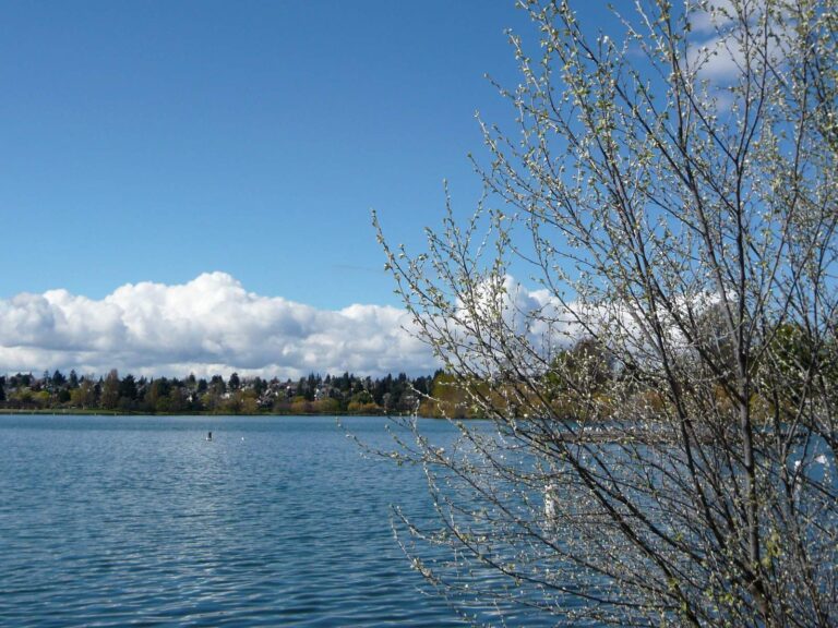
Photo: WordRidden, CC BY 2.0

Photo: SounderBruce, CC BY-SA 2.0
Short replies on fishing King County
How many WDFW and park launches serve King County?
34 launches on the layers (22 WDFW, 6 State Parks and 6 other agencies).
Which lake covers the most ground in King County?
Lake Washington, at 21,934 surface acres in the WDFW layer.
Which fish does WDFW map on water near King County?
Rainbow trout lead the count of water pages within 50 miles, followed by largemouth bass, coastal cutthroat trout and yellow perch.
Which King County stores keep jigs and leader?
72 in all, starting with Angle Maiden.
How many guide listings give a King County city?
Count 7 guides and charters with a local city.
Which Washington town holds the King County county offices?
Seattle is the seat.
How much does a visiting angler spend on a license in King County?
The Freshwater license is the base item here, $39.95 resident and $115.85 nonresident for the 2026-27 license year. Salmon and bottomfish trips on marine water take the $40.71 resident Saltwater license ($81.70 for nonresidents).
What counties lie around King County?
The nearest county pages are Pierce County, Snohomish County and Kitsap County.
Do any King County waters carry Special Rules?
The 2026-27 pamphlet prints 224 Special Rule entries touching this county, starting with Big Soos Creek; the table above shows the first ones.
Is there marine fishing in King County?
Seattle-Bremerton, Tacoma-Vashon Island, Colvos Passage and Commencement Bay; the marine table above links each page.
Has King County water put a fish on the WDFW list?
Black Crappie, 4.50 lbs, from Lake Washington, King County (May 1, 1956).
Does WDFW plant trout in King County?
63 WDFW plants so far in 2026, 172,544 fish; the latest went into Beaver Lakes T24 on Oct. 19, 2026.
Pick a lake or river in King County
Open a lake for its ramps, limits and stocking.